Tyler Stanfield
@TylerJStanfield


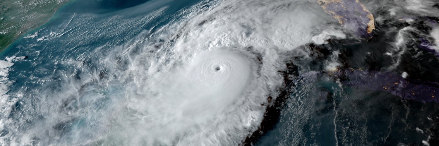
Excessive mid-latitude warmth and cooler tropics in the NHEM continue to be the forefront of the SST anomaly map as we approach peak hurricane season. Stretching the focus of heat poleward has known negative effects on vertical instability in the tropics in which TCs rely upon.

Convection associated with #Invest94L in the central Atlantic has become more concentrated this morning. There’s a brief window for a short-lived TC to develop before it encounters hostile conditions on Tuesday. No major threat, just a reminder that peak season is approaching.
The US brain drain will be felt for generations. Germany never recovered from theirs. Neither will we.
Breaking News: The EPA said it would eliminate its scientific research arm and begin firing hundreds of scientists, after denying that it intended to do so. nyti.ms/4500xIU
It's T-minus two weeks until SSMIS satellite microwave scans go away. The peak of hurricane season lies ahead. "Cuts to Weather Services Could Threaten Hurricane Forecasts" from @VI_Source includes quotes from Dr. Robert Atlas, @FranklinJamesL and me👇🏼 stthomassource.com/content/2025/0…
Specifically, models have honed in on this kink in the ITCZ associated with an AEW. We’ve seen it plenty of times before where models have to play catch up with a small system and overdo TCG as they try to initialize localized areas of vorticity. Not an imminent threat at all.
Some of the global models are hinting at the ITCZ getting more active to end the month. TCs rolling up within the ITCZ are common especially early in the season with recent examples: Elsa 2021 Gonzalo 2020 Beryl 2018 Bret, TD 4, Don 2017 Danny 2015 TD 2 2014 Chantal, Dorian 2013
Incredible shrinking cone! Great illustration showing how the Cone of Uncertainty has shrunk dramatically over time. Stark difference: Compare Kartina in 2005 to Helene in 2024. Hurricane forecasting has a come a long way due to the expertise of NOAA scientists and it's…
Something I noticed in the hours of Congressional budget meetings on NOAA/NWS is the intese focus on fully restaffing NWS but without recognition of the experience and institutional knowledge lost to DOGE cuts. There's no easy fix for losing so many mid- late career forecasters.
Some of the global models are hinting at the ITCZ getting more active to end the month. TCs rolling up within the ITCZ are common especially early in the season with recent examples: Elsa 2021 Gonzalo 2020 Beryl 2018 Bret, TD 4, Don 2017 Danny 2015 TD 2 2014 Chantal, Dorian 2013


🌀 Time is running out for the disturbance in the northern Gulf to develop into a tropical cyclone and odds have decreased to 30%. ☔️ Regardless, the heavy rain threat remains the same. 📲 Stay weather aware. ⚠️ Have multiple ways to get warnings. 🌊🚗 Avoid flooded roads.
⚠️ The threat for flash flooding will be greatest today and remain elevated into Friday, especially along the coast. ☔️ Most areas along and south of I-10 will see an additional 2-4" of rainfall and a few areas near the coast could see totals as high as 6-8" through Saturday.
The low-level center of #93L is inland over N FL now, with just some disorganized thunderstorms to the southwest out over water. We'll see if it can attempt to reorganize, but at this point it may not have enough time over water to develop significantly.
🌀 While a tropical depression cannot be ruled out near the coast on Thursday, the main focus remains the heavy rain threat. ⛈️ 3-5" of rain is in the forecast Wed-Sat along and south of I-10/12, but localized areas could see upwards of 8-10" especially near the coast. 👇👇👇
☔️ Deep tropical moisture is on our doorstep and this will increase the threat for heavy rainfall and flooding beginning on the coast today and then spread inland through the end of the week. 📲 Stay weather aware. ⚠️ Have multiple ways to get warnings. 🌊🚗 Avoid flooded roads.
As expected, the surface center continues to move inland near FL/GA and is unlikely to emerge into the Gulf. The mid-level center, collocated with deep convection, has moved into the NE Gulf. This will be the focus for a new center to form downshear as it moves west toward LA.
EPS guidance illustrates an uncertain future for #Invest93L. The sfc low is likely to bury itself inland over GA while the MLC stays decoupled and moves into the Gulf. Prospects of TC development are dependent on how quickly a new sfc center can redevelop before LA landfall.
The same people who claim the government is controlling the weather through human-caused modification are usually also the same people who don’t believe humans could be causing the climate to change or don’t believe the climate is changing at all. They’re so close to getting it.
I am so over this nonsense. 365K followers on this. For those of who can still think critically, I promise you there is always an explanation in between "climate emergency" and "the clouds are attacking us." Please take back the conversation and don't feed into the clickbait.
EPS guidance illustrates an uncertain future for #Invest93L. The sfc low is likely to bury itself inland over GA while the MLC stays decoupled and moves into the Gulf. Prospects of TC development are dependent on how quickly a new sfc center can redevelop before LA landfall.
#93L passed near buoy this morning, showing pressures are down to around 1014mb. However the storm itself doesn't look good as the LLC has sheared off and convection is limited. Some of the guidance keeps it over land now, and if it does get into the Gulf it will likely have a…
Same story with the ECMWF. It’s not impossible this system attempts to develop before moving into northern Florida. 12Z Euro has the vortmax move inland and never reemerge into the gulf fully. Still a lot of solutions on the table currently.
Case in point: 12z guidance is still correcting toward a more coherent surface low associated with this system at initialization. Main uncertainty then becomes how much of a tug north/inland this system feels due to a break in the high Tuesday before getting shoved westward.
Case in point: 12z guidance is still correcting toward a more coherent surface low associated with this system at initialization. Main uncertainty then becomes how much of a tug north/inland this system feels due to a break in the high Tuesday before getting shoved westward.
Even though it’s being sheared from the north currently, this deep convection at diurnal max this morning is a healthy sign for TCG. This weak surface low appears to be better defined than global guidance had originally indicated and will need to adjust.