Andy Hazelton
@AndyHazelton
Associate Scientist at the University of Miami CIMAS. This is a personal account and tweets do not represent the opinions of NOAA or UM. 3x FSU Alum #GoNoles
Wavebreaking? High latitude warmth? Slowest start to the season since 2009? All we need is FSU to get good at football again and it'll be 2013 all over again!
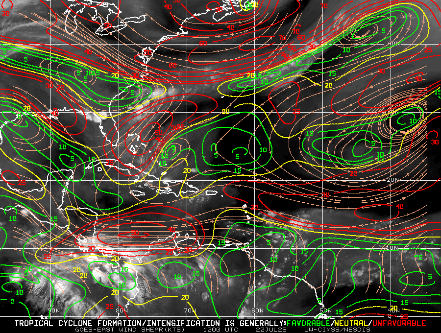
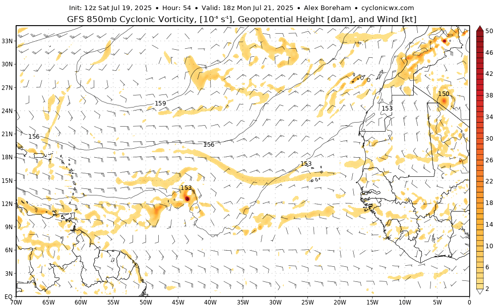
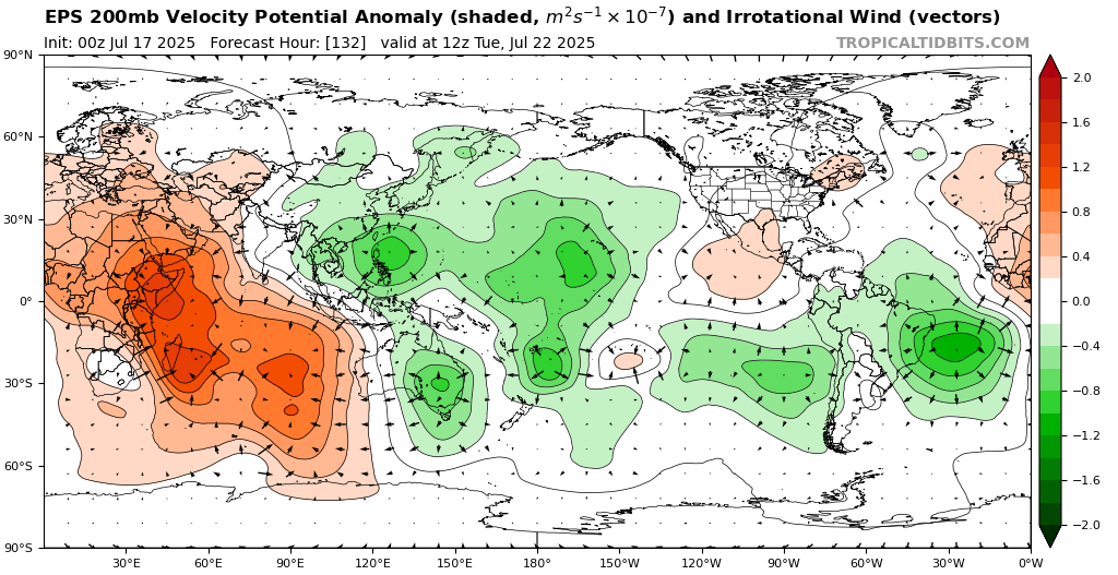
Good example of anticyclonic wavebreaking in the Atlantic to end the month. This will encourage TUTT formation with the higher PV air dipping south. This also leads to anticyclogenesis, creating a strong high pressure, which will dump drier air into the eastern Atlantic. Should…
Besides #94L, the wave over West Africa might be one to watch for a brief spin-up in the MDR later this week as it interacts with a Kelvin Wave. It'll face a lot of the same issues as #94L, though, with a lot of dry air lurking to the north and fairly fast trade wind flow into…

I'm kinda of the same opinion that August may be quiet in the Atlantic despite favorable MJO. Background stability is pretty hostile this year, and will suppress convection even if/when shear is more favorable. If we get Pacific MJO at peak (TBD but that's what current…
The stars are aligning on a seasonal and subseasonal scale for this year’s Atlantic Hurricane Season to be pretty underwhelming compared to normal thru early-mid Sep, while also finishing quite strong late Sep into Oct
Been working on this for a while - thanks to The Hill for publishing this op ed I worked on talking about the importance of NOAA's hurricane forecasts, including the research that underpins it all. Thanks to the writing team that helped as well! There has been some promising…
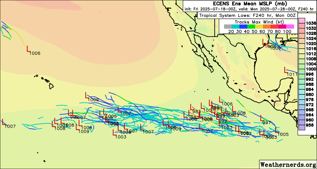
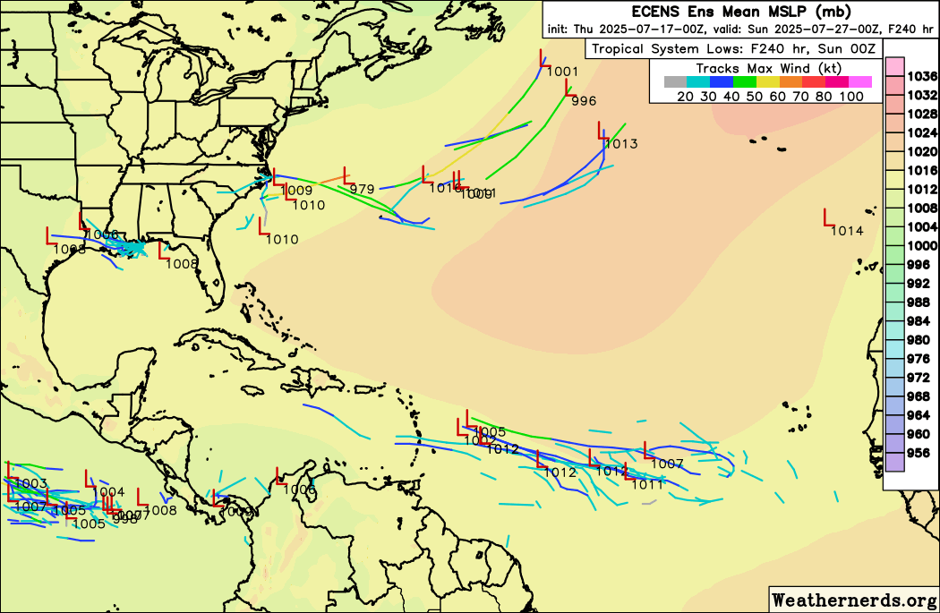
Models continue to advertise a low-end chance for a spin-up in the Atlantic MDR as a Kelvin Wave moves in. Perhaps an ITCZ spin-up. Likely wouldn't last very long due to hostile conditions. Also a slight chance of another 93L-like system in the Gulf or something off a front in…

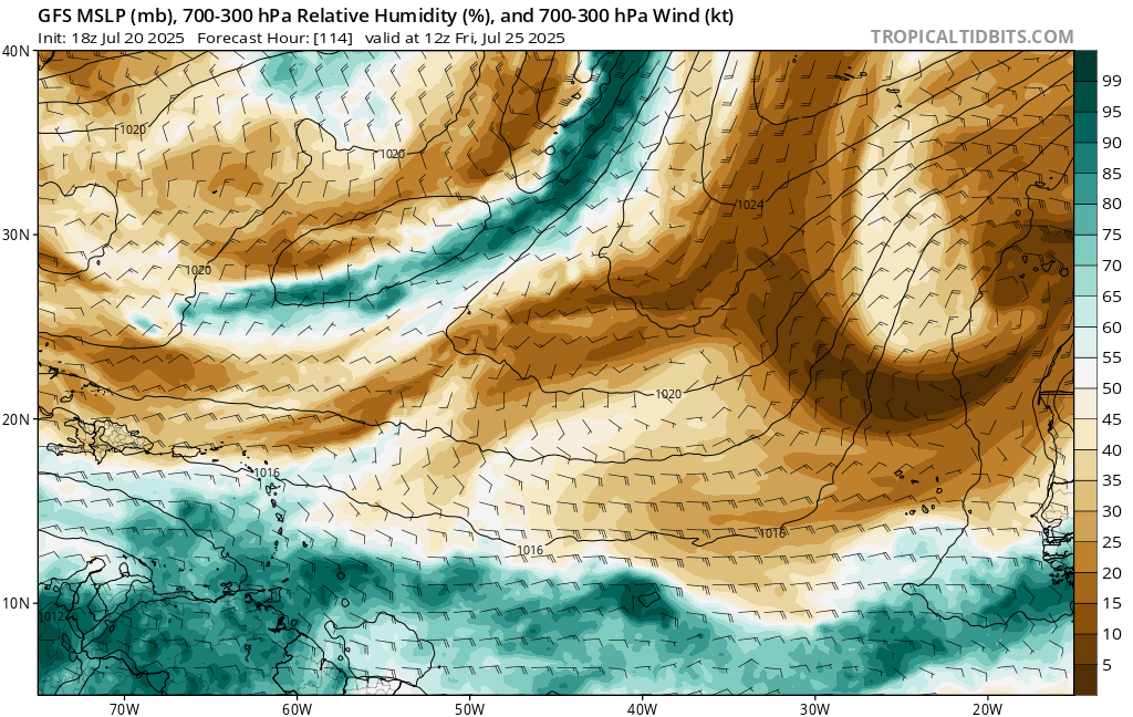
This +NAO configuration tends to cause issues for the Atlantic in a few ways. One of the big ones is sending dry air down into the MDR. You can see one prominent example on the Day 10 GFS. Along with the background stability, this is going to make it very difficult to get…
Basin wide high pressure will limit tropical development over the MDR along with a +NAO in the extended range.
#94L is still producing some scattered showers this morning, but nothing very organized. It's heading into a higher-shear environment in the Eastern Caribbean, so further development seems unlikely. Still probably at least couple of weeks away from the MDR potentially being…

Looks like this area of disturbed weather in the ITCZ was tagged as Invest #94L. May bring enhanced showers to the Lesser Antilles this week, but pretty low chances of development overall. The environment in the Caribbean is pretty hostile (as is typical for July), with strong…
Florida’s excessively hot weekend is due to this due to this a nearly record breaking heat dome. Deep red indicates values higher than the 99.5% threshold for this time of year. For you statistics gurus, it’s about 3.5 standard deviations/ sigma from the mean. Thanks @burgwx for…
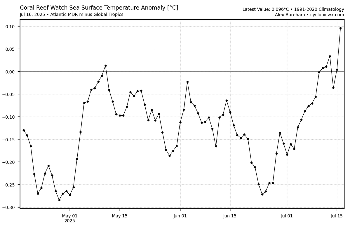
With the recent Atlantic warming, I thought it would be interesting to compare the global anomalies (detrended as always) with all the years in the OISST dataset. Few thoughts: -NW Atlantic warmth really stands out compared to most analog years. This subtropical warmth will…
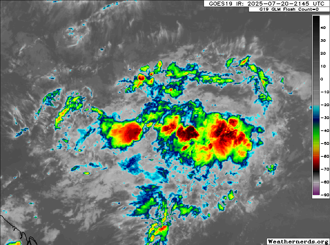
The area of disturbed weather in the Central Atlantic is still firing some thunderstorms along the ITCZ. Some development remains possible, although recent model runs look more elongated, and the environment is pretty marginal overall.

This area in the ITCZ looks pretty healthy today, and model signal has increased enough to warrant a mention in NHC's outlook. This system probably won't last very long due to dry air and then strong shear near the Caribbean Islands, but a brief TD/TS seems plausible.
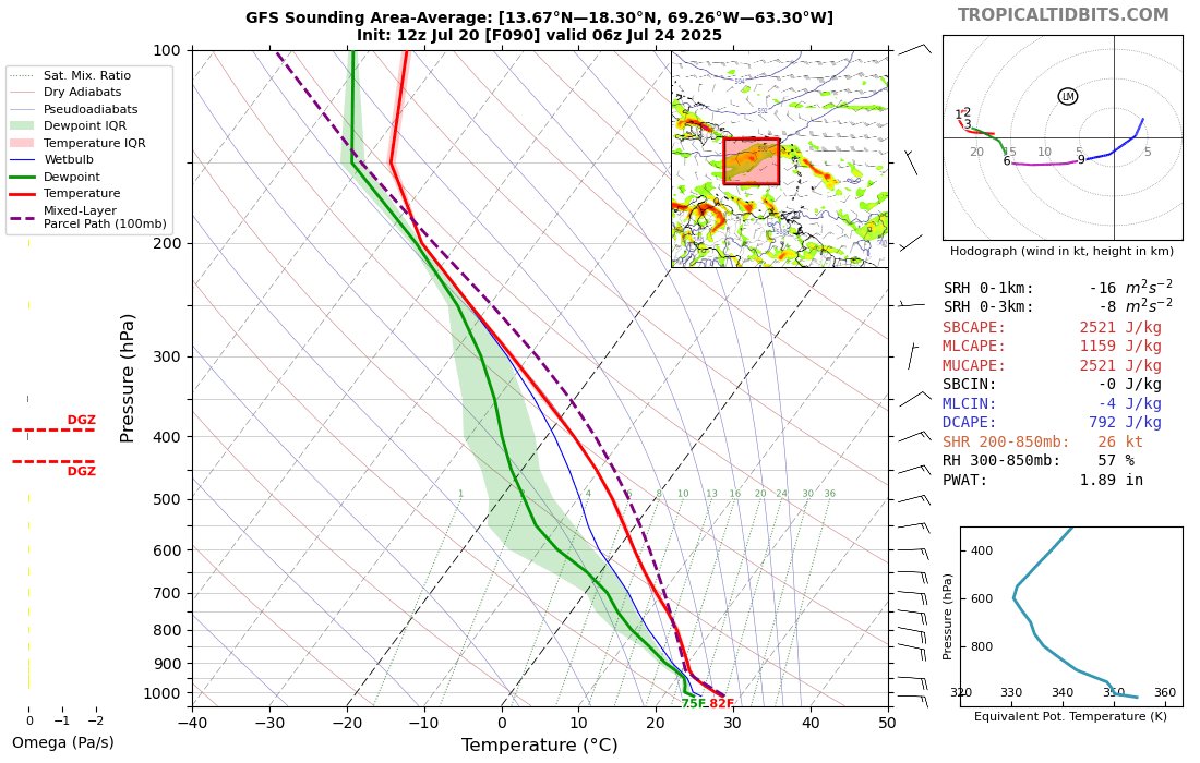
7/18 8pm EDT: A tropical wave interacting with a broad area of low pressure is producing disorganized showers and thunderstorms over the central tropical Atlantic. Slight development is possible late this weekend into early next week as it moves west-northwestward around 10 mph.…
Despite all the flooding from abundant tropical moisture to start the hurricane season, tropical systems have so far struggled to organize or hold together. The overall season-to-date ACE is the lowest we've seen since the early season shutout of 2009. ⬇️ michaelrlowry.substack.com/p/disturbance-…
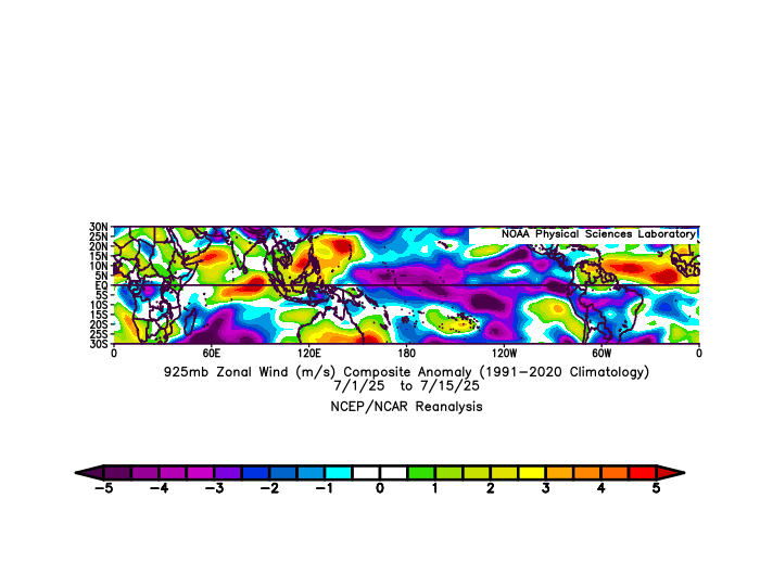
Recent trade wind patterns (weakened across the Atlantic, stronger across the East Pacific) have led to warming of the Atlantic MDR and cooling of ENSO. The Atlantic is now slightly warm relative to the global tropics, in a more favorable configuration than we've seen since…

With #93L's chances of development diminishing, the next (slight) chance for development in the Atlantic may be in the Central Atlantic in 7-8 days following the passage of a Kelvin Wave. This Kelvin Wave will give a brief convective boost to a low-amplitude wave forecast to come…

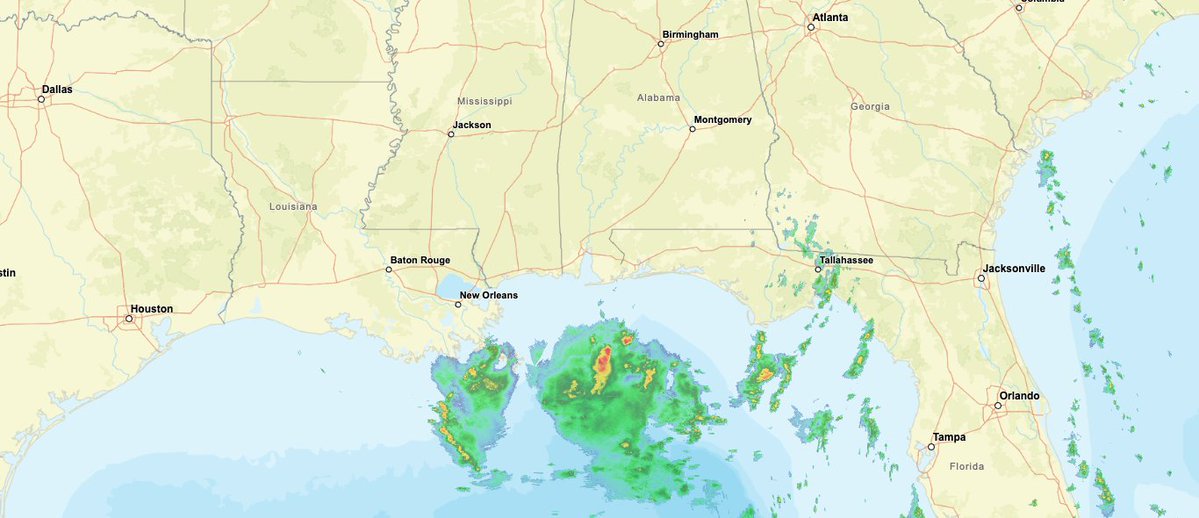
The low-level center of #93L is inland over N FL now, with just some disorganized thunderstorms to the southwest out over water. We'll see if it can attempt to reorganize, but at this point it may not have enough time over water to develop significantly.


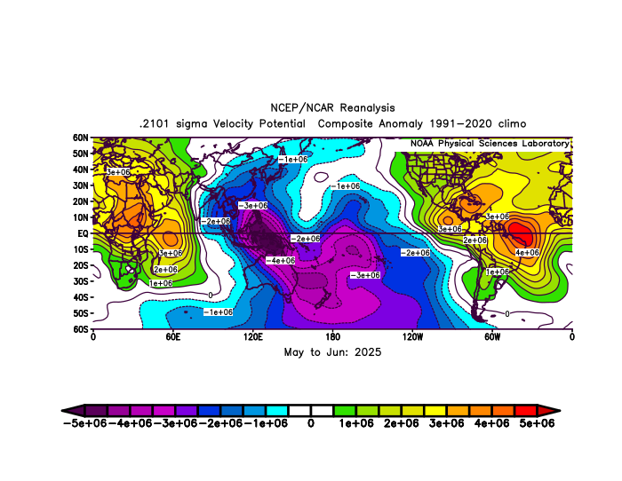
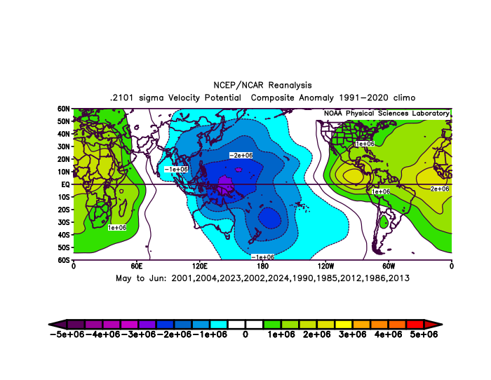
Based on a suggestion from @WxTca, I applied my analog matching technique for SSTs to "velocity potential" (a metric for large-scale rising/sinking motion) from the NCEP/NCAR reanalysis. The Top 10 years (since 1980) based on this metric for May-June were: 2001 2004 2023…
Some good news - based on what I can tell from initial reports, the draft budget bills coming out of the Senate and House seem to have much smaller cuts to NOAA than what was in the admin budget request. Also worth noting that even a flat budget (like what the Senate has) is…
#93L is a bit convectively-challenged this morning as it nears the NE FL coast. The low-level center is well north of the limited thunderstorm activity due to some ongoing northerly shear. It'll be interesting to see if the circulation stays over water in the Gulf, or a new one…

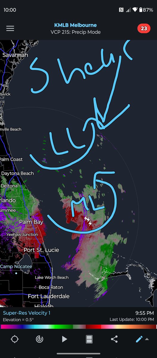
The Melbourne radar shows clear N-S vortex tilt in #93L due to some northerly shear. Probably won't fully resolve itself before the system crosses Florida sometime tomorrow. We'll see if the low level center is tugged south towards the MLC at all, which might give it more time…