Alex Boreham
@cyclonicwx
Tropical meteorologist, B.S. @floridastate, Masters student @FloridaTech. Amateur web, Python, & GrADS programmer. Also known as Not Sparta
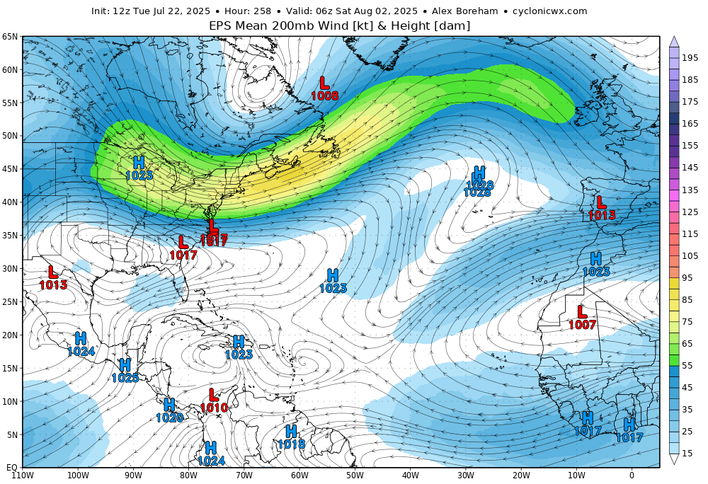
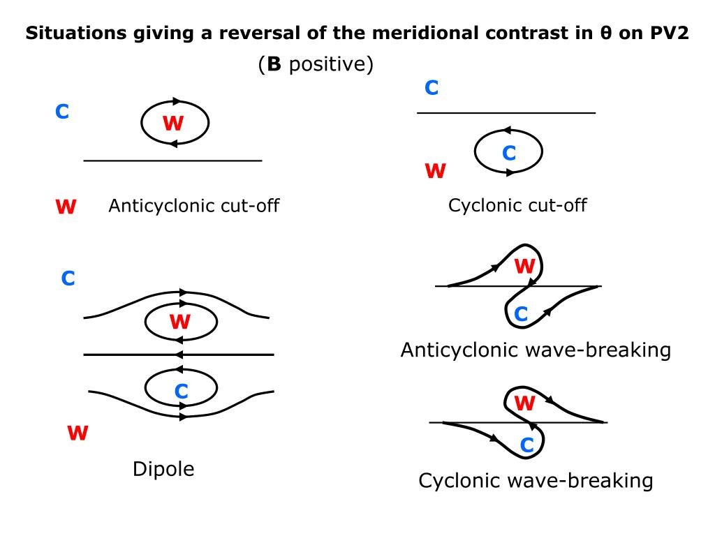
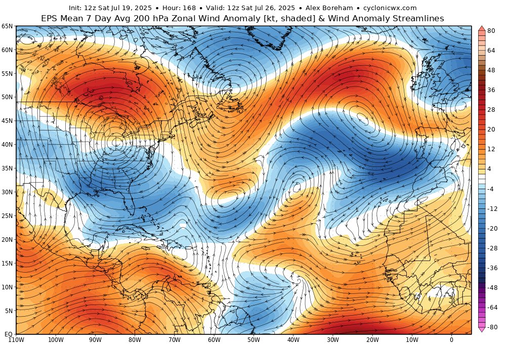
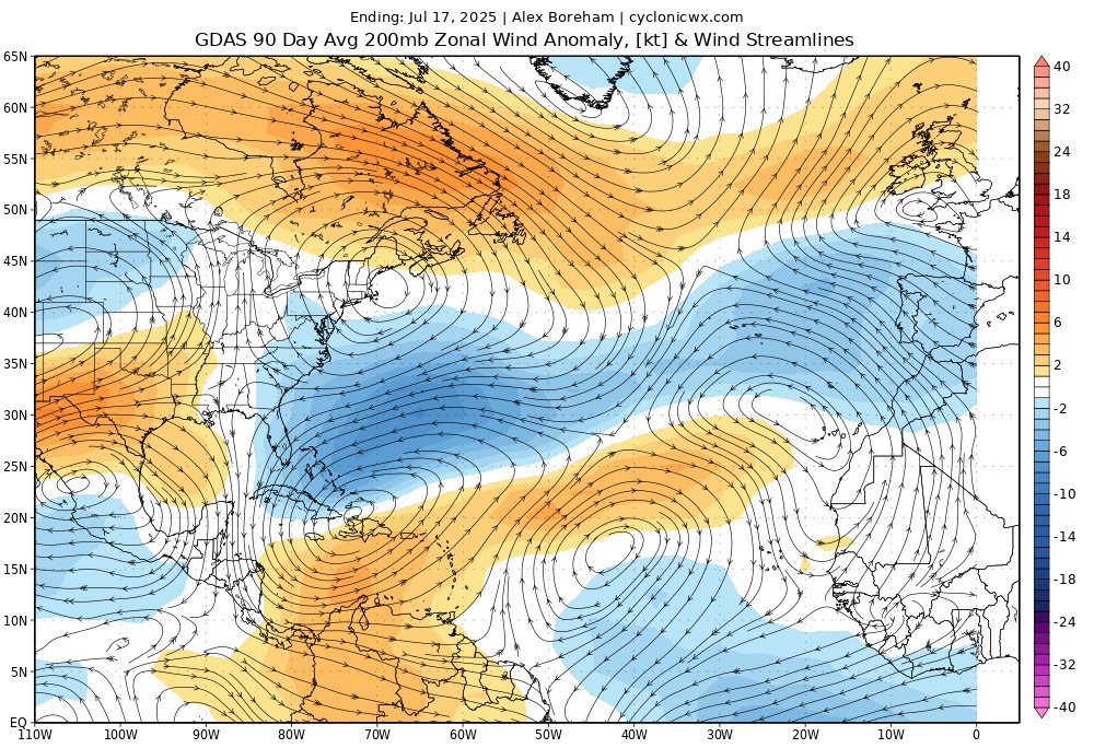
Good example of anticyclonic wavebreaking in the Atlantic to end the month. This will encourage TUTT formation with the higher PV air dipping south. This also leads to anticyclogenesis, creating a strong high pressure, which will dump drier air into the eastern Atlantic. Should…
Looks like some issues with the GOES data flowing right now. Luckily this year I've got a backup which is keeping things up to date. Only downsides are no data south of the equator and low resolution visible data in full disk. #93L still appears sheared, and its convection is…
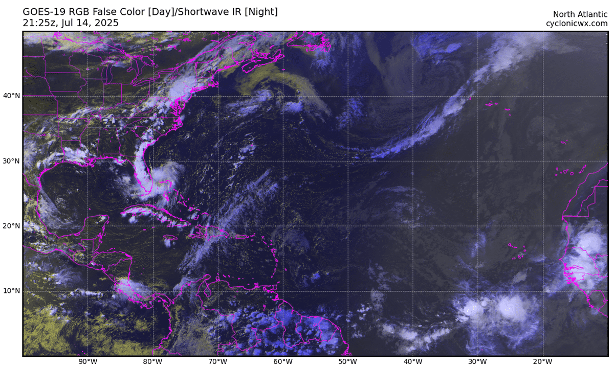
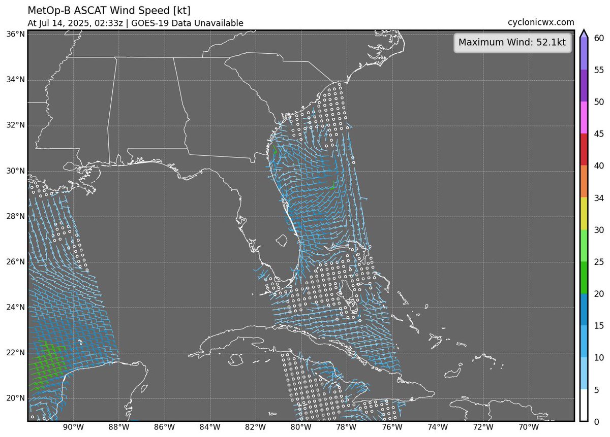
The east coast disturbance has been looking decent this morning, with a weak circulation apparent and widespread convection. Some notable NNE shear keeping the center on the edge of the convection. We'll have to watch its progress. Stronger system more likely if it develops…
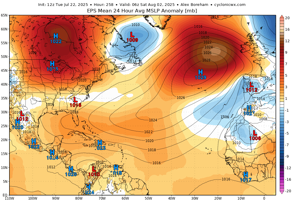
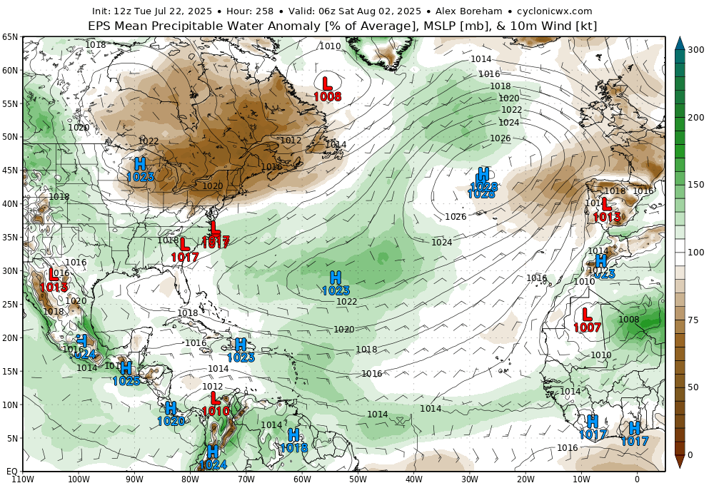
Interestingly strong signal for an anomalously strong Azores high towards the start of August on the EPS. It seems to be tied to a wave train incited by West Pacific convection over the coming days. Probably something worth watching, due to its possible impacts on the Atlantic.
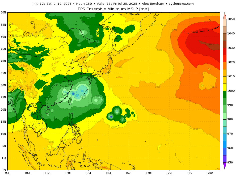
Today I'm filling a missing spot in the model lineup, adding EPS data! Another ensemble suite is nice to counteract GEFS's biases. You can see many of the same products GEFS has, with one extra - ensemble minimum MSLP, making it much easier to see how enthused the ensembles are…
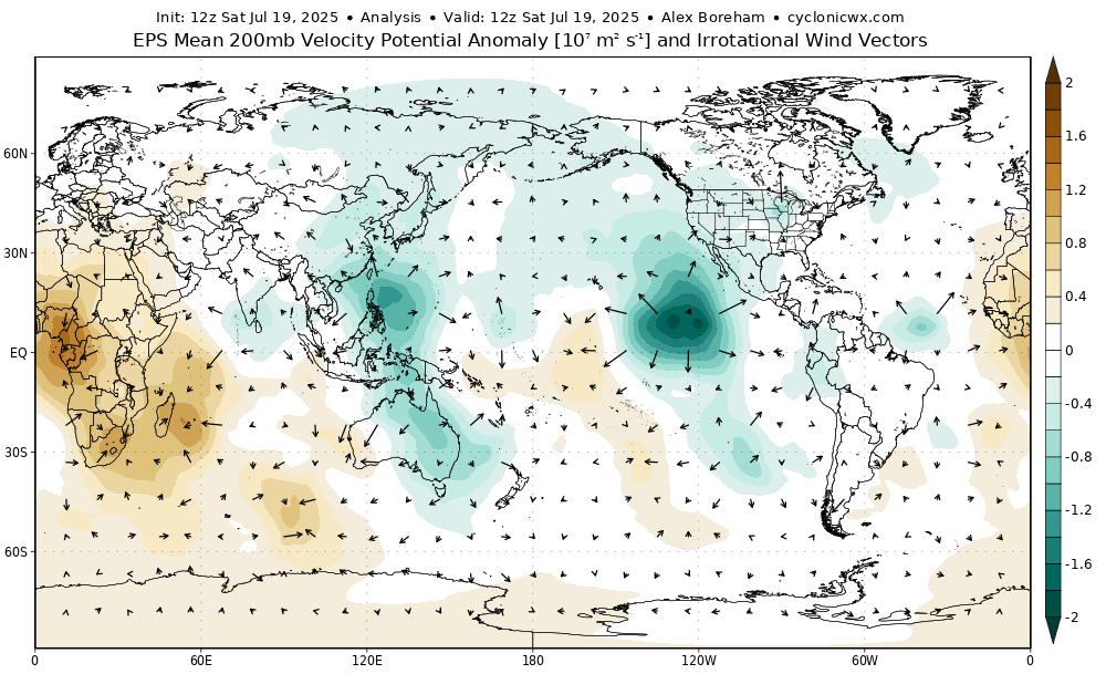
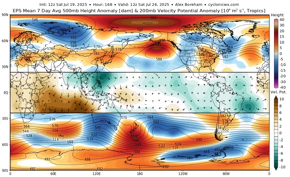
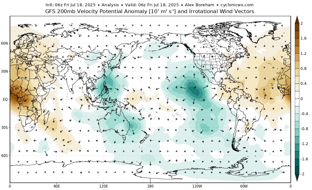
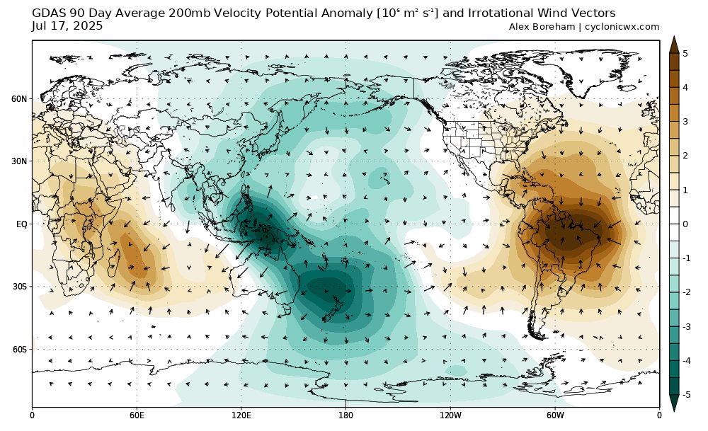
I've made some new velocity potential plots! There are both normal VP and also a 7-day averaged one that also comes with 500mb heights. Makes it easier to see how convection in the tropics influences the extratropical pattern! h/t @webberweather for the idea. More to come soon...
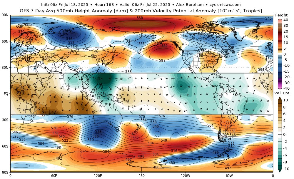
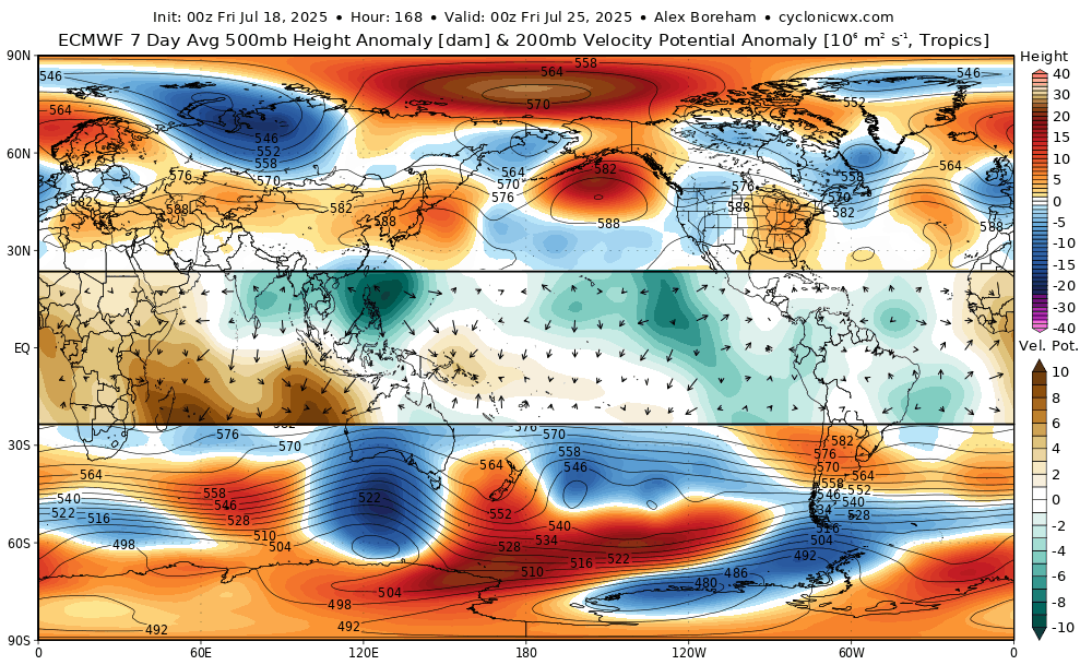
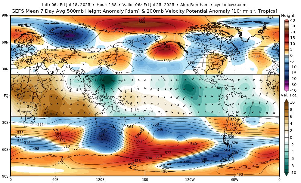
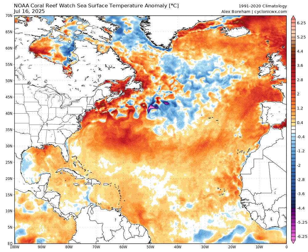
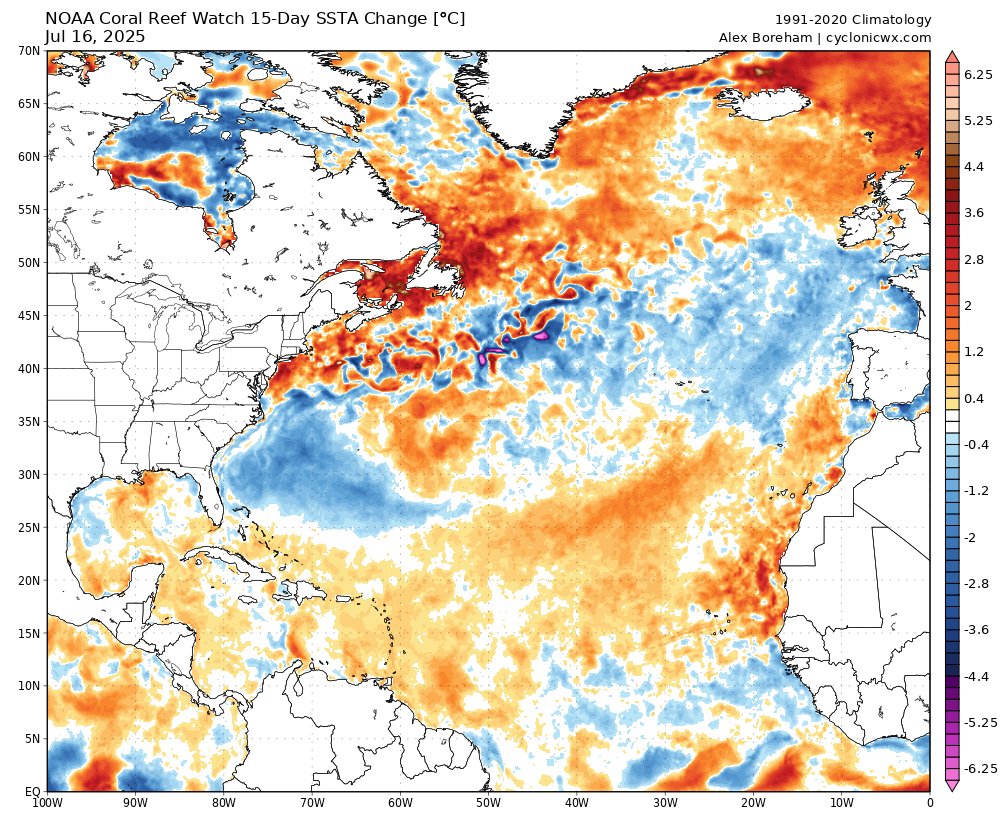
Tropical Atlantic SSTs have warmed recently, pushing it away from the much less active-looking configuration a few weeks ago. However, the El Nino-like tropical circulation remains, causing a strong TUTT and subsidence in the Atlantic. Between this and the subtropical warmth it…
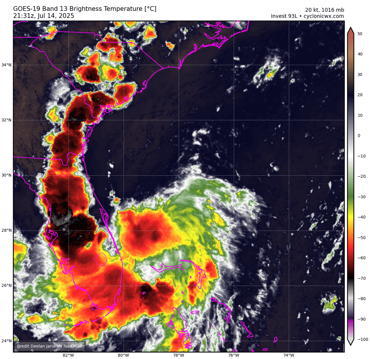
Invest #93L is getting better organized after going over the FL Peninsula & is likely a tropical depression already #93L's low-lvl center remains well defined w/ several prominent spiral bands. #93L's minimum pressure is ~1012mb, not unusual for a TD in this part of the Atlantic
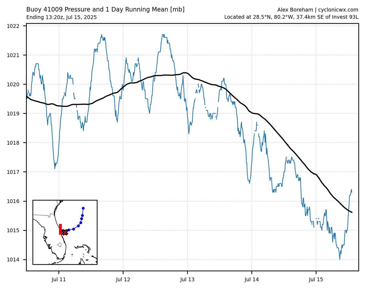
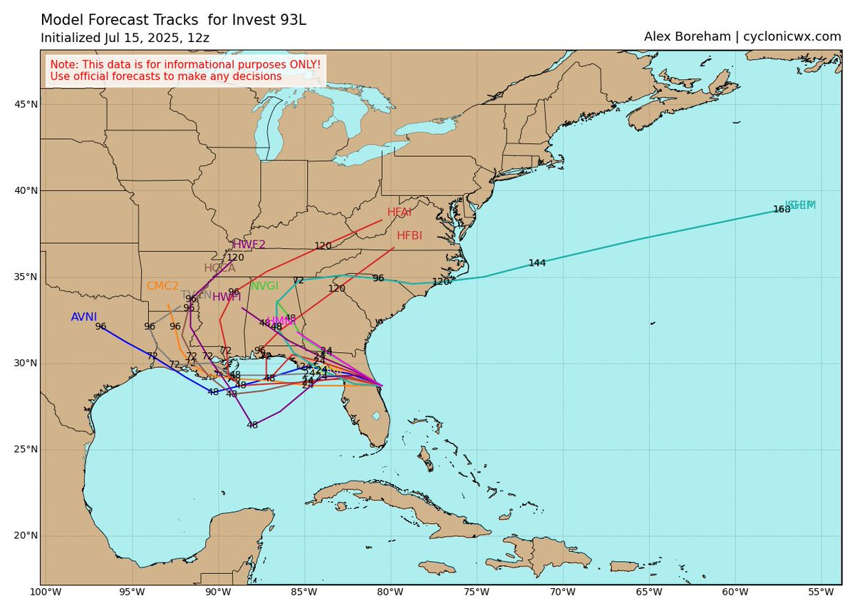
#93L passed near buoy this morning, showing pressures are down to around 1014mb. However the storm itself doesn't look good as the LLC has sheared off and convection is limited. Some of the guidance keeps it over land now, and if it does get into the Gulf it will likely have a…
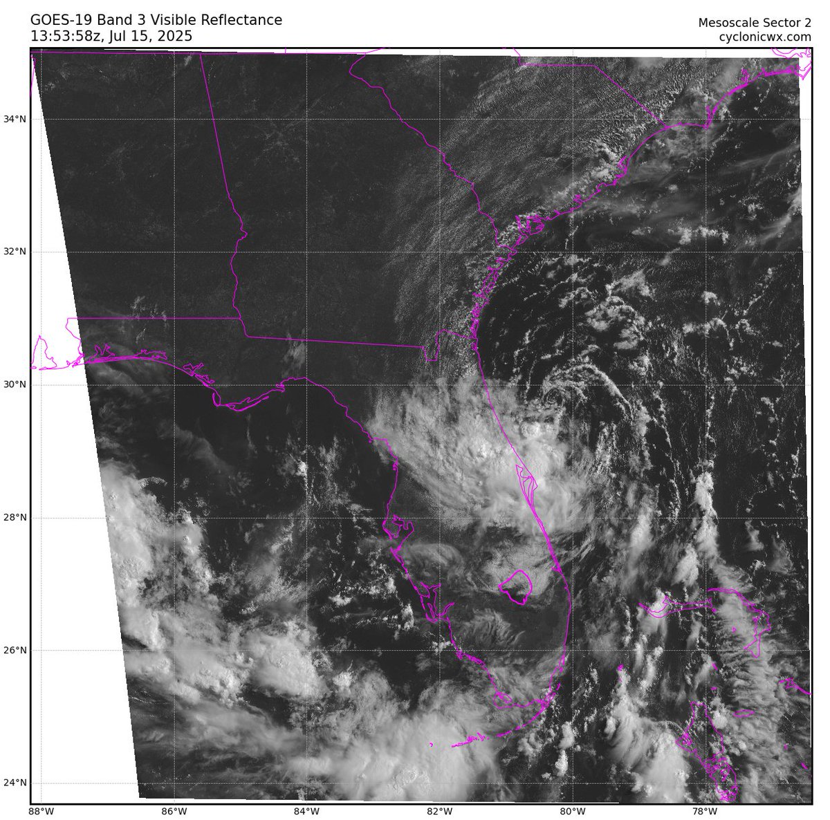
Luckily KMLB came back up right as #93L was designated. You can see some decent banding and a mid-level circulation around 29N. Certainly seems like a higher than 30% chance of development
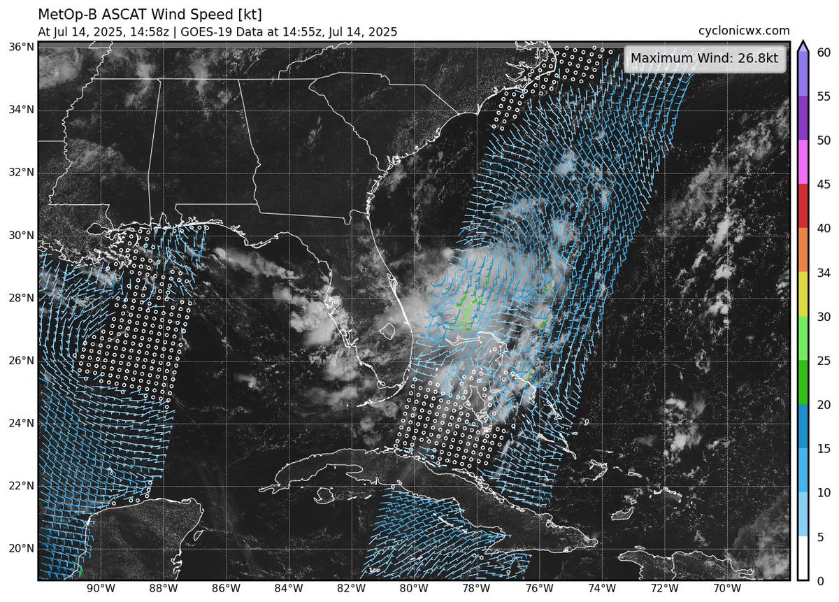
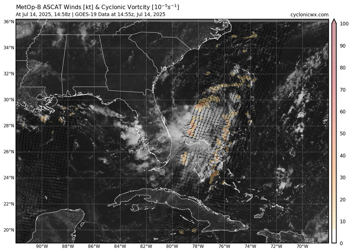
We got a nice partial hit from ASCAT a bit ago. Still an elongated trough, with the northern end sticking out of the convection. Still has some work to do but seems to be overshooting the models so far
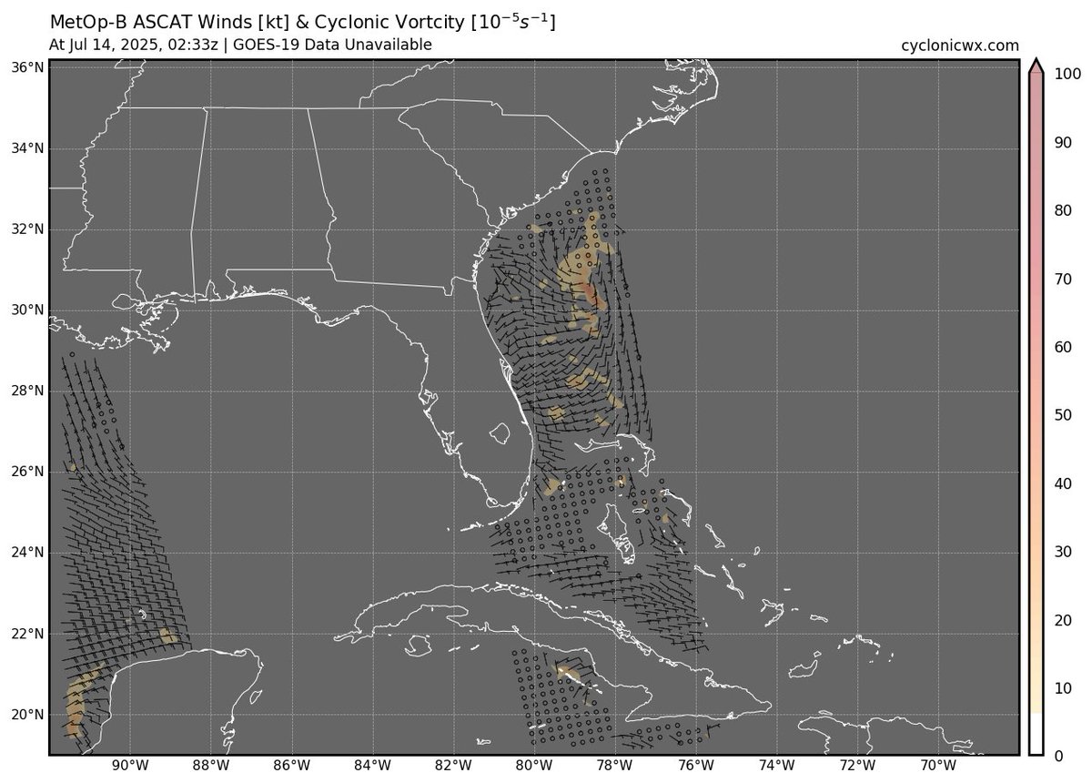
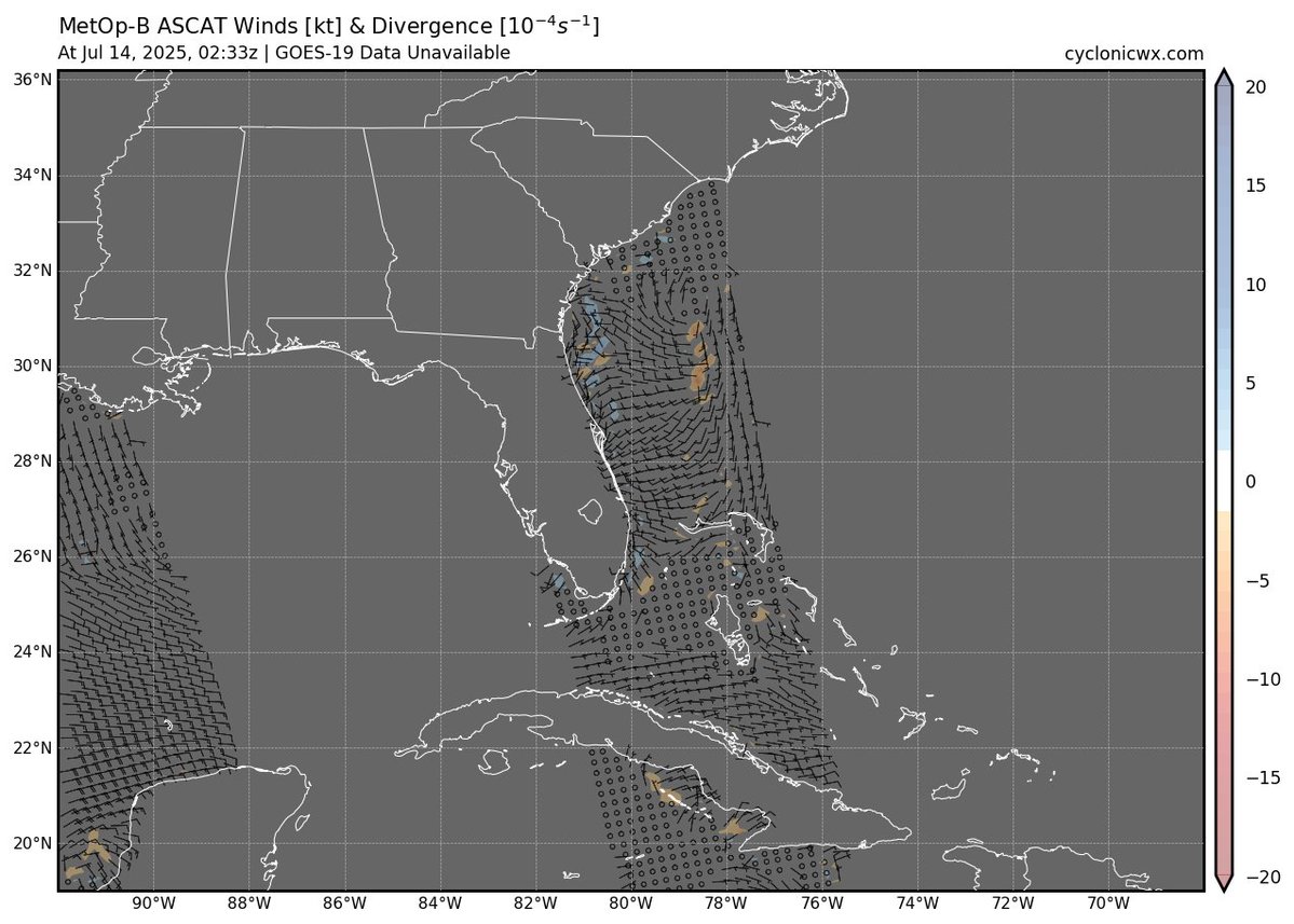
Here's another new feature: regional ASCAT views, because there isn't always an invest to look at (like disturbance off the SE coast). You can choose a tile from the map or just navigate with the arrows. I've also added maps of vorticity and divergence to make it easier to see…
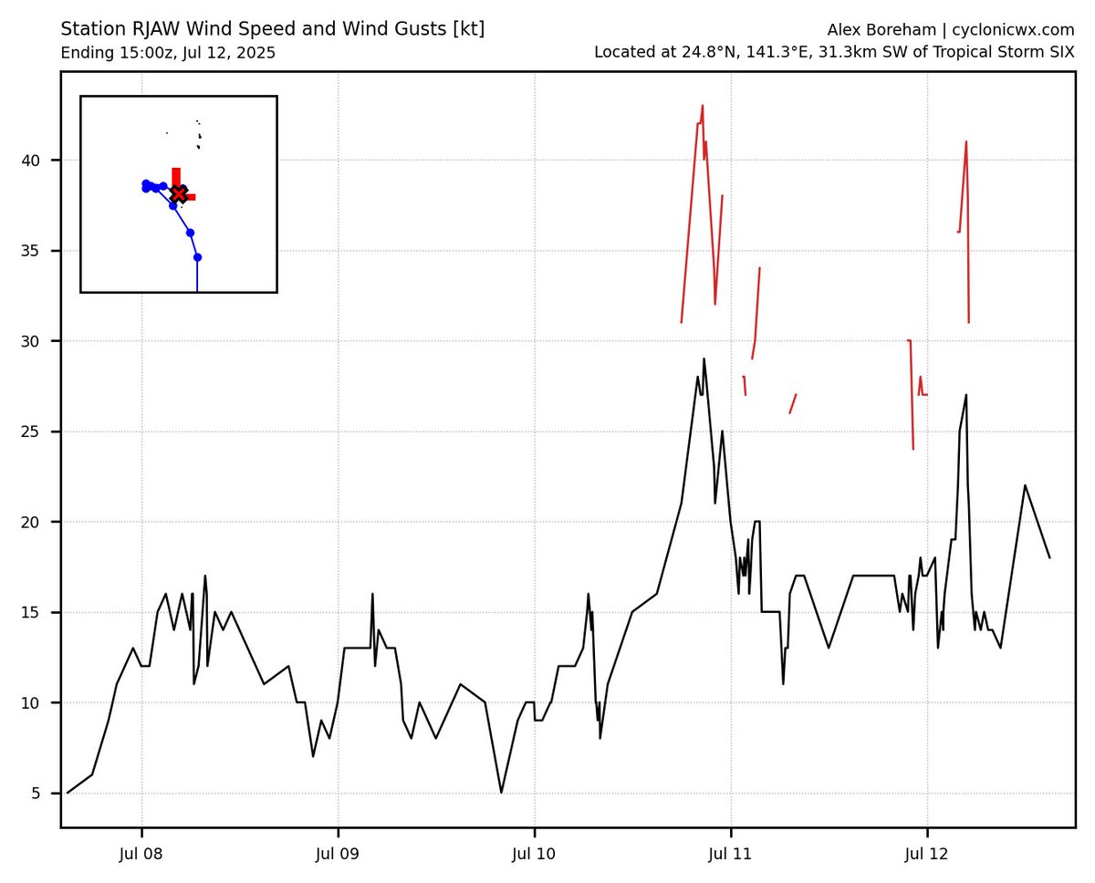
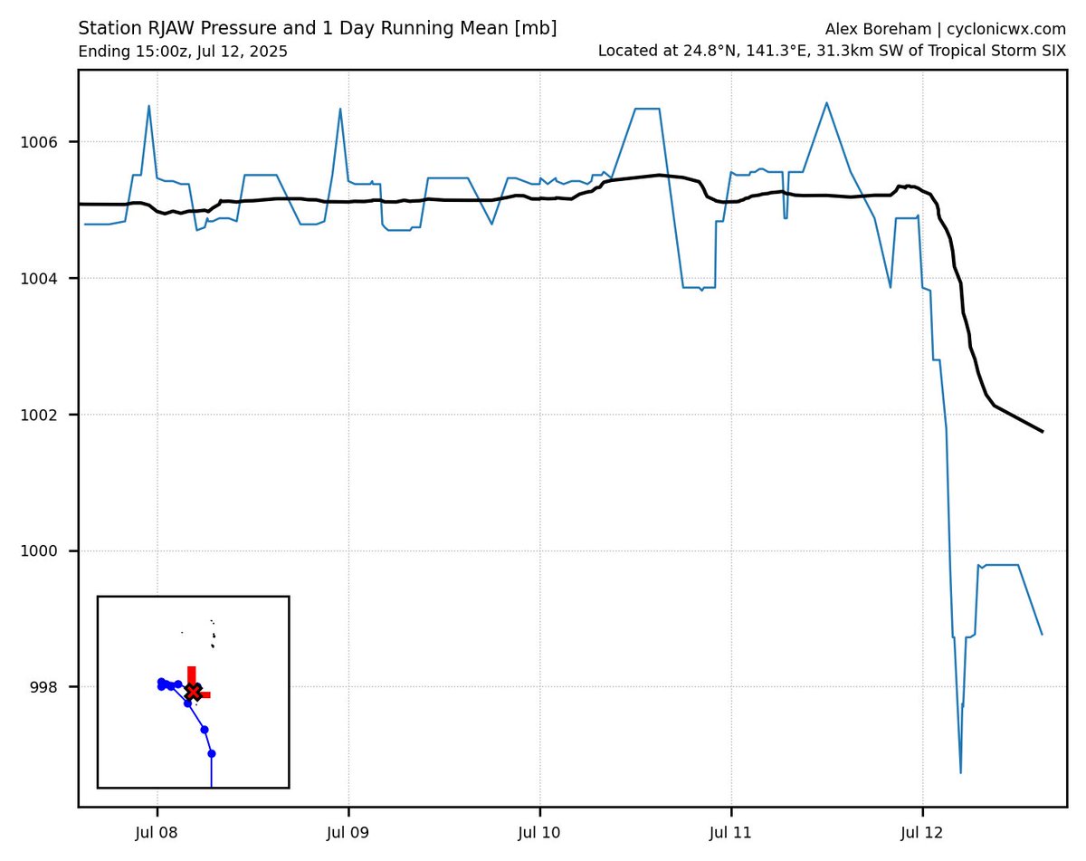
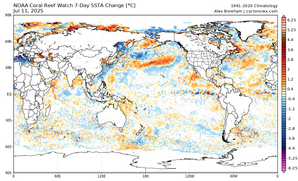
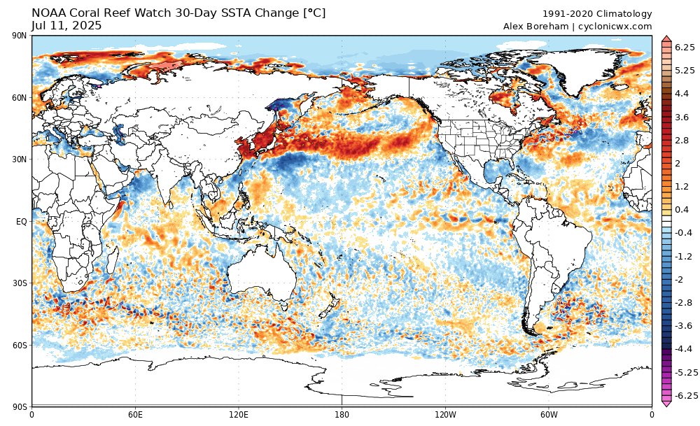
A couple new updates: you can now see data from METAR stations nearby active storms! Here we can see the pressure at RJAW drop with Six passing nearly overhead. I've also added 7- and 30-day SSTA change plots to add more context to the evolution of the SSTs. More to come soon!
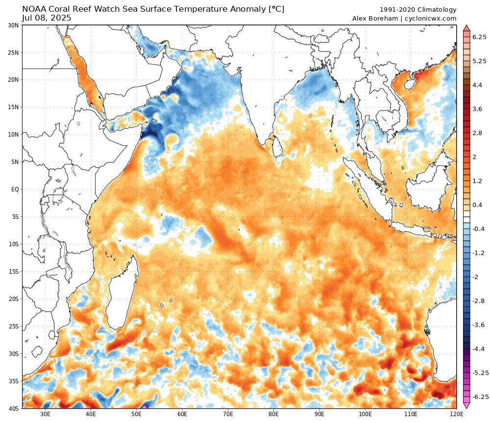
Strong westerly winds in the Arabian Sea per ASCAT. I imagine these winds have been persistent, leading to its water becoming cooler than average thanks to upwelling
#Chantal is very misaligned from shear now - its center is completely outside of the convection. However, it still packs high winds in the thunderstorms, so areas north of where Chantal makes landfall could still see gusty winds although the center will be quieter
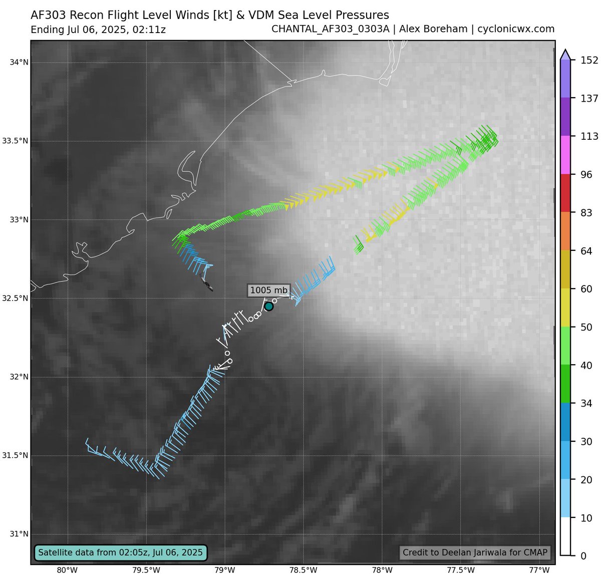
Tropical Storm #Chantal’s low level center has become exposed by strong wind shear. This LLC exists within a broader circulation though, and it will be worth watching if a new center tightens up beneath the bulk of the convection, where radar reveals robust mid-level rotation.
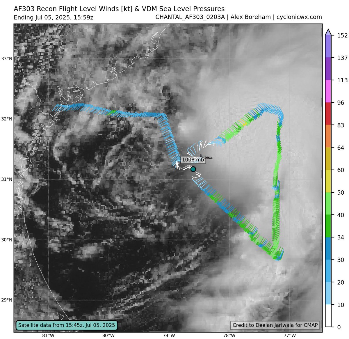
Newly formed Tropical Depression 03L is rather tilted in the vertical due to some 20kt of wind shear. You can see its mid-level center well offshore beneath the deep convection on land-based radar -- note the subtle rotation at 30.5N/78.0W here:
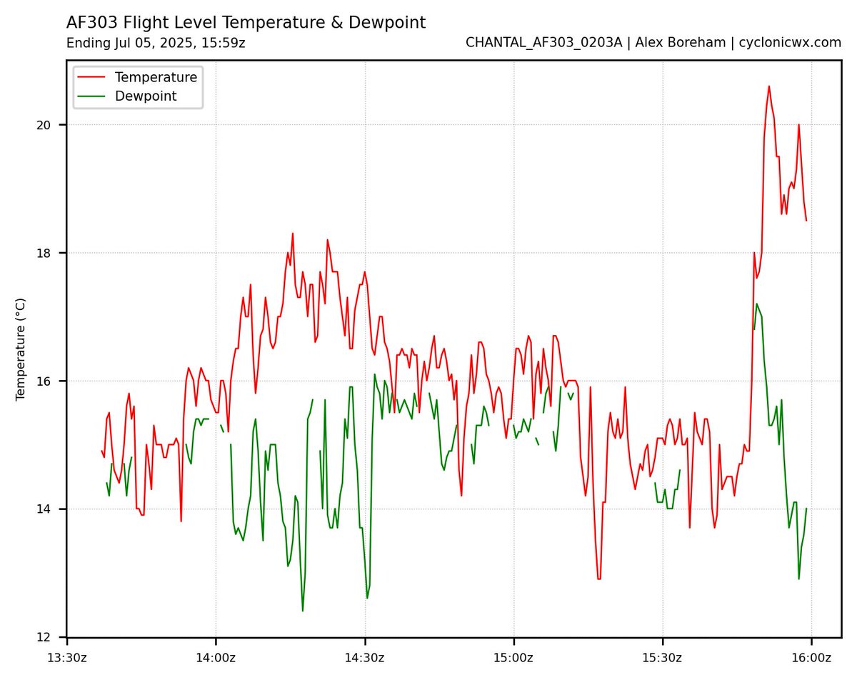
With displaced convection and shear, #Chantal appears to be undergoing a center reformation. There is a circulation center to the NE of the original center fix, with lower pressure and a temperature spike suggesting a stronger warm core. The east weighted nature is also apparent
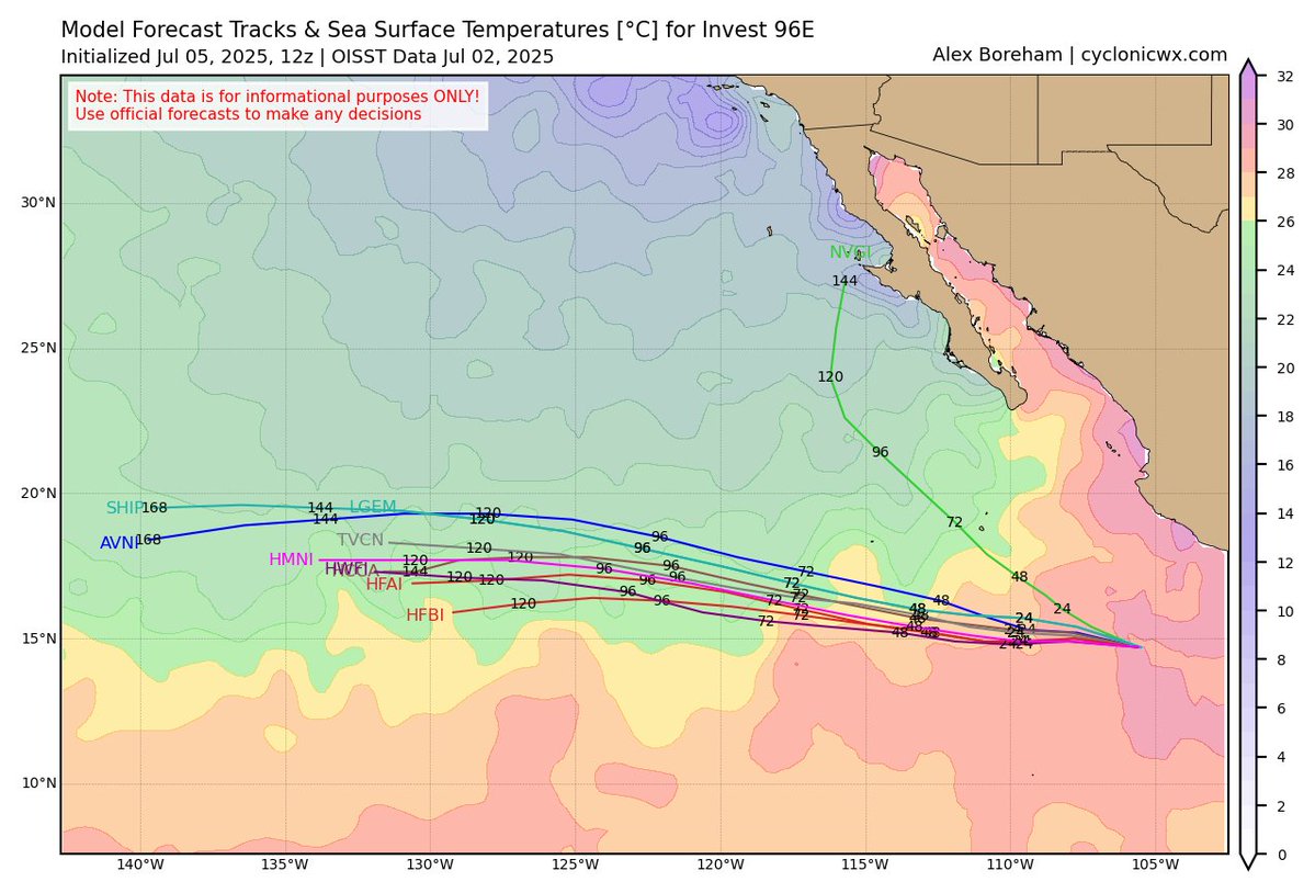
#96E is a good example of how -PDO/PMM can directly reduce activity in the East Pacific. It has been active near Mexico, but long tracking storms are not favored. 96E will run into cool water in a few days, an issue that would suppress activity far less in a +PDO/PMM environment
Newly formed Tropical Depression 03L is rather tilted in the vertical due to some 20kt of wind shear. You can see its mid-level center well offshore beneath the deep convection on land-based radar -- note the subtle rotation at 30.5N/78.0W here:
#92L is trying to get itself organized offshore. Radar from Jacksonville shows the structure well. There's some showers acting as a weak band delineating the low level circulation. But further east, you can also see the MLC embedded in the convection. It's definitely quite tilted…