Matthew Ferreira | MassachusettsWx
@MassachusettsWx
Battles a brittle bone disease. Passionate with weather, medical and forensic psychology/Criminal Justice. He/him.
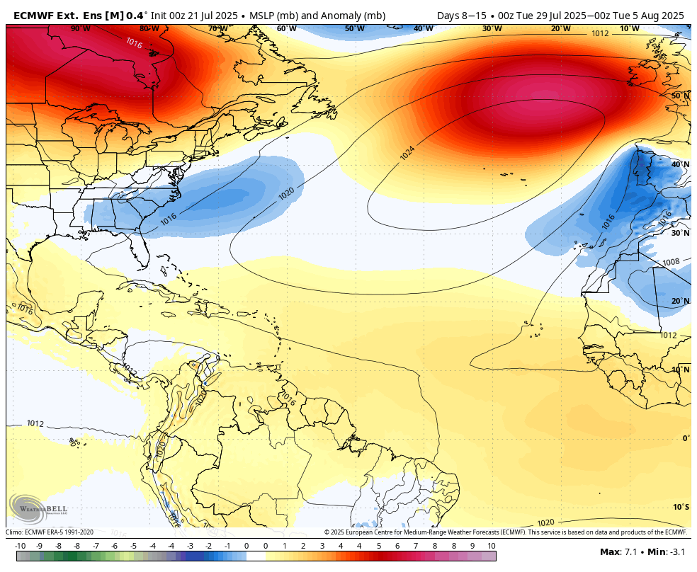
Been keeping an eye on ENSO and its evolution over the peak of the hurricane season and for winter 2025/26, and was fairly skeptical of a transition back to La Nina. However the recent EWB on top of the downwelling kelvin wave finally ending its impact has made thing less clear
**THIS IS NOT THE SPC OUTLOOK, SEE spc.noaa.gov FOR THE LATEST CONVECTIVE OUTLOOK** Loving to see this severe wx threat land on my birthday. Hoping to get the goods with @BenCohenTC!
We have added the ECMWF AIFS to Synoptic! Utilize most hi-resolution and interactive platform for the AIFS for: 🔴 Sim Radar 🔴 QPF 🔴 Wind Speed 🔴 Upper Air Heights, Winds & Temps 🔴 Snow Totals Check it out at synopticwx.com
Specifically in Boston, we start to lose decimal points in avg temps starting Wednesday and slowly accelerating until latee January.
Historically, this is the hottest time of the year for Boston. This weekend marks first step down of avg temps. Sad to see the hottest time of summer end so soon. :(
Historically, this is the hottest time of the year for Boston. This weekend marks first step down of avg temps. Sad to see the hottest time of summer end so soon. :(
Basin wide high pressure will limit tropical development over the MDR along with a +NAO in the extended range.
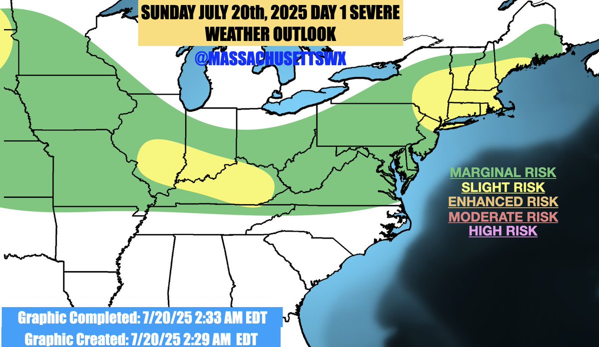
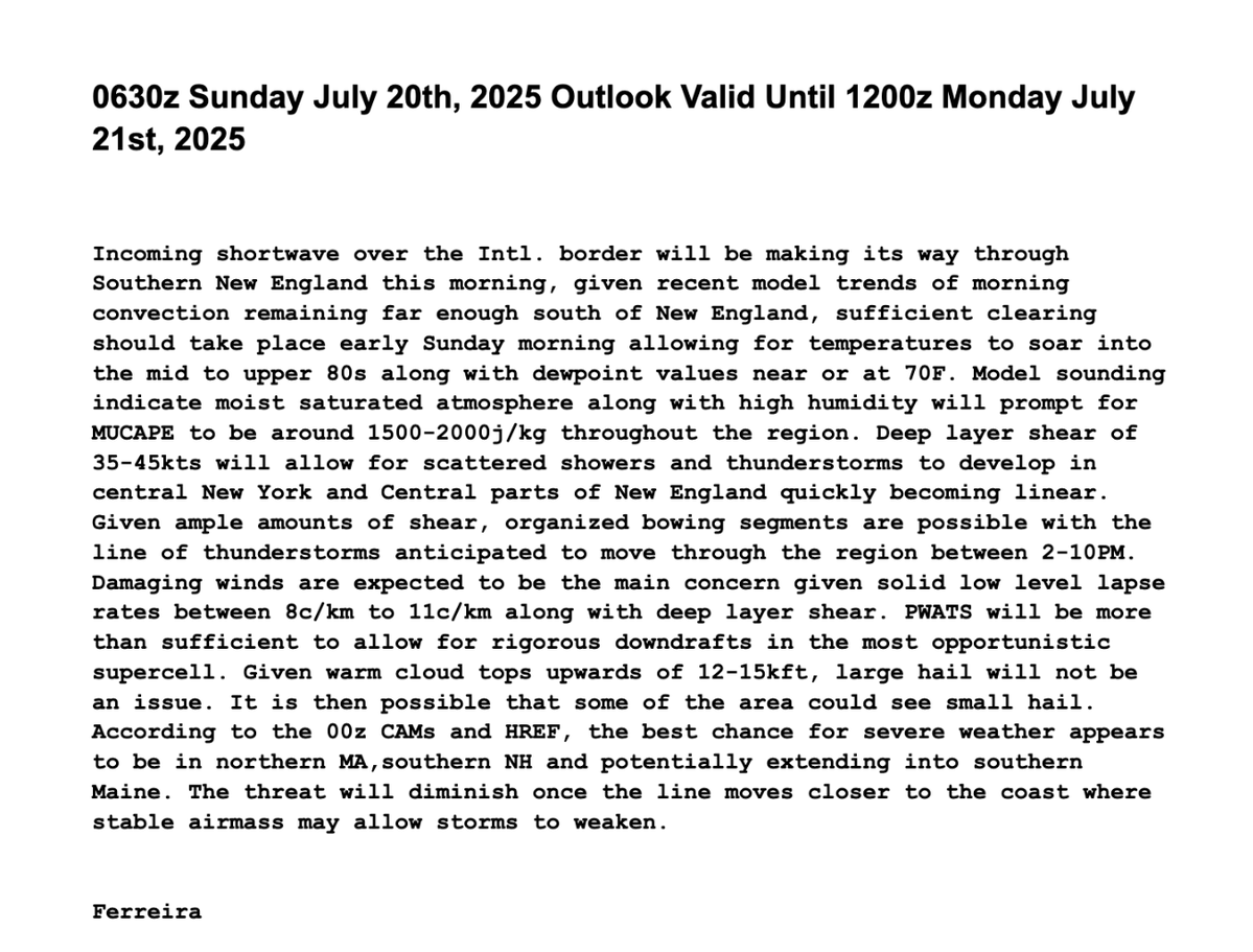
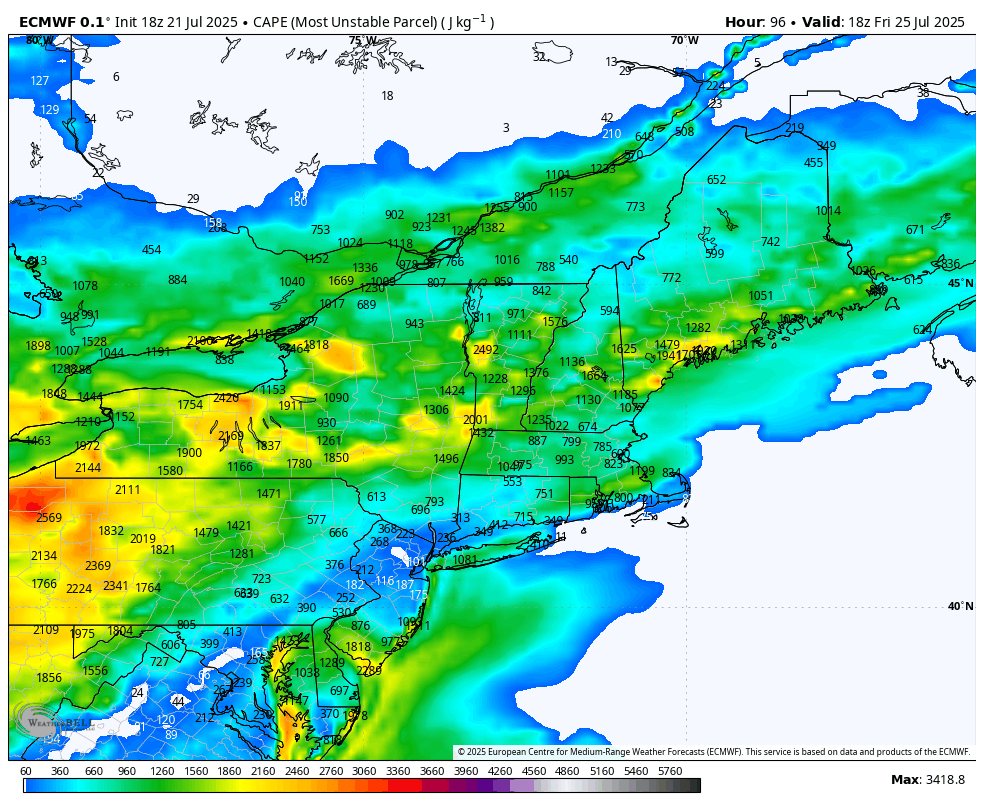
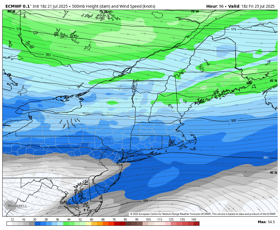
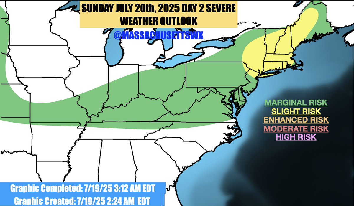
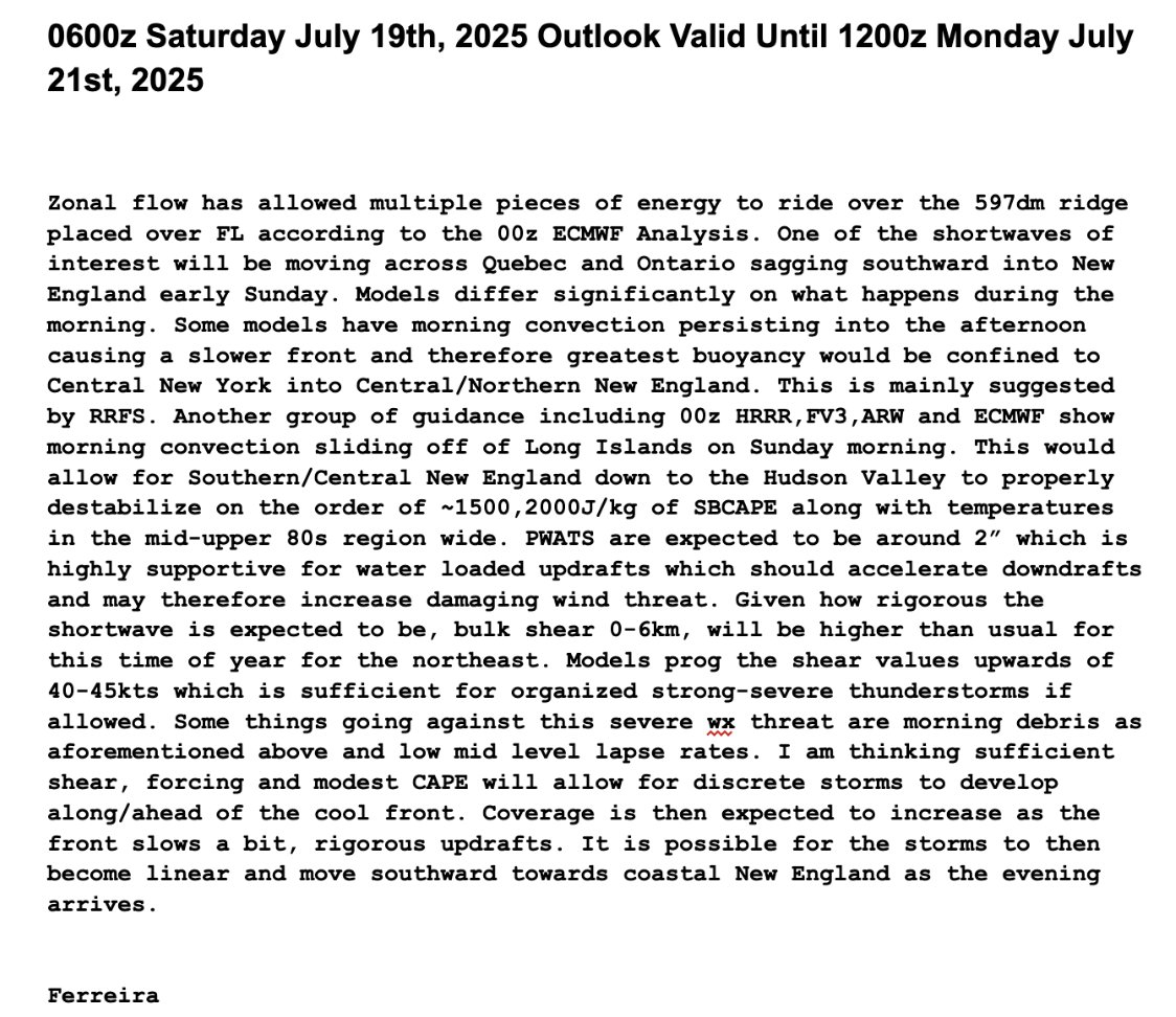
Unlike some others, I am not intrigued by Friday. Low CAPE values caused in part by lower dewpoint values and highest shear in CNE/NNE, will likely make it hard for storms to develop and become severe for SNE. Greatest risk for storms is further north in Central New England.
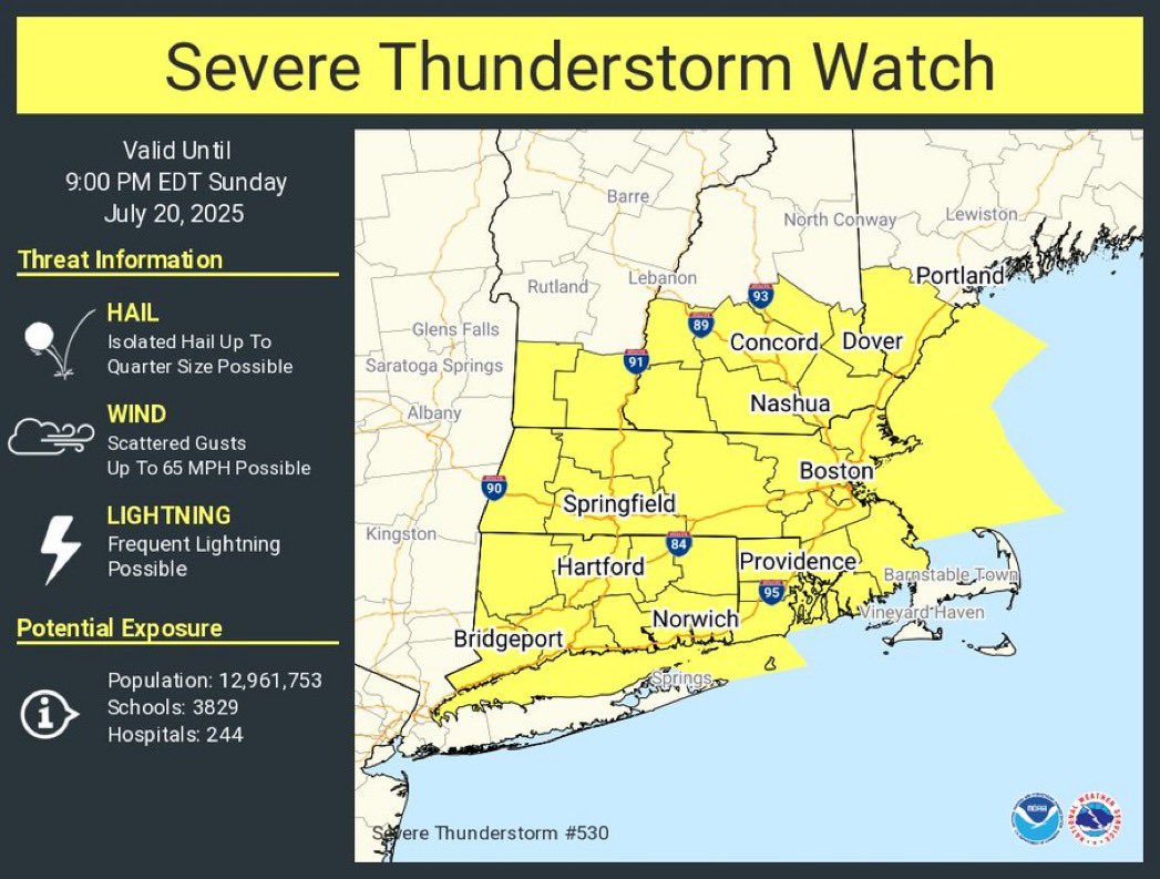
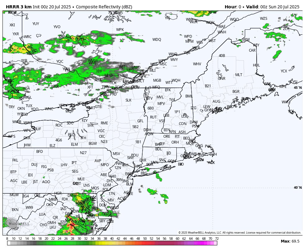
A Severe Thunderstorm Watch has been issued for most of MA, CT, RI, southern Vermont and New Hampshire up until 9PM EDT.
I’m starting to decrease confidence in a Severe Thunderstorm Watch but we still got another 20 minutes of this mesoscale discussion.
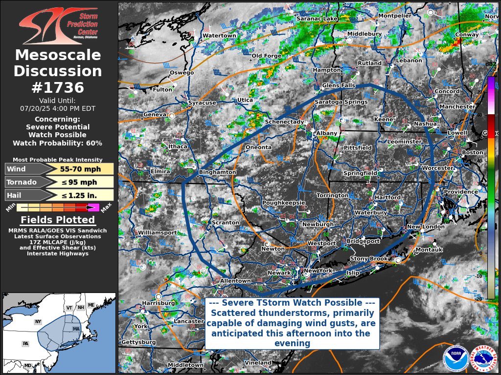
A Severe Thunderstorm Watch is possible over the next hour or so. Watch prob is 60%.
A Severe Thunderstorm Watch is possible over the next hour or so. Watch prob is 60%.
ITS OFFICIALLY MY BIRTHDAY IN UTC.
"our favorite" model only cause it showed a hurricane last week for #93L that never happened.
Where have I seen this movie before? Our favorite model, the ICON, is tracking the energy from the artist formerly known as #93L. Below is the 6z run.
**THIS IS NOT THE SPC OUTLOOK, SEE spc.noaa.gov FOR THE LATEST CONVECTIVE OUTLOOK** First thoughts for tomorrow is out! Thinking this is one of the best svr threat of the year thus far.
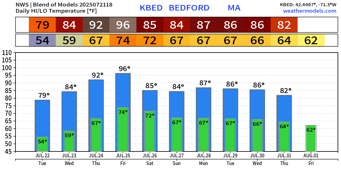
Today begins an interesting date. We begin climatically the hottest stretch of the year. The next week is statistically the warmest of the year, but we already hit 102 back in June. .
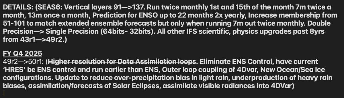
ECMWF's next IFS upgrade 50r1 should be announced soon if the current plan to upgrade this fall, stands. SEAS6 may or may not be implemented with 50r1. Awaiting more from ECMWF. Here are some of the upcoming features to 50r1 and SEAS6 below:
Literally the run after this, ICON dropped #93L. GFS,ECMWF,CMC prevailed
I'm honestly really impressed with how consistent ICON has been with #93L and how close it is with surface obs. Will keep watching!
Snowstorm for all....wait its August, nvm..
⛅AI can now generate global weather forecasts up to 60 days out, faster and more accurately than traditional models. #NVIDIAResearch’s FourCastNet 3 uses advanced AI and geometric deep learning to create a 15-day forecast in just over a minute, giving scientists and developers…
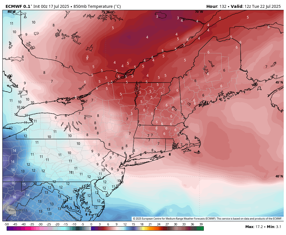
Unusual cool air mass typical for April and late October, will pass through the region early next week. Temps will be in the low to mid 70s with lows in the upper 50s low 60s! Enjoy!