National Hurricane Center
@NHC_Atlantic
Official operational X account of the National Hurricane Center for the Atlantic basin. More details: http://weather.gov/nws_x
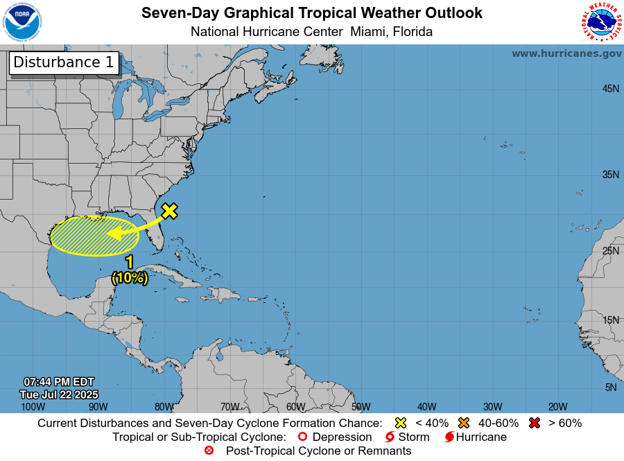
8pm EDT 22 July -- A trough of low pressure, currently located off the SE U.S. coast is forecast to move into the North-Central Gulf, and has a low chance (10%🟡) of tropical cyclone formation before it moves inland by this weekend. Latest Outlook: hurricanes.gov/gtwo.php?basin…
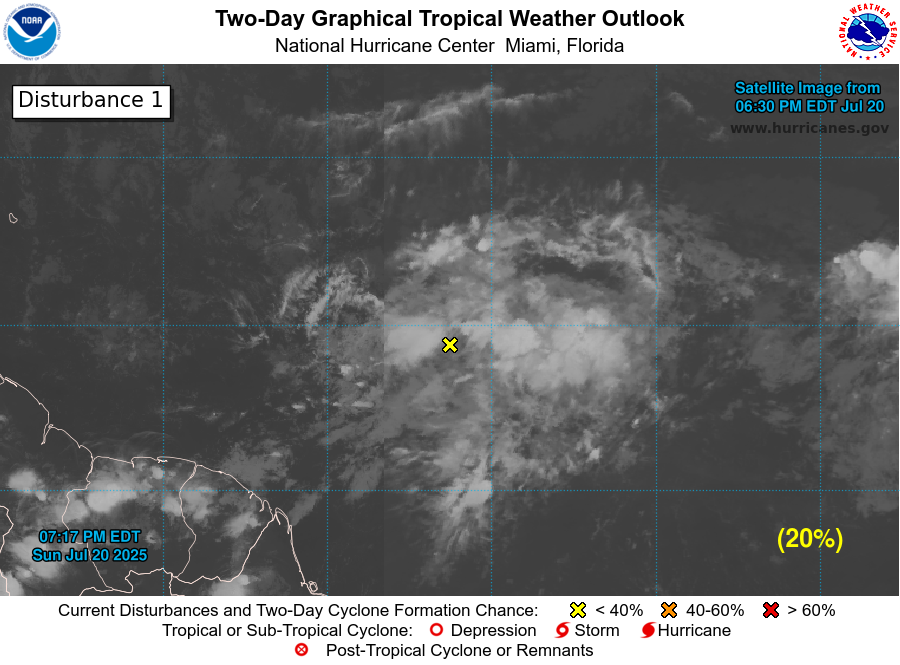
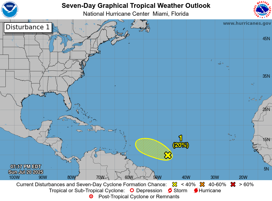
8pm EDT 20 July: NHC is watching a small area of low pressure (Invest #94L) in the Central Tropical Atlantic. This system has a low chance (20% 🟡) of becoming a tropical cyclone before moving into less favorable environmental conditions. Latest outlook: hurricanes.gov/gtwo.php?basin…
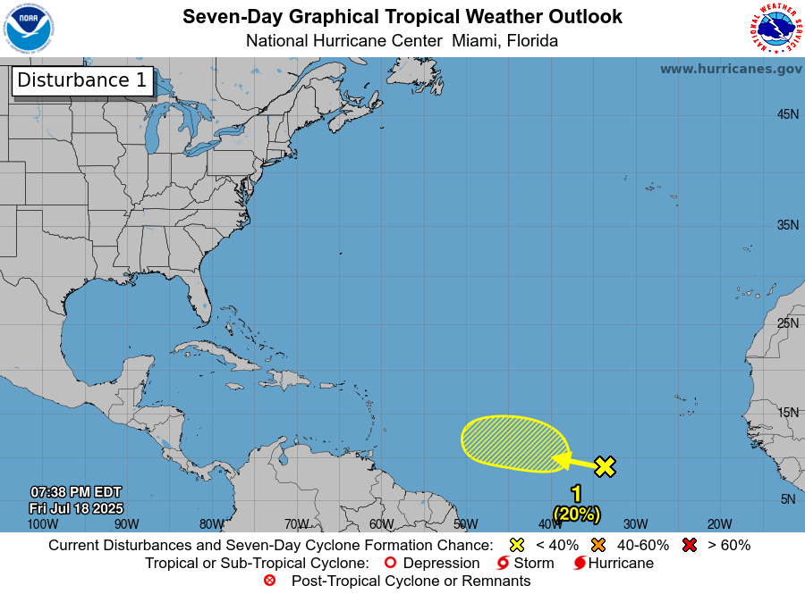
7/18 8pm EDT: A tropical wave interacting with a broad area of low pressure is producing disorganized showers and thunderstorms over the central tropical Atlantic. Slight development is possible late this weekend into early next week as it moves west-northwestward around 10 mph.…
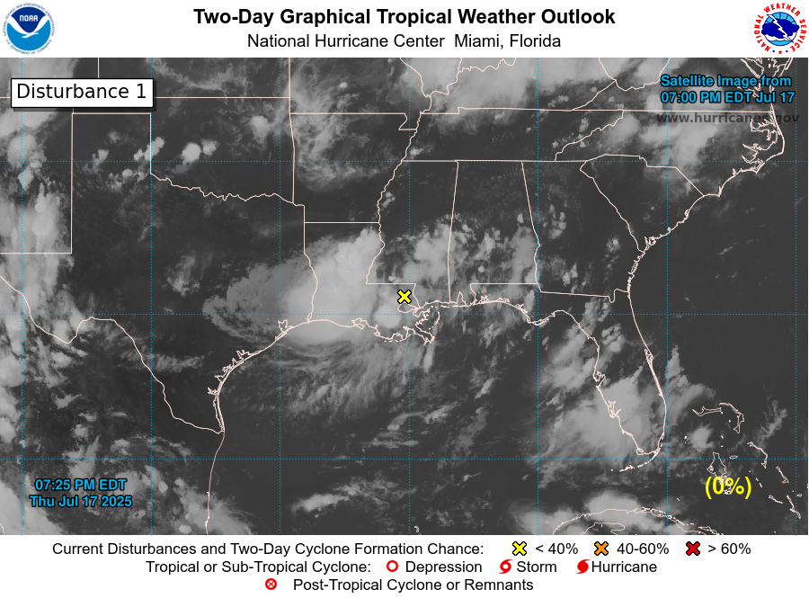
8 pm Thu Jul 17: A broad area of low pressure (#AL93) has moved inland over southeastern Louisiana, and development is therefore not expected. However, heavy rain and localized flash flooding remain possible through Friday along the north-central Gulf Coast. This is the last…
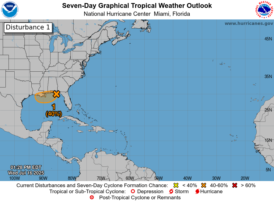
2pm 7/16: A low pressure area (Invest #93L) located near the coast of the Florida Panhandle is forecast to move westward to near the southeast coast of Louisiana on Thursday. Environmental conditions are generally favorable for some development, and a tropical depression could…

8pm 7/15: A low pressure area (Invest #93L) could emerge over the far northeastern & north-central Gulf, approaching Louisiana on Thursday as it moves westward. Environmental conditions over the Gulf are generally favorable, and a tropical depression could form if the system…
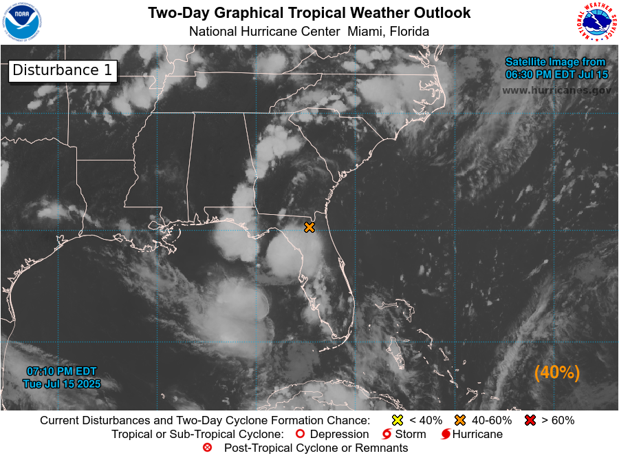
8pm EDT July 14: An area of low pressure off the east Florida Peninsula coast (Invest #93L) now has a medium chance (30%🟡2-day / 40%🟠7-day) of becoming a tropical cyclone as it moves westward into northeastern portion of the Gulf. Regardless of formation, heavy rainfall could…


July 14 8AM EDT: An area of low pressure located offshore the east coast of Florida is producing disorganized showers and thunderstorms this morning. This disturbance is forecast to move westward across Florida during the next day or so, and into the northeastern Gulf by late…

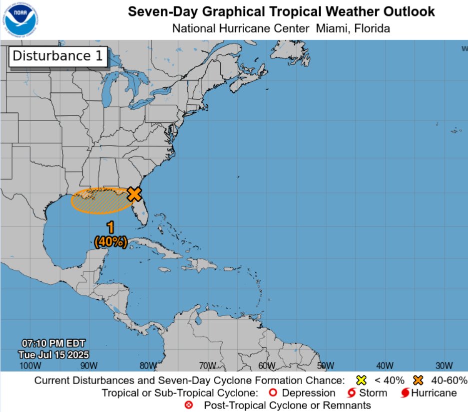
July 13 8pm EDT: A trough located off the Atlantic coast of northern Florida will move westward across Florida during the next day or so, and into the northeastern Gulf by late Tuesday. Some gradual development is possible mid-late week while it moves westward over the…
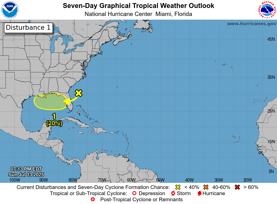
July 13: A trough of low pressure near the southeastern U.S. coast is expected move westward across Florida during the next day or so, and into the northeastern Gulf by Tuesday. Once it moves into the Gulf, there is a low chance of development (20%🟡) towards the middle to late…

Post-Tropical Cyclone #Chantal Advisory 14: The Flash Flood Threat From Post-Tropical Cyclone Chantal Has Waned. hurricanes.gov
Post-Tropical Cyclone #Chantal Advisory 13: Post-Tropical Cyclone Chantal Continues a Flash Flood Threat Into This Evening For Portions of the Eastern Mid-Atlantic States. hurricanes.gov
Post-Tropical Cyclone #Chantal Advisory 12: Chantal Becomes Post-Tropical. Flash Flood Threat Continues Near and Northeast of the Center. hurricanes.gov
Tropical Depression #Chantal Advisory 11: Chantal Moving Across Southern and Eastern Virginia. Flash Flood Threat Continues Near and Northeast of the Center. hurricanes.gov
Tropical Depression #Chantal Advisory 11: Chantal Moving Across Southern and Eastern Virginia. Flash Flood Threat Continues Near and Northeast of the Center. hurricanes.gov
Tropical Depression #Chantal Advisory 10: Chantal Moving Into Northern North Carolina. Flash Flood Threat Continues as Rainbands Move Across Northern North Carolina and South-Central Virginia. hurricanes.gov
7:45pm EDT 7/6 Flash Flood Warnings are ongoing across portions of North Carolina due to heavy rain from Tropical Depression #Chantal. Remember, turn around, don't drown, if you encounter water of unknown depth on the roadway. Flooding is especially dangerous at night. Monitor…
