
Eric Webb
@webberweather
Gov't meteorologist part of the weather industrial complex. UNCC & NCSU Alum Opinions are my own & not a reflection of my employer
I came up w/ list of analogs for this year's tornado season & this is what the 1°x1° tornado track density composite grid looks like over the CONUS using @NWSSPC's database that goes back to 1950. Note I used a 30-year sliding base period anomaly here to account for long-term…

I'm kinda of the same opinion that August may be quiet in the Atlantic despite favorable MJO. Background stability is pretty hostile this year, and will suppress convection even if/when shear is more favorable. If we get Pacific MJO at peak (TBD but that's what current…
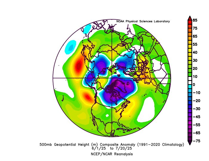
The stars are aligning on a seasonal and subseasonal scale for this year’s Atlantic Hurricane Season to be pretty underwhelming compared to normal thru early-mid Sep, while also finishing quite strong late Sep into Oct
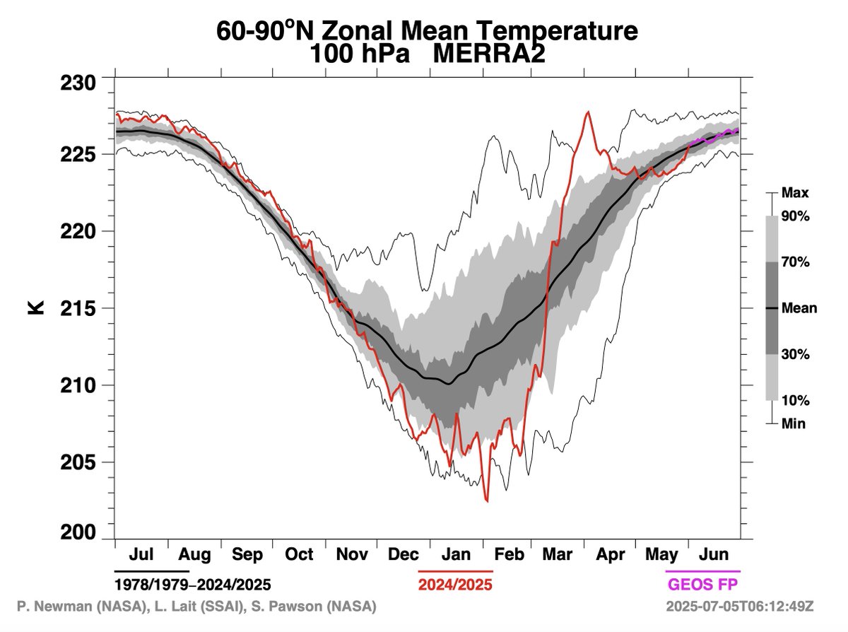
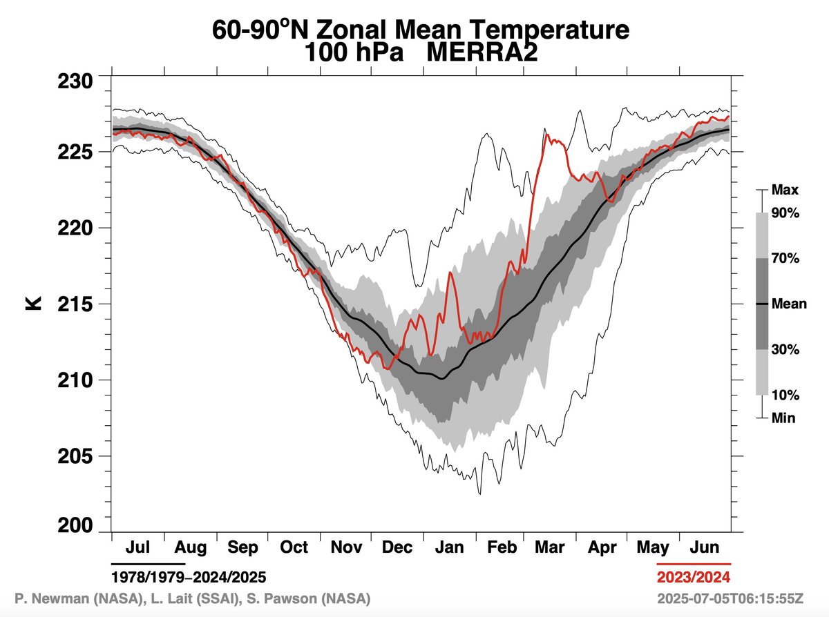
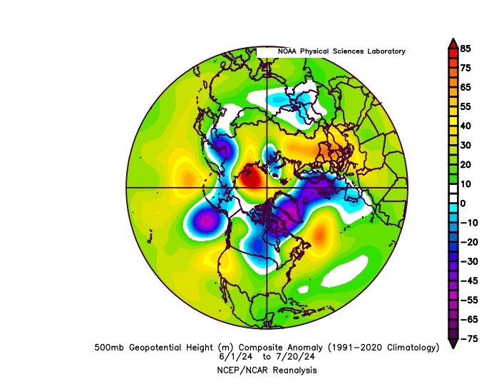
It's no coincidence that this yr & last yr's +NAO dominated summers have came after major strat warming events in early spring The persistent +NAO has kept the Atlantic cooler/more stable than it otherwise would be & shouldn't be ignored in seasonal fcsts nature.com/articles/s4324…
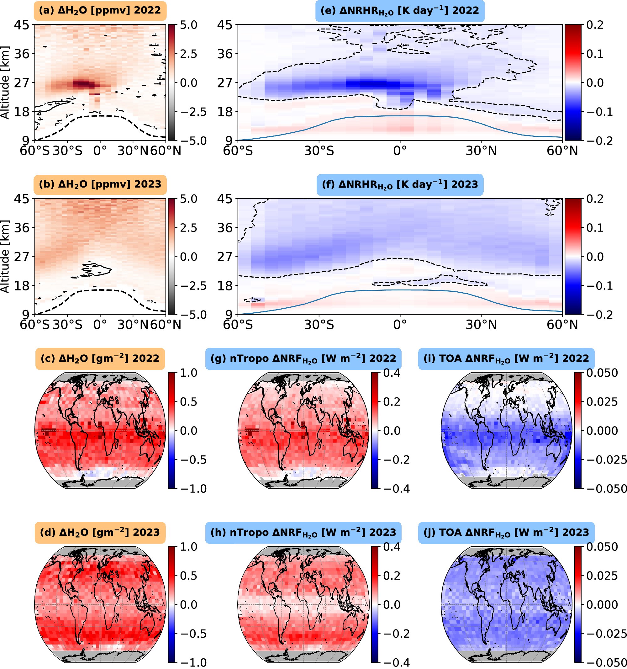
Yet another strong piece of evidence that the Hunga Tonga eruption had little (if anything) to do with the global warming that has happened since then. nature.com/articles/s4324…
I've made some new velocity potential plots! There are both normal VP and also a 7-day averaged one that also comes with 500mb heights. Makes it easier to see how convection in the tropics influences the extratropical pattern! h/t @webberweather for the idea. More to come soon...