WX-Midwest
@WxMidwest
SKYWARN SPOTTER, SPOTTER NETWORK, 17 yr career fireman, and former Emergency Management Coordinator
Developing thunderstorms are likely into the overnight. Severe storms are possible along with heavy rainfall. Damaging winds and large hail are possible with the stronger storms. There is a Slight Risk(level 2 out of 5) across most of the area for severe weather tonight.
Incredible LP cell north of Grundy Center, IA at 7:05 PM. @NWSDesMoines #iawx
Kinda felt that the previous edit pulled you out of the time with the modern cars. Here's one that could've actually happened.
Gave it my best
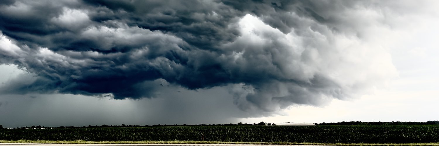
Take a look at this storm structure on this thunderstorm near Batavia, Iowa (located in southeast Iowa) around 7:30 Sunday evening. 📷: Jenna Barcus
Flash Flood Warning including West Des Moines IA, Clive IA and Norwalk IA until 1:30 AM CDT
Hot and humid weather will build into the area this week, with a continued low chance for evening and overnight storms through Monday night. Expect daily heat index readings over 100, starting Tuesday, and lasting much of the week ahead.
Another Nebraska/South Dakota Tornado Threat 🔴 Live Storm Chasing youtube.com/live/S8YeQFb1n… via @YouTube
A thunderstorm around 5pm Sunday produced this funnel cloud southeast of Anita, Iowa. @NWSDesMoines 📷: Kristen Hilpipre-Calhoun
🚨 BREAKING: The number of missing persons following the Kerr County, TX floods has dropped from 160 to just 3 Keep praying for these families 🙏🏻 Search efforts will continue until the remaining three are located. This is a MASSIVE undertaking led by President Trump,…
Police in southwest Kansas town asking residents to not approach mountain lion: kake.com/home/police-in… #KAKEnews
Saturday Morning #iawx as an MCS rolled through
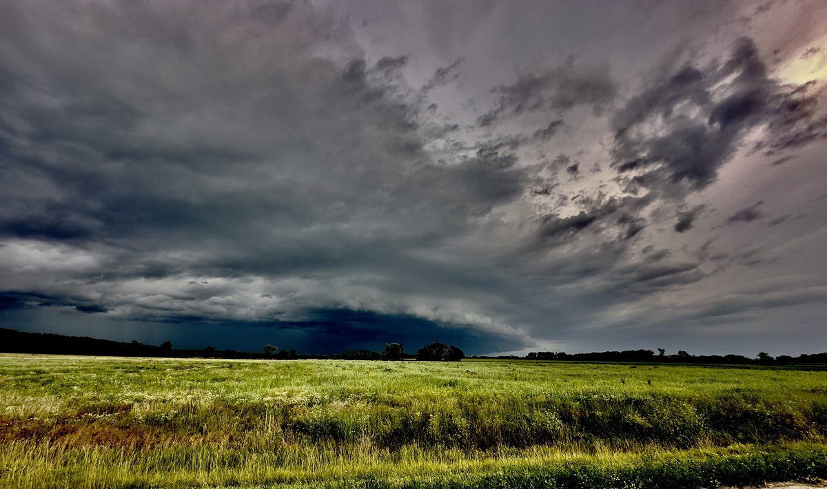
Iowa certainly had its share of SLCs (scary looking clouds) this Saturday morning! Strong thunderstorms produced heavy rain, gusty winds, and even a brief radar confirmed tornado in the Hawkeye state. Severe weather chances will linger in the Midwest to end the weekend. #IAwx
Iowa certainly had its share of SLCs (scary looking clouds) this Saturday morning! Strong thunderstorms produced heavy rain, gusty winds, and even a brief radar confirmed tornado in the Hawkeye state. Severe weather chances will linger in the Midwest to end the weekend. #IAwx
Additional storms with heavy rain may bring 1-2" of rain over a short time period tonight into Sun AM. Rainfall could potentially exceed 5" in isolated areas into Sun. The greatest flash flood potential exists between roughly US-20 and US-34 with a flood watch in effect into Sun.
More rounds of storms are expected thru Sunday. Additional storms are expected tonight into Sunday. A few of these thunderstorms could be severe. The main threats are frequent lightning, strong winds, and torrential rainfall leading to localized flash flooding. Stay aware!
⛈️An MCS, or mesoscale convective system, is ongoing over Iowa and the corn Belt. It will move through the Midwest and produce sporadic damaging gusts. MyRadar meteorologist @MatthewCappucci has a brief update.