IowaWeather.com
@IAStormChasing
The largest online Iowa weather network. Bringing you the best weather coverage devoted only to online viewers. #iawx
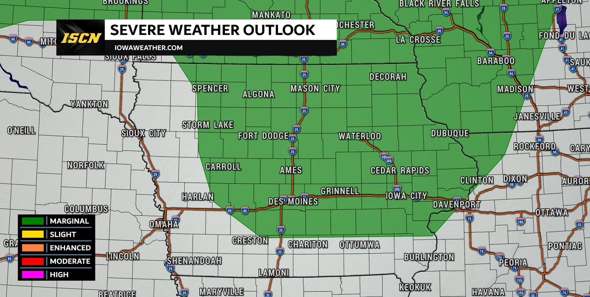
We're keeping a close eye on a weather system (called an MCV) that's currently spinning over northeast Kansas. This system is expected to move into central Iowa later this afternoon and could spark scattered thunderstorms. Here’s what to watch for: - Timing: Storms could start…
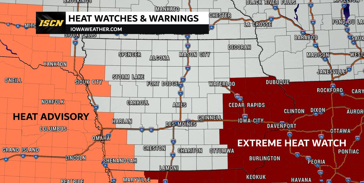
The heat will be on the increase this week. As of Monday morning, there are some parts of the state that have been placed under heat advisories and extreme heat watches. More heat related watches, warnings, and advisories will be issued throughout the week, so be sure to check…
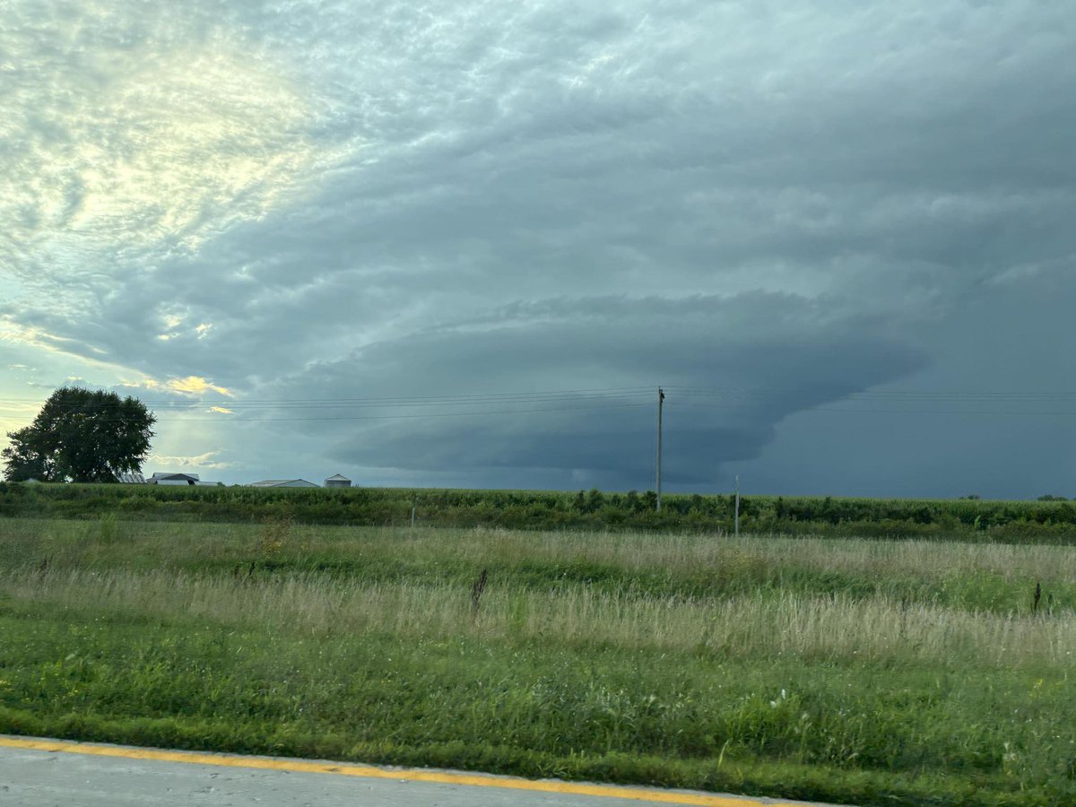
Take a look at this storm structure on this thunderstorm near Batavia, Iowa (located in southeast Iowa) around 7:30 Sunday evening. 📷: Jenna Barcus
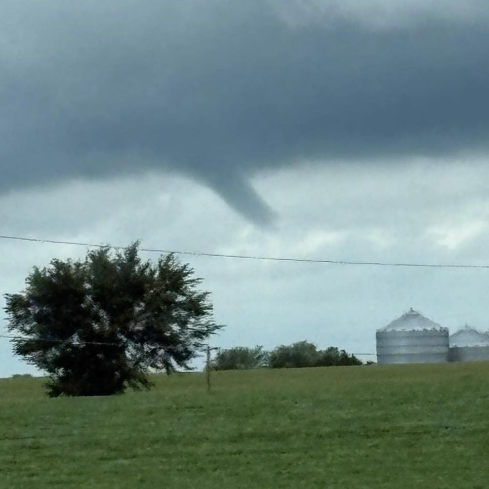
A thunderstorm around 5pm Sunday produced this funnel cloud southeast of Anita, Iowa. @NWSDesMoines 📷: Kristen Hilpipre-Calhoun
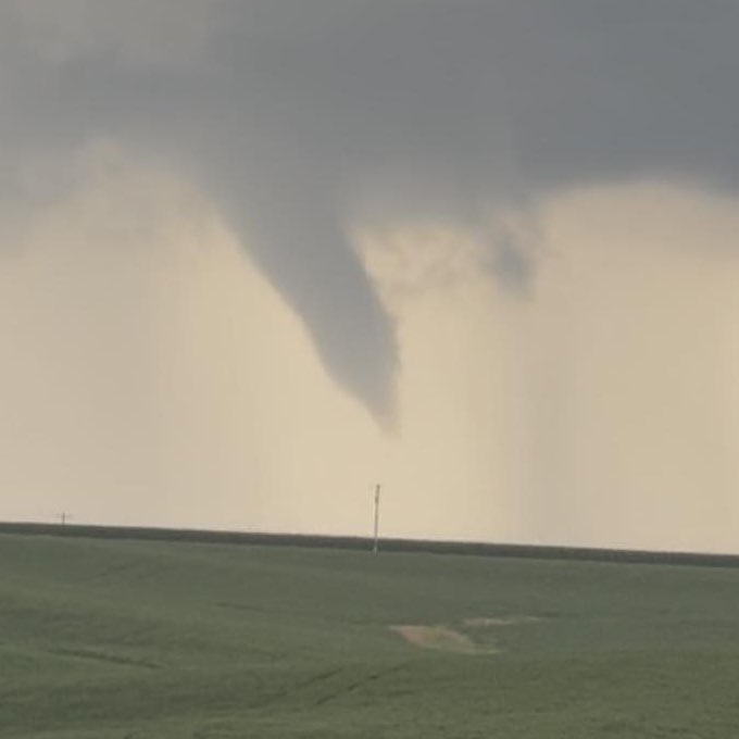
Seth Long captured this funnel cloud between Evansdale and Jesup, Iowa around 12:30 Sunday afternoon. @NWSQuadCities
Another shelf rolling into Fort Madison, Iowa 9:06 am on 7/19/2025 #iawx #iowastorms @IAStormChasing @NWSQuadCities
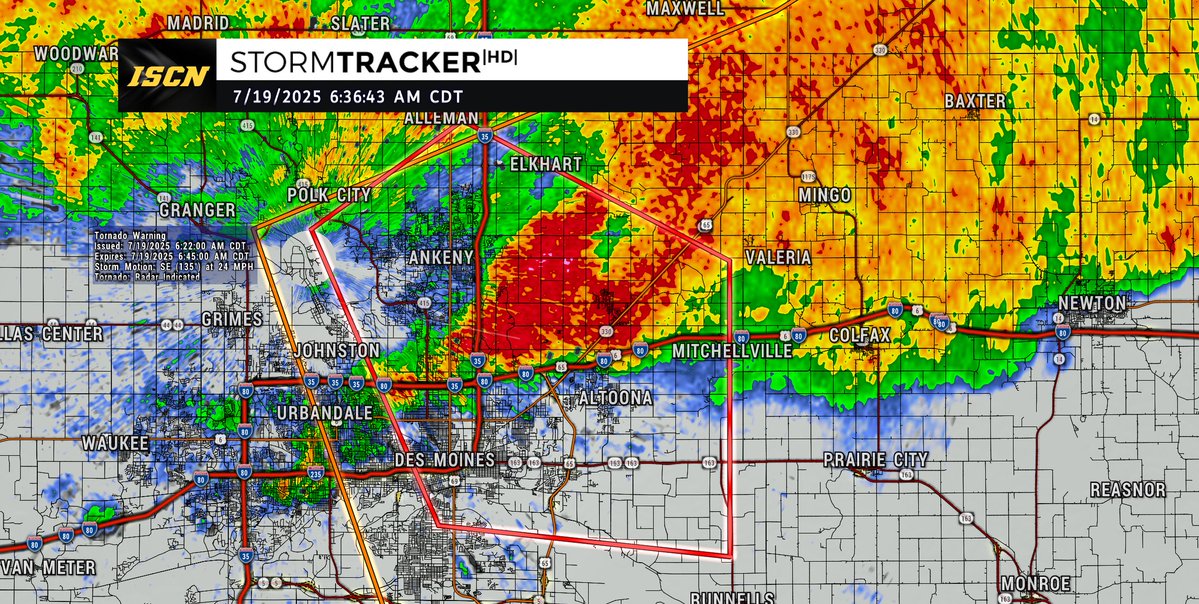
Tornado Warning continues for Des Moines IA, Ankeny IA and Altoona IA until 6:45 AM CDT
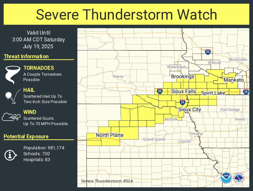
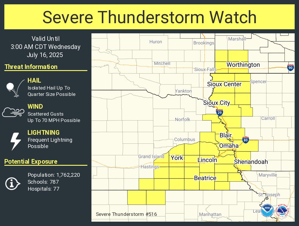
A severe thunderstorm watch has been issued for parts of Iowa, Minnesota, Nebraska and South Dakota until 3 AM CDT
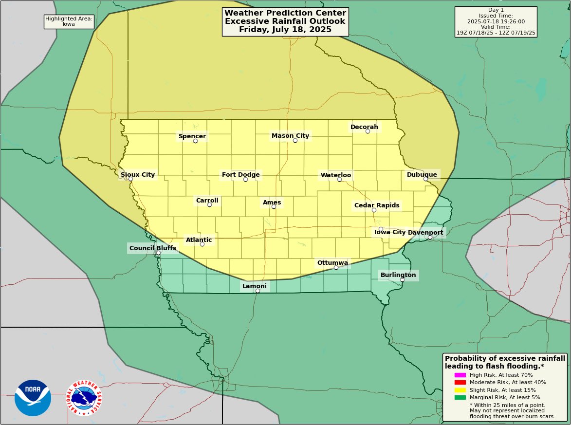
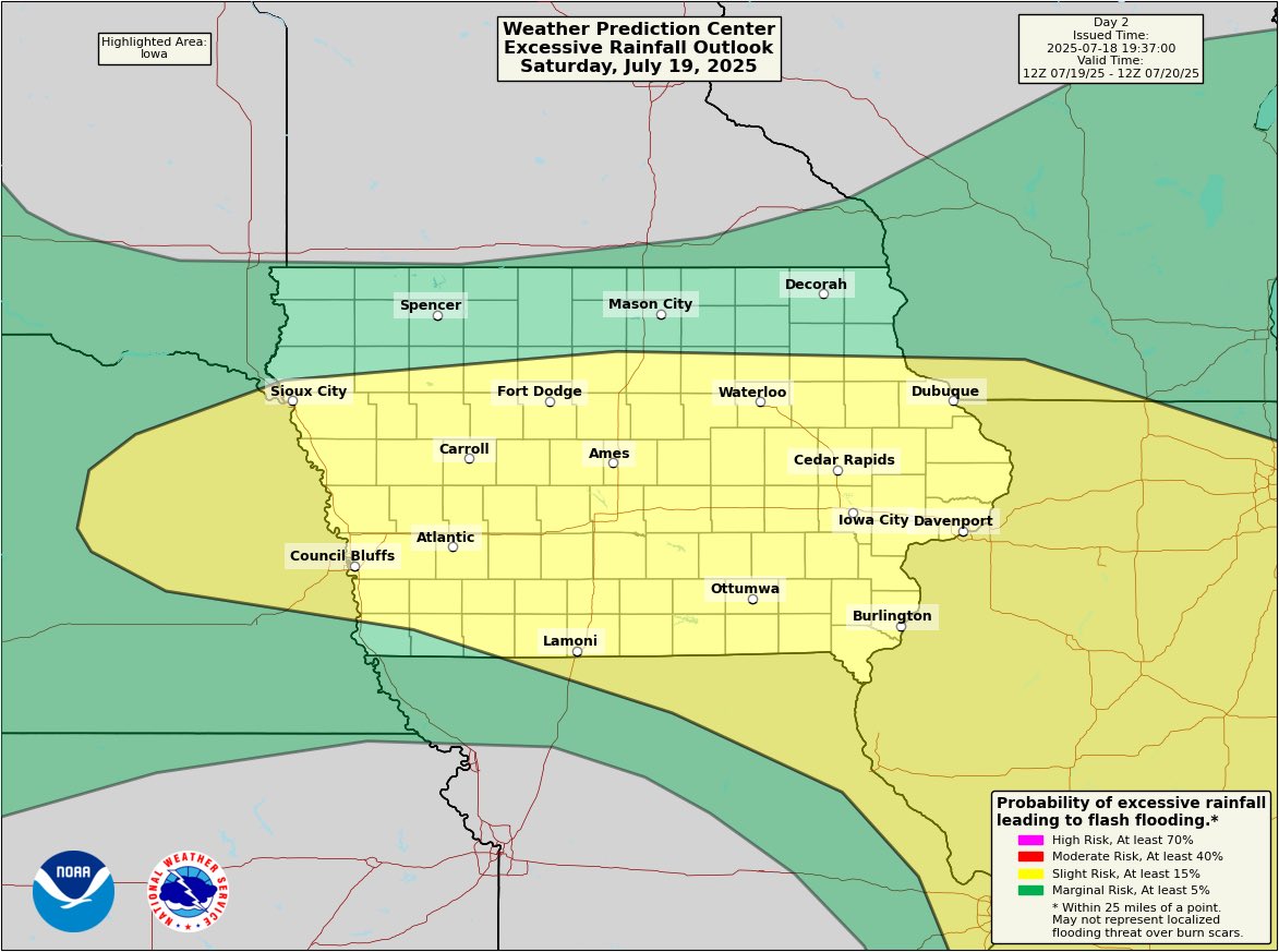
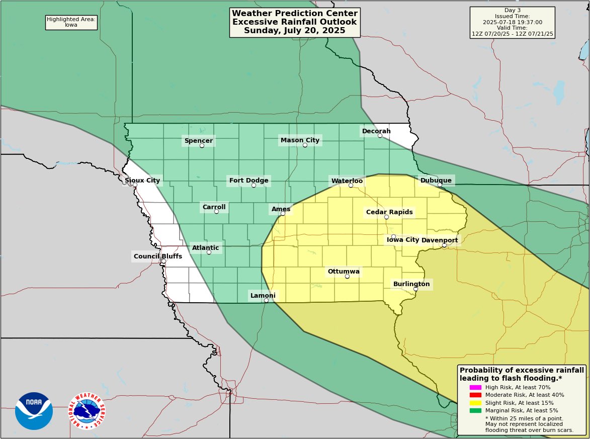
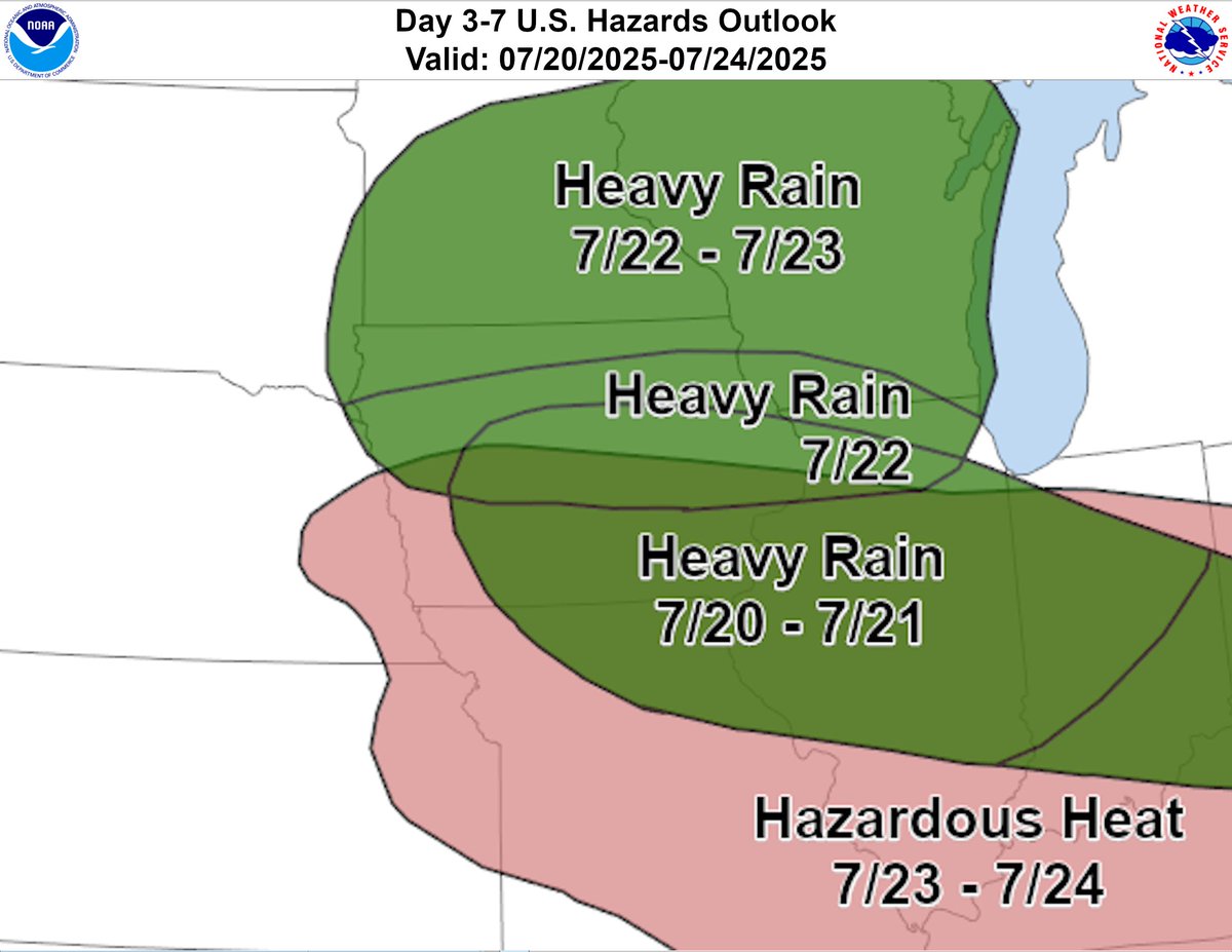
There will be multiple rounds of heavy rain with thunderstorms that impact the state this weekend, primarily during the overnight hours. Excessive rainfall outlooks pictured below.
A line of storms will be moving through Iowa during the overnight hours tonight. The primary threat with any storms that are severe will be damaging wind gust. There is also the potential early on across far northwestern Iowa for a tornado or two and large hail. 
Heavy rain and hazardous heat will be the story next week. The heavy rain potential will start this weekend and will continue into next week as the heat builds in. Temperatures will be in the 90s with heat index values in the 100s.
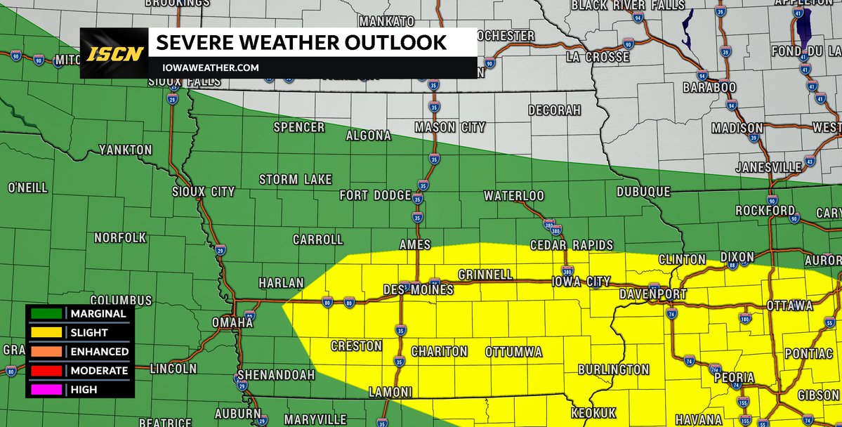
SATURDAY SEVERE WEATHER UPDATE: A stalled front over the region Saturday afternoon could set the stage for severe thunderstorms, especially in southern Iowa. Because of this, the Storm Prediction Center (SPC) has added a slight risk as of the 2:30PM Thursday update. What to…
ISCN storm chaser @coreycloudburst captured this tornado near Prairie Du Sac, Wisconsin around 1:30PM Wednesday.
A line of thunderstorms develop across Nebraska and South Dakota last night and tracked to the southeast, weakening below severe limits as they rolled into western Iowa.
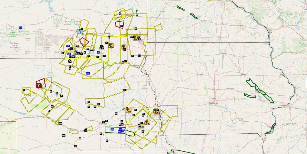
A severe thunderstorm watch has been issued for parts of western Iowa until 3 AM CDT Wednesday.
Another confirmed tornado from last weeks severe weather.
A NWS Storm Survey confirmed that a tornado touched down Friday evening (7/11/25) in Scott County west of Le Claire. It was rated an EF-0 with peak winds estimated at 85 mph. #iawx #ilwx
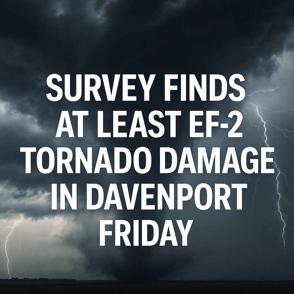
🚨 An NWS Storm Survey confirmed that a tornado touched down Friday evening (7/11/25) in Scott County from near Blue Grass to the west side of Davenport. It was rated an EF-2 with peak winds estimated at 120 mph. #iawx #tornado
From the National Weather Service in the Quad Cities: “An ongoing NWS Storm Damage Survey has determined that at least EF2 tornado damage occurred on the far southwest side of Davenport on Friday shortly after 5 PM. The strongest damage occurred at a Motorhome/RV Dealership.…