MyRadar Weather
@MyRadarWX
Keeping you ahead of the storm since 2009. Download for FREE!
🆕 Just launched: Map Tools in MyRadar! ✏️ Draw 📏 Measure 🔍 Inspect All FREE and available NOW! Start exploring more with every tap 👉 bit.ly/45t2q2J
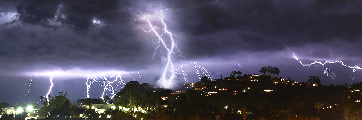
Ever heard of an LP, or "low precipitation", supercell? They're spinning thunderstorms that produce very little rain! LP supercells are spectacular. Precipitation either evaporates or, more often, it transported far to the northeast of the updraft, falling downwind. That lets…
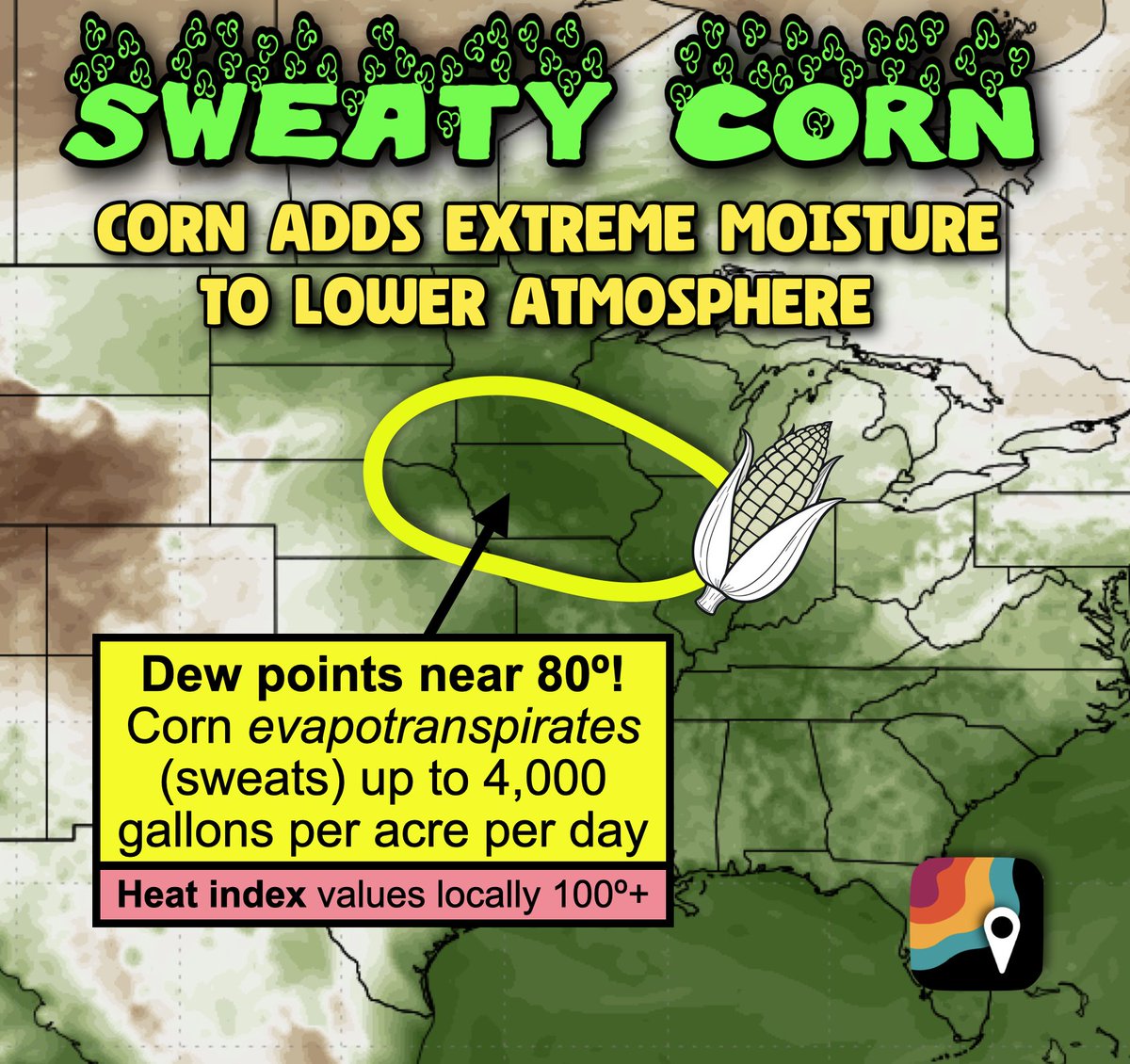
SWEATY CORN is in the forecast for parts of the Upper Midwest and Corn Belt this week. The corn, which is "knee high by July," is evapotranspirating – akin to sweating – profusely. A single acre of corn can release up to 4,000 gallons of water into the lower atmosphere per day!…
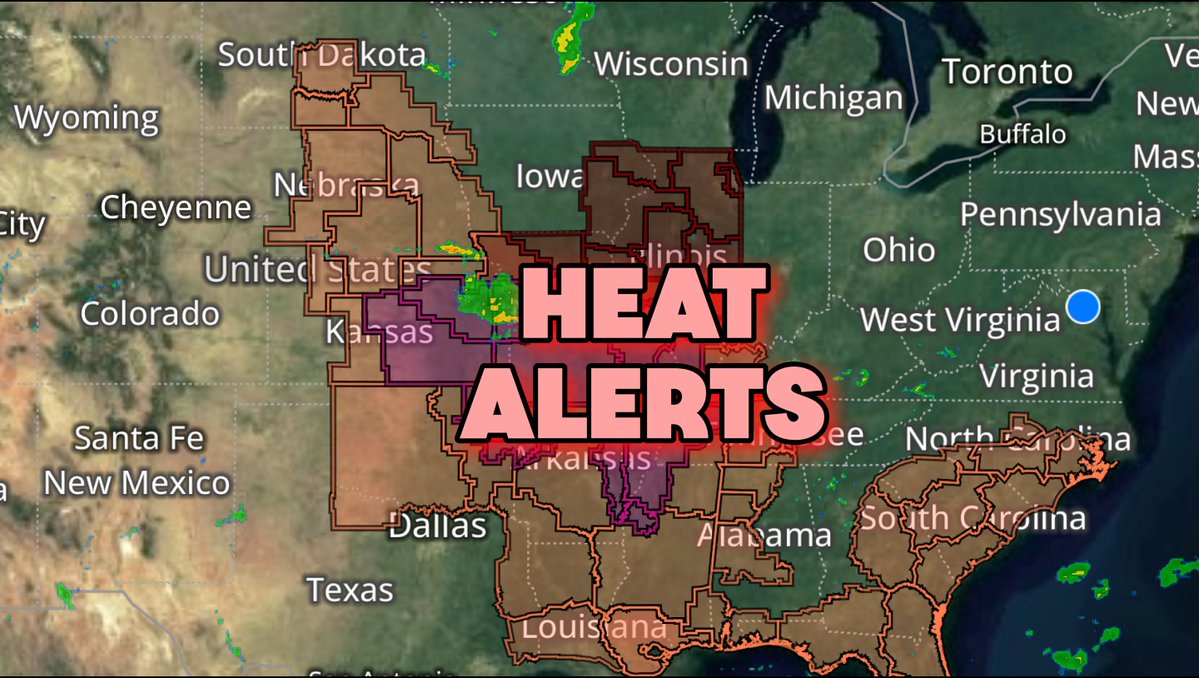
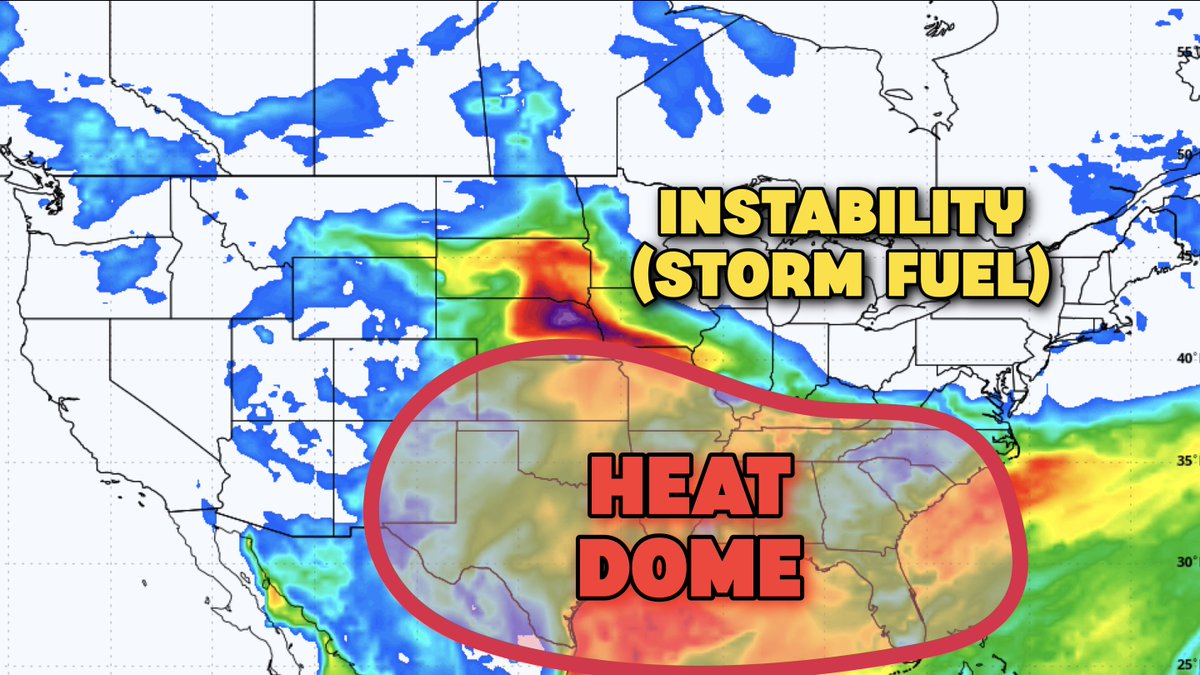
RING OF FIRE pattern is building in across the central/eastern United States. (Yes, that's a real term.) Here's what that means. We call it a "ring of fire" pattern because it's HOT! There's a heat dome – a ridge of hot high pressure and sinking air – bringing stifling heat and…
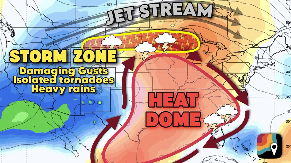
🌡️Stifling heat & humidity across the Mississippi Valley and Southeast, with windy thunderstorms across the Northern Tier. MyRadar meteorologist @MatthewCappucci breaks down how long the pattern lasts.
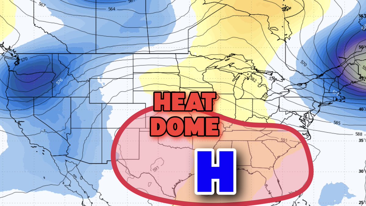
RING OF FIRE pattern: A heat dome, or ridge of high pressure, is present over much of the mid-South, leading to hot temperature and stifling humidity. On the edge of the heat dome, strong to severe thunderstorms are possible, tracing a "ring of fire" around the edges. (This is…
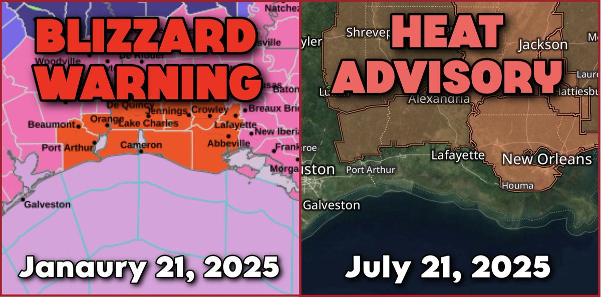
Six months ago today, the first-ever BLIZZARD WARNING was issued for the Gulf Coast in Louisiana. Now there's a heat advisory. What a difference half a year makes! This was the first recorded blizzard to affect the Gulf coast since 1895. Low pressure developed in the western…
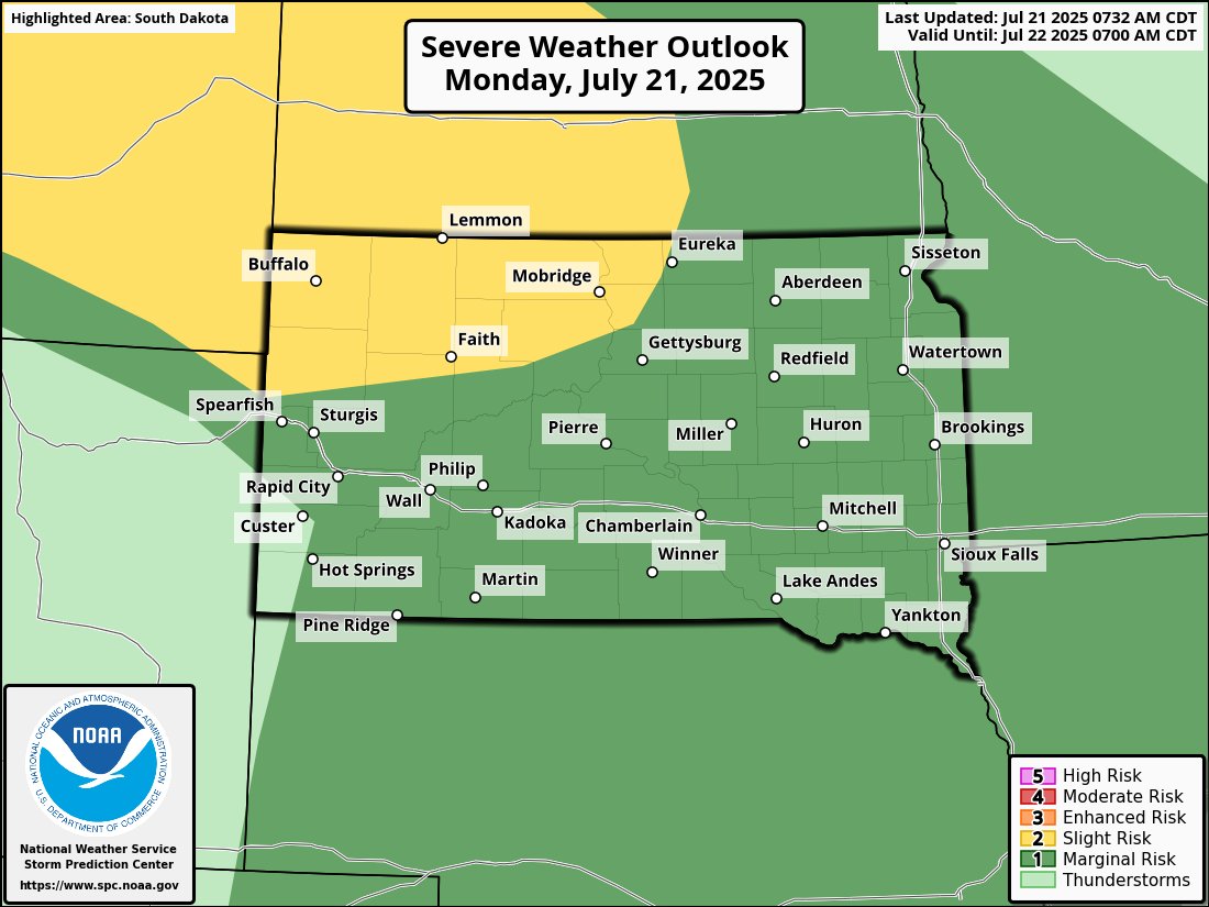
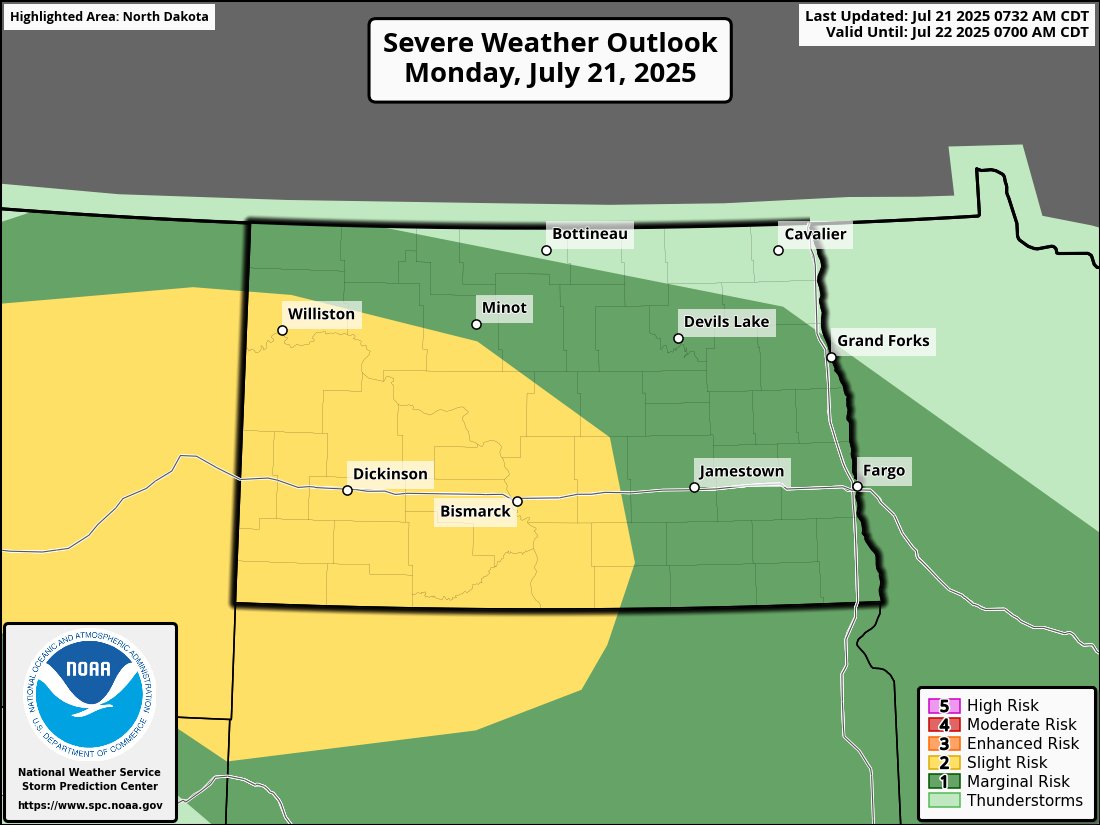
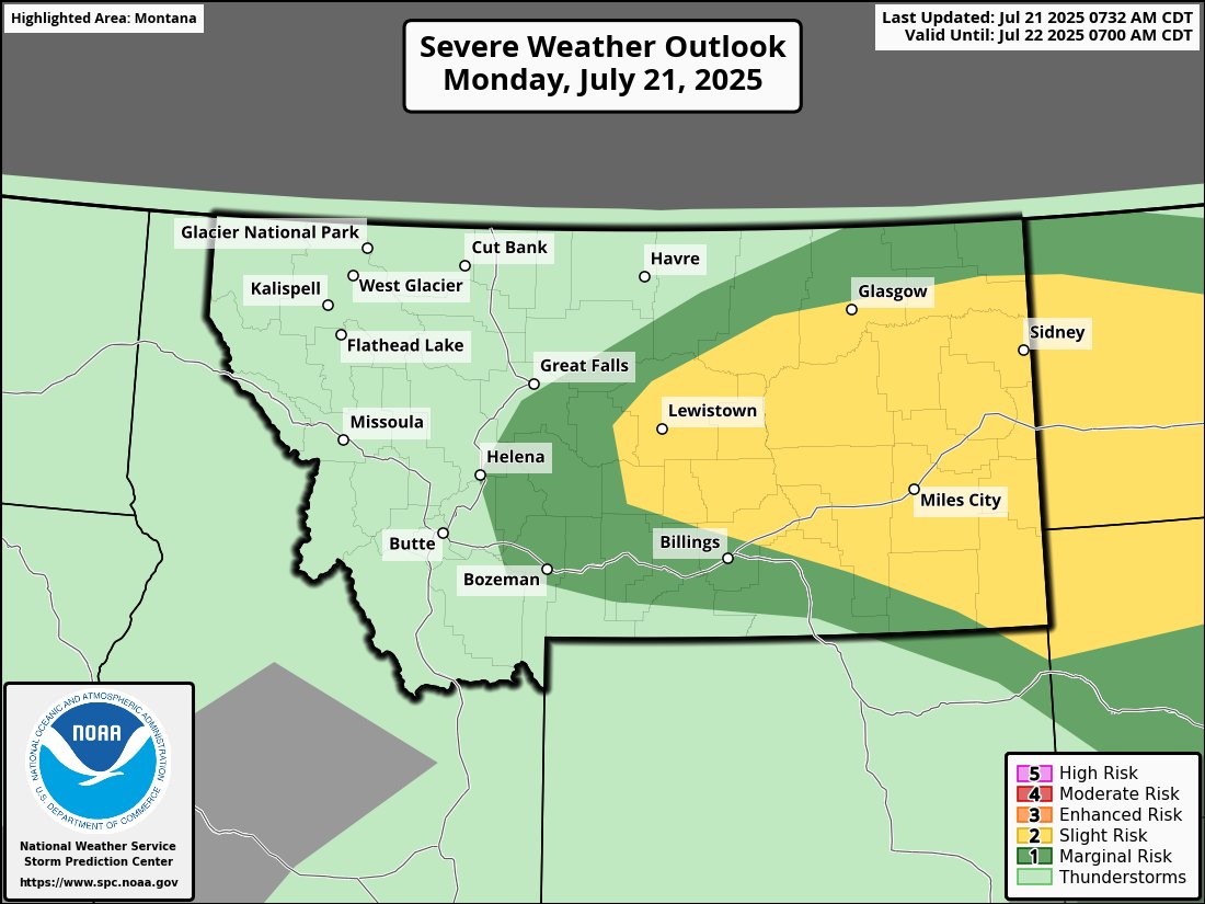
⛈️A few severe thunderstorms are likely today from Montana to western parts of the Dakotas. Damaging wind gusts, large hail, and an isolated tornado will be possible. MyRadar meteorologist @MatthewCappucci has the latest.
⚠️ Slight risk (2/5, yellow) for severe storms today across parts of the Northern Plains. Storms could bring: Large hail A tornado or two Damaging winds From Montana into the Dakotas, storms may develop this afternoon and continue into tonight.
⏰ Time's running out to enter to win the MyRadar Rain Check giveaway! One lucky winner will take home the grand prize — a brand-new iPhone or Google Pixel! 📱 ✅ Enter free 🔞 Must be 18+ to win 📍U.S. residents only 📆 Ends July 31, 2025 go.myradar.com/myradar-rainch…

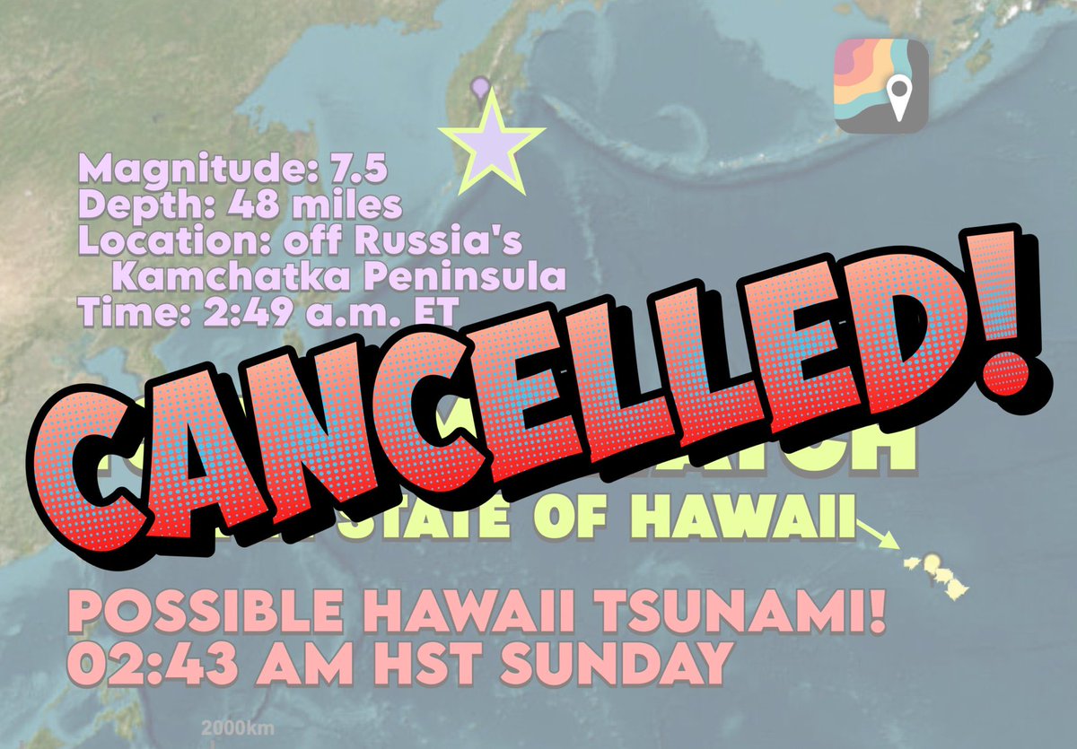
There is NOT TSUNAMI THREAT in Hawaii! The watch has been dropped; updated modeling indicates no tsunami will impact the archipelago.
⛈️Western parts of the Dakotas, extreme eastern Montana, and western Nebraska are at risk of isolated rotating supercell storms on Saturday. Damaging gusts, hail, and an isolated tornado are possible. Meteorologist @MatthewCappucci has an update.
⛈️An MCS, or mesoscale convective system, is ongoing over Iowa and the corn Belt. It will move through the Midwest and produce sporadic damaging gusts. MyRadar meteorologist @MatthewCappucci has a brief update.
⛈️A few rotating strong to severe thunderstorms with heavy rainfall are possible in the Mid-Atlantic. Damaging gusts and heavy rain are possible. MyRadar meteorologist @MatthewCappucci breaks down the latest.
💧 Got rain? Got proof? You could win. 💧 From June 1 to July 31 — when MyRadar sends a rain alert and the skies open up ☔ — show us! 📸 Post a screenshot of your alert + a photo of the rain using #MyRadarRainCheck 🏆 Weekly prizes + a chance to win a new iPhone or Pixel at…


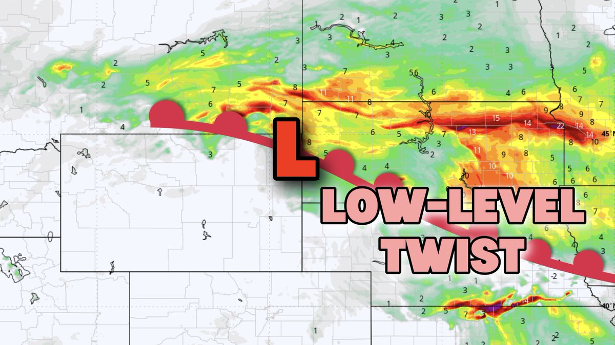
⛈️A few rotating storms are expected in southeastern South Dakota, northeast Nebraska, southwest Minnesota, and northern Iowa on Friday afternoon. A couple of tornadoes are also possible. MyRadar meteorologist @MatthewCappucci breaks down the latest.
⛈️Locally strong storms and heavy rainfall are possible across the Mid-Atlantic and Appalachians today. A few rainfall totals of 3 to 5 inches can’t be ruled out where storms “train,” or repeatedly target the same areas. Meteorologist @MatthewCappucci has an update.
Rainfall rates up to 3 inches per hour in western Louisiana as Invest 93L continues to spawn thundershowers. Here is an update from @JordanHallWX in Lafayette, Louisiana. #lawx #invest93L #wxtwittwr
A severe thunderstorm watch has been issued for parts of Maine, New Hampshire, New York and Vermont until 9 PM EDT