NWS Quad Cities
@NWSQuadCities
Official X Account for the National Weather Service Quad Cities. Details: https://www.weather.gov/nws_x Also Facebook: http://facebook.com/NWSQuadCities
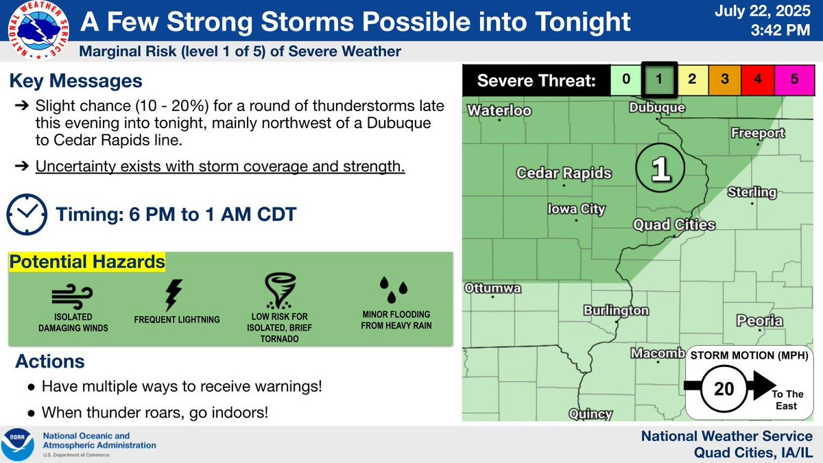
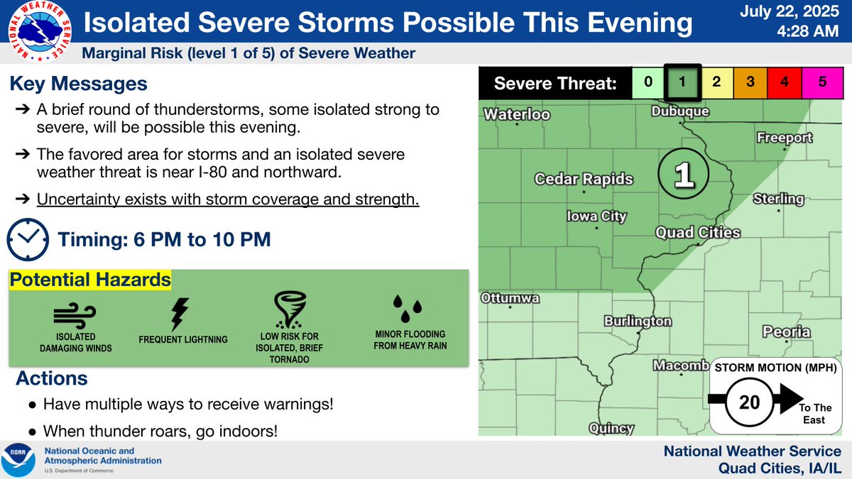
An active period of weather continues, with isolated strong to severe storms possible this evening into tonight, along with continued hot & very humid conditions through Thursday with Heat Advisories in effect area-wide Wednesday and Thursday. Stay cool, folks! #IAwx #ILwx #MOwx
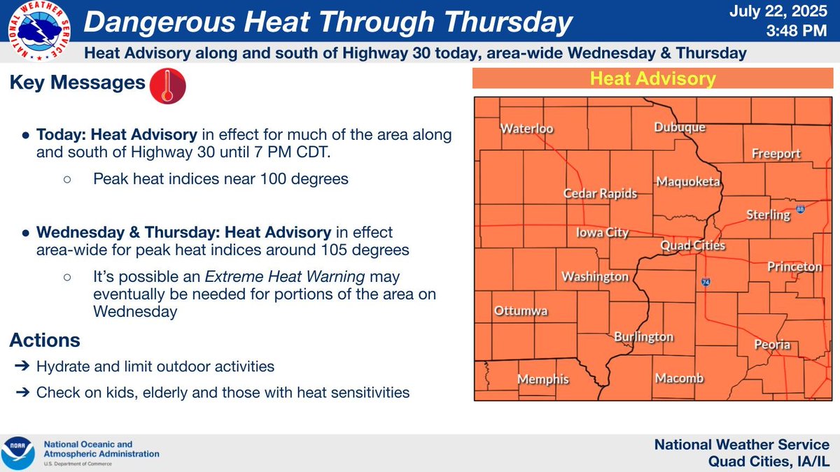

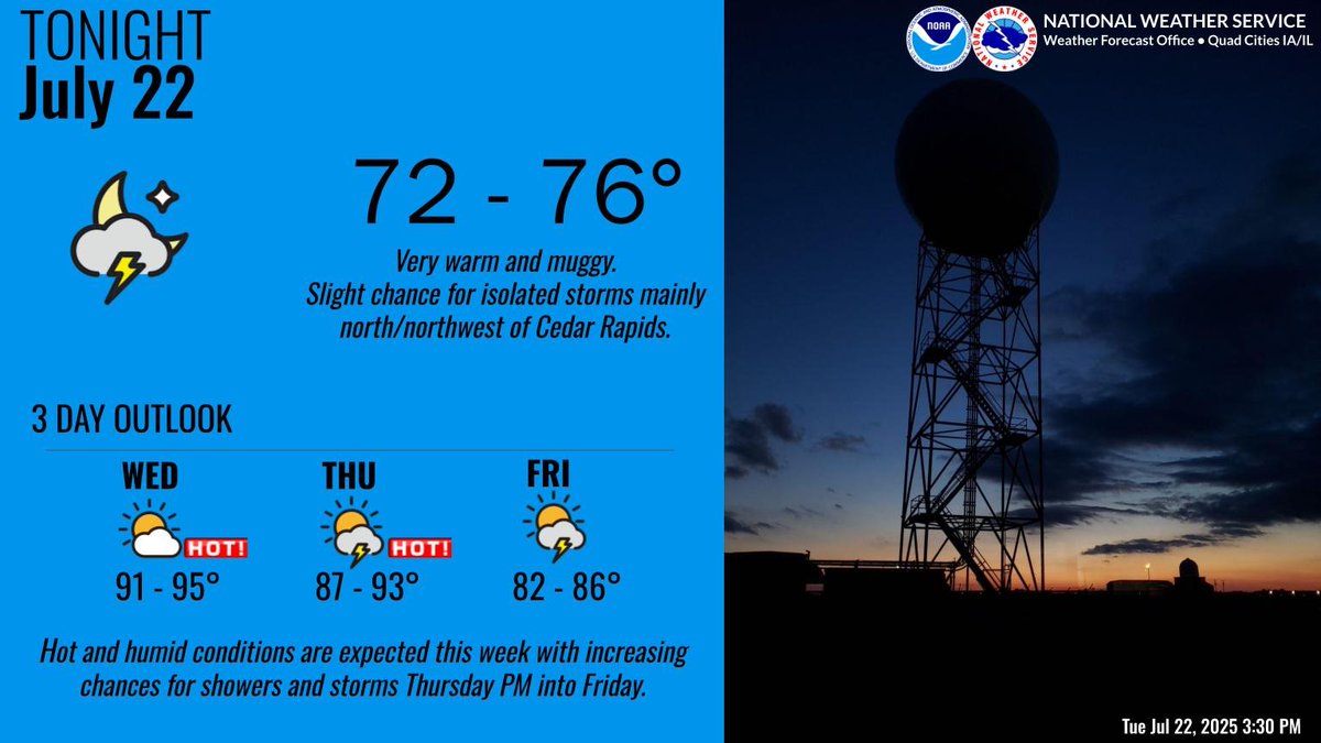
Very warm and muggy conditions are expected tonight with lows in the low to mid 70s. Oppressive conditions are expected Wednesday with peak heat indices around 105 degrees. We’ll see increasing chances for showers and storms Friday with a slight drop in temps. #IAwx #ILwx #MOwx
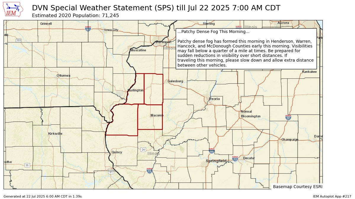
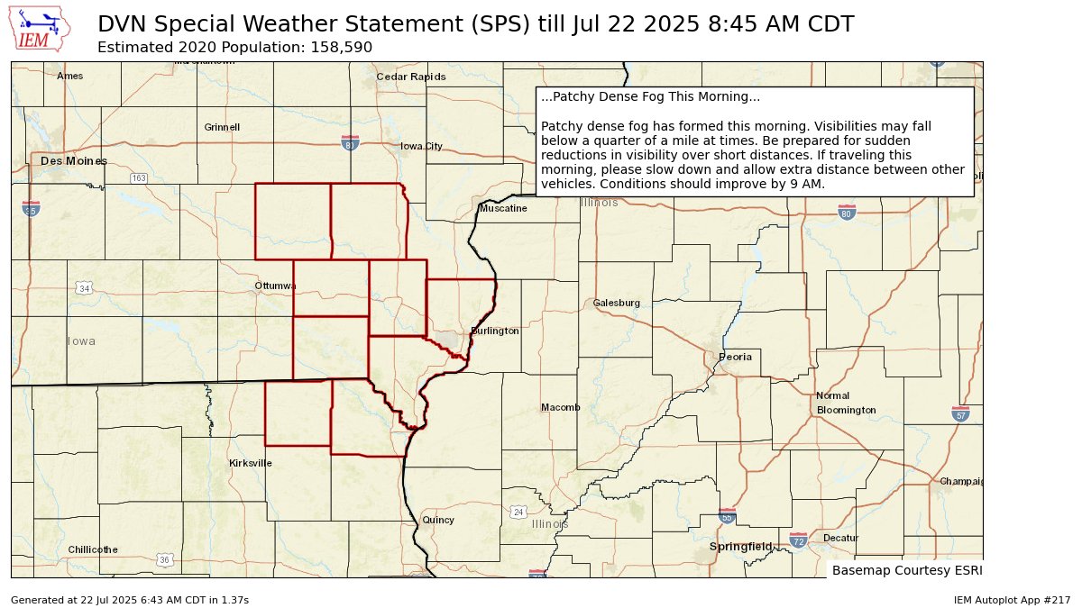
🚨 Patchy dense fog will be found across SE Iowa, NE Missouri and WC Illinois over the next couple of hours. Keep this in mind for the AM commute. Conditions should improve by 9 AM. #iawx #ilwx #mowx
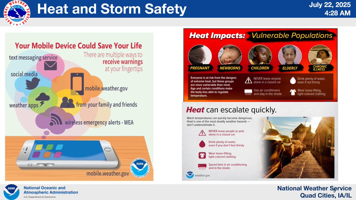
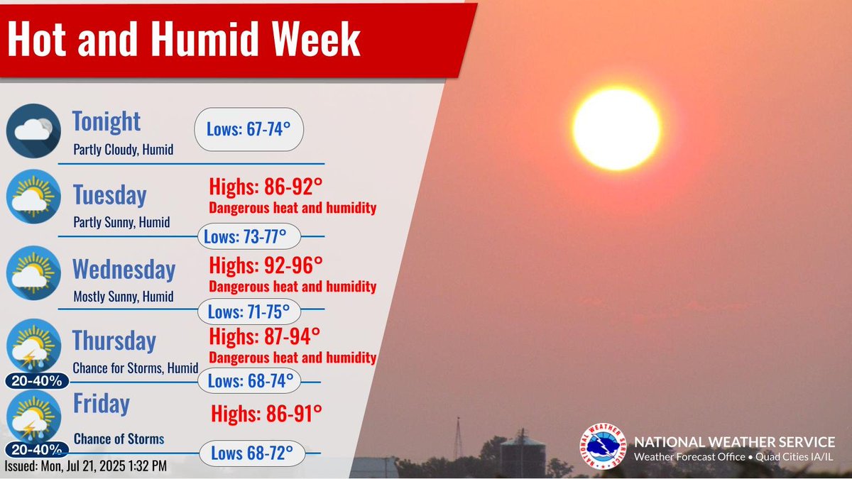
🥵Dangerous heat and very humid conditions will settle in over the next few days. There will also be storm chances this evening and also on Thursday with isolated severe storms possible. Stay weather aware and practice heat safety if you have to be outdoors! #iawx #ilwx #mowx
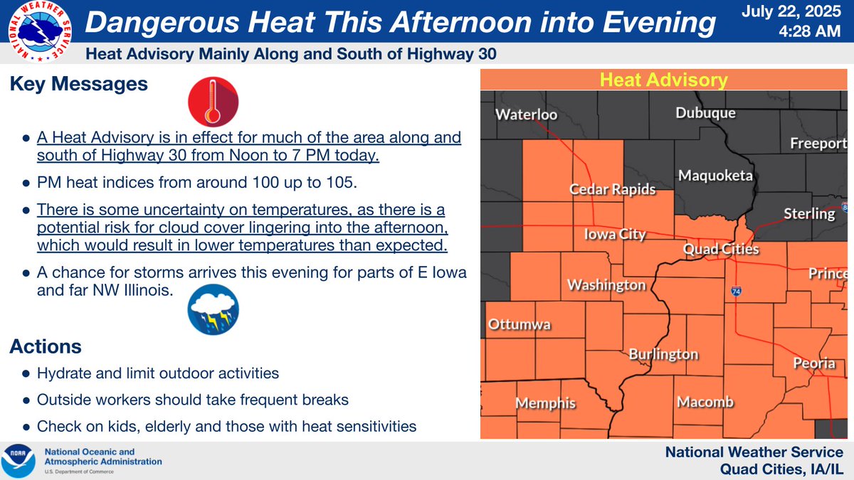

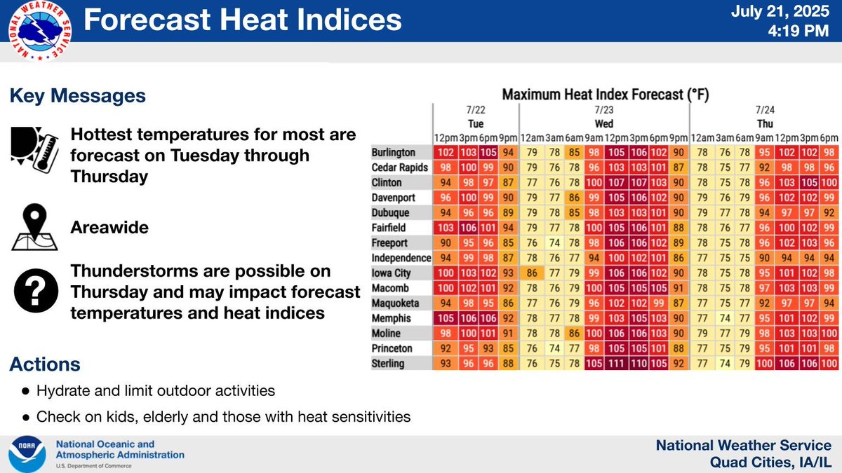
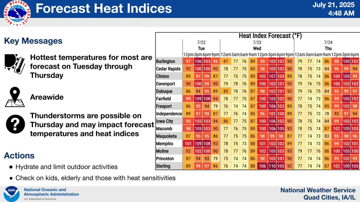
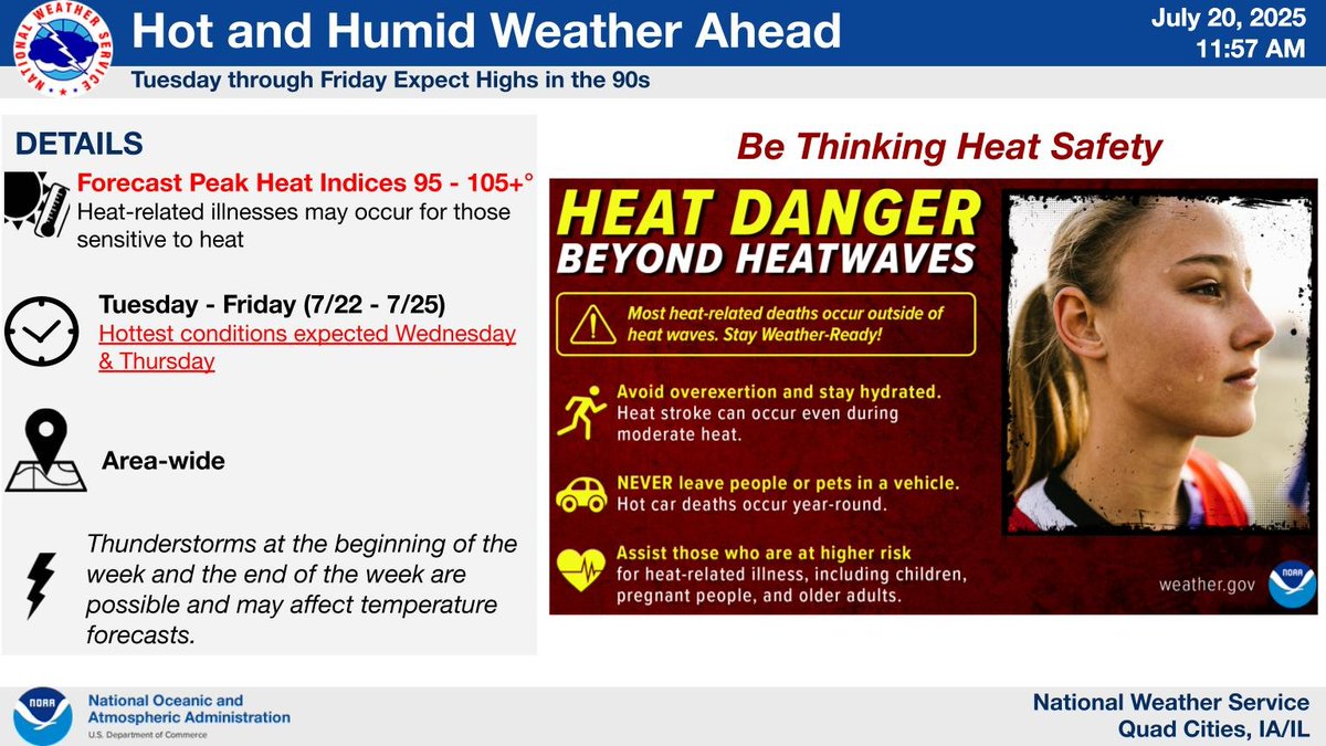
Heat indices of 95 to 105+ are forecast Tuesday through Thursday. Thunderstorms are possible on Thursday and may impact forecast temperatures and heat indices.
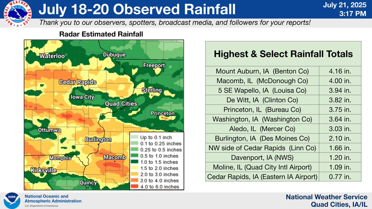
Multiple episodes of rain occurred across the region on Friday night through Sunday. Isolated flash flooding occurred in the early morning hours of Sunday, including in Louisa County, IA and Bureau County, IL. Thank you to our observers for their reports! mesonet.agron.iastate.edu/wx/afos/p.php?…
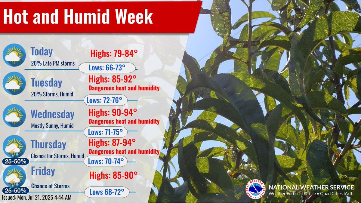
Increasingly hot and humid conditions will been seen this week with heat indices over 100 degrees during the day and 75 or warmer at night. Wednesday looks to be the most dangerous day for heat with heat indices of 105 or hotter. Relief is possible late week from storm complexes.
Heat indices of 95 to 105+ are forecast Tuesday through Thursday. Thunderstorms are possible on Thursday and may impact forecast temperatures and heat indices.
After lower humidity today, dangerous heat and humidity are forecast across the area Tuesday through Thursday. Chances for thunderstorms return on Thursday and Friday.
Hot and humid weather will build into the area this week, with a continued low chance for evening and overnight storms through Monday night. Expect daily heat index readings over 100, starting Tuesday, and lasting much of the week ahead.
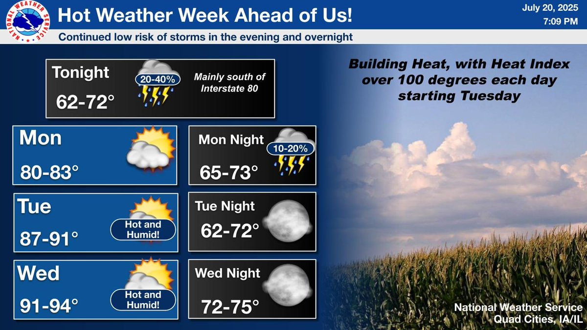
Hot and humid weather will build into the area this week, with a continued low chance for evening and overnight storms through Monday night. Expect daily heat index readings over 100, starting Tuesday, and lasting much of the week ahead.

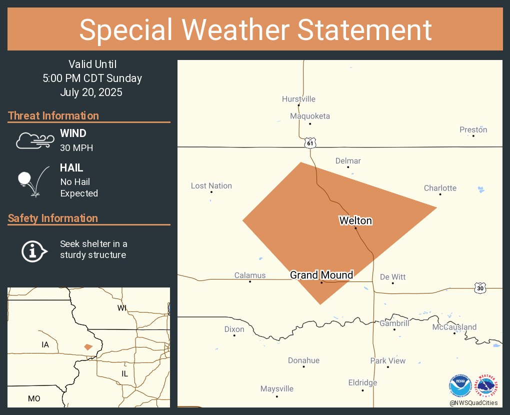
A special weather statement has been issued for Grand Mound IA and Welton IA until 5:00 PM CDT
This afternoon and early evening, isolated, small showers and thunderstorms will be found along a stalled front, from Anamosa IA, to Clinton IA, to Atkinson IL, to Magnolia IL. These are small isolated storms, but are slowly moving. Expect minor flooding.
Tuesday through Friday, we expect high temperatures in the 90s. Heat indices from 95F-105F+ are possible especially Wednesday and Thursday. Thunderstorms at the beginning of the week and the end of the week are possible and may affect temperature forecasts.
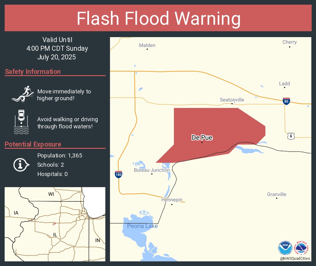
Flash Flood Warning including De Pue IL until 4:00 PM CDT
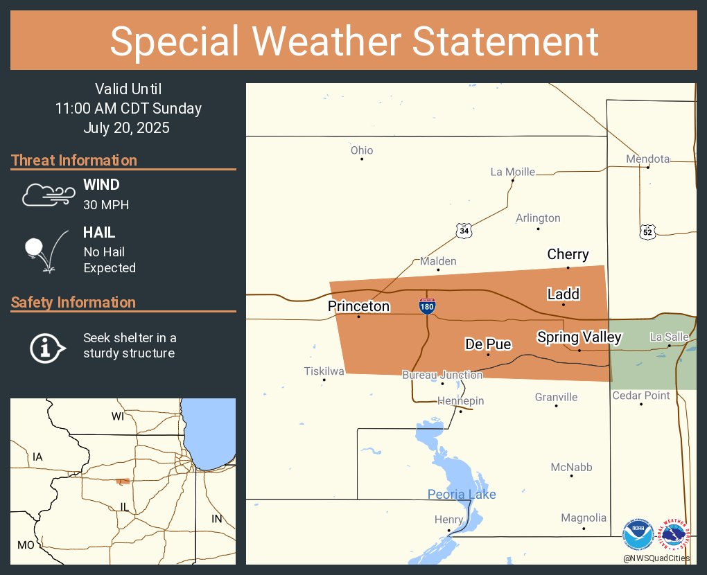
A special weather statement has been issued for Princeton IL, Spring Valley IL and De Pue IL until 11:00 AM CDT
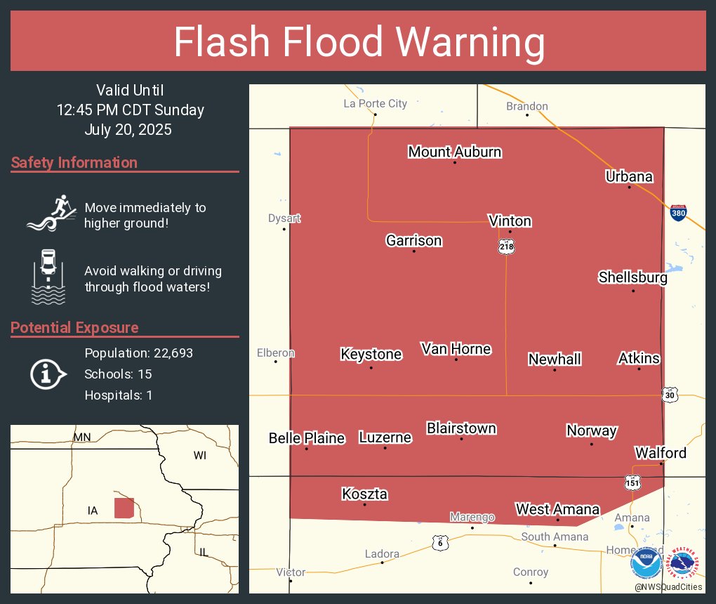
Flash Flood Warning including Vinton IA, Belle Plaine IA and Atkins IA until 12:45 PM CDT
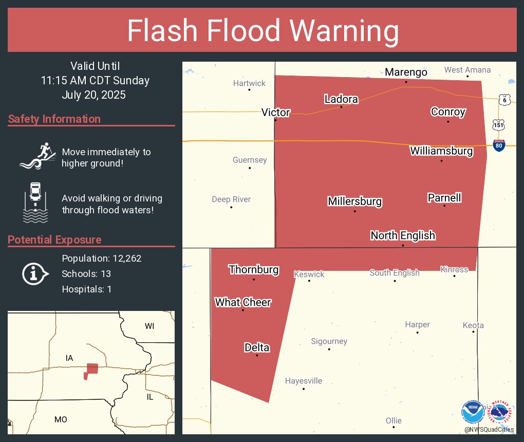
Flash Flood Warning including Williamsburg IA, Marengo IA and North English IA until 11:15 AM CDT