NWS Des Moines
@NWSDesMoines
Official X account for the National Weather Service Des Moines. Details: http://weather.gov/nws_x
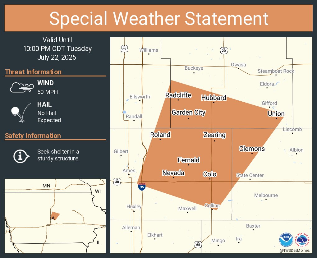
A special weather statement has been issued for Nevada IA, Roland IA and Colo IA until 10:00 PM CDT
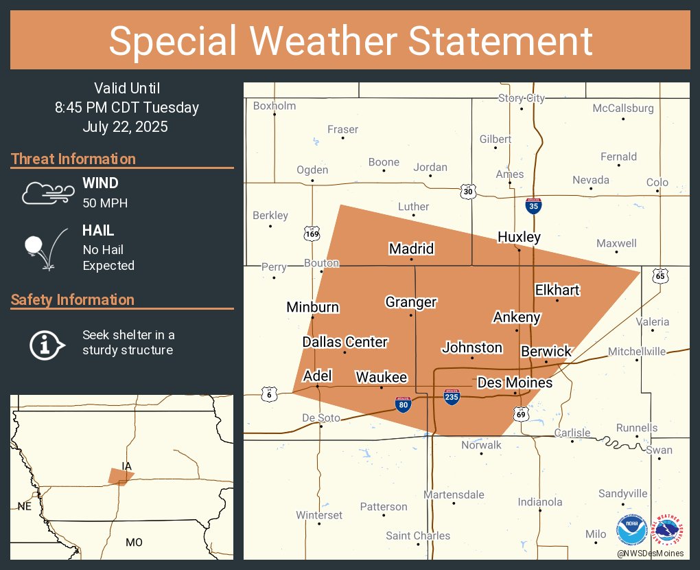
A special weather statement has been issued for Des Moines IA, West Des Moines IA and Ankeny IA until 8:45 PM CDT
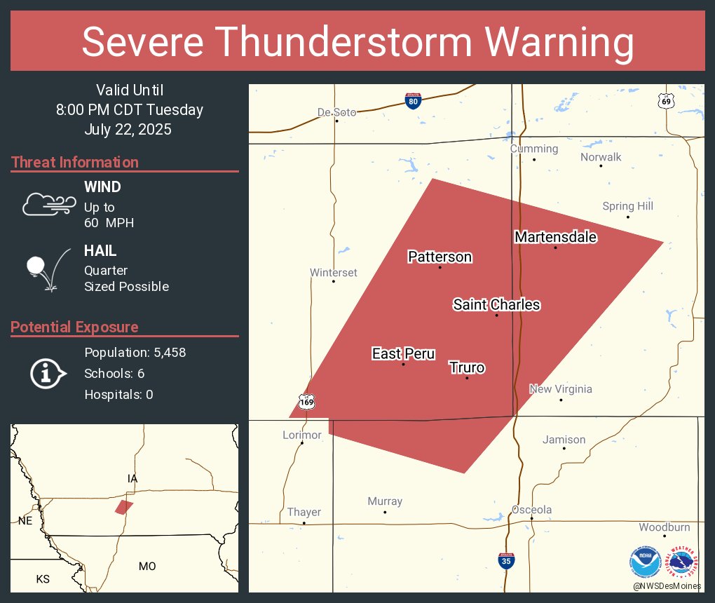
Severe Thunderstorm Warning including Saint Charles IA, Truro IA and Martensdale IA until 8:00 PM CDT
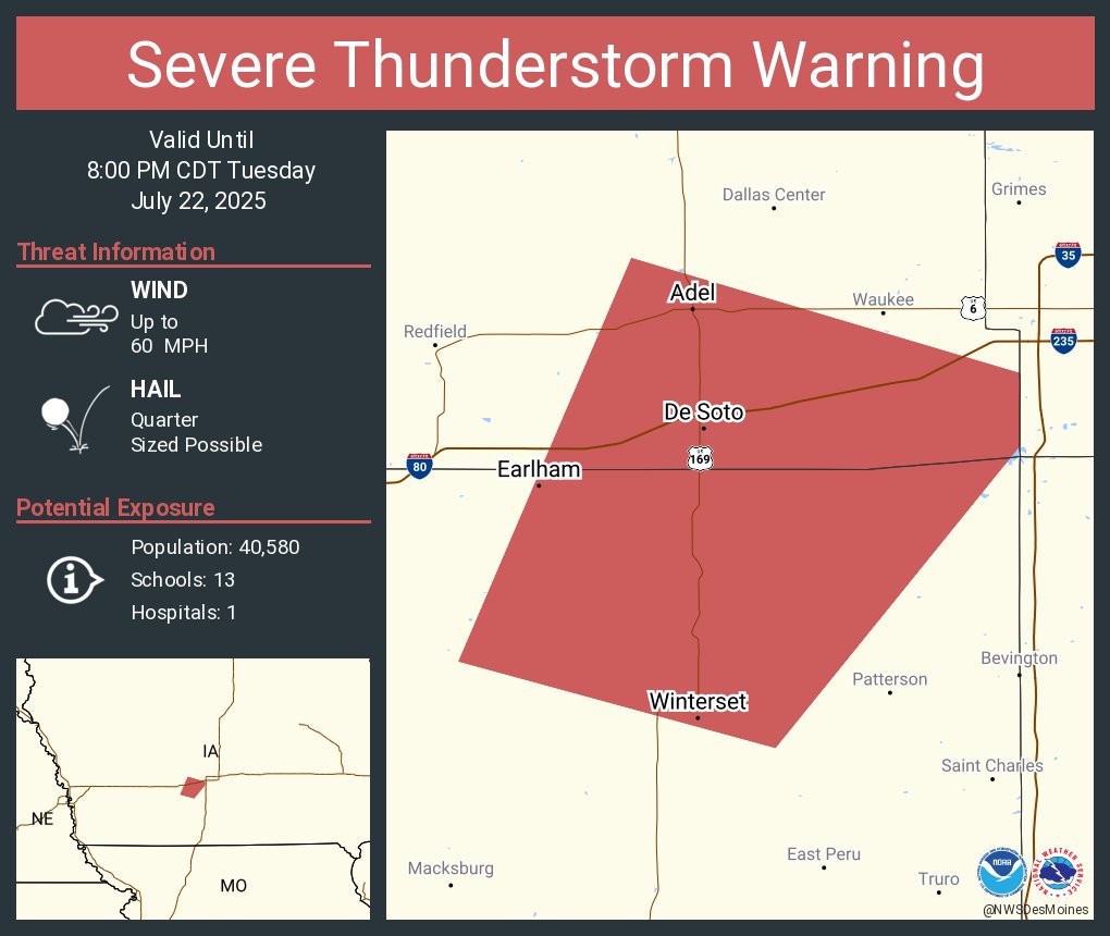
Severe Thunderstorm Warning including Winterset IA, Adel IA and Earlham IA until 8:00 PM CDT
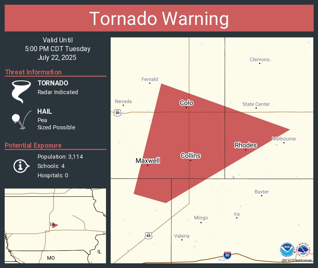
Tornado Warning including Maxwell IA, Colo IA and Collins IA until 5:00 PM CDT
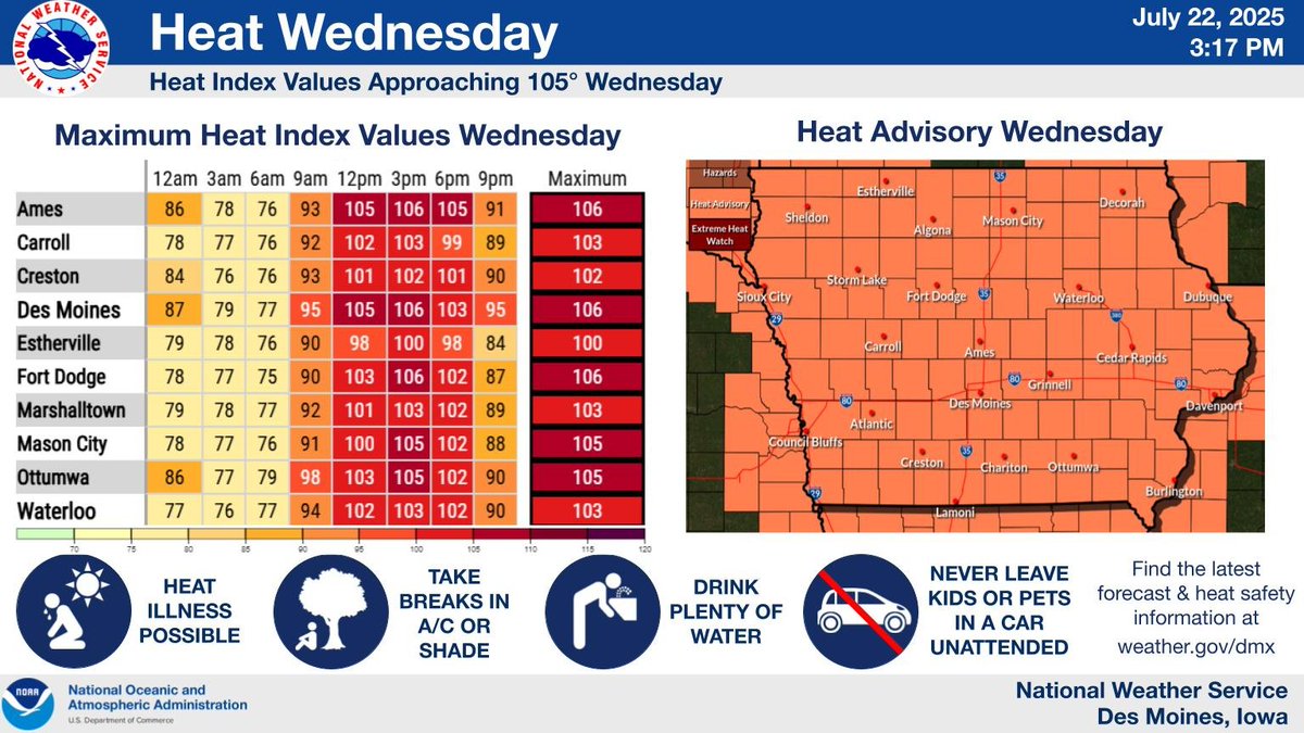
Hot and humid conditions are expected across Iowa Wednesday, with temperatures expected to reach into the low to mid 90s, and heat indices reaching up to 100-105 degrees. Please make sure if spending time outdoors to drink plenty and water and take frequent breaks. #iawx
A few strong to severe storms are possible later this afternoon and evening. Damaging winds and a tornado or two may occur. Also, conditions are favorable for funnel cloud development this afternoon and early evening. #iawx
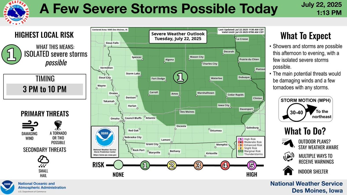
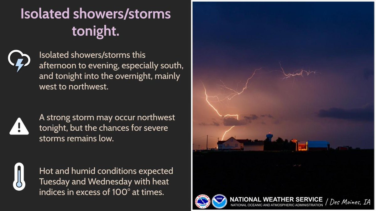
A few isolated storms are possible (~20-25% chance) this afternoon into evening, especially south, and tonight into the overnight mainly in the west/northwest. Although a strong storm could occur in the northwest tonight, the chances overall for severe storms remains low. #iawx
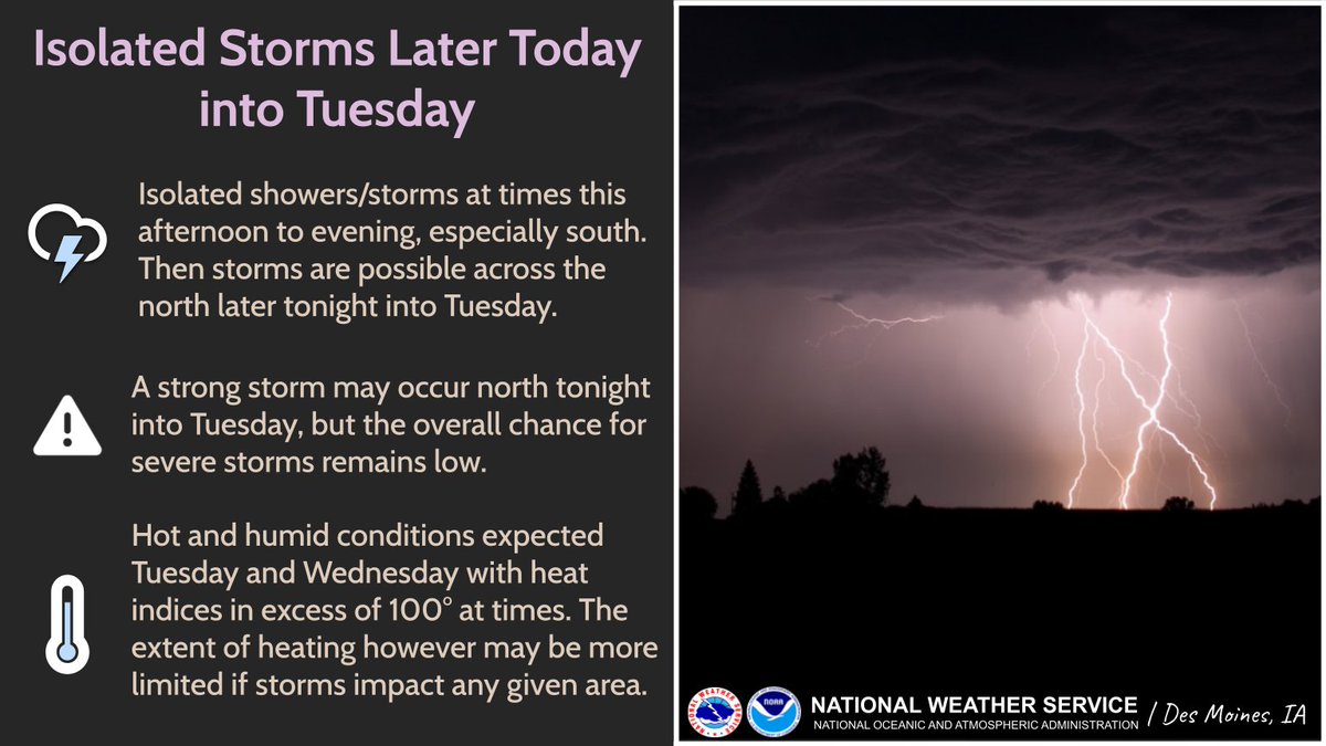
Hot and humid conditions are forecasted for Tuesday and Wednesday, especially in the south. Heat indices could exceed 105° on Tuesday afternoon. #iawx

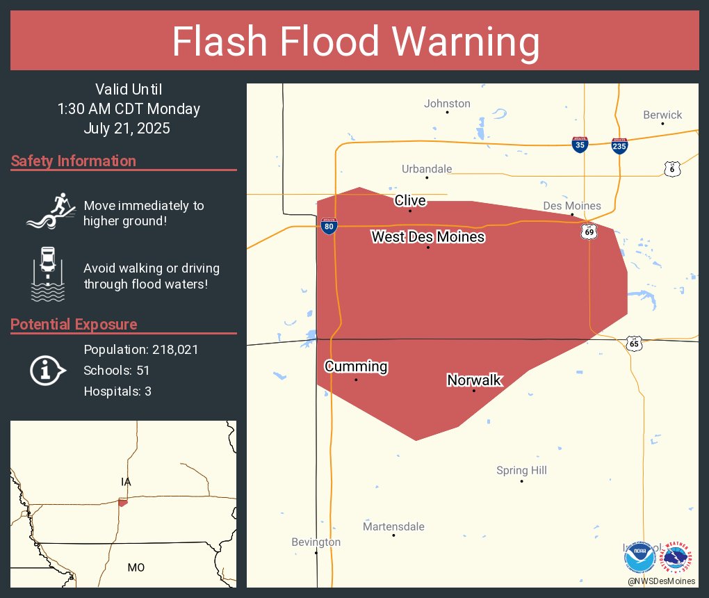
Flash Flood Warning including West Des Moines IA, Clive IA and Norwalk IA until 1:30 AM CDT
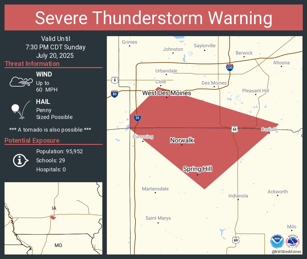
Severe Thunderstorm Warning including West Des Moines IA, Norwalk IA and Spring Hill IA until 7:30 PM CDT
CONDITIONS ARE FAVORABLE FOR FUNNEL CLOUDS for Adair, Adams, Audubon, Cass, Clarke, Dallas, Guthrie, Jasper, Lucas, Madison, Mahaska, Marion, Monroe, Polk, Poweshiek, Union, Wapello, Warren [IA] till 7:00 PM CDT mesonet.agron.iastate.edu/p.php?pid=2025…
Isolated showers and storms are possible (~20-25% chance) this afternoon through tonight. Although a strong storm could occur NW tonight, the chances overall for severe storms remains low. Additional storm chances at times this week with hot and humid conditions midweek.
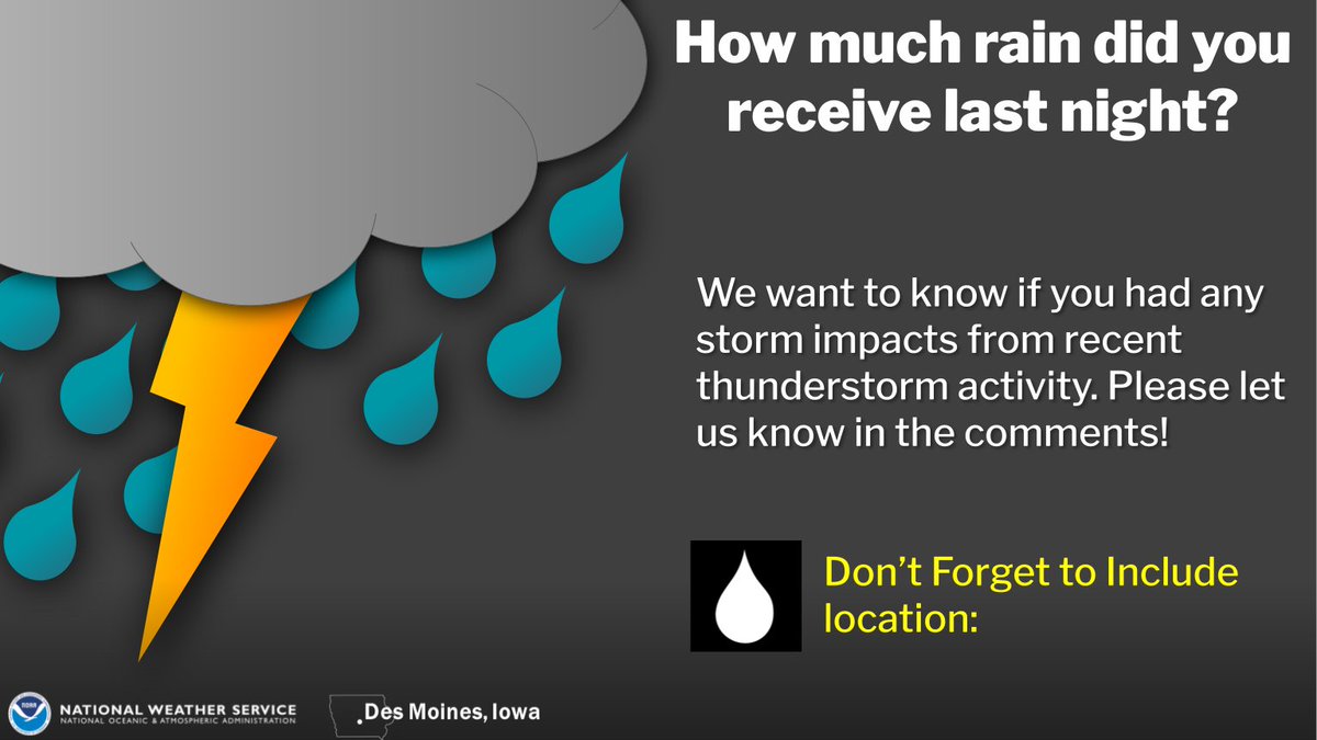
We had a lot of rainfall last night! How much did you receive? Let us know in the comments. #iawx
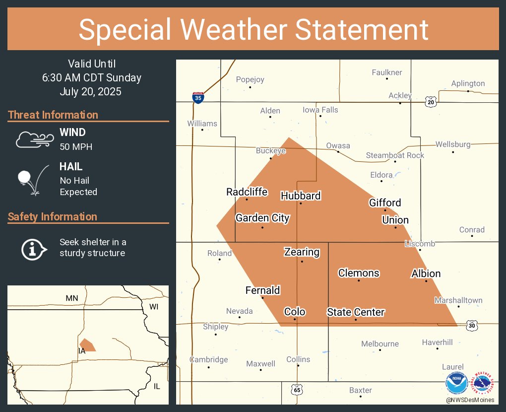
A special weather statement has been issued for State Center IA, Colo IA and Hubbard IA until 6:30 AM CDT
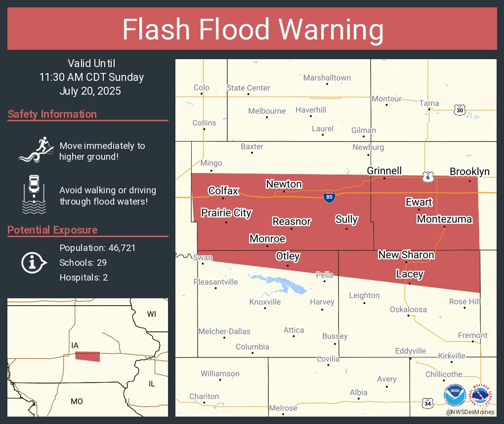
Flash Flood Warning including Newton IA, Grinnell IA and Colfax IA until 11:30 AM CDT
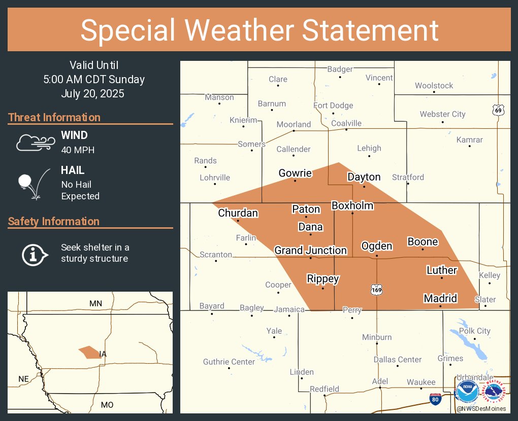
A special weather statement has been issued for Boone IA, Madrid IA and Ogden IA until 5:00 AM CDT
#WPC_MD 0766 affecting much of IA and adjacent portions of far northeast NE, northwest IL, and northeast MO, #ilwx #iawx #mowx #newx, wpc.ncep.noaa.gov/metwatch/metwa…
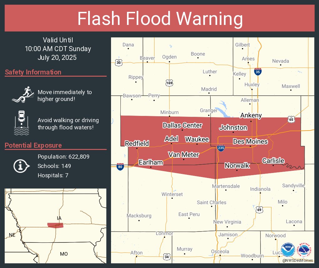
Heavy rainfall amounts of 2 to 4" are being observed on the western portions of the metro, with intense rainfall rates of 1 to 3" per hour. Additional rainfall of 1 to 3" is expected. Flash flooding is likely, especially in low lying and poor drainage areas. #iawx
Flash Flood Warning including Des Moines IA, West Des Moines IA and Ankeny IA until 10:00 AM CDT
Flash Flood Warning including Des Moines IA, West Des Moines IA and Ankeny IA until 10:00 AM CDT