Florida Tropics
@FloridaTropics1
Florida Wx throughout the year, with a special focus on the tropics during Hurricane Season. For official information, please refer to the @NWS and @NWSNHC.
With X acting up, a reminder you can follow us on other platforms! Thank you for the support. Facebook - facebook.com/FloridaTropics1 Instagram - instagram.com/floridatropics… Threads - threads.net/@floridatropic… Bluesky - bsky.app/profile/florid…
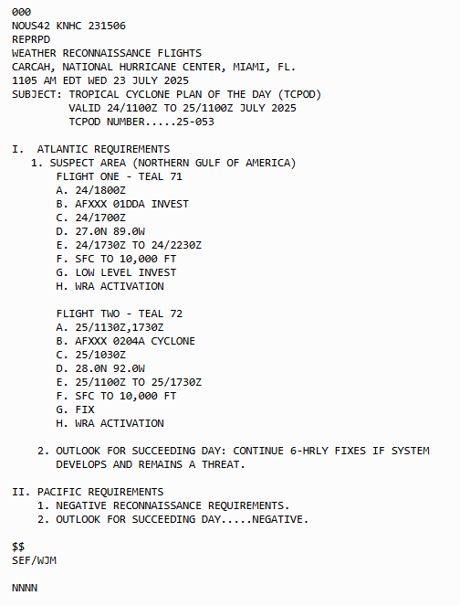
We have two recon flights scheduled for tomorrow and Friday for our area of interest. Let's see if @53rdWRS will get to fly this one!
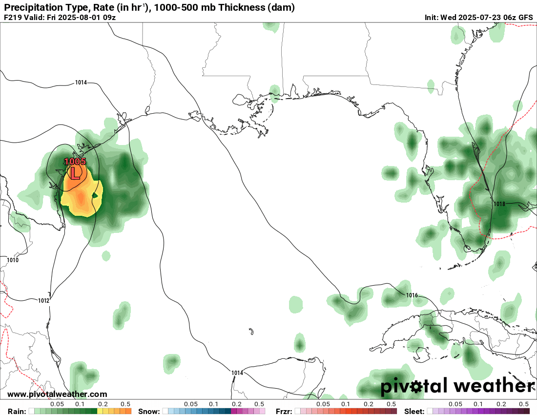
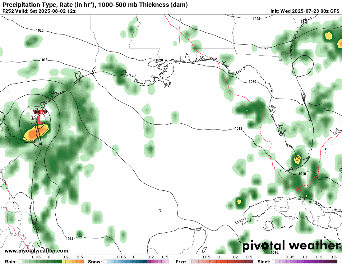
The 6z/0z GFS is picking up on a storm in the day 7-10 range headed west in the Gulf towards South Texas (Corpus Christi area). Something to watch as this would fit within the area designated by the global tropics outlook yesterday.
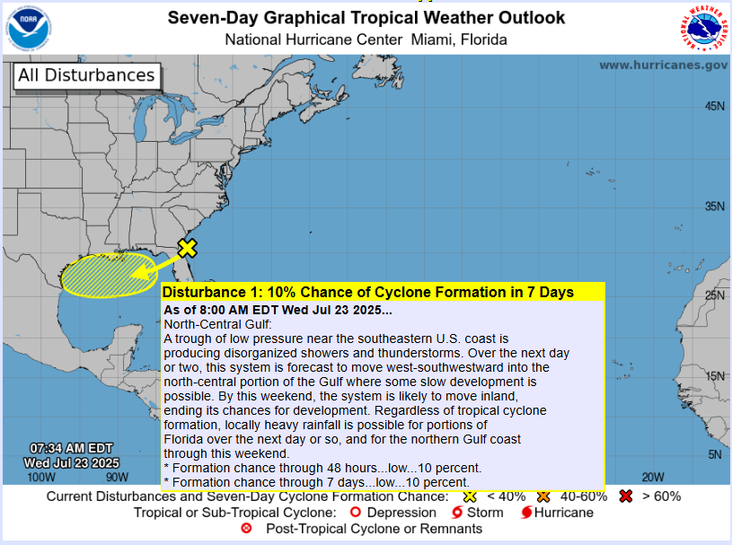
Good morning! 8 AM outlook from NHC maintains 10% development chances for the AOI near Florida this morning.
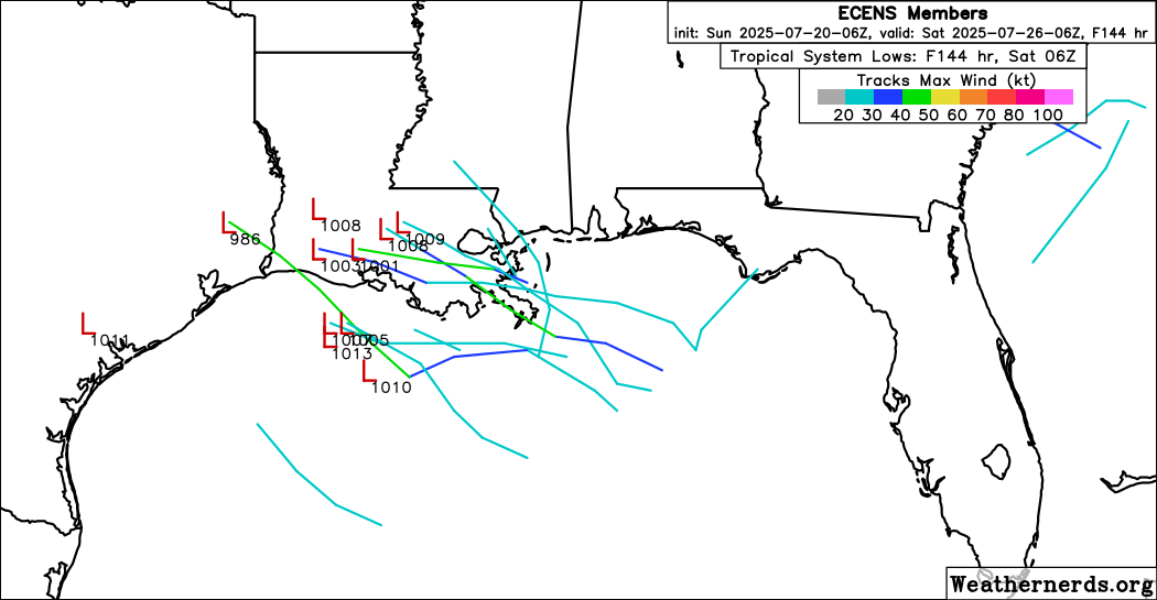
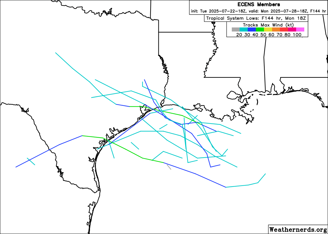
18z Euro ensemble members are showing some potential for development as the newly highlighted AOI approaches the Texas coast later this week.
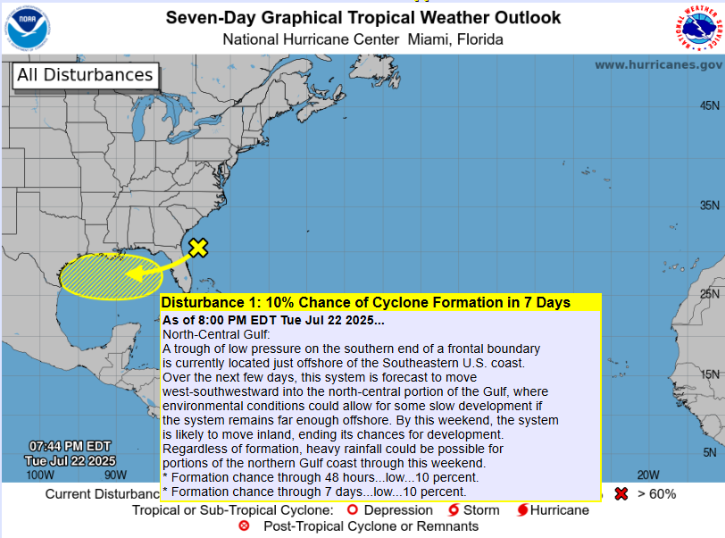
The NHC has just marked an area of low pressure off the SE coast with 10% development chances once it enters the Gulf later this week. Where have I seen this picture before? 🤣
MELBOURNE FLOODING: intense rain in a matter of minutes causes flooding on Babcock St and side streets near @FloridaTech in Melbourne. Roof collapse at Joseph N. Davis Community Center due to heavy rain. Video = GP @MyNews13 @NWSMelbourne
7/22/25 3PM ET 📡 ⛈️ 💥 It’s getting messy with these storms converging on each other. The I-10 corridor down to #Tallahassee is will be impacted imminently. Seek shelter if you’re in the area. Can’t rule out a severe thunderstorm and/or flash flood warning. #FLwx #GAwx #ALwx
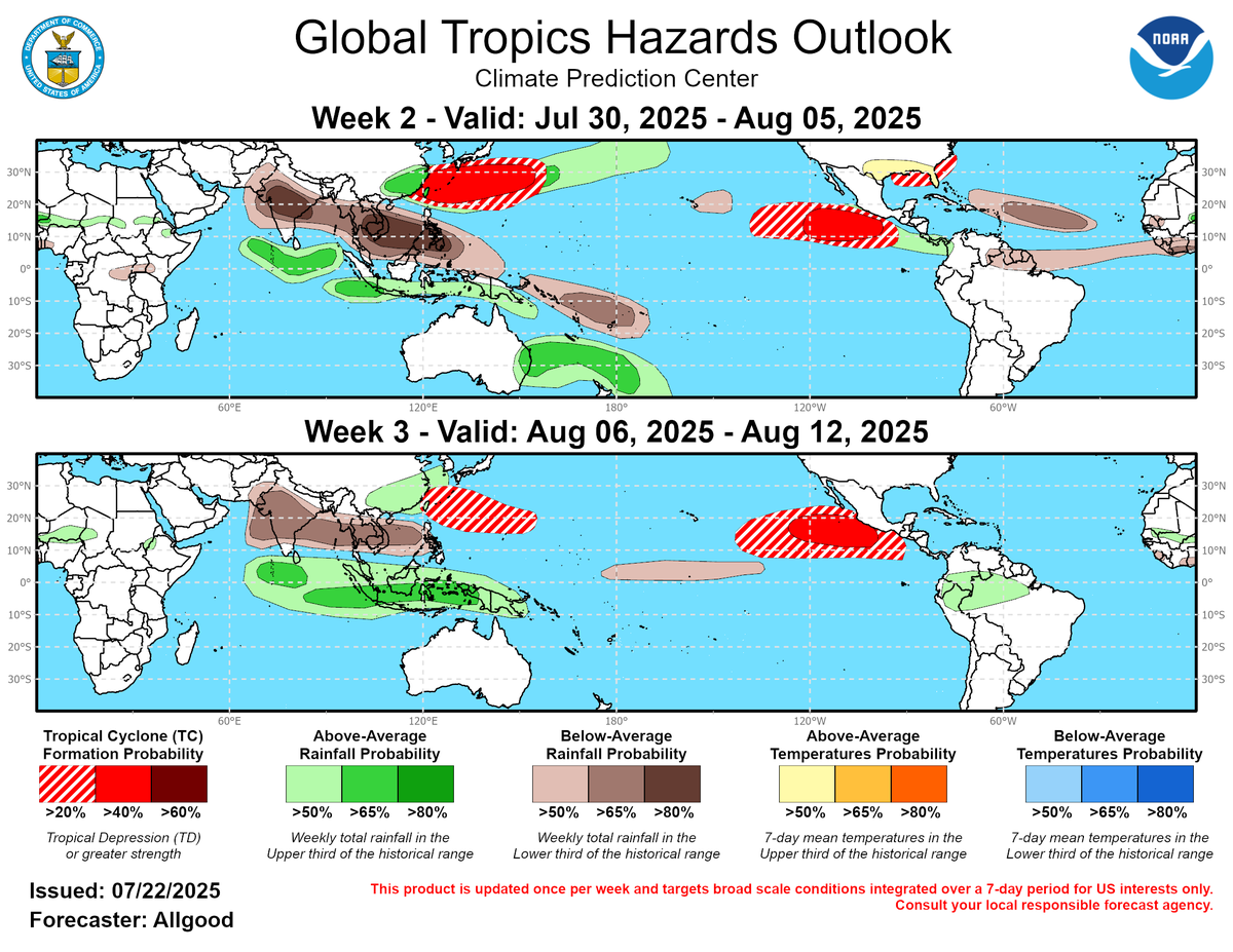
The latest Global Tropics Hazards Outlook has highlighted both the Gulf and Atlantic sides of Florida for a low chance of tropical cyclone formation possibility between July 30 and August 5. The following week is looking quiet basin-wide. Keep watching.
Heads up in the Ocala area. Flooding from heavy rains this morning.
At 6:43 AM EDT, 4 SSE Lowell [Marion Co, FL] Public reports Flood. Roadway is starting to overflow with water on NW Gainesville Road in Ocala near NW 89th place. #flwx mesonet.agron.iastate.edu/lsr/?by=wfo&wf…
The Atlantic tropics stay relatively quiet with some MDR waves and this weeks and nexts attempt at something with a couple deep moisture surges in the northern Gulf, but these are extreme long shots. You may see NHC outlook areas at times, but otherwise we will likely go into…
Tomorrow is going to be an active #weather day for the entire #Florida peninsula. Heavy #rain with #lightning and some storms even becoming #severe. Totals will be 1-3" of rain within 3-5" locally. Urban #flooding possible. #WxUpdate #FLWX #CentralFLWX 📡✝️⛈️
Wouldn’t mind some of that after today! 🥵
Six months ago today we had historic snowfall in Northwest Florida. Yes, I’m still talking about it ☃️😎
Invest #94L is back down to 10% development chances this afternoon. Prospects are quite dim for this one moving forward.
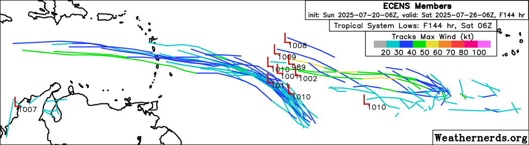
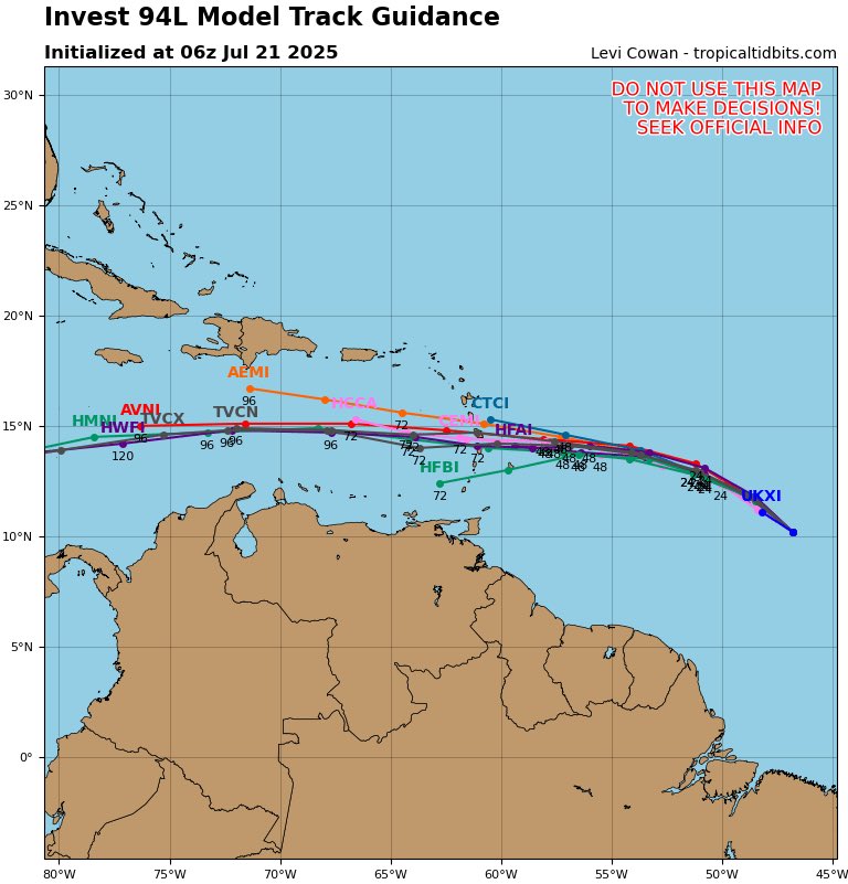
Good morning! First spaghetti models for #94L are shown below. Most models don’t show the system becoming much of anything but the energy will make its way through the Windward Islands and into the Caribbean later this week.
What a shot!
The sunset tonight in Southwest Florida was special. There was a strong storm over Sanibel, towering over 45,000 feet, illuminated at sunset for all to see (and take pics of). @WINKNews @stormhour
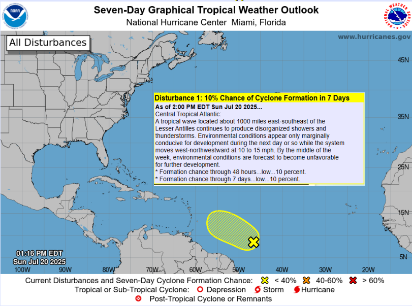
An area of low pressures has a low (20%) chance of development over the Central Tropical Atlantic within the next 48 hrs. TOO EARLY to determine what impacts, if any, are possible for West Central & #SWFL! Please continue to monitor the forecast for updates! #FLwx
Time for some spaghetti models! #94L
8pm EDT 20 July: NHC is watching a small area of low pressure (Invest #94L) in the Central Tropical Atlantic. This system has a low chance (20% 🟡) of becoming a tropical cyclone before moving into less favorable environmental conditions. Latest outlook: hurricanes.gov/gtwo.php?basin…
Afternoon update from the NHC keeps very low development chances (10%) for the area of interest in the central Atlantic.
6z Euro ensembles are continuing to show some potential in both the Gulf and the main development region (MDR).