
Zach Covey
@ZachCoveyTV
| Hurricane Specialist | Spectrum News | @FloridaState Alumnus
New Day. New Season. Same Stanley Cup Champions! #ALLCAPS #RockTheRed
🌅 #ALLCAPS #StanleyCup
🥱
The NHC has just marked an area of low pressure off the SE coast with 10% development chances once it enters the Gulf later this week. Where have I seen this picture before? 🤣
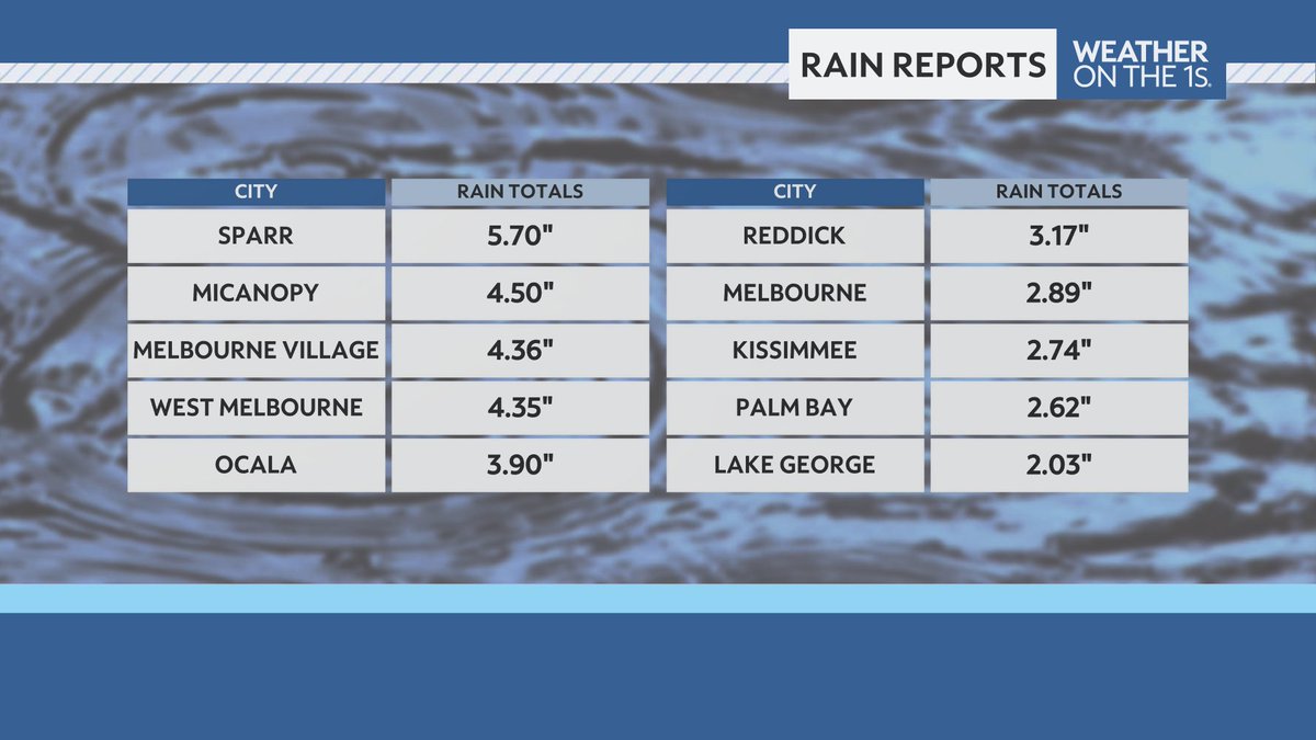
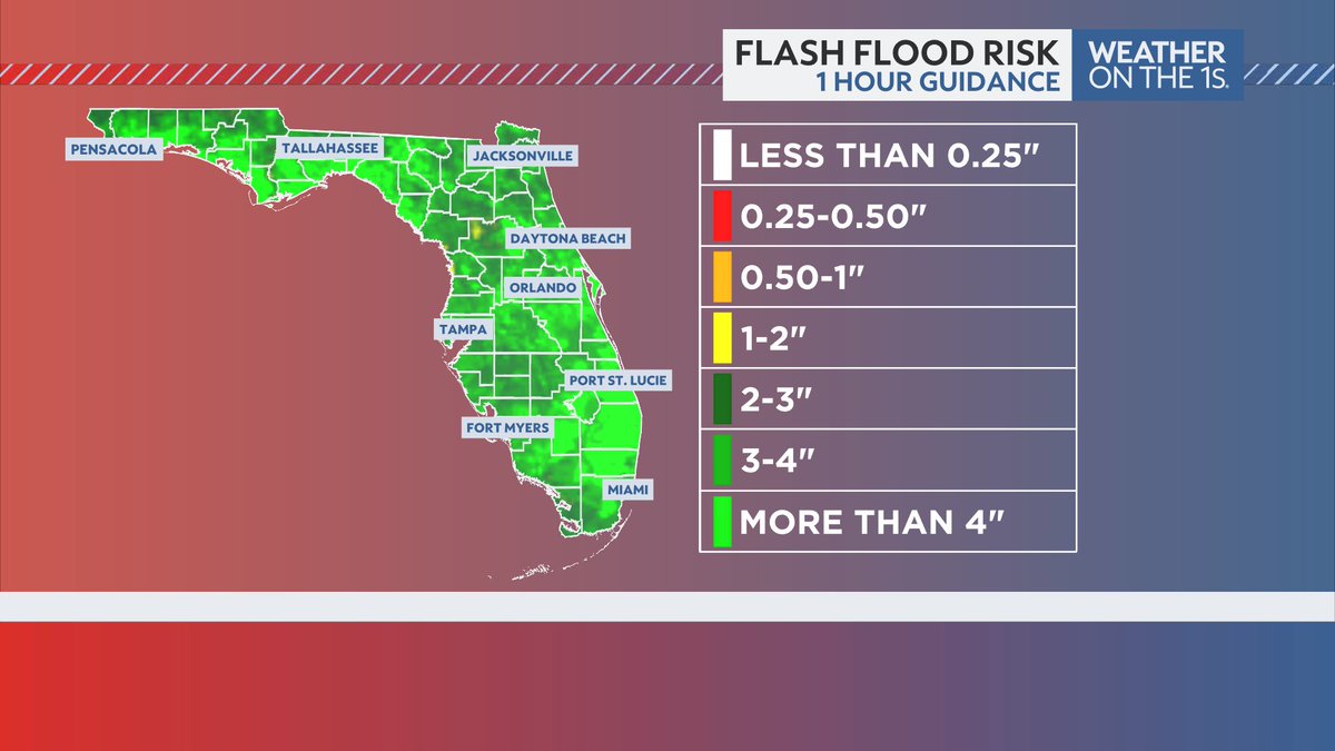
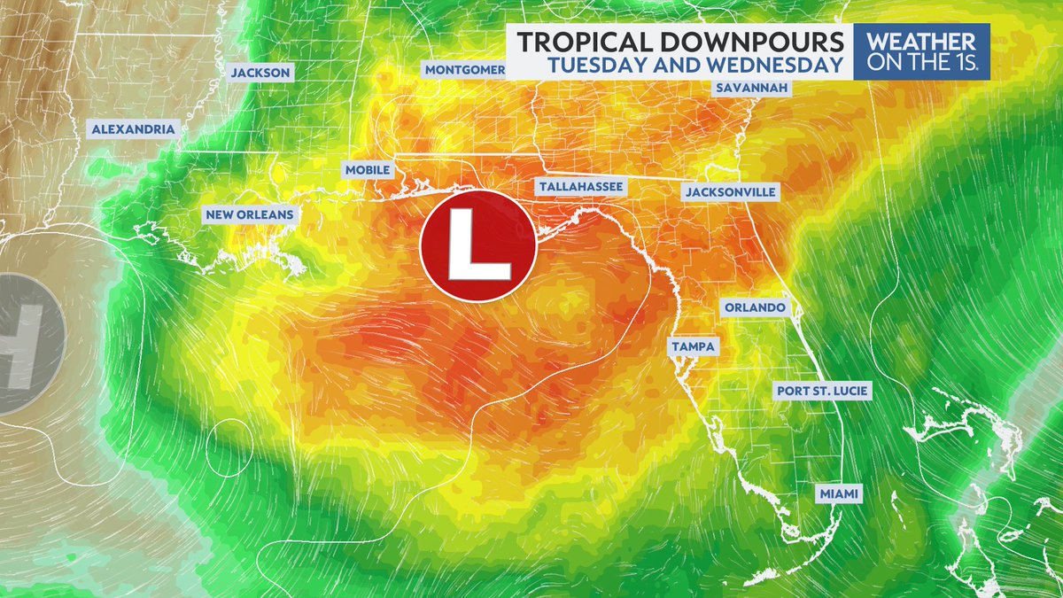
It's been a soggy day for much of Central Florida. Several locations picking up over 2 inches of rain today. Expect another rainy day tomorrow, prompting more flood alerts through the region. #FLwx @mynews13
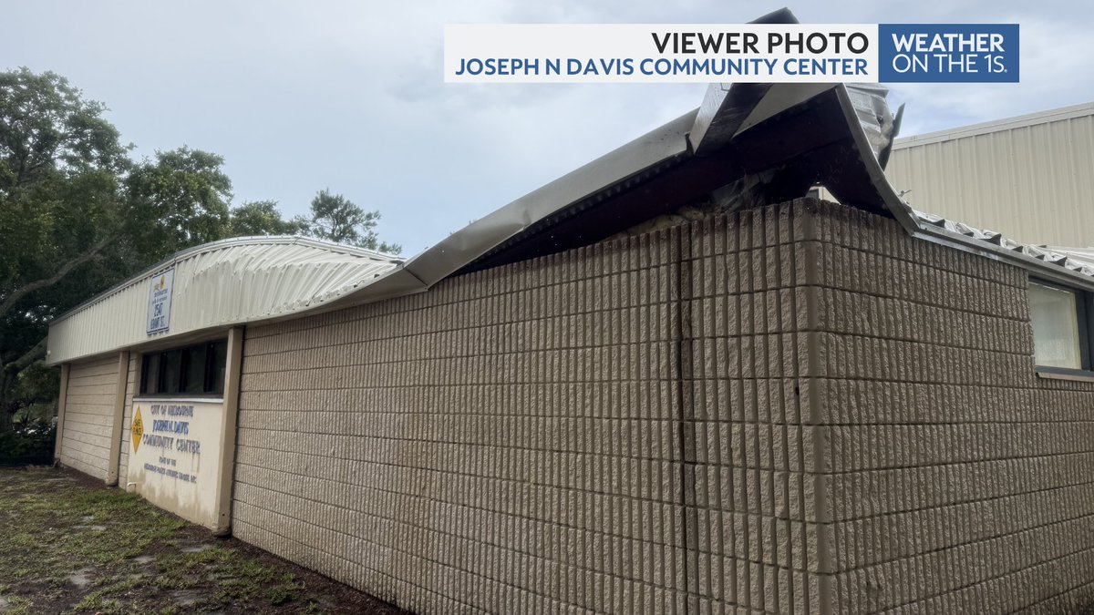
We're following a roof collapse at the Joseph N Davis community center in Brevard county following heavy rainfall over the past hour. #FLwx @mynews13 @NWSMelbourne
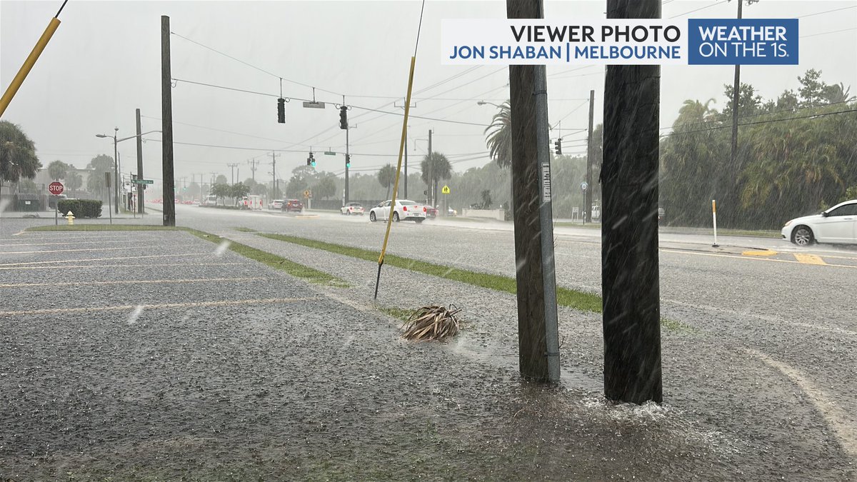
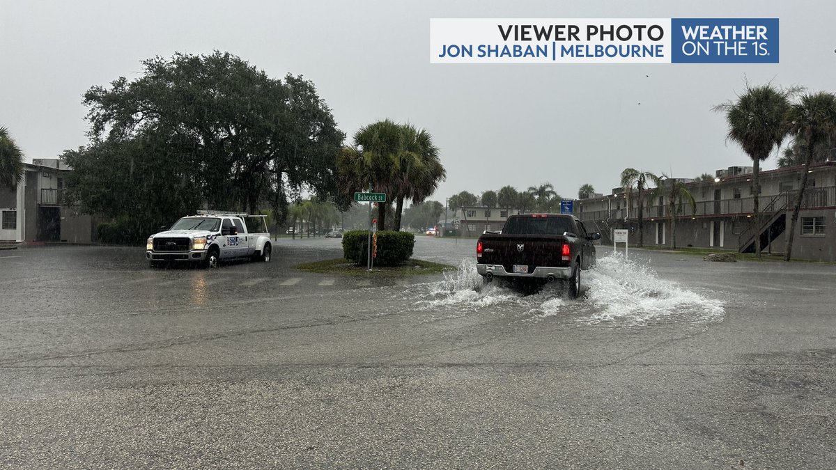
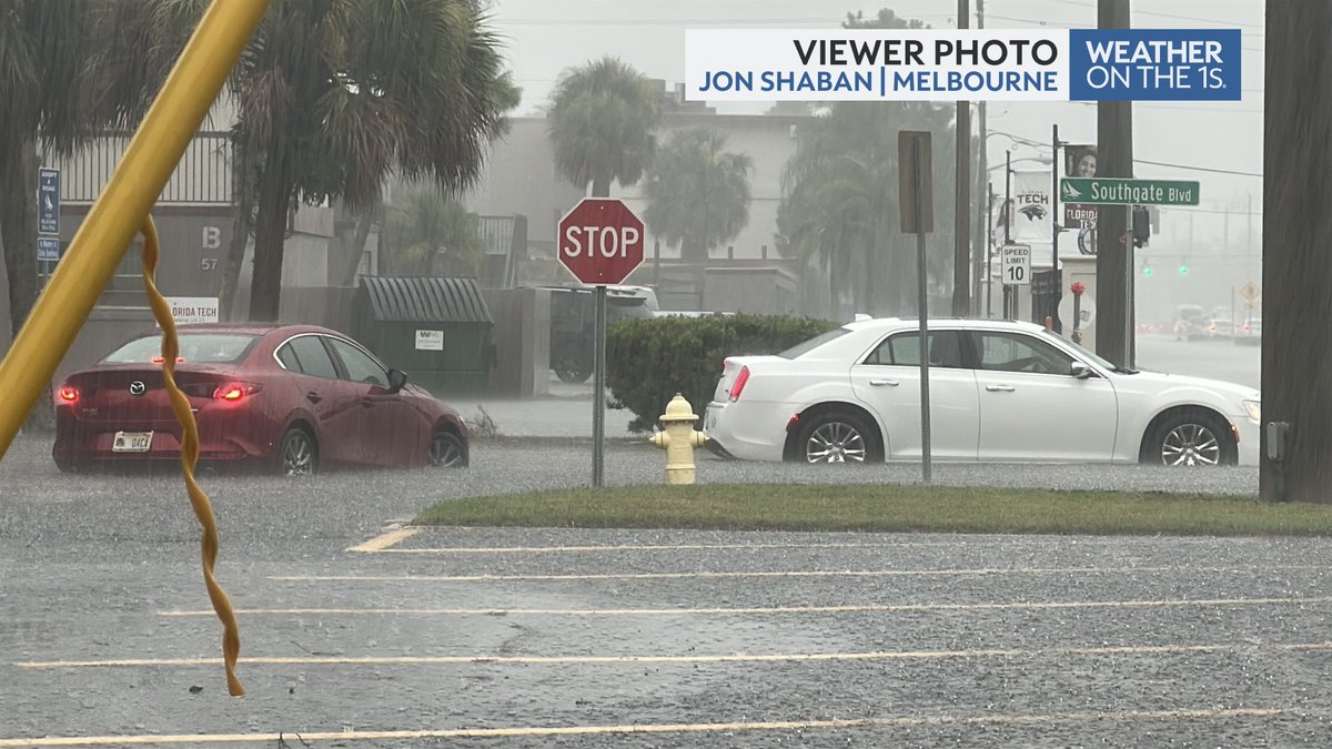
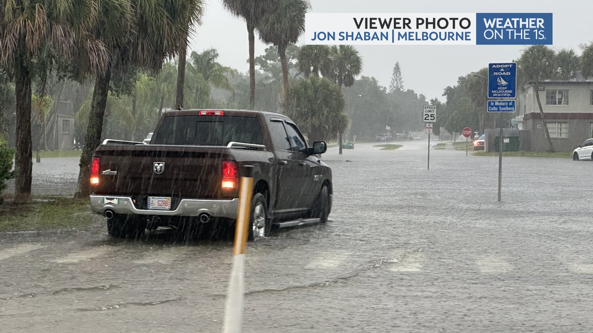
Flash Flood Warning in southern Brevard county through 4:00 p.m. Flooding along Babcock Road is stranding a few cars off Southgate Blvd. Remember - Turn Around, Don't Drown! #FLwx @mynews13 @NWSMelbourne
With another batch of heavy rain on the way into Marion county, we'll be watching the I-75 corridor near Citra, Ocala and Belleview for some flooding. Only takes about 1-2" inches in an hour to begin flooding roadways according to the latest in house guidance. #FLwx @mynews13
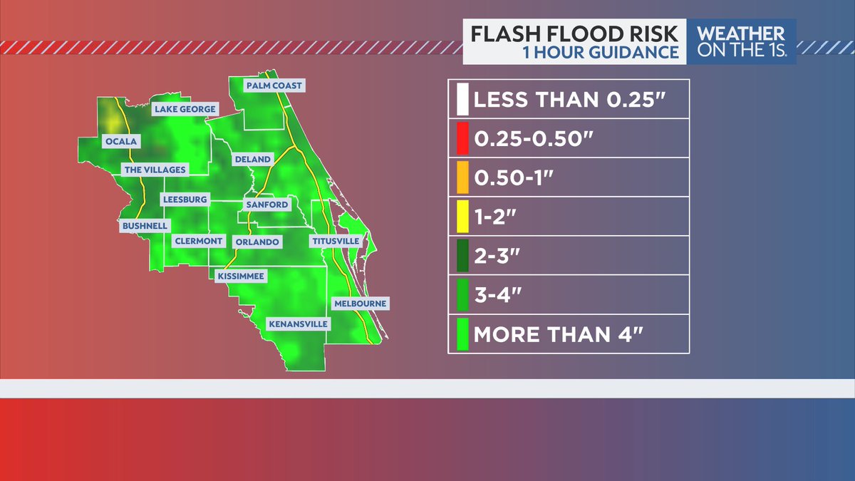
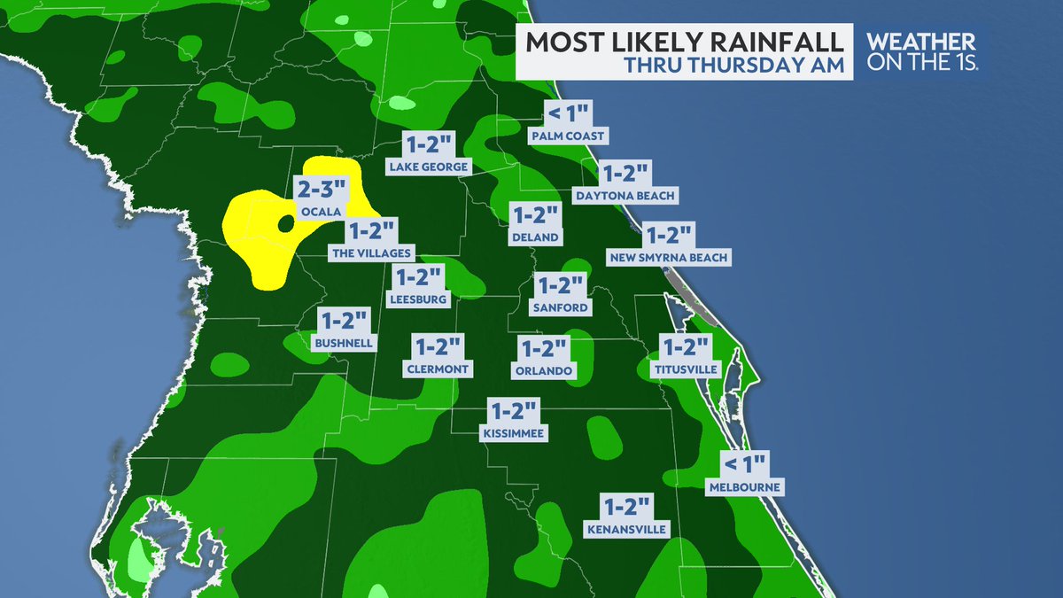
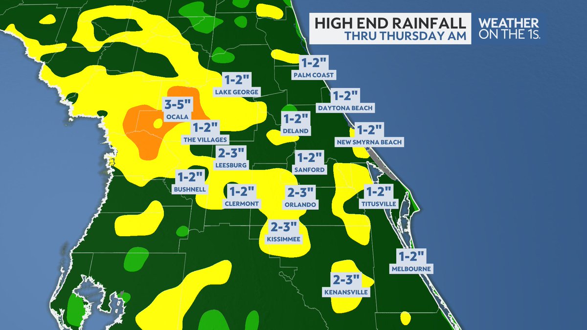
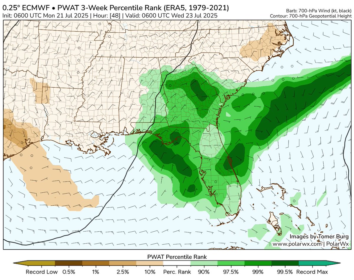
Atmospheric moisture values are nearing the top 1% across Central Florida the next 48 hours. Expect several inches of rainfall through Thursday AM. And while Flash Flooding will be very isolated, we will need to watch spots in Marion county for that threat. #FLwx @mynews13
This is from the earlier Flash Flood Warning this morning in Marion county. More heavy rainfall on the way today across Central Florida as PWAT values near the top 1%. #FLwx @mynews13
water starting to enter the roadway - 7:34am 15350 NE Jacksonville Rd Citra, FL 32113 @NWSJacksonville

Hey Data Wizards - I need your help. I'm sick and tired of using RainVision in WSI MAX. I'm going to start ingesting rainfall observations using the water.noaa.gov site, but I need to know the units it's using in the NetCDF file. Anyone know? water.noaa.gov/about/precipit…
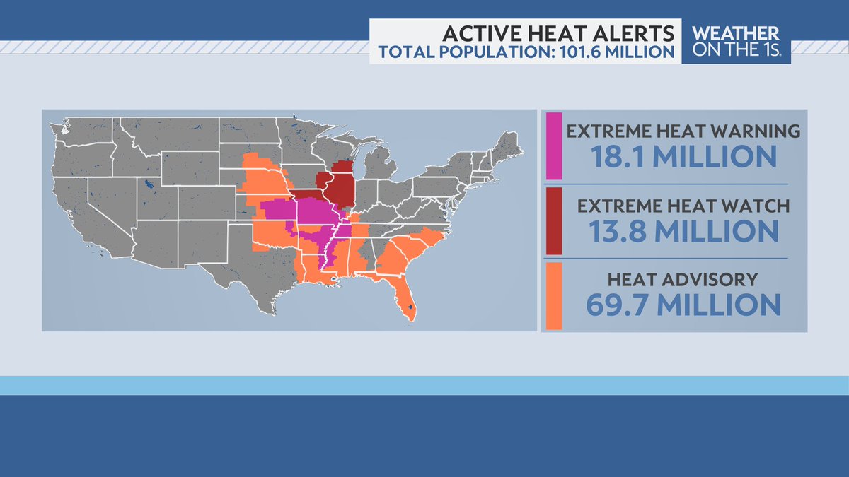
While the heat will begin to subside for Florida and the Gulf Coast over the next few days, the heat is building in the central U.S. Currently over 100 million Americans are under some sort of heat alert. More heat returns to Florida next weekend too! #FLwx @mynews13
It's not record setting, but our moisture values in Orlando and Central Florida will be nearing the top 1% over the next 48 hours. What's that mean? It's about to get rainy. And I'm not talking seabreeze rainy - I'm talking all day, grey and gloomy, rainy. #FLwx
Invest #94L is a snooze fest. Too dry, too stable, too dusty. I'm a bit intrigued with what's coming off Africa by Wednesday. Still going to battle dust and stability, but could 94L be the "lineman" this wave needs to bust through for a touchdown? Hmm?
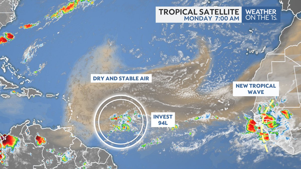
8pm EDT 20 July: NHC is watching a small area of low pressure (Invest #94L) in the Central Tropical Atlantic. This system has a low chance (20% 🟡) of becoming a tropical cyclone before moving into less favorable environmental conditions. Latest outlook: hurricanes.gov/gtwo.php?basin…
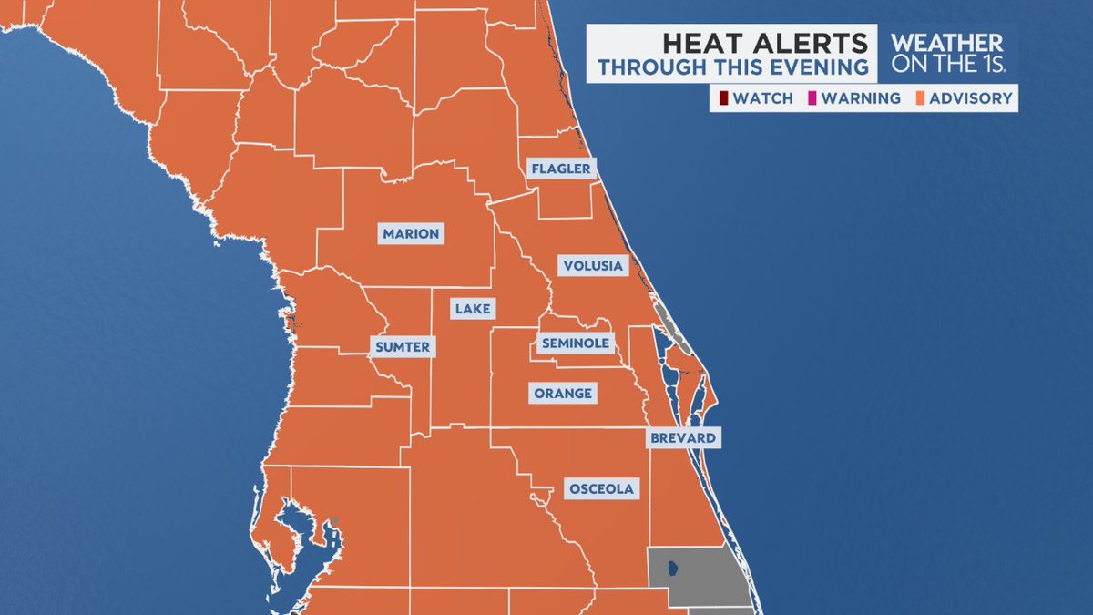
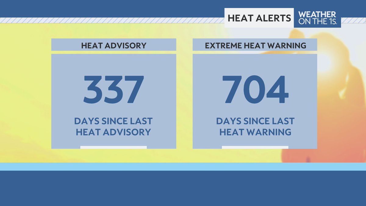
Today marks the third Heat Advisory of the year for Central Florida. This means the region has tripled its annual heat advisory issuance. On average, the region sees one Heat Advisory per year. This heat continues into Monday once again. #FLwx @MyNews13
The NHC has introduced an AOI in the central MDR this evening for a convectively active AEW. Models are in agreement on the formation of a transient tropical depression or storm, but we’ll need to closely monitor the potential for significant dry, stable air entrainment into…
7/18 8pm EDT: A tropical wave interacting with a broad area of low pressure is producing disorganized showers and thunderstorms over the central tropical Atlantic. Slight development is possible late this weekend into early next week as it moves west-northwestward around 10 mph.…
7/18 8pm EDT: A tropical wave interacting with a broad area of low pressure is producing disorganized showers and thunderstorms over the central tropical Atlantic. Slight development is possible late this weekend into early next week as it moves west-northwestward around 10 mph.…
Central Florida got it's first heat advisory since August of last year today. While more Heat Advisories are likely through the weekend, Extreme Heat Warnings appear unlikely. #FLwx @mynews13
No wonder the heat this weekend is cranking in Central Florida - we're likely to set a new record for 500hPa heights through Sunday morning. Get ready for highs in the mid and upper 90s, and heat index values upwards of 110° in spots! #FLwx @mynews13

I wasn't ready for this view of Uranus.
The inside of Uranus is not as cold as expected 🤔 Data from Voyager 2’s 1986 flyby suggested that Uranus is unusually cold inside. Now, advanced computer modeling and a new look at old data reveal that Uranus is warmer than previously thought: go.nasa.gov/44EpDOC