Andrew Austin-Adler
@WeathermanAAA_
Student Meteorologist specializing in Tropical Cyclones. | Providing Analysis and factual forecasts on global weather phenomena 🌦️
Hey #wxtwitter! a little update; after many, many messages to support, I still haven't heard much about the status of the @weatherman_aaa account. At this point, im probably going to have to make a new one at least temporarily. Holding out hope!
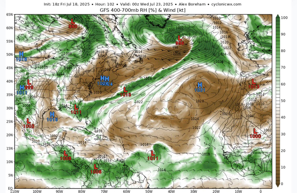
In stark contrast to #94L, the next wave rolling off the W Coast of Africa has a realistic shot to develop One major indicator is the +PWAT anomalies NW of the wave axis, which looks a lot like the Brammer & Thorncroft (2015) "developing" AEW composite. journals.ametsoc.org/view/journals/…
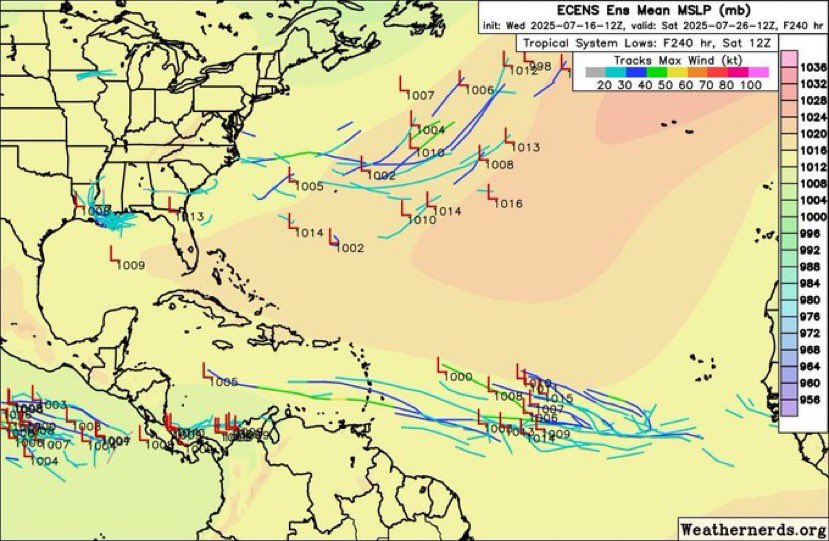
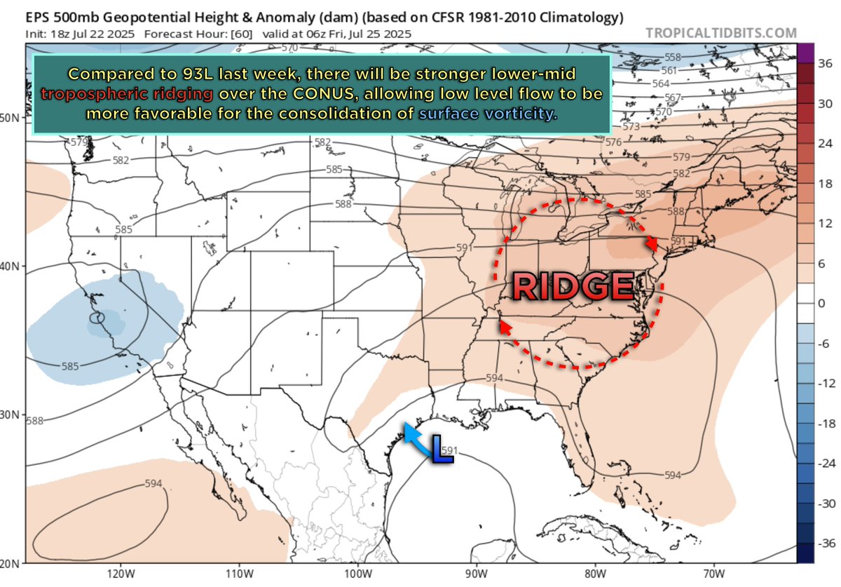
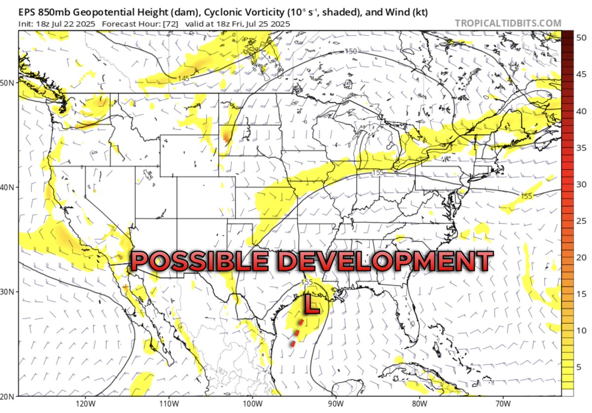
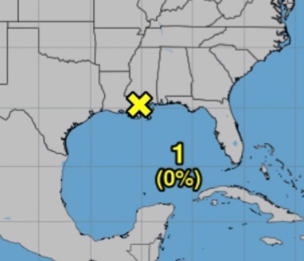
🥱 Looks like the gulf coast will be dealing with a #93L redux this week and into the weekend. I will say, unlike 93L, I expect that whatever feature eventually emerges in the Gulf will encounter slightly more favorable conditions for genesis given stronger ridging in the…
With the dissipation of #94L, the Atlantic should quiet down again, aside from A few marginal cases of genesis potential, mainly from non tropical features. This is a hallmark of the increased stability and hostile background conditions. Will be interesting to see if the…


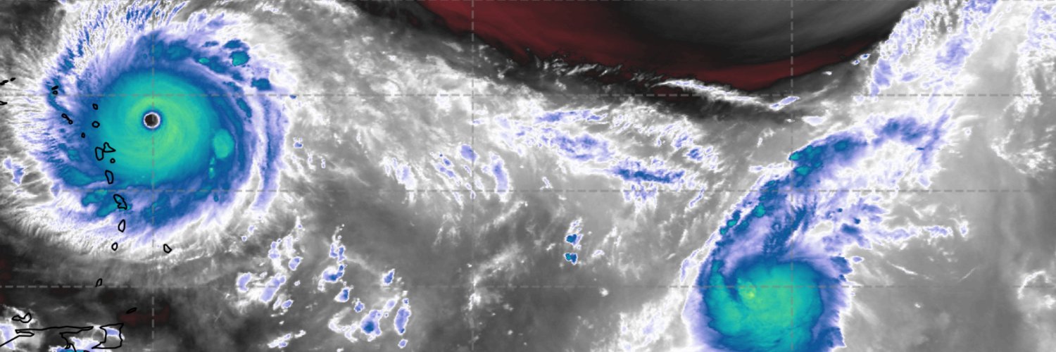
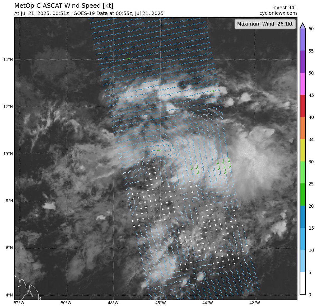
A rather amplified wave axis exists within #94L currently, as denoted from a recent ASCAT pass over the region. You can also visually see the ITCZ “rolling up” and attempting to amplify vorticity along the tip of the wave axis. Once the wave detaches and moves north, dry air…
NHC has raised chances back up to 20/20 saying that the shower and thunderstorm activity has become better concentrated. Conditions seem generally favorable over the next 24 to 36 hours
Very curious as to why invest #94L was designated this evening despite a decrease in genesis chances. A fairly formidable dry air outbreak to the north combined with the shear wall past 60W will make for incredibly difficult formation conditions. Seems like a waste of resources…
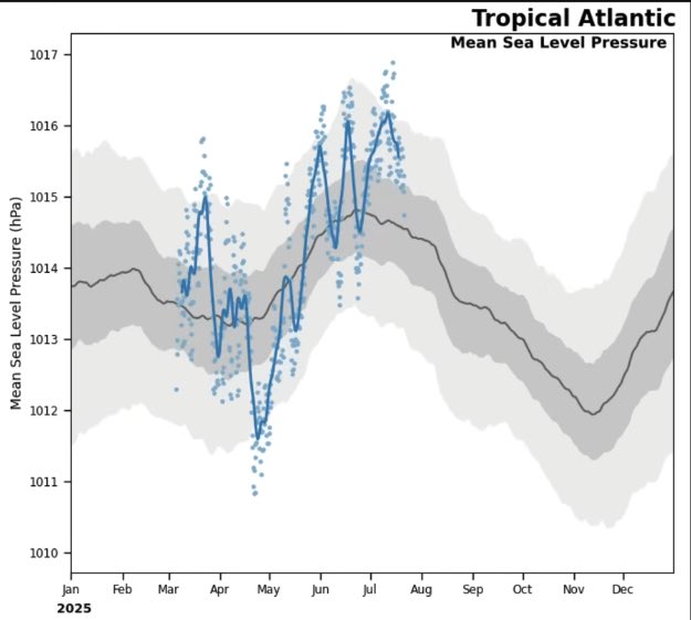
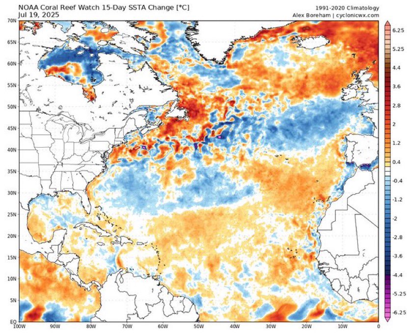
Definitely trends you’d want (or not want) to see for activity prospects in the Atlantic. The Canary Current and the MDR have experienced rather significant warming in the past 2 weeks, while anomalies in the subtropics have begun to cool. Remains to be seen how much this…
TSUNAMI WATCH HAS BEEN CANCELLED FOR THE STATE OF HAWAII
This 40 frame GIF really puts into perspective the warming trends we have observed within the MDR and Canary current this month. While the SSTA configuration has certainly improved as compared to earlier snapshots, it still remains to be seen if it can have any meaningful…
Low probability at this range, but with an approaching Kelvin wave locally improving the upper air pattern and favoring anomalous low-level westerlies, it may be worth watching the end of the month for the first chance of a MDR disturbance that has reasonable odds of genesis.
Models have steadily come down from their bullish solutions for our AEW in the central Atlantic. Part of this is due to their difficulties in resolving small systems, and initializing on localized vorticity maxima that isn't necessarily present. Additionally, as the wave axis…
The NHC has introduced an AOI in the central MDR this evening for a convectively active AEW. Models are in agreement on the formation of a transient tropical depression or storm, but we’ll need to closely monitor the potential for significant dry, stable air entrainment into…
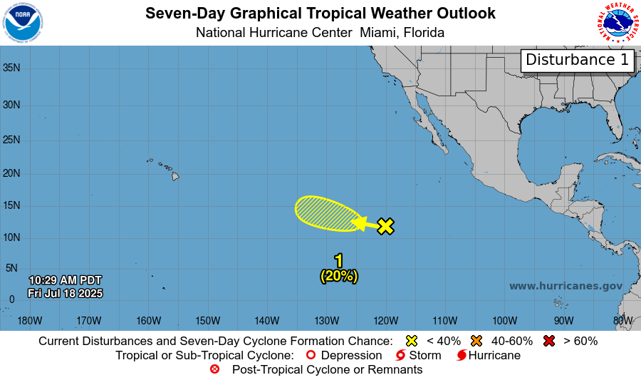
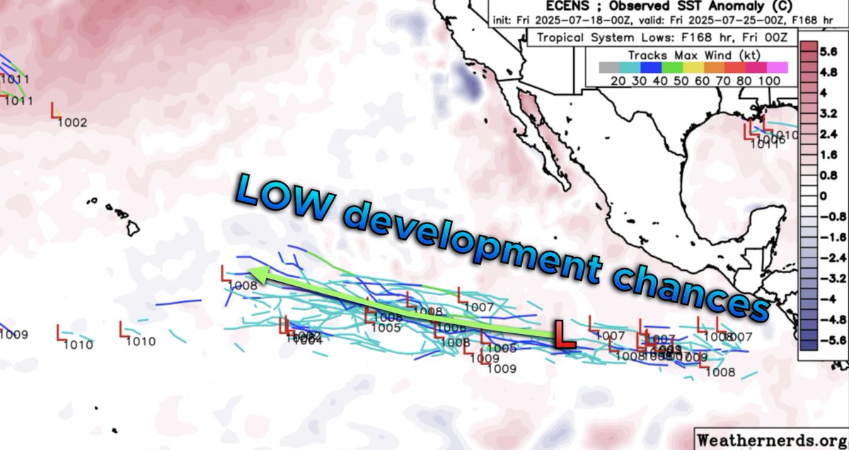
The 2:00pm EDT update has introduced a low chance AOI for the Pacific. We could definitely see some marginal formation, though a tight SST gradient to the west will make whatever incipient disturbance that generates have a difficult time consolidating long-term.
With the passage of a kelvin wave in the next two weeks, some of the guidance has grown in favor of an “ITCZ rollup” event in the MDR. We could also observe genesis out in the open Atlantic as a front swings offshore the eastern CONUS. It will be interesting to see if these…
Welp, looks like #93L will be our first failed invest this season. Big loss for models such as the Icon and HRRR. (Shouldn’t have been used in the first place imo) There’s a slight possibility the remnant disturbance could re-emerge within the next week; remains to be seen…
A stretched/weak hadley cell is usually a result of a weak mid-tropospheric temperature gradient between the tropics and mid-latitudes. This can generate a lack of hurricane activity as tropical cyclones are unable to efficiently transport heat out of the tropics. This typically…
What causes this stretched hadly cell??
There's a lot of noise on social media w/ this East Atlantic tropical wave at the end of July While there are some things going for it, I'm not a huge fan of this big Saharan Dust outbreak that's hot on its heels. These often occur immediately before & during Kelvin Wave passage
Starting to see some support for a leading CCKW to move across the basin during the last week of July, before the main ascending branch of the MJO reaches the Atlantic in August. The EPS is picking up on an amplified wave in the long range, which if anything means that the…