Chris Hall, Y'all
@ChrisHallWx
606 Storm Chasing - Kentucky Colonel - All media inquiries contact @severestudios / P.O Box 1824 Hazard, KY 41702 📦 ✉️
This is our linktree to most of our links. Thank you all so much for supporting us over the past couple of months. None of this would have been possible without your help. linktr.ee/606stormchasing
8pm EDT 22 July -- A trough of low pressure, currently located off the SE U.S. coast is forecast to move into the North-Central Gulf, and has a low chance (10%🟡) of tropical cyclone formation before it moves inland by this weekend. Latest Outlook: hurricanes.gov/gtwo.php?basin…
It is with more sadness than mere words can convey that we have to report that our beloved Ozzy Osbourne has passed away this morning. He was with his family and surrounded by love. We ask everyone to respect our family privacy at this time. Sharon, Jack, Kelly, Aimee and…
oh my god
Ozzy Osbourne has passed away at the age of 76.
Dee Atchley captures this waterspout as it comes ashore on Island Beach State Park, NJ. @NBCPhiladelphia @NWS_MountHolly
It will not stop! Radar says nearly 6" has fallen. Not good
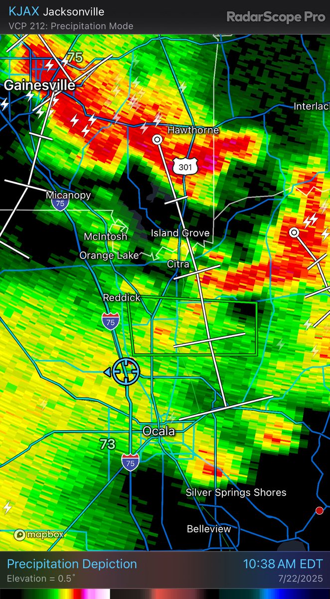
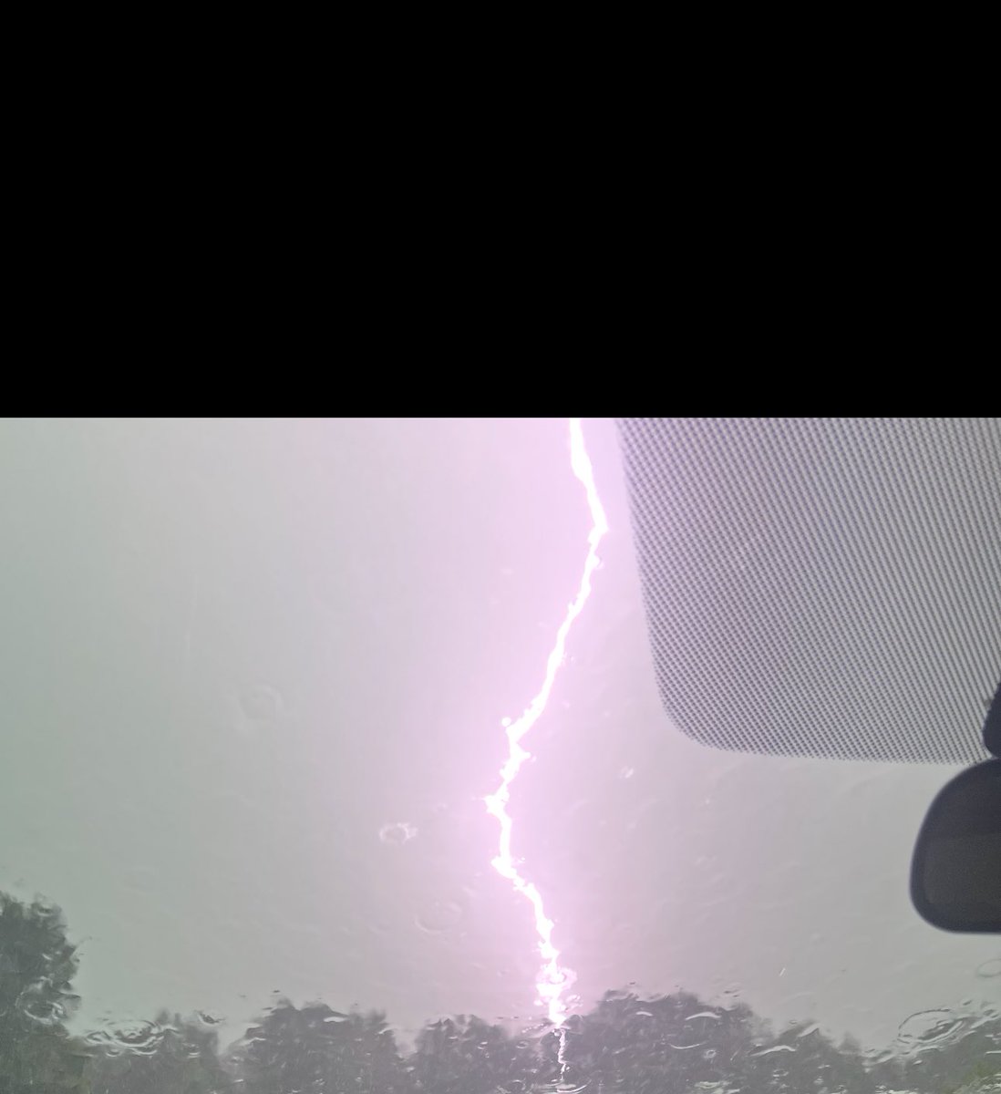
⚡️ Ka chow! Frequent cloud to ground lightning earlier in Ocala, FL. @NWSJacksonville
Entrance to Florida fire school on NW Gainesville RD 8am, multiple roads with significant water running over them or standing in area @NWSJacksonville
water starting to enter the roadway - 7:34am 15350 NE Jacksonville Rd Citra, FL 32113 @NWSJacksonville
County Road 329 near the intersection of NE. 7th Ave. 7:26am @NWSJacksonville
1725 CR-329 Citra, FL 32113 7:20am @NWSJacksonville multiple areas jet with water starting to overtake the roadways
North of Ocala, FL 7:12am! Big shelf cloud! (Didn't expect to be chasing this AM!) @NWSJacksonville

Roadway is starting to overflow with water on NW Gainesville Road in Ocala near NW 89th place. Torrential rain continues @NWSJacksonville
#BREAKING: Southwest Florida tornado caught on camera in Desoto County hurling debris into the air this evening at 5:40 PM. This video was taken east of US-17 and south CR-760A with rotation shown on WINK Live Doppler 3X. I'll continue to keep you updated with the latest.…

A MODERATE risk is in effect in our Day 1 Excessive Rainfall Outlook. More details: go.usa.gov/cu3Dw
8pm EDT 20 July: NHC is watching a small area of low pressure (Invest #94L) in the Central Tropical Atlantic. This system has a low chance (20% 🟡) of becoming a tropical cyclone before moving into less favorable environmental conditions. Latest outlook: hurricanes.gov/gtwo.php?basin…
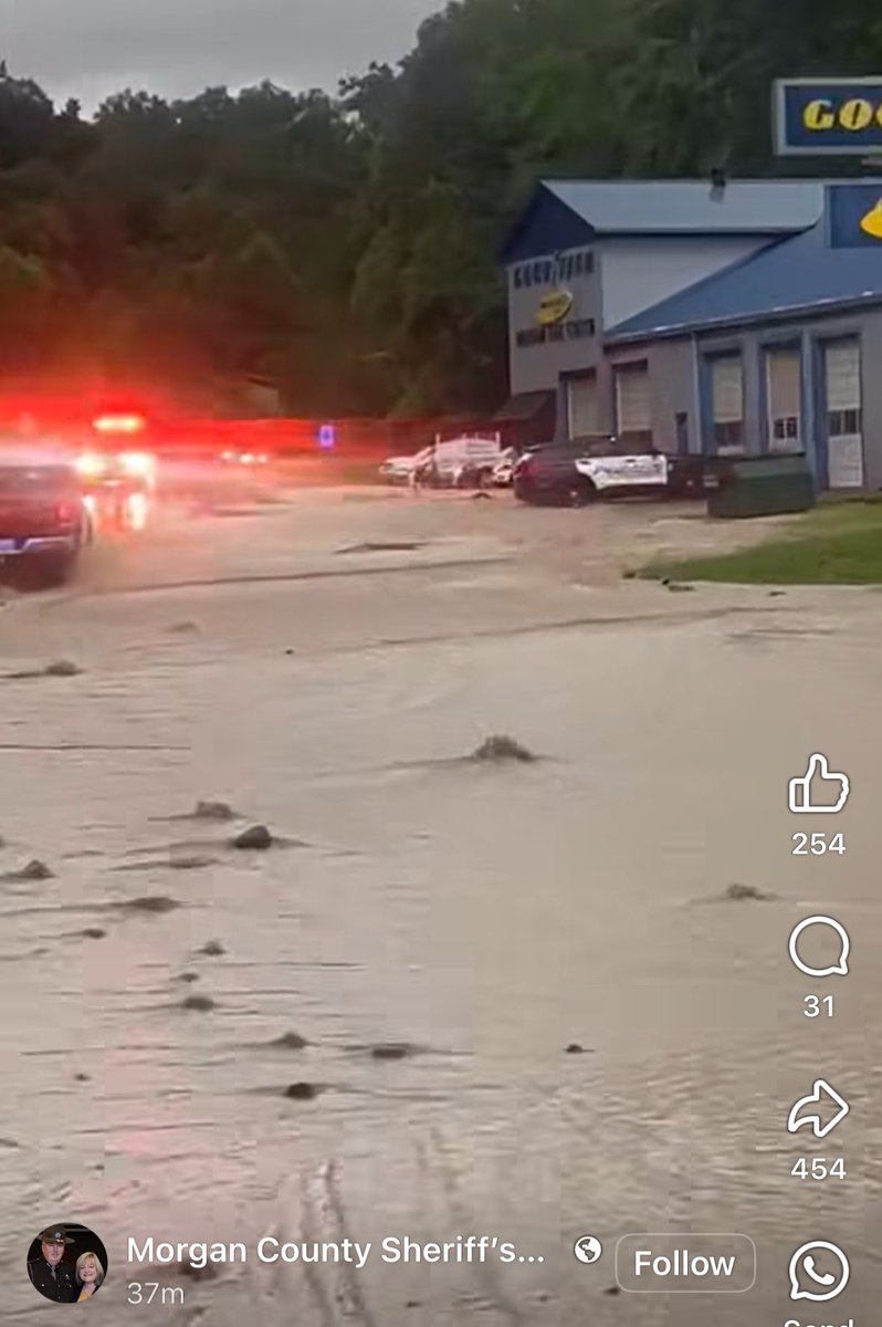
Morgan County sheriff showing flash flooding ongoing in West Liberty, KY

hi kentucky
Tornado Warning including Cincinnati OH, Cincinnati-Northern Ky Airport KY and Covington KY until 7:30 PM EDT