Deelan Jariwala
@WxTca
Just another weather enthusiast that obsessively tracks the tropics and impulsively codes. UM ‘26
With significant external threats to NOAA, I figured it may be pertinent to discuss what TC forecasting looked like a mere half century ago. All images used in this thread come from the NHC — I will be focusing on 1974’s Hurricane Fifi, at 00z on September 19th.

Been working on this for a while - thanks to The Hill for publishing this op ed I worked on talking about the importance of NOAA's hurricane forecasts, including the research that underpins it all. Thanks to the writing team that helped as well! There has been some promising…
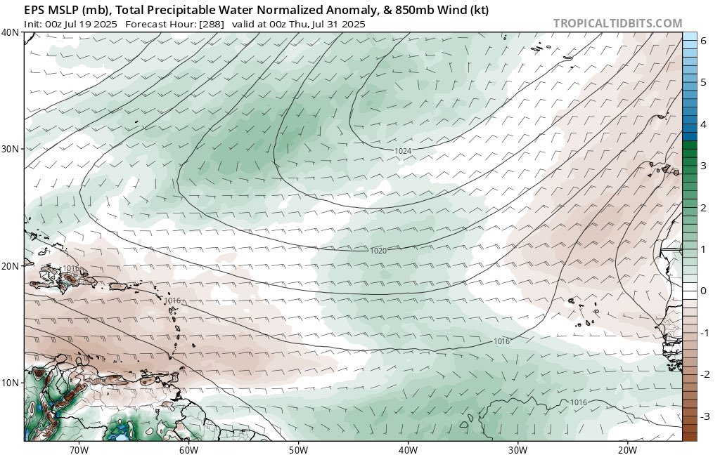
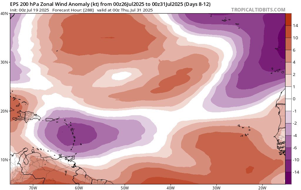
The stars are aligning on a seasonal and subseasonal scale for this year’s Atlantic Hurricane Season to be pretty underwhelming compared to normal thru early-mid Sep, while also finishing quite strong late Sep into Oct
?
I am smarter than climate scientists. That’s exactly what I said.
It's mind boggling to me that 1.5 years after the 2023/24 El Nino, our global SSTs are still running higher then they were during the peak of the last Super El Nino back in 2015/16.
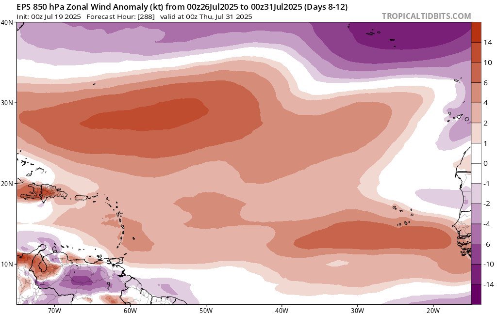
Low probability at this range, but with an approaching Kelvin wave locally improving the upper air pattern and favoring anomalous low-level westerlies, it may be worth watching the end of the month for the first chance of a MDR disturbance that has reasonable odds of genesis.
Specifically, models have honed in on this kink in the ITCZ associated with an AEW. We’ve seen it plenty of times before where models have to play catch up with a small system and overdo TCG as they try to initialize localized areas of vorticity. Not an imminent threat at all.
Some of the global models are hinting at the ITCZ getting more active to end the month. TCs rolling up within the ITCZ are common especially early in the season with recent examples: Elsa 2021 Gonzalo 2020 Beryl 2018 Bret, TD 4, Don 2017 Danny 2015 TD 2 2014 Chantal, Dorian 2013
Models are trying to key in on some potential development out in the East-Central Atlantic ITCZ next week While a CCKW will pass overhead & shear looks favorable for a few days, the Saharan Air Layer/Dust outbreak to its north & northwest could be a road block to development
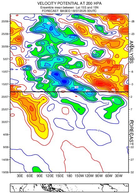
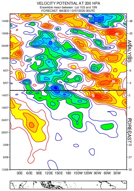
Based on a suggestion from @WxTca, I applied my analog matching technique for SSTs to "velocity potential" (a metric for large-scale rising/sinking motion) from the NCEP/NCAR reanalysis. The Top 10 years (since 1980) based on this metric for May-June were: 2001 2004 2023…
ASCAT pass over #93L shows a closed and well-defined low level center off the Florida coast Meanwhile, MLB radar shows fairly strong low to-mid level rotation w/ some prominent banding. Are we really sure this only has a 40% chance of development?
We got a nice partial hit from ASCAT a bit ago. Still an elongated trough, with the northern end sticking out of the convection. Still has some work to do but seems to be overshooting the models so far
It will be worth watching the evolution of the upcoming monsoonal mess in the WPAC as the MJO passes through the basin. Models overestimating the strength of ridging (and by proxy, the extent of westerlies) could underestimate convection and have the MJO propagate too quickly.
Public service announcement:
Yes they can control the weather. It’s ridiculous for anyone to lie and say it can’t be done.