Texas Storm Chasers ⚡
@TxStormChasers
Get your local forecasts, weather articles, and video forecasts from the Texas Storm Chasers, along with interactive weather radar in TSC's Mobile App.
Did you have fun keeping an eye on the disturbance that moved across the Gulf last week? Let's do it again! Expect rain and storm chances to increase towards the end of the week as this disturbance moves in, though it's too early to say much with certainty beyond that.
350pm Radar Update: Scattered thunderstorms are developing along an outflow boundary approaching El Paso from the south. Additional development is expected in the El Paso metro area in the next hour or so with heavy downpours and gusty winds.
🥵 Heat Advisories have been added for North Texas tomorrow (July 24) as it is forecast to feel like 105-108°F in the afternoon. Heat Advisories are also in effect today in East Texas and SE Texas
The first 100 degree day of the year is likely for most of North and Central Texas on Thursday or Friday.
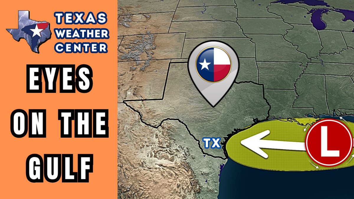
We’ve got our eyes on a tropical disturbance in the Gulf. It’s not expected to cause major issues, but coastal TX could see some rain Fri–Sat. West TX gets storms too. The rest of y’all? Just hot. Details + video: texasstormchasers.com/forecast/gulf-… #TXwx

New Texas weather forecast: TexasWeatherRoundup.video
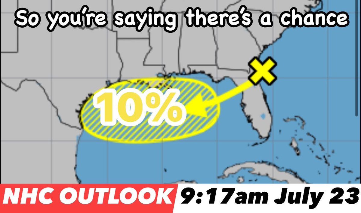
Tracking the #Tropics: There is a 10% chance of tropical formation over the next 48 hours in the northern Gulf. “A trough of low pressure near the southeastern U.S. coast is producing disorganized showers and thunderstorms. Over the next day or two, this system is forecast to…
Yesterday the body of a missing woman from the Kerr County flooding was discovered in Kerrville. The search continues for two more missing people in Kerr: One adult male and one female child from Camp Mystic.

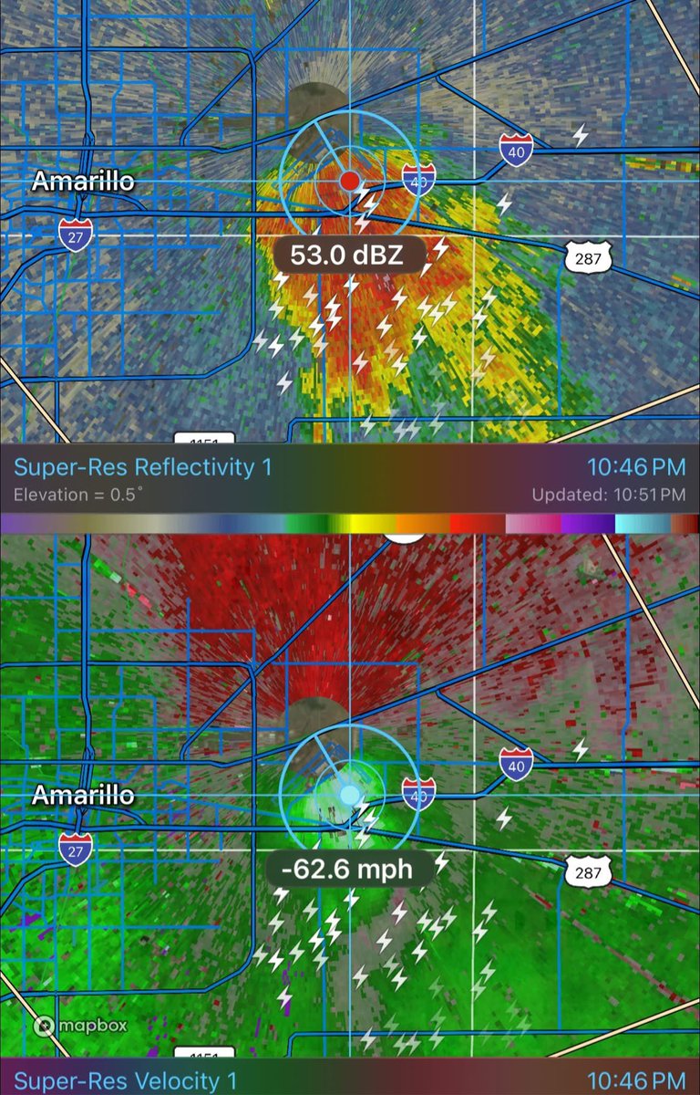
Strong winds blowing through parts of eastern Amarillo #Texas moments ago! (10:45pm July 22)
10:50pm — Severe storm on the east side of Amarillo near the Bucees! Winds gusting over 60mph as indicated by radar! #txwx
Scattered showers and storms have developed this evening between Eagle Pass and Crystal City, as well as over Mexico. Brief heavy rain and cloud to ground lightning is accompanying this activity as it moves north-northwest. Father north, light rain is ongoing in Del Rio.
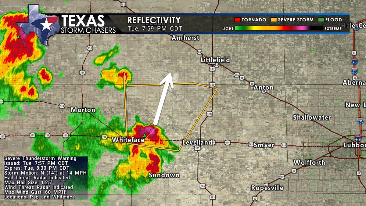
🕗 7:59 PM CDT Severe Thunderstorm Warning until 8:30 PM for parts of Bailey and Hockley Counties in northwest Texas. A strong storm near Whiteface, moving north at 15 MPH, is producing: Wind gusts up to 60 MPH Hail up to 1.25 inches (half-dollar size) Threats include hail…
#WPC_MD 0781 affecting Southeast Arizona through Far West Texas, #txwx #nmwx #azwx, wpc.ncep.noaa.gov/metwatch/metwa…
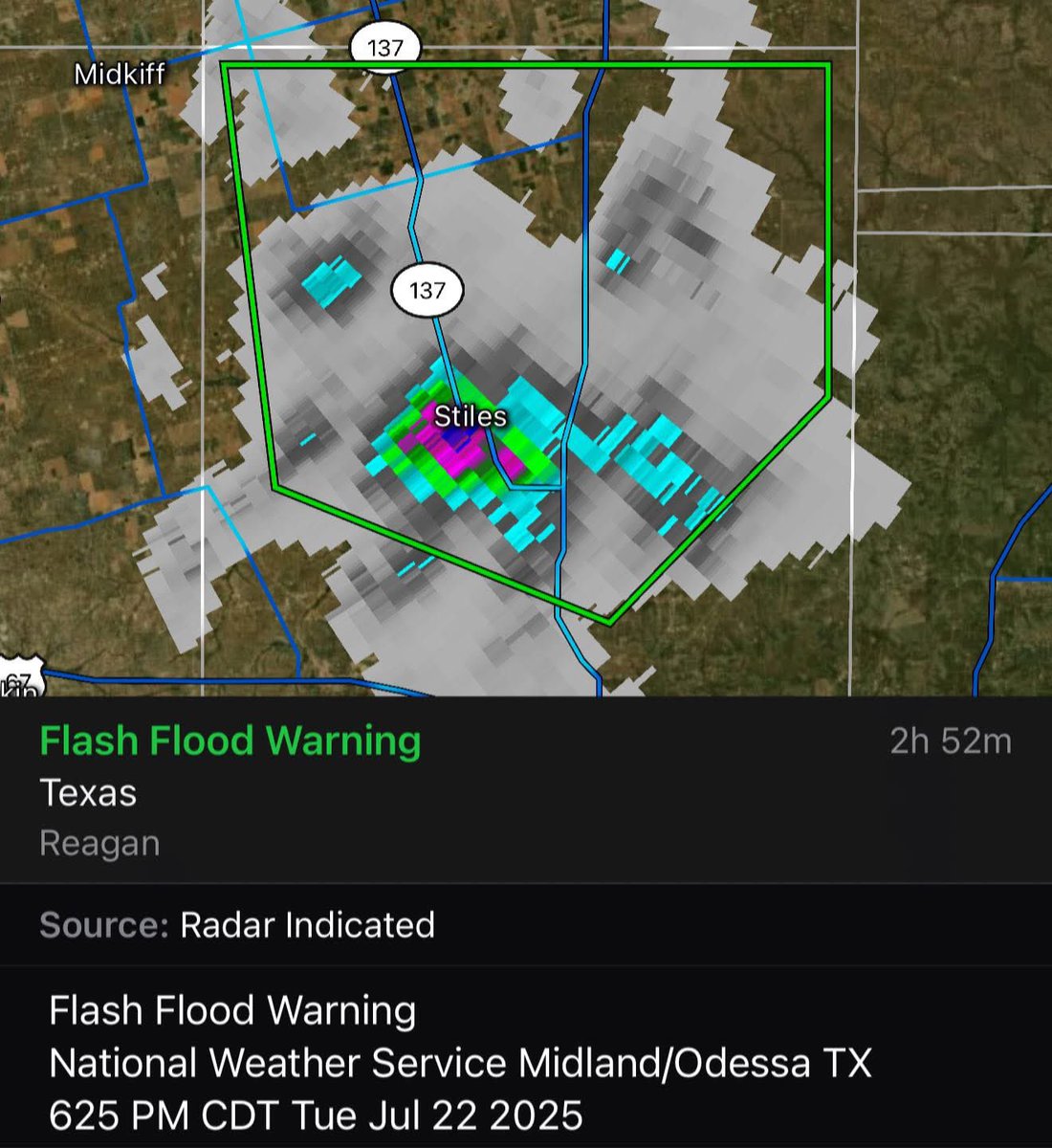
⚠️ New Flash Flood Warning for Northern Reagan County in western Texas Until 930 PM CDT. At 625 PM CDT, Doppler radar indicated thunderstorms producing heavy rain across the warned area. Between 1 and 2 inches of rain have fallen. Additional rainfall amounts of 0.5 to 1.5 inches…
#WPC_MD 0780 affecting Portions of West Texas through the Cap Rock and into the High Plains of New Mexico, #txwx #nmwx, wpc.ncep.noaa.gov/metwatch/metwa…
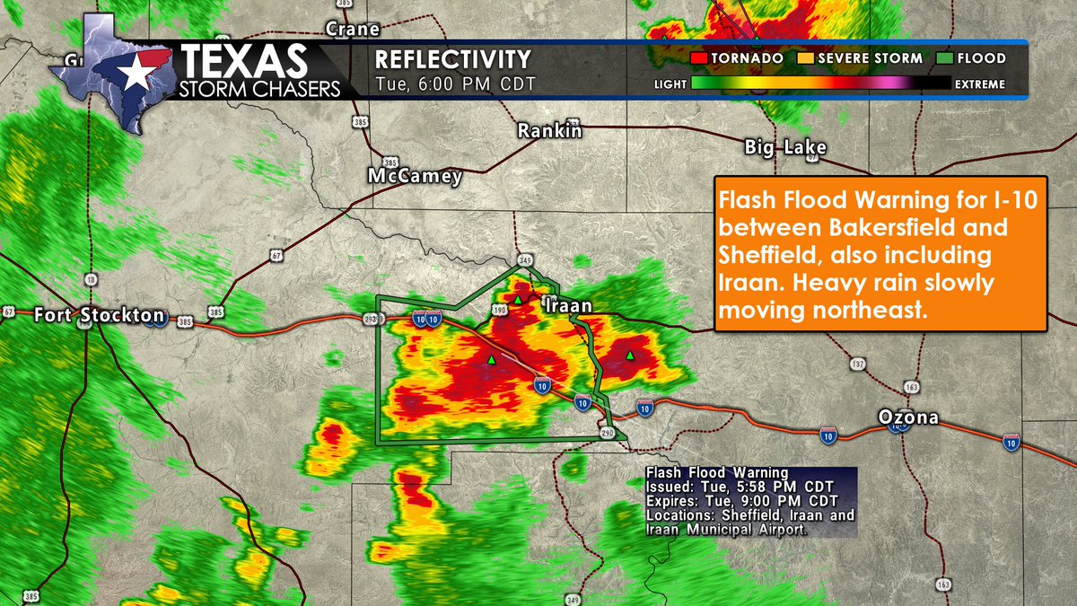
🕕 6:00 PM CDT 🚨 Flash Flood Warning until 9:00 PM for east-central Pecos County, including Iraan, Sheffield, and I-10 between Bakersfield and Sheffield. Radar shows 1–2" of rain so far, with more incoming. Heavy rain is slowly moving northeast, increasing the risk of flooding.…
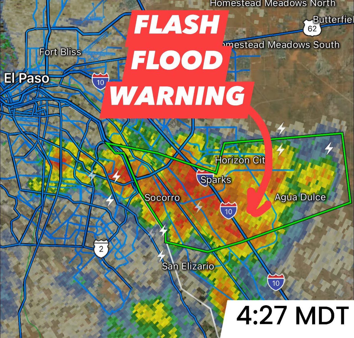
⚠️ Flash Flood Warning for Central El Paso County in western Texas Until 545 PM MDT. At 426 PM MDT, Slow moving thunderstorms with very heavy rainfall are affecting parts of the Lower Valley, especially Socorro and parts of Horizon City, where radar estimates and rain gauges…
Severe Thunderstorm Warning including Dryden TX until 5:30 PM CDT
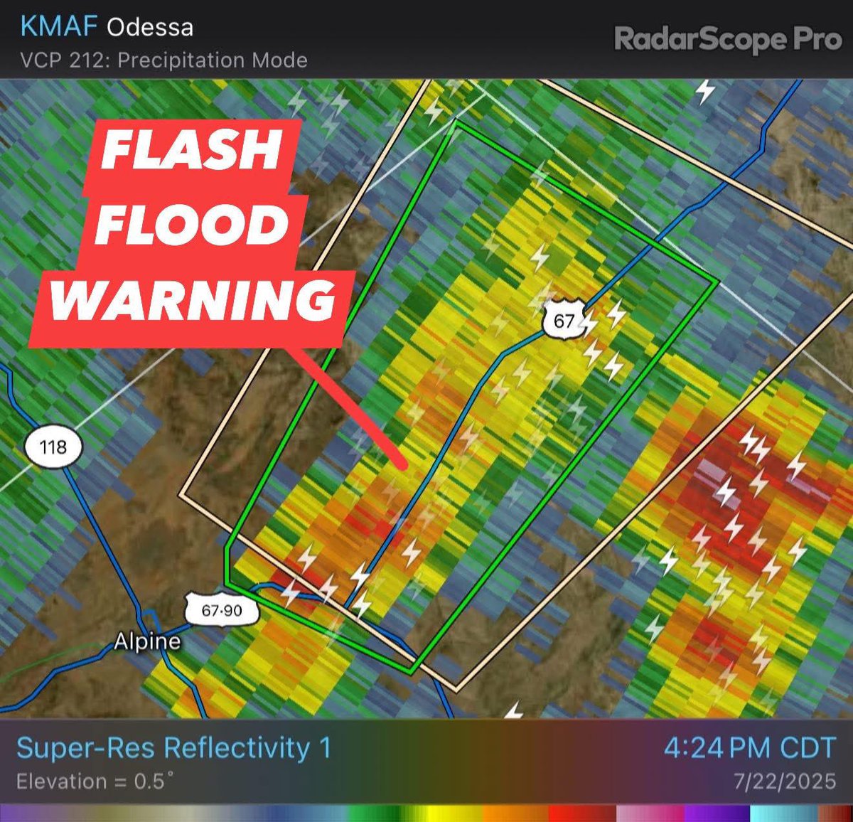
⚠️ Flash Flood Warning for Northern Brewster County in southwestern Texas Until 730 PM CDT. At 421 PM CDT, Doppler radar indicated thunderstorms producing heavy rain across the warned area. Between 1 and 2 inches of rain have fallen. Additional rainfall amounts of 0.5 to 1 inch…