NWS Houston
@NWSHouston
Official X account for the National Weather Service Houston/Galveston TX. Details: http://weather.gov/nws_x
Did you have fun keeping an eye on the disturbance that moved across the Gulf last week? Let's do it again! Expect rain and storm chances to increase towards the end of the week as this disturbance moves in, though it's too early to say much with certainty beyond that.
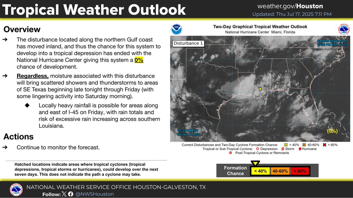
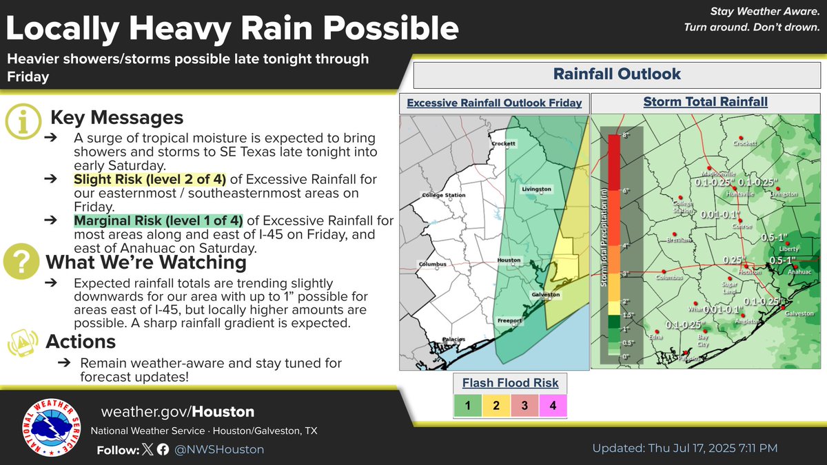
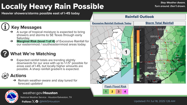
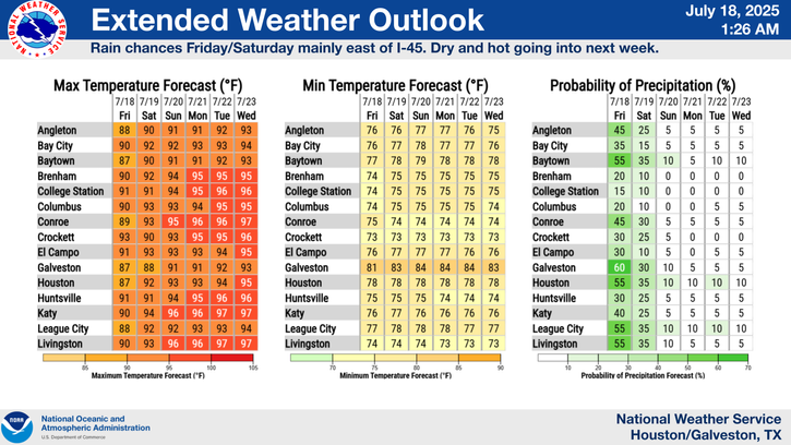
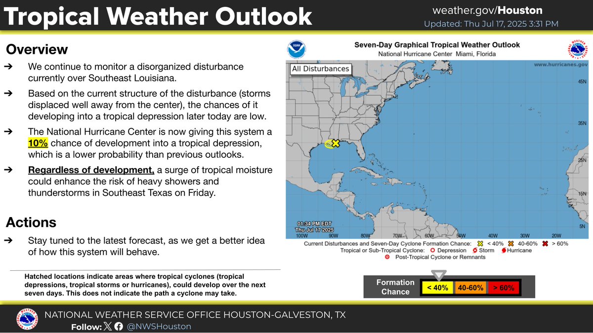
The system we've been monitoring the past few days has moved onshore into southern Louisiana - thus ending the chance of it developing into a tropical depression. Regardless, moisture from this system may bring locally heavy rainfall to areas east of I-45 on Friday. #TXwx
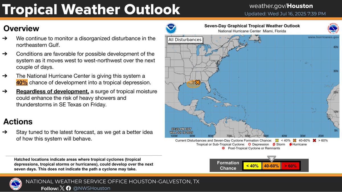
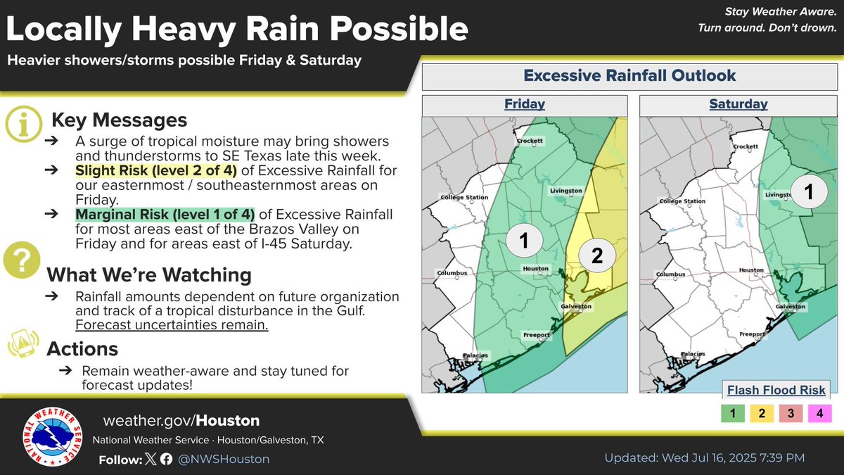
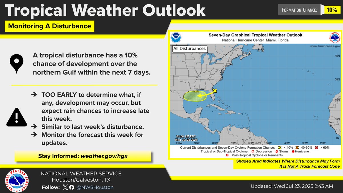
We're still keeping an eye on the northern Gulf for tropical development. Forecast remains unchanged, with a 40% chance of tropical formation. Regardless of development, heavier rains/storms are still possible for Friday. Stay tunned for additional updates. #TXwx #HOUwx
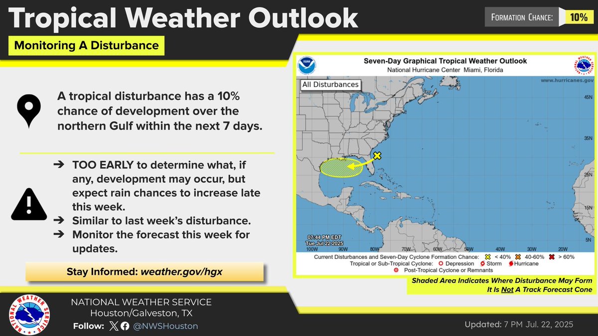
-Watching another disorganized disturbance in the Gulf. -NHC giving it a 10% chance of becoming a depression. -System should enhance shower/thunderstorm activity late Thursday-Saturday, possibly Sunday. -Localized flooding possible. #HOUwx #GLSwx #BCSwx #TXwx


Hot & humid weather through tomorrow with heat indices rising to near 105°F in spots. Slightly cooler weather on Friday as rain chances increase as a system approaches from the east. Speaking of, no changes with regard to that system as NHC maintains a 10% chance of development.
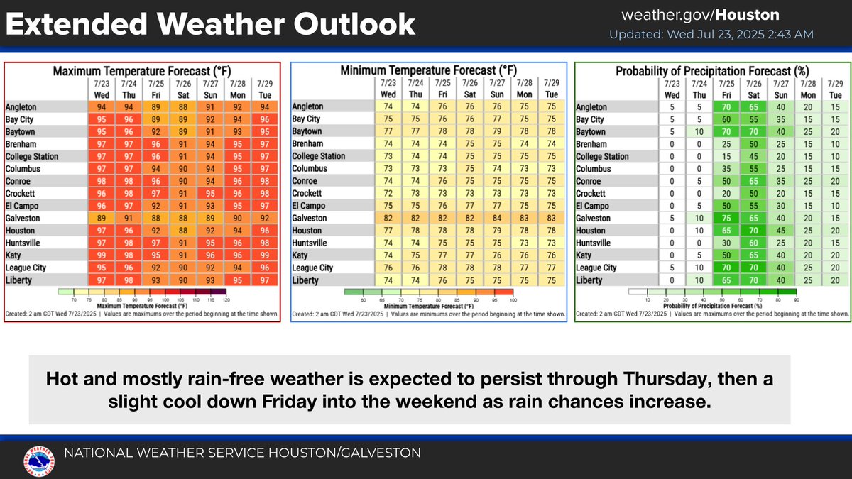
Hot, humid, and mostly rain-free weather will continue through Thursday. Slightly cooler weather is expected by the end of the week as rain chances and cloud cover increase. #HOUwx
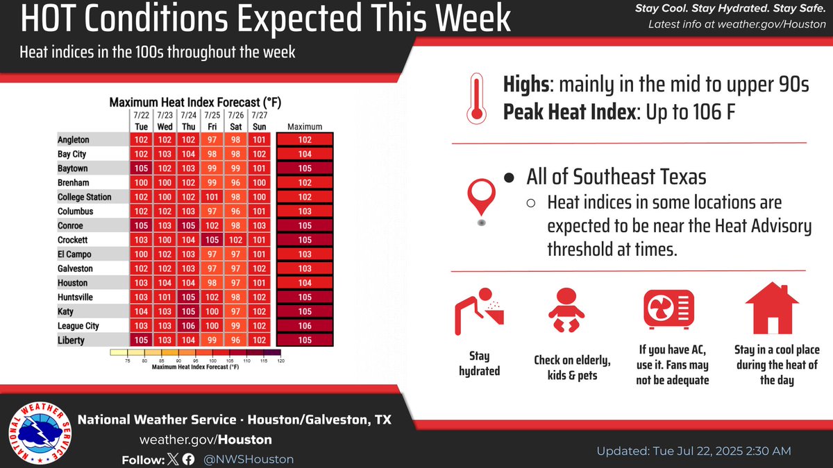
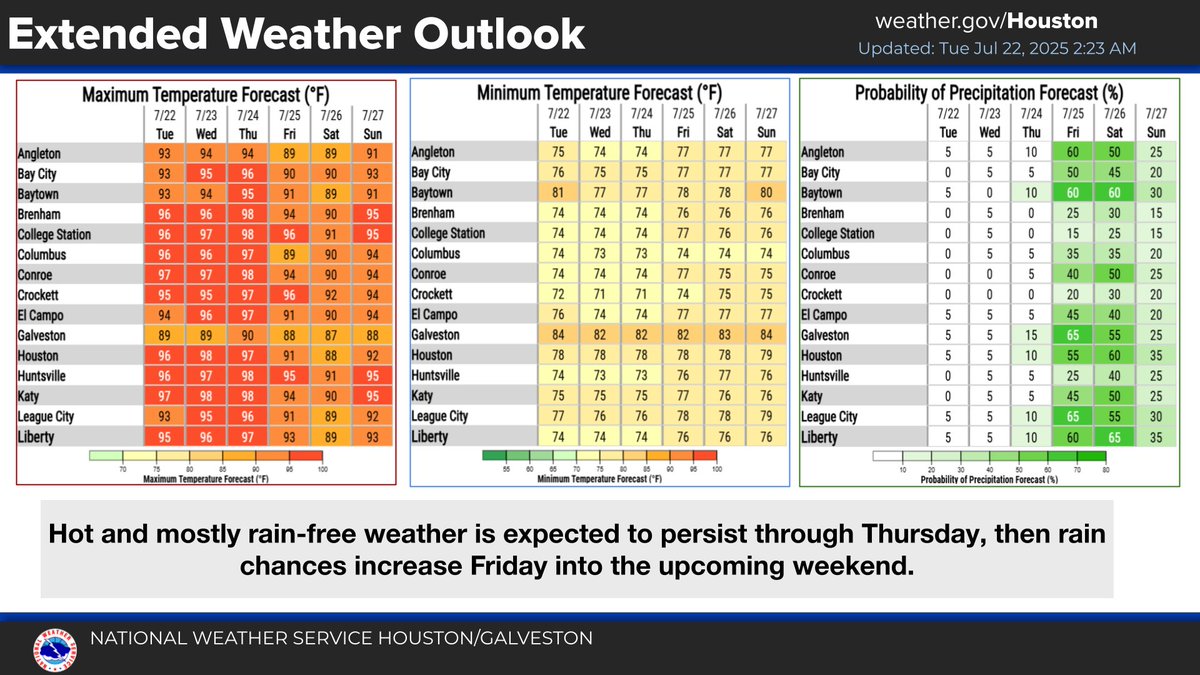
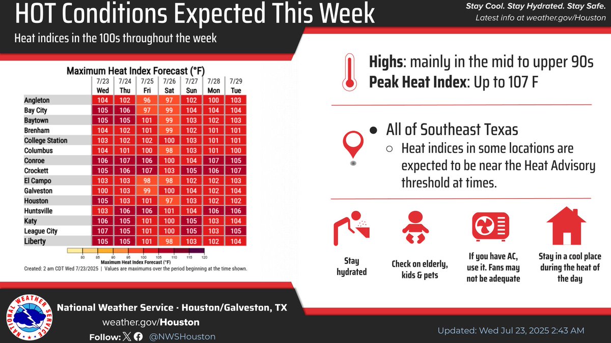
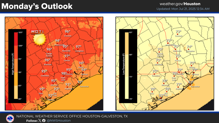
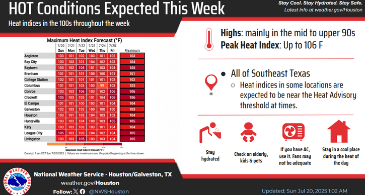
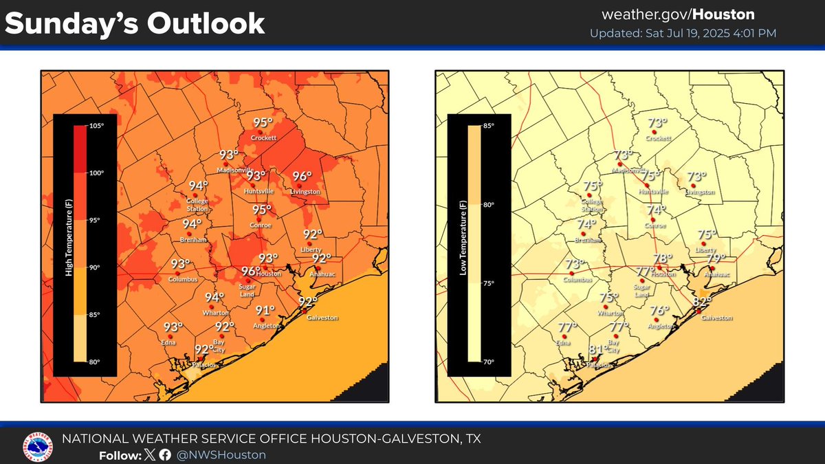
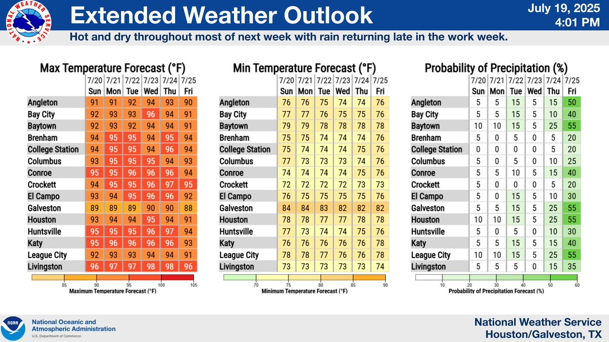
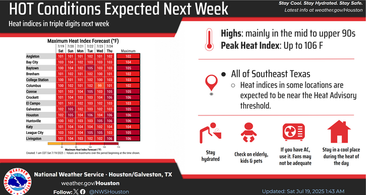
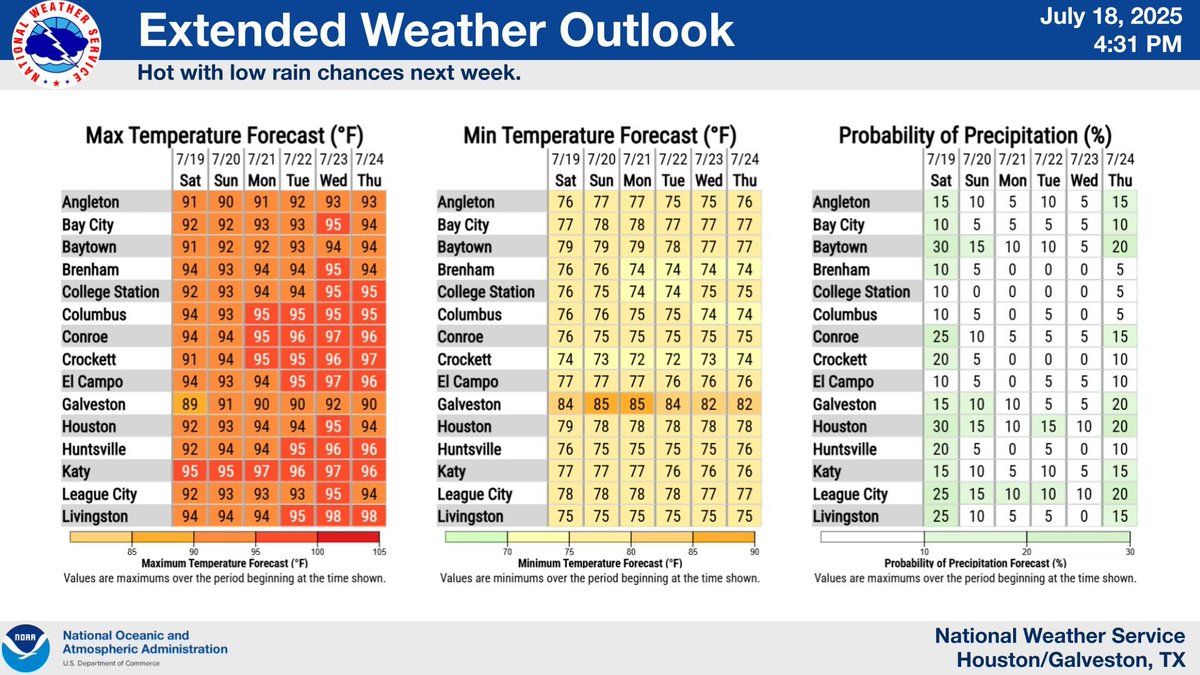
Happy Monday, SE Texas! Hot and mostly dry conditions will be with us for most of the work week with temperatures in the mid to upper 90s and heat indices in the 100s. Be sure to practice heat safety! Rain chances return towards the end of the work week.#TXwx #HOUwx #BCSwx #GLSwx
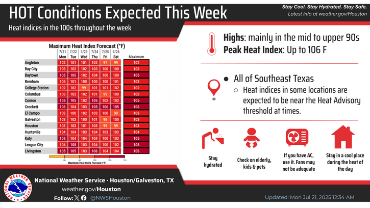


Temperatures will be on an upward trend beginning today with high temperatures reaching the mid to upper 90s by midweek. Heat indices will be in the 100s, but rain chances make their return towards the end of the work week. #TXwx #HOUwx #GLSwx #BCSwx
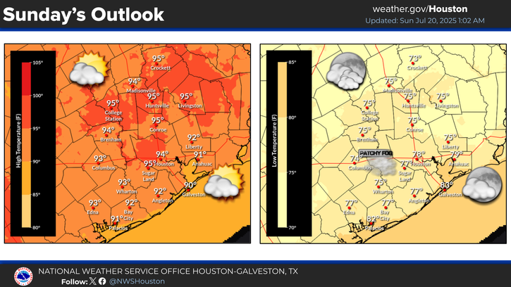
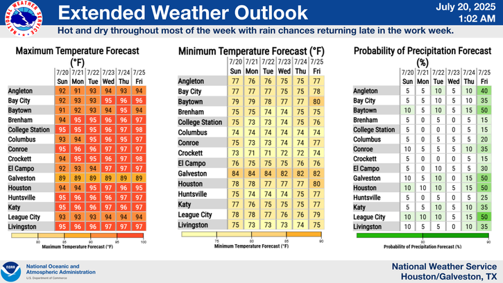

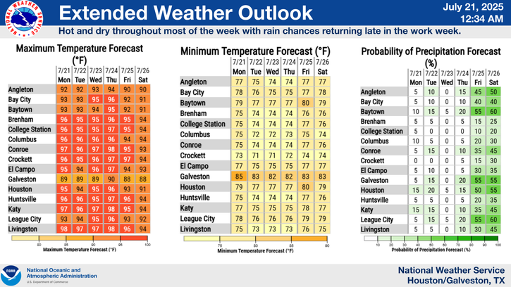
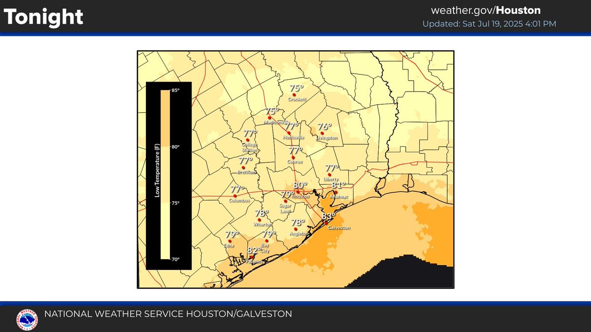
Warm weather is still expected tonight and through the rest of the weekend. Expect hot and dry conditions throughout most of next week with rain returning late in the work week. Look for highs in the upper 80s/90s and lows in the 70s/lower 80s. #TXwx #HOUwx
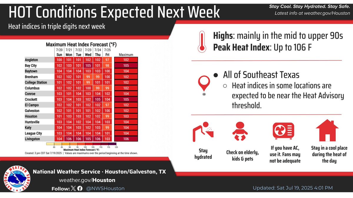
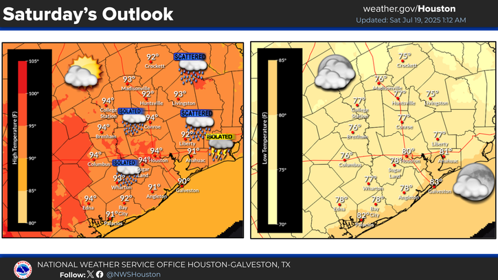
Rain chances persist today with the potential for a few storms with locally heavy rainfall this afternoon. After today, we crank up the heat! High temperatures next week will be in the mid to upper 90s with heat indices well into the triple digits. #TXwx #HOUwx #BCSwx #GLSwx
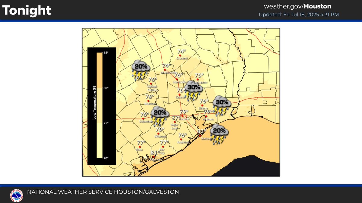
5:30pm Radar Update: Showers & storms have developed along the coast with isolated activity further inland. The storms today have been producing locally heavy rainfall up to 1” & gusty winds. Activity is expected to end after sunset with isolated storms returning tomorrow. #HOUwx
Afternoon forecast update for SE Texas. Showers and thunderstorms should taper off this evening with warm weather continuing overnight. Rain chances broadly decrease over the weekend into next week. #TXwx #HOUwx
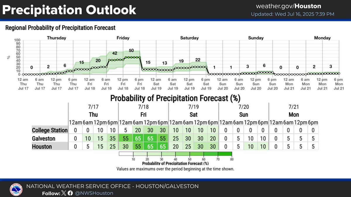
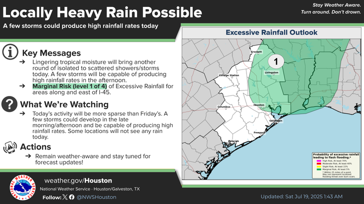
Radar Update (6:15am): Scattered to widespread rain showers are beginning to move in from the east this morning as tropical moisture increases. Locally heavy rainfall is possible east of I-45 today. #TXwx #HOUwx #GLSwx
Rainfall is beginning to move in from the east this morning due to the increase in tropical moisture. Locally heavy rainfall remains possible today east of I-45. Going into early next week we transition to a hot and dry weather pattern. #TXwx #HOUwx #GLSwx #BCSwx
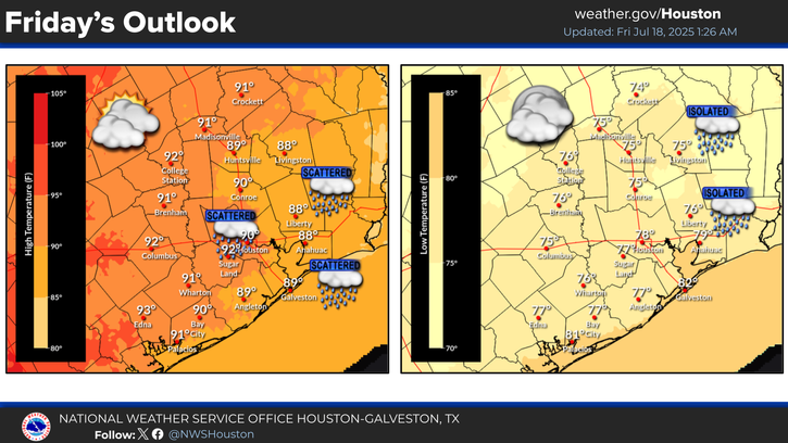
Updated forecast for SE Texas. Warm weather continues tonight with rain chances rising as we head into Friday. #TXwx #HOUwx
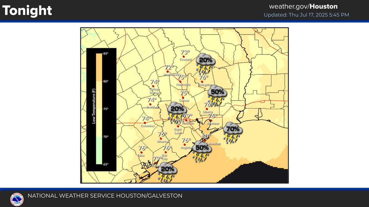
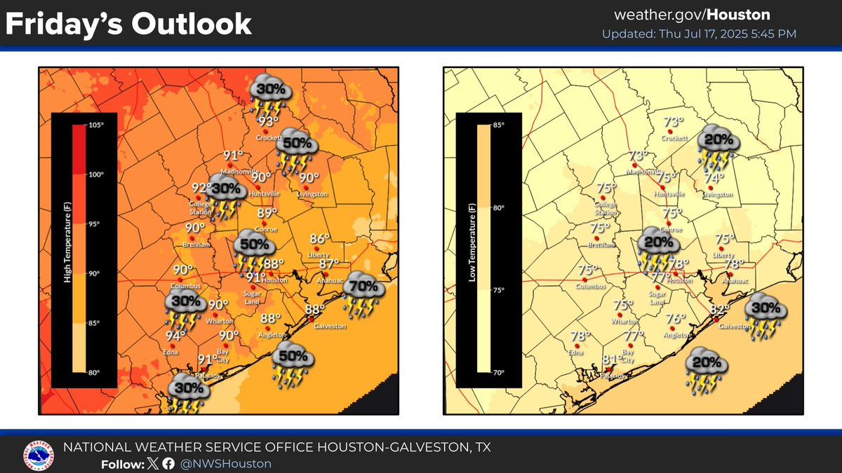

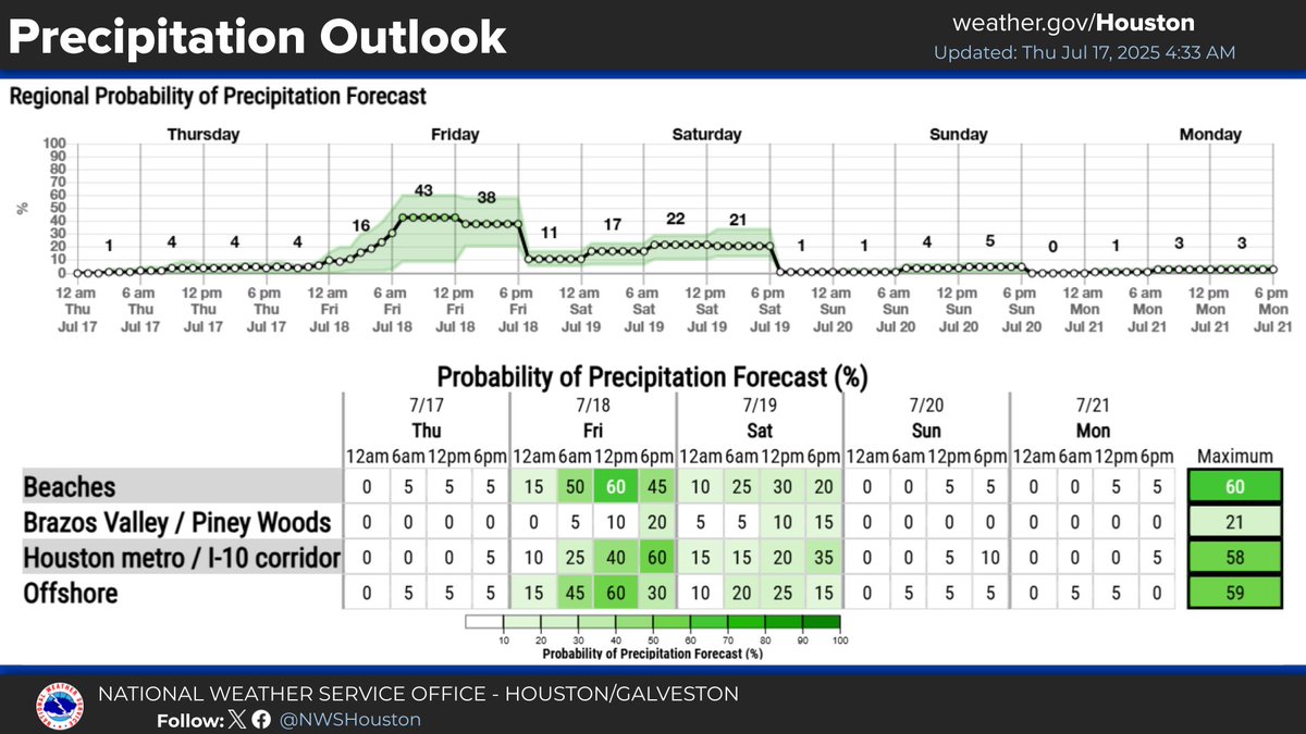
The disturbance over Southeast LA now has a lower chance of development (10%) based its current structure and location. Regardless, showers & thunderstorms are expected to increase later tonight into Friday as the bulk of the moisture moves into Southeast TX. #txwx
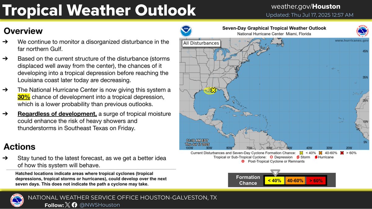
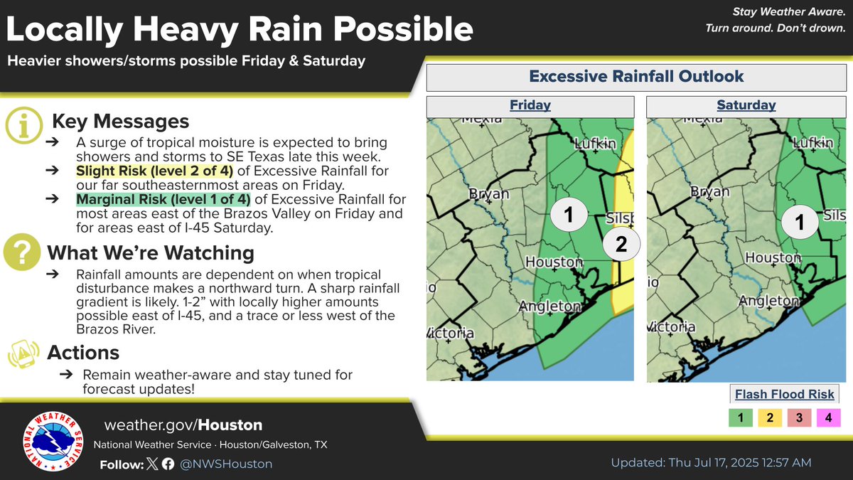
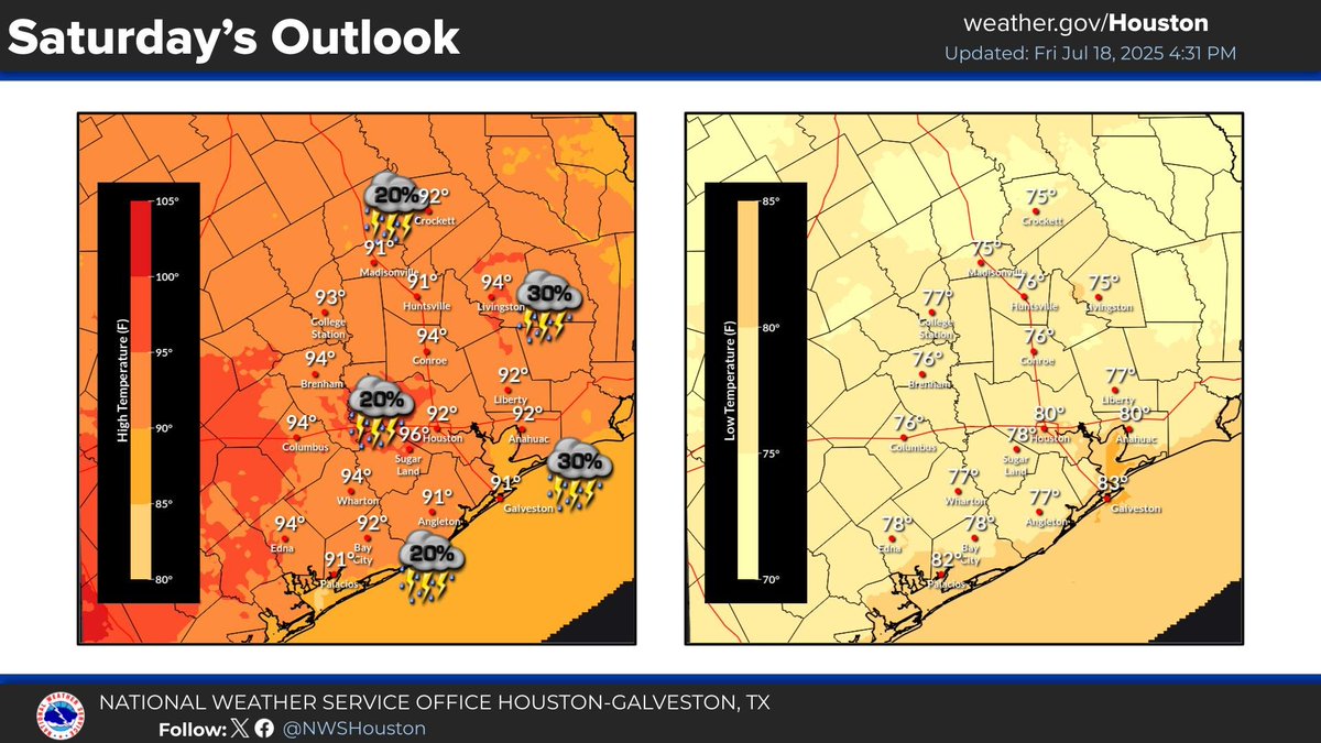
The disturbance in the Gulf remains rather disorganized leading to lower chances of becoming a tropical depression (30%). Regardless of development, increasing moisture will raise our rain chances Friday/Saturday with locally heavy rain possible east of I-45. #TXwx #HOUwx #GLSwx