NWS Austin/San Antonio
@NWSSanAntonio
Official Twitter account for the National Weather Service Austin/San Antonio. Details: http://weather.gov/nws_x
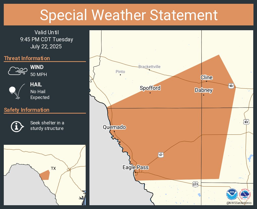
A special weather statement has been issued for Eagle Pass TX, Seco Mines TX and Quemado TX until 9:45 PM CDT
Scattered showers and storms have developed this evening between Eagle Pass and Crystal City, as well as over Mexico. Brief heavy rain and cloud to ground lightning is accompanying this activity as it moves north-northwest. Father north, light rain is ongoing in Del Rio.
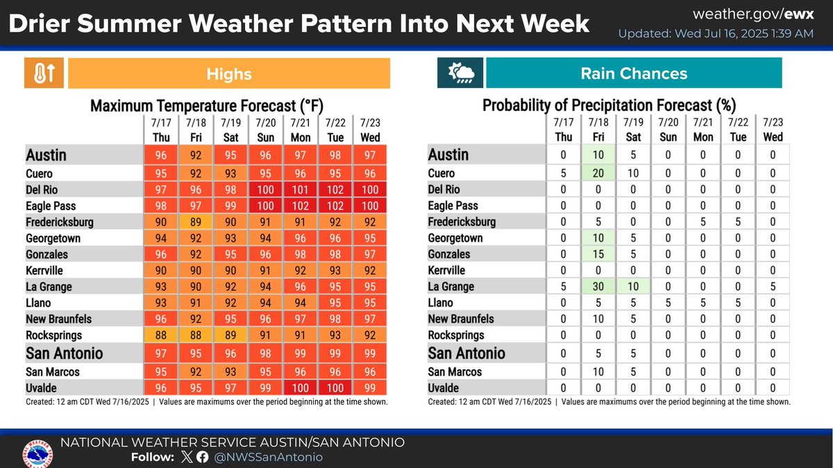
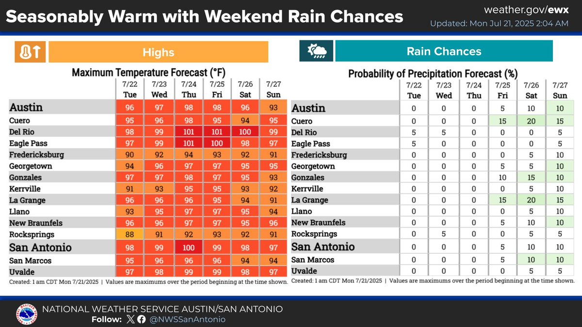
Seasonably warm to hot weather will continue over the next several days with elevated heat index values up to around 105 for many areas each afternoon. Low rain chances will affect mainly the Coastal Prairies into parts of the I-35 Corridor over the weekend.


7:15 AM: A pocket of rain has developed on the backside of an upper level disturbance across the Hill Country. A few lightning strikes are even noted. The activity is expected to lift northward and out of the area by the afternoon hours. #txwx
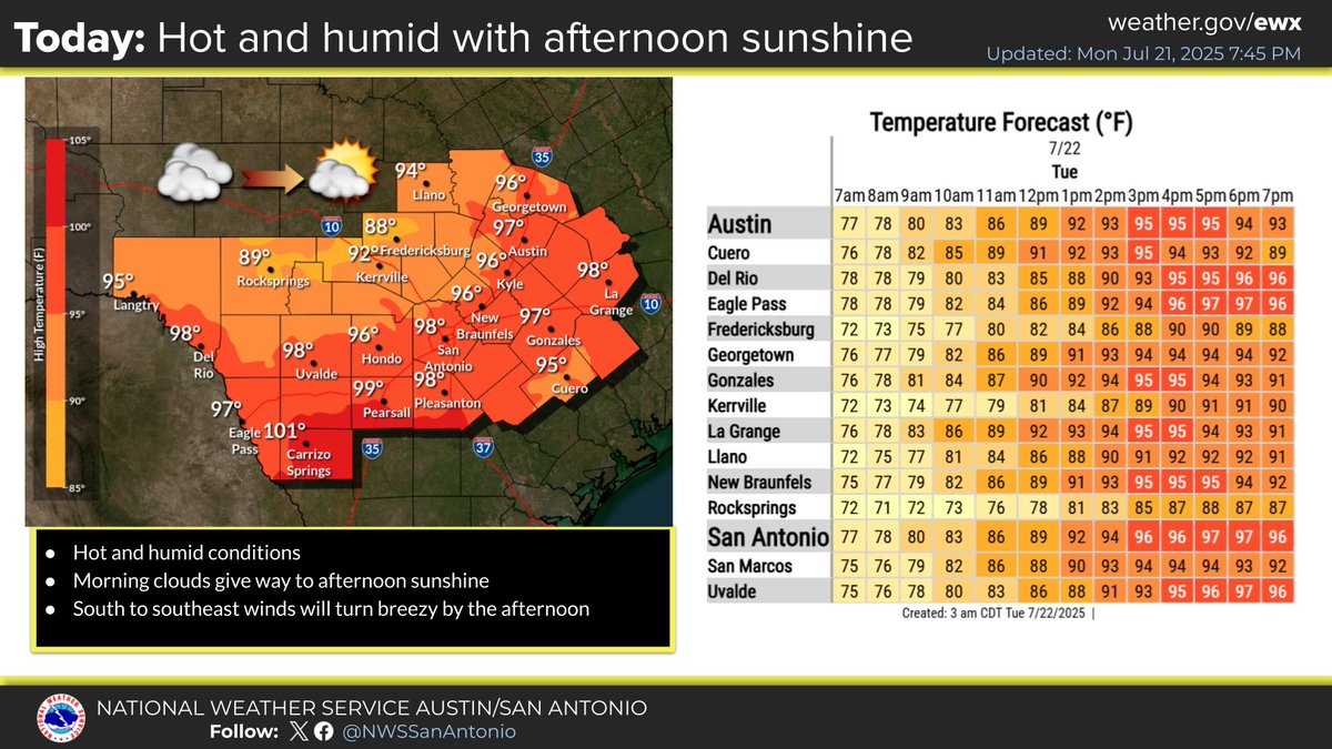
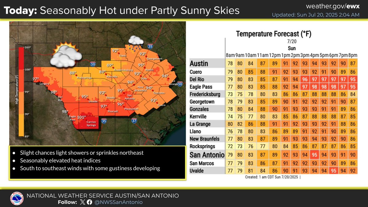
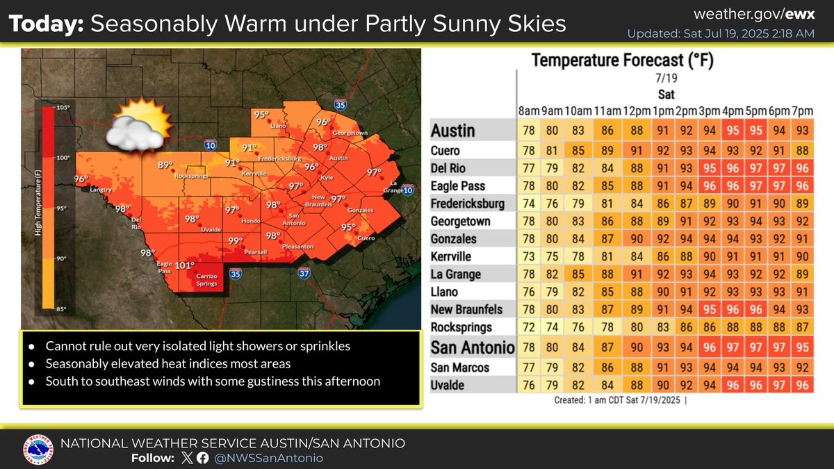
Yet another hot and dry day is expected across South Central Texas. Some morning clouds will give way to partly cloudy to mostly sunny skies this afternoon. Wind will pick up and become breezy out of the southeast later today.
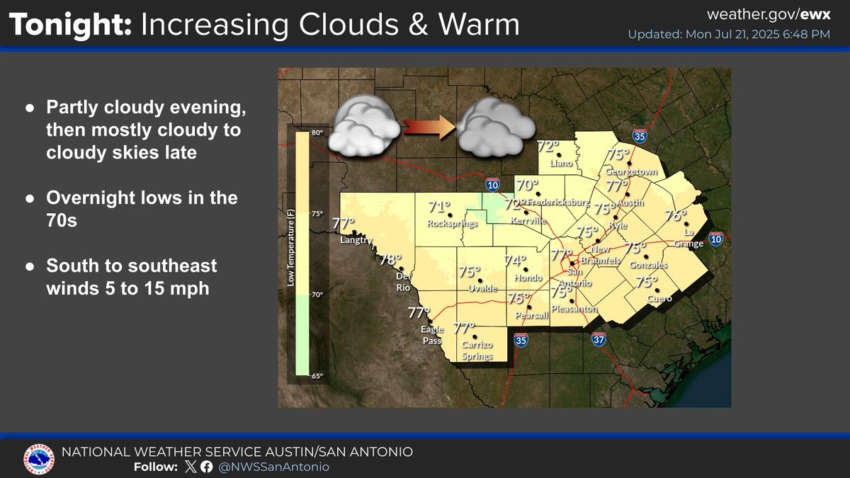
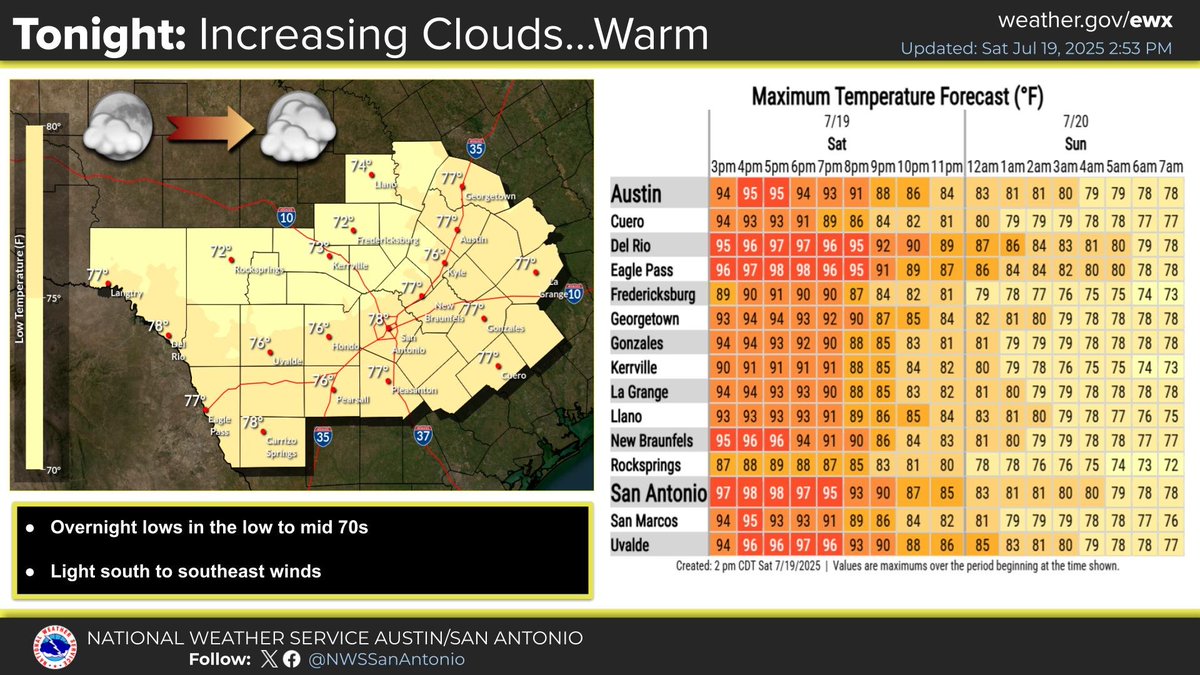
Tonight: Increasing clouds with some peaks of the moon with low temperatures remaining warm overnight. Temperatures in the extended remain seasonable for late July. Chances of rain return to areas near the Coastal Plains and potentially the I-35 Corridor this weekend. #txwx
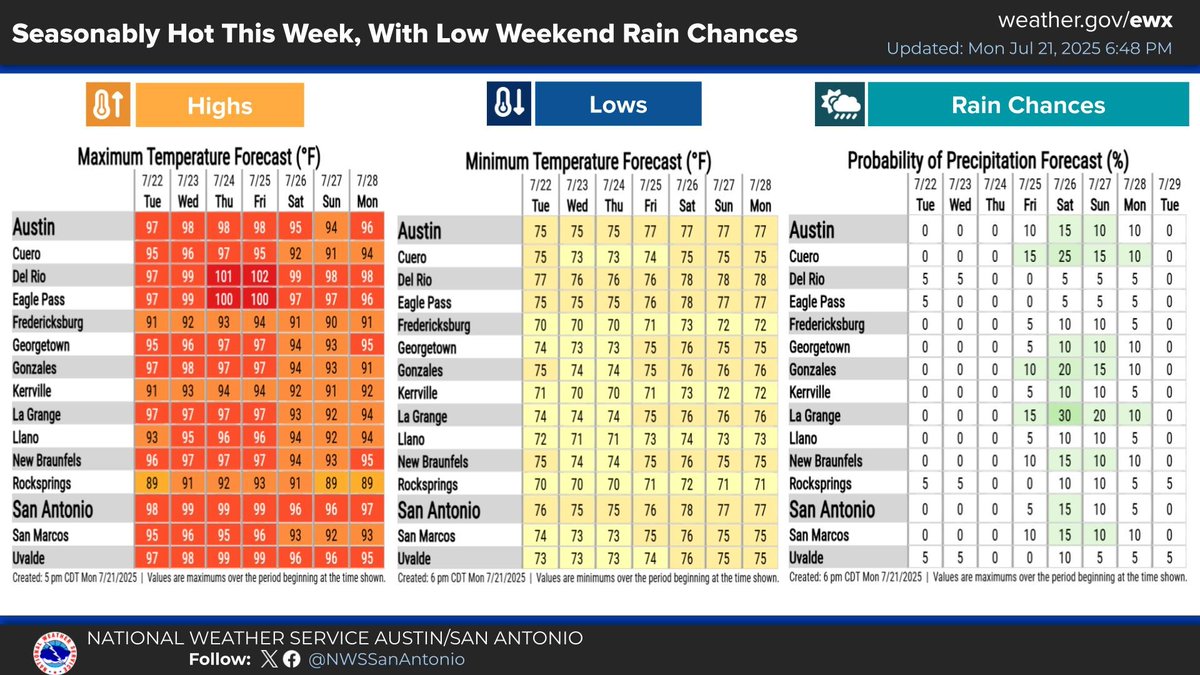
Temperatures will be within a few degrees of late July averages. Slight chances of rain return to areas near the Coastal Plains this coming weekend. Otherwise, rain is not expected.
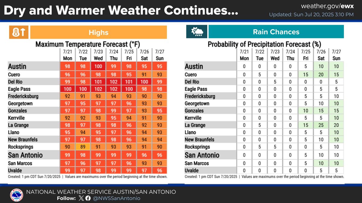
Tonight expect mostly cloudy skies with maybe some peaks of the moon. Otherwise it will remain warm overnight. Dry and warmer weather continues for the rest of the extended with rain chances returning by Saturday. #txwx

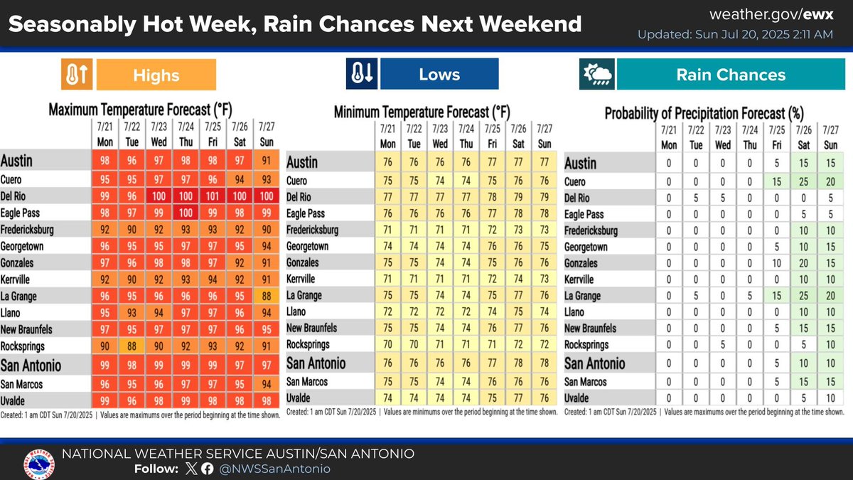
A seasonable weather pattern with temperatures within a few degrees of mid to late July averages is expected this coming week. Rain chances return to our eastern areas next weekend along with slightly "cooler" temperatures by next Sunday.
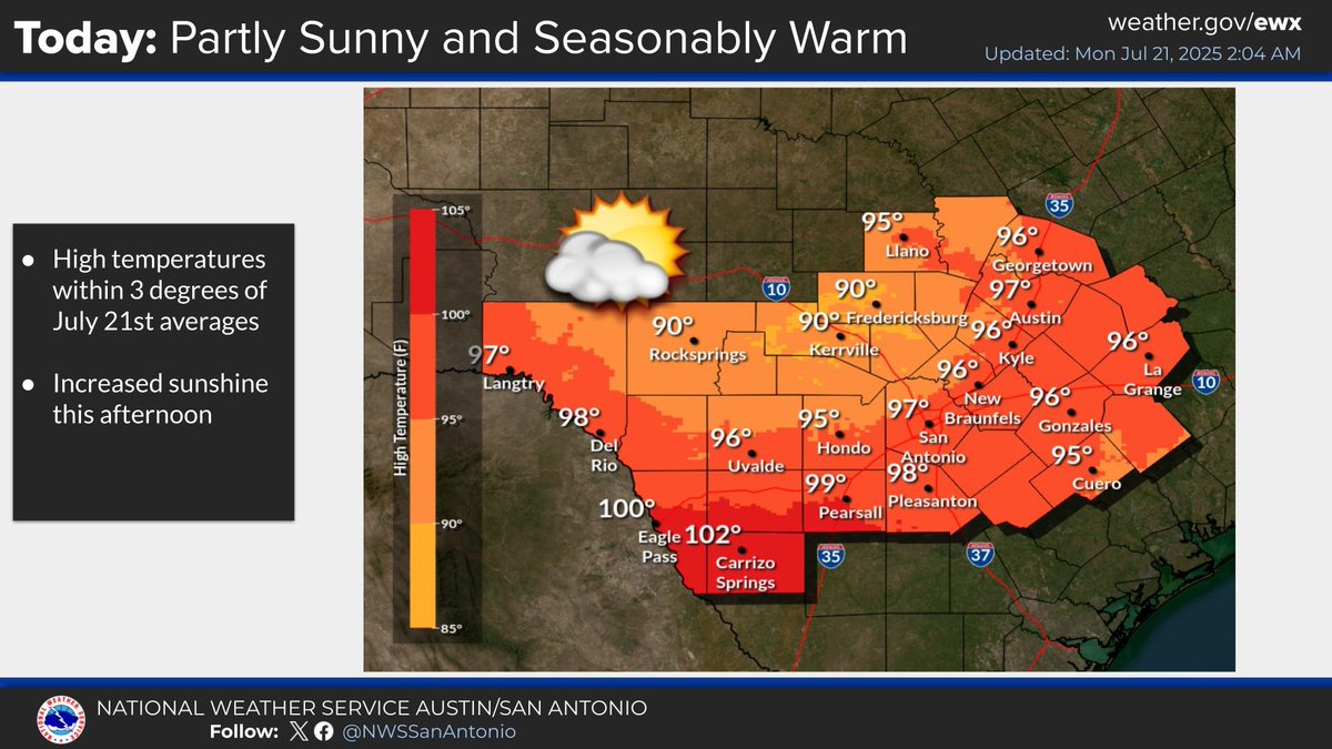
Partly sunny with slight chances of light showers or sprinkles. Temperatures within a few degrees of average with highs ranging from upper 80s Hill Country to lower 100s southern Rio Plains. Seasonably elevated heat index values expected.
Tonight expect increasing clouds late with warm overnight temperatures. Dry and warmer weather continues for the rest of the extended with rain chances returning Saturday.
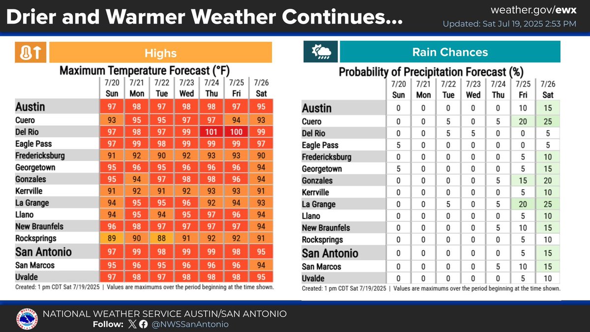
A seasonable weather pattern for mid to late July is expected over the next seven days. Rain chances return to our eastern areas late next week into next weekend.

Isolated showers have made it into portions of Fayette and Lavaca counties along and south of I-10. Activity could generate a few lightning strikes as well. Not expecting for much more inland progression with most areas remaining dry. #txwx
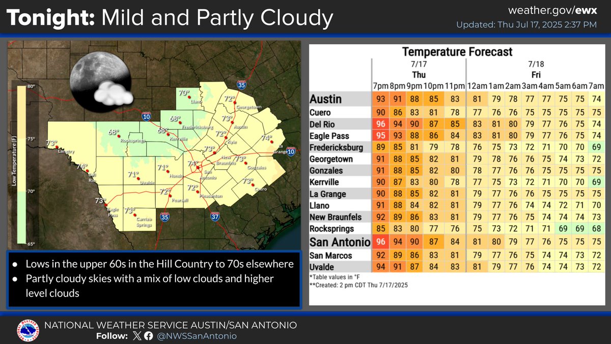
Mild tonight with partly to mostly cloudy skies. Low temperatures will be in the 70s. Winds will be from the south to southeast at 5-10 mph.

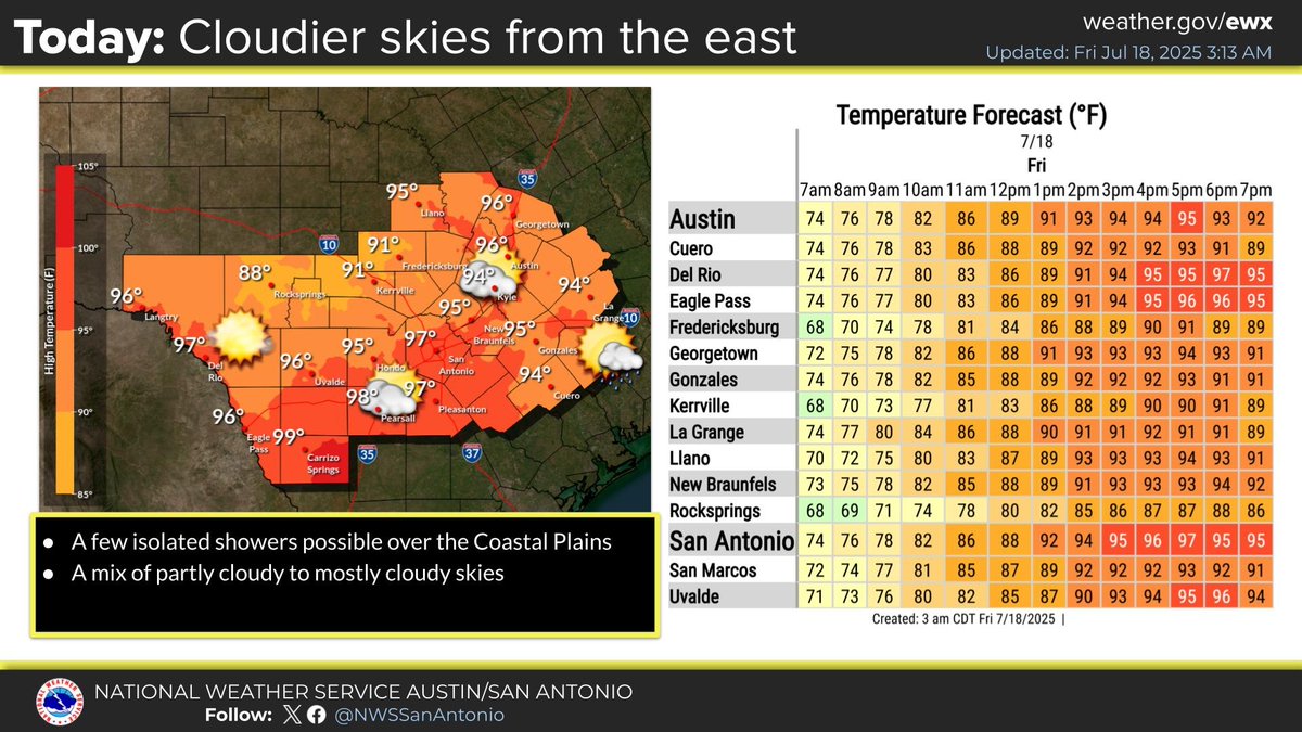
Somewhat cloudier skies are forecast today as moisture filters in from a tropical disturbance to the east. A few isolated showers are possible over the Coastal Plains, but it'll be dry for most. Typical summer heat and dry weather is forecast this weekend into next week. #txwx

Mild tonight featuring partly cloudy skies with lows in the upper 60s and 70s. Standard Summer heat will continue with little to no rain expected. Best chance of a spotty shower would be from Friday into early Saturday with a tropical disturbance off the coast of Louisiana. #txwx
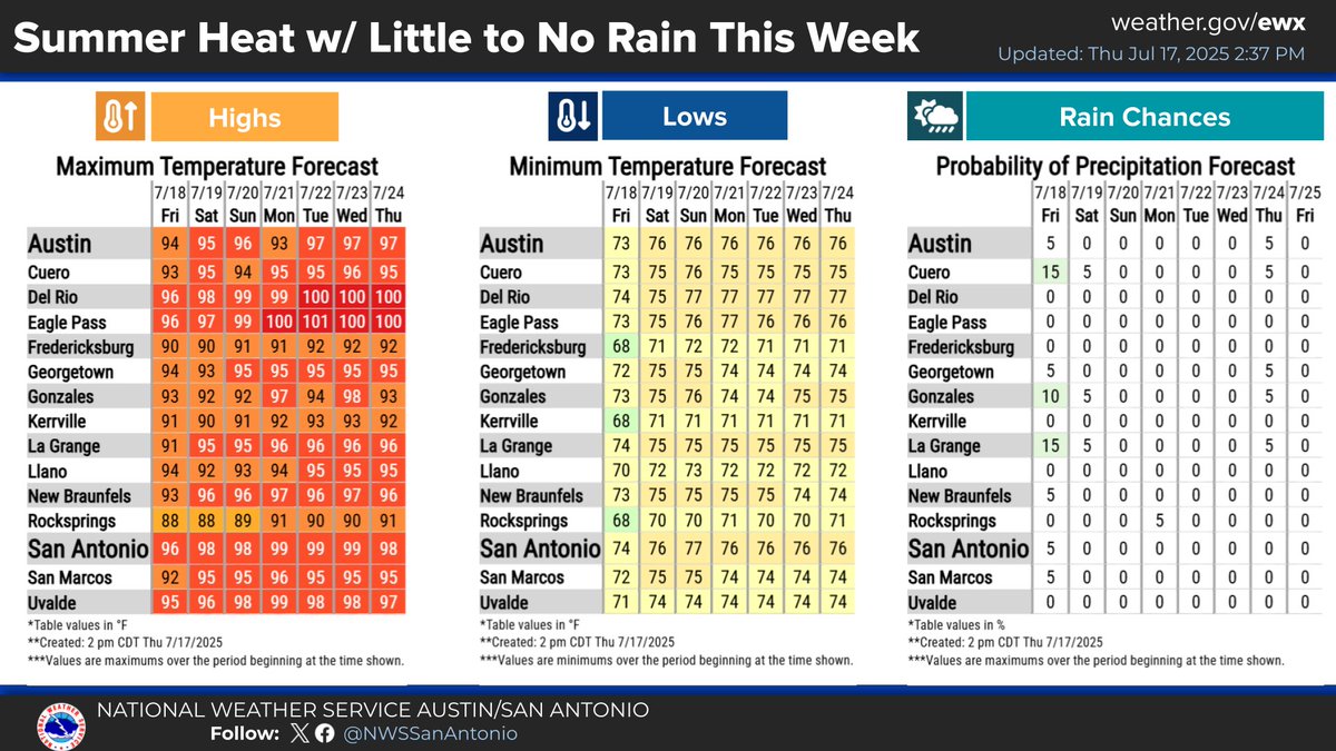

Morning clouds will give way to mostly sunny skies this afternoon with highs mainly in the 90s across South Central Texas. Besides some low chances for showers in the Coastal Plains Friday associated with a tropical disturbance in the Gulf, dry weather is forecast into next week.
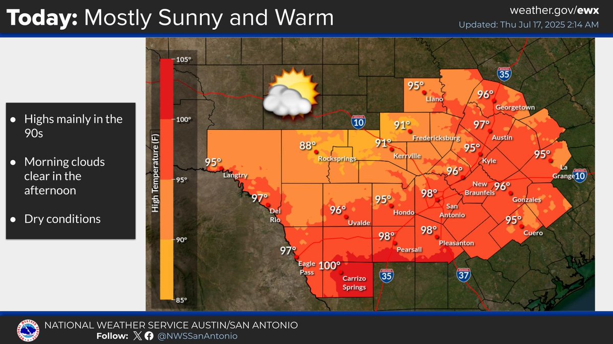
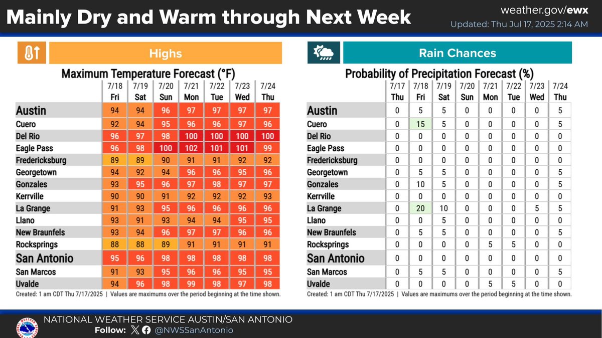
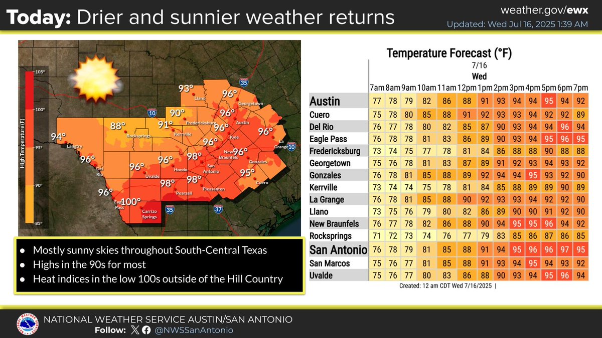
A drier and warmer weather pattern more typical of July is expected into next week. Highs today will be in the 90s for most with heat index values in the low 100s outside of the Hill Country. Low chances for isolated showers exist Friday in the Coastal Plains. #txwx