NWS Fort Worth
@NWSFortWorth
Official X account for the National Weather Service Fort Worth. Details: http://weather.gov/nws_x
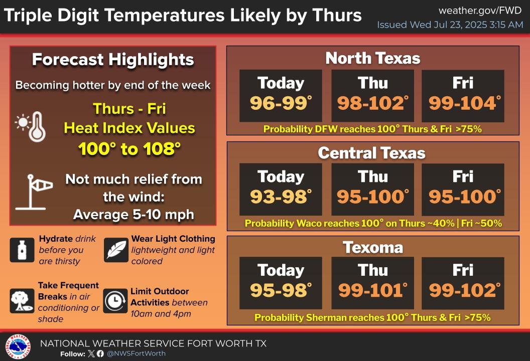
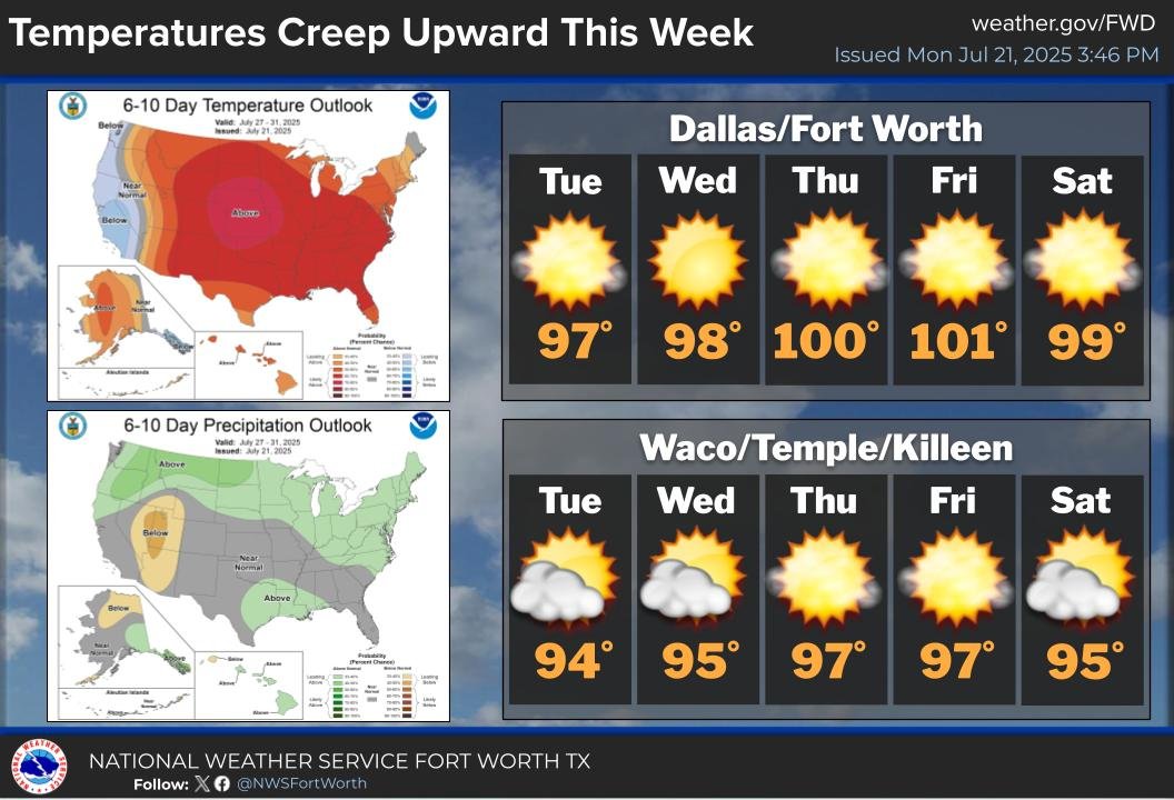
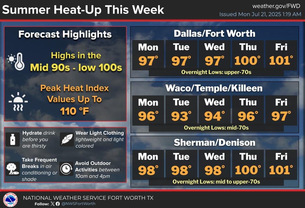
Temps will continue to rise through the end of the week with many locations hitting the century mark by Thu and Fri. Above-average temps look to persist across much of North and Central TX into August, so make sure you are keeping you and your loved ones safe from the heat! #txwx
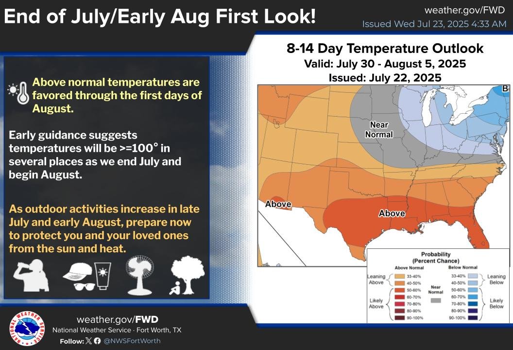
Early guidance is pointing towards above normal temps & a better likelihood of triple digit temps for the last few days of July and early days of Aug. As outdoor activities increase in late July/early Aug, prepare now to protect you & your loved ones from the sun & heat #txwx

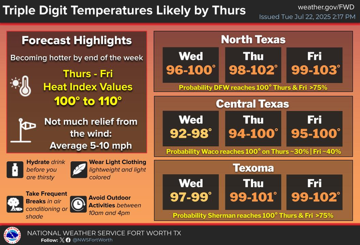
Temps will continue to climb through the end of the week with most areas near 100° by Thurs & Fri. Heat Index values will also be on the rise with some areas east of I-35 experiencing heat index values of 105-110° by the end of the week. #dfwwx #ctxwx #texomawx
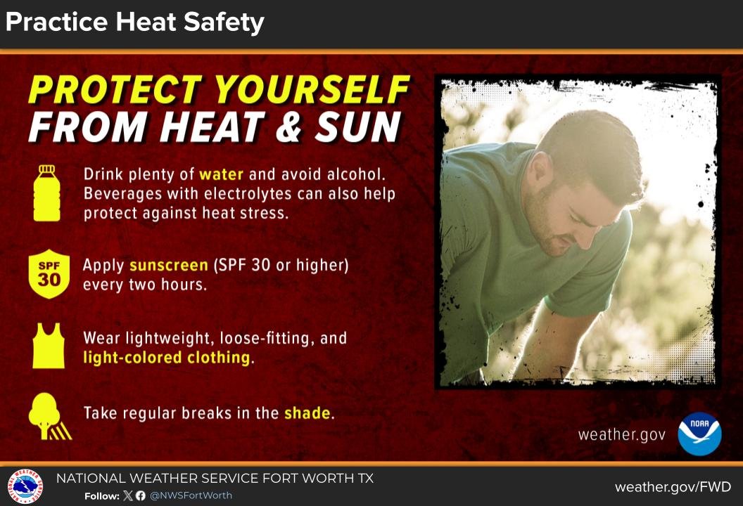
Here are some friendly reminders on how to protect yourself from the heat! Wear light-colored clothing and sunscreen. Stay hydrated. Work outdoors early or very late in the day. #dfwwx #ctxwx
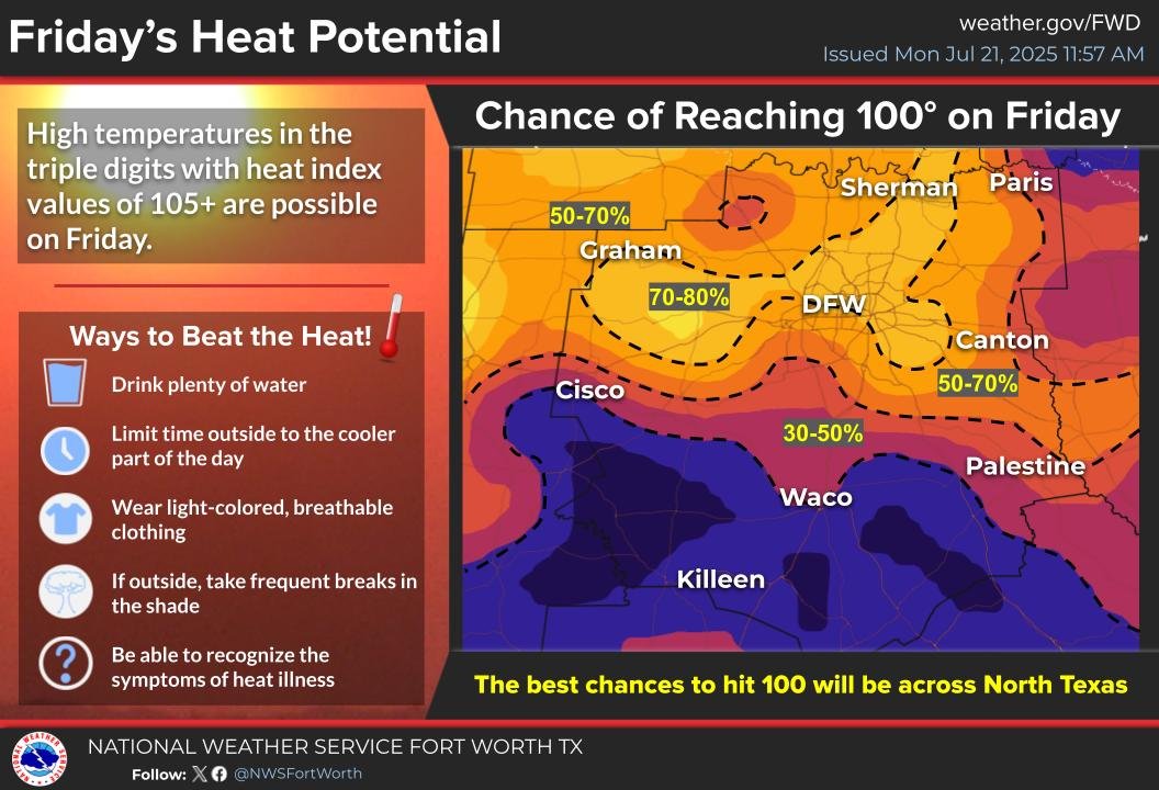
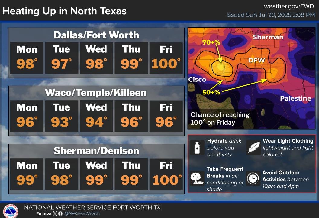
Strengthening high pressure aloft will maintain a slow warming trend this week, with triple digit high temperatures a good possibility for parts of North Texas by Friday. #ctxwx #texomawx #dfwwx
A toasty end to the week is expected with high temperatures reaching triple digits for some areas by Friday, along with heat indices of 105+. Remember to stay hydrated and take it easy outdoors. #dfwwx #texomawx #ctxwx
🔥Summer heat is building in!🔥Though it's over 3 weeks later than average, looks like triple digit heat may finally make its way into North Texas. If you plan on being outdoors, stay hydrated, stay cool, and stay safe!
Strengthening high pressure aloft will bring hot and rain-free weather this week. The latter half of the week should be the hottest, especially across North Texas, where Probabilities for reaching triple digits on Friday are highest. #texomawx #dfwwx #ctxwx
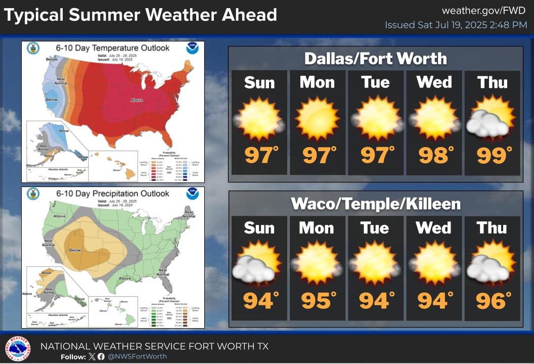
Near average temps and sunny skies are on tap across the area each day this week. The one exception will be locations in Central TX where temps look to remain slightly below average due to the high surface moisture content from excessive rain earlier this month.
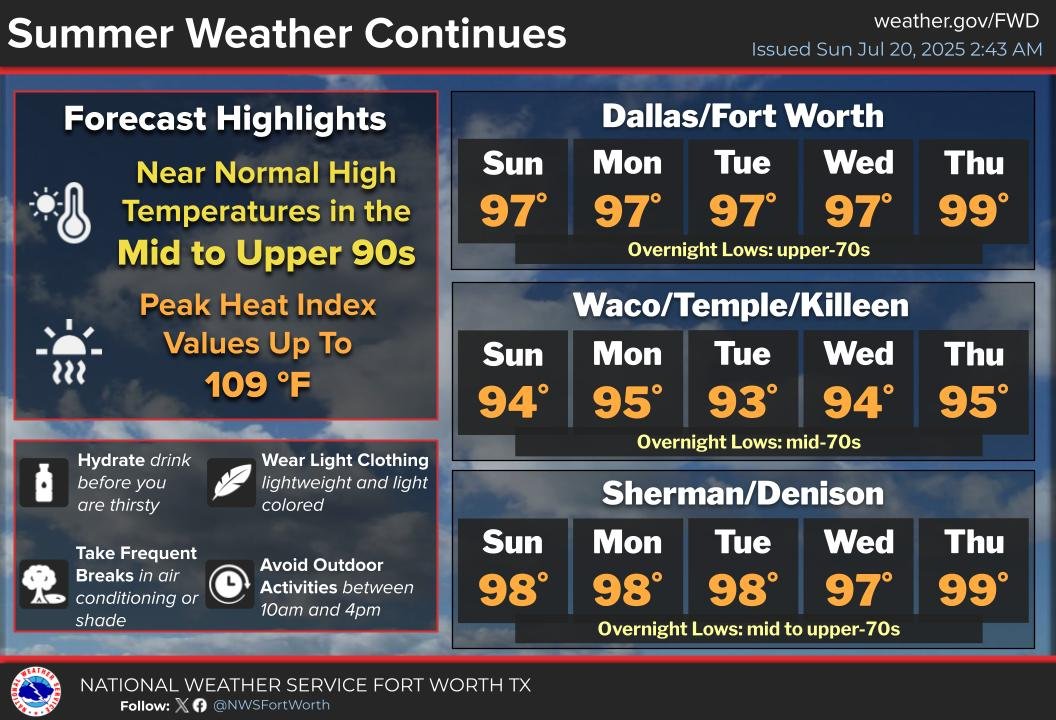
A typical week of summer weather can be expected for the upcoming week with lows in the 70s and highs in the mid to upper 90s. #ctxwx #texomawx #dfwwx
415 pm: Light rain continues to move southwest across parts of Southeast Texas & the Brazos Valley. Minimal rainfall is expected. Otherwise, humid and warm conditions will prevail. #ctxwx #etxwx
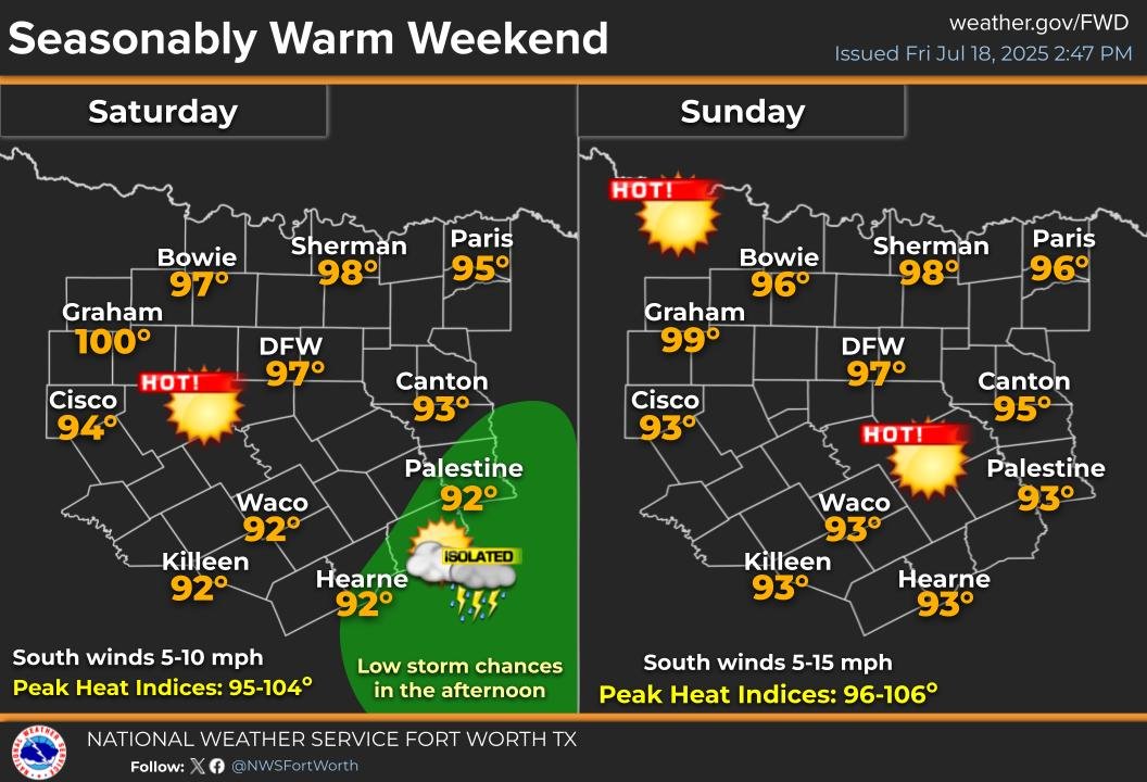
Weekend forecast: A seasonably warm weekend is expected with low rain chances in southeast Texas on Saturday. Heat index values will rise past 100 degrees in several places this weekend. Make sure to avoid heat related illnesses this weekend if you must be outdoors! #dfwwx #ctxwx
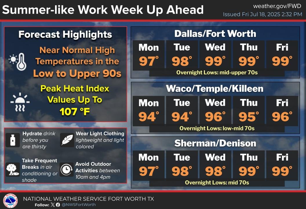
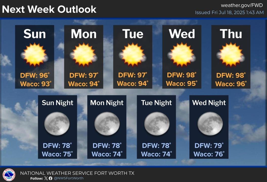
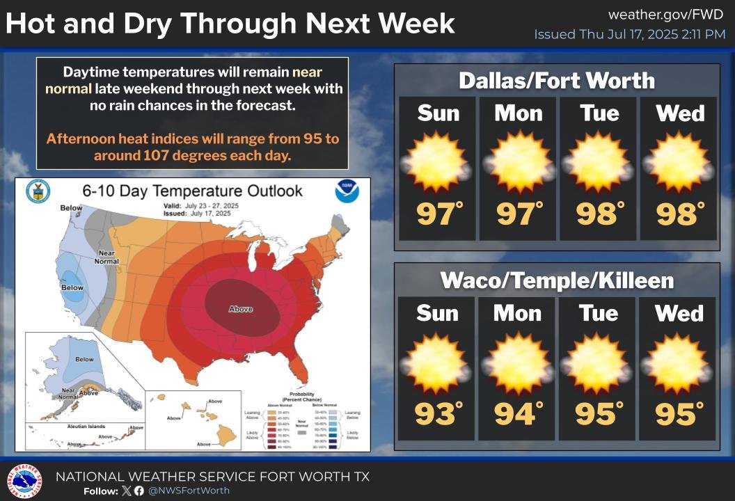
With ridging finally building into the region, more seasonal summer weather is on tap this upcoming week. Each day, expect plentiful sun and highs in the low upper 90s, alongside peak heat index values up to 107. Overnights will remain warm in the 70s. #dfwwx #ctxwx #txwx
Summer will be in full force next week, with sun and highs in the mid to upper 90s each day! Enjoy the drier weather and warmth! 🏊♂️⛳🍨🍉
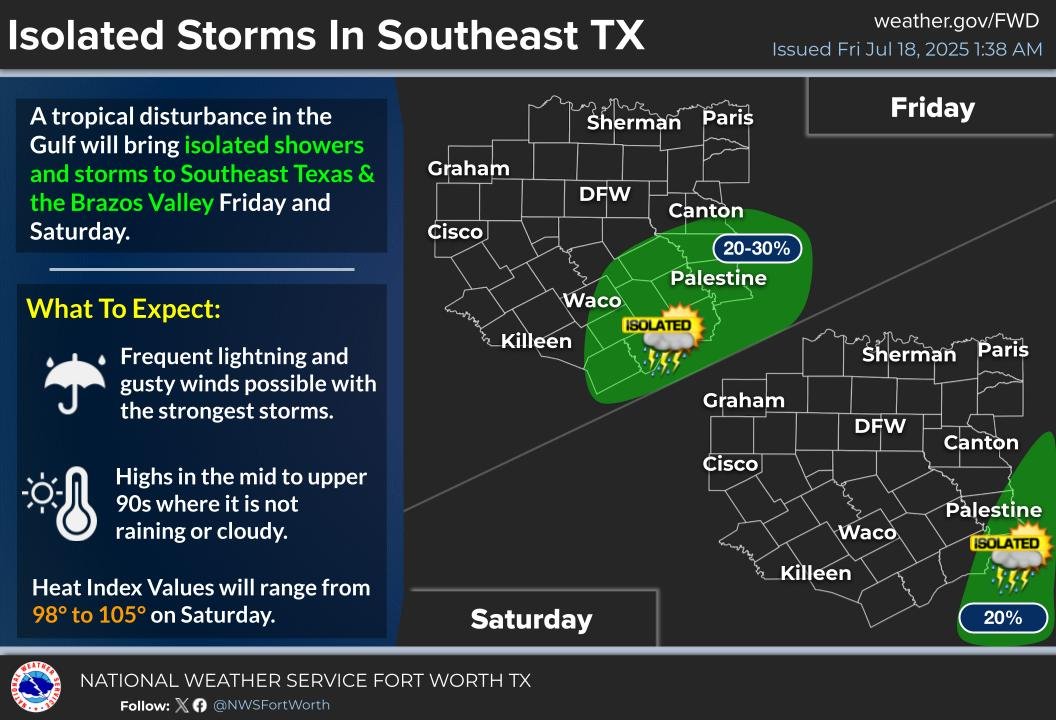
A weak tropical wave will bring isolated showers and storms to southeast Texas and the Brazos Valley today and tomorrow during the afternoon and evening hours. Otherwise, summer will strengthen its grip across our area with plenty of sun and highs in the mid and upper 90s!!
Daytime temperatures will remain near normal through next week with no rain chances. High temperatures will peak in the mid-upper 90s with "feels like" temperatures up to 107 F. #dfwwx #ctxwx
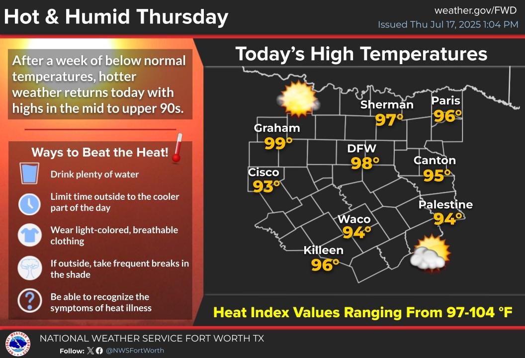
Hot and humid conditions are expected today with high temperatures in the mid to upper 90s and afternoon heat index values ranging from 97 to 104 degrees. Practice proper heat safety if spending extended periods of time outdoors! #txwx #dfwwx #ctxwx
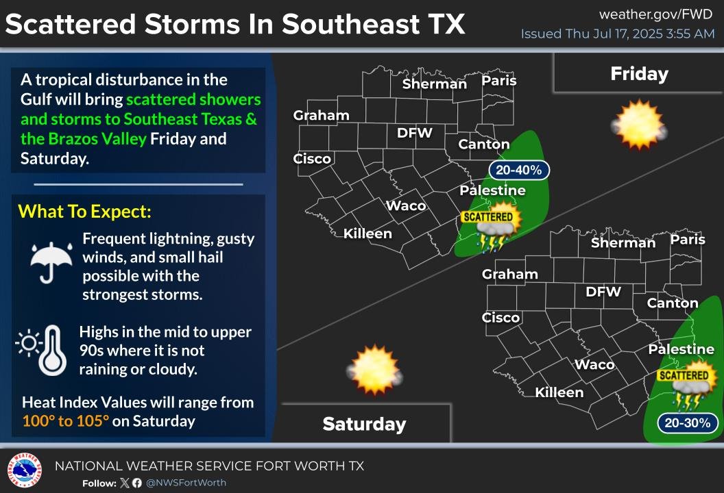
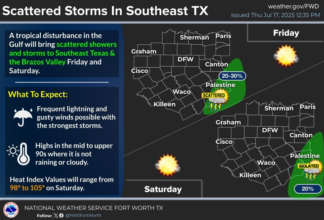
Scattered showers and storms to Southeast Texas and the Brazos Valley Friday and Saturday. Severe weather is not expected but frequent lightning and gusty winds will be possible with the strongest storms. #ctxwx #txwx
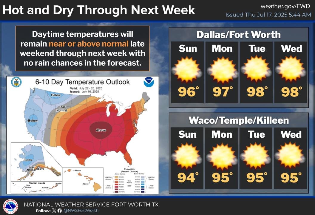
Daytime temperatures will remain near or above normal late this weekend through next week with no additional rain chances in the forecast . Highs will be in the mid to upper 90s with widespread peak heat index values above 100 degrees. #dfwwx #ctxwx
A tropical disturbance in the Gulf will bring scattered showers and storms to Southeast Texas and the Brazos Valley Friday and Saturday. Temperatures will also climb into the mid to upper 90s where it is not raining or cloudy. #dfwwx #ctxwx