NWS El Paso
@NWSElPaso
Official X account for the National Weather Service El Paso, TX. Details: http://weather.gov/twitter
After a hot and mostly dry weekend for us, moisture increases again early next week. A storm system moving through northern Mexico will bring better storm chances area-wide Mon/Tue with a low threat of flash flooding. 🥵⛈️ #nmwx #txwx


Aviso de Inundación Repentina continúa Mescalero NM, Bent NM hasta las 8:00 PM MDT

Flash Flood Warning continues for Mescalero NM and Bent NM until 8:00 PM MDT

Aviso de Inundación Repentina incluye Mescalero NM, Bent NM hasta las 7:30 PM MDT
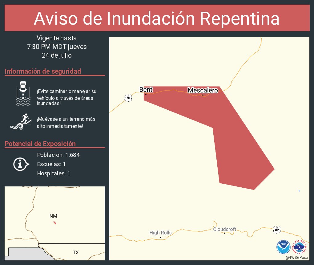
Flash Flood Warning including Mescalero NM and Bent NM until 7:30 PM MDT

340pm Radar Update: Looking at the Tularosa Basin, a cluster of thunderstorms is producing heavy rainfall west of US-54 and produced a gusty outflow heading south towards Holloman AFB and Alamogordo. Blowing dust and lowered visibility can be seen in this area.
Aviso de Inundación Repentina incluye Doña Ana County, NM hasta las 6:00 PM MDT

Flash Flood Warning including Doña Ana County, NM, Sierra County, NM until 6:00 PM MDT

A special weather statement has been issued for Mayhill NM, Weed NM and Sacramento NM until 1:30 PM MDT #NMwx

1031pm Here is a look ahead to this weekend. Warmer and drier. #txwx #nmwx facebook.com/photo/?fbid=11…

810pm Here is your forecast for Thursday. #txwx #nmwx facebook.com/photo/?fbid=11…


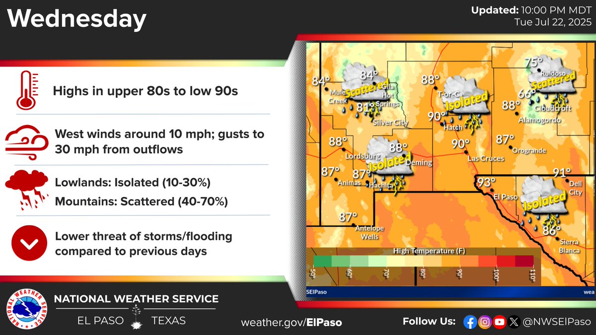
Storm chances diminish on Wednesday as moisture begins to exit the region. Still, spotty showers or storms are possible for the lowlands with better coverage in the mountains. #nmwx #txwx
Aviso de Inundación Repentina continúa Bent NM hasta las 3:00 AM MDT


Aviso de Inundación Repentina continúa Bent NM hasta las 11:00 PM MDT


Aviso de Inundación Repentina incluye Otero County, NM hasta las 12:00 AM MDT

Flash Flood Warning including Otero County, NM until 12:00 AM MDT

Aviso de Inundación Repentina incluye Bent NM hasta las 11:00 PM MDT
