Kyle J Gillett
@wxkylegillett
Storm chaser, Aurora hunter, Photographer. Severe storm researcher and M.S. student at UND. SounderPy developer.
Yesterday's dusty wedge tornado passing southwest of Dickinson, North Dakota over a small area of badlands as the sun illuminates the backside. #NDwx

By now some folks have probably seen early versions of Report Buddy floating around. Holden snagged the first tornado pic with it. Ill be open sourcing the code that started as a personal replacement/enhancment for spotter network and mping. adlyons.github.io/report_buddy.h…
@NWSRapidCity reported near Parmelee, SD Todd County (Lat 43.323, Lon -101.057) at 7/20/2025, 6:30:05 PM. #SDwx // generated by Report Buddy: V0.5
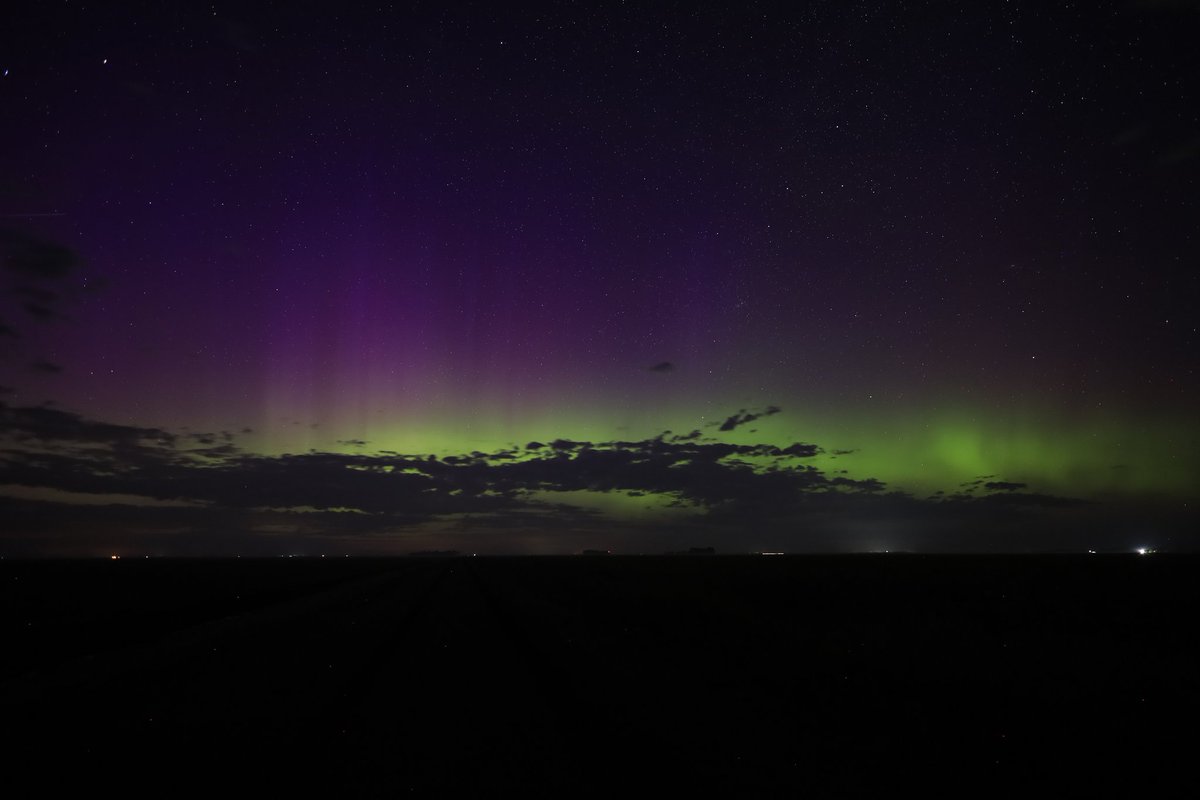
Fun northern lights display last night, northwest of Warren, Minnesota. This may be strange, but I have been wanting this aurora + cloud shot for awhile now. #MNwx #aurora
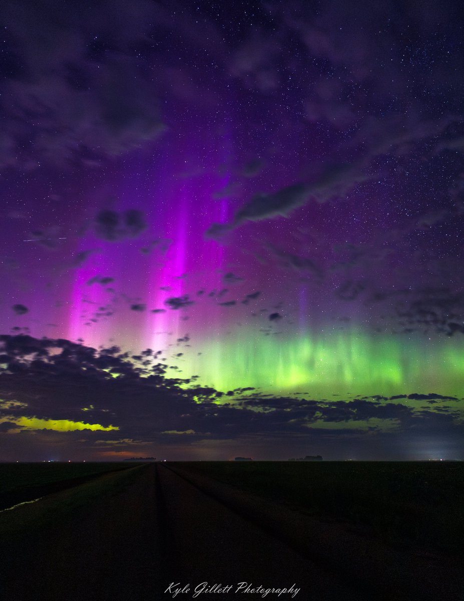
nice aurora substorm with tall purple pillars north of March, Minnesota happening now #MNwx #aurora @AuroraNotify
This seems to be resurfacing a bit right now... stay tuned for what we are cooking up with @TornadoCoaching 👀👀👀
This streamwiseness project is already proving useful: This map of 0-3km vorticity that is streamwise (SWV), SRH, and SRW shows the important relationship between SRW & SWV with SRH. Forecasters should carefully consider what background kinematic property dominates SRH...(1/5)
Kinda felt that the previous edit pulled you out of the time with the modern cars. Here's one that could've actually happened.
Gave it my best
making decisions based solely on radar, not your actual surroundings (storm features, wind direction, road network, etc)
what screams “beginner storm chaser”

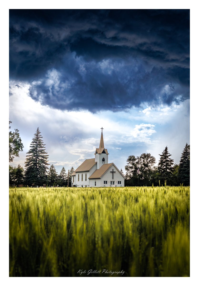
"The Storm Above" -- weak cloud-base rotation passes above Ness Lutheran Church, outside of Mekinock, North Dakota on July 7th. A combo of my two favorite compositions: old buildings/churches & wheat fields. #NDwx
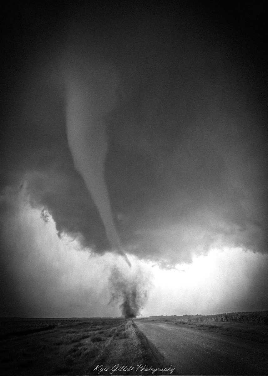
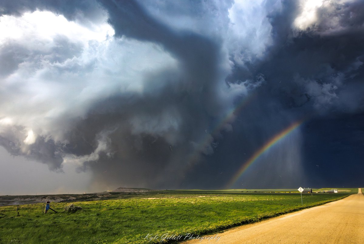
The dusty Dickinson wedge tornado and double rainbow on June 19th. #NDwx
VWP progression loop as Laura approached the KLCH radar, up until the moment it got obliterated.
WOW, that was close. 🌪 This footage from our GVSU Allendale camera shows just how close a tornado came to forming. It's in fast motion so the rotation is easier to see. The cloud lowerings are unlikely to have been a touchdown... but it doesn't get much closer than that.

so many people: "You're moving to North Dakota?? You know there's nothing up there, right????" me: *exactly*
Incredible tornado rolling over a hill near Sauk City, #wiwx about 45 mins ago