Carl Jones
@Wx_Jones
Meteorologist. 🎓FSU. North Florida native, North Dakota transfer. Weather, satellites, blowing snow, aurora #GOESR #JPSS1 @NASASocial
Mid-level Water Vapor images from @NOAASatellites #GOES19/#GOESEast showed that an outflow boundary from a decaying Mesoscale Convective System over northern Iowa (which produced a few wind gusts >50 knots) also created a vertically-propagating gravity wave that moved S and SW.
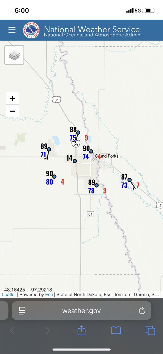
The latest view from @NDAWNmesonet New Salem. Severe Thunderstorm Warning is out for that area. #ndwx
Pretty easy to see where the area of high pressure is located by looking at the visible satellite. It's currently located across southern Mississippi, which puts us on the drier and hotter side of it. Heat Advisories are in place again tomorrow. #FLwx #GAwx #ALwx
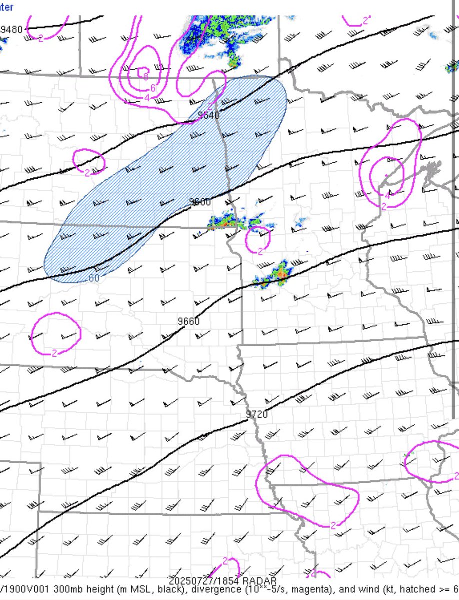
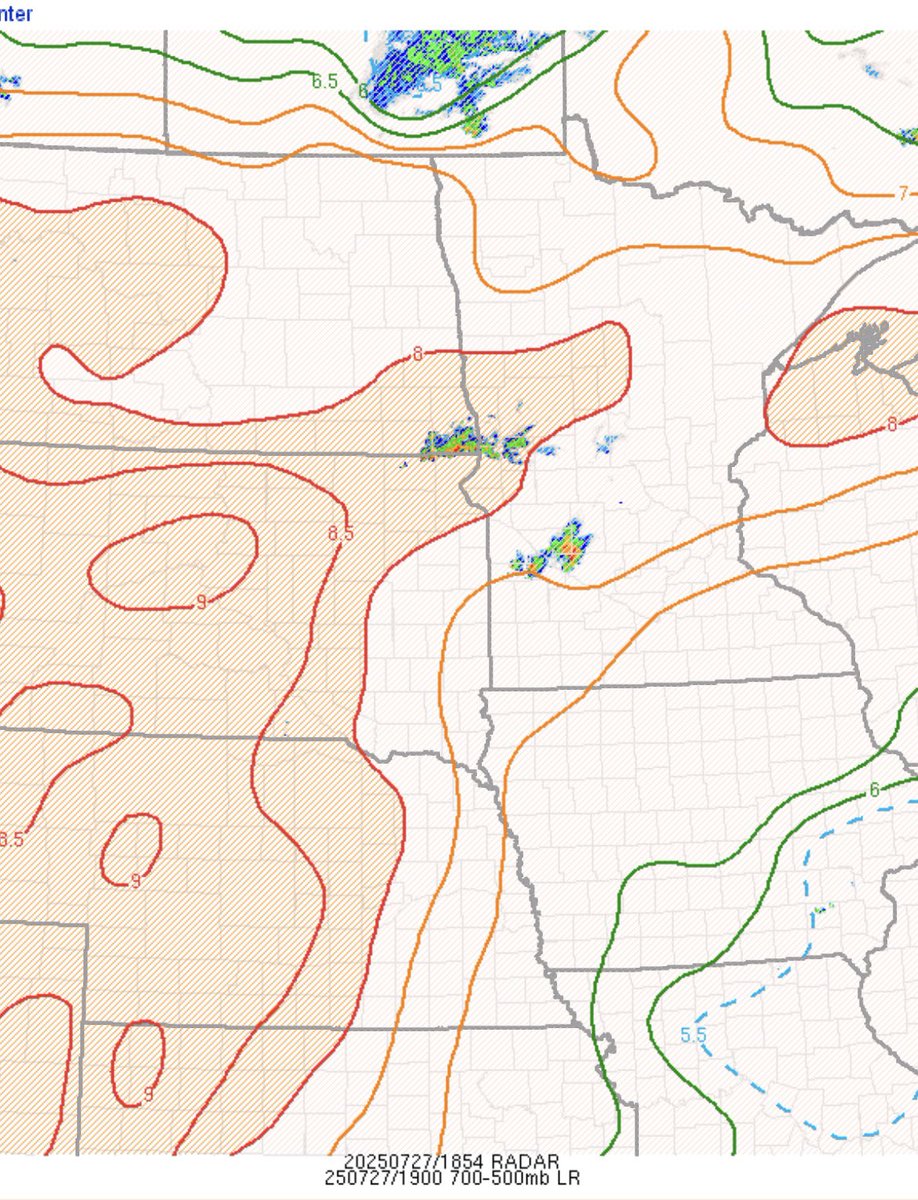
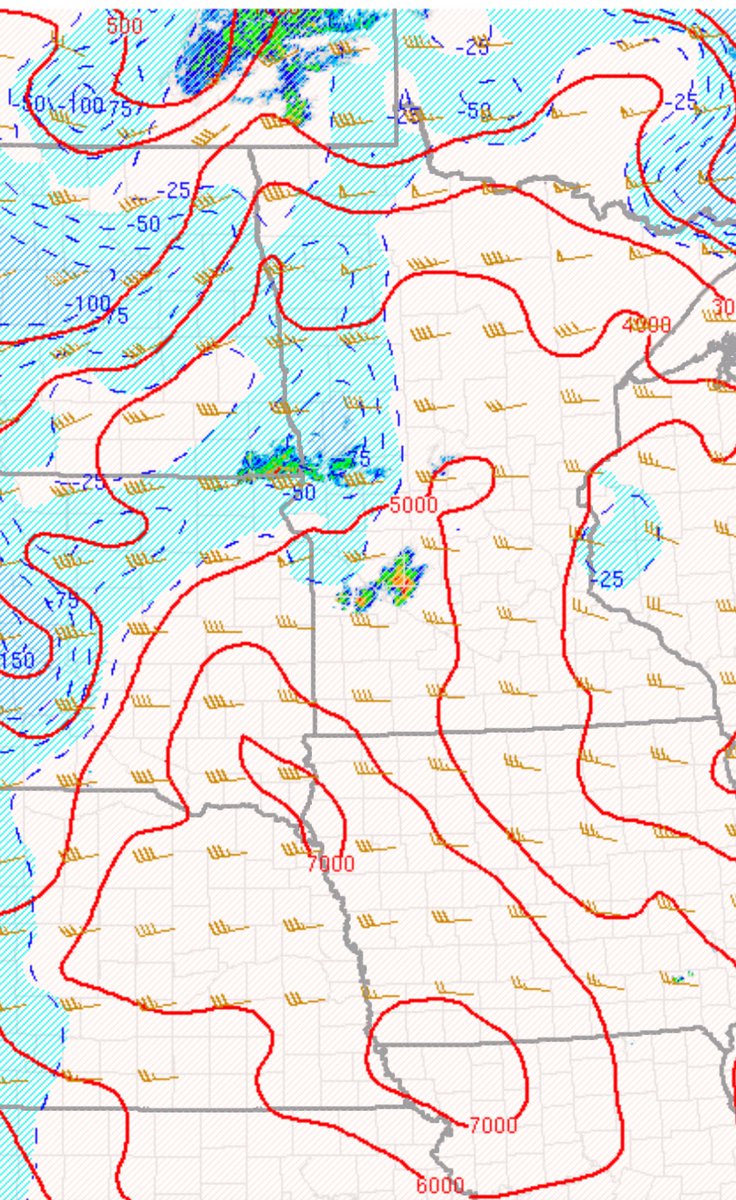
Impressive severe weather parameters already in place in the Upper Midwest, both thermodynamically and kinematically. Decent potential at significant severe hazards today/tonight. #mnwx #ndwx #sdwx

A fresh bouquet of photons, arranged by #FCI Cloud Type RGB, found over Botswana this morning (06:20 UTC).
Severe storms on July 20th left this hail scar that began about 8-10 miles southwest of Belfield and extended east southeast to just south of the Dickinson Airport, then southeast to around 15 miles north of Mott. The length of this hail scar was approximately 42 miles. #NDwx
Lots of rain along the north shore! Our co-op parking lot is once again…a lake… with a boat. 😅 Sooo very Grand Marais!
.@NOAA’s first satellite fully dedicated to continuous, operational #SpaceWeather monitoring has arrived in Florida! The Space Weather Follow On - Lagrange 1 (#SWFOL1) 🛰️ will launch this fall and head to Lagrange point 1 (~1 million miles from Earth) where it will keep…
Freakin dream shot
Incredible shot of last night’s storm rolling through Jacksonville. 📸: IG shaneroheu
Incredible shot of last night’s storm rolling through Jacksonville. 📸: IG shaneroheu
BRYSEN WRIGHT WITH ONE OF THE MOST INCREDIBLE CATCHES YOU'LL EVER SEE 😱 @SCNext
Minimum 124 mph.. ..as high as 202 mph 🧊 💨 💨 💨 💨
Finally dug through the Morton, TX hail camera data. A 1.6” diam. stone travelled between 36.5-64” (some uncertainty given the exact path it took) and took only 0.0182 seconds to do it. The means at minimum the stone was moving at 124 mph, and could’ve been as high as 202 mph.
Pretty spectacular evolution of big active regions - 4143, 4136, 4146 and 4139 (left to right) - over the past 3 days. 4143 and 4136 each have a 20% chance of M-class and 5% chance of X-class flares.
Daryl is great! His work is a great example of providing a “value added” service to weather and climate data. I literally sit on a repo of the data at NCEI, but more often than not I’m going to IEM to get information quickly. Kudos to @akrherz!
If you've seen a niche weather stat, odds are that it can from @akrherz and the Iowa Environmental Mesonet! Listen to our brand-new episode to learn the in's and out's of the website 👉 linktr.ee/WeatherGeeks
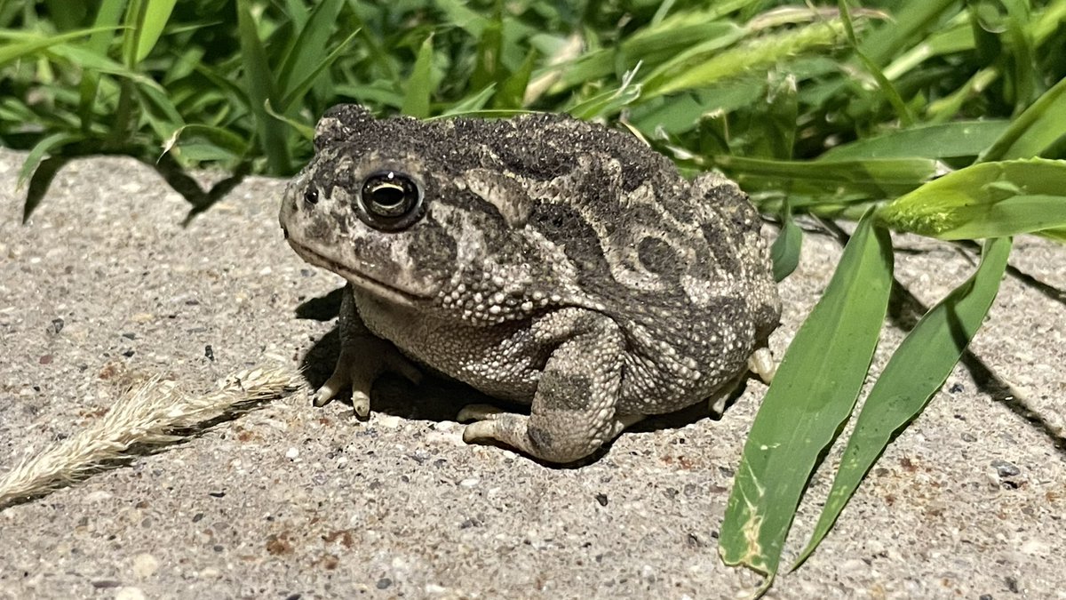
Had a friend greet me at the office for my midnight shift. First toad I’ve seen up here since living in Grand Forks, ND. So this was a treat. I may have interrupted his ant dinner under the parking lot lights. I owe you buddy. Maybe see you at the 06Z ob.
It’s true - got to share this special moment with Mom ♥️. Not only was Mom’s first tornado, it was G’s and V’s first too. Also all shared with @Daileyweather ♥️ Really a dream come true.
Thank you Carl!! My first tornado!!🌪️
This is not true. NWS offices are NOT overstaffed. Every NWS office in the country has several unfilled positions. What she is probably referring to is that staff who were off work were brought in on overtime to aid in the response to active weather, because they're dedicated.
Leavitt: "There were record-breaking lead times in the lead up to this catastrophe ... in fact, one of the offices was actually overstaffed. They had more people than they need."