NWS Bismarck
@NWSBismarck
Official X account for the National Weather Service Bismarck, North Dakota. Details: https://www.weather.gov/nws_x
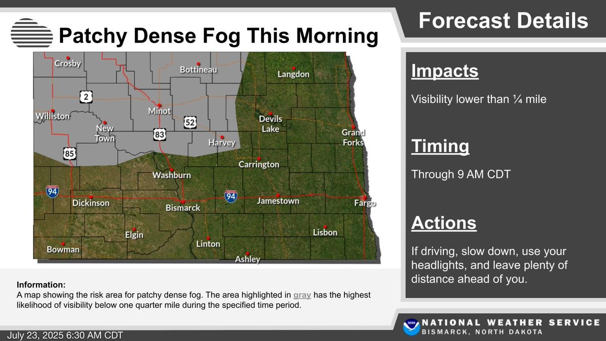
Patchy dense fog will impact much of northwest and north central North Dakota through mid morning. Be prepared for rapidly changing conditions on the morning commute! #NDwx
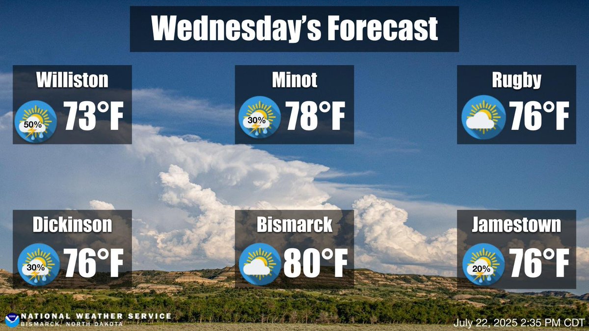
Below average high temperatures today will quickly warm back to near to above average in time for the weekend. Except for Thursday, daily chances for showers and thunderstorms remain in the forecast. It will also remain humid through the weekend. #NDwx

Be prepared for patchy dense fog across northwest and north central North Dakota early this morning! #NDwx

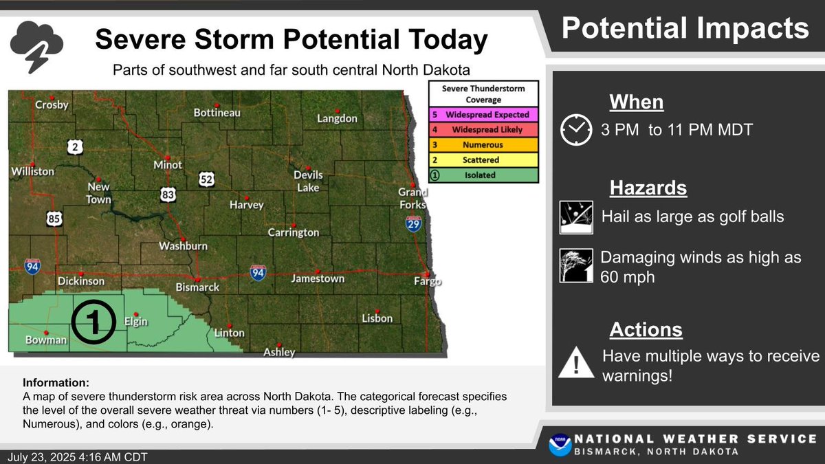
Isolated severe thunderstorms (risk level 1 out of 5) are possible across parts of southwest and far south central North Dakota this afternoon and evening. Potential hazards include hail as large as golf balls and damaging winds up to 60 mph. #NDwx
Slow-moving thunderstorms could produce rainfall amounts up to 3 inches in a short amount of time from south central ND into the James River Valley early this morning. This may result in localized flooding. Flooded roads can be extremely difficult to see at night! #NDwx

Another day with chances for thunderstorms. No severe thunderstorms are expected. #NDwx
Afternoon Update: The slight risk was pushed south. Timing looks to be later this evening through the overnight. #NDwx
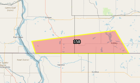
Looking for storm reports from INSIDE this red box. Between the river and Ashley. The storm occurred between midnight and 1am CT. Looking for wind damage or hail reports. #NDwx #agwx
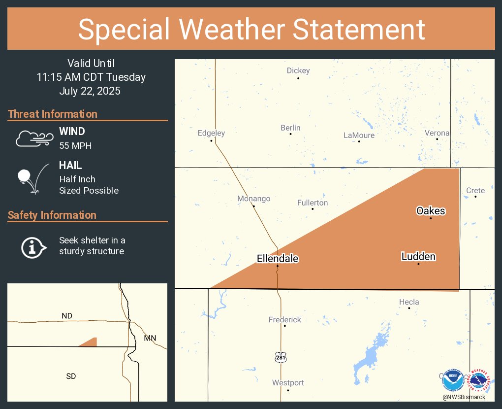
A special weather statement has been issued for Oakes ND, Ellendale ND and Ludden ND until 11:15 AM CDT
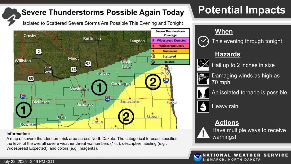
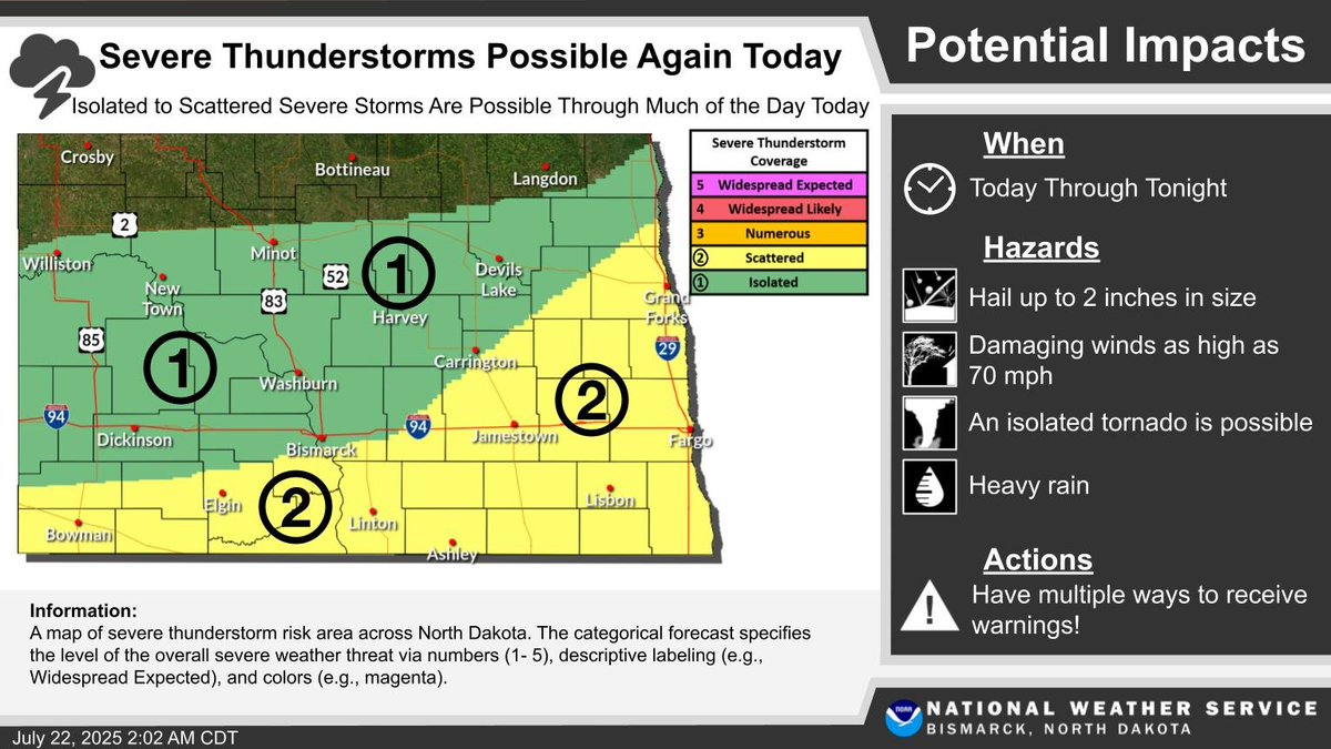
Scattered thunderstorms will continue through the early morning hours with isolated severe storms possible. Another round of scattered severe thunderstorms is possible once again later today through tonight.
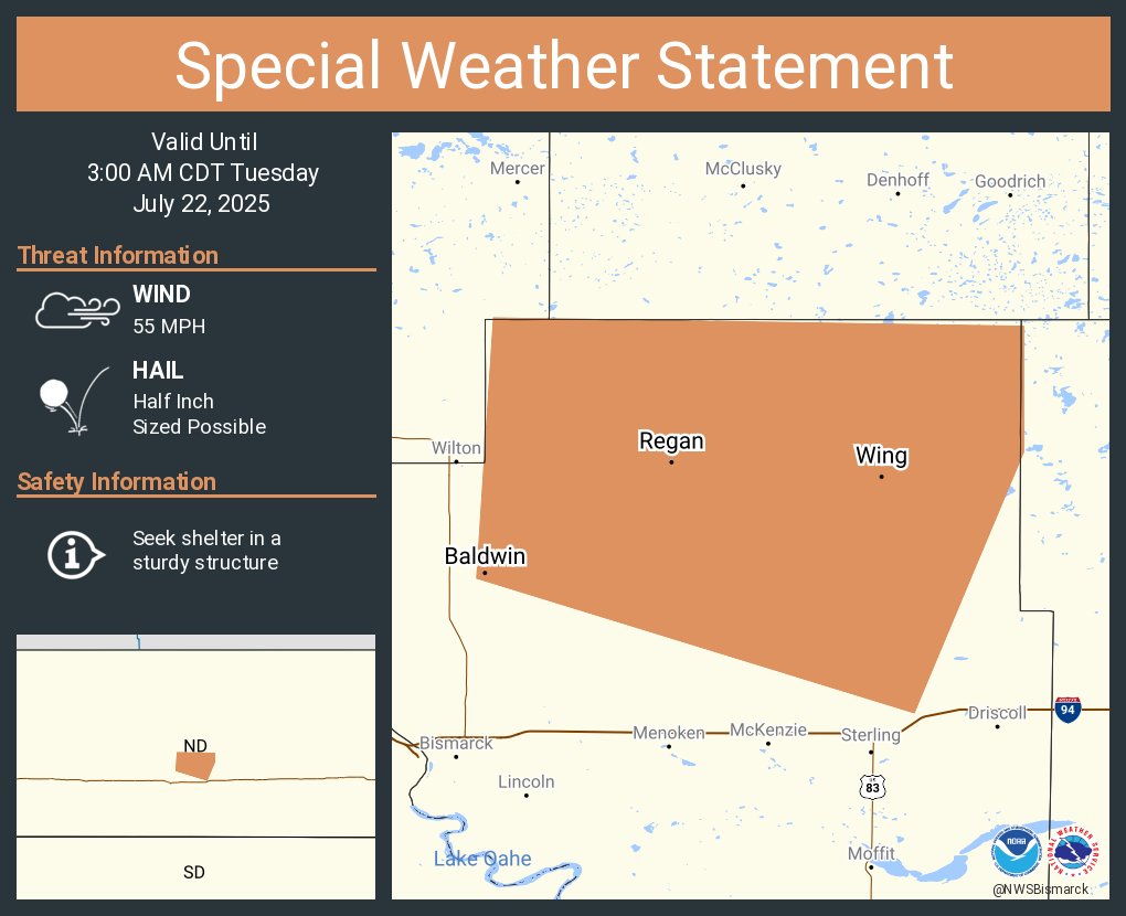
A special weather statement has been issued for Wing ND, Regan ND and Baldwin ND until 3:00 AM CDT
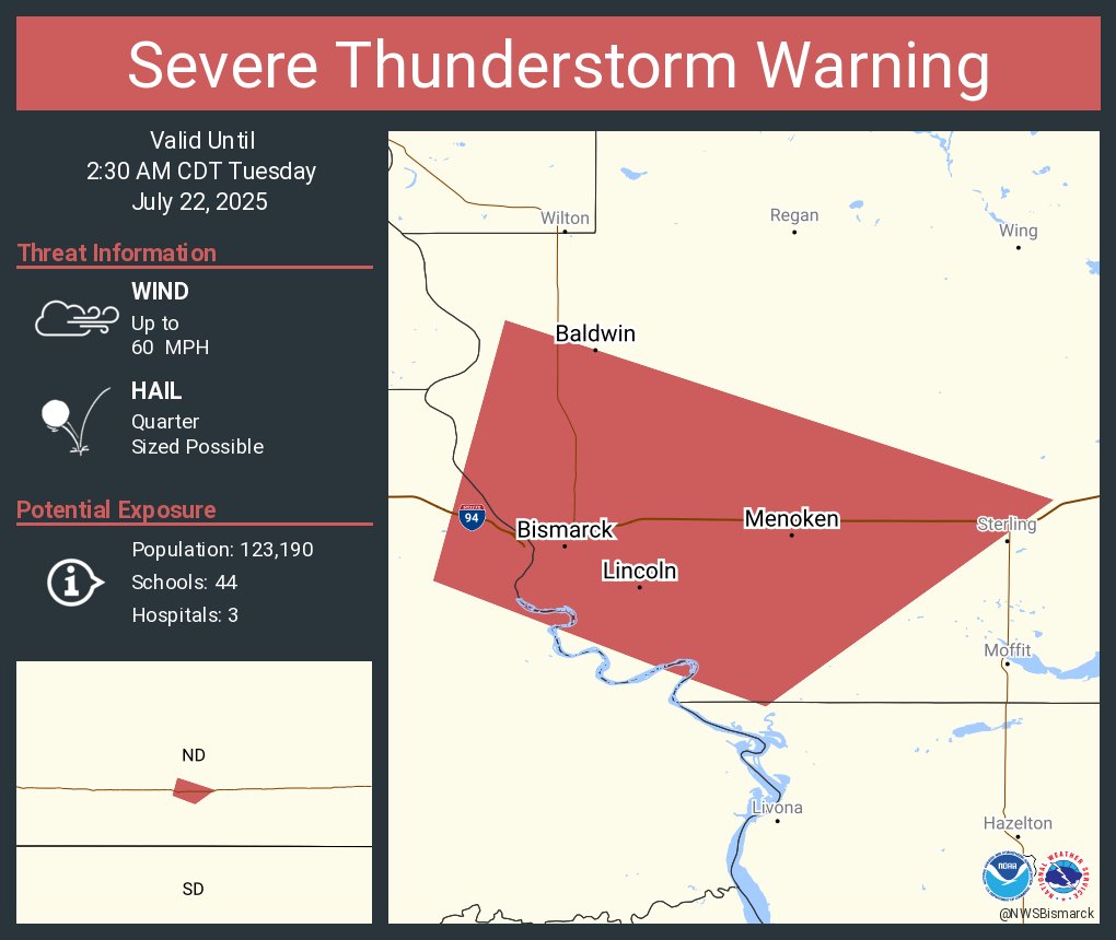
Severe Thunderstorm Warning continues for Bismarck ND, Mandan ND and Lincoln ND until 2:30 AM CDT
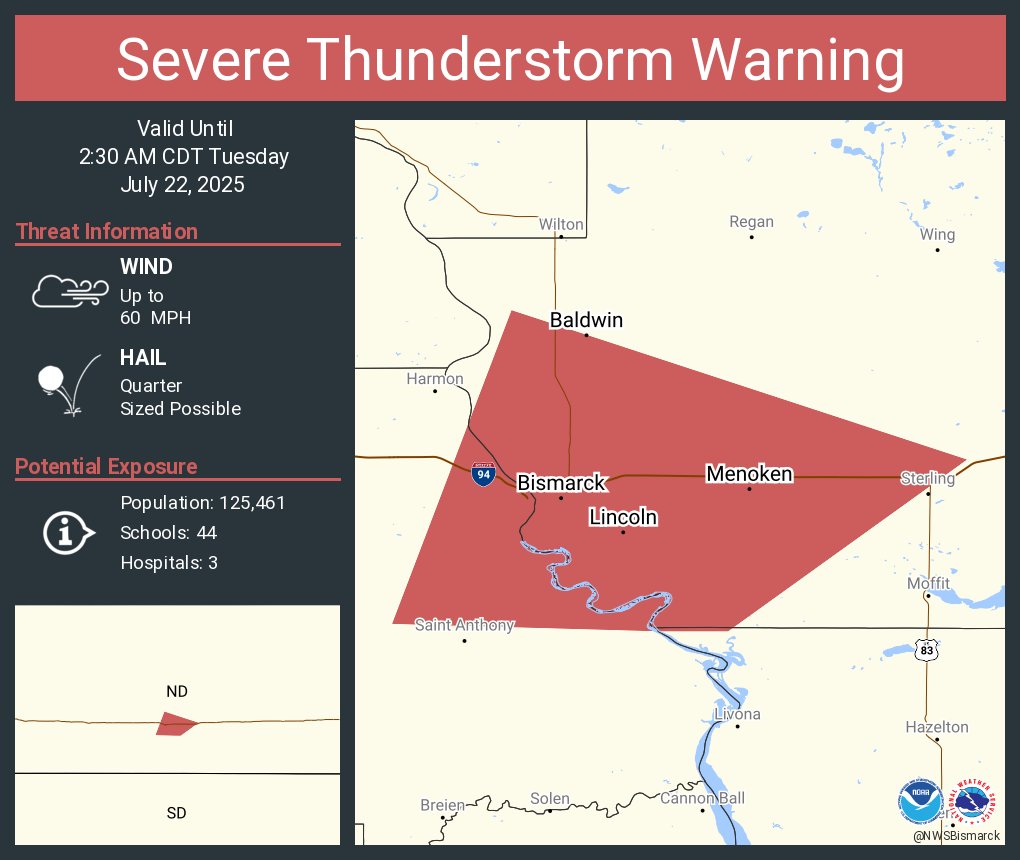
Severe Thunderstorm Warning continues for Bismarck ND, Mandan ND and Lincoln ND until 2:30 AM CDT
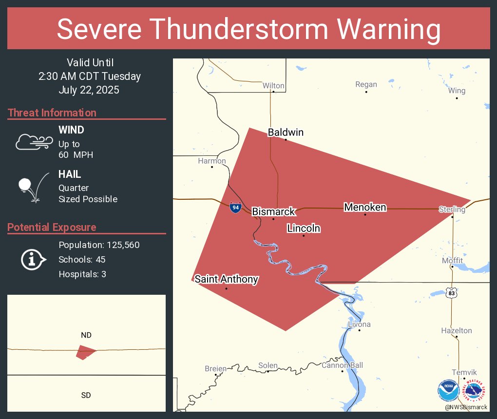
Severe Thunderstorm Warning continues for Bismarck ND, Mandan ND and Lincoln ND until 2:30 AM CDT

Severe Thunderstorm Warning including Bismarck ND, Mandan ND and Lincoln ND until 2:30 AM CDT
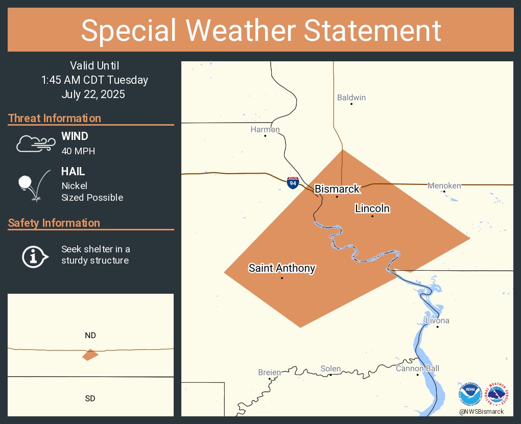
A special weather statement has been issued for Bismarck ND, Lincoln ND and Saint Anthony ND until 1:45 AM CDT
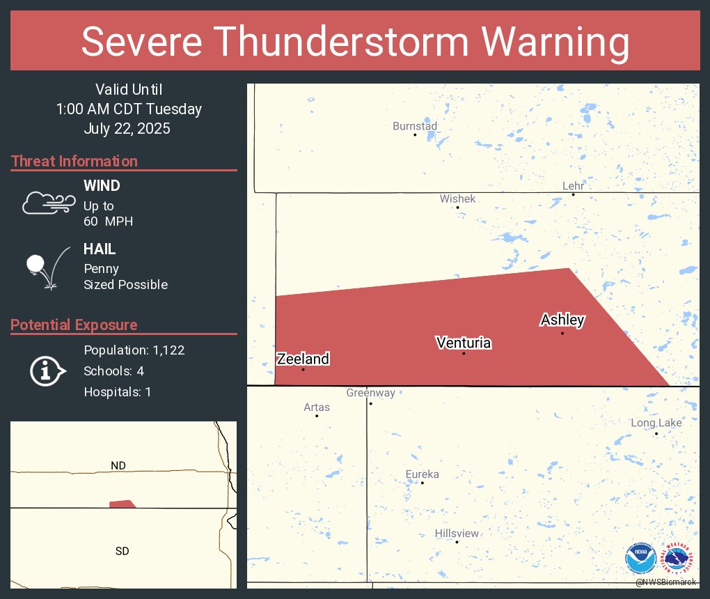
Severe Thunderstorm Warning continues for Ashley ND, Zeeland ND and Venturia ND until 1:00 AM CDT
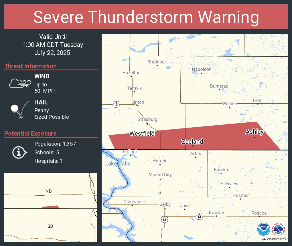
Severe Thunderstorm Warning continues for Ashley ND, Zeeland ND and Hague ND until 1:00 AM CDT

Severe Thunderstorm Warning including Ashley ND, Zeeland ND and Hague ND until 1:00 AM CDT
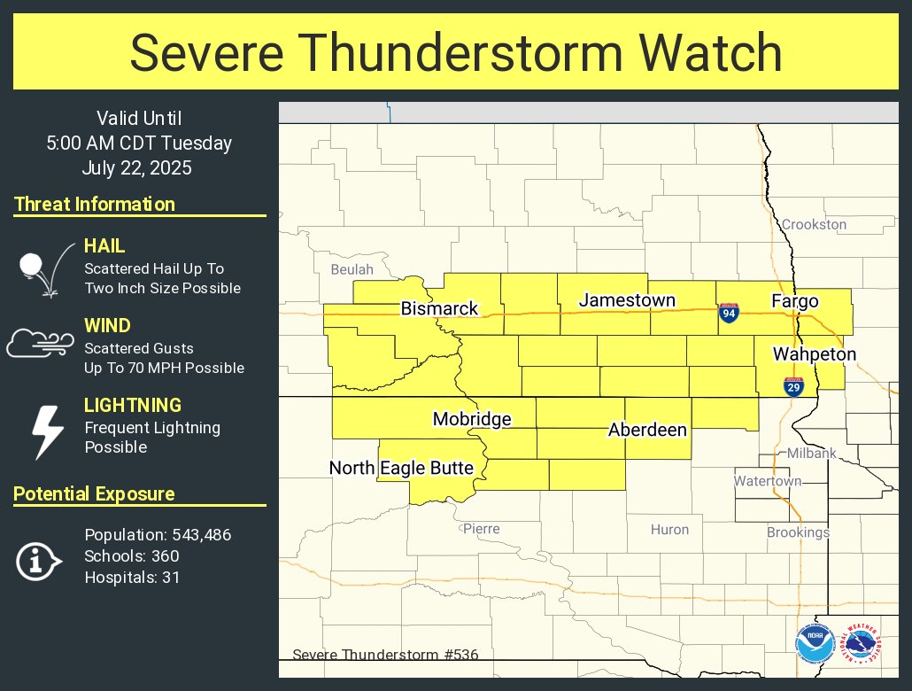
A severe thunderstorm watch has been issued for parts of Minnesota, North Dakota and South Dakota until 5 AM CDT