
ReadyIllinois
@ReadyIllinois
The Illinois Emergency Management Agency and Office of Homeland Security (IEMA-OHS)
Flash Flood Warning including Pinckneyville IL, Tamaroa IL and Swanwick IL until 4:00 PM CDT
It'll be dangerously hot and humid this week, especially Wednesday. Take steps to stay cool: stay inside as much as possible, keep curtains and shades drawn, take cool showers, visit a cooling center if you're uncomfortable at home. keepcool.illinois.gov #ILWx
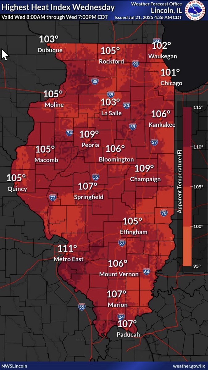
Here is a look at high temperatures and peak heat index readings over the next 7 days at select cities across our region.
This muggy weather will continue this week in #Illinois. It moves from northern parts of the state to cover all areas by Wednesday. Believe it or not, southern Illinois could see peak heat indices of between 105-115°F. #ILWx
Flash Flood Warning including Decatur IL until 2:00 PM CDT
Aviso de Inundación Repentina incluye Decatur IL hasta las 2:00 PM CDT
Flash Flood Warning including Flora IL and Xenia IL until 2:15 PM CDT
Aviso de Inundación Repentina incluye Flora IL, Xenia IL hasta las 2:15 PM CDT
Flash Flood Warning continues for Princeton IN, Mount Carmel IL and Oakland City IN until 1:30 PM CDT
As a storm system moves across Illinois, we will enjoy lots o’ weather risks. Do you have a back up plan if one of those risks becomes reality, like flash flooding? Turn around, don’t drown. #ILWx #TADD
We have a chance for storms every day, but a higher (level 2 of 5) risk on Saturday and Saturday night. It'll also be hot and humid. Cooling centers in #Illinois: keepcool.illinois.gov #ILWx
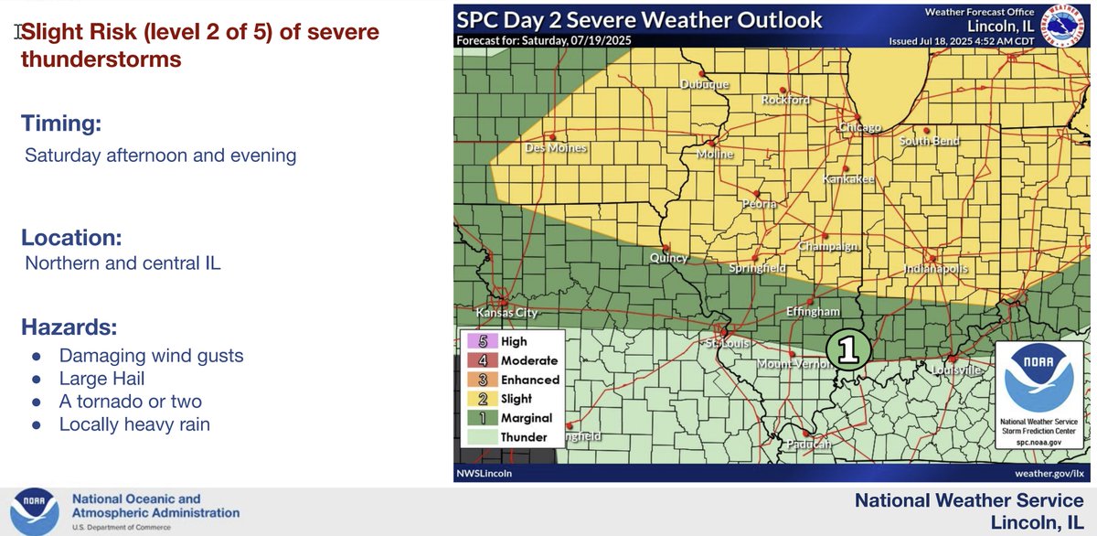
Expected scattered to widespread storms tomorrow across the area with highs in the upper 80s to lower 90s. Saturday kicks off a heatwave with heat indices reaching 100 to 110 Saturday through Monday and possibly higher on Tuesday, Wednesday, and Thursday.
The Mattoon area is looking for volunteers to help with water distribution. Can you spare some time over the next week? Sign up here: surveymonkey.com/r/3WMMCHF

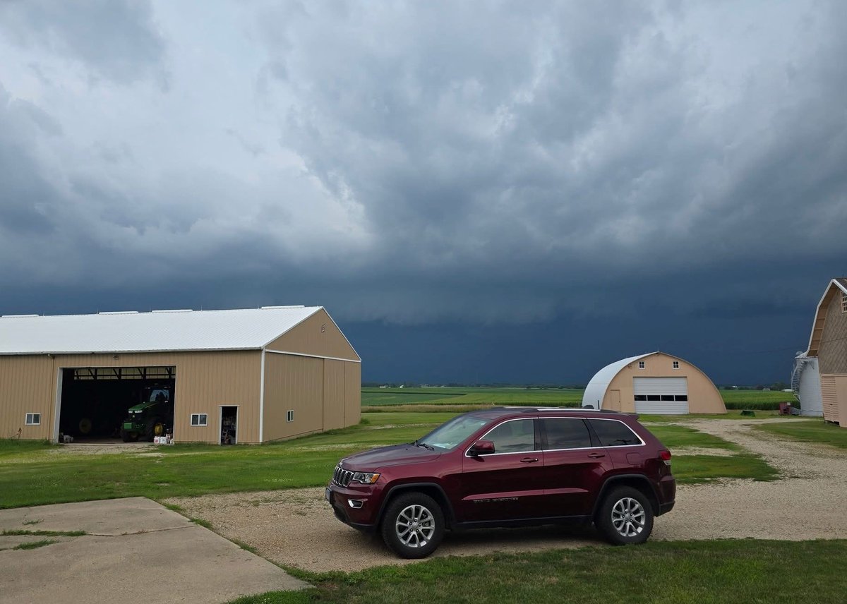
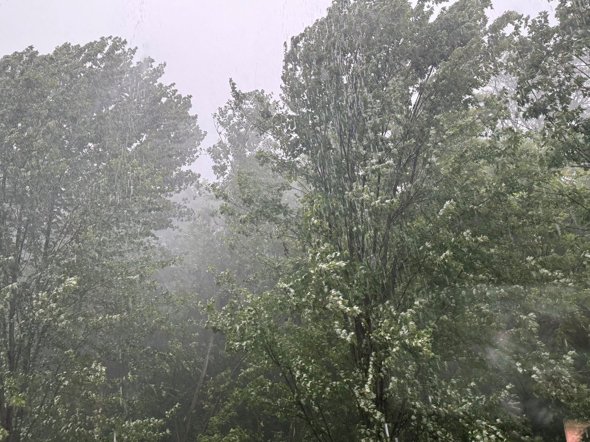
Got storms? Add photos and tell us your go-to weather preparedness tip. #ILWx
Severe Thunderstorm Warning including Aurora IL, Naperville IL and Wheaton IL until 4:00 PM CDT
Aviso de Tormenta Severa incluye Aurora IL, Naperville IL, Wheaton IL hasta las 4:00 PM CDT
Aviso de Tormenta Severa incluye Oswego IL, Yorkville IL, Minooka IL hasta las 3:15 PM CDT
Severe Thunderstorm Warning including Oswego IL, Yorkville IL and Minooka IL until 3:15 PM CDT