NWS Chicago
@NWSChicago
Official X account for the National Weather Service Chicago. Details: http://weather.gov/nws_x
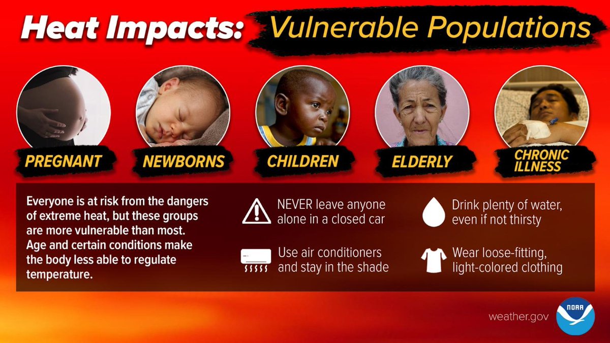
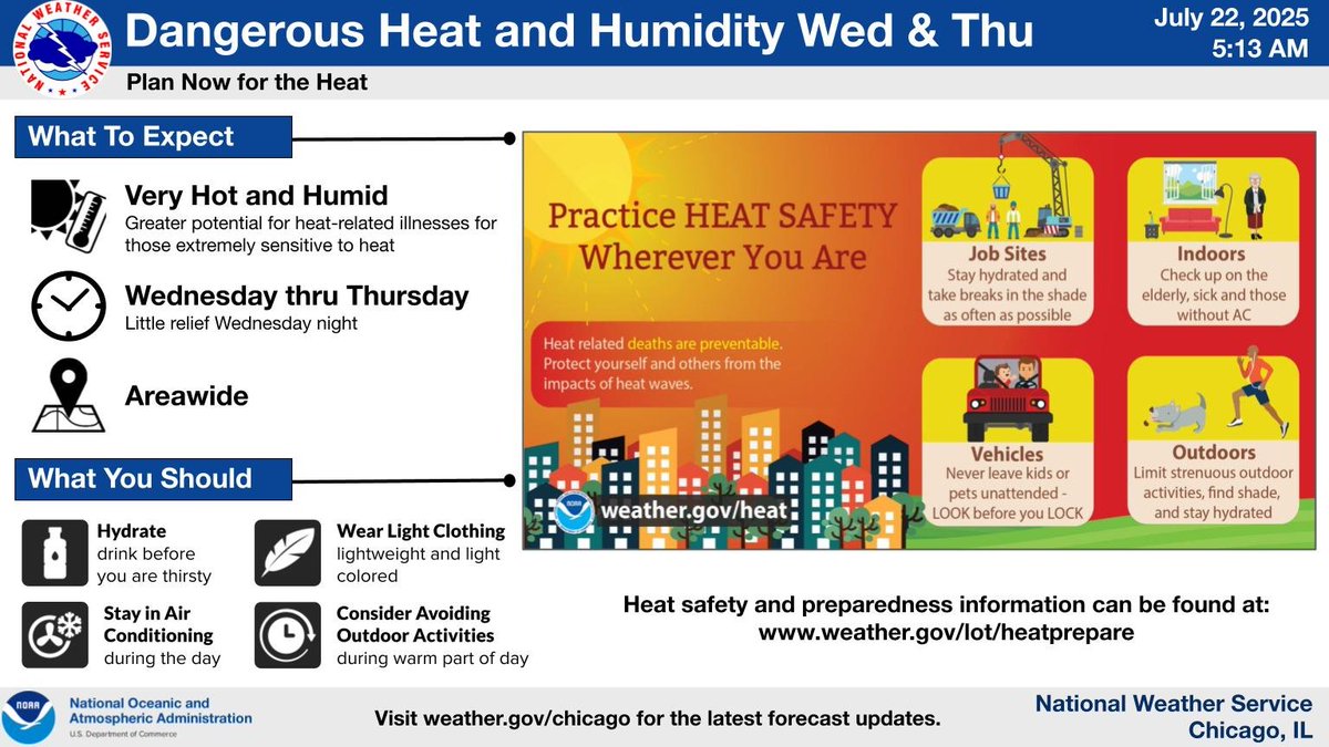
Everyone is at risk from the dangers of extreme heat, but these groups are more vulnerable than most. Ensure that your loved ones and neighbors are safe from the heat and remain Weather-Ready. weather.gov/safety/heat-du…
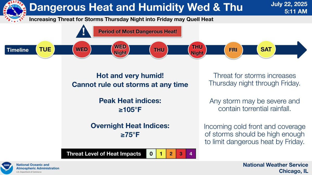
The worst of the heat will be on Wednesday and Thursday when heat index values will be above 100 degrees. Storms will roam through the area Thursday night and Friday, quelling the heat. #ILwx #INwx
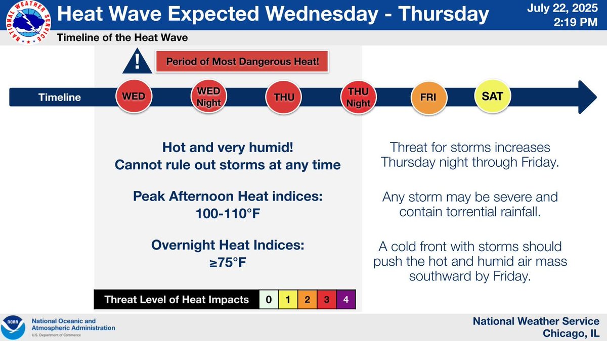
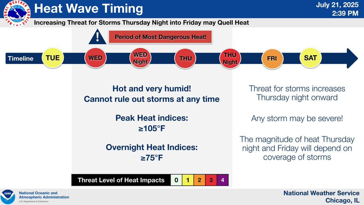
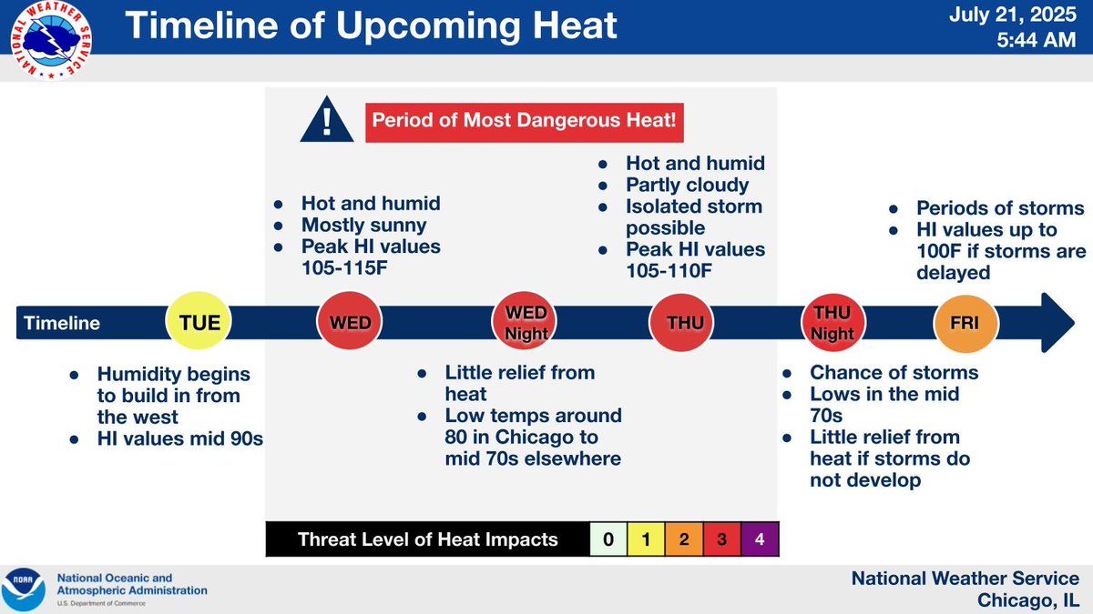
Here is an updated timeline for the upcoming heatwave. The worst conditions will be tomorrow and Thursday, including the overnight period. Chances for storms will increase Thursday afternoon into Friday, quelling the heat. #ILwx #INwx
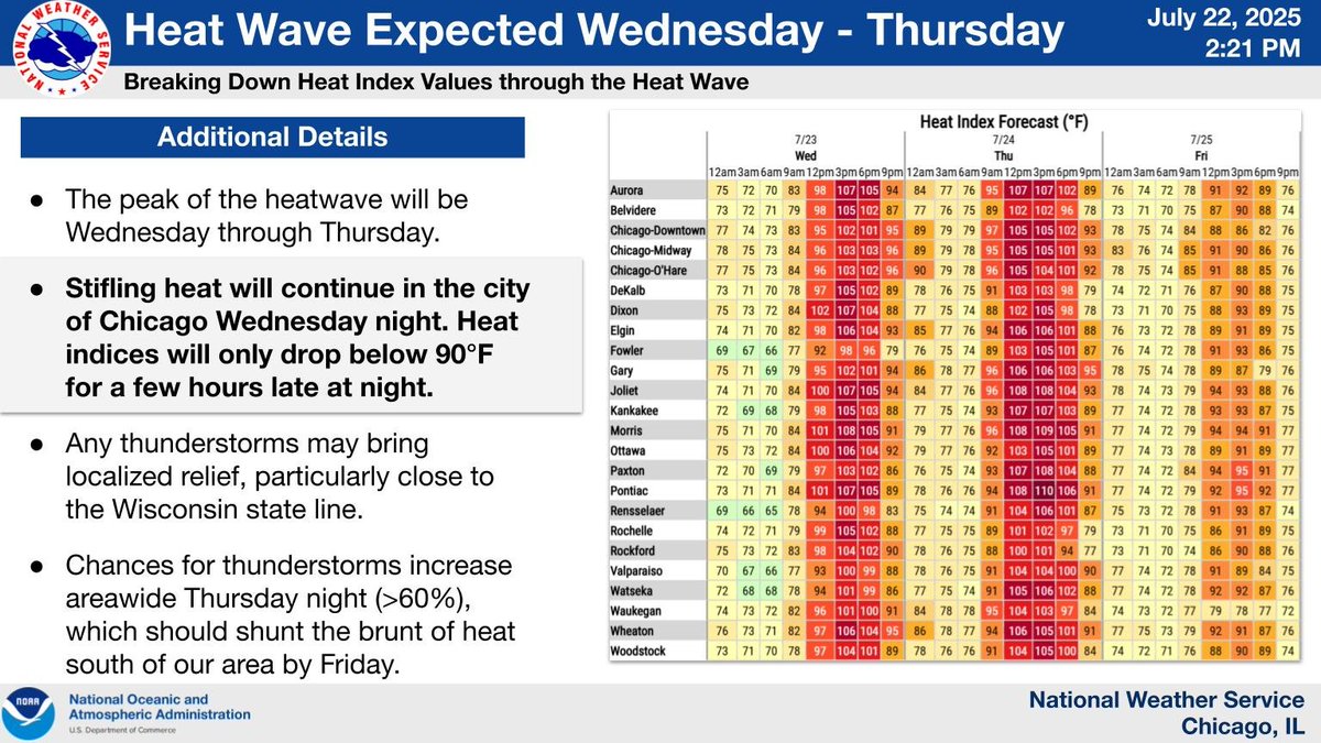
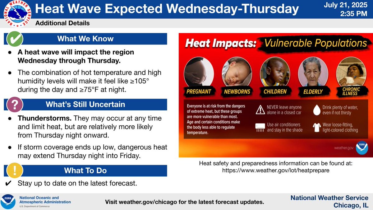
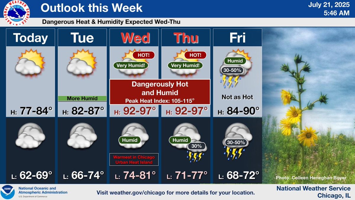
Here are additional details on the upcoming heat wave. The main impact will be stifling humidity levels, including during the overnight period. Heat index values will only drop below 90F for a few hours in the city of Chicago Wednesday night! #ILwx #INwx
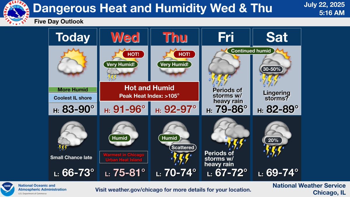
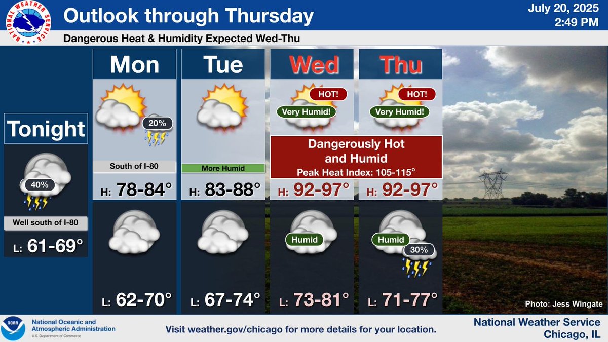
It will turn warmer and noticeably more humid today. However, more significant heat and humidity is expected for Wed and Thu, when heat indices may exceed 105. The pattern turns stormy later in the week, which should help bring some relief from the dangerous heat. #ILwx #INwx
Be prepared for the hot and humid weather expected Wednesday through Thursday. #ILwx #INwx
Here is a timeline of the upcoming heat wave. Chances for storms will incrementally increase Thursday night into Friday, likely quelling the heat. #ILwx #INwx
Assuming storms don't unexpectedly move through the area, Wednesday and Thursday will be very hot and humid. The heat may extend into Friday for parts of our area, depending on coverage of storms.
Here is a timeline of the upcoming heat wave. Chances for storms will incrementally increase Thursday night into Friday, likely quelling the heat. #ILwx #INwx
Drier and pleasant weather is expected today. However, dangerous heat and humidity will built into the area for Wednesday and Thursday. The chances for stormy weather then returns at the end of the week as a cold front approaches the region.
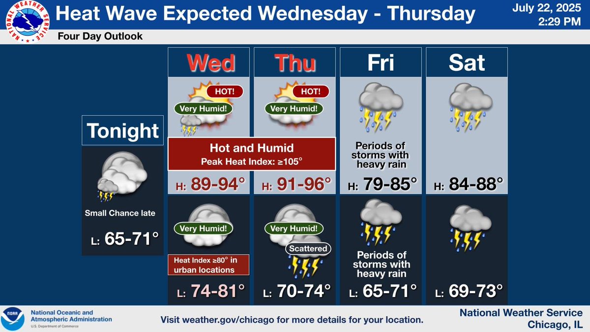
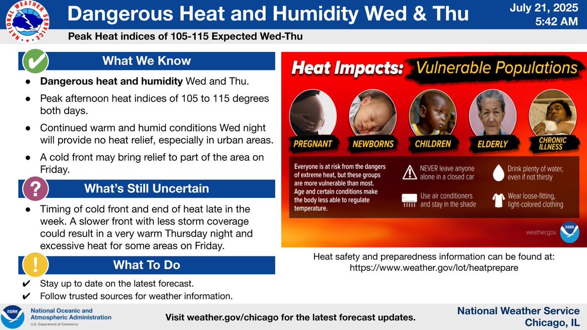
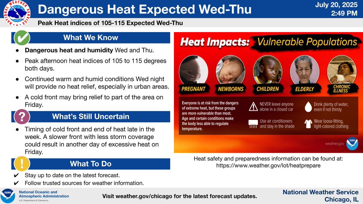
Dangerous heat index values of 105 to 115 degrees are expected Wednesday and Thursday. This stretch of heat will also include very warm conditions Wednesday night and possibly Thursday night. Stay up to date on the latest forecast.
Heat and humidity will begin to build from the west on Tuesday, with dangerous heat expected Wednesday through Thursday. While thunderstorms are expected to bring relief from the heat by late Friday, a slower arrival will mean continued heat into Friday.
[4:40 PM 7/20] Showers & a few storms will redevelop this PM, with the main threat area well south of I-80. Funnel clouds are possible with any showers south of the Illinois/Kankakee Rivers. If storms continue to intensify, the threat for a brief tornado or two can't be ruled out
![NWSChicago's tweet image. [4:40 PM 7/20] Showers & a few storms will redevelop this PM, with the main threat area well south of I-80. Funnel clouds are possible with any showers south of the Illinois/Kankakee Rivers. If storms continue to intensify, the threat for a brief tornado or two can't be ruled out](https://pbs.twimg.com/media/GwVOmJoXQAETV6D.jpg)
A few storms may linger this evening well south of I-80. Drier weather arrives for much of the area Mon, lingering through mid-week. Hot and humid conditions return, especially Wed/Thu, with the next chance for precipitation at the end of the week with a cold front.
Heat and humidity builds across the region by midweek. Peak heat indices of 105 to 115 degrees are expected Wed-Thu. There are some signs that some relief from the heat may come with a cold front Fri, but uncertainty remains with this. Stay up to date on the latest forecast.
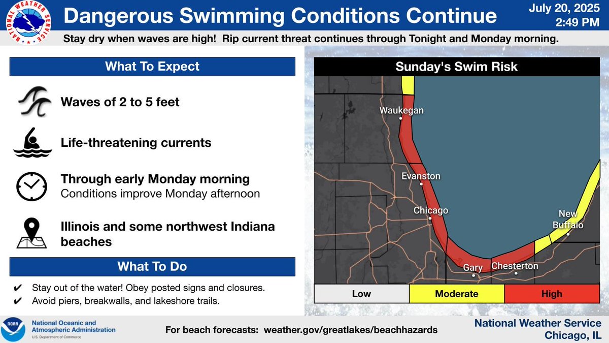
Dangerous swimming conditions will continue tonight into Monday morning at area beaches. Stay out of the water, and obey posted signs and closures. Conditions will improve Monday afternoon. #ILwx #INwx
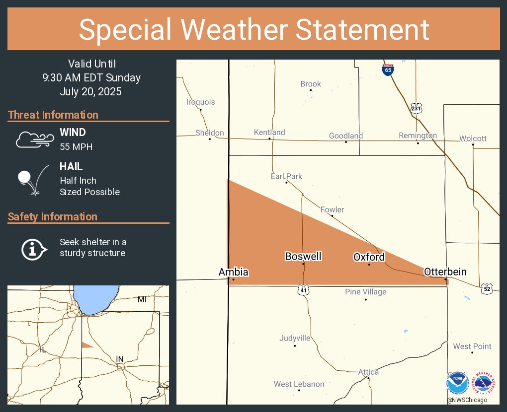
A special weather statement has been issued for Otterbein IN, Oxford IN and Boswell IN until 9:30 AM EDT
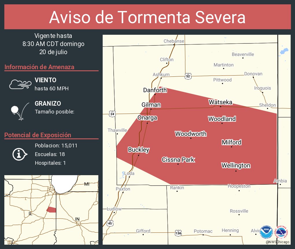
Aviso de Tormenta Severa incluye Watseka IL, Gilman IL, Onarga IL hasta las 8:30 AM CDT
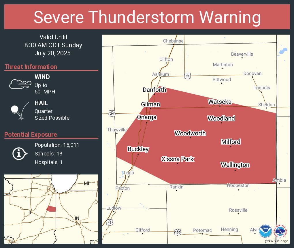
Severe Thunderstorm Warning including Watseka IL, Gilman IL and Onarga IL until 8:30 AM CDT
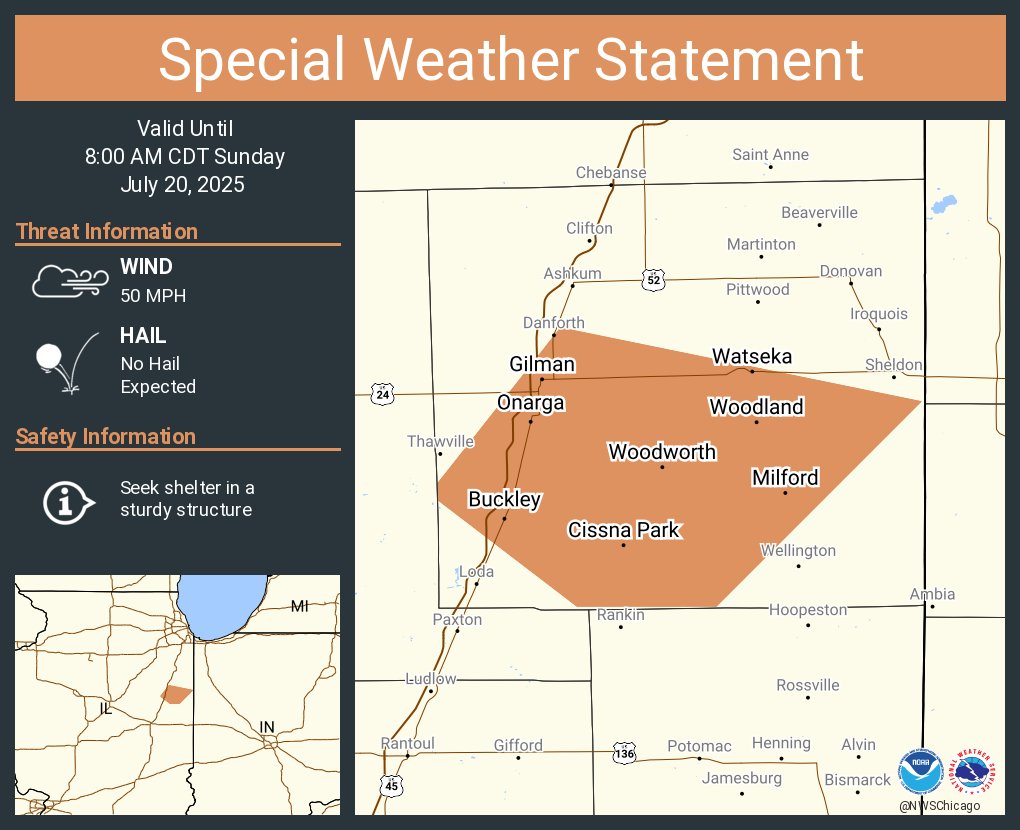
A special weather statement has been issued for Watseka IL, Gilman IL and Onarga IL until 8:00 AM CDT