NWS Paducah, KY
@NWSPaducah
Open 24/7/365, NWS Paducah issues vital forecast and warning information for 58 counties across west KY, southeast MO, southern IL, and southwest IN.
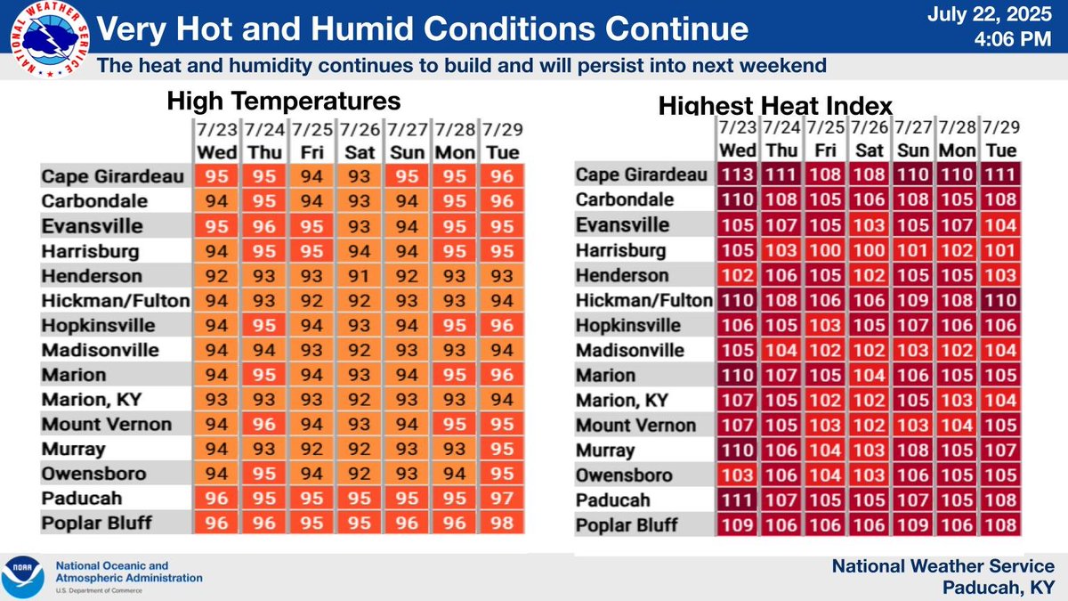
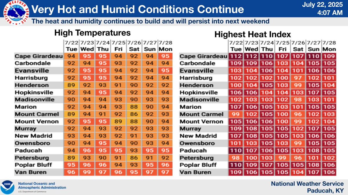
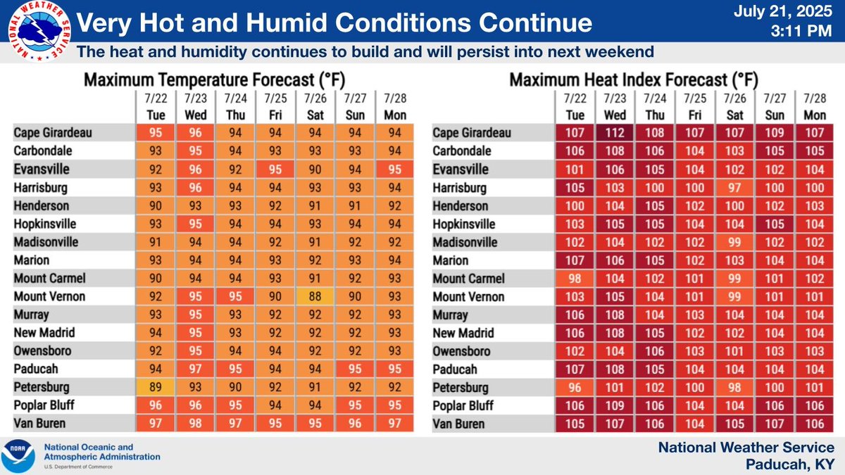
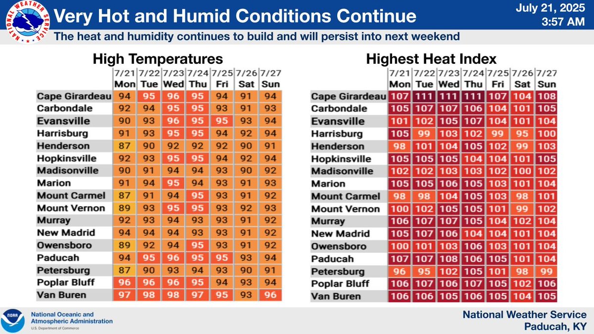
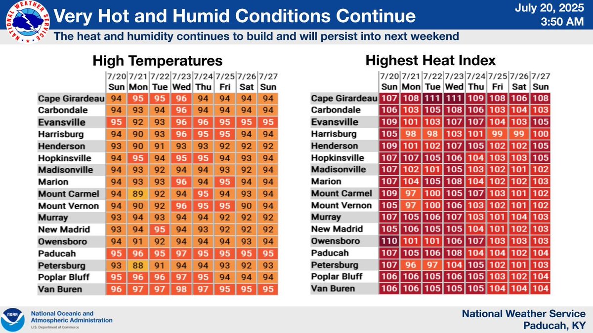
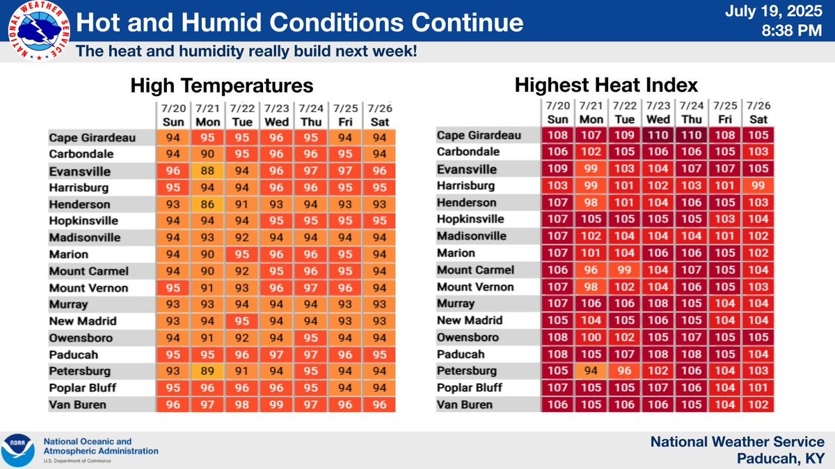
Here is a look at high temperatures and peak heat index readings over the next 7 days at select cities across our region.
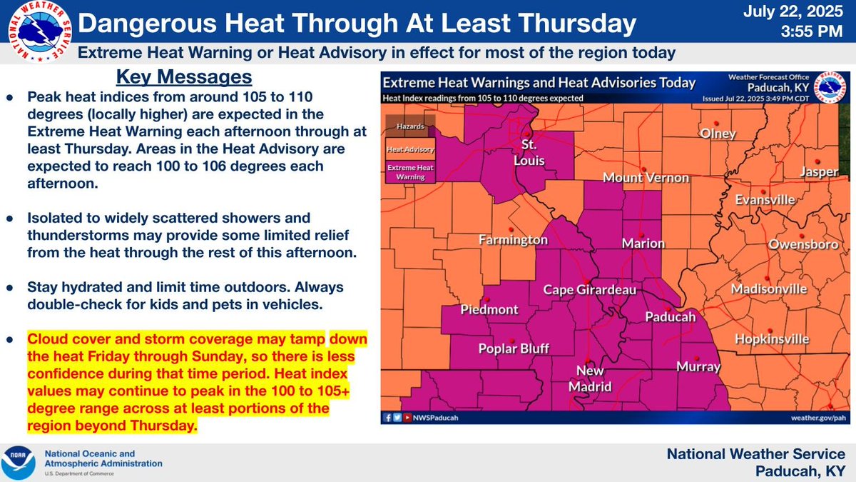
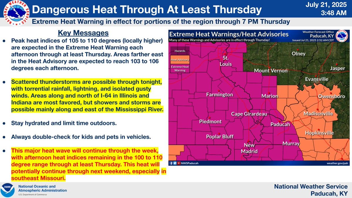
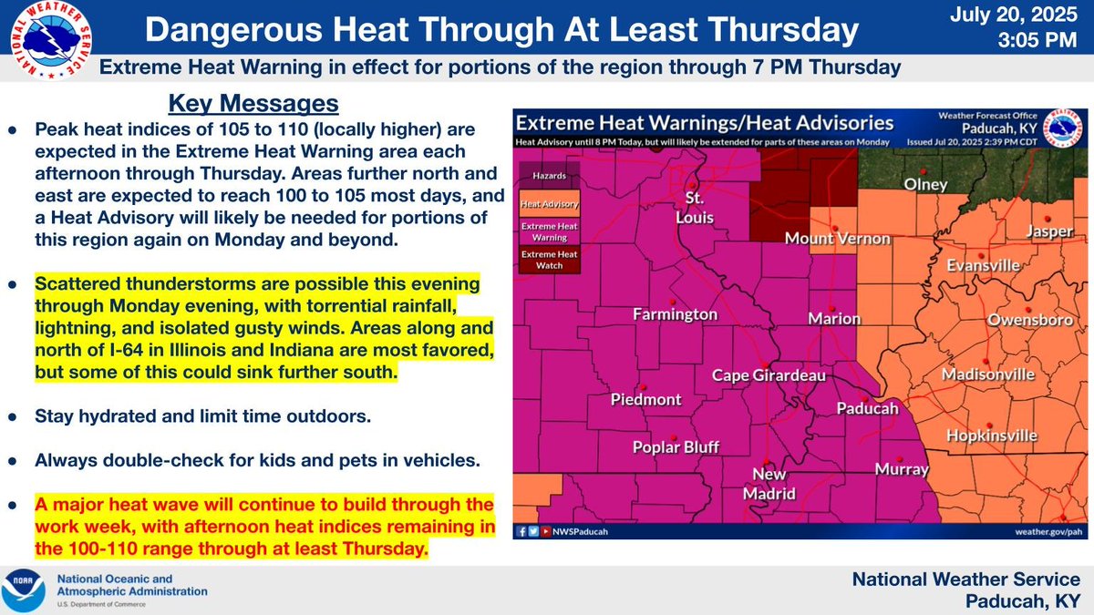
Dangerous heat and humidity will continue for the entire region this week.
Here is a look at high temperatures and peak heat index readings over the next 7 days at select cities across our region.
The entire region will continue to experience dangerous heat and humidity this week.
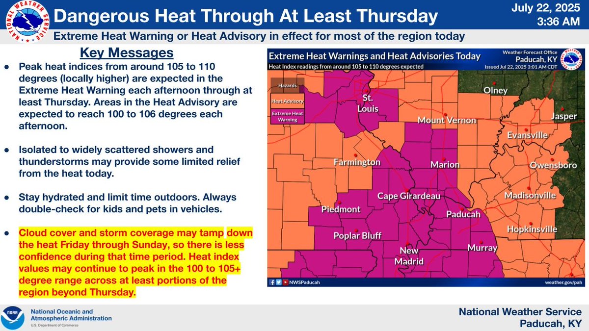
Dangerous heat and humidity will continue through the week. The heat will build back north and east across portions of the region that saw a brief respite from the heat today, and heat headlines will likely be needed for the entire region at some point this week.
Here is a look at high temperatures and peak heat index readings over the next 7 days at select cities across our region.
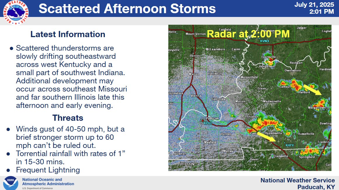
2 PM Update on Storms Today. A few strong storms are possible. Main threats are gusty winds, torrential rainfall, and frequent lightning.
Here is a look at high temperatures and peak heat index readings over the next 7 days at select cities across our region.
Our region will continue to experience very hot and humid conditions this week, with Extreme Heat Warnings and Heat Advisories in effect for most of our area.
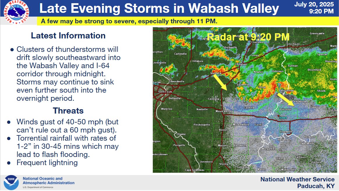
[10:09 PM CDT Sunday, 7/20] Update: The Severe Thunderstorm Watch has been canceled early. Thunderstorms are ongoing in the Wabash River Valley, but will remain below severe limits. Heavy rain and flash flooding will also be a threat overnight.
9:20 PM Update: The severe threat is decreasing with the storms, but a few strong to briefly severe storms may still be possible over the next couple of hrs. The main threat as we head towards midnight and into the overnight will likely morph into more of a flash flood threat.
7:50 PM Update: Latest on the severe storm threat across the Wabash Valley this evening.
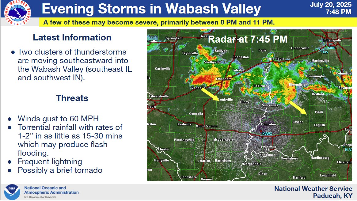
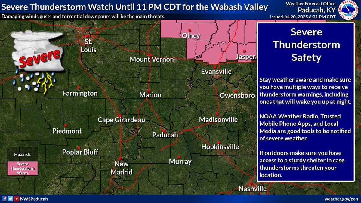
A Severe Thunderstorm Watch has been issued until 11 PM CDT for parts of the Lower Wabash Valley in southeast Illinois and southwest Indiana. Damaging wind gusts and flash flooding will be the main risks.
Here is a look at high temperatures and peak heat index readings over the next 7 days at select cities across our region.

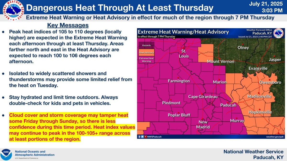
Dangerous heat and humidity will be the main story this coming wk. An Extreme Heat Warning is now in effect thru 7 PM Thurs for a good chunk of the region. We likely will need additional heat headlines further east Mon and beyond, but scattered storms complicate things a bit.
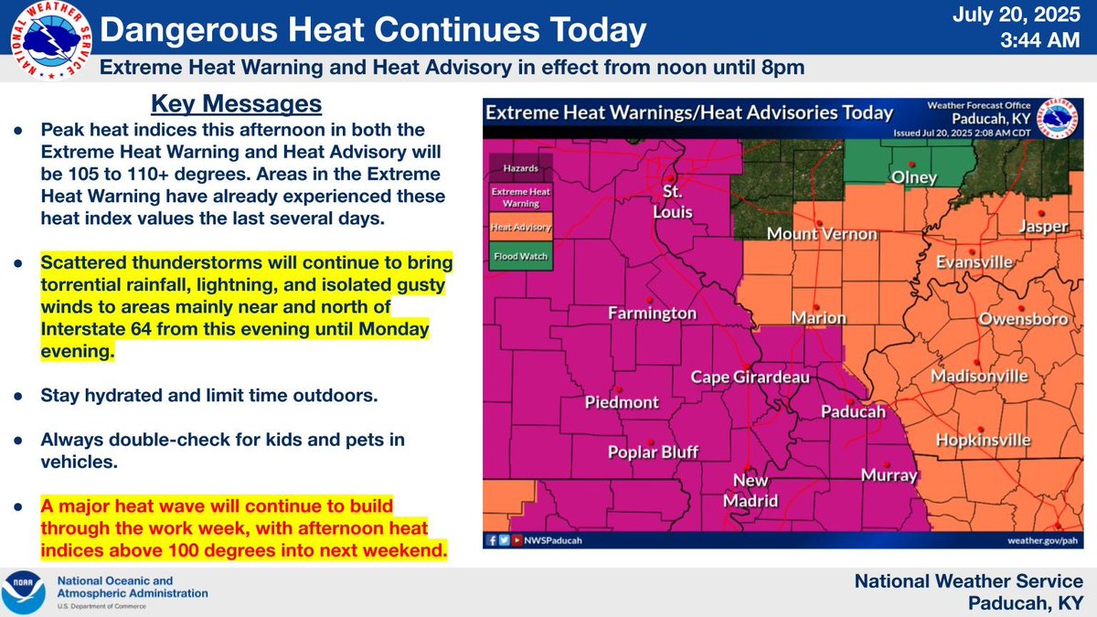
Heat and humidity will continue to be a concern today and through the week, with Extreme Heat Warnings and Heat Advisories in effect today.
Our region will continue to deal with very hot and humid conditions today and through the upcoming week.
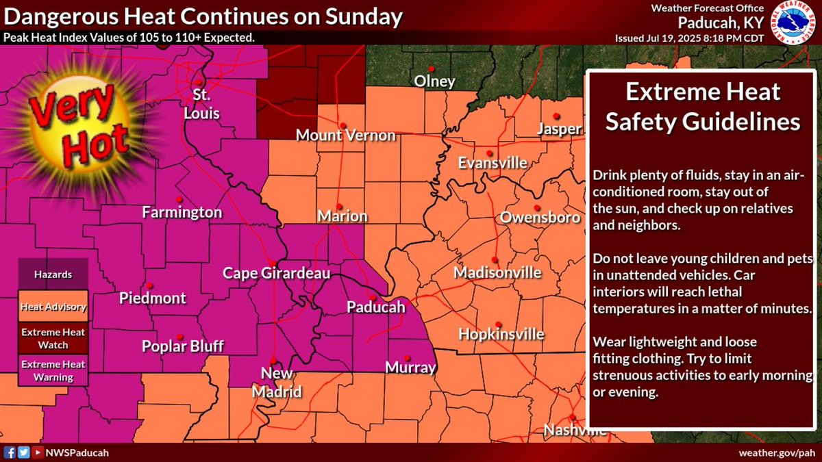
Dangerous heat and humidity will continue Sunday into next week. On Sunday expect peak heat index values of 105 to 110 degrees. \n\nDrink plenty of fluids, stay in an air-conditioned room, stay out of the sun, and check up on relatives and neighbors.
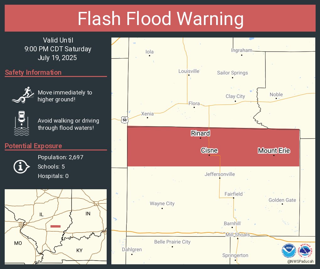
Flash Flood Warning continues for Cisne IL, Mount Erie IL and Johnsonville IL until 9:00 PM CDT
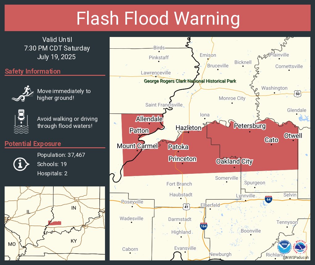
Flash Flood Warning continues for Princeton IN, Mount Carmel IL and Oakland City IN until 7:30 PM CDT