NWS Lincoln IL
@NWSLincolnIL
Official X account for the National Weather Service Lincoln, IL. Details: http://weather.gov/nws_x
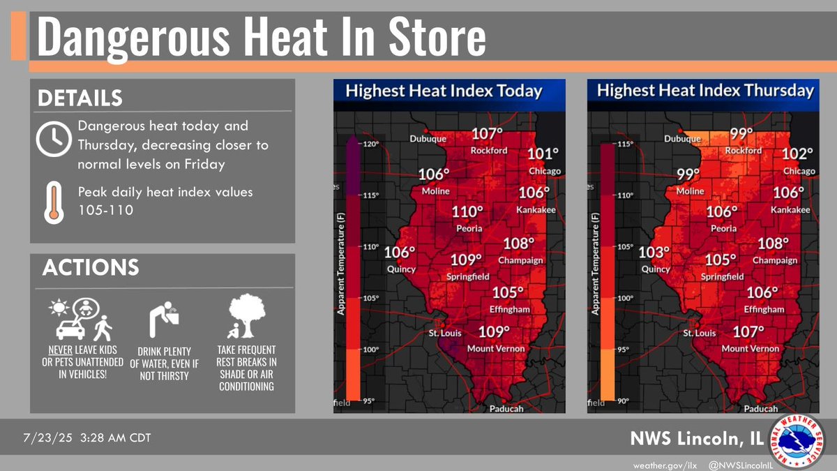
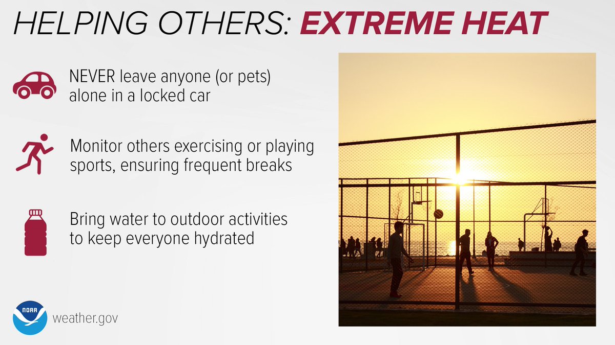
Dangerous heat in store through Thursday in central IL, taking a slight break on Friday. Expect heat index values 105 to 110 each afternoon through Thursday. Never leave kids or pets unattended in vehicles, drink plenty of water, and take frequent breaks from the heat. #ilwx
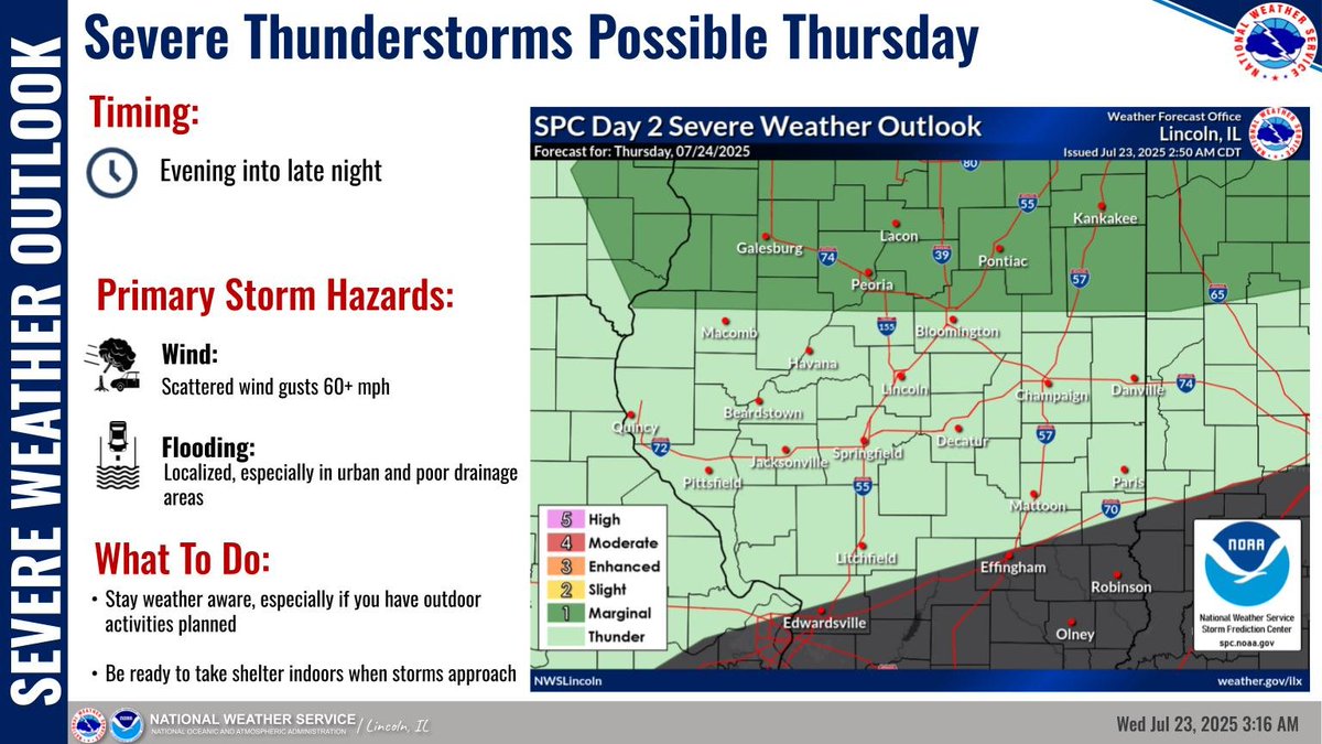
Severe thunderstorms possible Thursday evening in northern portions of central IL, possibly continuing late into the night. Primary storm hazards are scattered wind gusts 60 mph or more and localized flooding, especially in urban and poor drainage areas. #ilwx
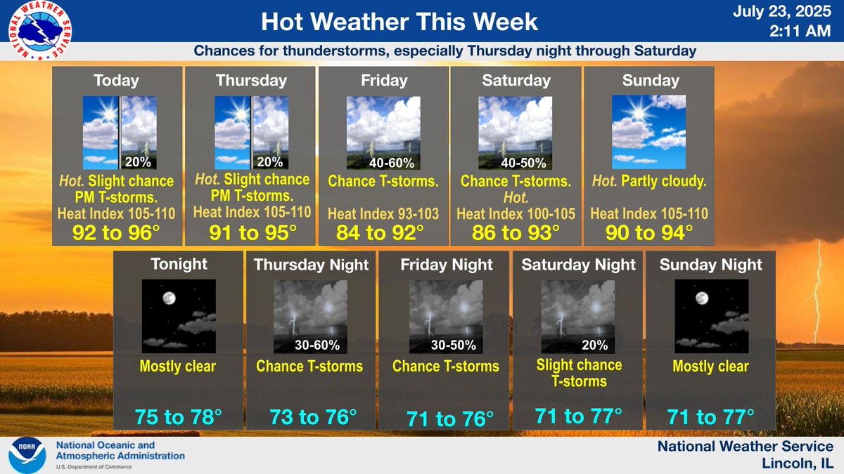
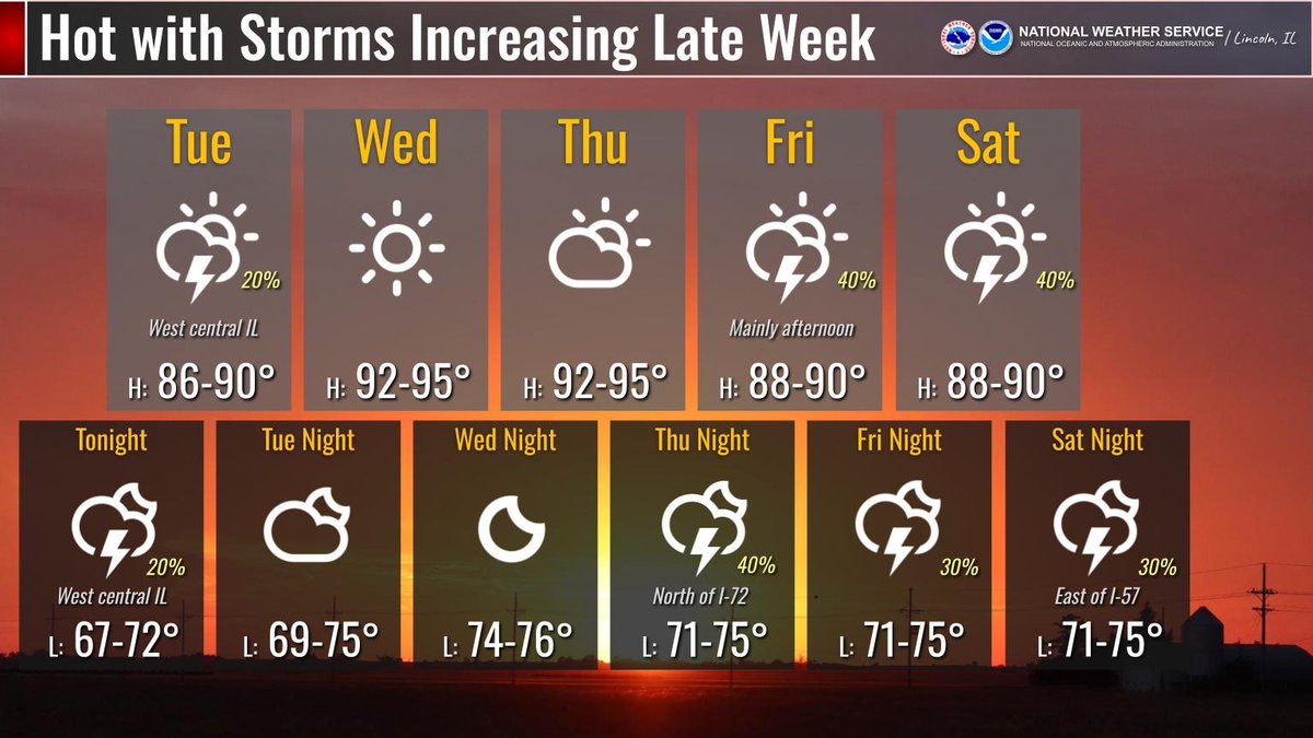
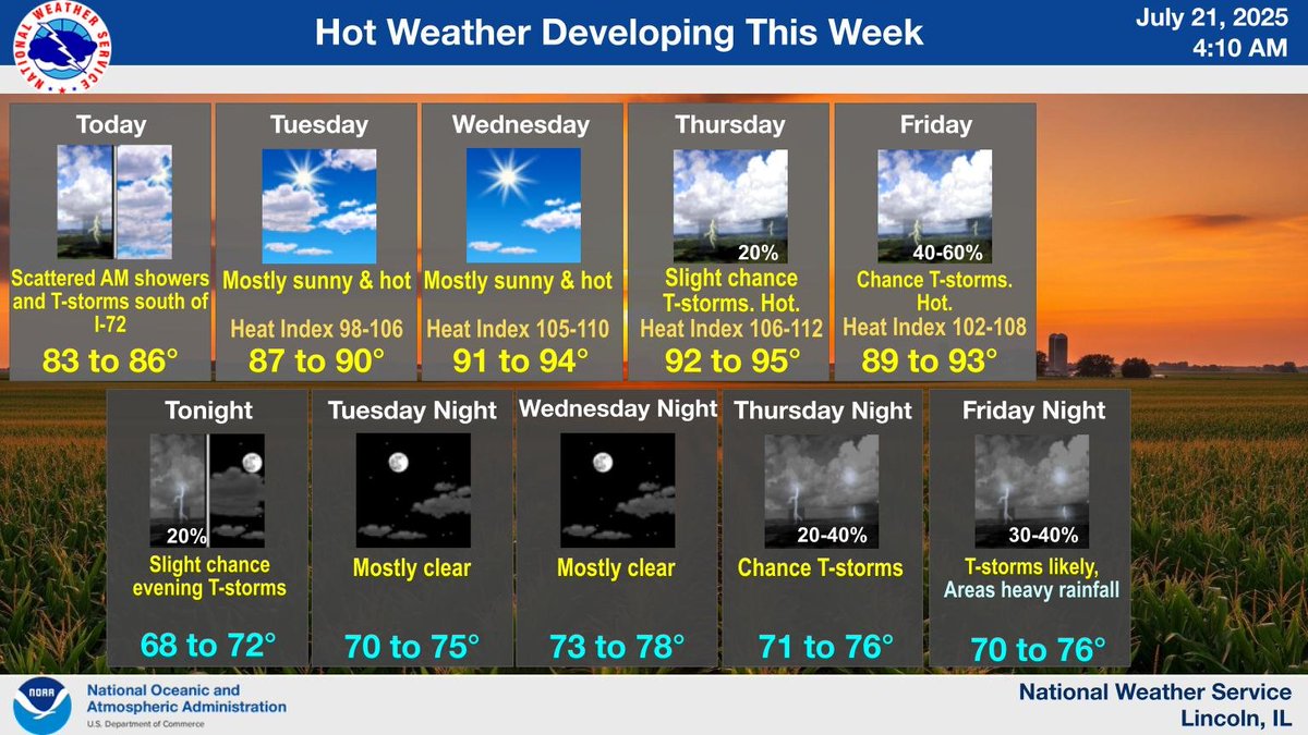
Hot weather this week in central IL, with highs rising into the 90s today and Thursday, along with heat index peaking around 105 to 110. High temperatures take a slight break on Friday with scattered thunderstorms, then heat ramps up again over the weekend. #ilwx
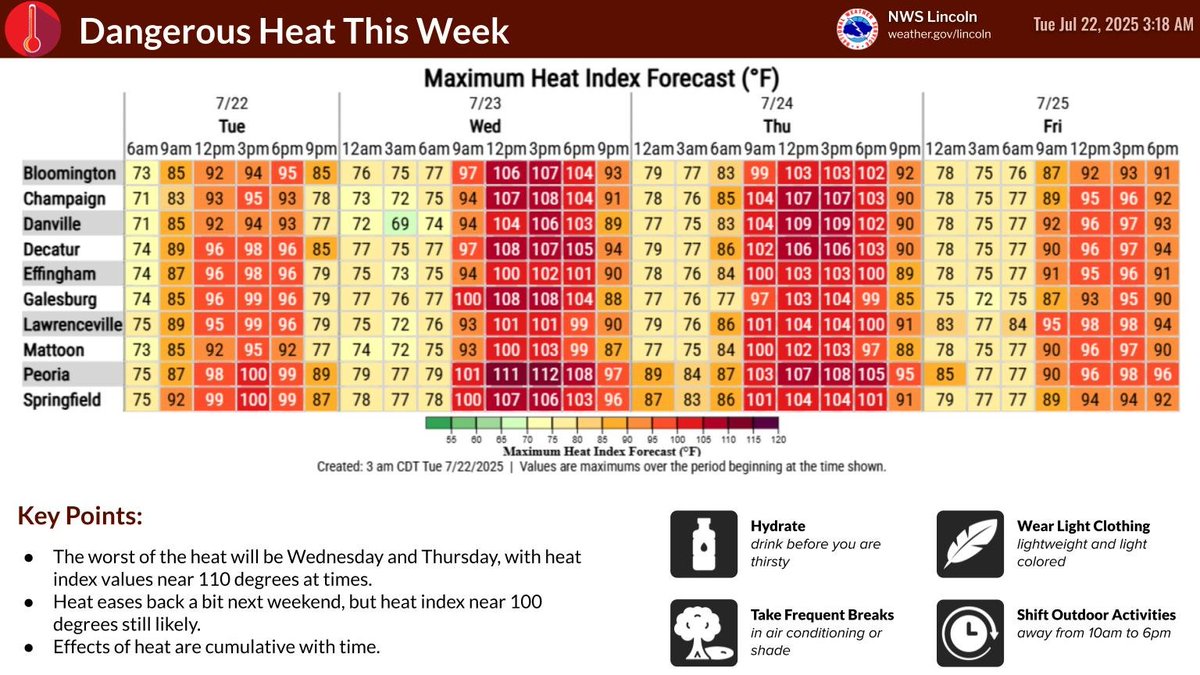
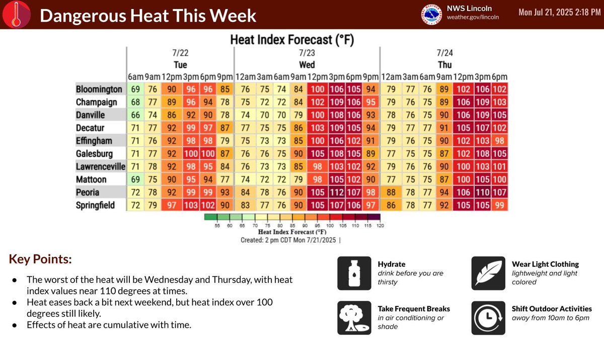
Heat is the NUMBER ONE cause of weather-related fatalities in the U.S. Both Wednesday and Thursday will feature heat index readings from 105 to 115 degrees. Please take the heat seriously and use extra caution over the next couple of days. #ilwx
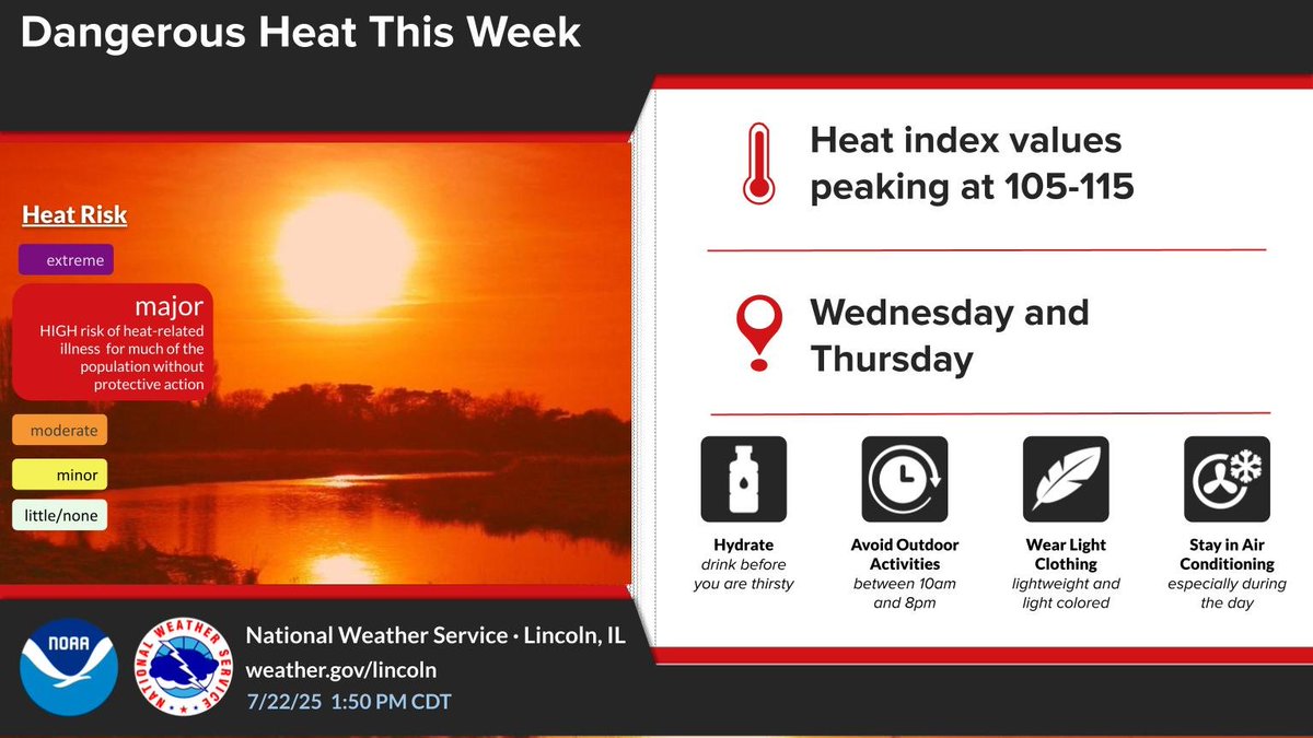
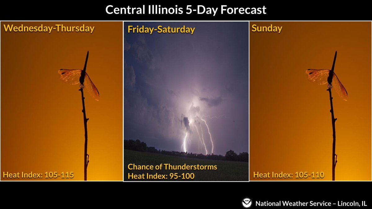
Hot and humid weather will prevail for the next several days. The highest heat index readings of 105-115 will occur Wednesday and Thursday, followed by a chance of thunderstorms by Friday and Saturday. #ilwx
Dangerous heat will develop for the middle of this week, with heat index peaking near 110 degrees at times Wednesday and Thursday. A Heat Advisory is in effect for today west of I-55, and an Excessive Heat Watch is in effect for Wednesday and Thursday for all of central IL. #ilwx
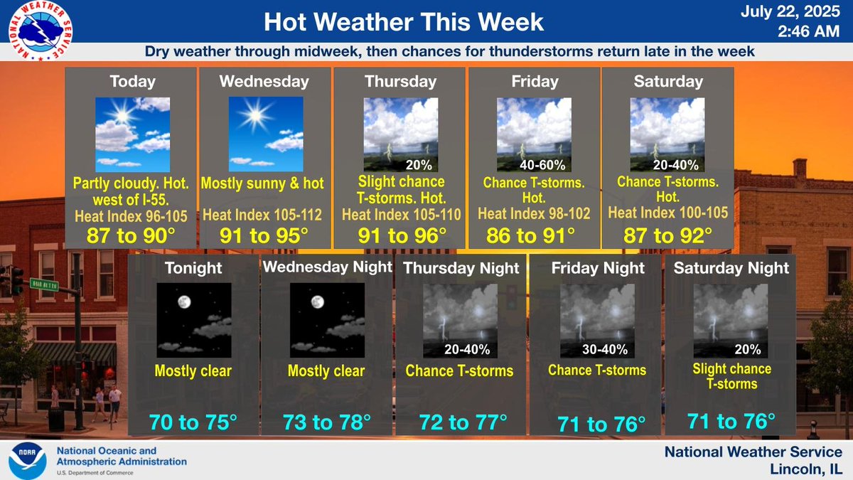
Hot weather is expected this week in central IL, with highs rising into the 90s Wednesday and Thursday, along with heat index peaking around 105 to 110. Areas west of I-55 will see the hottest weather today, with heat index 100 to 105. Dry through midweek. #ilwx
Dangerous heat is expected across central Illinois through the end of the week. Afternoon heat indices will peak well above 100 degrees each day. Follow these tips to stay safe during the heat wave! #ILwx
We're still on track for widespread heat index values of 105-110 degrees on Wednesday and Thursday, easing back just slightly during the upcoming weekend. A significant pattern change doesn't look likely until the middle of next week. #ILwx
While a few thunderstorms can't be ruled out in west central Illinois tonight and Tuesday, the main threat for any rain will be late week. In the meantime, temperatures will continue to trend upward, hottest on Wednesday and Thursday with widespread highs in the 90s. #ILwx
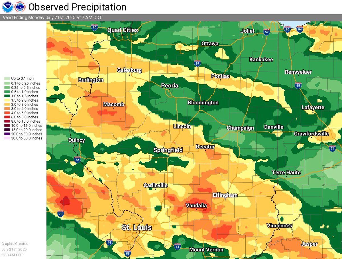
Here's a look at how much rain has fallen over the last 3 days. While there was an area from Peoria southeast through Champaign that had lesser amounts, totals over an inch were common. Select areas saw 4-6" or more from Macomb to west of Effingham. #ILwx
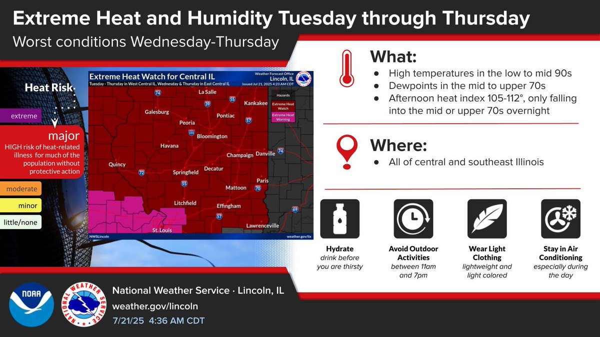
Heat index values will rise to around 105 to 112 daily midweek, and only fall to the mid to upper 70s overnight. An Extreme Heat Watch is in effect in West Central IL Tuesday through Thursday, and in East Central IL Wednesday through Thursday. #ilwx
Hot weather will develop this week in central IL, with highs rising into the 90s most areas Wednesday through Friday. Heat index will peak around 105 to 110 daily Wednesday through Friday. Dry weather can be expected most of the week. #ilwx
Aviso de Inundación Repentina incluye Effingham IL, Altamont IL, Teutopolis IL hasta las 4:00 AM CDT

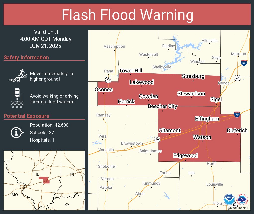
Flash Flood Warning including Effingham IL, Altamont IL and Teutopolis IL until 4:00 AM CDT
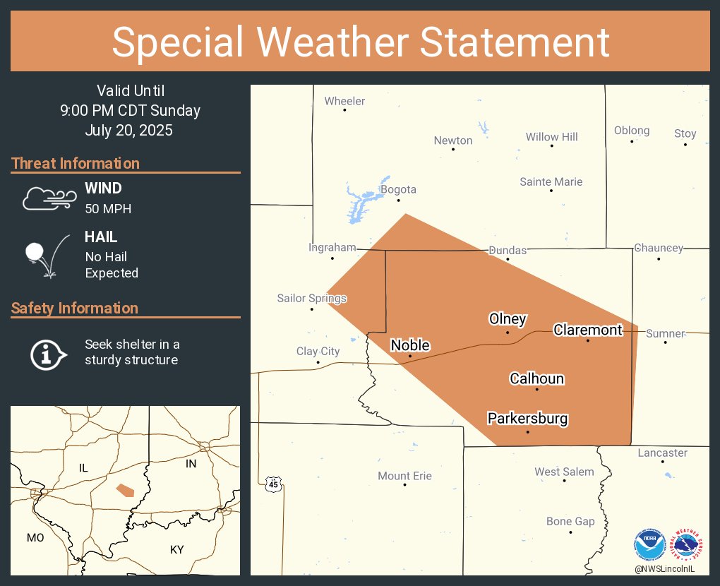
A special weather statement has been issued for Olney IL, Noble IL and Parkersburg IL until 9:00 PM CDT
Aviso de Tormenta Severa incluye Lawrenceville IL, Flat Rock IL, Russellville IL hasta las 7:30 PM CDT
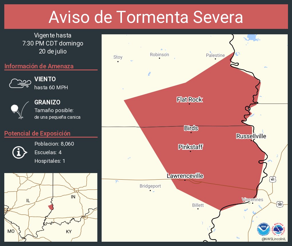
Severe Thunderstorm Warning including Lawrenceville IL, Flat Rock IL and Russellville IL until 7:30 PM CDT

Aviso de Tormenta Severa continúa Robinson IL, Newton IL, Oblong IL hasta las 7:15 PM CDT
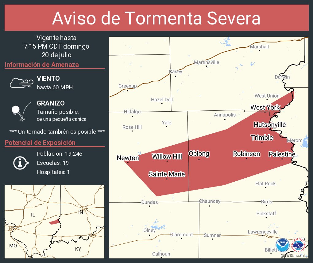
Severe Thunderstorm Warning continues for Robinson IL, Newton IL and Oblong IL until 7:15 PM CDT
