NWS Tampa Bay
@NWSTampaBay
Official Twitter account for the National Weather Service Tampa Bay Area, FL. Details: http://weather.gov/twitter
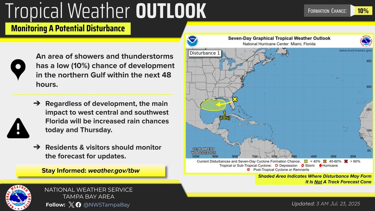
There is a low chance (10%) of tropical development over the northern Gulf during the next 48 hours. Regardless of development, increased rain chances are expected today and Thursday across west central and southwest Florida.
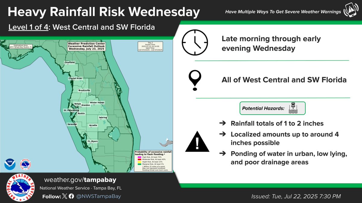
Another day of localized heavy rainfall expected tomorrow from scattered to numerous thunderstorms #FLwx
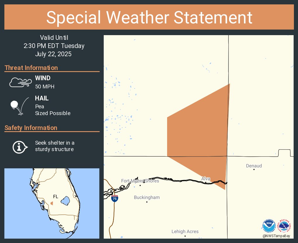
A special weather statement has been issued for Charlotte County, FL until 2:30 PM EDT
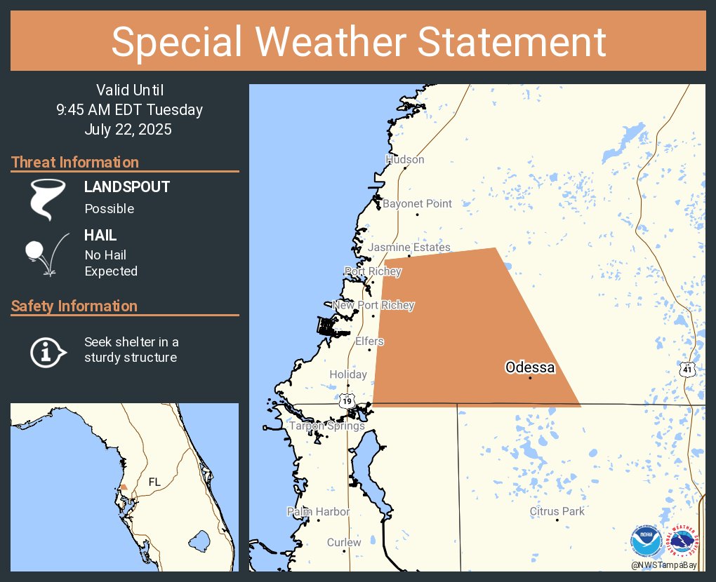
A special weather statement has been issued for Odessa FL until 9:45 AM EDT
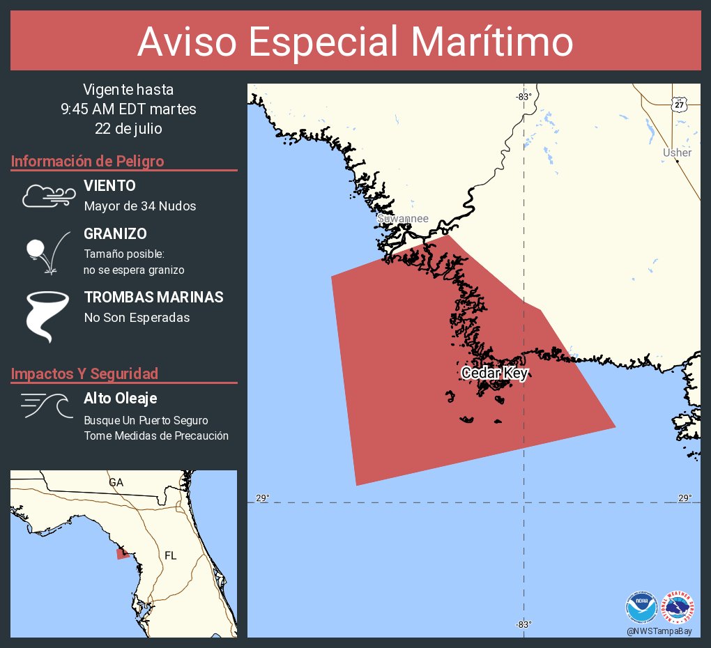
Aviso Especial Marítimo incluye Aguas costeras desde Tarpon Springs a Río Suwannee FL hacia afuera 20 MN hasta las 9:45 AM EDT
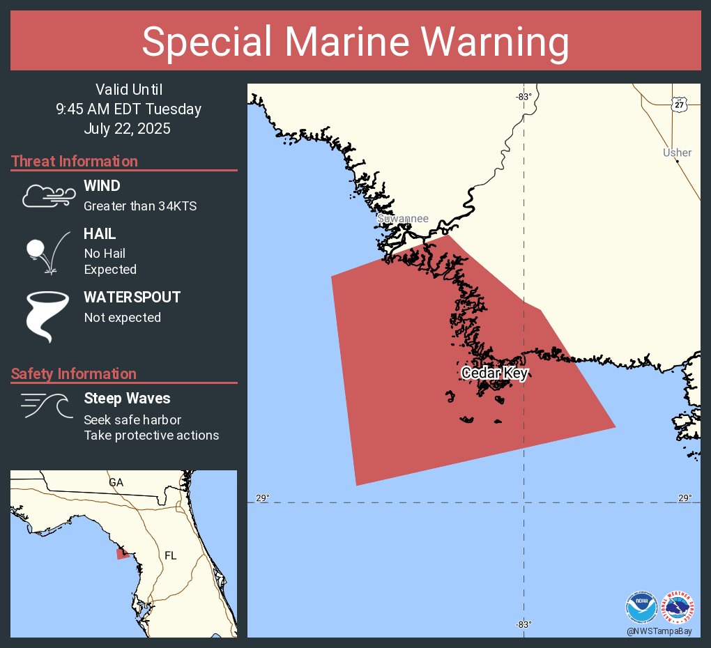
Special Marine Warning including the Coastal waters from Tarpon Springs to Suwannee River FL out 20 NM until 9:45 AM EDT
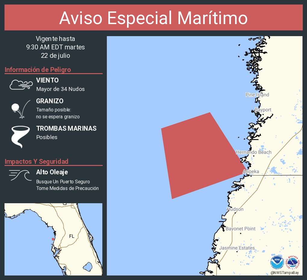
Aviso Especial Marítimo incluye Aguas costeras desde Tarpon Springs a Río Suwannee FL hacia afuera 20 MN hasta las 9:30 AM EDT
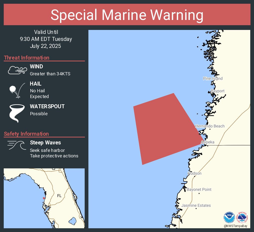
Special Marine Warning including the Coastal waters from Tarpon Springs to Suwannee River FL out 20 NM until 9:30 AM EDT
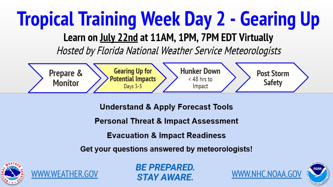
📢 Today (July 22) 👇 🌀 FL Tropical Training Week Day 2 Learn from #FLwx NWS meteorologists about -Forecast Tools -Personal Threats -Evacuation & Impact Readiness Q&A session also! Register & learn more: weather.gov/jax/FloridaTro… ⏰ 3 sessions - 11AM, 1PM, 7PM EDT ⏰
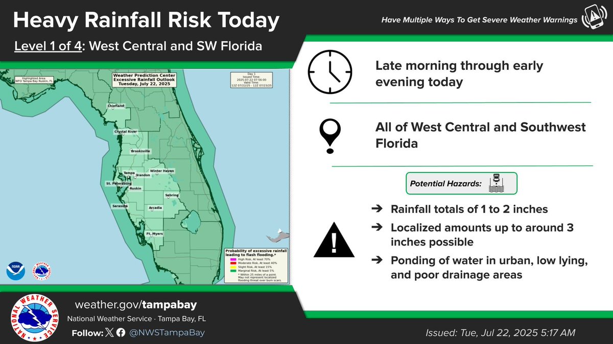
Deeper moisture filling into the area today and Wednesday will allow for some heavy rainfall, resulting in a marginal risk of excessive rainfall leading to flash flooding.
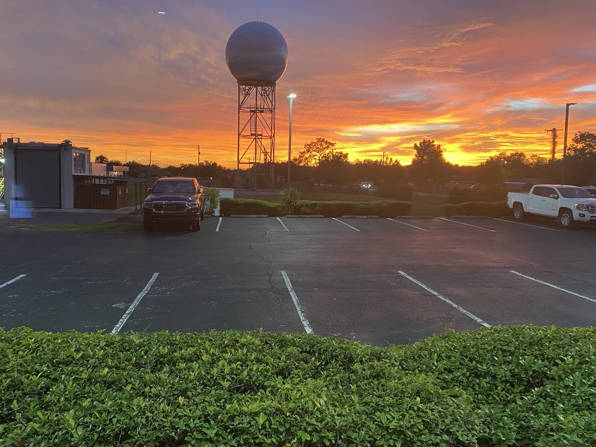
A great view of the sunset from our office this evening! What was your view? 😍🌅 #FLwx
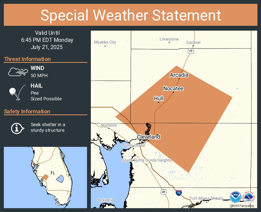
A special weather statement has been issued for Arcadia FL, Nocatee FL and Cleveland FL until 6:45 PM EDT
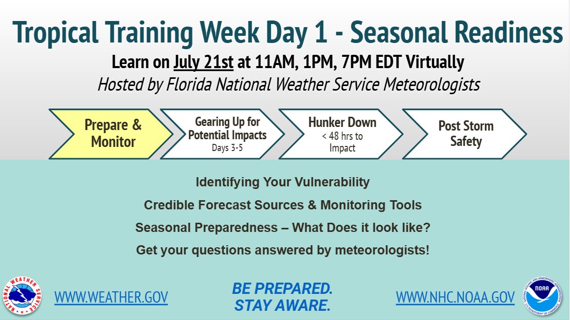
📢 Today (July 21) 👇 🌀 FL Tropical Training Week Day 1 Learn from #FLwx NWS meteorologists about -seasonal readiness -personal vulnerability -credible forecast sources Q&A session! Register & learn more: weather.gov/jax/FloridaTro… ⏰ 3 sessions - 11AM, 1PM, 7PM EDT ⏰
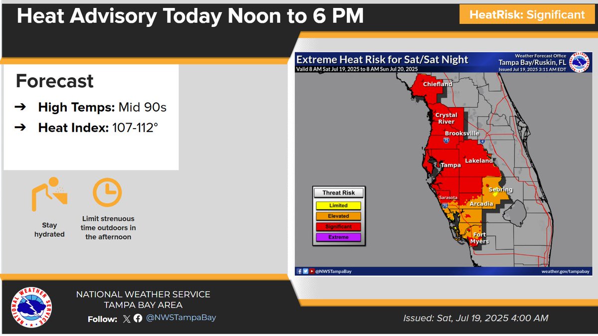
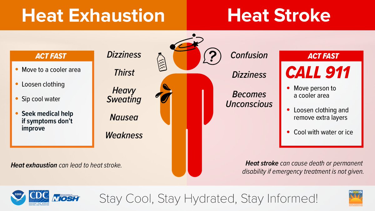
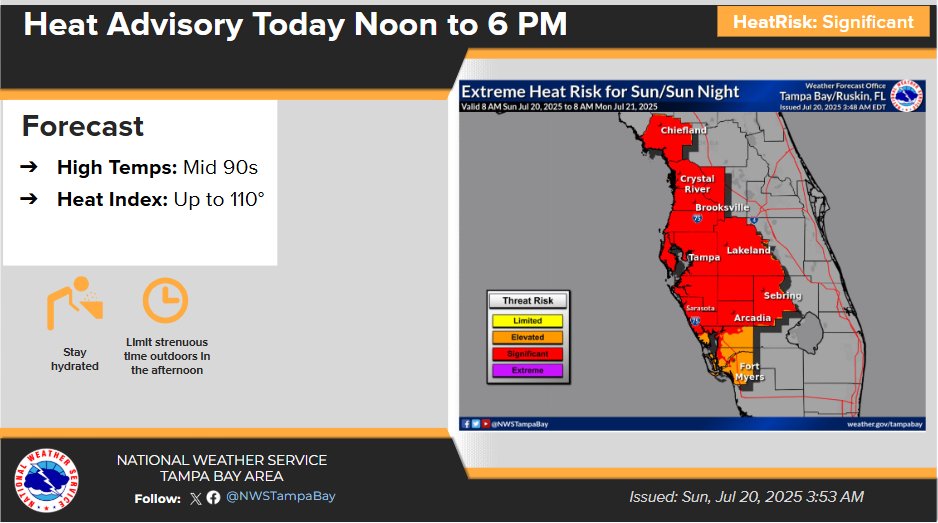
A Heat Advisory is in effect for all of west central and southwest Florida from noon to 6 PM today. Learn the symptoms of Extreme Heat exposure and the appropriate responses: weather.gov/safety/heat-il…
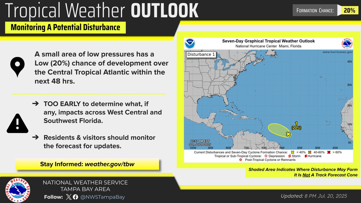
An area of low pressures has a low (20%) chance of development over the Central Tropical Atlantic within the next 48 hrs. TOO EARLY to determine what impacts, if any, are possible for West Central & #SWFL! Please continue to monitor the forecast for updates! #FLwx
A Heat Advisory is in effect from noon to 6 PM. Partly cloudy and hot with isolated to scattered afternoon showers and thunderstorms. Highs in the lower to mid 90s. Heat indices of 106 to 110.
The very little activity that we had today mostly north of Tampa Bay is slowly dissipating. 🌘 Overnight lows will be warm staying in the mid to upper 70s. ☀️ On Sunday, another very warm day so plan ahead of any outdoor activities! #FLwx
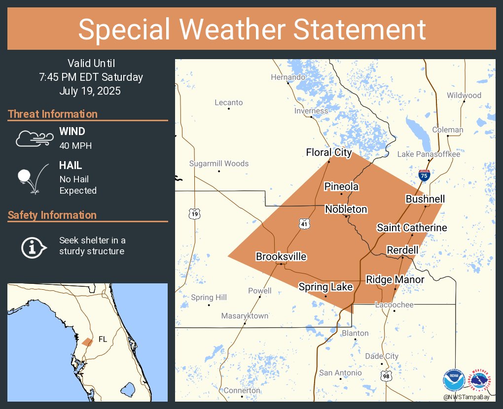
A special weather statement has been issued for Brooksville FL, Floral City FL and Ridge Manor FL until 7:45 PM EDT
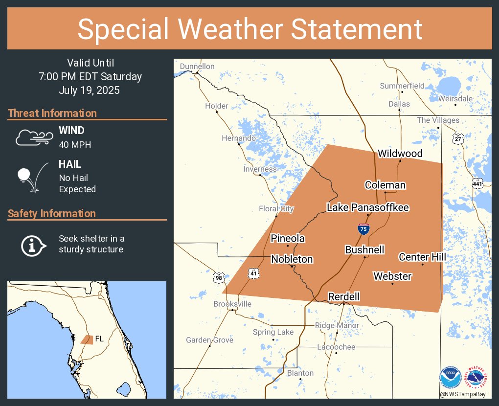
A special weather statement has been issued for Wildwood FL, Lake Panasoffkee FL and Bushnell FL until 7:00 PM EDT
Mostly sunny and hot. Slight chance of an afternoon shower or thunderstorm. Highs in the mid 90s. Heat indices of 107 to 112 this afternoon.