Anthony Baglione WX
@wx_anthony
Meteorologist | Iowa State ‘20 | @wish_tv intern | Columbus, OH ▶️ Ames, IA ▶️ New Bern ▶️ Raleigh, NC |
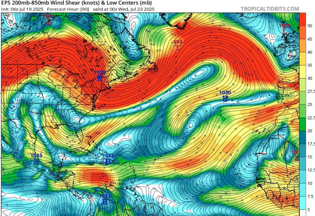
Not worried about the first wave out there now, but, in a few days, another wave off of #Africa could have some attempt at developing. Still will have some hostility in the form of dry air/shear. Big model spread but consistent theme of showing something #tropics #weather

#Tampa had never hit 100 before today! Wow this #heat is no joke! #flwx #weather #summer
Tampa broke the all time high record reaching 100° today!! #FLwx
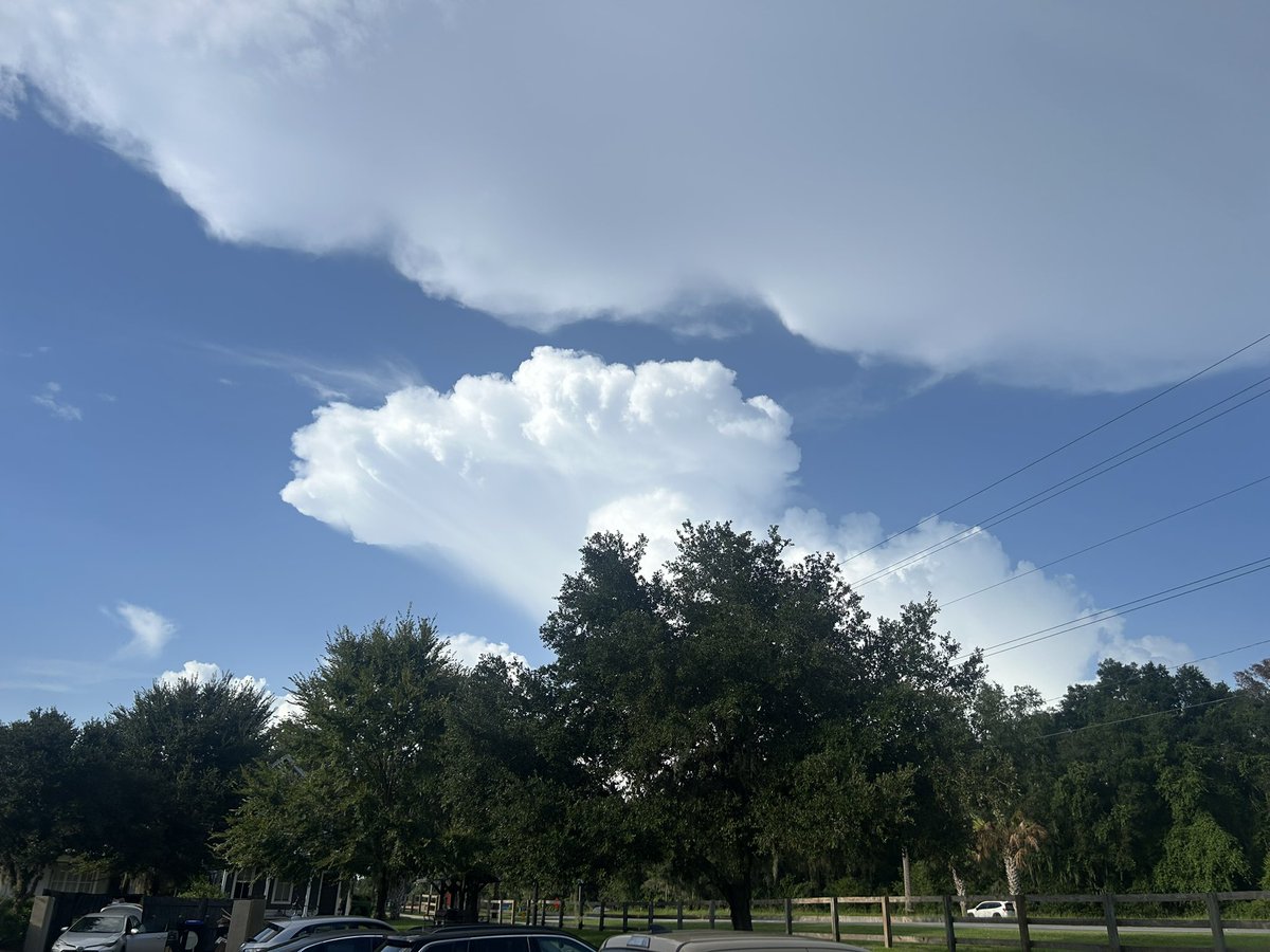
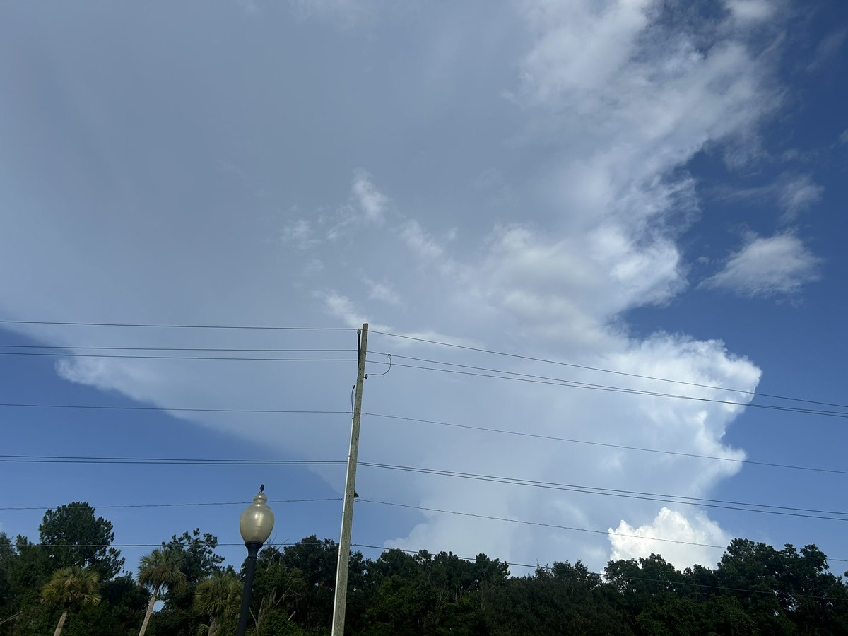
Some picturesque #FL storms this afternoon. Beautiful billowing clouds! #flwx #weather #florida
Tropics starting to brew a bit! Likely starting August with some waves to watch. Just a monitor situation right now! #tropics #weather #flwx #hurricaneseason
A LONG way to go in the season. Don’t let your guard down #hurricaneseason #tropics #weather #Atlantic
On average, 86% of all named tropical systems in the Atlantic occur after August 2, and the first hurricane doesn't form until August 11. We have a long season to go. Prepare now, and learn more about how at weather.gov/safety/hurrica…
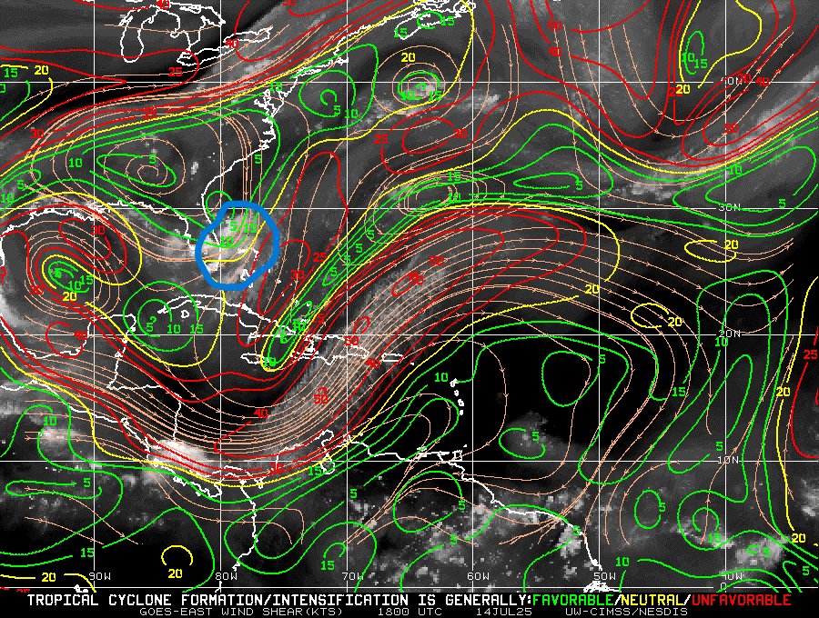
Some nice convection blowing up on wave coming off of #Africa. Decent model support for some slight development in the short-term. After that- same common story with dry air and some upper hostility. Will watch just in case #tropics #weather #Caribbean #HurricaneSeason
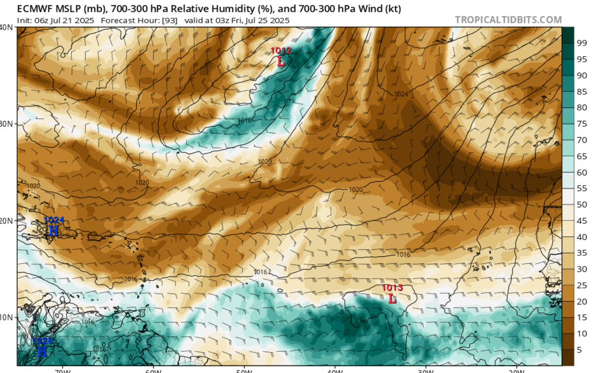
Still watching this #tropical wave in the #Atlantic. May see quick system try and develop before the islands. After that, not looking like it'll survive with increasing hostile conditions. Don't see this as a US threat as it stands now #tropics #weather #flwx #HurricaneSeason
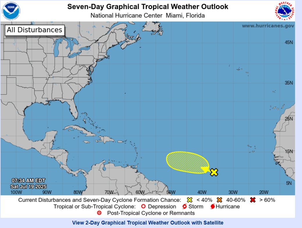
New area marked in the #Atlantic. Will have to watch for potential development #tropics #HurricaneSeason #flwx #Caribbean
Up to 40% now for #93L. Development potential is certainly there #tropics #weather #flwx #lawx #mswx #alwx #gawx
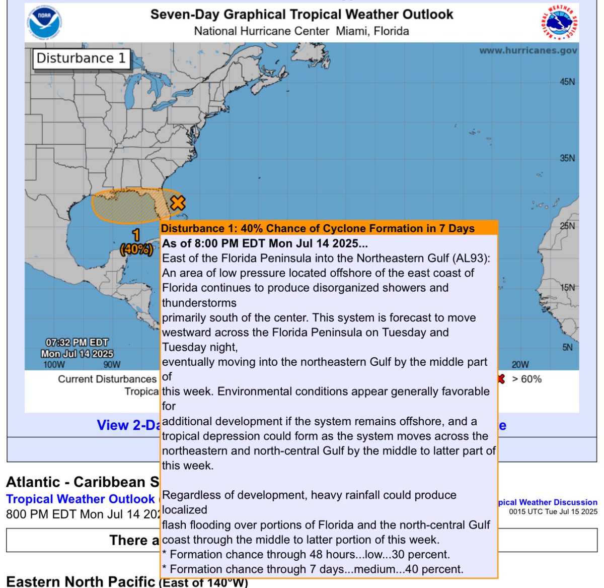
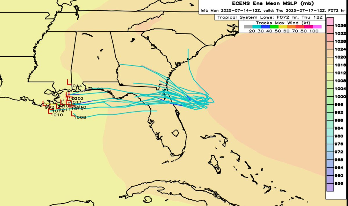
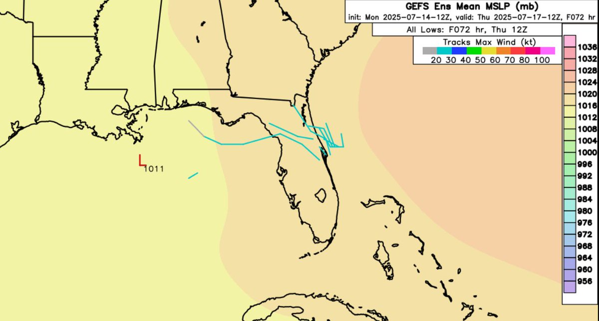
#93L slinging lots of showers and storms across #FL. Some light shear from the north pushing convection a bit south of circulation. Models still all over the place with GFS saying poof and Euro locked onto low pressure area. Will watch and see! #tropics #weather #panhandle #flwx
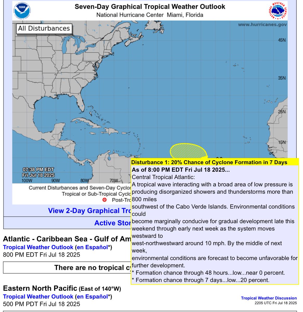
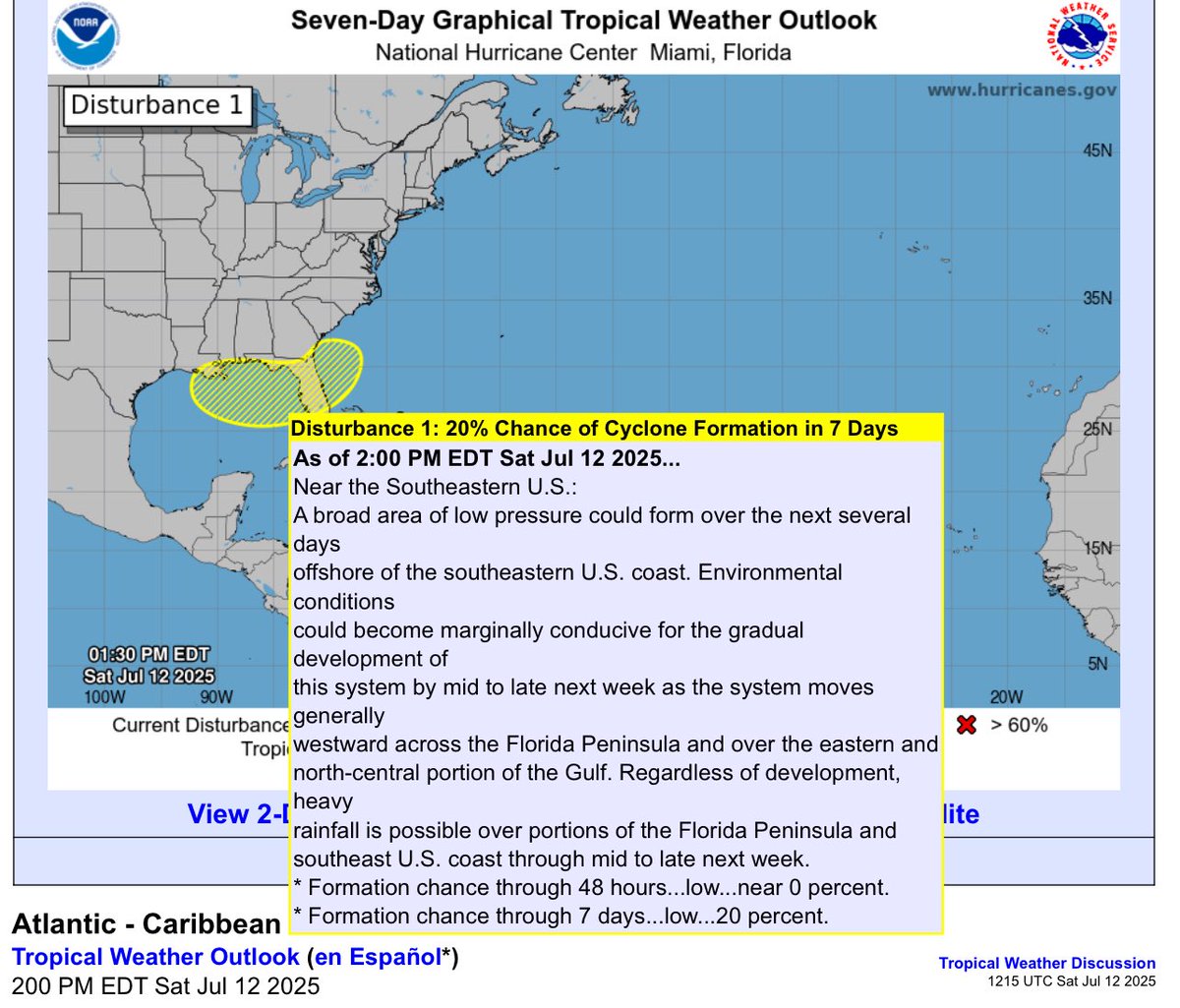
JUST IN from the NHC- we have yellow blobbage across #FL and into the #Gulf. 20% chance for tropical development. Chances still remain low right now #flwx #Florida #tropics #tropicalweather
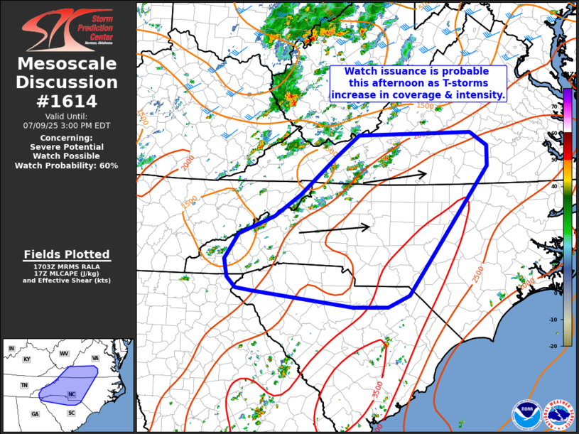
SVR T'Storm Watch possible (60%) across #NC #VA and #SC. Storm likely over the coming hours for many #ncwx #scwx #vawx #gawx #weather
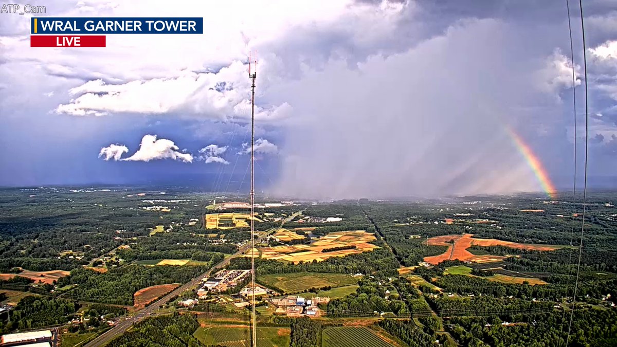
Do you see the rainbow outside?? Beautiful!! #ncwx #NorthCarolina #weather
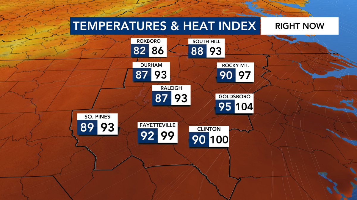
Goldsboro- you okay? Maybe grab some ice cream. Yikes! #ncwx #NorthCarolina #weather
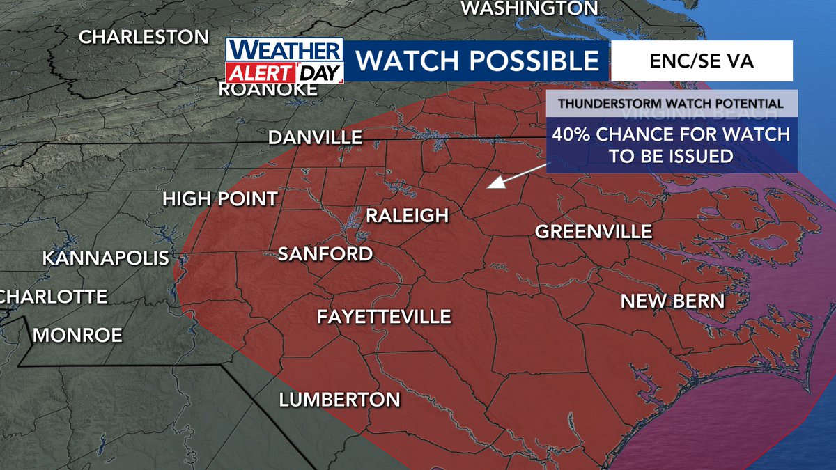
SVR T'STORM WATCH possible in the next few hours across our area. The SPC mentions a 40% chance of being issued. We'll still see lots of dry-time, but any storms that get going could be strong. You can feel the storm fuel in the air! #ncwx #NorthCarolina #weather
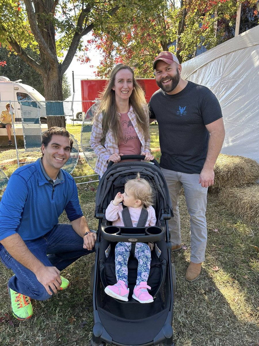
Some news to share with you all! This weekend will mark my last weekend shows @WRAL as I have made the difficult decision to explore new opportunities. I am so grateful for the opportunity and wonderful team with which I have worked. As for the next move- stay tuned! #ncwx
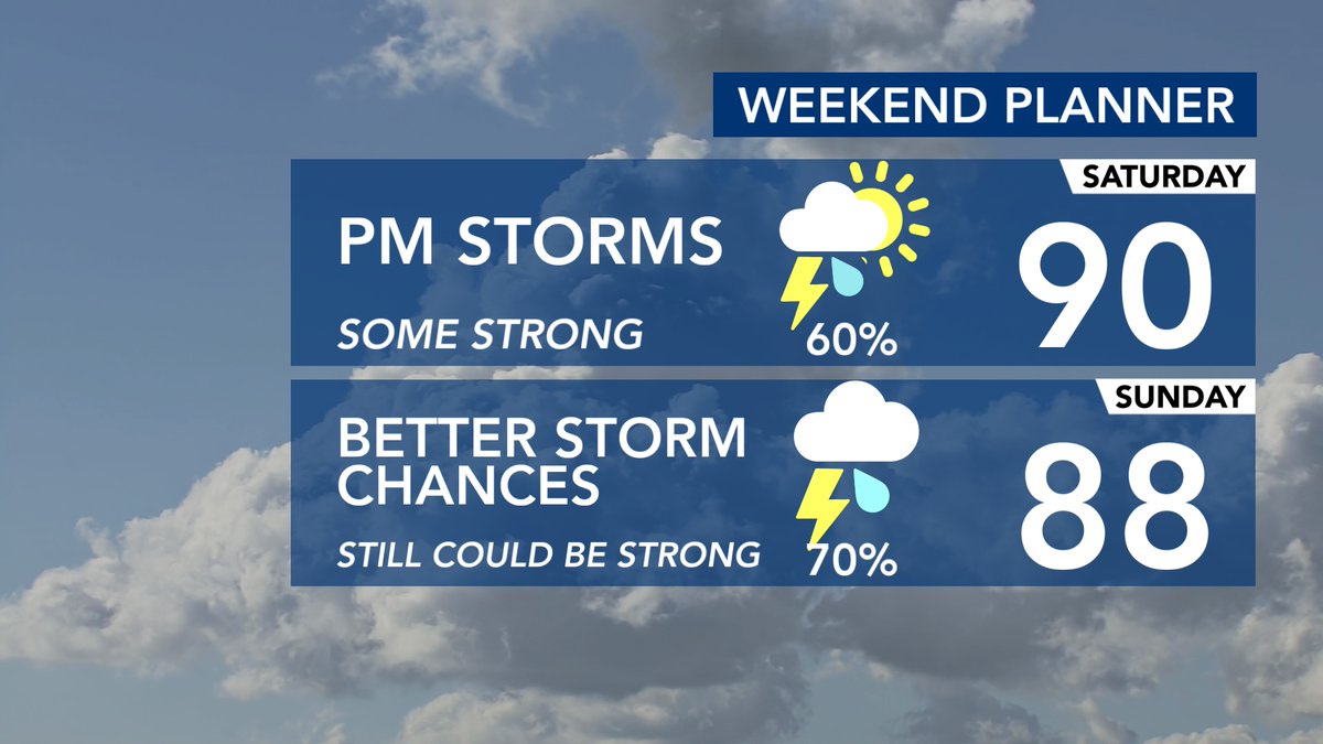
WEEKEND PLANNER: We will still have some dry periods, mainly during the mornings, but scattered strong storms are possible each day. Feels-like values tomorrow will also be approaching 100! #ncwx #NorthCarolina #weather
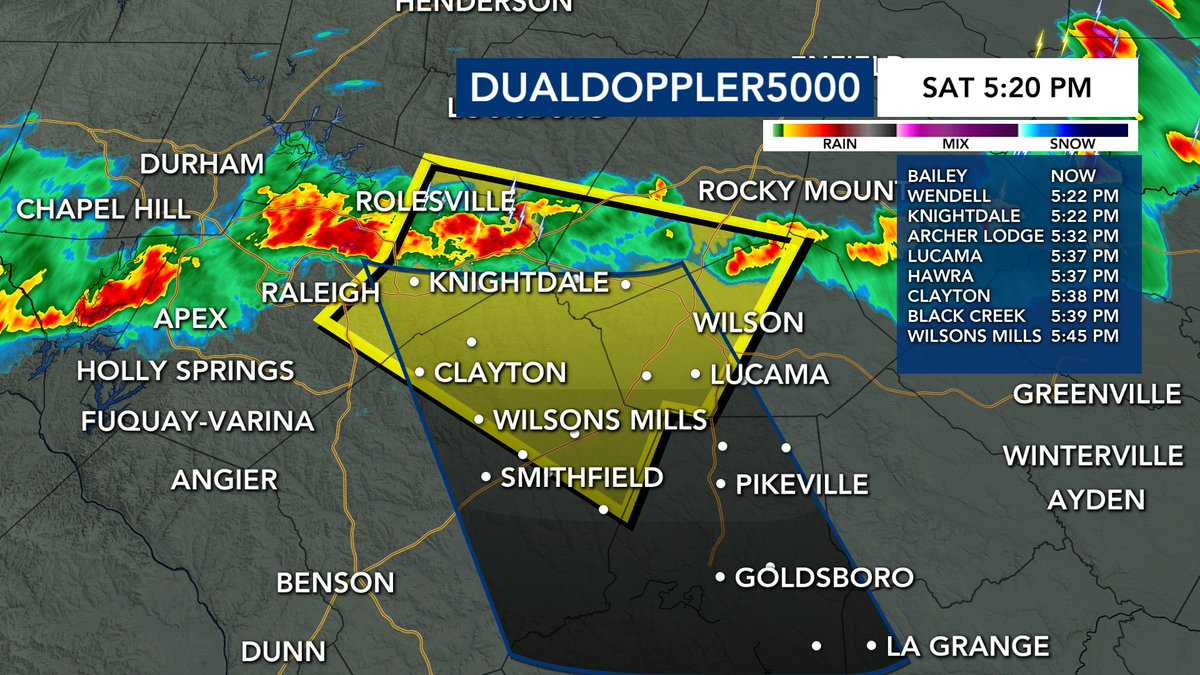
SEVERE THUNDERSTORM WARNING now out until 6 PM for parts of Nash, Wake, Wilson, Johnston, and Franklin counties. 60 mph wind gusts and small hail possible #ncwx #NorthCarolina #weather
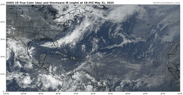
The sun sets on the last day before the #Atlantic hurricane season starts! We will see what June-November holds #weather #tropics #hurricane #hurricaneseason