Eric Snodgrass
@snodgrss
Former Sr Science Fellow Nutrien Ag Solutions. Former Dir of Undergrad Studies in Atmospheric Science at UIUC
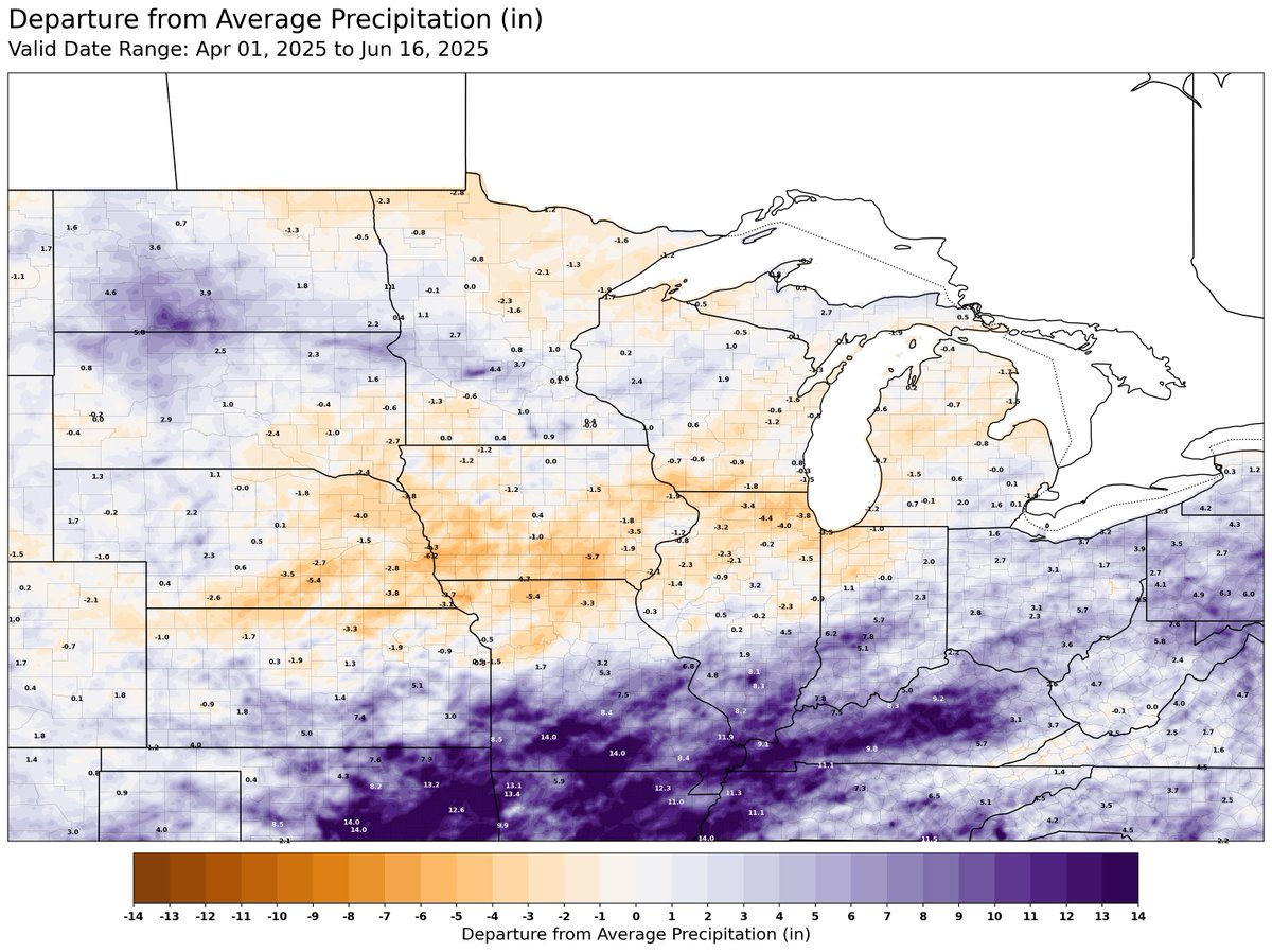
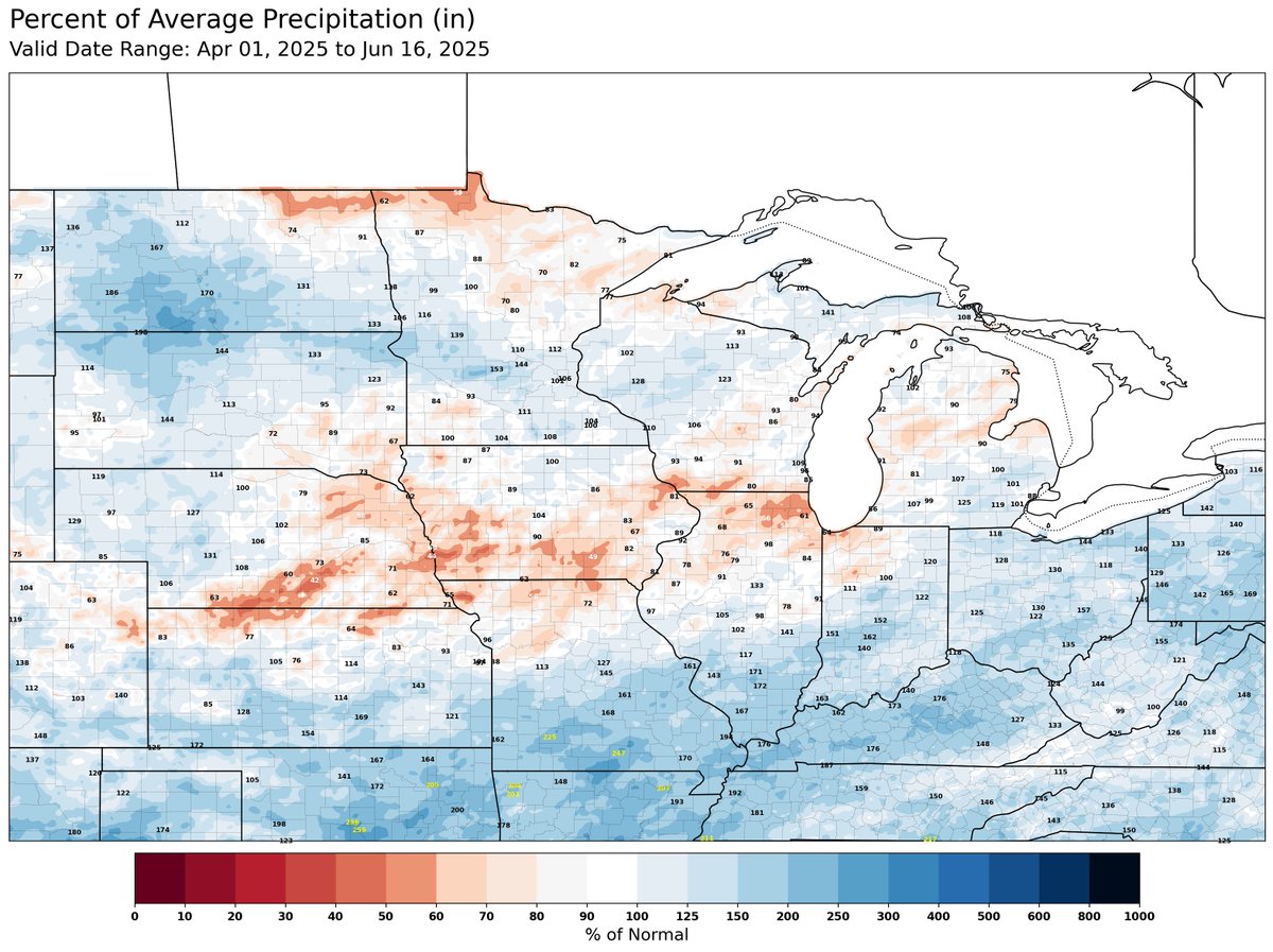
2024 was drought from July-Oct and corn blown flat by Helene.THIS year we struggled to find a window for field work. Late plant,replant,weed management,hay. As @snodgrss says, the maps don’t really reflect our struggle.Focal ugly pockets. #SWOhio #notpretty #45169 #45107
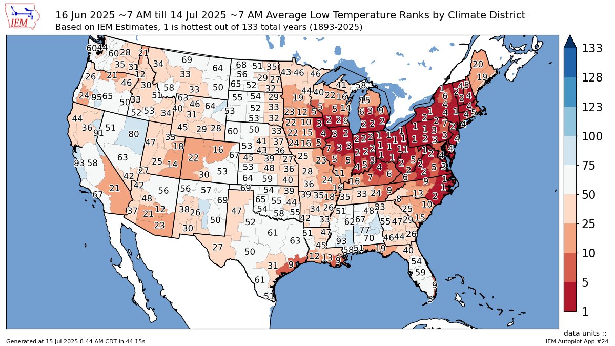
With the forecast returning heat as we work through the rest of July, I wanted to show a map of average low temperature ranks from June 16 to July 14. We've had some hot/humid nights across the eastern Cornbelt through the MidAtlantic and Northeast, and I don't anticipate much…
@snodgrss beautiful double rainbow on the evening of July 5th in Ankeny, Iowa. 1.38” of rain in our rain gauge yesterday. Please feel free to share if you would like.
South Dakota was ELECTRIC ⚡️ last night! @MyRadarWX @SevereStudios #sdwx #wxtwitter
The dichotomy of summertime precipitation - repeated rounds of widespread rain & thunderstorms associated with stronger jet stream flow over the top of the ridge of high pressure, with daily disorganized pop-up thunderstorms each afternoon beneath the ridge.
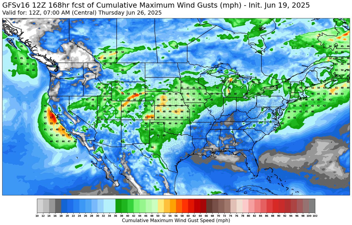
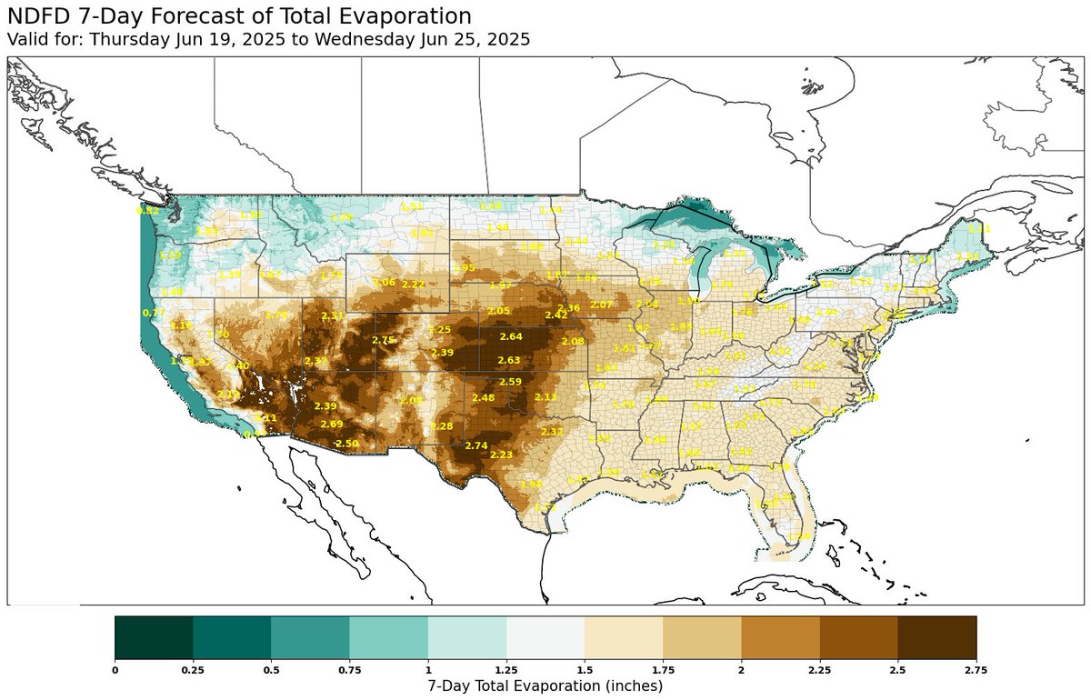
As the winds start to crank in the Plains, so will evaporation rates. Here are the 7-day GFS maximum accumulated wind gusts and the 7-day evaporation forecast from NDFD.
We are literally froggy over here in southwest Ohio. Check our stats for 45177. Late plant, no sun, so many consistent rain days, replant, poor emergence—just a terrible plant this year. Last summer dealt with D2. Reckon we prayed too hard for rain last year.
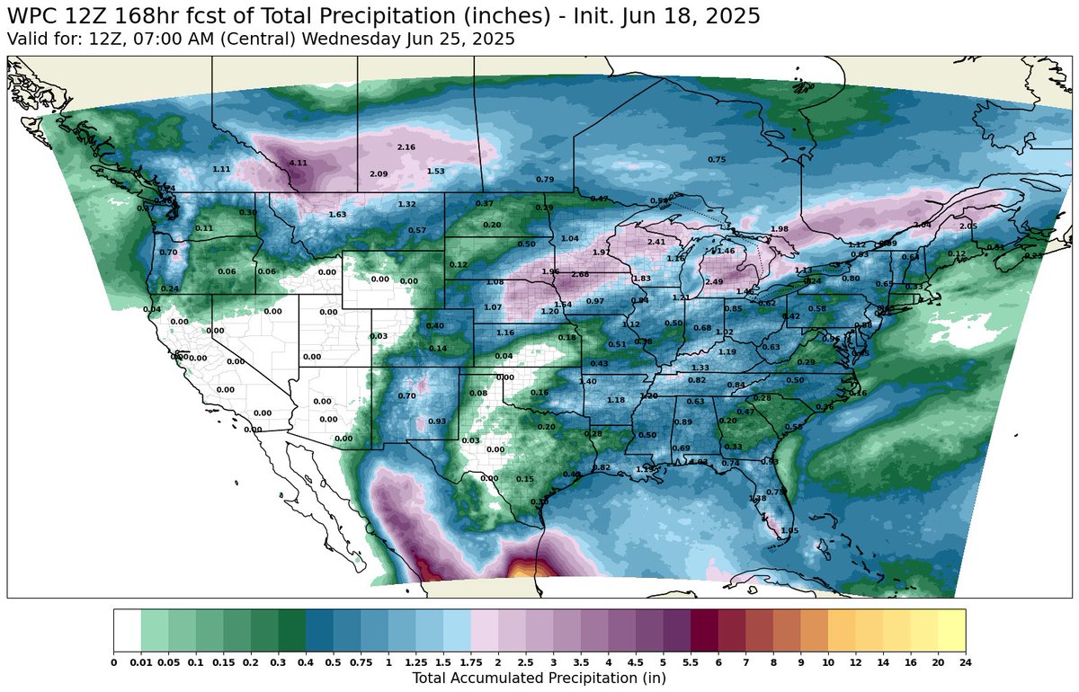
Be watching this Cornbelt forecast closely. Not only is there a significant severe weather threat in the Eastern Cornbelt, but the Ring of Fire storms that build around a Nashville High will likely be hyper local in rainfall delivery. If these rains miss the drier areas, expect…

@snodgrss first good rain since mid May for our area! Bring it on!
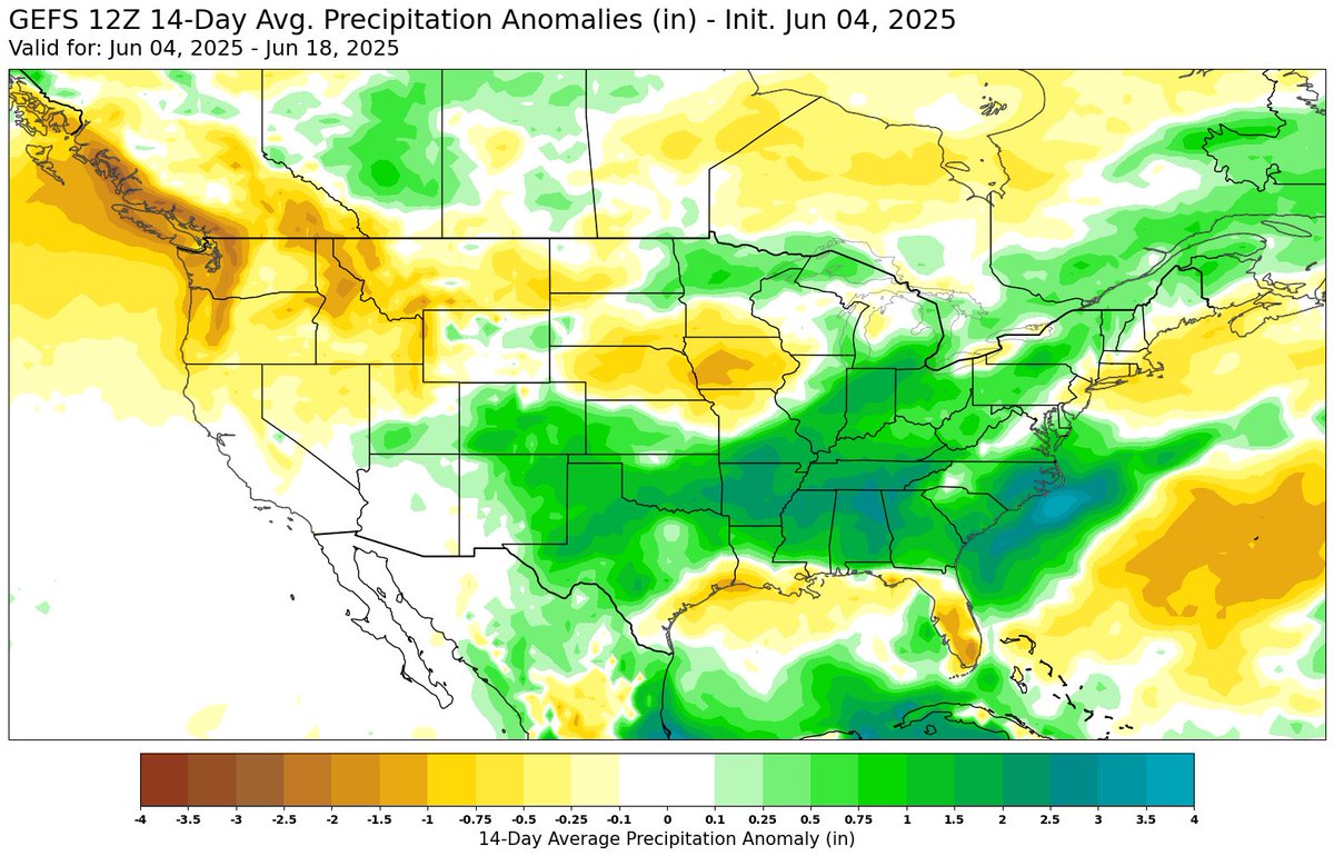
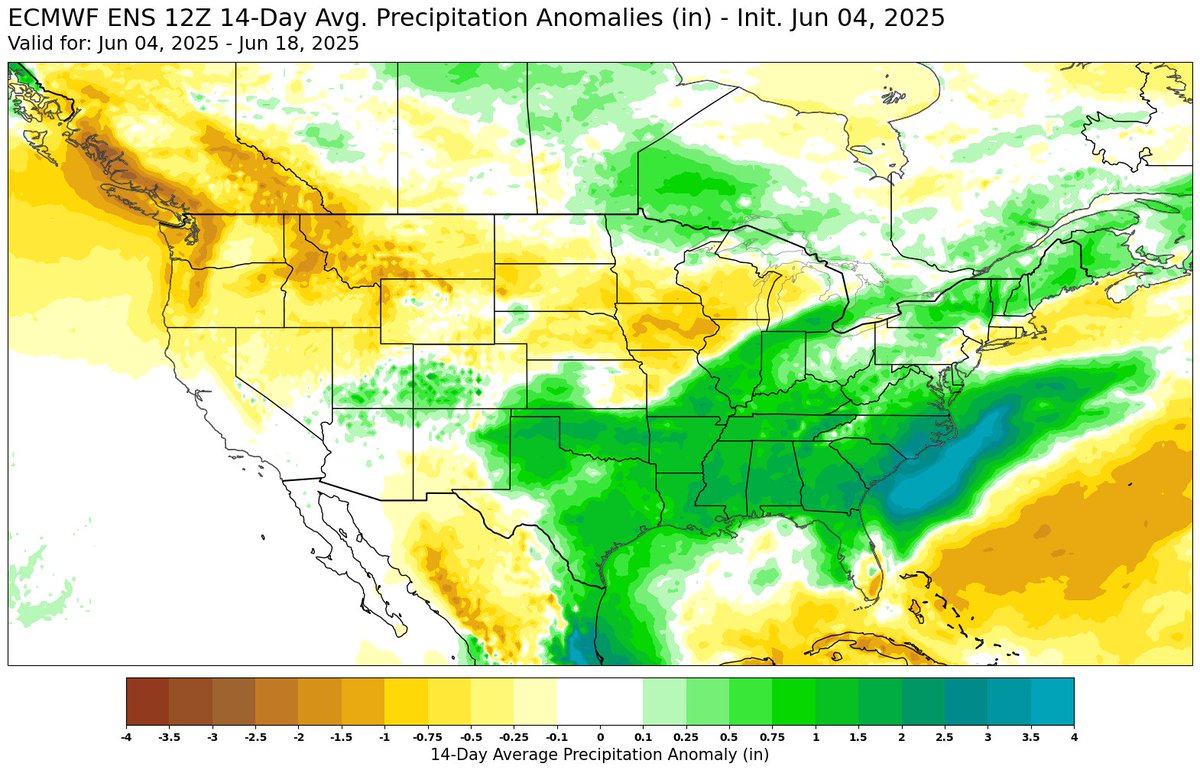
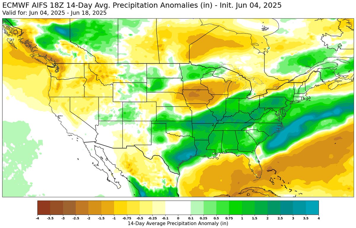
GFS Ensemble, ECMWF Ensemble, and ECMWF AIFS 14-Day Precipitation Anomalies. Western Cornbelt is forecast drier (Iowa at the center of the dry region)
If you thought the picture we posted yesterday was good...just check out this timelapse of the same storm! 🤯 Video courtesy of Mesonet technician Steve Thompson (taken Sunday, May 18 near Freedom, OK). #okwx #okmesonet
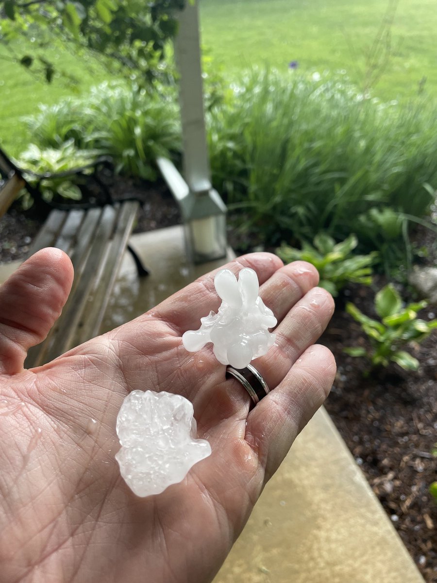
@NWSLincolnIL 445pm May 20, 2025 in Mahomet, IL. Most were slightly smaller than golf ball sized.
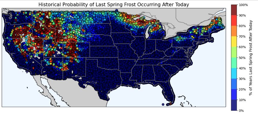
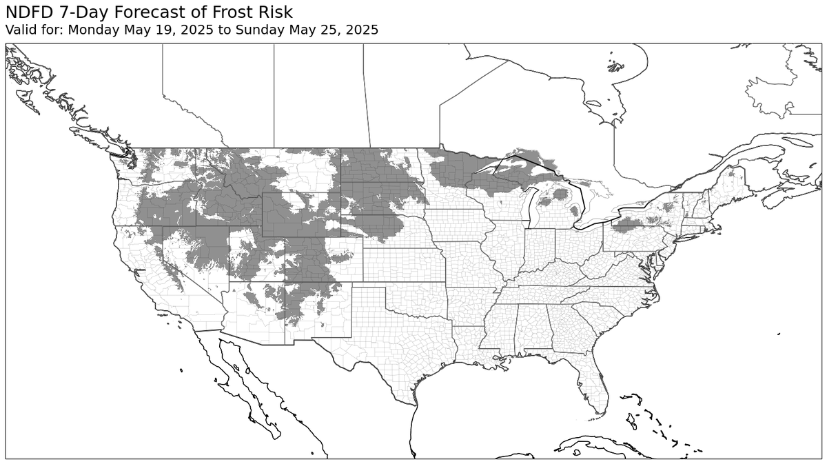
Two maps to consider with the cold air coming in the Central US behind this deep low. 1. Historical probability of having a frost after today using PRISM data from 1981-2024. 2. 7-Day Forecast of frost risk (in grey) where temps could get below 35°F.
Visible satellite loop of a splitting supercell in south-central Oklahoma this evening. Cloud tops with the dominant right moving cell has been pushing 60,000 feet at times. #OKwx
Wow - Impressive dust storm on the back side of these storms in IL/IN. I am still cleaning out my eyes...
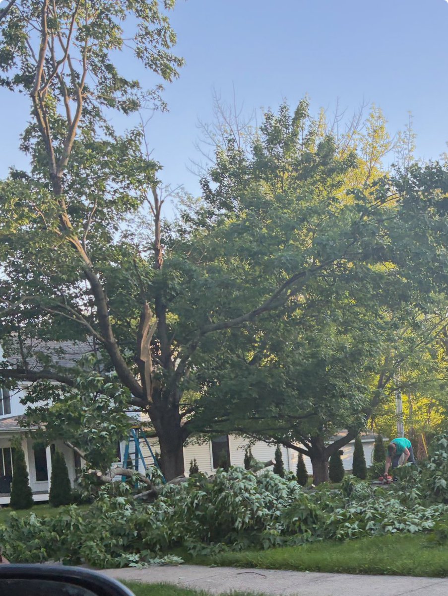
@NWSLincolnIL a lot of tree damage like this around Mahomet, IL. branches 6-10” in diameter are down across town. Terrible dust storm too.