Andrew Pritchard
@skydrama
Focused on Disruptive Weather | Award Winning Weather Risk Communicator | Observer of Severe Storms ⛈️🌪️💨 Contact/License: [email protected]
My weather chatter is moving! Words: skydrama.net Video: youtube.com/andrewpritchard 🦋: bsky.app/profile/skydra…
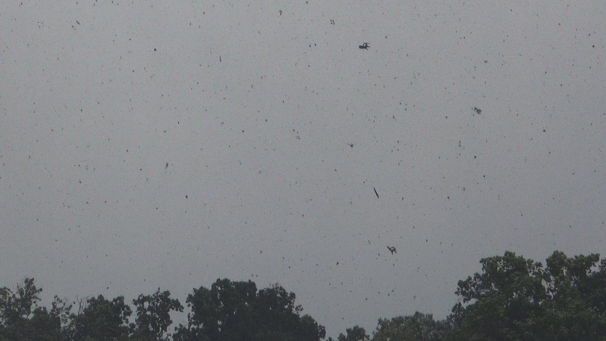
A YouTube commenter asked if that was a chair flying around in the air in my video of the Sauk City, WI tornado on July 16th. No - it's two chairs. Maybe three? Someones patio set took a ride, anyway.
Here's a link to my appearance on Fox Weather this morning, talking summer weather and agriculture! foxweather.com/watch/fmc-15md…
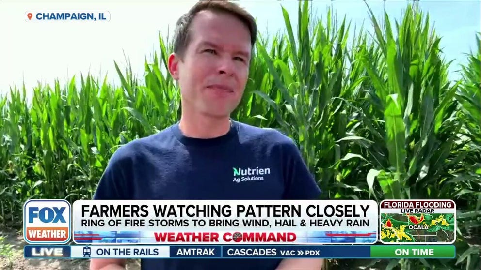
We've reached a critical point in the 2025 growing season across the Cornbelt - catch me on the Fox Weather network a little after 10:30 AM CT to give an update on current crop conditions and the weather outlook heading into August.
Weather Command with @StephenMorganTV @MarissaTorresTV @haleymeierwx starts now on @foxweather - looking forward to chatting midwest heat & storms with @LMichaels_Fox6 coming up, & Ag Wx with @skydrama in the 11am ET hour!
15 years ago today I chased my first Wisconsin twisters! Fun little chase of a couple tornadic mini-supercells in a high instability summertime setup: youtu.be/Mobux_uo5-Y
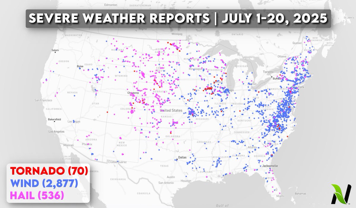
Stormy July so far! Here's a look at month-to-date severe weather reports... July is typically a big month for damaging thunderstorm winds, and with 2,877 reports of wind damage it's certainly come through. 70 tornadoes as well, with several notable events!
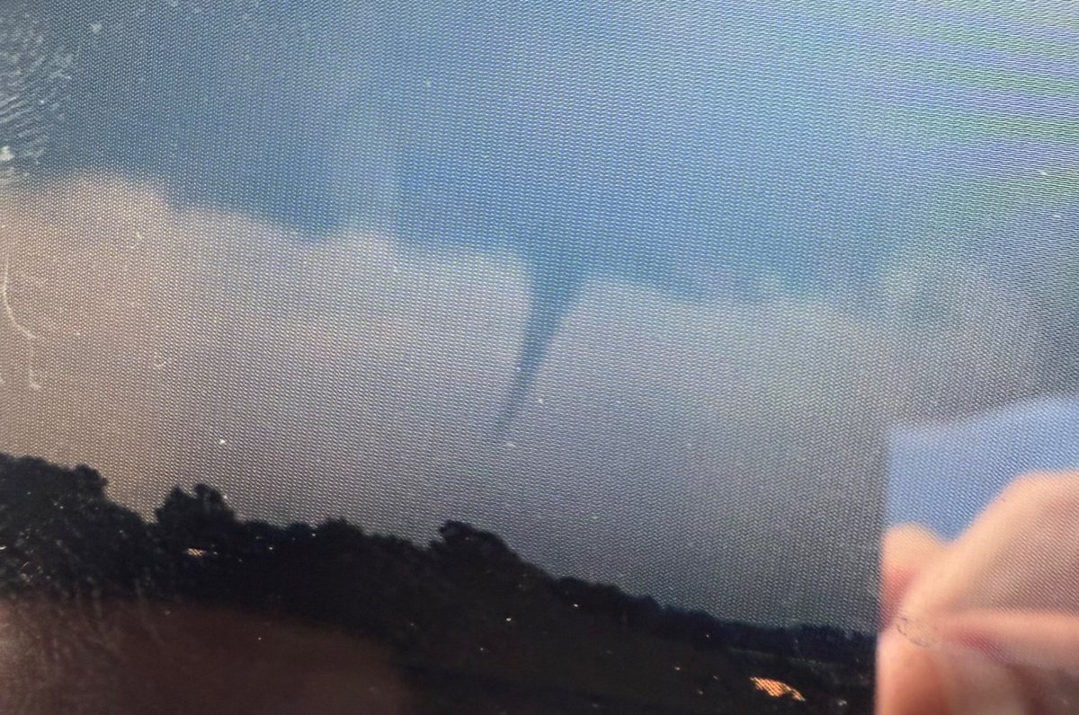
Funnel cloud, possible tornado observed north of Chatsworth, IL around 3:30 PM this afternoon. Persisted for 5-10 minutes.
WPC issues Day 1 Moderate Risk Excessive Rainfall Outlook at Jul 20, 15:49z for ILX wpc.ncep.noaa.gov/qpf/excessive_…
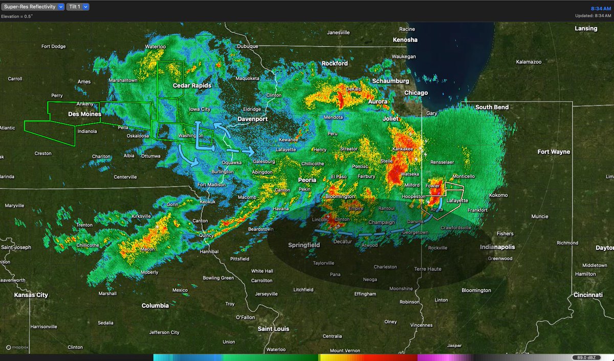
Drawing on the radar this morning, curious little set of ingredients across central Illinois today. Outflow boundary being deposited by morning storms with an upstream MCV to generate a second round. Might watch for a few PM rotating storms near I-72, I-70 in c/e IL into w IN.
NEW Storm Observation VLOG! On July 16th I paused vacation mode and went into storm observation mode, intercepting a tree-tossing Wisconsin tornado at close range near Sauk City: youtu.be/dFjM8UrvMm4?si…
Not often I get to document tornadoes in the early afternoon and grill steaks for myself and the family in the evening.
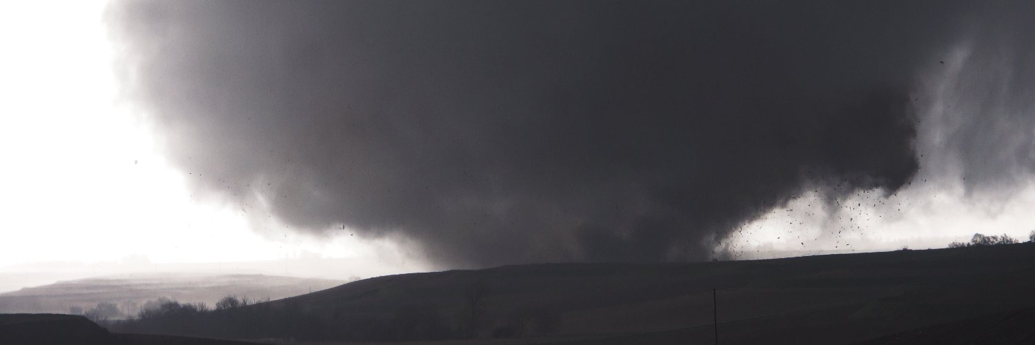
Filmed an intense tornado hitting Sauk City, Wisconsin earlier this afternoon from close-range.
Documented three tornadoes in Wisconsin early this afternoon, the strongest of which went right through a neighborhood in Sauk City, Wisconsin. #WIwx youtu.be/lMDRBh_V-QM
Filmed an intense tornado hitting Sauk City, Wisconsin earlier this afternoon from close-range.

5 years ago today! I was super excited about the setup on July 15th, 2020 but early storms merged into a messy cluster across western Illinois. Hugged the couplet of a disorganized but still strongly rotating supercell and eventually... this happened! youtu.be/tCTz7ZCgyFU
Some video highlights from yesterday's mostly underwhelming storm chase in eastern Iowa. Lots of tornado warned storms weakly rotating aloft, and nothing more! youtu.be/TlzgML9NmBo
Thanks in advance for not making "HustleBitch" your number one source for accurate weather takes on the world wide web.
🚨 BREAKING: 833,000 SQUARE MILES UNDER THREAT - WHAT THE HELL IS COMING TOMORROW? Tomorrow’s “marginal” storm risk just became the 3rd largest in recorded history, and nobody’s talking about it. That’s not a forecast. That’s a continental-level event. Hail, wind, lightning,…