Landon Moeller
@landon_wx
⚡Severe/Winter/Aurora ❆ Weather Enthusiast. Storm Chaser. Nikon Z 📸. 20 yrs old. Spotter. Meteorology Student. COOP Weather Observer. 📏 (27🌪️)

Aurora Tuesday night near Oneonta, NY during a substorm around 11:05pm
The dew point at WFO Chicago’s office is currently 27° C/81° F! 🌽 #ilwx

A CME is heading straight for Earth. It’s neither impressive nor fast, but it’s something. It’s possible that the flux rope may be visualized in this loop, though perhaps heading mainly south of the Sun-Earth line.
July 23, 2010: The United States' record largest hailstone fell near Vivian, South Dakota. The stone was measured at an incredible 8.0" in diameter and had a weight of 1.9375 lbs. It was spawned by a powerful supercell that produced many other stones 6" or larger. #wxhistory
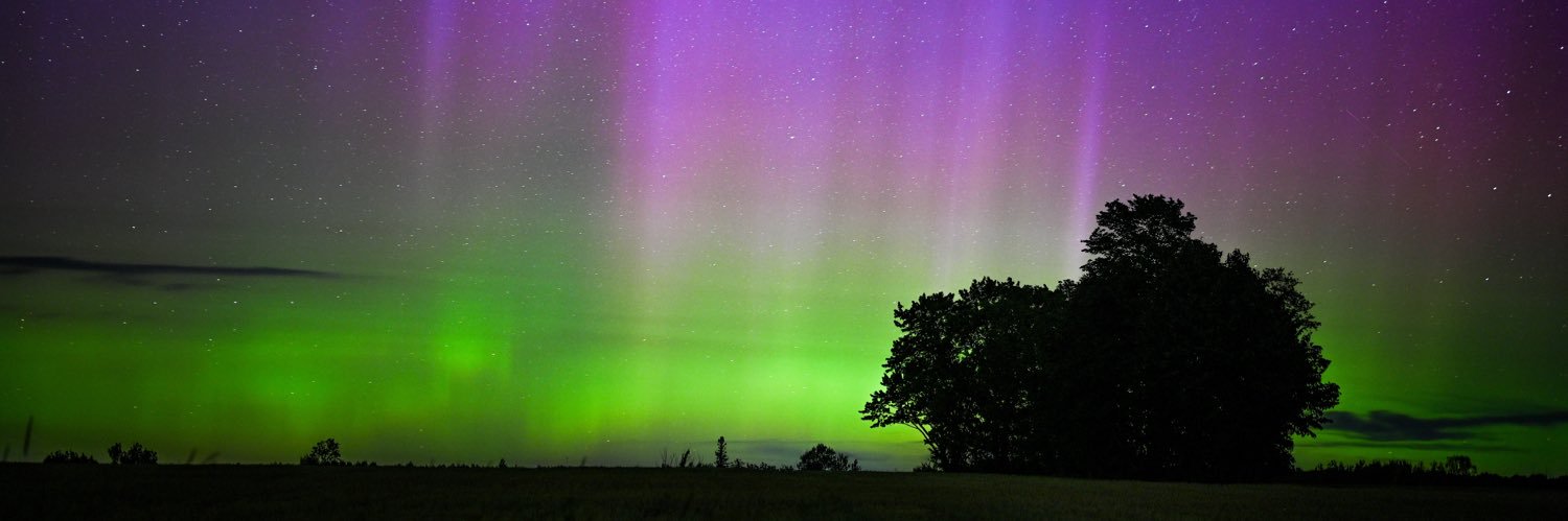
nice aurora substorm with tall purple pillars north of March, Minnesota happening now #MNwx #aurora @AuroraNotify
There was just a nice substorm in Maine! More of these will be possible through the night.

Rather impressive data for a CIR. Let’s hope this continues into tonight for possible mid-latitude aurora.

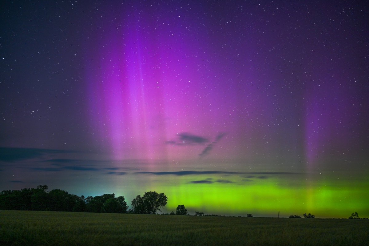
It has officially been 3 years since a new hobby started for me. I have seen it 42 times since. This was one of the first aurora photos I ever took up in northern Wisconsin. When and where was your first?
.@NOAA’s first satellite fully dedicated to continuous, operational #SpaceWeather monitoring has arrived in Florida! The Space Weather Follow On - Lagrange 1 (#SWFOL1) 🛰️ will launch this fall and head to Lagrange point 1 (~1 million miles from Earth) where it will keep…
Line of very tiny (1-2 miles across) mini-supercells across the southern LOT CWA #ilwx

Ready to see these beautiful colors again. It’s been too long. May 10, 2024 Southern Illinois
Could get a strong line of elevated storms rolling through N Illinois Saturday morning. Wouldn't be surprised at isolated instances of large hail either if any semi-discrete mode materializes. This certainly could overwork the atmosphere for any hopes of afternoon development.

Hail nearly a foot deep in some areas near Benchlands, Alberta! #abstorm
Just like the Casino, MN tornado (which formed in a similar MCV-driven environment) from 6/16/25, these tornadoes appear more "violent" than the damage they incur. The upward vertical motions in the FC are truly impressive, in contrast to its tangential velocities. #wiwx
VIOLENT TORNADO PRAIRIE DU SAC, WISCONSIN @NWSMilwaukee
The Sauk City, WI supercell 10 minutes before producing a couple of tornadoes this afternoon #WIwx

VIOLENT TORNADO PRAIRIE DU SAC, WISCONSIN @NWSMilwaukee
Weak un condensed tornado NE of Mazomanie on 78 at 1:15 pm @NWSMilwaukee

Another day, another MCV in the cornbelt. Not particularly impressed with this one, but believe the best chance for any tornadoes is near the north end of the 5% risk from SWODY1.
