World Climate Service
@WorldClimateSvc
Insight and tools for long-range forecasting: objective seasonal and subseasonal prediction. Tweets by Prescient Weather cofounder Richard James, PhD
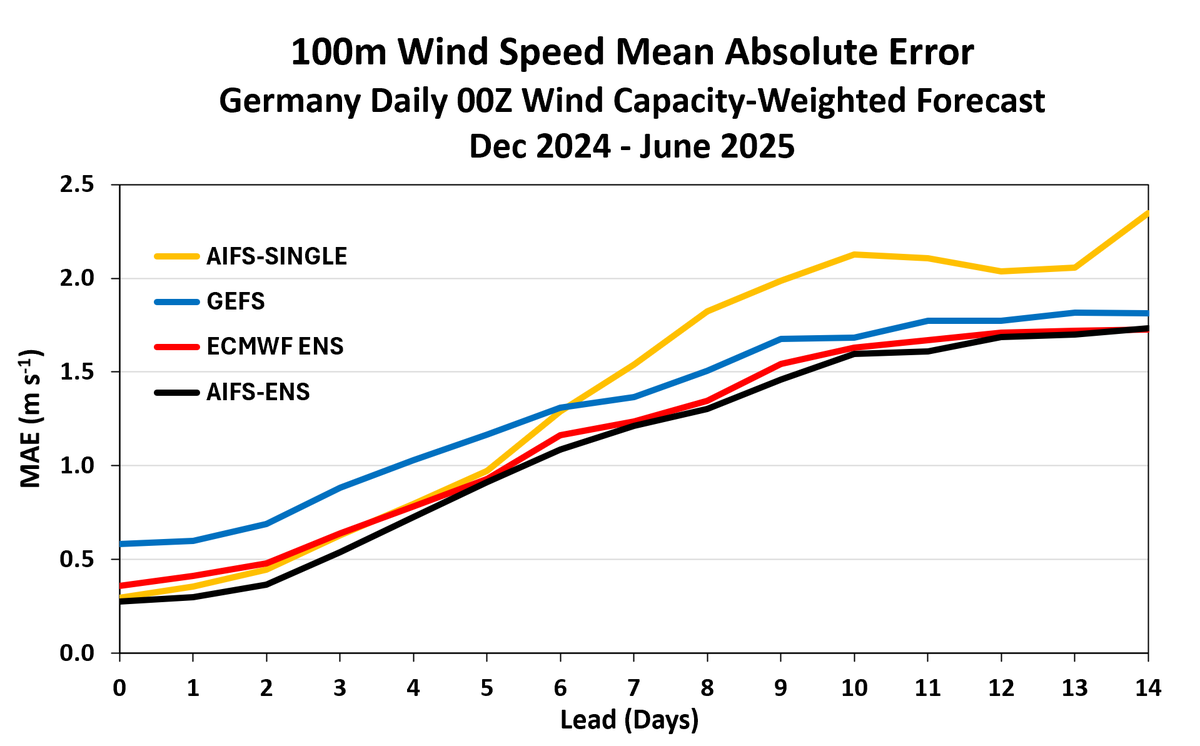
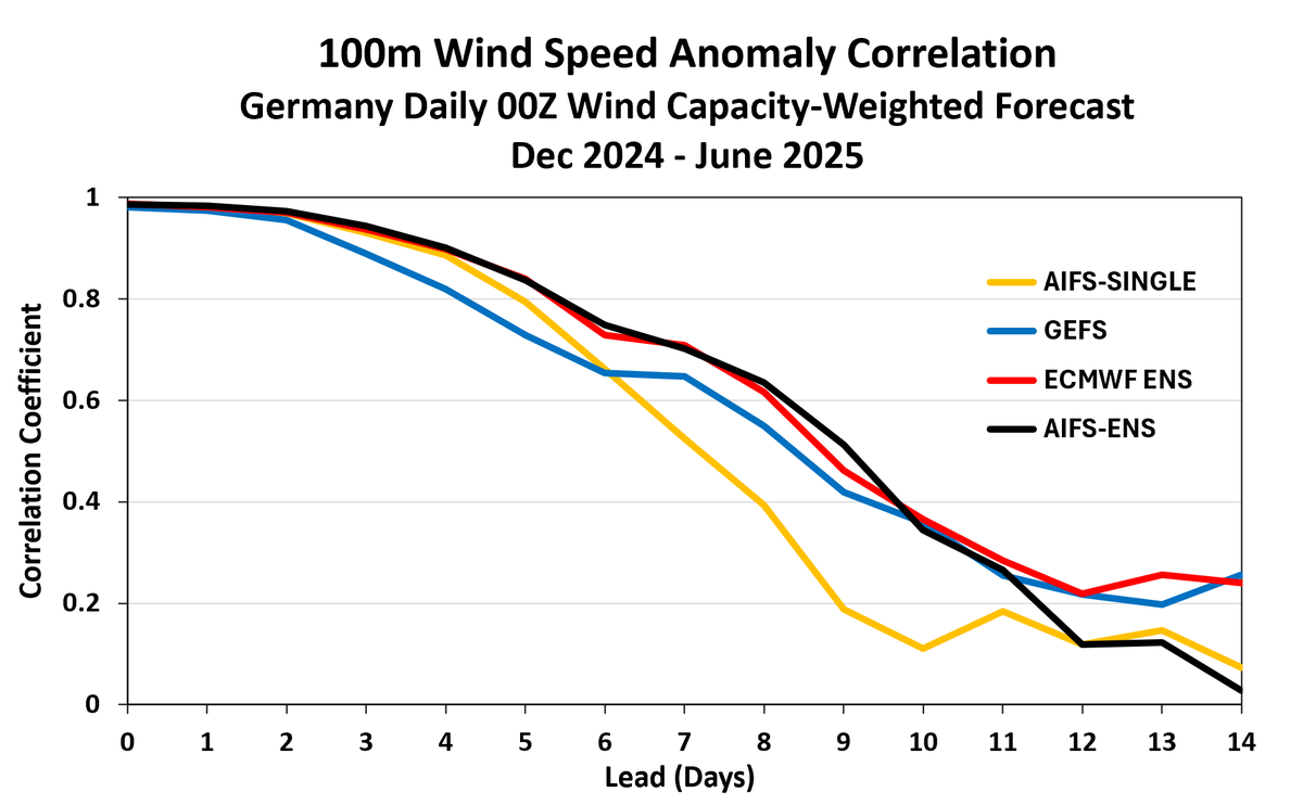
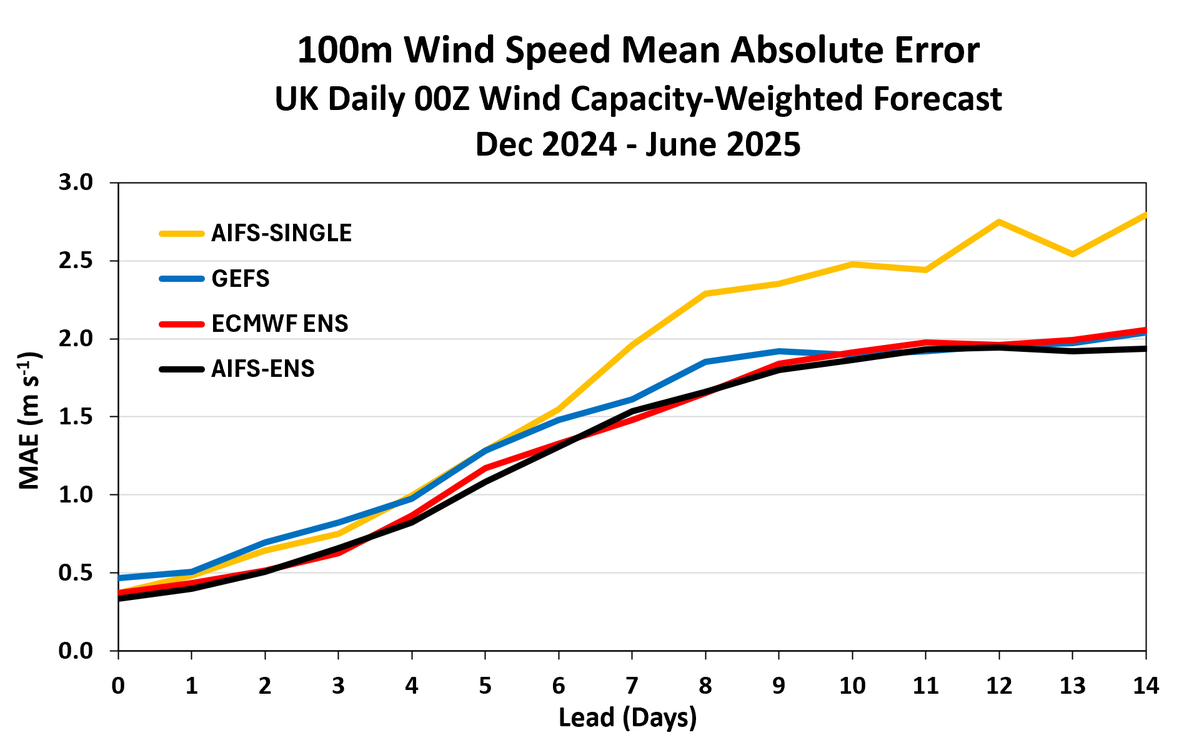
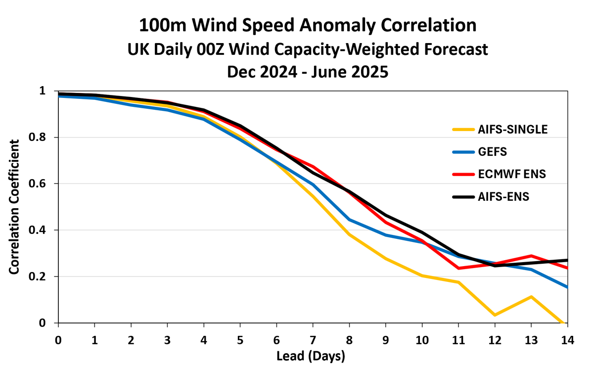
With 7+ months of AIFS-ENS data in our historical forecast database, here's a quick look at performance for DE/UK wind (capacity-weighted). AIFS-ENS (ensemble mean) slightly outperforms IFS-ENS out to Day 9 for Germany; comparable skill for UK. Huge improvement over AIFS-Single.
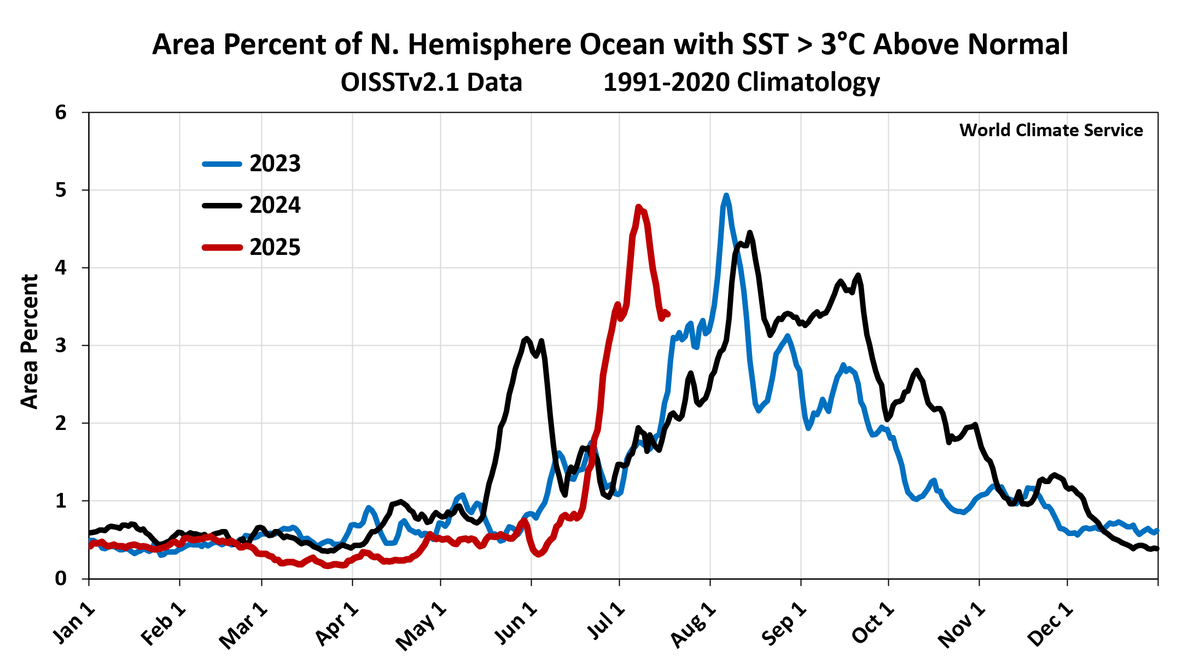
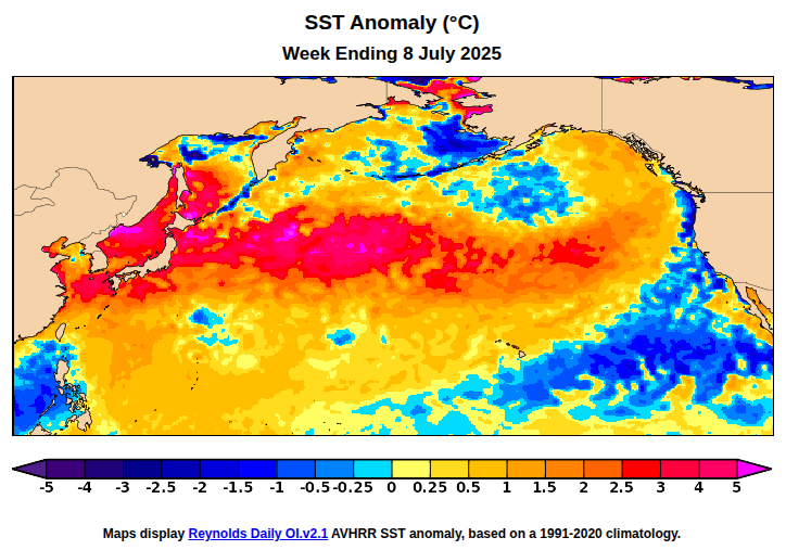
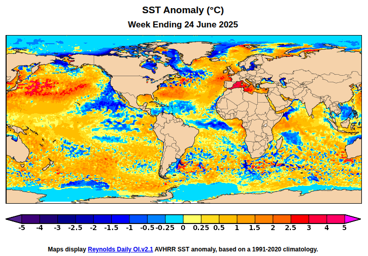
Tracking mid-high latitude marine heatwaves: 2023-2025 have all seen >3°C SST anomalies briefly covering over 4% of N Hemisphere oceans in summer (not observed in 1981-2022). This year's "heatwave" emerged earlier than 2023 and 2024. Where to from here?
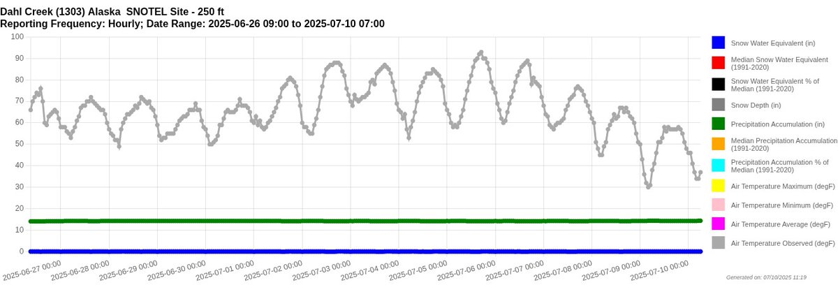
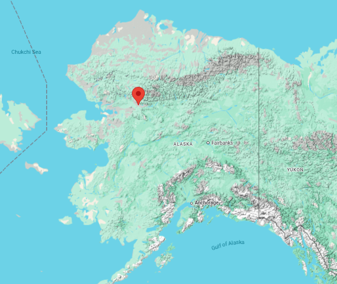
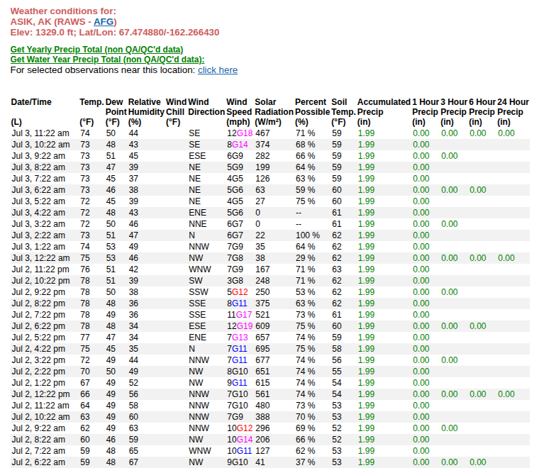
Heat wave in northern Alaska: up to 34°C (93°F) on Saturday at a site near Kobuk in the northwestern interior. Back down to -1°C (30°F) yesterday morning.
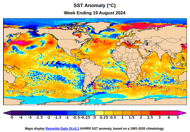
Japan's version of the 2015-16 Northeast Pacific "Blob", but over a much larger area, and with a closer connection to subsurface warmth
Anomalous heat in this region has been investigated by by this rdcu.be/etVPC paper, which suggests that subsurface OHC increase in this reagion is also outstanding!
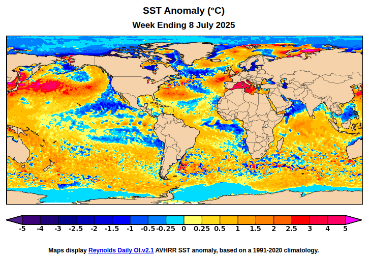
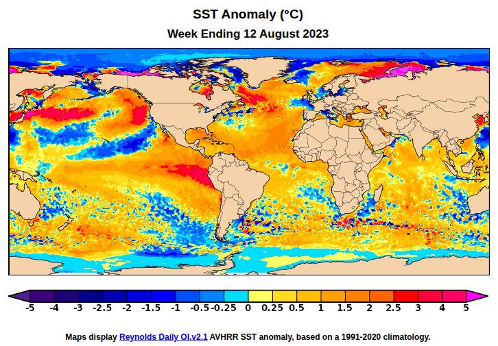
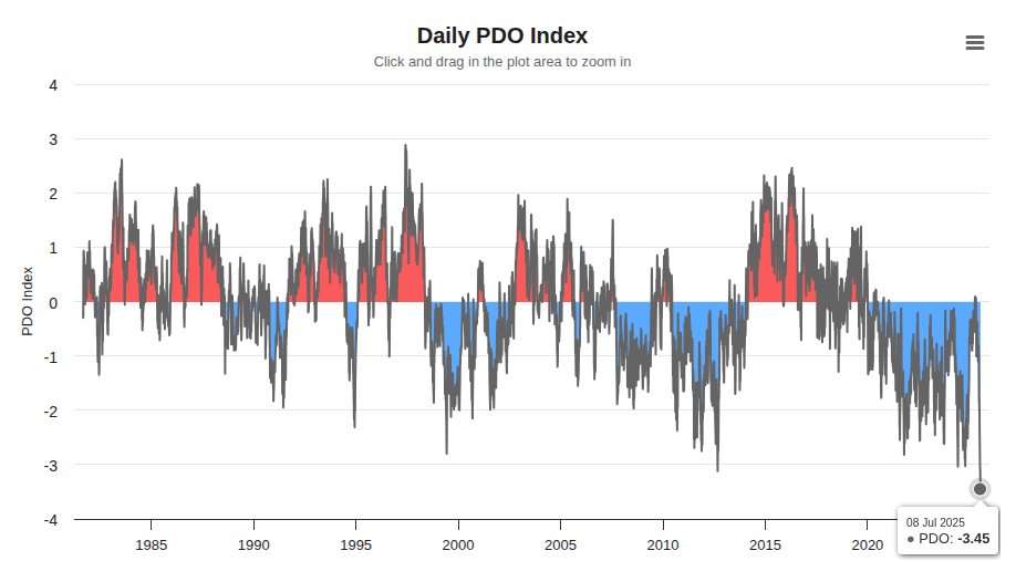
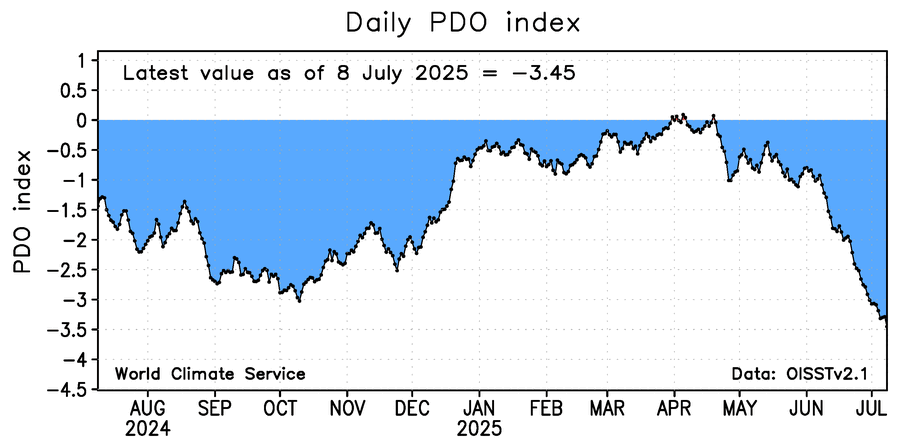
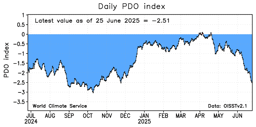
The western Mediterranean marine heatwave is justifiably getting a lot of attention, but the North Pacific warmth is extreme as well - and over a much larger area. The incredible warmth from Japan eastward has driven the daily PDO index to a new record low value (1981-present).
Northern Alaska heatwave: this automated site above the Arctic Circle (about 40 miles north of Kotzebue) didn't drop below 72°F last "night". Daily min temps above 70°F are very rare, though not unprecedented, in Alaska. Here's one from Umiat, on the North Slope, in 1982.

This month's CanSIPS update keeps the positive NAO pattern going into September, suggesting more of the same for Europe (broadly speaking): a big north-south contrast in temperature and rainfall. Northeast U.S. ridging would be a concerning look for East Coast hurricane issues.
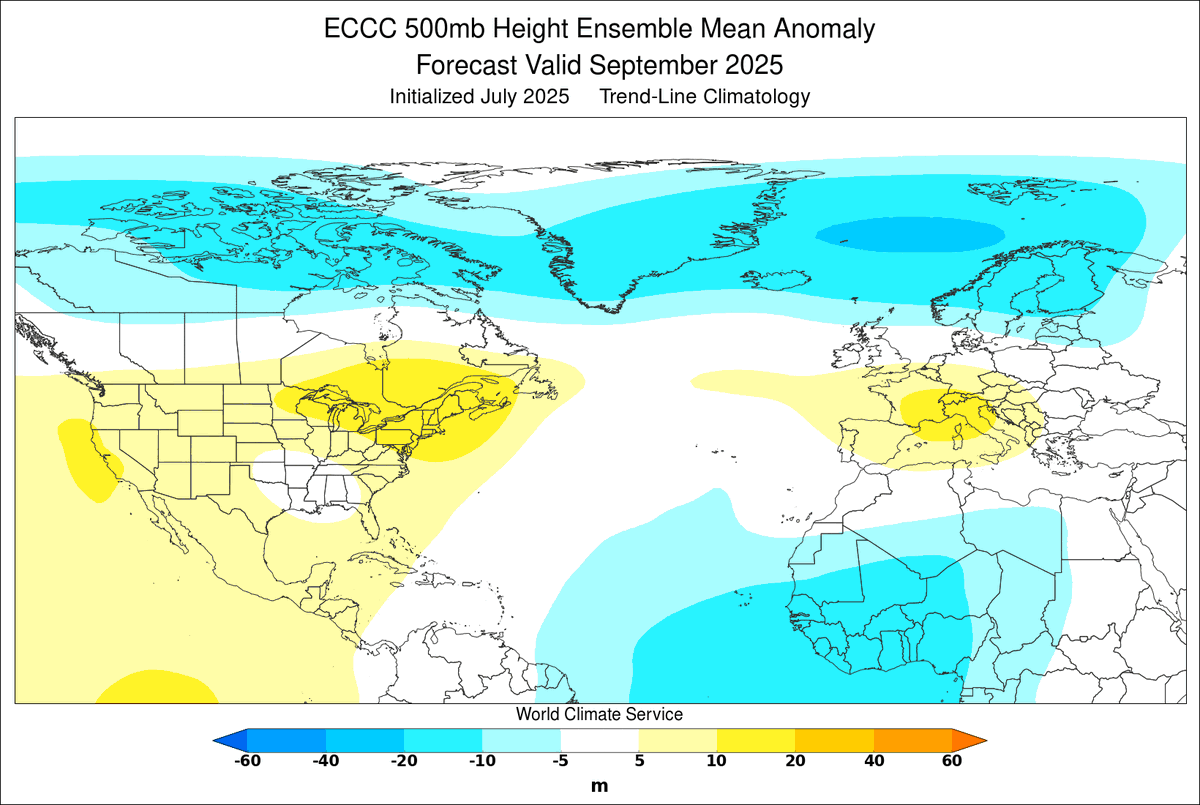
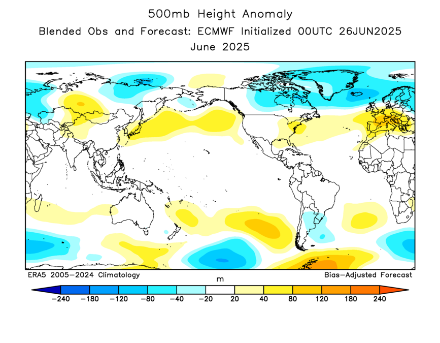
While western Mediterranean SSTs are extremely high, Baltic SSTs are now much below normal, a consequence of the remarkable north-south pattern contrast across Europe. Meanwhile, North Pacific ridging is reinforcing major warmth and driving the PDO back to strongly negative.
"Declining yield variability" for US corn and soybeans. As noted in this thread, it's partly (mostly?) related to benign mid-summer weather in the central US - particularly in the last decade. The last significantly hot July was in 2012.
1. After Monday, the focus in grain markets will begin to narrow in on U.S. yield prospects. My farmdoc colleagues are out with an excellent new article on corn and soybean yield variability over the last 50 years. farmdocdaily.illinois.edu/2025/06/declin…
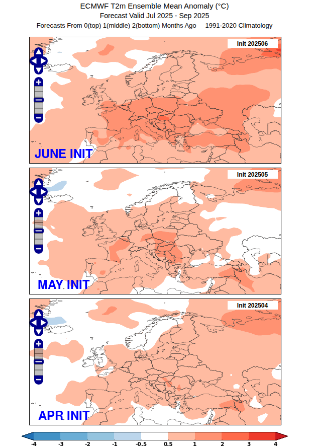
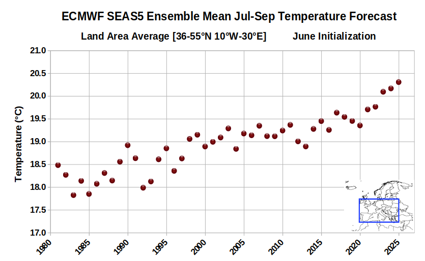
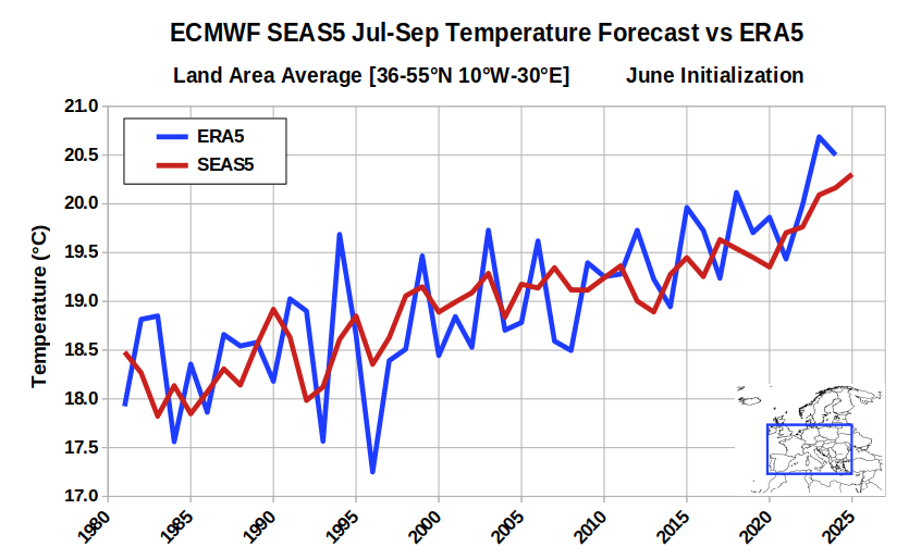
Yesterday's ECMWF seasonal forecast certainly raised the stakes for unusual heat across central and southern Europe. For this region, it's the warmest Jul-Sep forecast in the model's history (June init). However - there isn't much skill beyond simply the long-term trend.
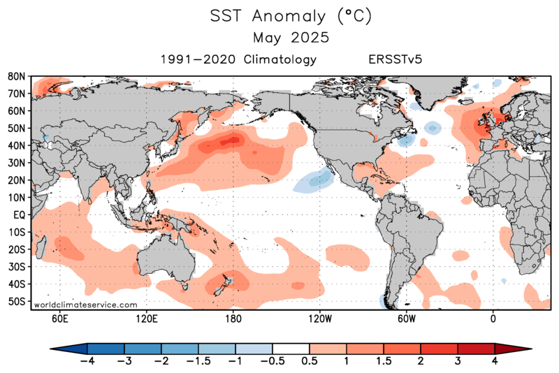
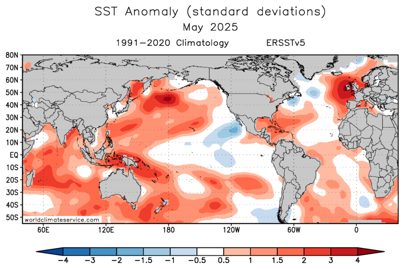
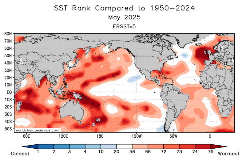
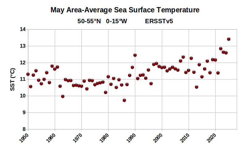
Last month's sea surface warmth near Ireland and the UK is one of the most pronounced temperature anomalies in the global oceans. May SSTs were locally more than 4 standard deviations above the 1991-2020 climate (ERSSTv5 data).
Nigeria flood disaster: "Residents believe a dam collapse upstream exacerbated the flooding in Mokwa"
🚨 Deadly flash floods hit #Nigeria on Thursday, 29 May, over 150 lives lost & 3000+ displaced. Poor infrastructure worsened the tragedy. Yet the event was well forecasted in ACMAD biweekly multi-hazard outlook and @nimetnigeria issued warnings on 28 May. ⚠️ Early warnings save…