
Tango
@TangoH21
SE Weather 🌤 BHAFC 💙 McLaren 🧡 LH44 🔴
Cheeky little stack some lightning taken over Herne Bay the other day. Thank you to @TangoH21 for the help with this 🫡
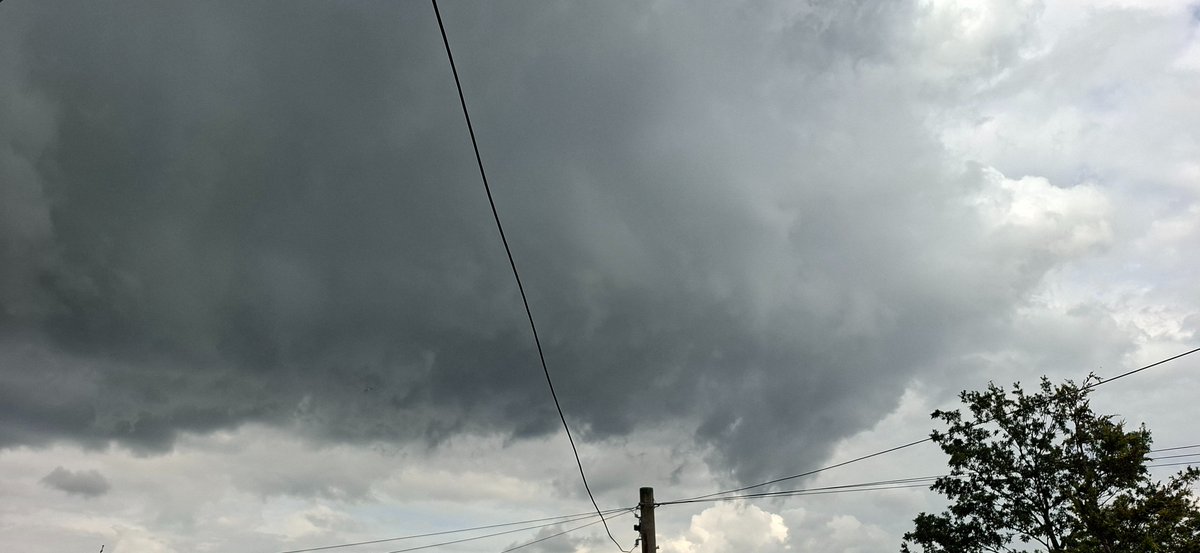
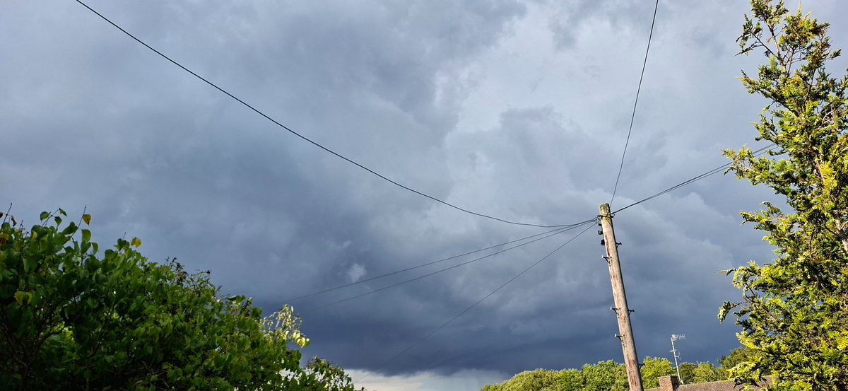
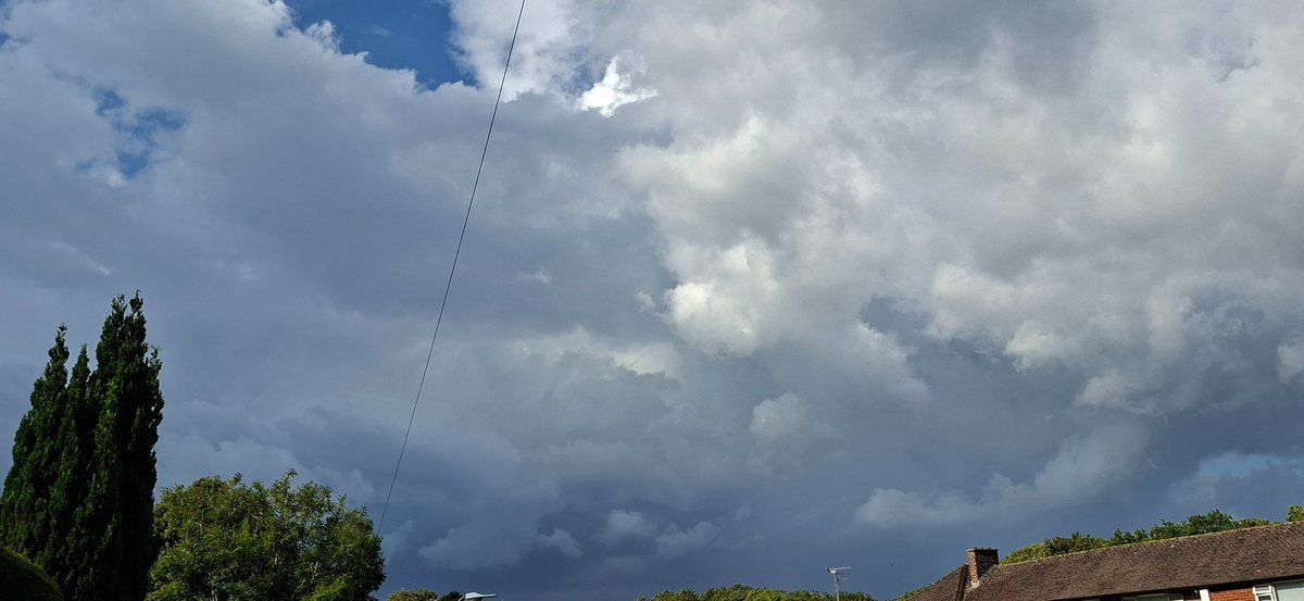
More menacing skies today, been mostly cloudy under the convergence but plenty of towering Cu drifting south.
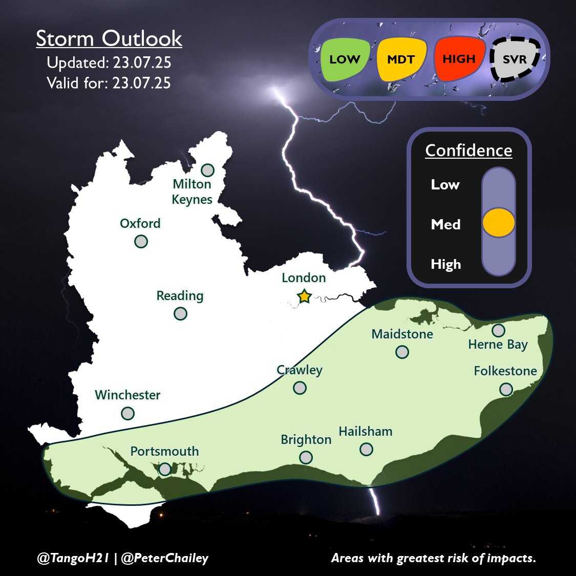
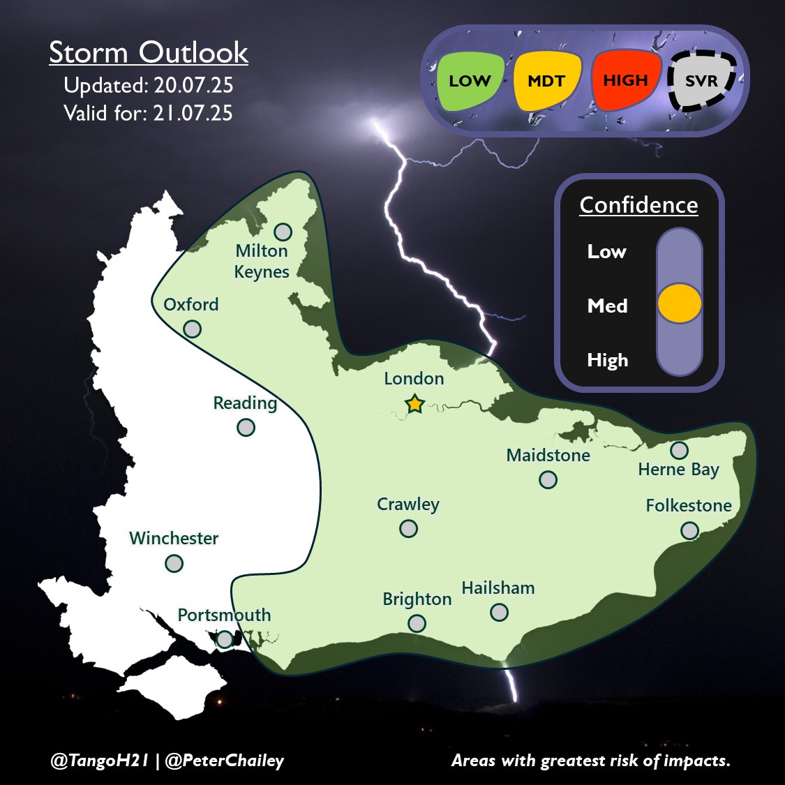
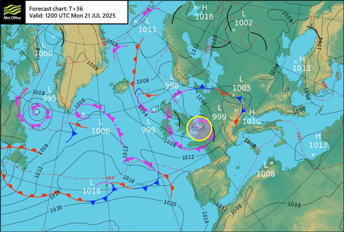
An upper trough and associated cold pool will enhance shower activity today. As the overnight rain clears, thundery downpours will likely develop along the south coast, aided by a convergence trough. Any storms will be slow-moving and bring the risk of flash flooding.
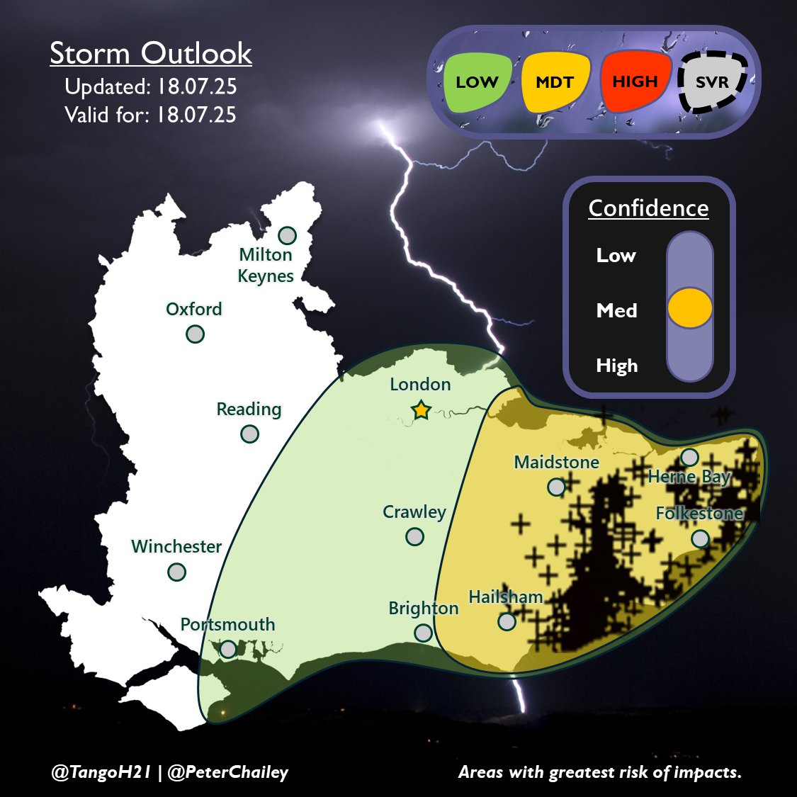
Here's how the outlook for last Friday night verified ⛈️ Overall, one of our strongest forecasts so far, with all strikes remaining in the MDT zone. The western extent of the heavy rain was well captured by the LOW risk. More showery weather to come in the next couple of days.
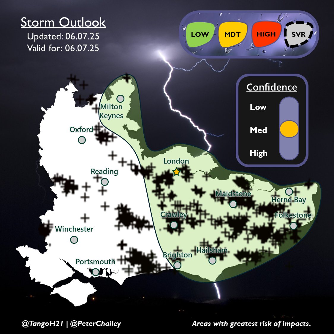
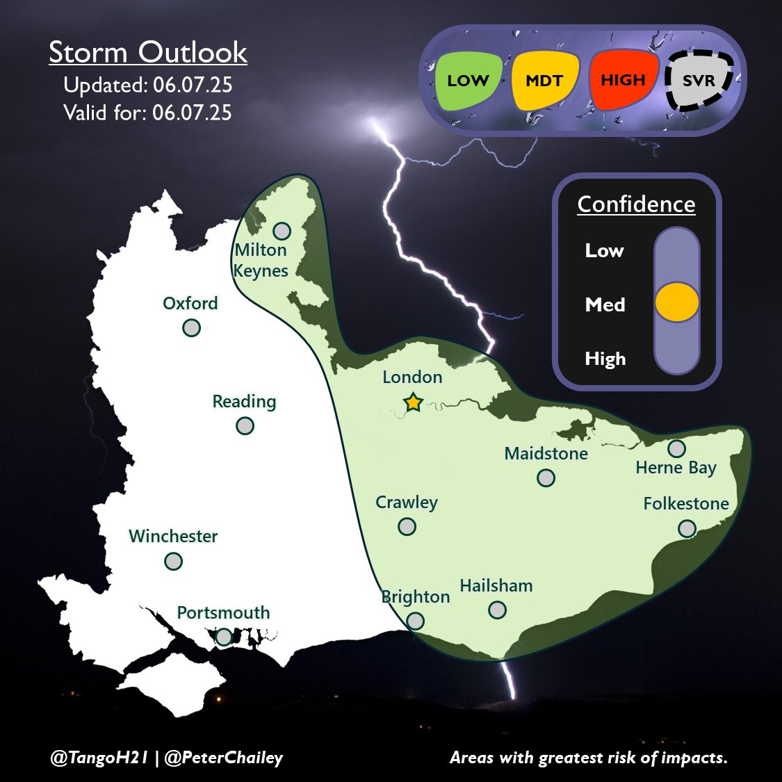
Here's how today's outlook performed, with what turned out be quite an active day ⚡️ After the early morning downpours cleared, daytime heating enabled numerous slow-moving storms to develop in the afternoon, aided by convergence and mild shear/helicity under a slack trough.
Plenty of lightning photos to come but what an idea to come to Herne Bay
Some good rumbles of thunder and dramatic skies from these cells passing over Sussex 🌩 #ukweather #thunderstorm
Following heavy rain overnight, which brought flooding to some areas, diurnal heating and wind convergence from the approaching surface shortwave will promote the chance of thundery downpours through the afternoon.
The risk of unsettled and convective weather for SE England is likely to resume overnight and through Monday afternoon. This courtesy of a weakening area of low pressure associated with an eastward-moving upper trough, which will raise lapse rates and wind shear.
An area of low pressure located to our SW will drag up warm Theta W values of up to 18°C of which will engage with an approaching cold front destabilising the environment. The main risk will be of rain where values may exceed 100mm in a short period of time, hence our MDT.
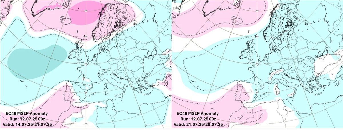
A look at the rest of July's #ukweather prospects 🌦️ The current area of high pressure is drifting to the north. With high pressure also expected to develop to the south, this will result in low pressure residing around the UK, enhancing the chance of rain as of late.
BREAKING: Christian Horner is to exit Red Bull Racing with immediate effect #F1
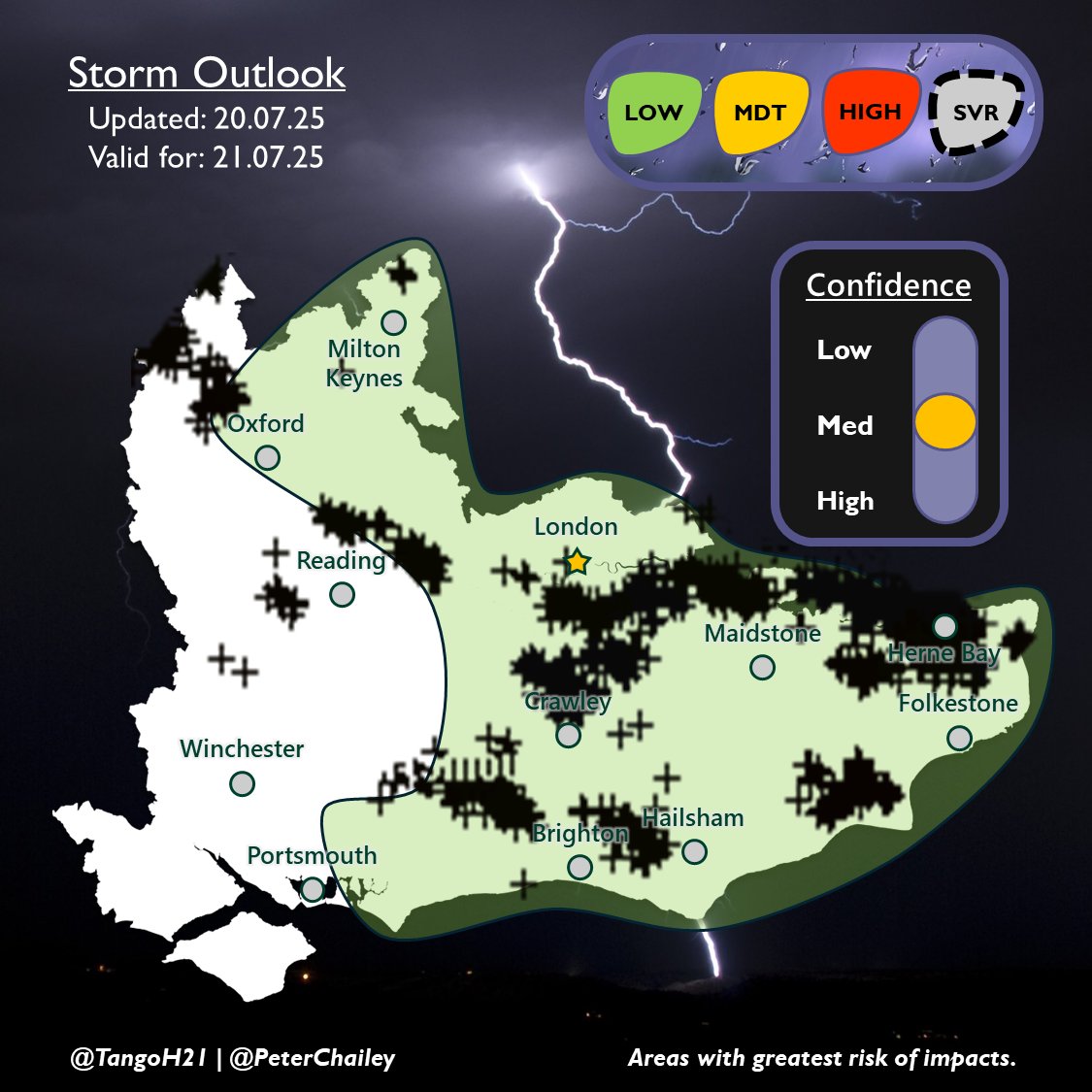
Here's how Sunday's outlook fared in terms of lightning (some strikes missing) ⚡️ An active day, similar to 21st May, with more storms further west than anticipated. The heaviest downpours and bulk of the lightning though were in the low risk area. #ukweather #thunderstorm
P3 - YEESSSSS!!! 🤩 NICO HULKENBERG SCORES HIS FIRST F1 PODIUM IN HIS 239TH RACE 👏👏👏 #F1 #BritishGP
Morning 👋 During this afternoon, thundery downpours should develop courtesy of a SErly tracking shortwave, convergence and cooler air moving in aloft. In the risk area, there's potential for lines of showers, with rain, small hail and lightning ⛈️
Epic Light Show! Fireworks and lightning collide in this stunning scene from Mustang, Oklahoma 🌩️🎇
Following verification, temperatures peaked at 35.8 °C at Faversham on 1 July, making this the highest temperature reached so far this year. This surpasses the previous figure of 34.7 °C recorded at St James's Park, which was reported on the same day.