Chailey peter jr 🌩️
@PeterChailey
Pretending to be an amateur storm chaser
🌩️It's been an active weekend with heavy rain and #thunderstorms affecting large swathes of the UK ☔️Check out this video of a funnel cloud developing around Wrexham captured by one of our forecasters this morning (21st July 2025)
Some nice convective towers going up here near Hailsham.
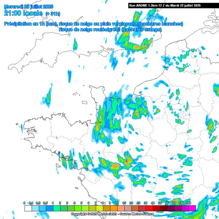
An upper trough and associated cold pool will enhance shower activity today. As the overnight rain clears, thundery downpours will likely develop along the south coast, aided by a convergence trough. Any storms will be slow-moving and bring the risk of flash flooding.
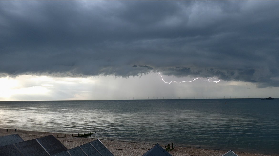
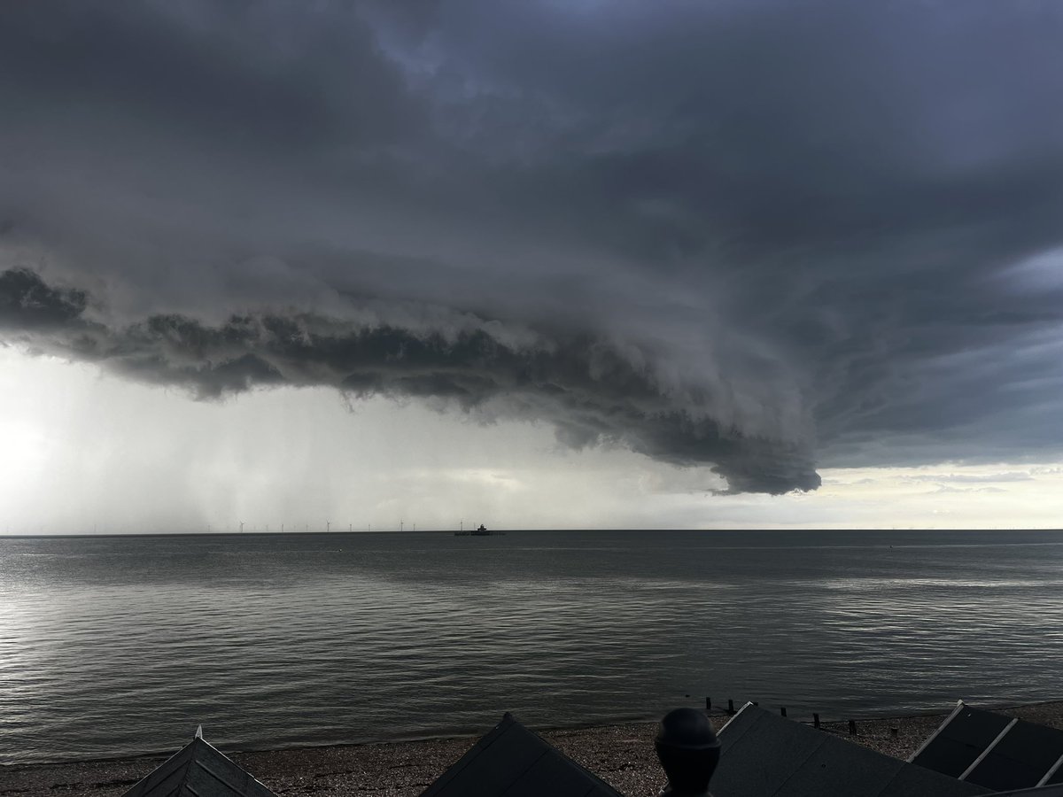
Another photo from the Herne Bay storm that I’ve just found whilst editing a video.
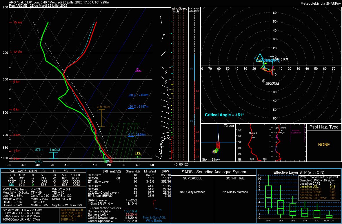
Another risk of some storms tomorrow in the South East. Weak shear shouldn’t allow for much organisation to any storms so probably ‘popcorn’ in nature. Small risk once again for some funnel clouds maybe even a weak tornado but the chance in any location is small as always.
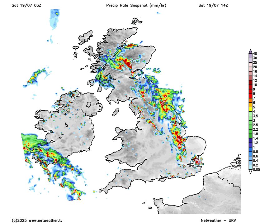
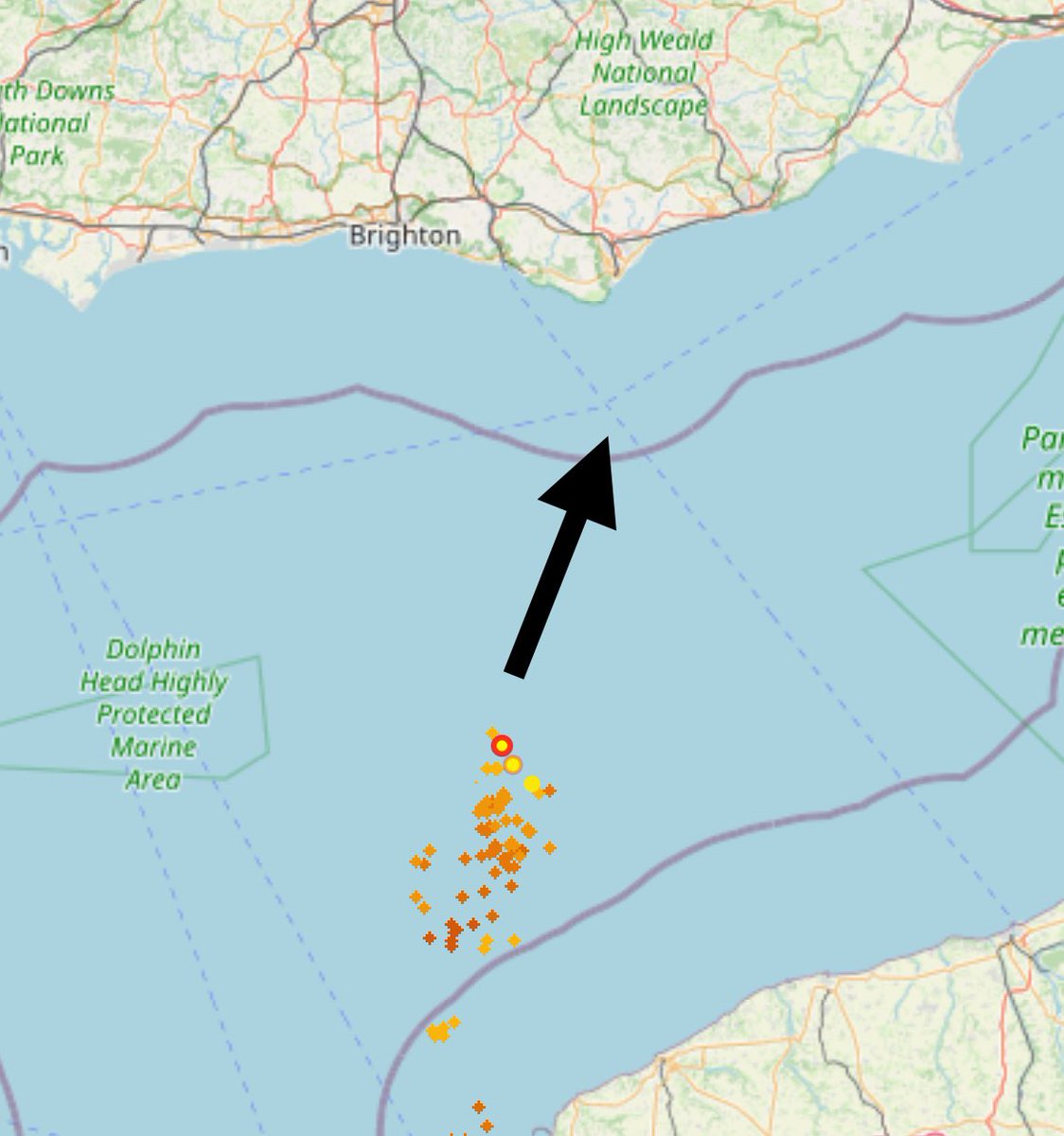
Here's how the outlook for last Friday night verified ⛈️ Overall, one of our strongest forecasts so far, with all strikes remaining in the MDT zone. The western extent of the heavy rain was well captured by the LOW risk. More showery weather to come in the next couple of days.
Here's how today's outlook performed, with what turned out be quite an active day ⚡️ After the early morning downpours cleared, daytime heating enabled numerous slow-moving storms to develop in the afternoon, aided by convergence and mild shear/helicity under a slack trough.
Plenty of lightning photos to come but what an idea to come to Herne Bay


Following heavy rain overnight, which brought flooding to some areas, diurnal heating and wind convergence from the approaching surface shortwave will promote the chance of thundery downpours through the afternoon.
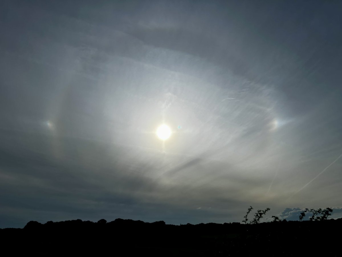
A cheeky sundog gracing us with his presence this evening
Potential for some more thundery showers this afternoon as the rain band clears north although will largely depend on how well any cloud clears. But could be one or two active cells
Do love it when the lightning decides to strike behind the one bit of cloud in your shot!
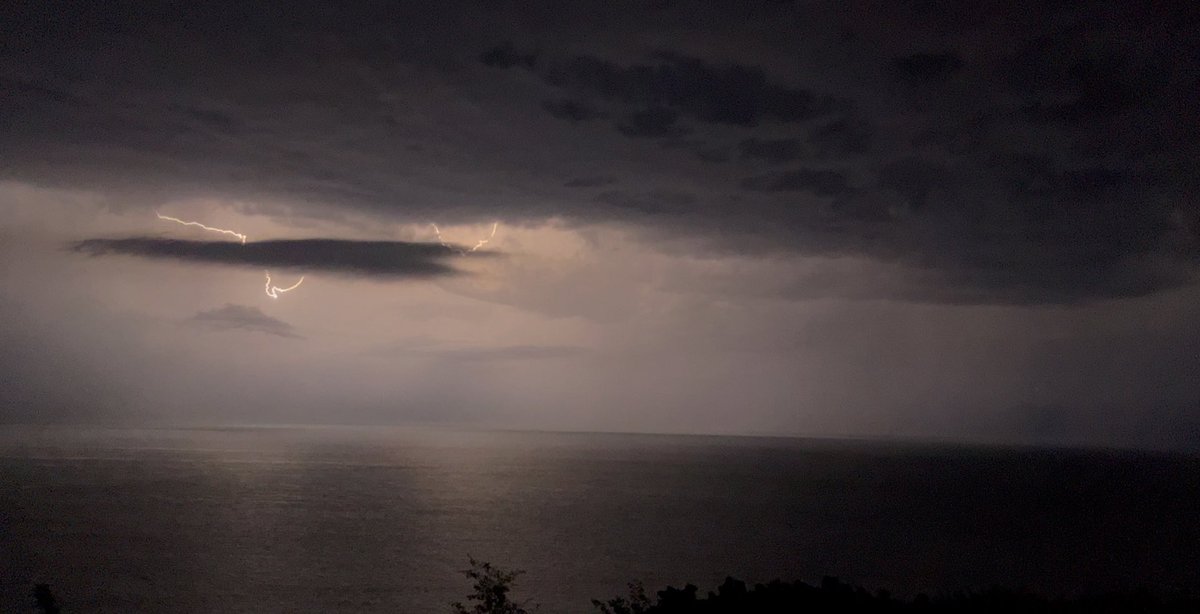

As expected, lightning is rather sporadic. Should be on the south coast in the next few hours, if it survives

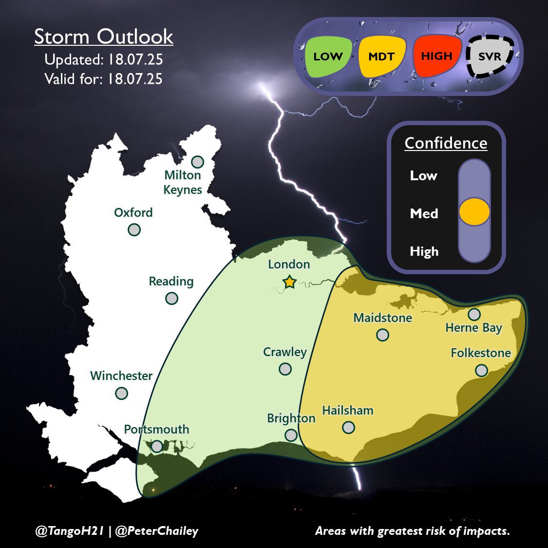
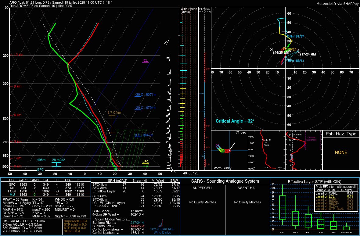
An area of low pressure located to our SW will drag up warm Theta W values of up to 18°C of which will engage with an approaching cold front destabilising the environment. The main risk will be of rain where values may exceed 100mm in a short period of time, hence our MDT.