Sonya Stevens
@SStevensWCIV
AMS Certified Broadcast Meteorologist on @ABCNews4 & @FOX24Charleston, mom of 2, wife, Christian, NC State grad & Lowcountry native living gluten free. #chswx
Winds were whipping on Abbapoola Creek on Johns Island today ahead of Tropical Storm Chantal! @natwxdesk #chswx
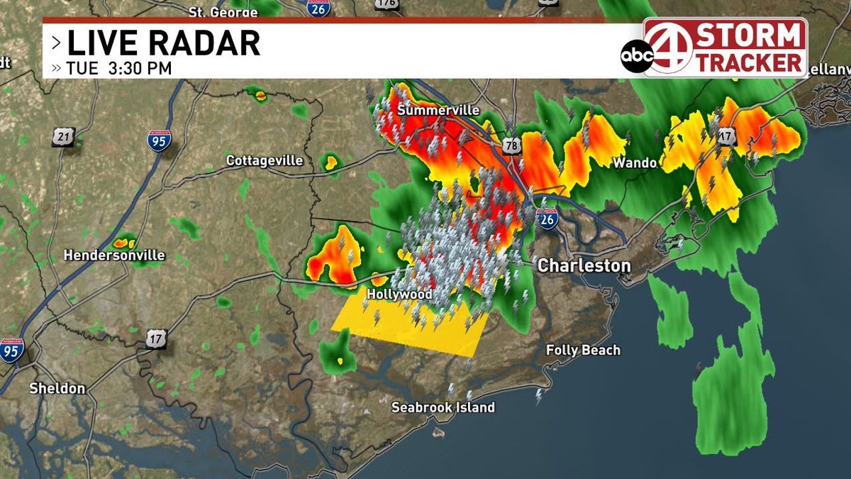
A Severe Thunderstorm Warning for part of Charleston county until 4:15pm. 60mph wind gusts and small hail along with lots of lightning and heavy rain for southern parts of the country like West Ashley, Hollywood, Ravenel, Johns Island, etc. as storms move south. #chswx
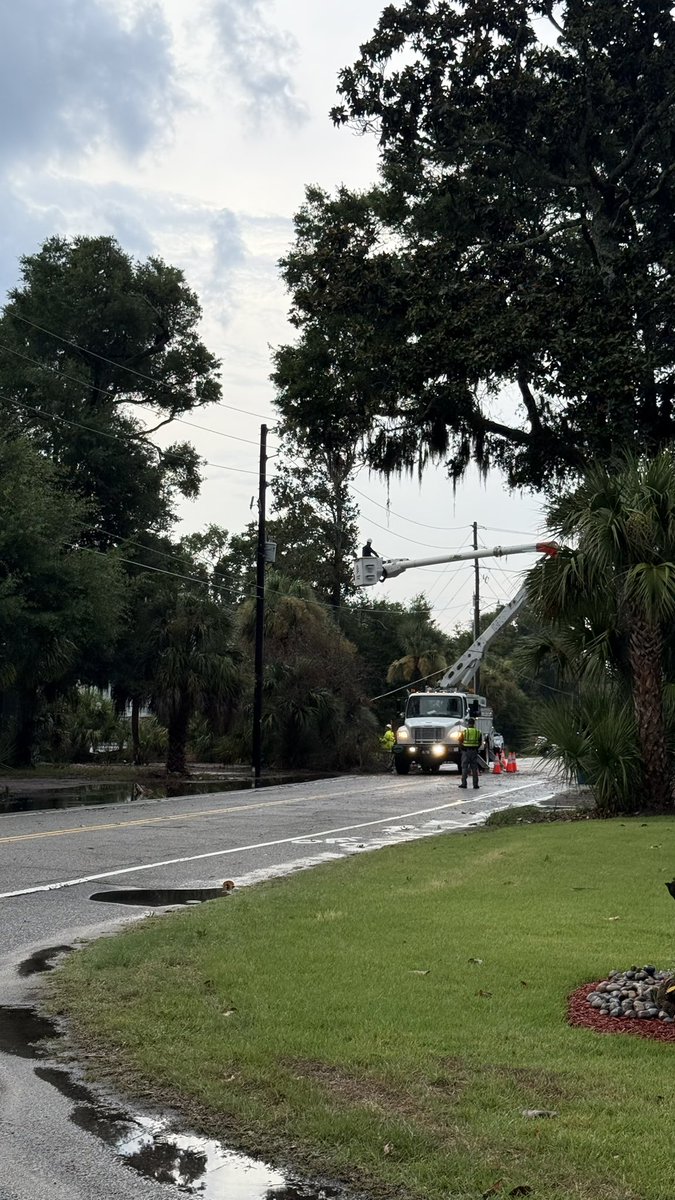
A non-severe thunderstorm resulted in some flooding and a tree down on a power line on Edisto Island, SC, Monday. @natwxdesk


Heat advisory until 8 PM. It could feel up to 110 at times! Please take it easy today!!#chswx
Thundering good at my house…a few thunderstorms have popped up! #chswx
All the various parts of a supercell thunderstorm. Cool, eh?
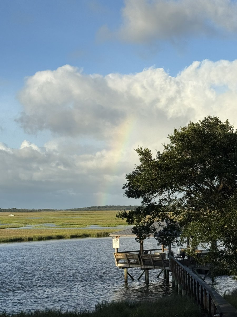
Seeing a rainbow never gets old … even if it’s a faint one. I spotted this in Charlotte over the weekend. @natwxdesk
⚠️TRAFFIC ALERT: River Road near Brownswood Road is shut down on Johns Island after a dump truck carrying sand overturned. Drivers are encouraged to find an alternate route as crews work to clean up the roadway. #CHSnews #CCSO
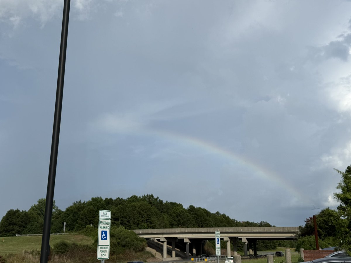
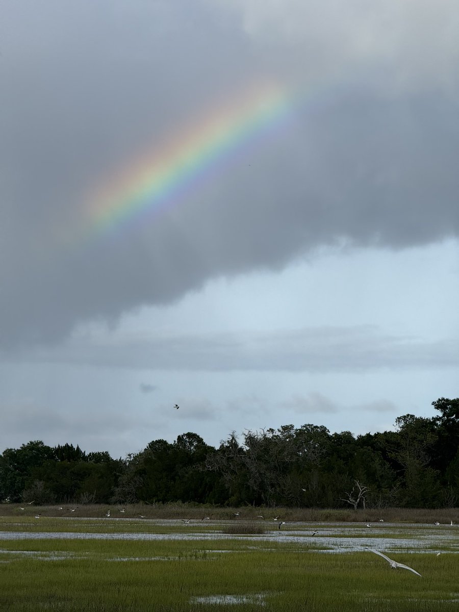
With the bands of showers moving onshore, there were a few different rainbows out at dad’s house on Johns Island today! @natwxdesk #chswx
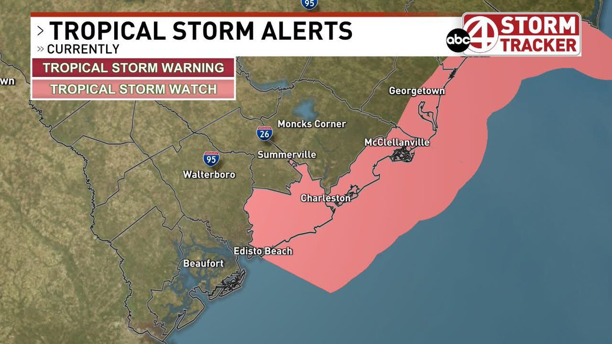
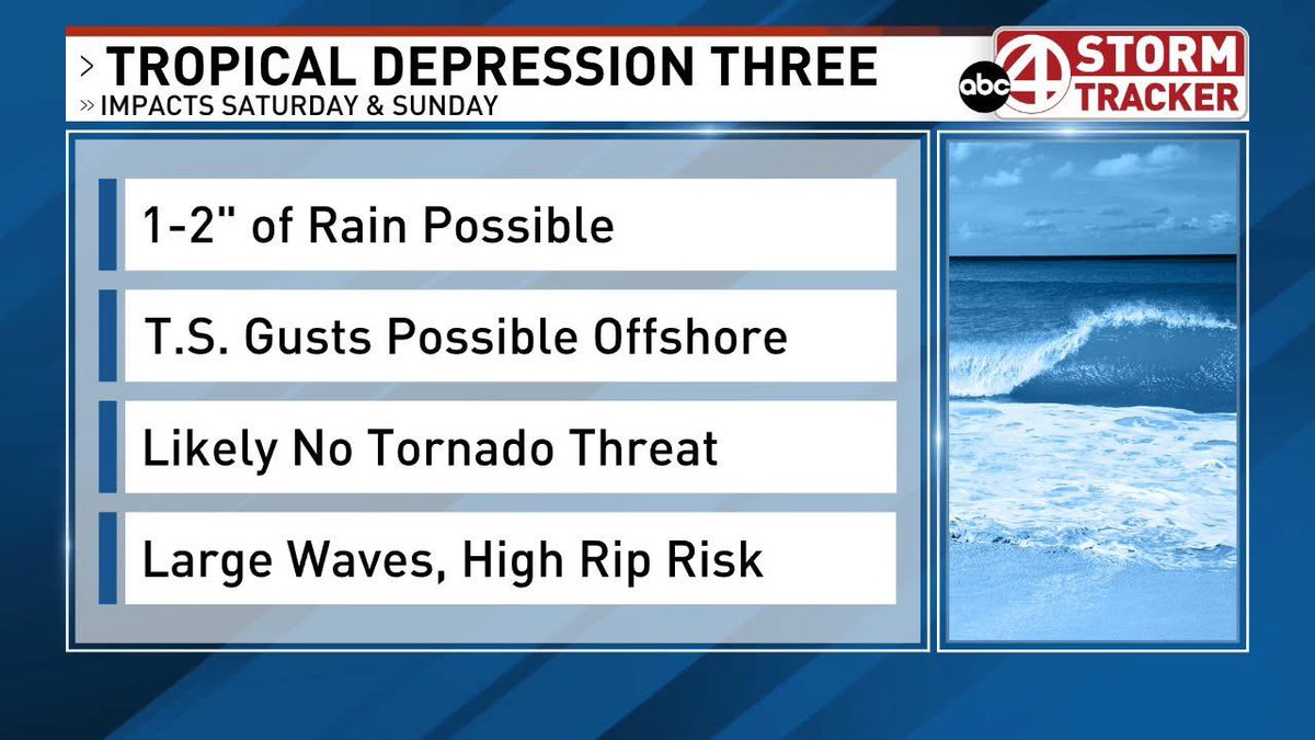
A Tropical Storm Watch is in effect for Charleston and coastal Georgetown county (likely where the landfall will be early Sunday). Here is a look at the impacts I’m expecting right now…stay tuned for more updates this weekend! #chswx
11pm Fri on TD Three: Strengthening expected Sat…will then be TS Chantal. Landfall expected bn Beaufort to Georgetown county...likely Sun AM. Expect some thundershowers (heavy rain possible), breezy conditions, esp. near the coast, rough surf & high risk of rip currents. #chswx

NHC will initiate advisories on Tropical Depression Three, located in the Atlantic Ocean offshore of the southeastern United States, at 500 PM EDT (2100 UTC).
2 pm EDT - Satellite data indicate that the system located about 150 miles off the northeast Florida coast has become better defined today with an area of strong winds located on its east side. A short-lived subtropical or tropical depression could form later today or on…
Between a stalled front and the sea breeze, thunderstorms are firing up this afternoon! Keep the rain gear handy!! #chswx
8 am EDT - A tropical or subtropical depression could form near the southeast U.S. this weekend or early next week. Heavy rainfall is possible across portions of the southeast U.S., particularly across the west-central Florida coast. Visit hurricanes.gov for more info.
Aircraft data indicates that the depression over the Bay of Campeche has become Tropical Storm Barry. Details: weather.gov/chs/tropical#a… #Tropicalstormbarry
Tropical Storm #Barry Advisory 4: Aircraft Data Indicates Depression Has Become Tropical Storm Barry. Heavy Rains Continuing Over Eastern Mexico For the Next Several Days. hurricanes.gov
A montage of shelf clouds and lightning from around the Lowcountry from Wednesday night! #chswx @natwxdesk
Here’s a few of my favorite lightning photos from Wednesday evenings storms as they split around Moncks Corner #scwx #chswx #stormhour @chswx @NWSCharlestonSC @LCWxDave @spann @RobStormTeam2 @BILLWALSHTV
Here’s my favorite shelf cloud photos from Wednesday evenings storms. You don’t see them like this in South Carolina’s low country very often. #scwx #chswx #stormhour @spann @chswx @NWSCharlestonSC @LCWxDave @BILLWALSHTV @RobStormTeam2