
St. Paul Emergency Management
@ReadyStPaul
The City’s emergency readiness planning efforts focus on all-hazards, disasters, preparedness, and recovery to ensure that St. Paul remains safe and resilient.
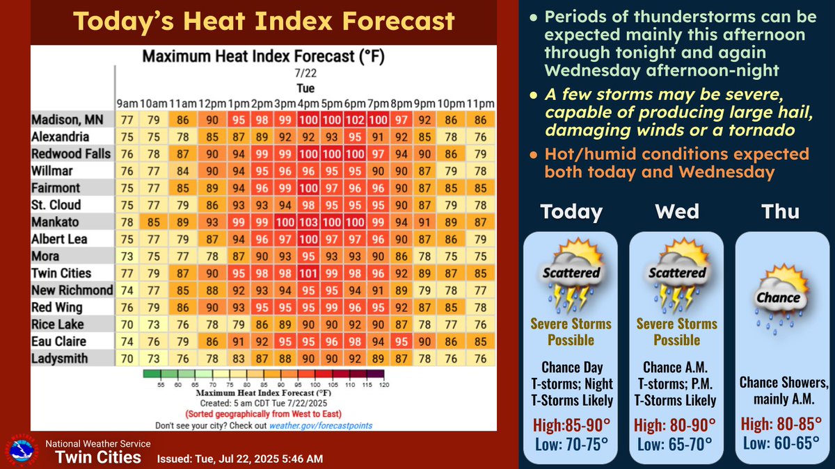
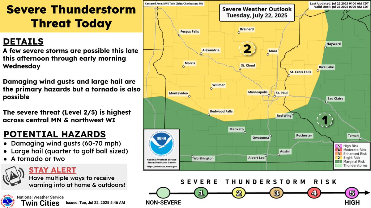
Hot & humid conditions will feature heat index values into the upper 90s to lower 100s today in @cityofsaintpaul. Stay hydrated and never leave pets or animals in the car! Then this afternoon and tomorrow severe t-storms are possible. Be aware of developing conditions. #mnwx
Stay Safe This July! It's the peak month for grilling accidents, injuries, and fires. Follow these stats and tips to ensure a fun and safe summer!
Scam alert: People in Minnesota are getting fake msgs from a phony “Minnesota Department of Vehicle Administration DMV).” That agency doesn’t exist. DPS and DVS will never send a text asking for money. Don’t click links. Delete the message.
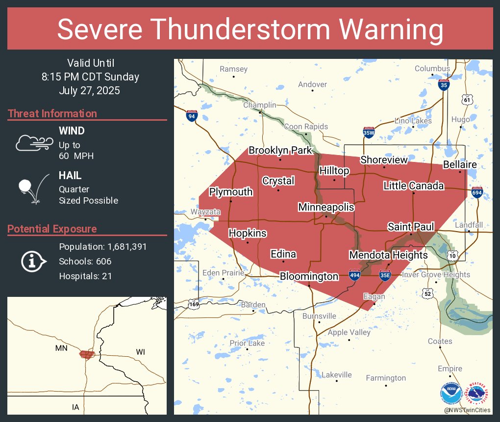
Severe Thunderstorm WARNING has been issued for cityofsaintpaulThis is a dangerous storm.Take shelter if you are outside and stay inside until it has fully passed the area. This storm is producing significant lightning, wind, and rain. Monitor local weather sources. #mnwx
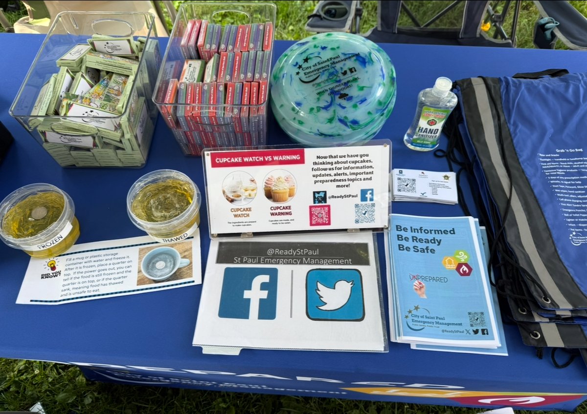
We are talking preparedness at Safe Summer Nights. We have Go Bags, information, chalk, and emergency pizza cutters. Come learn more about how to be prepared @femaregion5 @mndps_hsem @sppdmn @stpaulons

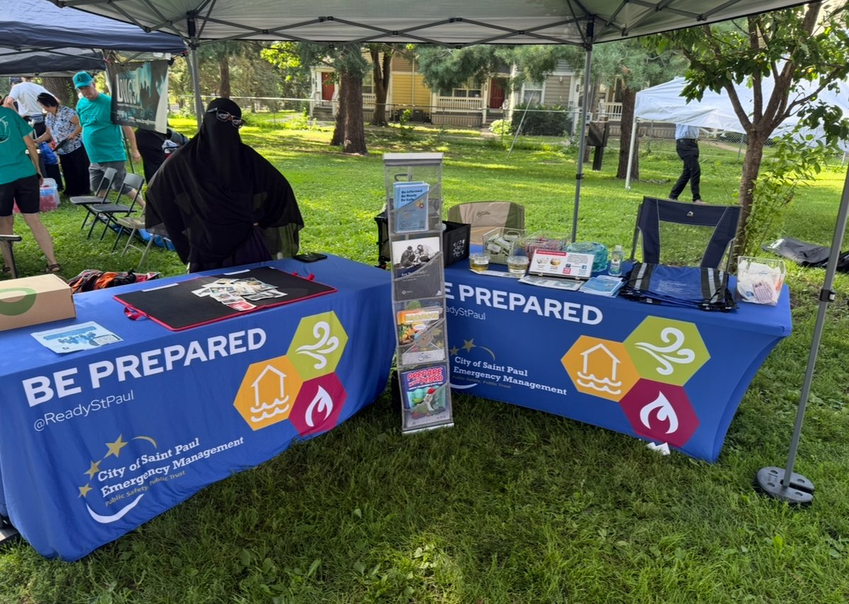
We will be there talking preparedness topics. Come see us and pick up your emergency pizza cutter! @MnDPS_HSEM @femaregion5
TONIGHT! Join Safe Summer Nights with @sppdmn , @StPaulFireDept, and @SaintPaulParks at El Rio Vista Rec Center this evening. These family-friendly events offer food, safety demonstrations, bike giveaways, games, and more. See you tonight!
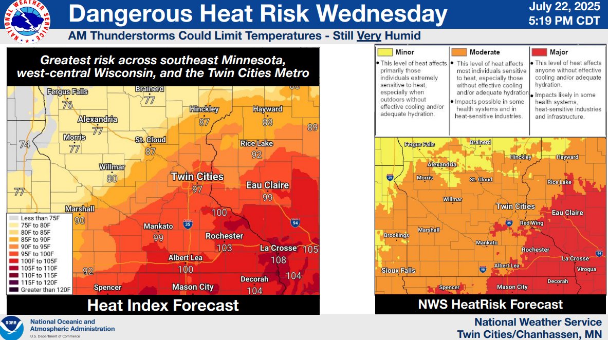
Another round of dangerous heat and humidity is on deck for Wednesday. A heat advisory has been issued. It goes into effect at noon and will continue through 8 PM. There is a slight risk for severe storms too. #mnwx
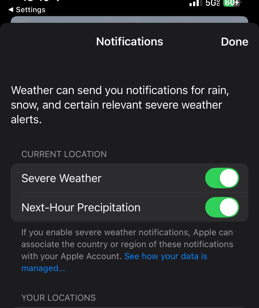
🌩️ Let’s talk about weather alerts. We have apps that alert us and NWS Wireless Emergency Alerts that are issued. Make sure they override silent mode📱iPhone users have another option 📲Settings ➡️ Notifications ➡️ Scroll down to Weather ‼️Turn on alerts and set location 📍 #mnwx

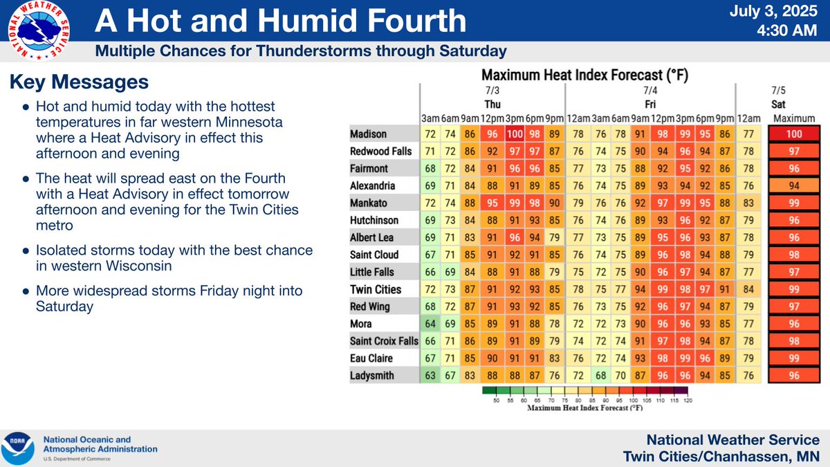
A Heat Advisory 🌡️🥵 has been issued including cityofsaintpaul . It'll be a hot and humid 4th of July, so drink plenty of fluids if spending time outdoors! Do not leave kids or pets in the car—Look before you lock! Strong t-storms are possible, so be weather aware #mnwx
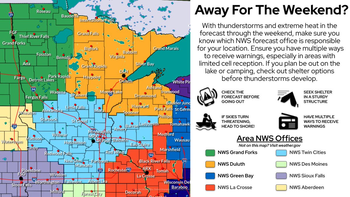
With thunderstorms and extreme heat in the forecast through the weekend, make sure you know which NWS forecast office is responsible for your location. Ensure you have multiple ways to receive warnings and check out shelter options BEFORE storms develop! weather.gov/forecastpoints
1:50PM Update: We are warning free across our area. The storms still present a heavy rain threat, with isolated strong winds. There's a non-zero risk in western WI for severe winds with storms still anchored to the gust front. #mnwx #wiwx
The outflow boundary from the northern metro storms has sunk south toward the 35 split in the southern metro, so it doesn't appear tornadoes are likely in the core metro anymore. Therefore, the tornado warning expired at 1 am. Strong winds and heavy rain are still expected #mnwx
Severe Thunderstorm Warning including Woodbury MN, Maplewood MN and Cottage Grove MN until 2:00 AM CDT
11:45PM Update: The line of storms continues to produce heavy rainfall and damaging wind gusts with trees knocked down. We are watching for potential flooding as the storms start to stall out along a line from west to east. This could include the Twin Cities metro. #mnwx #wiwx