Nick's Weather Eye
@NickJF75
Hi, I'm Nick Finnis, a Forecaster for Netweather - one of the UK's leading independent weather media/news websites. I specialise in severe weather forecasts.
Hmmm, bit close for comfort…
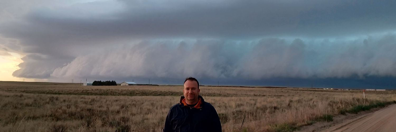
I got some crazy videos today - this was northwest of Watertown like 39 minutes ago, this tornado was mean - more soon
20 years ago today Birmingham was struck by this T5/6 tornado. torro.org.uk/pdf/Birmingham…
Violent, loud tornado earlier west of Watertown, SD. #sdwx
Turkey recorded its highest temperature on record on Friday with 50.5°C recorded in Silopi ⚠️📈 This exceeds the previous record of 49.5°C recorded on 15th August 2023 🌡️ This extreme heat is bringing serious health impacts and giving a very high risk of wildfires 🔥
THUNDERSTORM WATCH - SAT 26 JULY 2025 ⚡️ Issued 2025-07-26 09:03:20 Valid: 26/07/2025 0800 to 27/07/2025 0600 Forecast Details 👇 netweather.tv/weather-foreca…

Too hot for me, don’t get why people holiday there this time of year. The heatwave continues in Greece, with highs reaching 45.8°C in Skala, Messinia, today and temperatures > 39°C at 85% of the @meteogr weather station network.
🌡️🔥 Στους 44-45 °C η μέγιστη θερμοκρασία την Παρασκευή 24/07 - Πάνω από το 85% του πληθυσμού βίωσε μέγιστες θερμοκρασίες άνω των 39°C 🔗 meteo.gr/article_view.c…
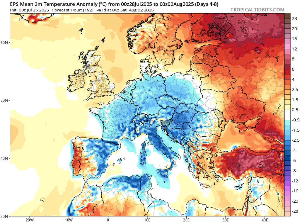
Jetting off on Holiday to mainland Europe next week? Large parts, especially southern, from E Spain across Italy to the Balkans (heatwave currently) are forecast to temps some 1-4C below normal, thanks to slow-moving cut-off low with cool NW flow. UK slightly warmer than average.

Norway just shattered heat records. For the first time ever, temps topped 30°C for 13 straight days — 8°C to 10°C above normal for July. Climate change had a strong to exceptional fingerprint on this unprecedented heat wave. 🧵/1
A timelapse showing 30 minutes worth of clouds flowing over Mt Adams and then Mt Washington after sunrise this morning (22 July 2025). #NHwx #NH #mountains #capcloud #timelapse
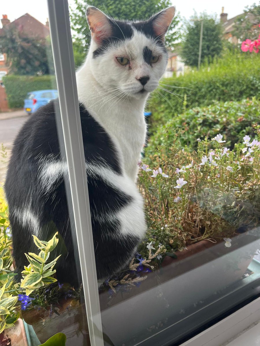
I don't care that I'm damaging the plants in your windowsill planter. It makes for a comfortable lookout seat.
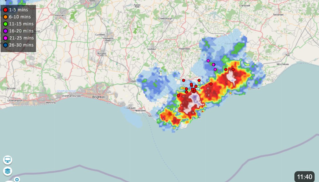
The coastal stretch Brighton-eastward has today seen an excellent example of thunderstorms kicking off along part of a convergence line, their outflow then travelling along the convergence line in both directions, triggering further thunderstorms. Meteorologically brilliant!
A microcosm of wetness and thunder to be found in coastal East Sussex in a generally quiet and dry UK this late morning. Radar from Netweather.tv