
⛈ New Castle Co. Skywarn 🌪
@NCCO_DE_Skywarn
New Castle County Skywarn - Information on potential Severe Weather and Severe Wx Reports. Activation on 448.825 PL -131.8 or 2nd 146.700 -131.8 DMR 3135691
Good Morning.. another unsettled day but showers and thunderstorms that have a slight chance of making themselves know later today.
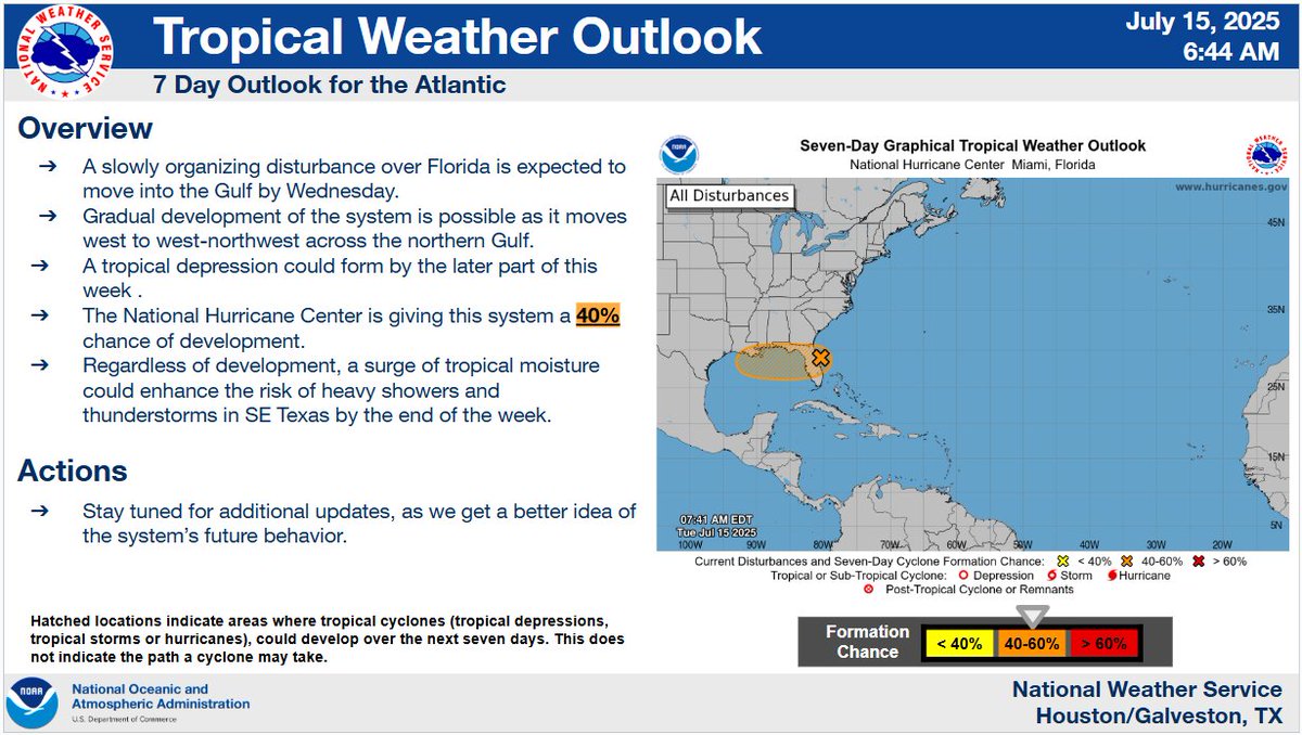
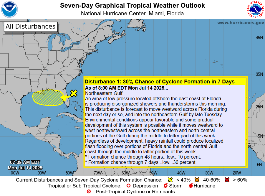
7/18 8pm EDT: A tropical wave interacting with a broad area of low pressure is producing disorganized showers and thunderstorms over the central tropical Atlantic. Slight development is possible late this weekend into early next week as it moves west-northwestward around 10 mph.…
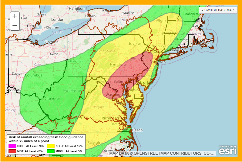
This is the @NWSWPC excessive rainfall outlook.
Just Unbelievable it is, at 0355 hours, frigin 81°F with a heat index of 84°F. Incredible !
A new drought monitor was released today, and our area, for the first time since May 7, 2024, has no area within any drought categories. #NJwx #MDwx #DEwx #PAwx
Quick look at Satellite shows mostly sunny conditions for just about everyone for now.
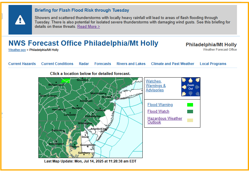
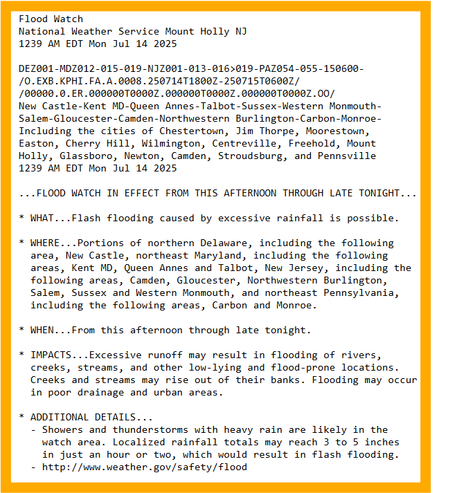
Good Afternoon... Muggy conditions continue.. Flood Watch, Heat Advisories, and threat of #SevereWX @NWS_MountHolly Has updated its Briefing package which is below and can be found here: weather.gov/media/phi/curr…
A look at the radar.. few scattered showers in Kent and Sussex at the moment. Keep an eye out for 'training' that may occur locally.
Meso Discussion 1668 Watch Possible 40% spc.noaa.gov/products/md/md…
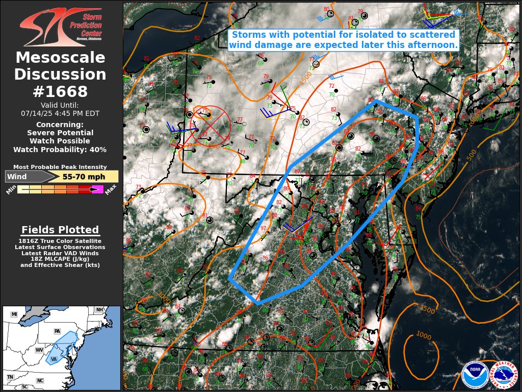
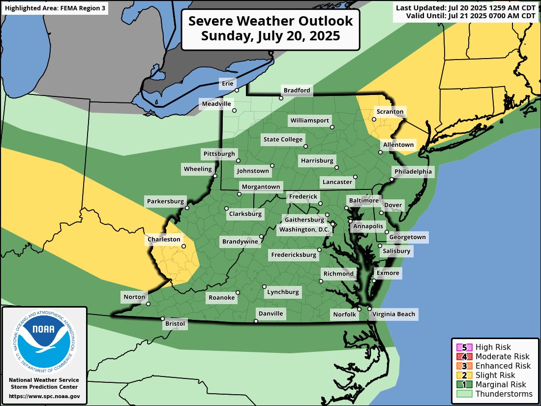
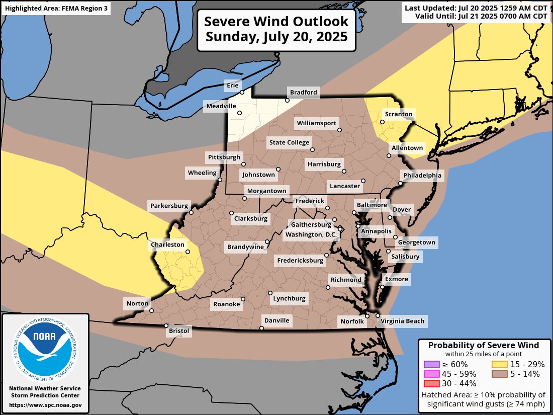
SPC Has increased the risk to Slight for portions of PA and MD this afternoon. #PAWX #MDWX #DEWX
Disturbance 10 is better defined than court jester Euro is saying it would be at this point. Looks like a weak low is forming just north of the convection.
A quick look at the forecast... Remember now is the time to prepare as we slowly close in to the heart of the hurricane season !!! #Hurricanes #tropics #storms
Flood Watches are posted regarding the significant chance of "Excessive Rainfall" visit weather.gov/phi for more :
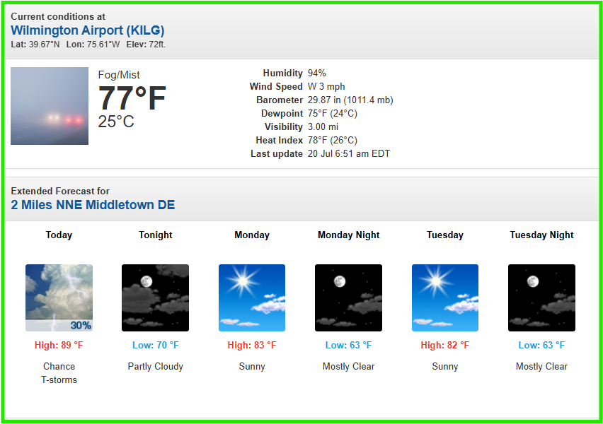
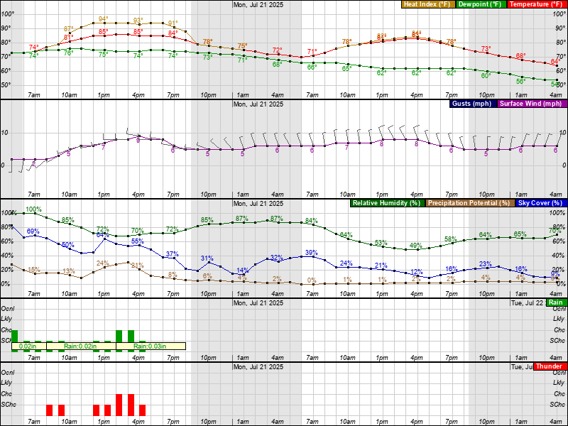
A digital format look at the #Forecast for #Dover_DE
PHI issues Flash Flood Warning [flash flood: radar indicated] for Kent [DE] till Jul 10, 8:15 PM EDT mesonet.agron.iastate.edu/vtec/f/2025-O-…
Flash Flood Warning including Dover DE, Camden DE and Rodney Village DE until 8:15 PM EDT
#WPC_MD 0637 affecting Northern Delmarva...Southern NJ, #njwx #dewx #mdwx, wpc.ncep.noaa.gov/metwatch/metwa…
Been observing some training occurring in Southern #NCCO