Met4Cast
@Met4CastUK
Serious about weather? We are too. UK storms, snow, and climate facts without the hype. Follow to be the storm expert in your group chat.
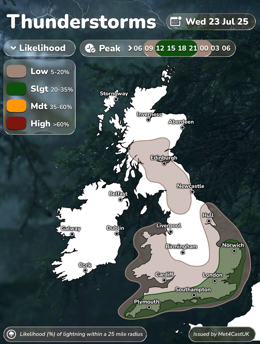
WED 23 JULY 25 Surface convergence will be the primary driver of heavy showers & thunderstorms on Wednesday across East Anglia, southeast, southern & southwest England. Small chance of localised flooding and funnel clouds near convergence lines.
I was considering a low-end MDT risk to highlight the convergence & greatest lightning risk but saturated profiles & generally skinny CAPE may limit lightning activity. As such, confidence wasn’t high enough for a higher risk level tomorrow.
WED 23 JULY 25 Surface convergence will be the primary driver of heavy showers & thunderstorms on Wednesday across East Anglia, southeast, southern & southwest England. Small chance of localised flooding and funnel clouds near convergence lines.
Fun fact: thunderstorms are the only type of weather that involves thunder 🤗
The future of the AMOC is one of the most urgent — and uncertain — questions in climate science. In this new Met Office video, I share insights from our Nature paper on how Southern Ocean winds may help prevent an AMOC collapse as the planet warms 🎥 youtu.be/GbmdoB1tN9I?fe…
This is astonishing. Global sea surface temperatures are once again pushing close to record breaking temperatures despite the lack of El Nino. This is largely driven by a very, very warm seas in the Pacific & around northwest Europe.
The weather over the next week across the UK will be rather non-descript. Dry with showers at times, temperatures generally around average.
Significant flooding in Huadian Town in Ji’an, Jilin Province, China. Severe weather keeps getting more severe & more frequent.
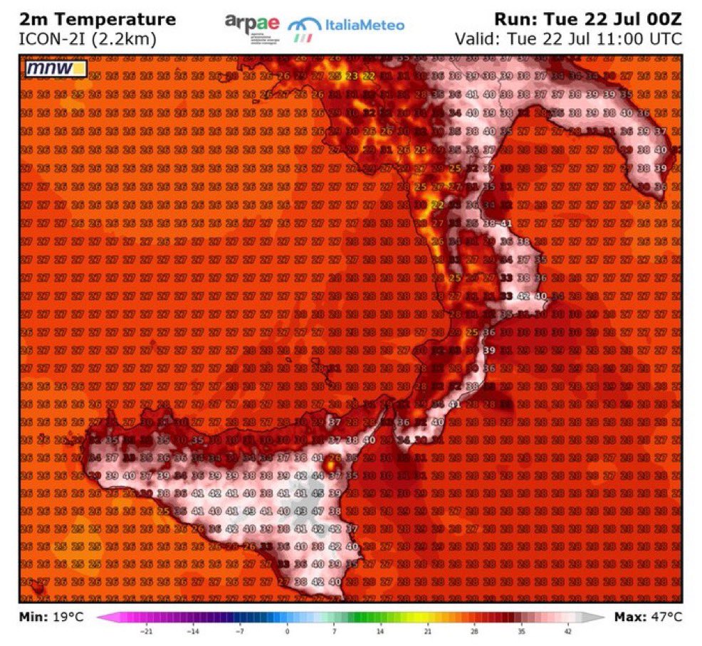
Sicily is currently experiencing a pretty extreme heatwave with temperatures potentially reaching as high as 45°C 🥵
TUE 22 JULY 25 Surface convergence will drive shower activity on Tuesday, primarily across eastern & southeastern counties. Whilst the lightning risk is lower than Monday, a few sporadic strikes are possible.
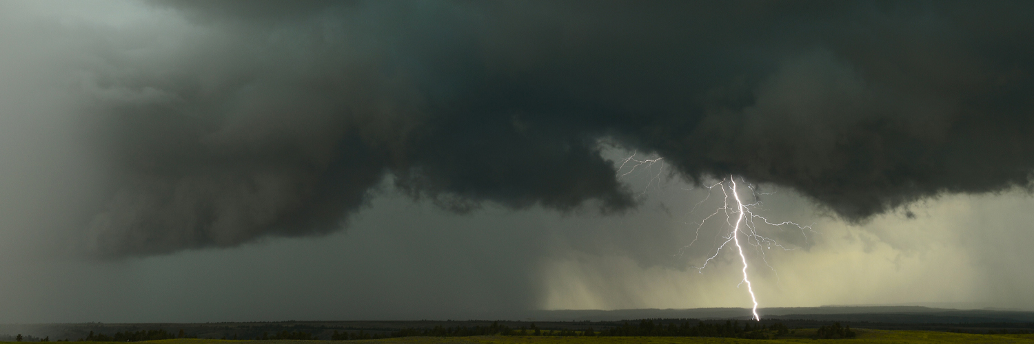
Here my results today regarding lightning. First time actually being able to capture lightning with this camera so still learning the settings. Hopefully won’t be long before I can get some more practice in 😅
Thank you Shane taken today Pole Moor Huddersfield
While watching an active Thunderstorm to my north east from Bishopbridge, I spotted a funnel cloud at around 17:20BST to the east. I would guess its somewhere near Ludford @TorroUK 🌪️