Jeff Lindner
@JeffLindner1
Meteorologist for Harris County, TX. Director of Harris County Flood Control District flood operations and forecasting. Any opinions are my own.
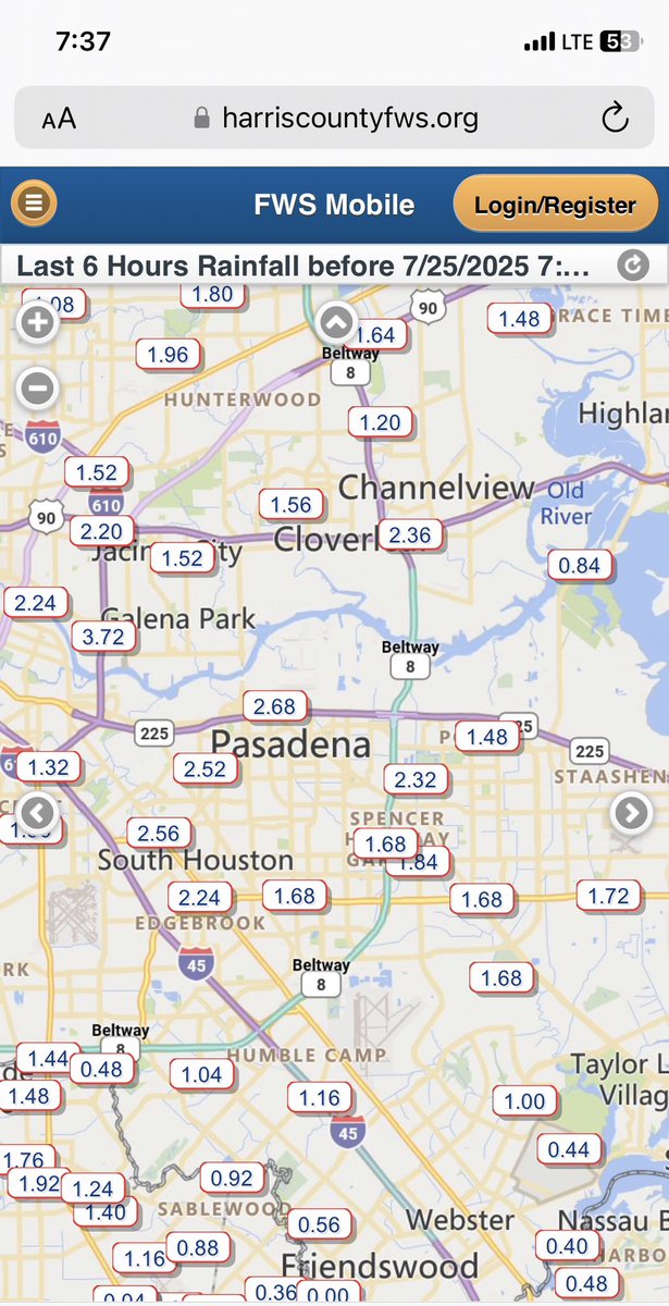
Heavy rainfall counties over SE Harris County although rainfall rates are coming down some. Street flooding likely in the blue circled area #houwx #txwx
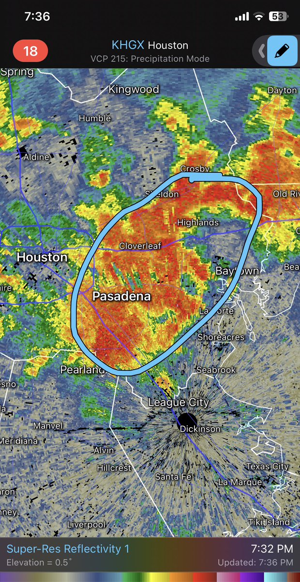
Heavy rainfall from slow moving and training storms over portions of the metro area with rainfall rates of 1-2 inches per 30 min. Street flooding likely in blue circled area #houwx #txwx

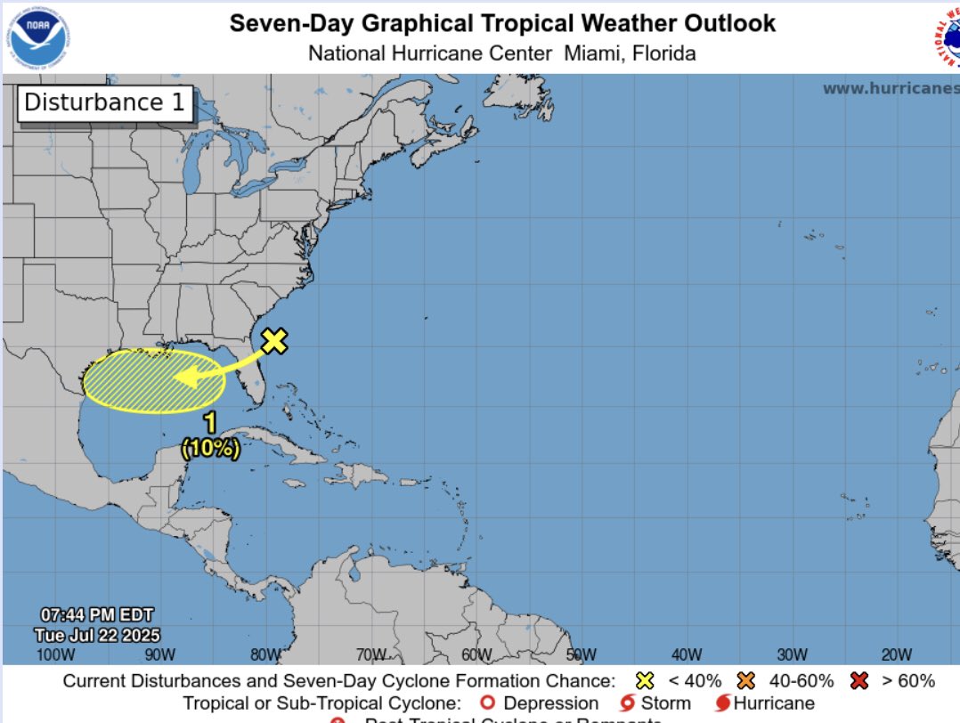
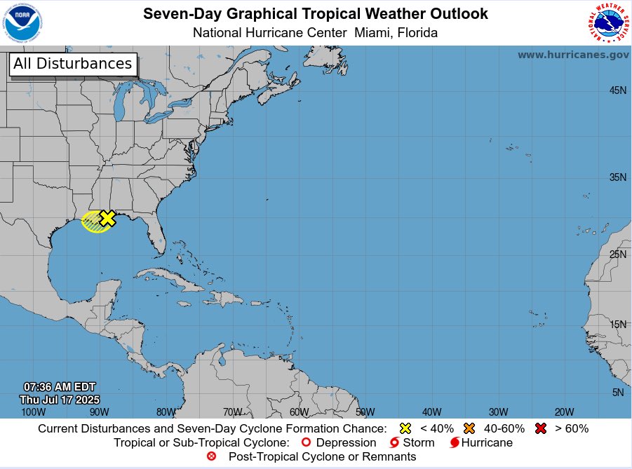
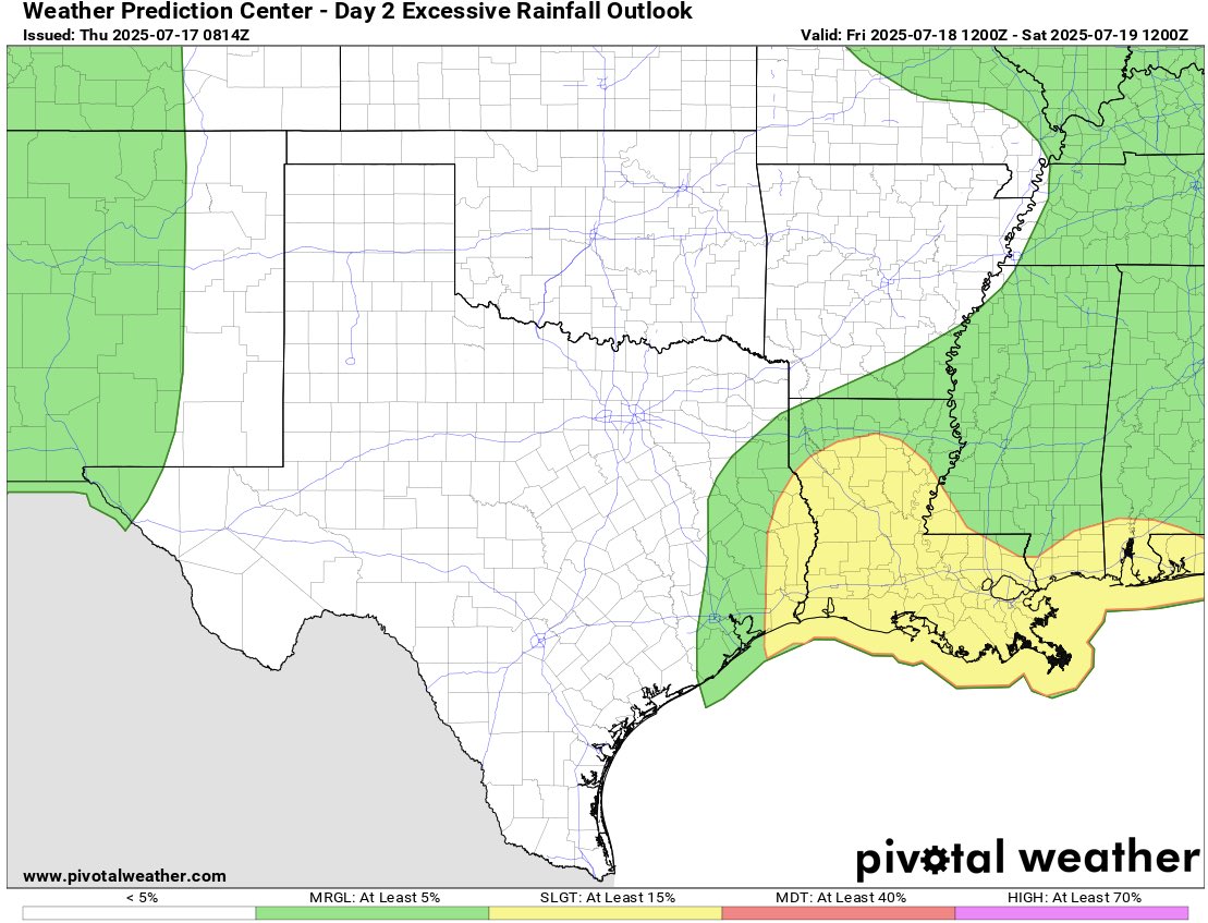
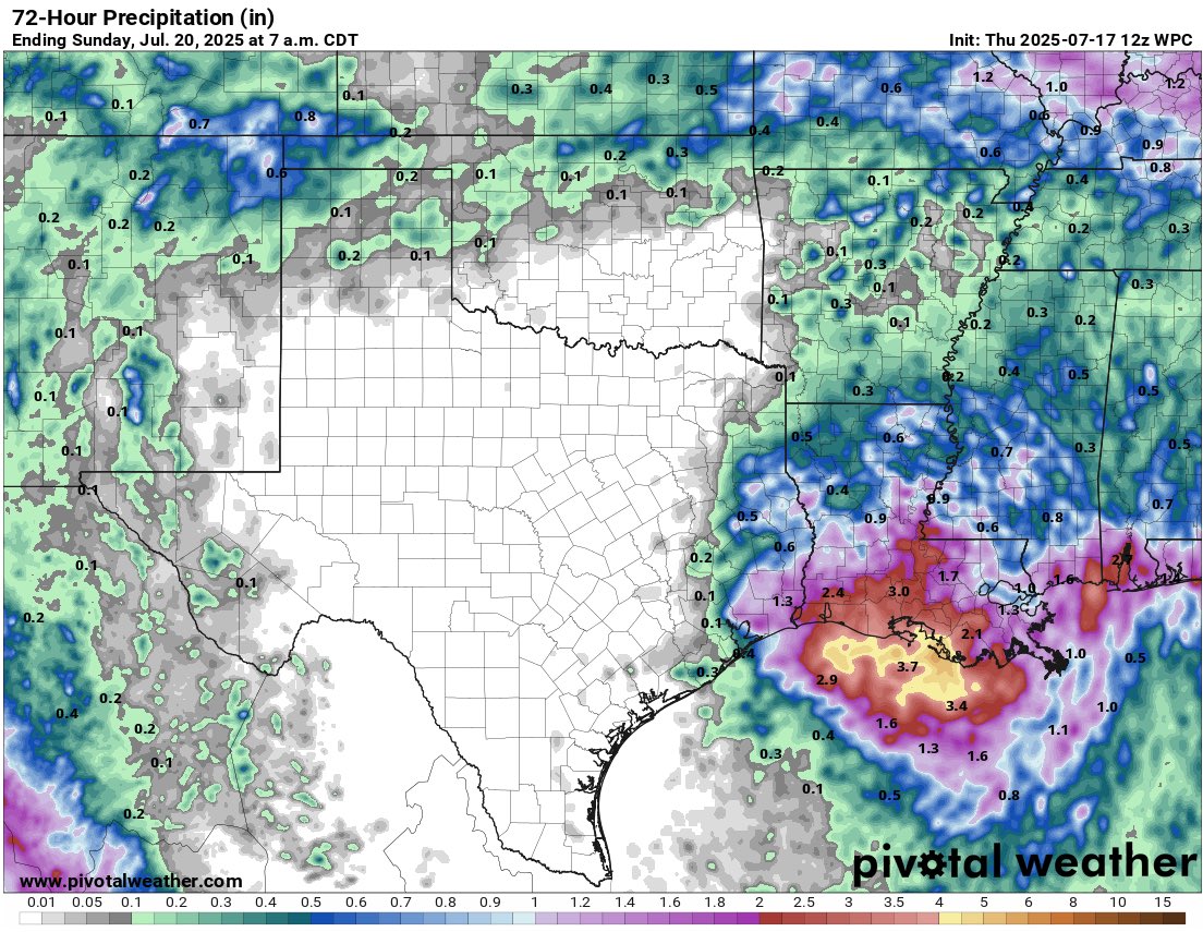
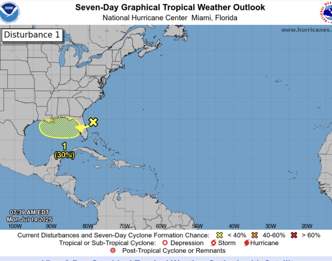
Low end (10%) chance that a tropical Depression may attempt to develop in the northern Gulf late this week as it moves generally west toward the TX/LA coast. Regardless of development, rain chances increase Friday and Saturday locally. #txwx #houwx
Flooding in Houston can occur rapidly, and even a few inches of rain can cause significant problems. I encourage you to sign up for free flood alerts from the Harris County Flood Control District so you can stay informed and safe before the water rises. 👉 SIGN UP:…
Moisture increases later today, but looks like the heaviest rains with 93L will remain east of our local area #houwx #txwx
Floodgate operations from Lake Buchanan today. LCRA opened a total of four floodgates at Buchanan Dam on July 14 – the first floodgate operations there since May 2019. This coordinated response helps manage significant water inflows across the Highland Lakes system.
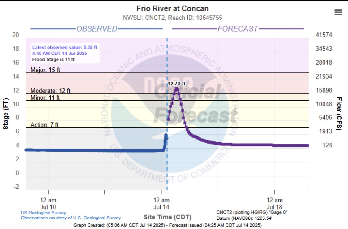
The Frio River at Concan and the Frio River below Dry Frio near Uvalde is now forecast to reach major flood stage. Seek higher ground along the river. #txwx
Some slow development is possible with this system in the northern Gulf later this week. A good idea to check forecast daily for changes #houwx #txwx
Flash flooding again over SW TX this time the Frio River. #txwx
San Saba River southeast of Brady via John Williams @fox7austin #txwx
Here's a look at rainfall totals since midnight. Follow the Hydromet for the latest real-time data on rainfall, streamflow, lake levels and more: hydromet.lcra.org
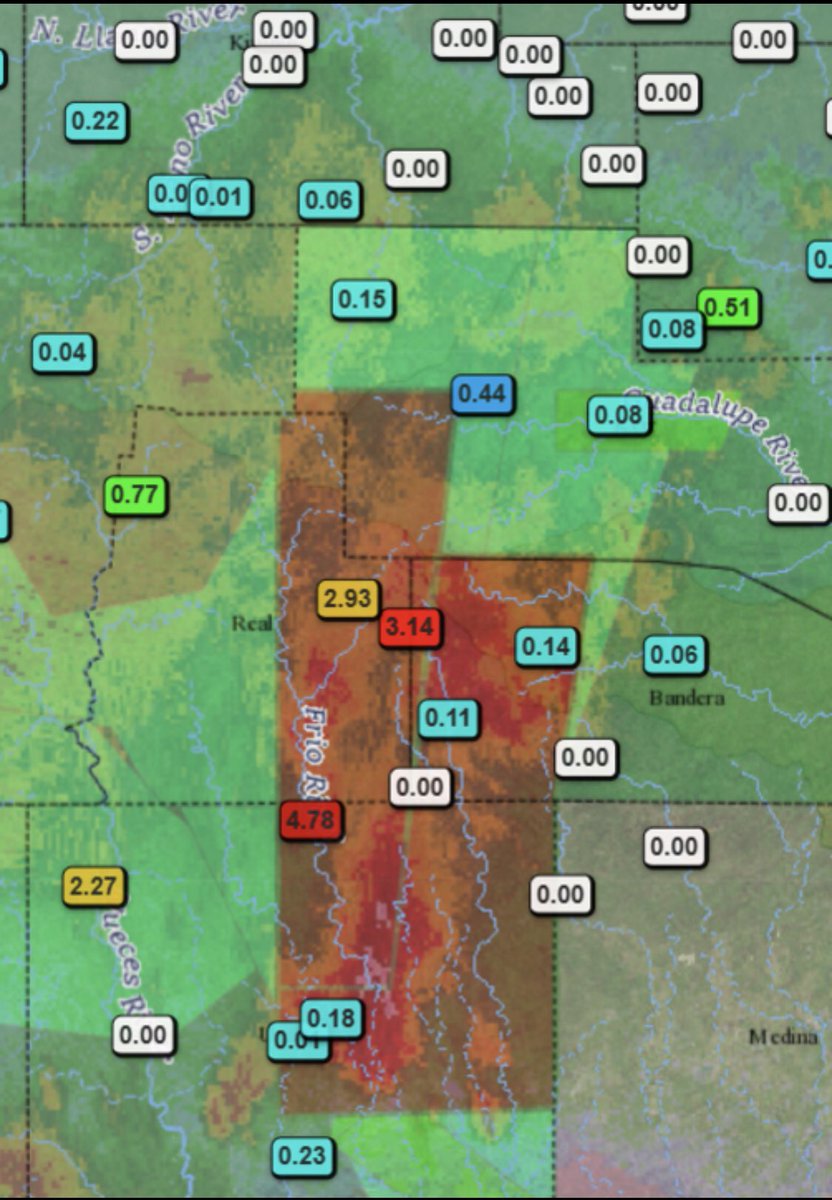
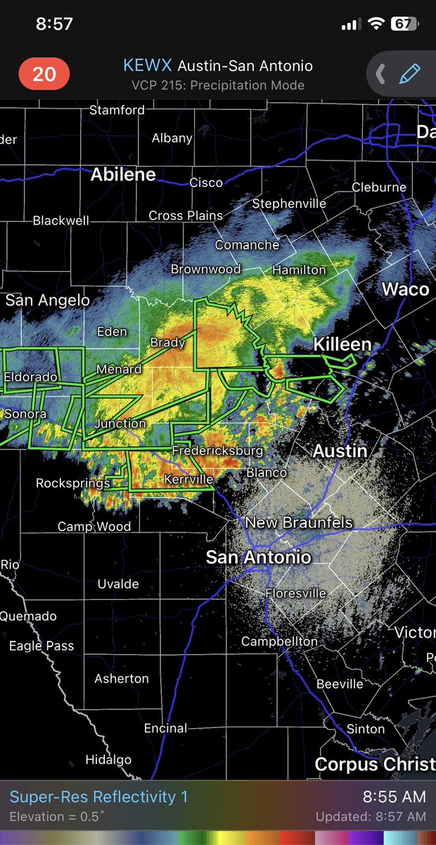
Flash flooding and significant river rises ongoing across the TX Hill Country this morning. Numerous low water crossings are flooded making travel dangerous. Persons should closely monitor creeks and rivers and be prepared to move to higher ground #txwx
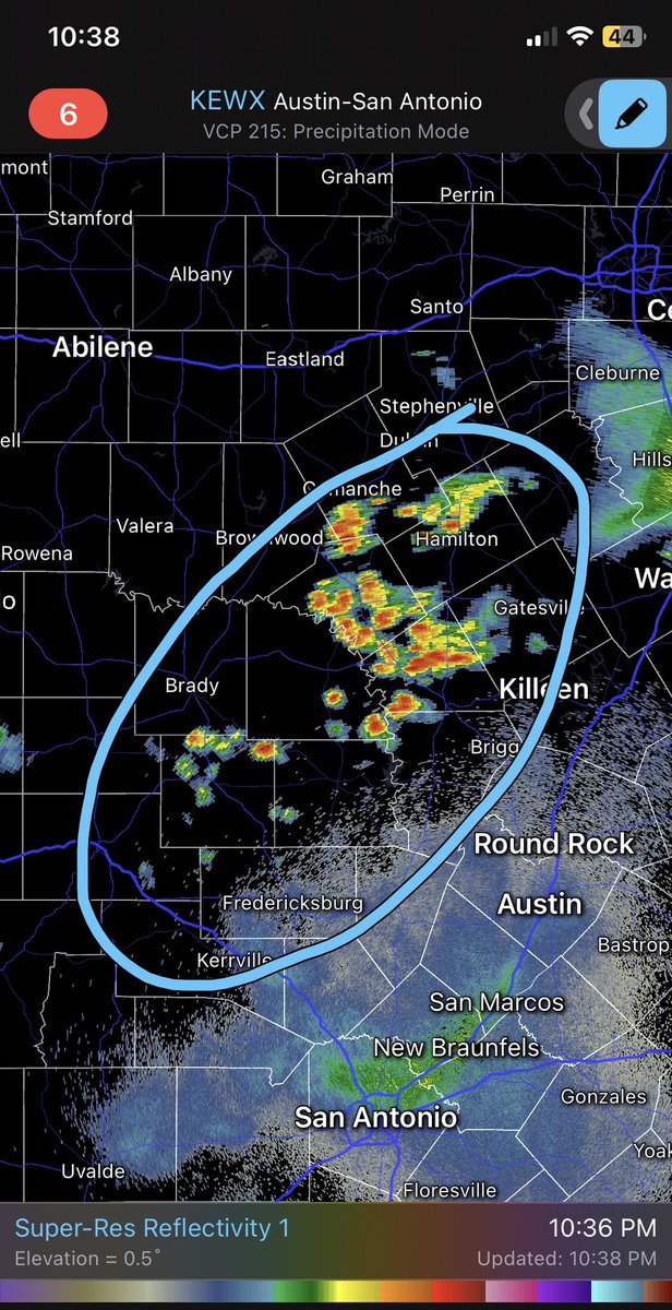
Watch out for flooding along the Lampasas and Leon Rivers today in Bell and Coryell counties. Stay away from areas where water covers the road! #ctxwx
Flash Flood Emergency including San Saba County, TX until 7:00 AM CDT
Heavy rain falling across the northern parts of Burnet and Llano Counties. These are observed rainfall amounts for the last 2 hours (2 to 4 am). #txwx
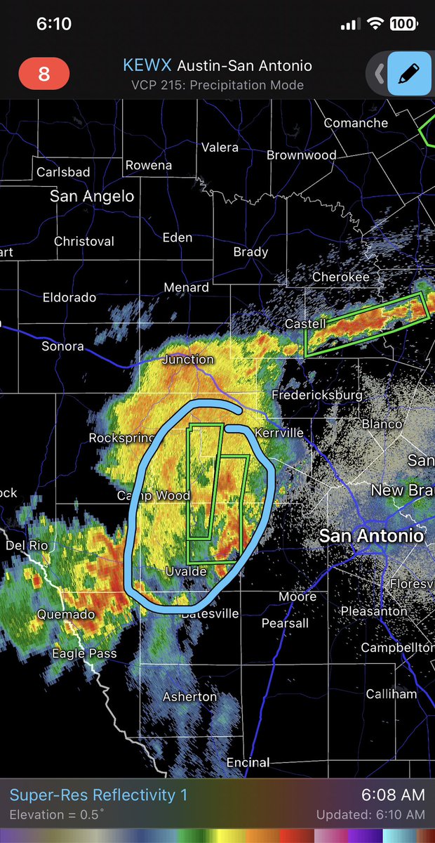
Dangerous and potentially life threatening flash flood event tonight into Sunday for portions of the Texas Hill Country and I-35 corridor. #txwx
Potentially serious situation unfolding across the Hill Country tonight
#WPC_MD 0665 affecting Central Texas, #txwx, wpc.ncep.noaa.gov/metwatch/metwa…
Put together some of the preliminary data for the Hunt and Kerrville River gages for this event and how historically this compares #txwx


133/ A 20nm TFR has been placed over nearly all of Kerr Co. as well as a flight corridor between Kerr Co. and Canyon Lake to facilitate rescue and recovery operations. NO MEDIA OR PRIVATE DRONES are authorized.