NWS San Angelo
@NWSSanAngelo
Official Twitter account for the National Weather Service Abilene/San Angelo. Details: http://weather.gov/nws_x
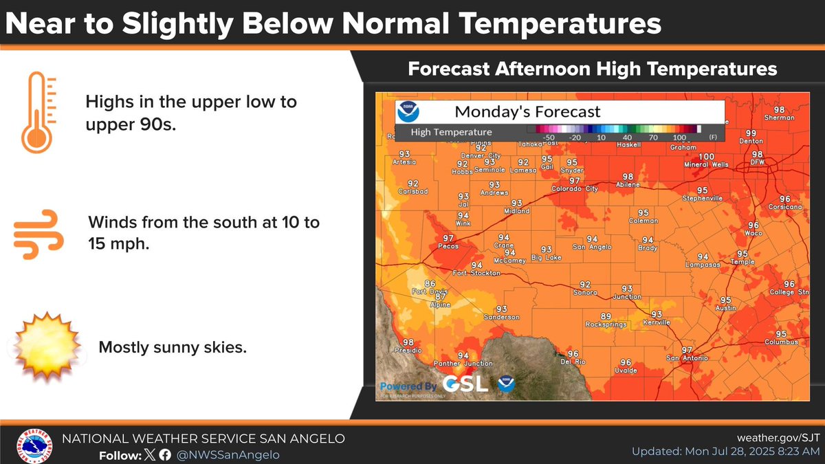
Mostly sunny today, with near to slightly below normal temperatures. #sjtwx #abiwx #txwx
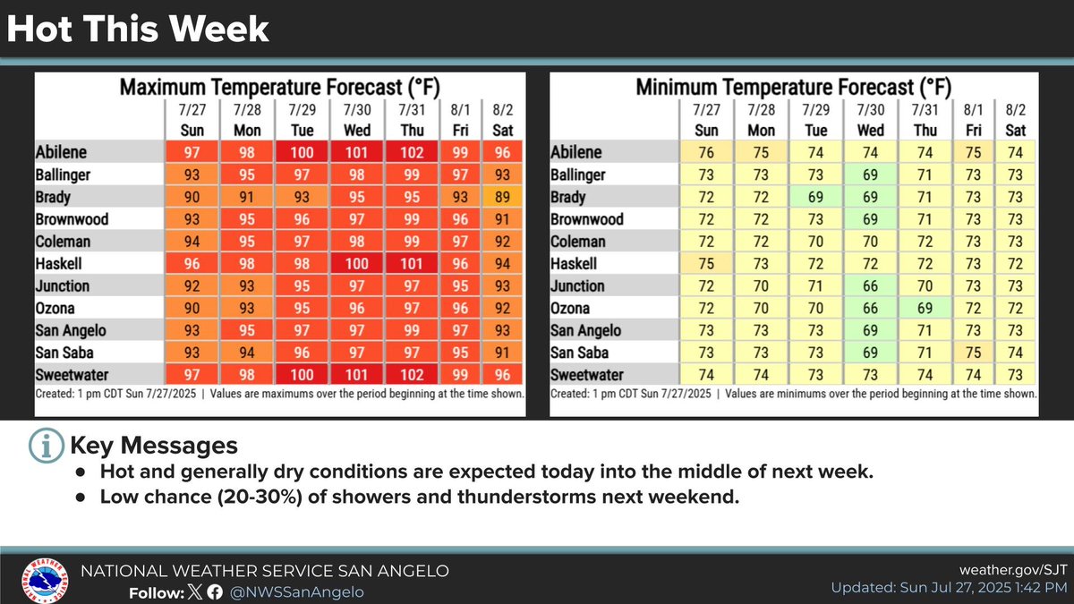
Hot and generally dry conditions will continue through much of the work week, with increasing temperatures by the middle of the week. Low end rain chances return by next weekend. #sjtwx #txwx #abiwx
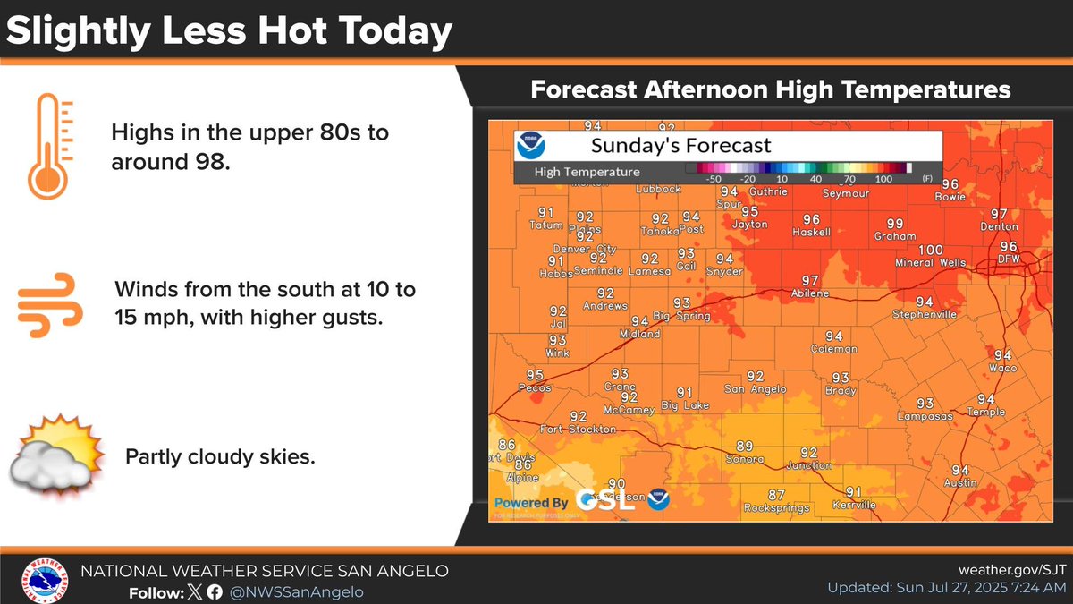
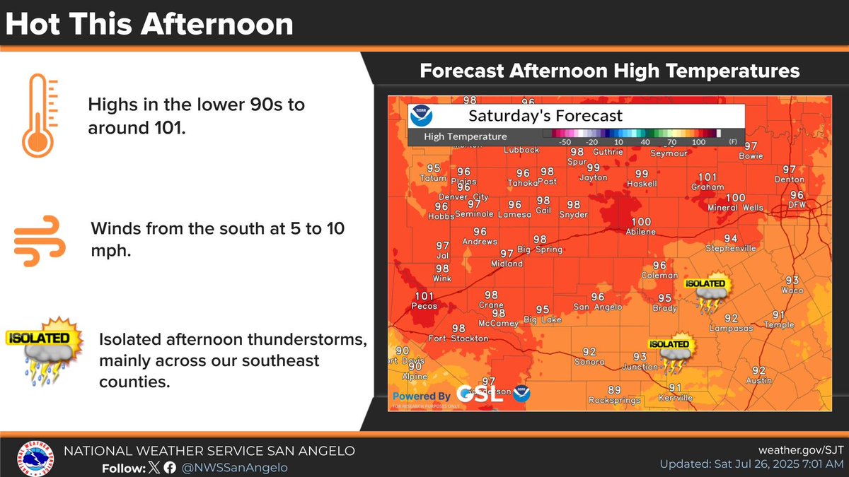
High temperatures this afternoon will be slightly cooler than what we saw across the area yesterday. Although an isolated shower or thunderstorm can't be ruled out across our southeast counties this afternoon, mainly dry conditions are expected. #sjtwx #abiwx #txwx
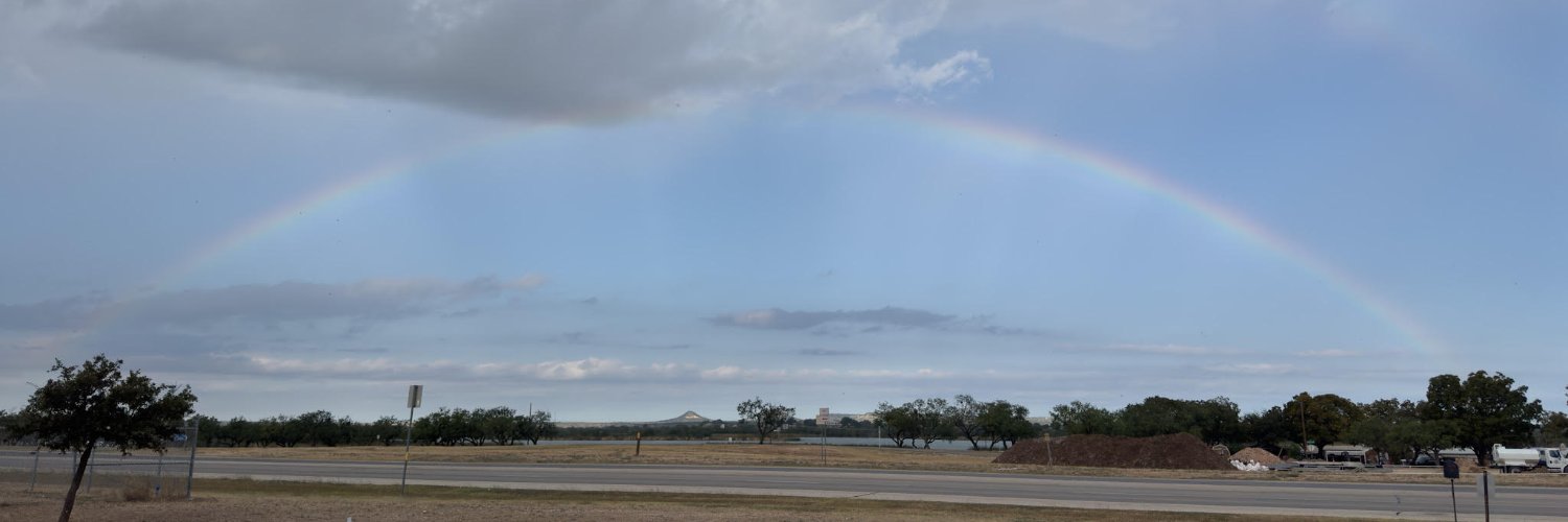
4:10pm 7/26/25: scattered showers and storms, producing brief downpours and lightning, will continue across the northwest Hill Country through mid evening. Be cautious driving in this area as visibility will suddenly lower in heavy rainfall. #txwx #sjtwx
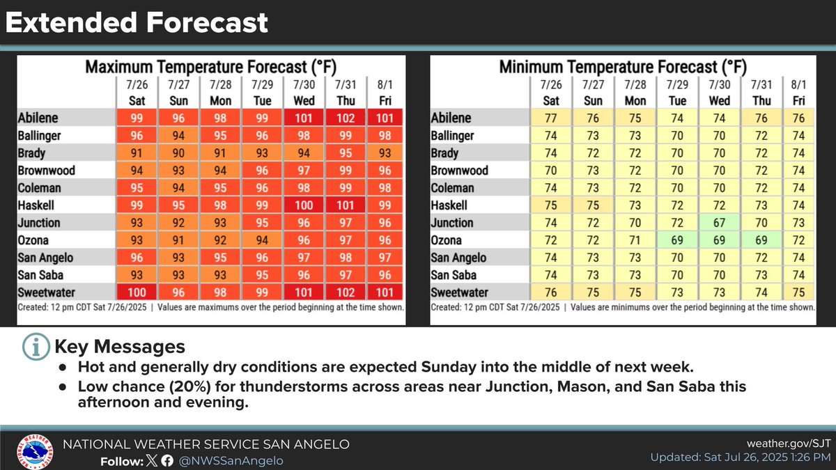
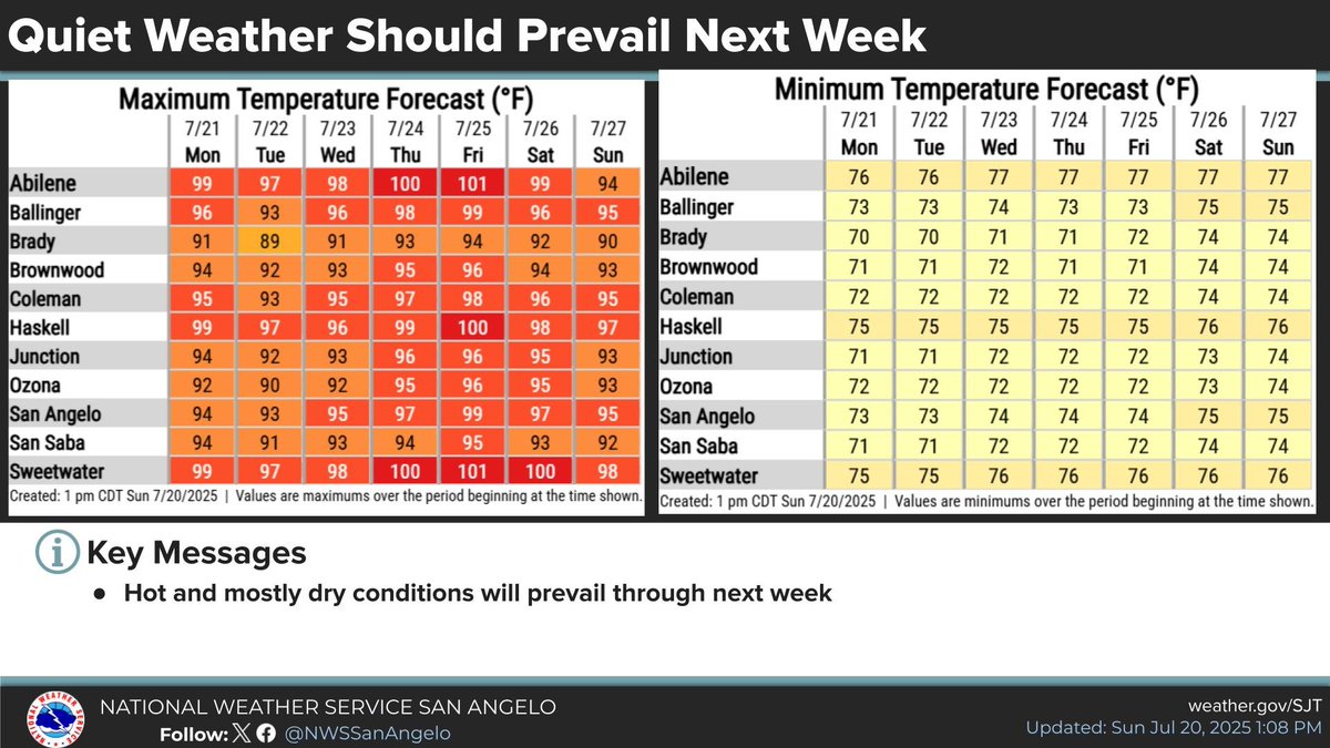
Hot and generally dry conditions are expected Sunday into next week, with the hottest temperatures across the Big Country. #sjtwx #txwx #abiwx
We are expecting another hot day across the area, although temperatures will be a couple degrees cooler than what we saw yesterday. Isolated showers and thunderstorms are possible this afternoon and early evening, mainly across our southeast counties. #sjtwx #abiwx #txwx
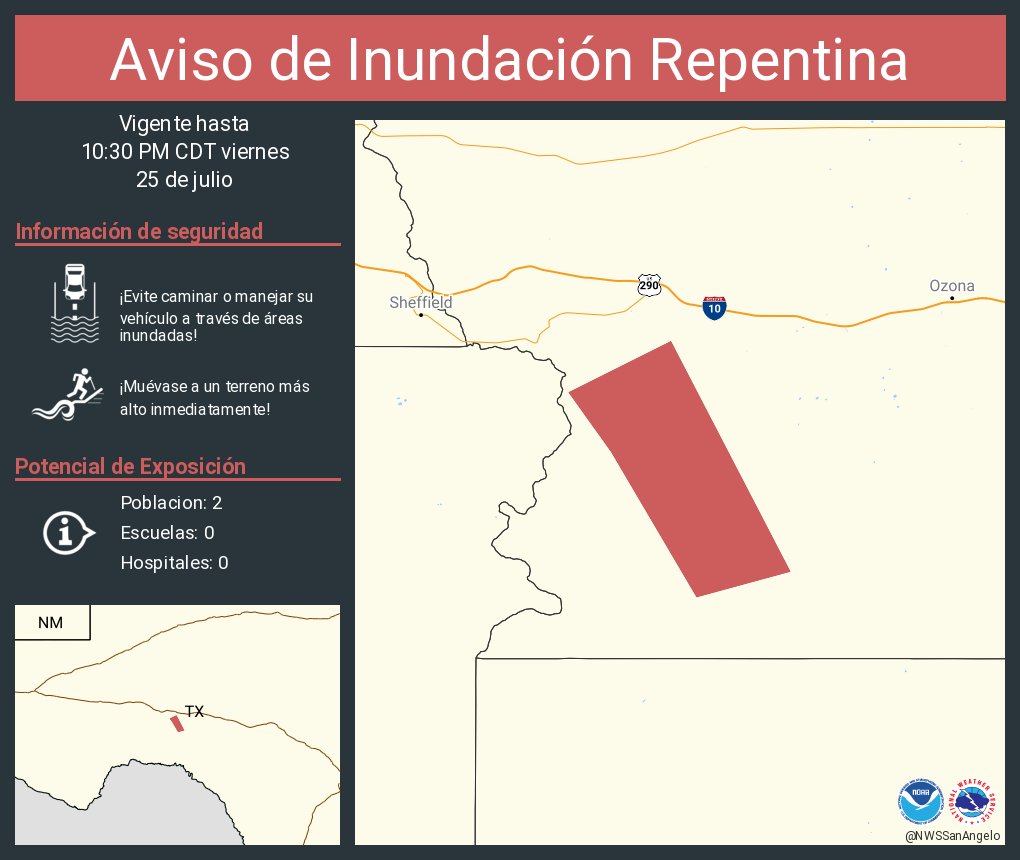
Aviso de Inundación Repentina incluye Crockett County, TX hasta las 10:30 PM CDT
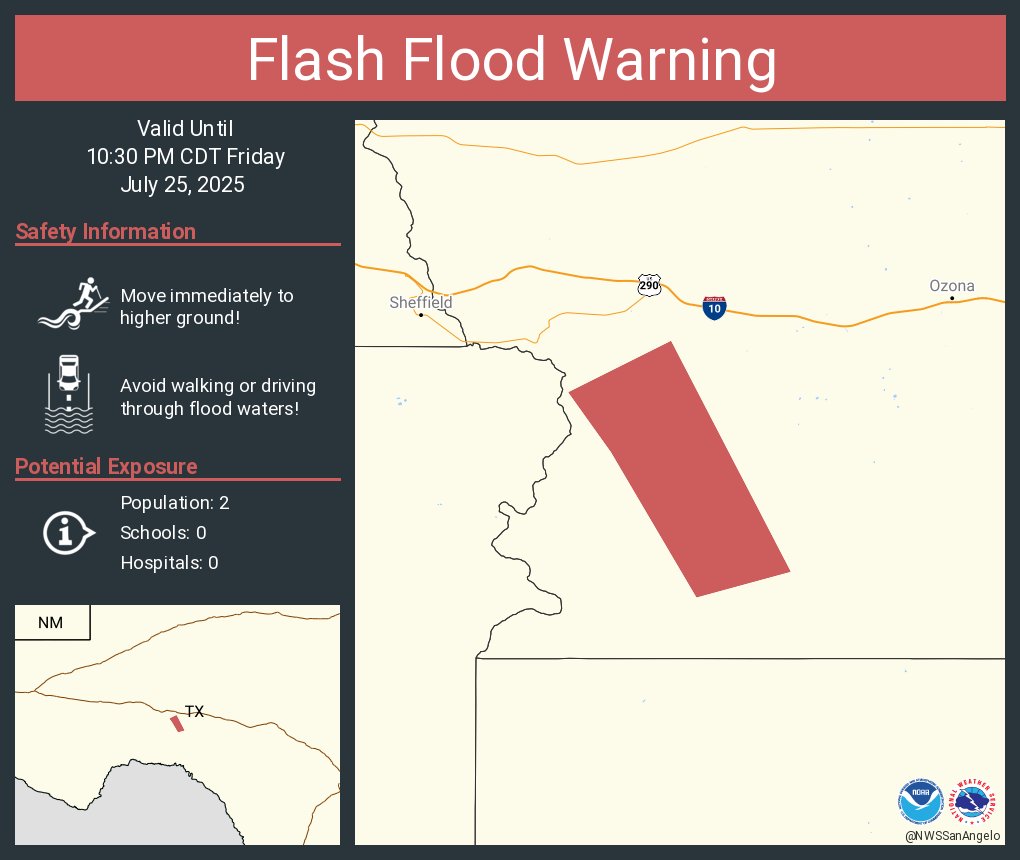
Flash Flood Warning including Crockett County, TX until 10:30 PM CDT
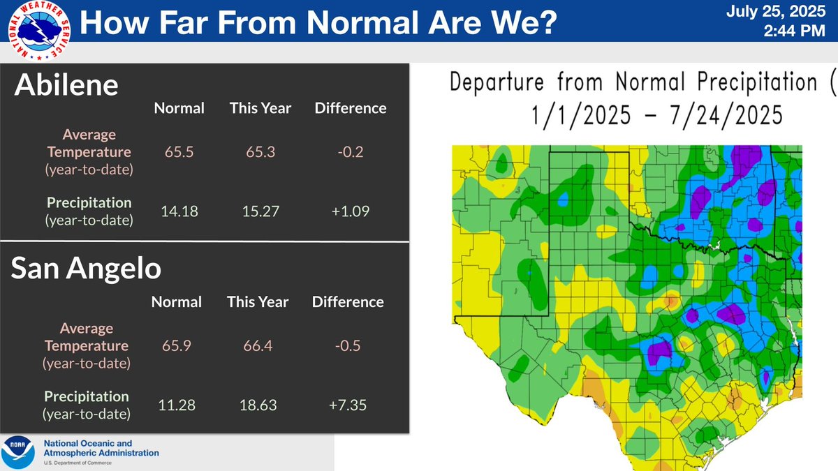
The main change has been the historic rainfall and flooding on the 4th of July and later episodes this month, that have brought rainfall totals well above normal from the Concho Valley into the Hill Country. Temperatures have been slightly below normal this year. #TXWX #SJTWX
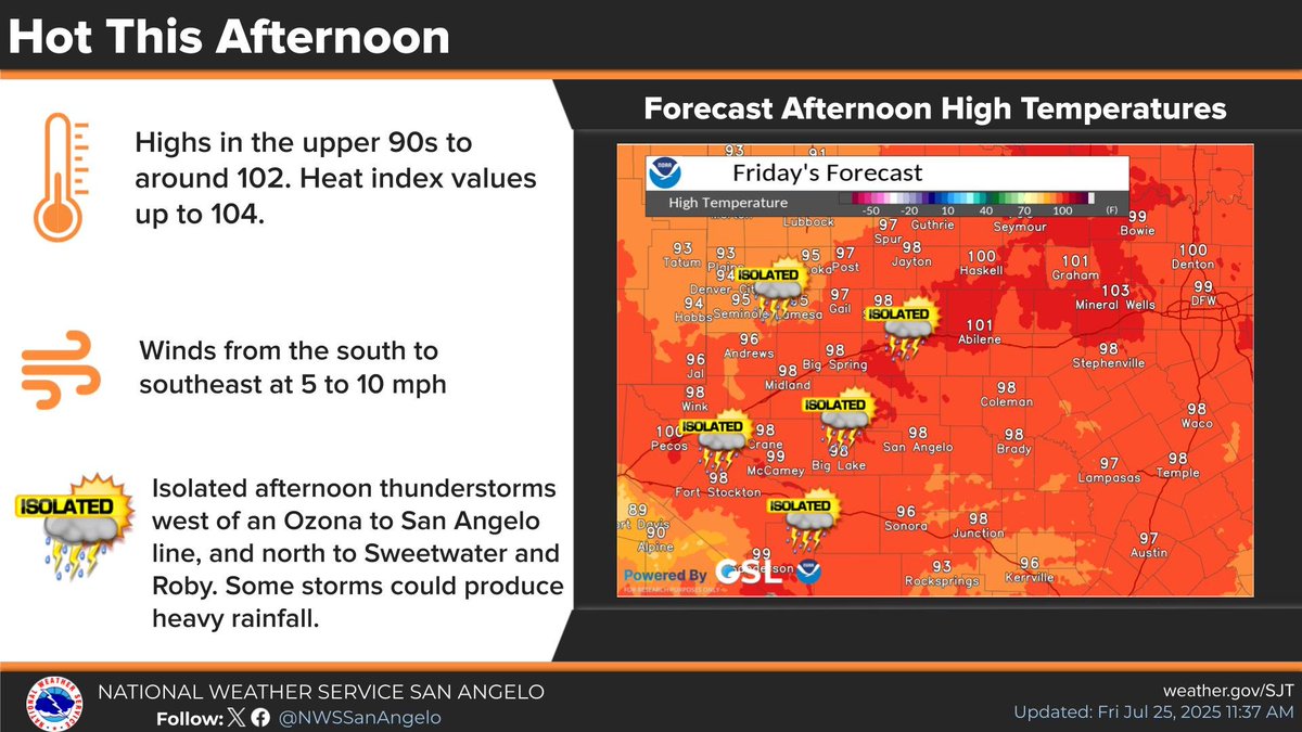
Isolated afternoon thunderstorms, are possible mainly west to the west of an Ozona to San Angelo to Abilene to Haskell line after 3 PM. Some storms could produce locally heavy rainfall. #TXWX #SJTWX #ABIWX
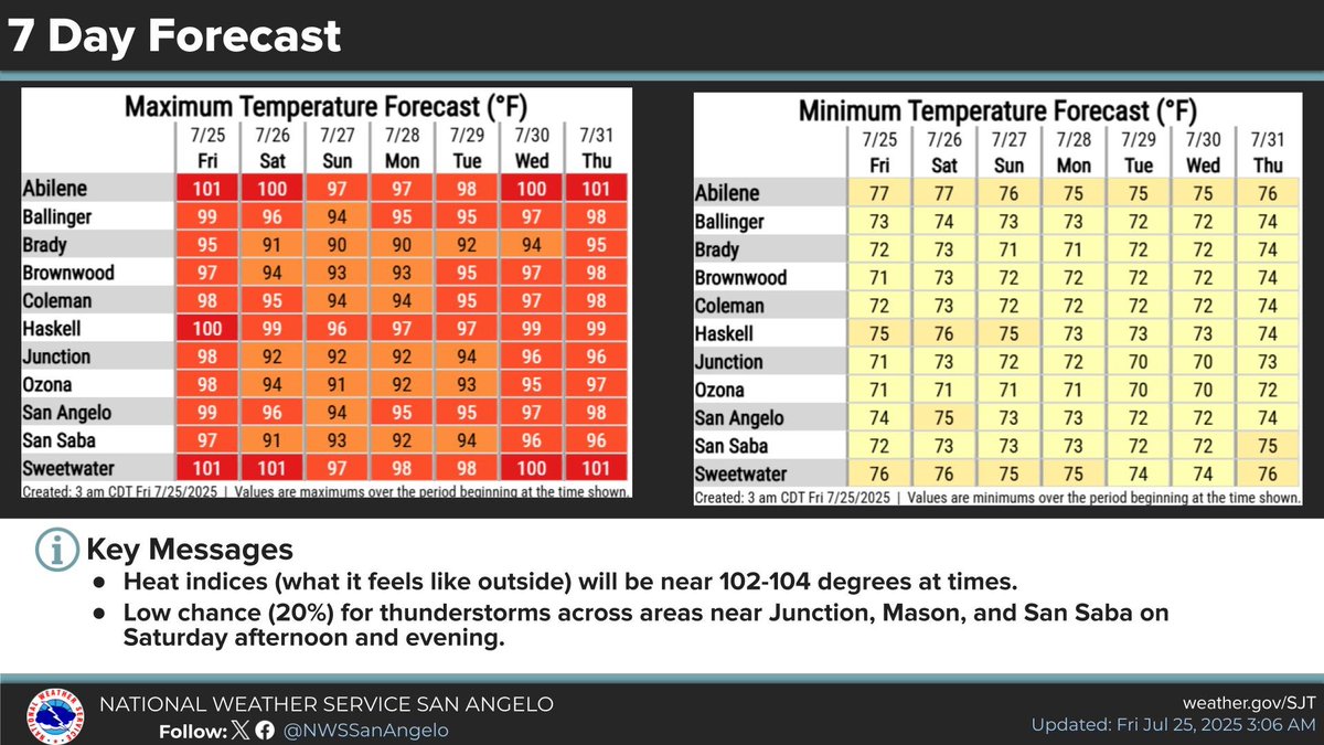
Mainly hot and dry into next week. Isolated afternoon thunderstorms are possible Saturday and Sunday from Junction and Mason to Brady and San Saba. Humidity values will remain high. #TXWX #SJTWX #ABIWX
Mainly hot and dry into next week. Isolated afternoon thunderstorms are possible Saturday from Junction and Mason to Brady and San Saba. Humidity values will remain high and concerns about excessive Heat will increase. #TXWX #SJTWX #ABIWX
Some very hit & miss showers/storms will continue to develop across the extreme western portions of the area thru 7 PM, mainly west of a Sterling City-Sweetwater-Haskell line. Most of these will be short lived, with gusty winds & brief moderate rainfall possible. #sjtwx #txwx
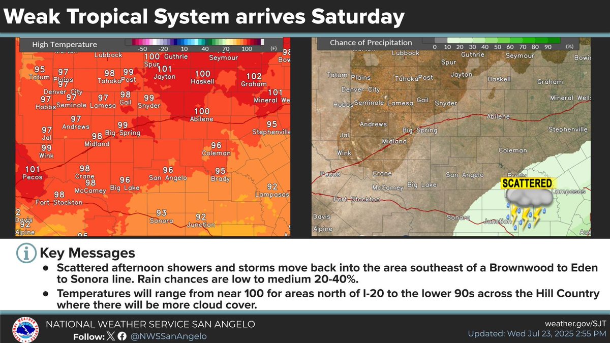
Quiet the next few days for WC TX. Next weather maker a tropical wave arriving onto the TX coast that will spread scattered showers/storms into areas south of Brownwood-Eden-Sonora line Saturday afternoon. Brief downpours possible but not expected to be widespread. #sjtwx #txwx
Few light showers across the area this AM but nothing that's going to produce more than a tenth of an inch of rain. Heavier rain with some storms still possible for areas west of an Ozona to Sterling City to Haskell line this PM. Nothing severe expected. #sjtwx #txwx
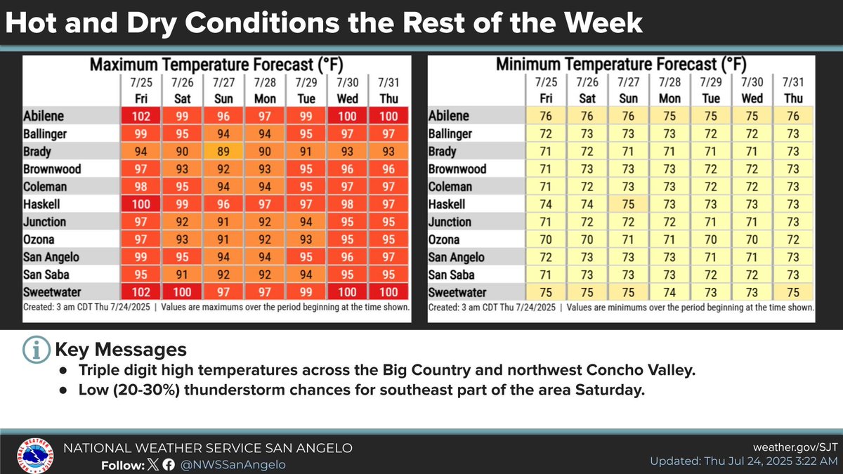
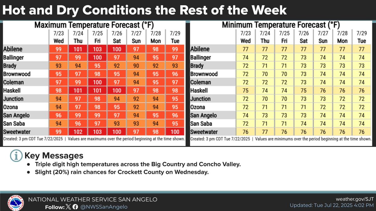
Temperatures will climb the rest of the week, with triple digits likely across much of the Big Country and Concho Valley by Thursday and Friday. Heat advisories may be needed later in the week especially across the Big Country. #sjtwx #txwx
Update to add a mention of showers/storms to the areas around Mason, San Saba, and Junction for a few hours this AM. Mainly light to moderate rainfall with most areas seeing less than a tenth of an inch of rain. Don't expect the activity to last much past 10 AM. #sjtwx #txwx
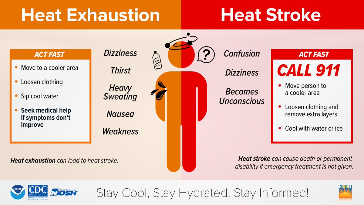
With high pressure working its way into the forecast by the end of this week, we could see temperatures of 98-102. With these hot conditions in place, we could see an increase in heat related illnesses. Here's a quick reminder about heat stroke and heat exhaustion.
Most locations will remain hot and dry. In fact, high pressure will shift to the west and strengthen across the region leaving even hotter conditions in place for Thursday and Friday. Temperatures for a few locations across the region are posted down below. #sjtwx
If you have been following our previous posts, then you are aware that we will see many locations with much hotter temperatures over the next week or so. Given this potential, we will post this quick reminder from the National Highway Traffic Safety Administration on heat safety: