Emma Walker
@EmmaWalkerWx
25 |📍WI & IL | Just your average Midwestern girl whose favorite hobby is chasing tornadoes & the aurora with 10yrs of experience.🌪️ Follow along for the ride!
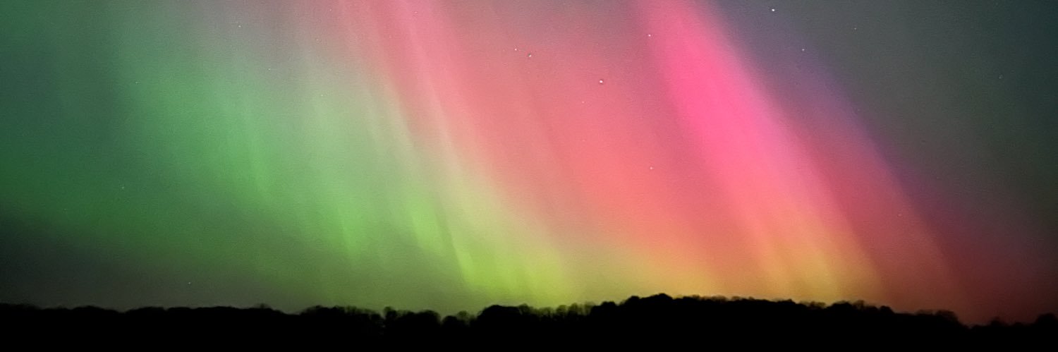
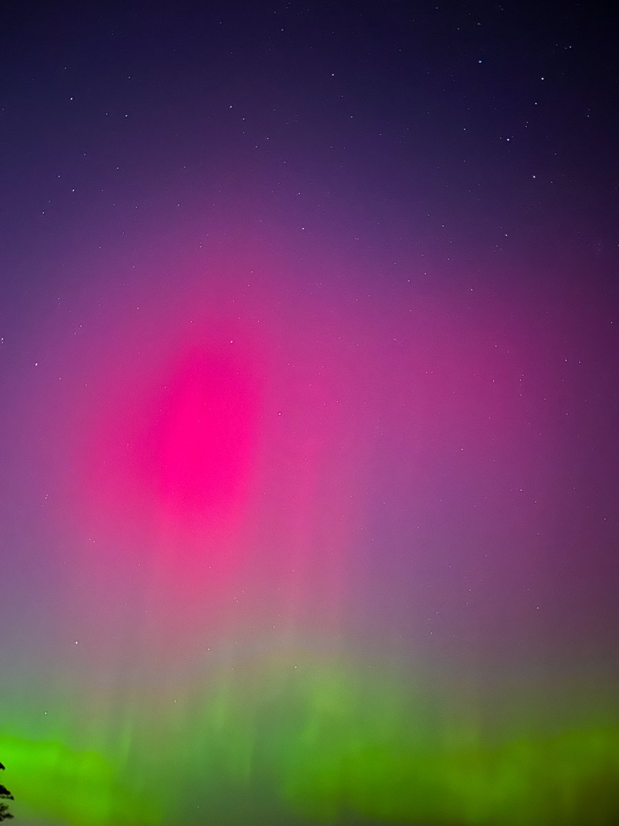
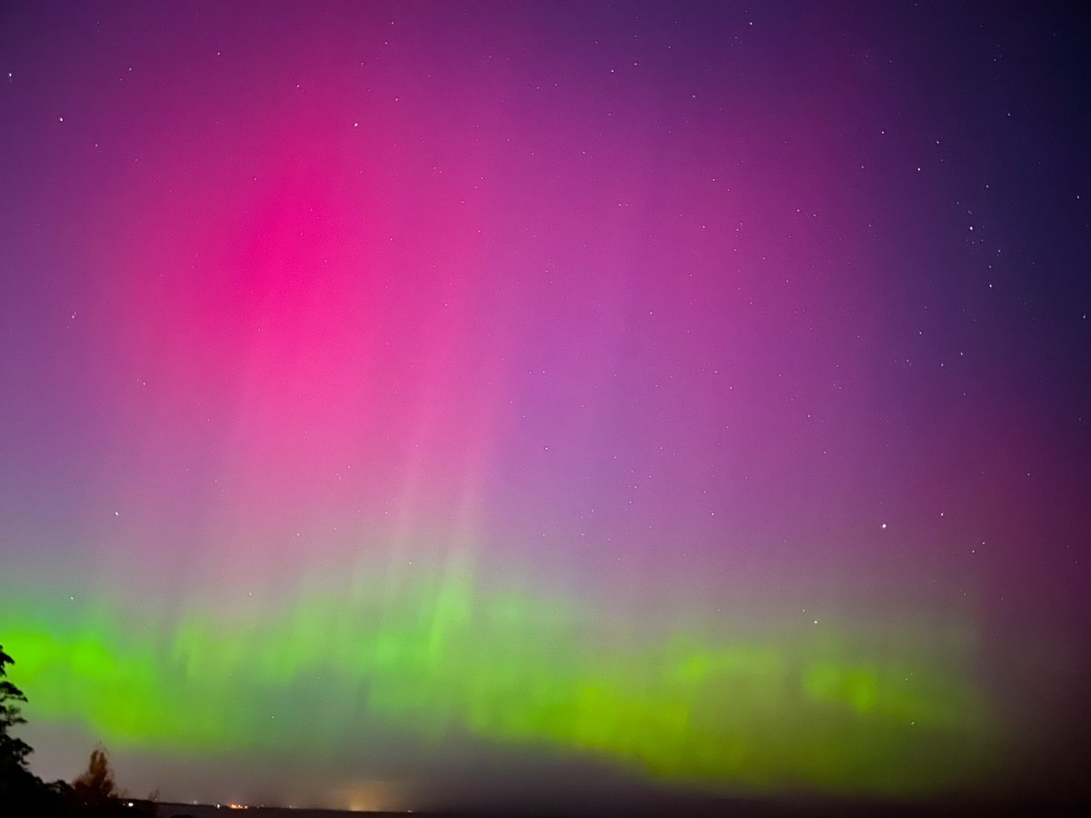
Never in a million years did I think it would be possible to see such bright and vivid aurora over Milwaukee with so much light pollution, but here we are! I’m still speechless. #AuroraBorealis #Aurora #NorthernLights #SpaceWeather #WIwx #Milwaukee #MKE


A FEW TORNADOES are likely today from the High Plains to the Ohio Valley! 5% tornado risk was just added to Nebraska... Live stream is possible!
Just spotted a rotating, low-hanging wall cloud while driving SE on I-74 near Crawfordsville, IN. Seriously heavy rain accompanying this storm too. @NWSIndianapolis #INwx #IndianaWX


Not every day that you get to witness and film a tornado forming! WOOHOO! This was at approx. 3:30pm CST in Hustisford, WI! @NWSMilwaukee #WIwx #Tornado #TornadoWarning #SevereWX #StormChasing #StormChaser
Beautiful wall cloud trying to produce d in Watertown, WI! @NWSMilwaukee #WIwx #SevereWX #Tornado #TornadoWarning #StormChasing #StormChaser
The preexisting tornado warning for areas NE of Dodgeville, WI has been upgraded to a PDS tornado warning! A confirmed & extremely dangerous tornado is on the ground now! This is a life-threatening situation! #WIwx #SevereWX #Tornado #TornadoWarning #StormChaser #StormChasing


ANOTHER new tornado warning for areas just SW of Lima Ridge, WI! #WIwx #SevereWX #Tornado #TornadoWarning #StormChaser #StormChasing

New tornado warning for just NW of Monroe, WI! Heading toward New Glarus! #WIwx #SevereWX #Tornado #TornadoWarning #StormChaser #StormChasing

LARGE TORNADO IN DOUGLEVILLE WISCONSIN! #wxtwitter #wiwx
Observed damaging tornado on the ground just NE of Dodgeville, WI! 🌪️ #WIwx #SevereWX #Tornado #TornadoWarning #StormChasing #StormChaser

Tornado Warning including Barneveld WI, Arena WI and Ridgeway WI until 1:00 PM CDT
A tornado watch has been issued for parts of Wisconsin until 6 PM CDT
First tornado warning of the day has been issued for Dodgeville for radar indicated rotation. Remain weather aware now through sunset, southern Wisconsin.
(1 of 2) Line of storms this afternoon between noon-7pm. Strong to severe thunderstorms embedded in the line producing damaging winds & heavy rainfall. Storms look to push out over Lake Michigan after 7pm with some lingering showers thru the remainder of the evening. #wiwx
BREAKING: 132+ fatalities and 165+ missing from the Texas Floods last week. This is one of the deadliest non-tropical storm flooding events in the past 50 years.
We had some measured winds in the 70-80mph range in SW WI tonight. We're looking to document any damage that occurred from these storms. Please list your location and approximate time that it occurred. Feel free to share your best shelf cloud picture as well. #wiwx
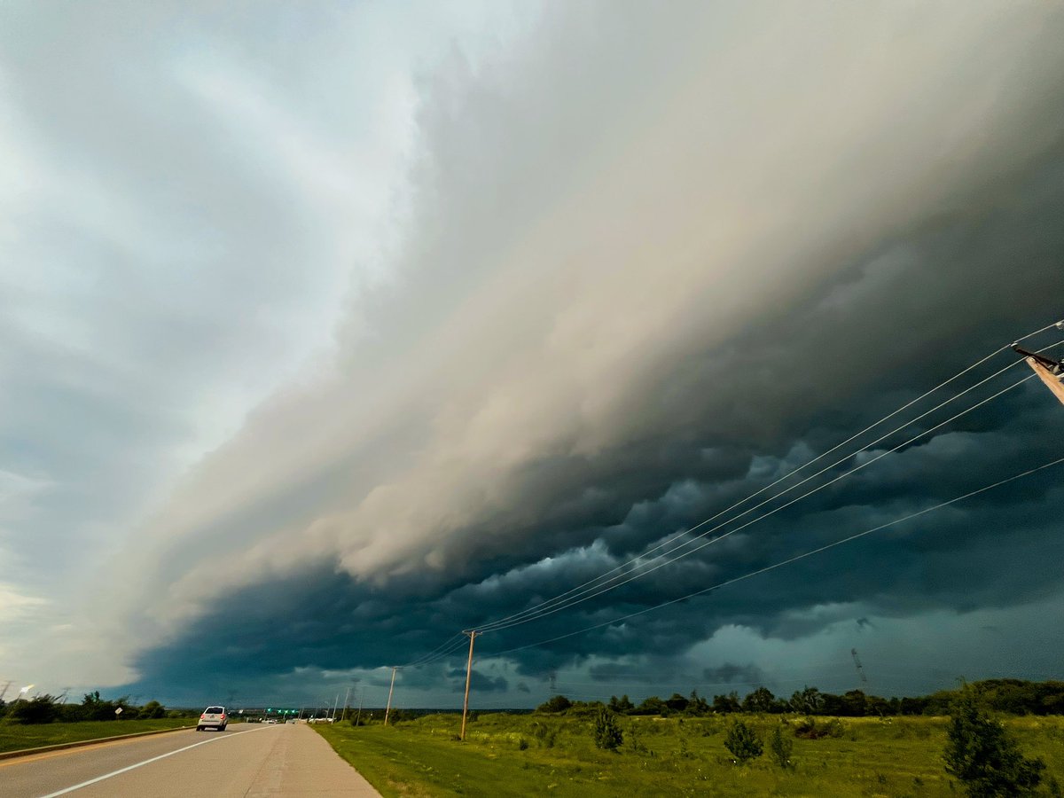
Probably the most incredible shelf cloud i have ever seen this evening over downtown Janesville, Wis. #wiwx
Quad Cites: Emergency management & law enforcement continue to report major life-threatening flash flooding, especially in/near Davenport. There have been business & residences flooded, & numerous stranded cars. Flash Flood Emergency remains in effect! Avoid immediate travel!
Well that was insanely disappointing. 🤦🏻♀️ #ILwx #WIwx #SevereWX #SevereThunderstormWarning #Tornado #TornadoWarning #StormChasing #StormChaser
Storm rolling through Machesney Park, IL! Beautiful shelf cloud with lots of rotation within. #ILwx #SevereWX #StormChaser #StormChasing @MaxVelocityWX