
NWS Milwaukee
@NWSMilwaukee
Official Twitter account for the National Weather Service in Milwaukee. Details: http://weather.gov/twitter
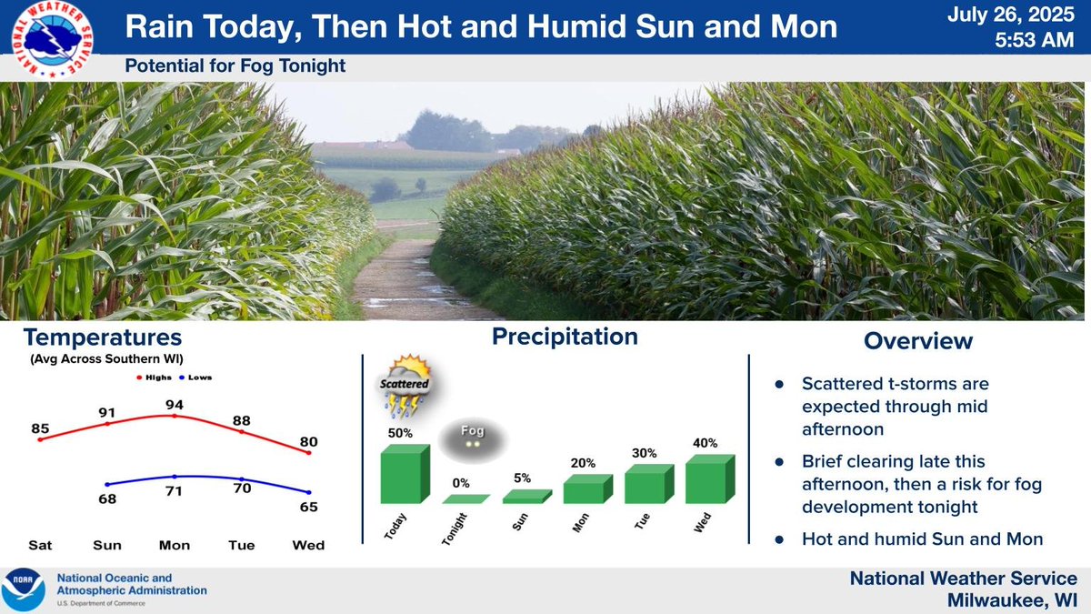
Occasional rain and thunderstorms are expected today, with torrential rainfall expected at times. Rain will end by late afternoon, with fog looking increasingly likely tonight. Some dense fog is possible. Hot and humid weather is then expected for Sunday and Monday.
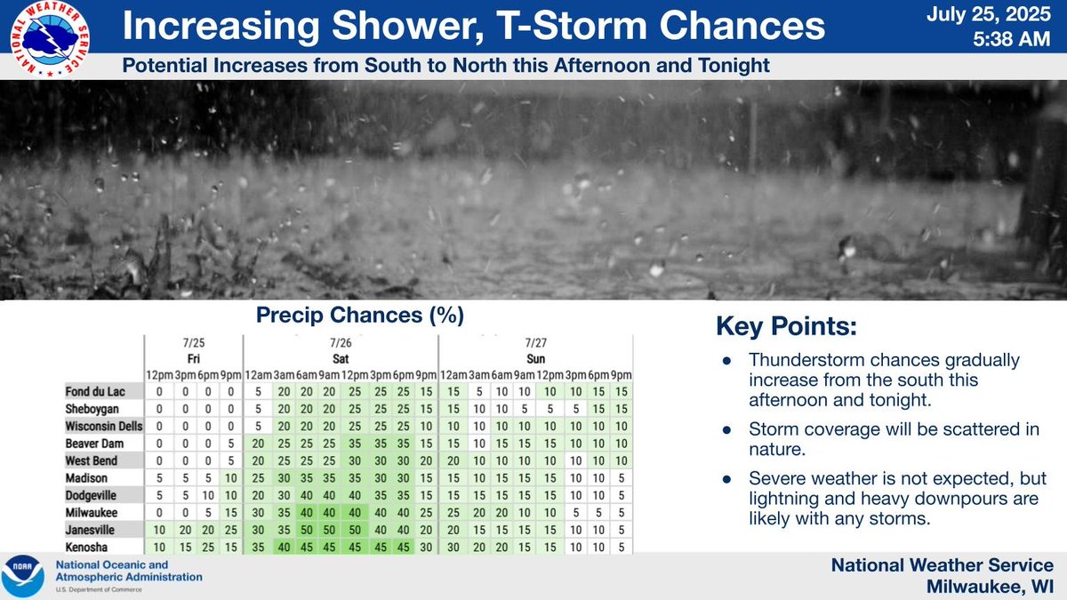
Chances for showers and storms will gradually increase from the south late this afternoon into the overnight, with shower/storm chances continuing on Saturday. Storms will be scattered in nature. Severe weather is not anticipated, but lightning and heavy downpours are expected.
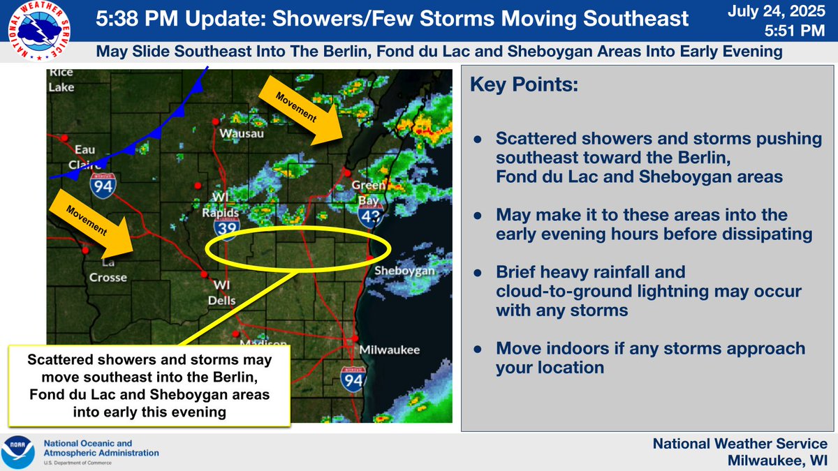
Scattered showers and a few storms were moving southeast and may affect the Berlin, Fond du Lac and Sheboygan areas into early this evening. Brief heavy rainfall and cloud-to-ground lightning may occur with any storms. Go indoors if any storms approach your location. #swiwx #wiwx
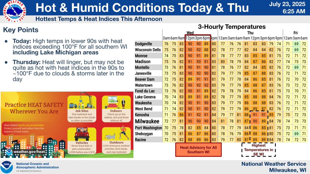
The heat and humidity will continue today. Clouds and potential storms within the vicinity of a front this afternoon will help limit the heat indices a little. If we have a prolonged period of sunshine today, then any storms that develop could be strong this afternoon. #wiwx
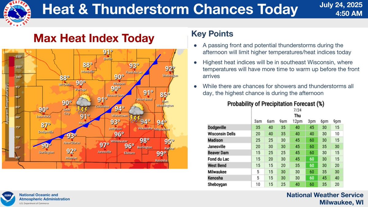
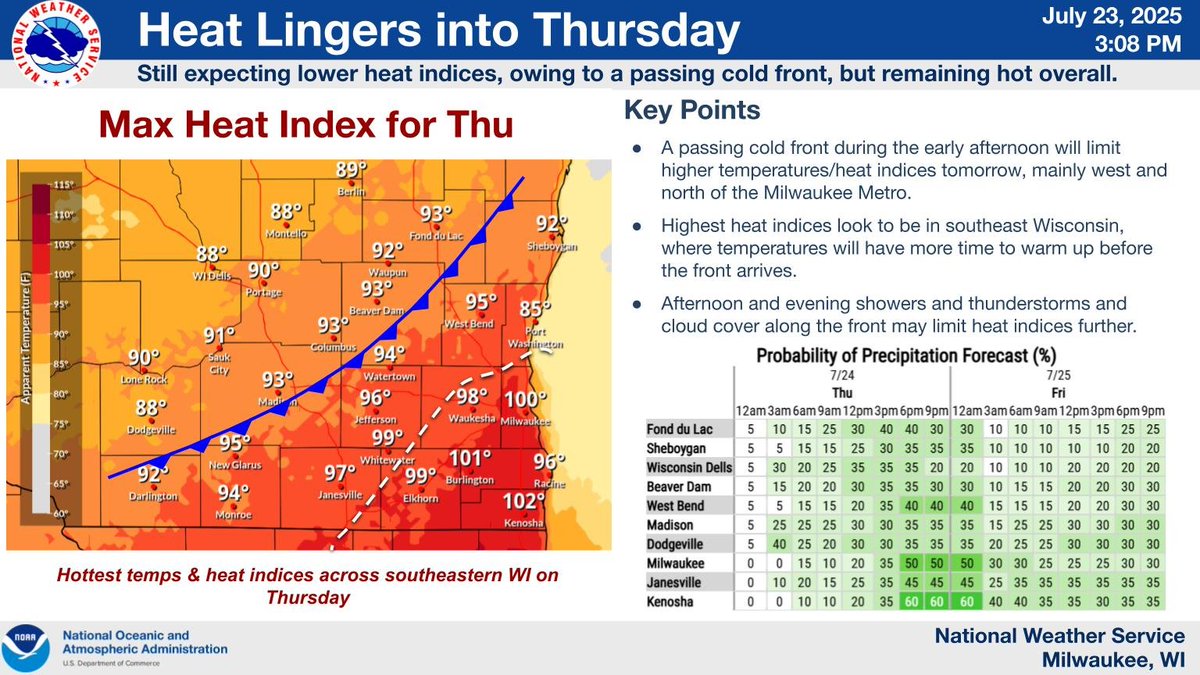
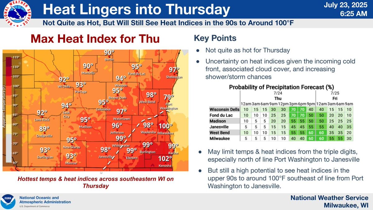
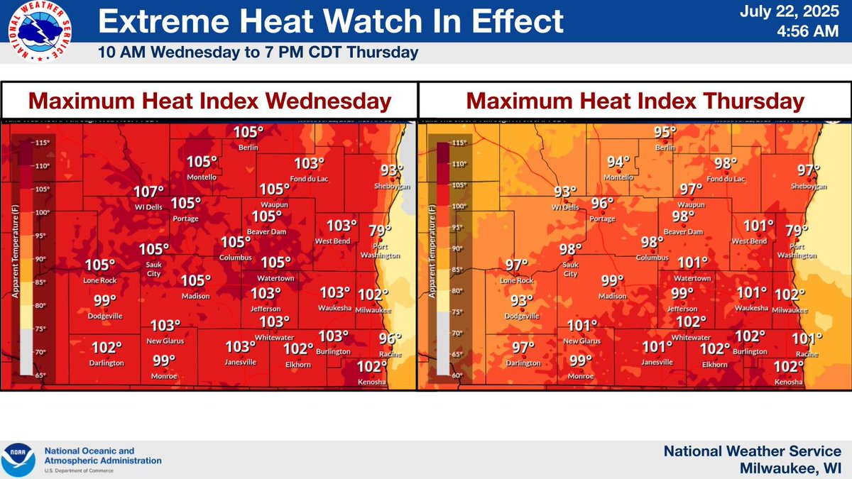
A cold front is expected to come through tomorrow afternoon, which may limit heat indices between 100 - 105 from occurring tomorrow. However, high heat indices near 100 may occur in southeast Wisconsin, where temperatures will have time to rise before the front arrives. #wiwx
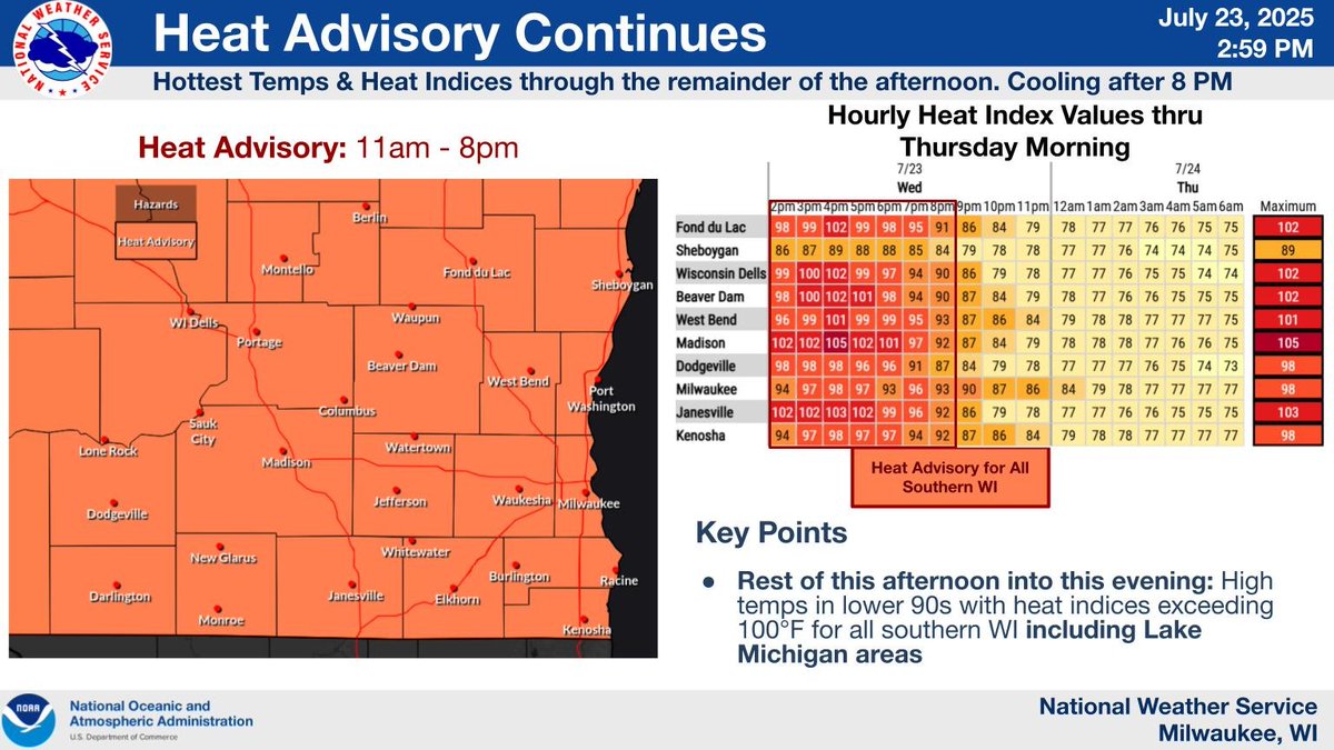
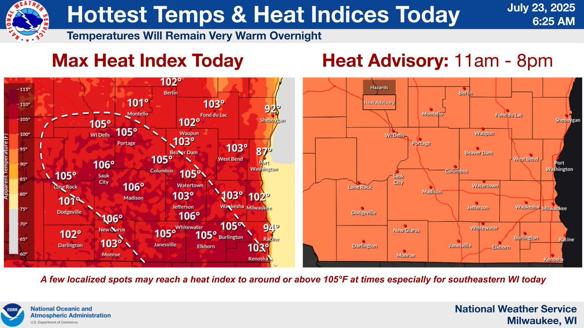
The Heat Advisory will remain in effect until 8pm. Heat Indices will approach 100 - 105 over the next few hours, with locally higher indices possible, as we've warmed well following morning storms. If you plan on being outside, please take frequent breaks and stay hydrated! #wiwx
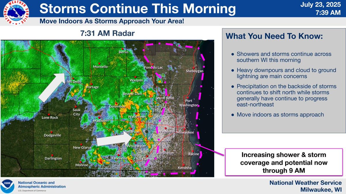
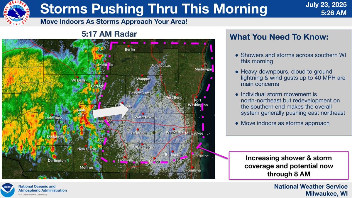
Showers and storms continue across southern WI this morning. Heavy downpours and cloud to ground lightning are main concerns. Precipitation on the backside of storms continues to shift north while storms generally have continue to progress east-northeast. #wiwx
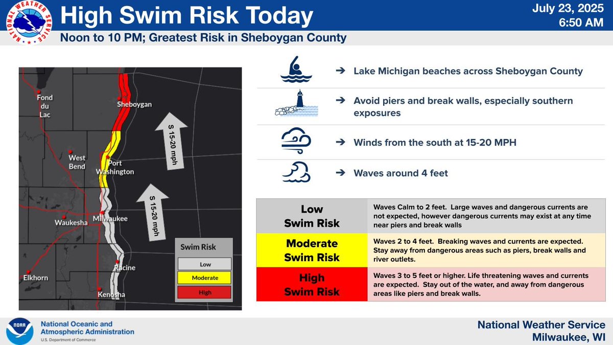
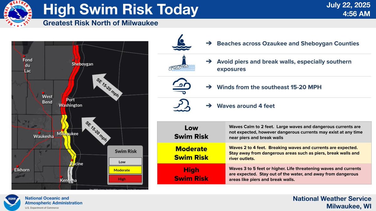
High Swim Risk at Lake Michigan beaches in Sheboygan County today. The safest choice is to stay out of the water, but if you do venture into the lake, wear a life jacket and use extreme caution. #wiwx
Hot and humid conditions expected today with a Heat Advisory in effect for today. There is some increased uncertainty on how warm it will get with the lingering morning storms/showers and clouds now expected but this is expected to clear out later today and warm up quickly. #wiwx
Showers and storms across southern WI this morning. Heavy downpours, cloud to ground lightning and wind gusts up to 40 MPH are main concerns. Individual storm movement is NNE but redevelopment on the southern end makes the overall system generally pushing ENE. #wiwx
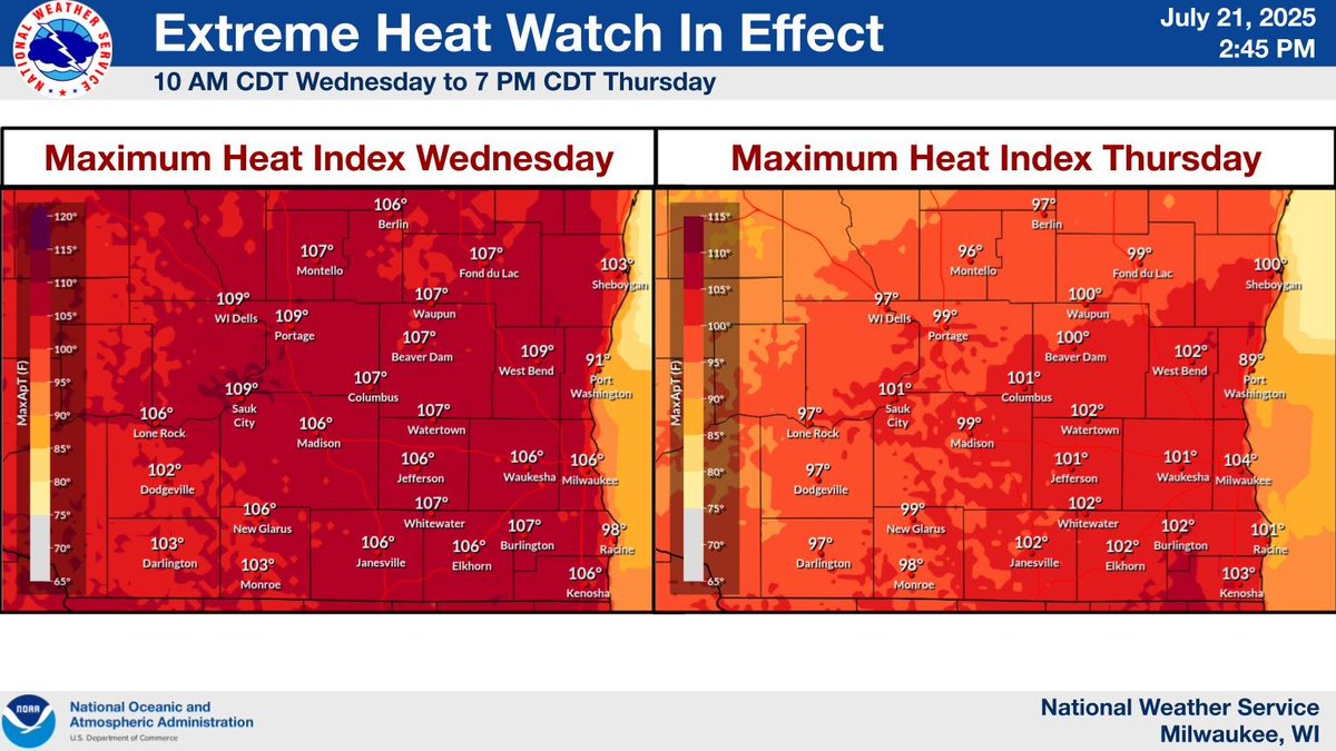
Looking at a hot and humid stretch Wed into Thursday with the hottest "feel like temps" at above 100°F for Wed afternoon. Warmth lingers into Thu, but with clouds and showers won't be quite as hot. #wiwx
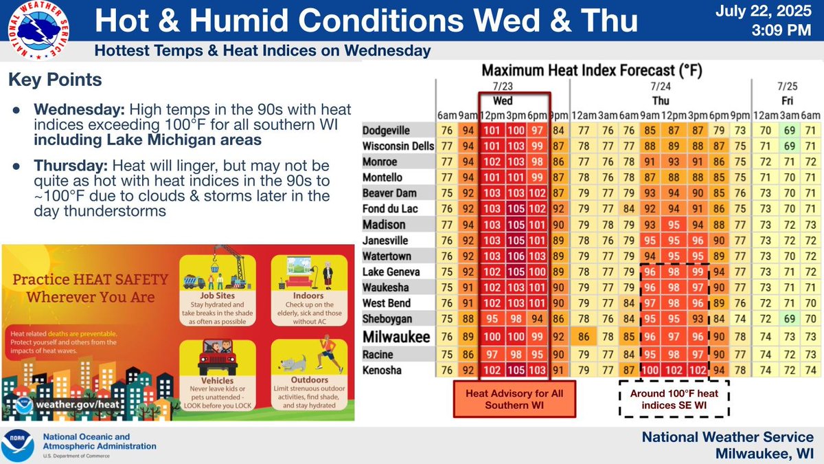
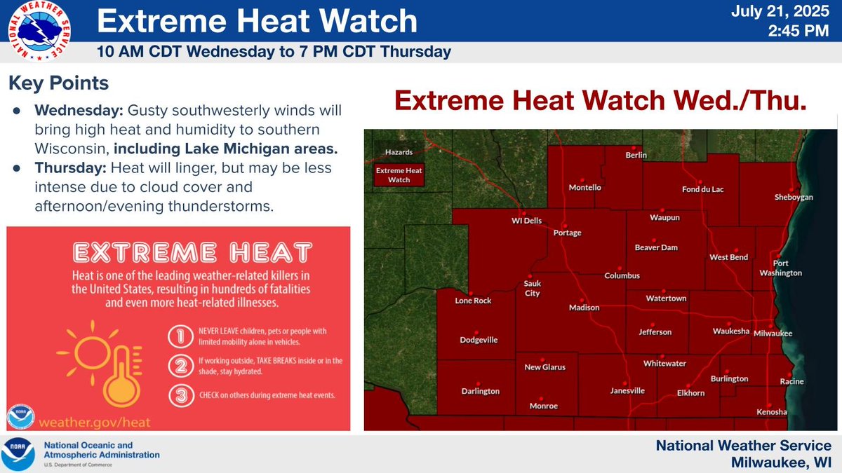
A hot and humid airmass will move in Wednesday and linger into Thursday. Limit your time outside and check on others. #wiwx

High Swim Risk at Lake Michigan beaches in Ozaukee and Sheboygan Counties today. The safest choice is to stay out of the water, but if you do venture into the lake, wear a life jacket and use extreme caution. #wiwx
Southwesterly winds will bring extreme heat and high humidity all the way to the Lake Michigan shoreline areas on Wednesday. Expect weaker winds and more cloud cover on Thursday, but heat lingers. Thunderstorms will develop Thursday afternoon/evening. #swiwx #wiwx
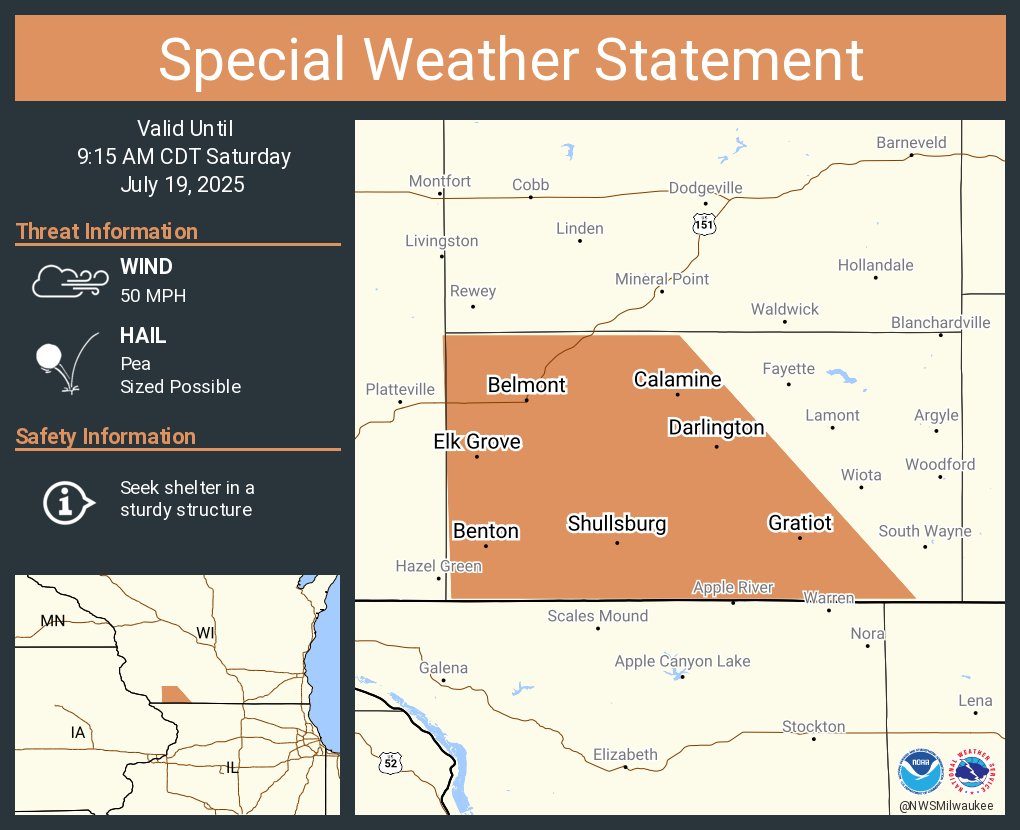
A special weather statement has been issued for Darlington WI, Shullsburg WI and Belmont WI until 9:15 AM CDT
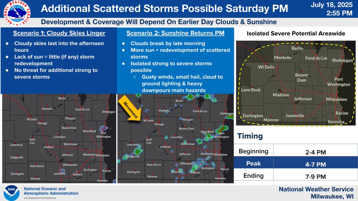
Scattered showers and storms are possible through this evening. A few strong storms could produce gusty winds and hail. Any evening storm development will depend on our sky cover through mid afternoon. Keep an eye on the radar if you have outdoor plans today. #wiwx
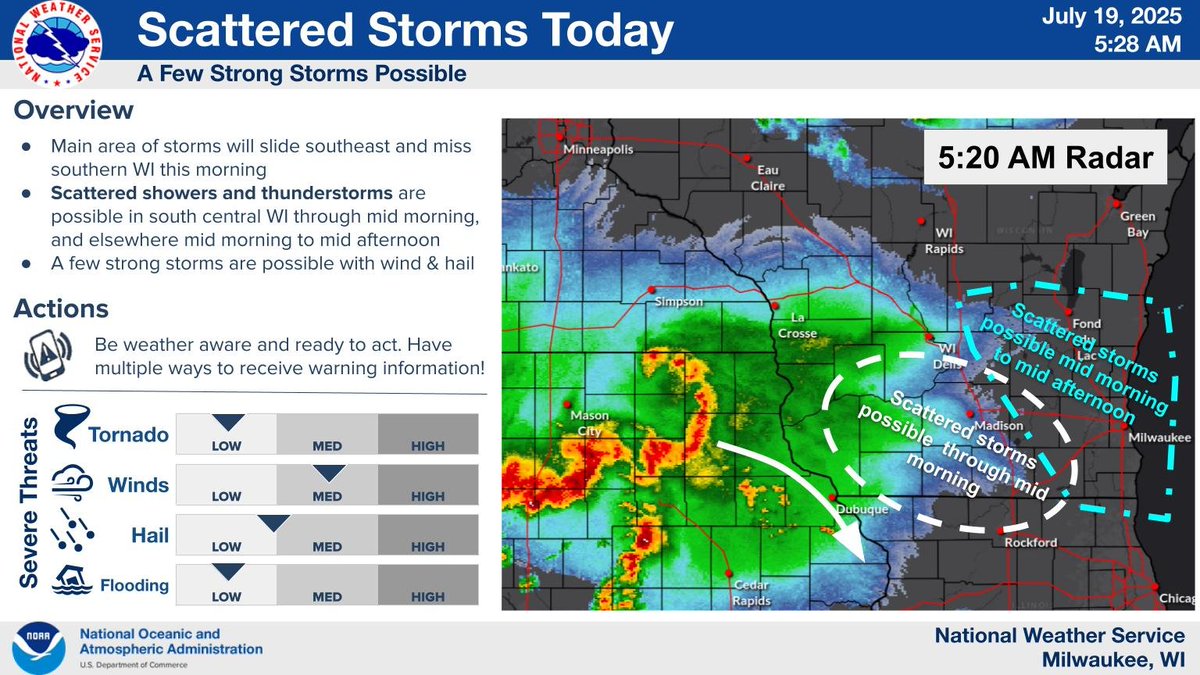

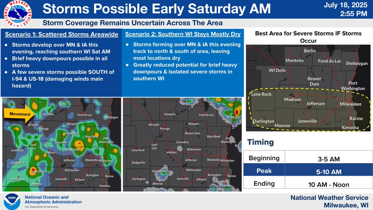
2 rounds of storms are possible late tonight through Saturday afternoon. A few strong to severe storms can't be ruled out, with gusty winds and hail being the main concerns. Brief heavy downpours are possible in all storms. Keep up with the forecast through tomorrow! #wiwx
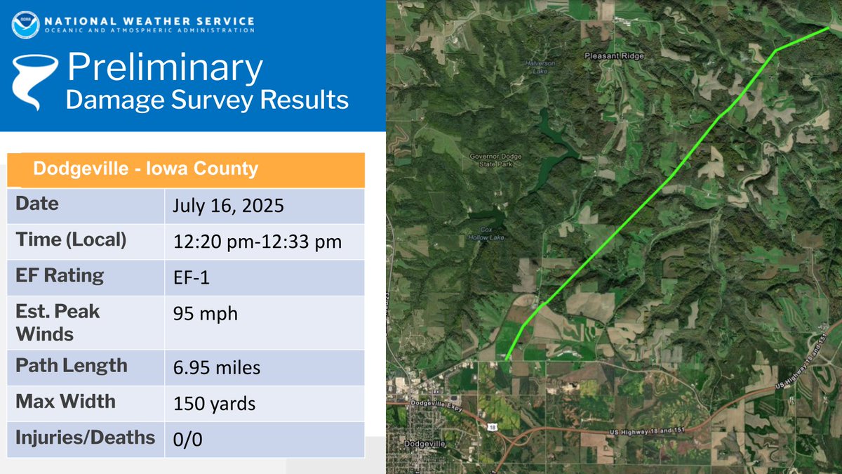
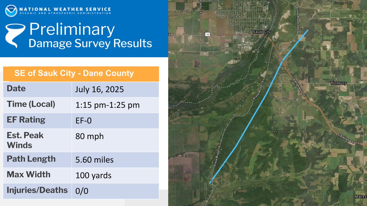
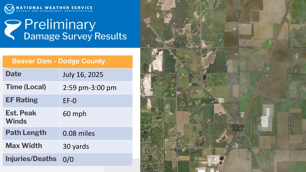
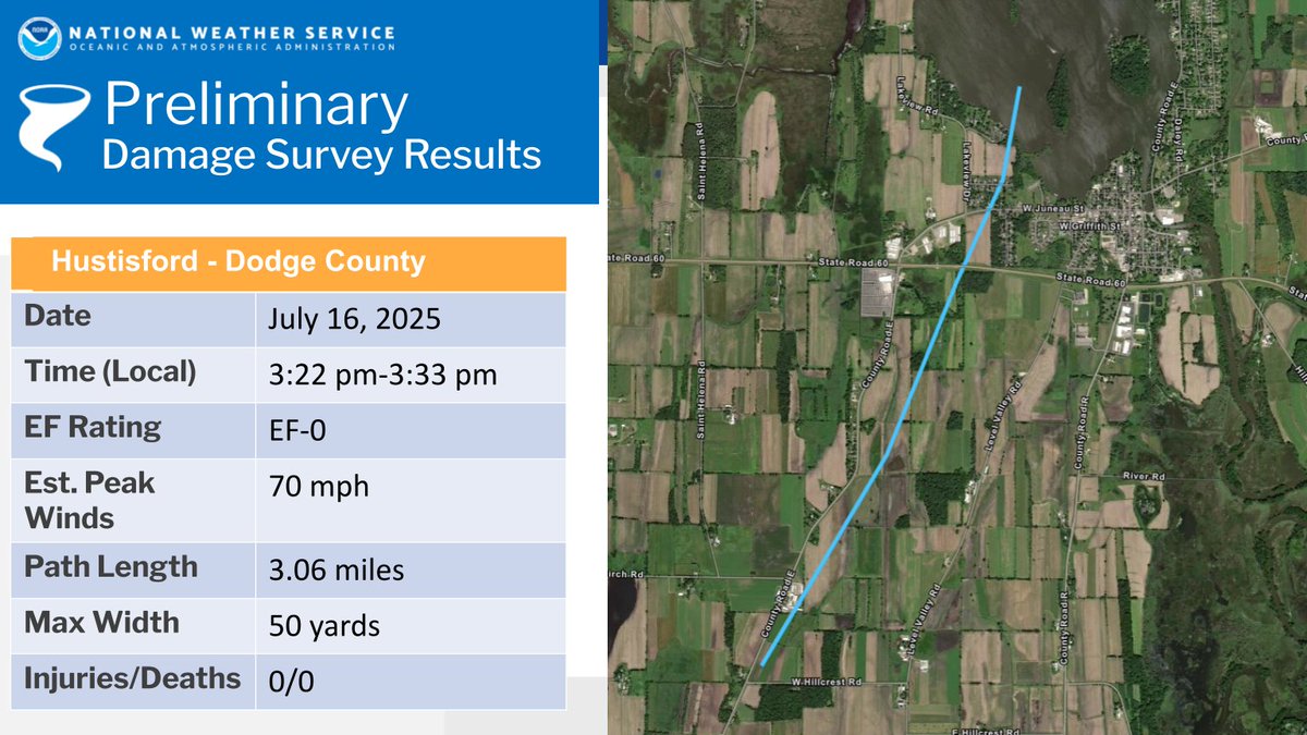
Updated Survey Info: 4 tornadoes documented from Wednesday's severe storms. 1 EF-1 and 3 EF-0s from the NWS Milwaukee area. For more information, please visit: weather.gov/mkx/july162025… #wiwx
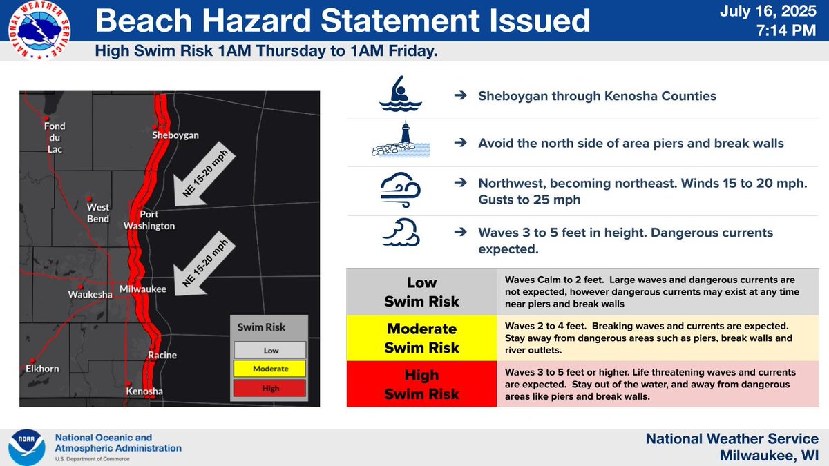
A Beach Hazard Statement is in effect for high swim risk conditions from 1 AM Thursday to 1 AM Friday. Gusty northwest to northeast winds will drive dangerous lake current, especially near piers and breakwalls. Waves will also be dangerous around 3 to 5 feet.
We currently have 10 areas that had rotation (dark blue) that we're looking for any information on. The main areas where we have video/pics are Dodgeville, Mazomanie, Beaver Dam and Hustisford. Any cross streets with damage is helpful. #wiwx
Thank you to all of the storm spotters, chasers and law enforcement that gave us real time reports today of the tornadoes and funnel/wall clouds! We're now trying to figure out where to survey, so if you are aware of any damage, please let us know. #wiwx