
Cole Stern
@ColeWeather25
Based in Long Island, NY. Meteorology lover and researcher. Bowling, coding, and chess sidequests. Working on Something Big
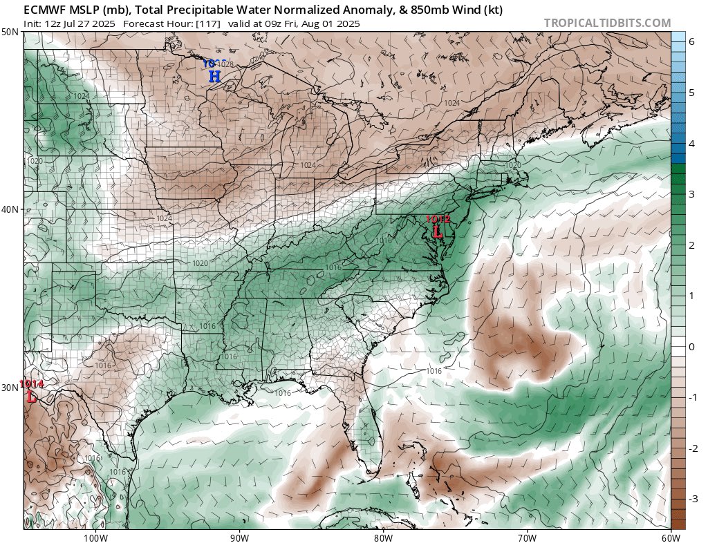
National blend of models hinting at that potential soaker Thursday into Friday.
I’d look out for possibly significant flash flooding Thursday into Friday across New Jersey, Long Island, NYC, and SNE. Deep tropical moisture with PWATs up to 2.3-2.4” combined with stalled front. Euro is currently most aggressive, but other models seem to be catching up.


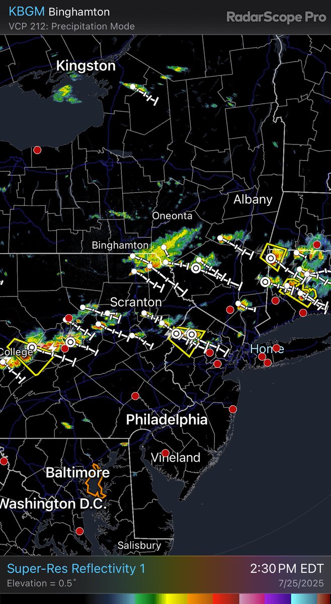
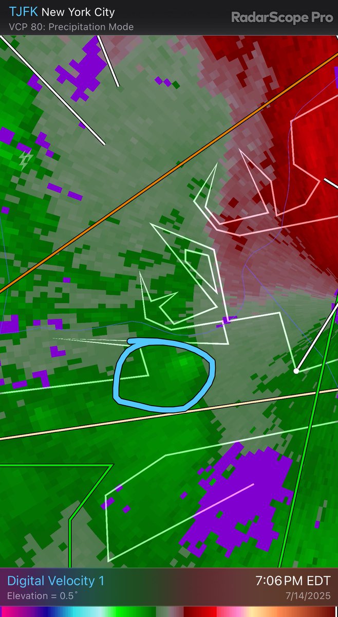
A severe thunderstorm watch has been issued for parts of Connecticut, Delaware, Massachusetts, New Jersey, New York, Pennsylvania and Rhode Island until 9 PM EDT
#SPC issues Day 2 Slight Convective Risk at Jul 24, 17:30z for OKX spc.noaa.gov/products/outlo…
Dee Atchley captures this waterspout as it comes ashore on Island Beach State Park, NJ. @NBCPhiladelphia @NWS_MountHolly
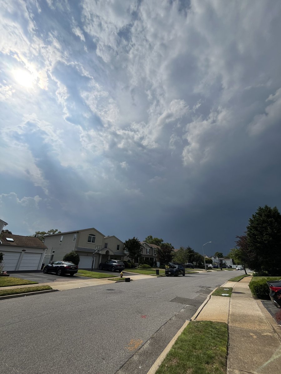
Downpours exploding overhead but there’s no rain shaft very weird

These maps are kinda silly because some of these countries are huge and have many different climates embedded within them. Like, no way the south has a climate anything like the northwestern third of china.
North American climate zones compared with Eurasian regions
A bit of good news after the devastating floods in Texas: More than 100 people previously reported as missing have been confirmed safe. Only 3 people are still missing.

79.2° hit right now
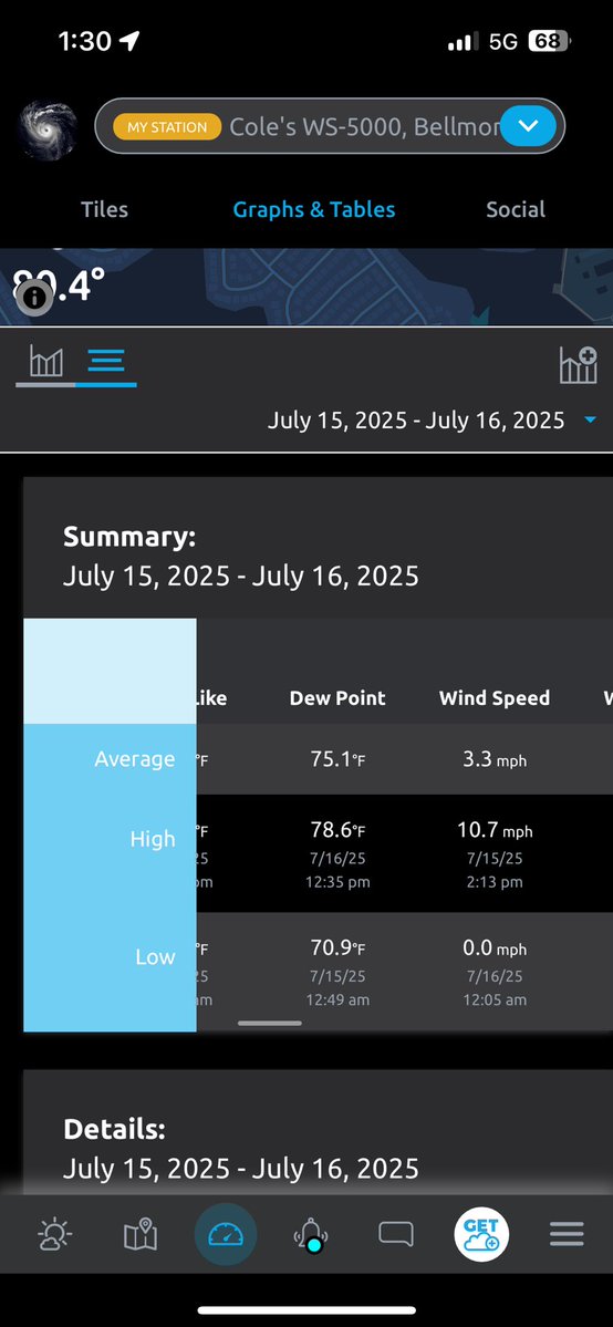
New station high dew point of 78.6° today in south Nassau county. Rounds up to 79°. Absolutely brutal
New station high dew point of 78.6° today in south Nassau county. Rounds up to 79°. Absolutely brutal
Based on a suggestion from @WxTca, I applied my analog matching technique for SSTs to "velocity potential" (a metric for large-scale rising/sinking motion) from the NCEP/NCAR reanalysis. The Top 10 years (since 1980) based on this metric for May-June were: 2001 2004 2023…
#WPC_MD 0689 affecting Central and Northern Mid Atlantic, #nywx #ctwx #mawx #njwx #pawx #dewx #vawx #mdwx #dcwx #wvwx, wpc.ncep.noaa.gov/metwatch/metwa…

