WWL-TV Weather
@wwltvweather
Your Local Weather Experts for Southeast Louisiana. @WWLTV
Invest 93 is unorganized. Low level center over Panhandle, but all the rain in the Gulf. We could still see a low spin up over the next 24-48 hours as it drifts along the Louisiana Coast. Regardless, expect tropical showers between Wed- Fri. There will be dry hours...maybe many.
Wow! What a sunrise as a shower moves through New Orleans. Have a great Friday and keep the umbrella nearby.
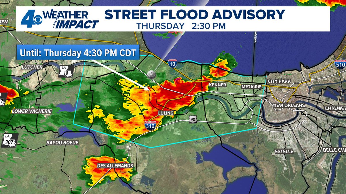
A Street Flood Advisory has been issued for parts of Jefferson, St. Charles, St. John The Baptist, Orleans until 7/24 4:30PM. Street flooding is possible in these areas. Don't drive through flooded roads. #BeOn4
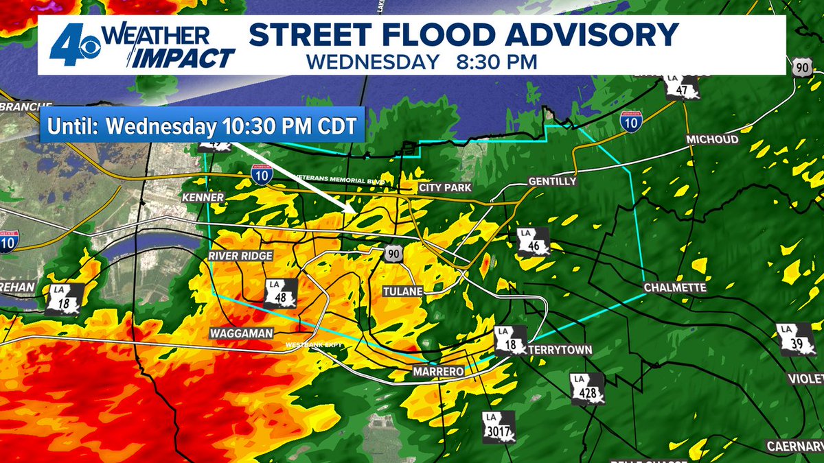
A Street Flood Advisory has been issued for parts of Orleans, Jefferson, St. Bernard until 7/23 10:30PM. Street flooding is possible in these areas. Don't drive through flooded roads. #BeOn4
Déjà vu this week. Tropical moisture builds along the northern Gulf this week bringing a risk for heavy showers. Wednesday-Sunday are best chances for rain. Development doesn't look very likely at all. Wind shear likely keeps disturbance unorganized.
A Flash Flood Warning has been issued for parts of St. Charles, St. John The Baptist until 7/17 8:00PM. Street flooding is happening or about to happen. #BeOn4

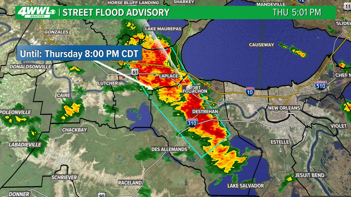
A Street Flood Advisory has been issued for parts of St. Charles, St. John The Baptist until 7/17 8:00PM. Street flooding is possible in these areas. Don't drive through flooded roads. #BeOn4
A Street Flood Advisory has been issued for parts of Orleans, Jefferson, St. Bernard until 7/17 4:45PM. Street flooding is possible in these areas. Don't drive through flooded roads. #BeOn4

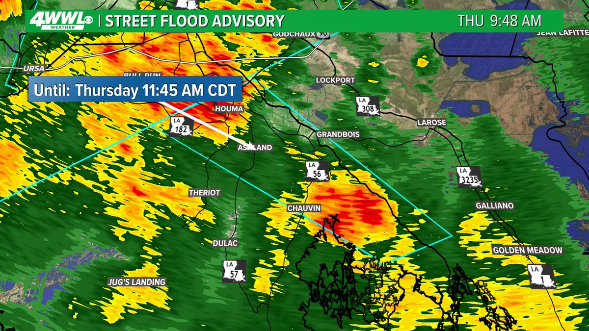
A Street Flood Advisory has been issued for parts of Terrebonne, Lafourche until 7/17 11:45AM. Street flooding is possible in these areas. Don't drive through flooded roads. #BeOn4
Tropical Update: Invest 93 remains mostly unorganized with rain. Showers will pass through Thursday and Friday with a risk for isolated flooding. But what happens after Invest 93 moves away? Well it looks like it could come back next week. Ya! for unwanted guests that come back…
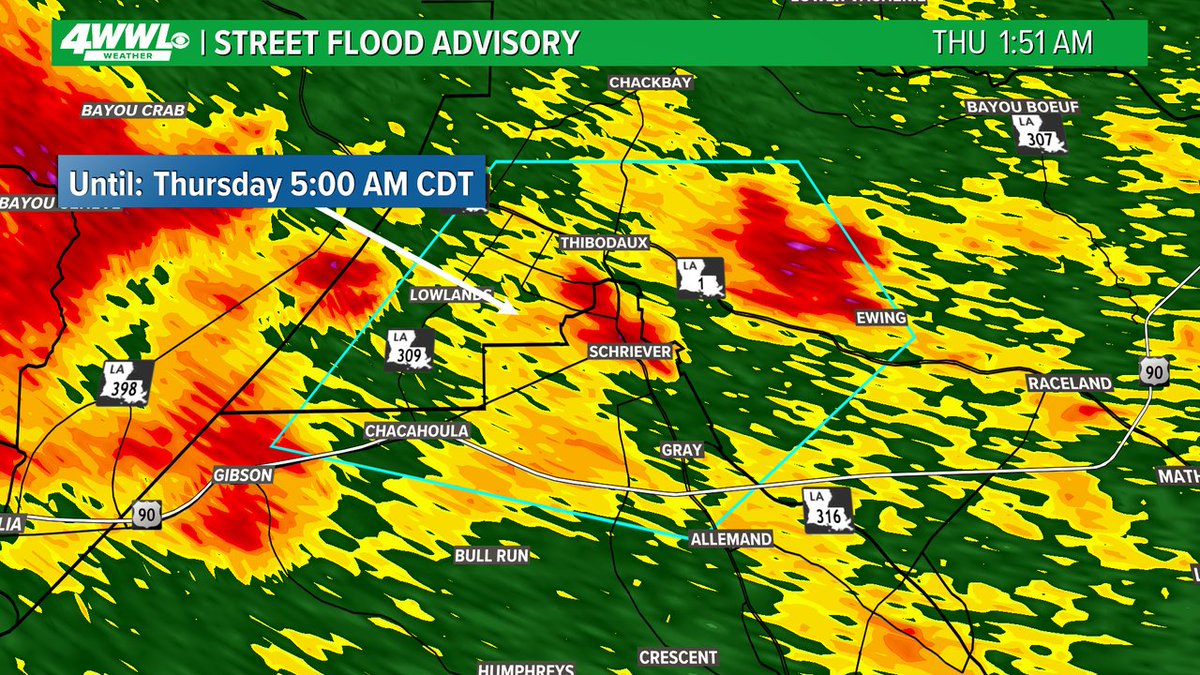
A Street Flood Advisory has been issued for parts of Lafourche, Terrebonne until 7/17 5:00AM. Street flooding is possible in these areas. Don't drive through flooded roads. #BeOn4
A Severe Thunderstorm Warning has been issued for areas in Terrebonne, Lafourche, Assumption until 7/17 12:00AM. Seek shelter indoors until the storm has passed. #BeOn4

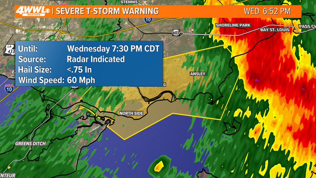
A Severe Thunderstorm Warning has been issued for areas in Hancock, St. Tammany until 7/16 7:30PM. Seek shelter indoors until the storm has passed. #BeOn4
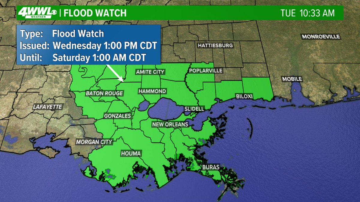
FLOOD WATCH issued for areas in green. Heavy rainfall could lead to flooding. #BeOn4
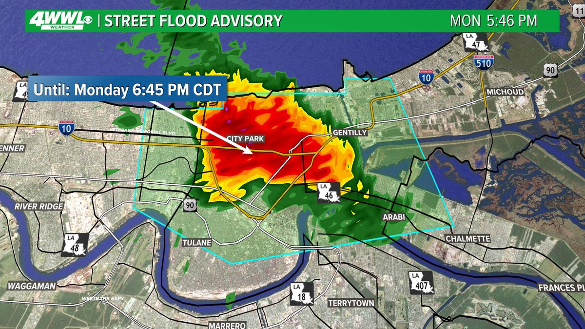
A Street Flood Advisory has been issued for parts of Orleans, Jefferson, St. Bernard until 7/14 6:45PM. Street flooding is possible in these areas. Don't drive through flooded roads. #BeOn4
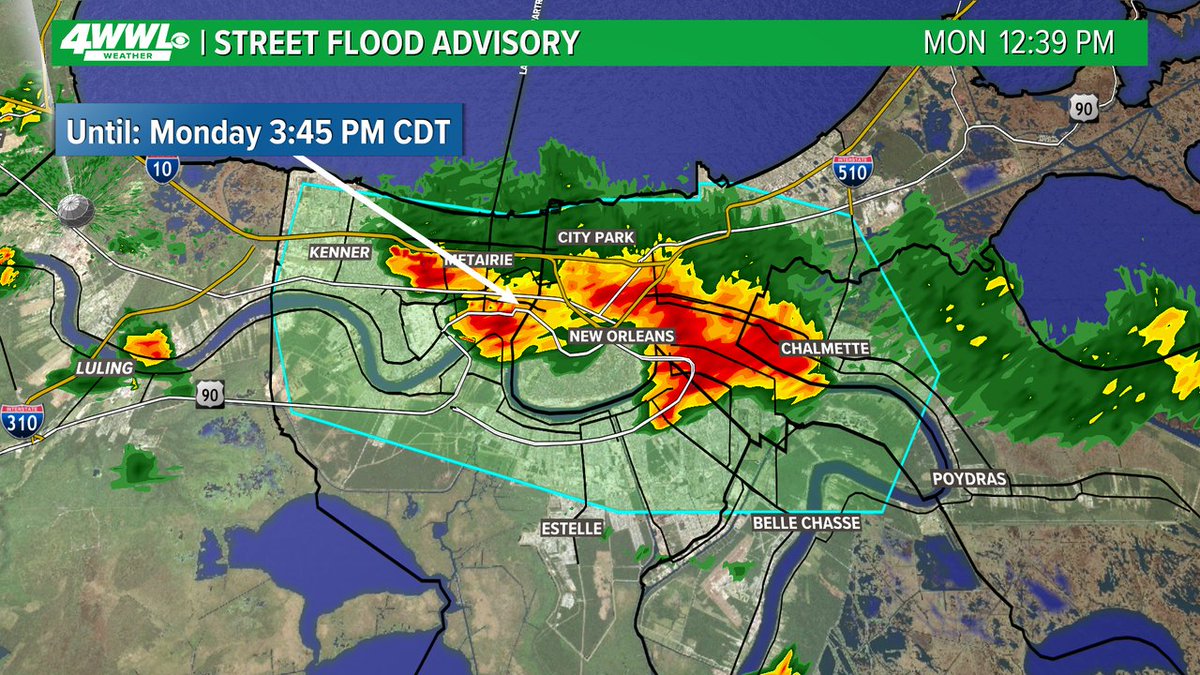
A Street Flood Advisory has been issued for parts of Orleans, Jefferson, St. Bernard, Plaquemines, St. Charles until 7/14 3:45PM. Street flooding is possible in these areas. Don't drive through flooded roads. #BeOn4
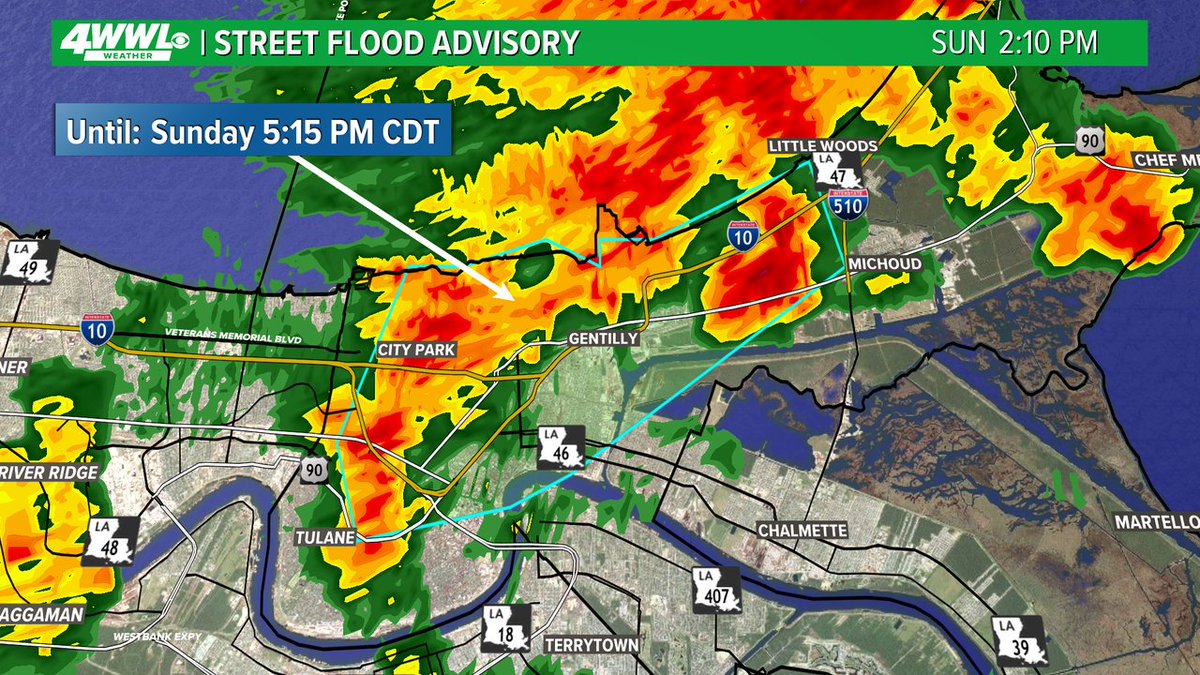
A Street Flood Advisory has been issued for parts of Orleans until 7/13 5:15PM. Street flooding is possible in these areas. Don't drive through flooded roads. #BeOn4
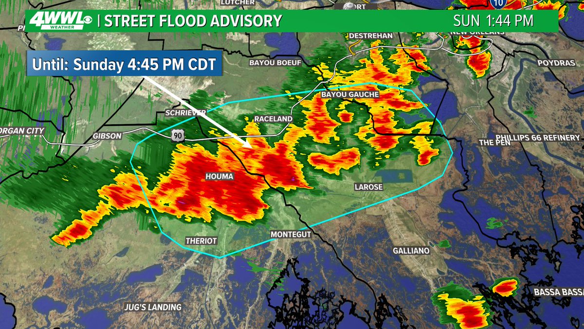
A Street Flood Advisory has been issued for parts of Terrebonne, Lafourche, St. Charles, Jefferson until 7/13 4:45PM. Street flooding is possible in these areas. Don't drive through flooded roads. #BeOn4
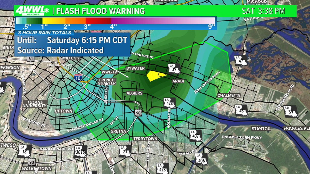
A Flash Flood Warning has been issued for parts of the New Orleans Metro until 7/12 6:15PM. Street flooding is happening or about to happen. Don't drive through flooded roads. #BeOn4
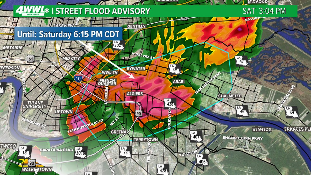
A Street Flood Advisory has been issued for parts of Orleans, Jefferson, St. Bernard until 7/12 6:15PM. Street flooding is possible in these areas. Don't drive through flooded roads. #BeOn4