Project WeatherEye
@stsweathereye
http://SeeTheStorm.net | Project WeatherEye: Live Streaming tornado and severe storm paths in real time. Join us at http://ProjectWeatherEye.com
Get ready—Project WeatherEye launches NOW, igniting a revolutionary live-streaming field project that redefines weather content. Join us for an electrifying front-row seat as we engineer, build, and deploy cutting-edge cameras into the heart of storm paths—tornadoes, hail cores,…
🌪️This is what it looks like to deploy a Rapid Deployment Device. This one took longer than usual, but these are designed to be as portable as possible with intended deployment times of less than 60 seconds from stopping the car to moving on. A whole team works behind the…
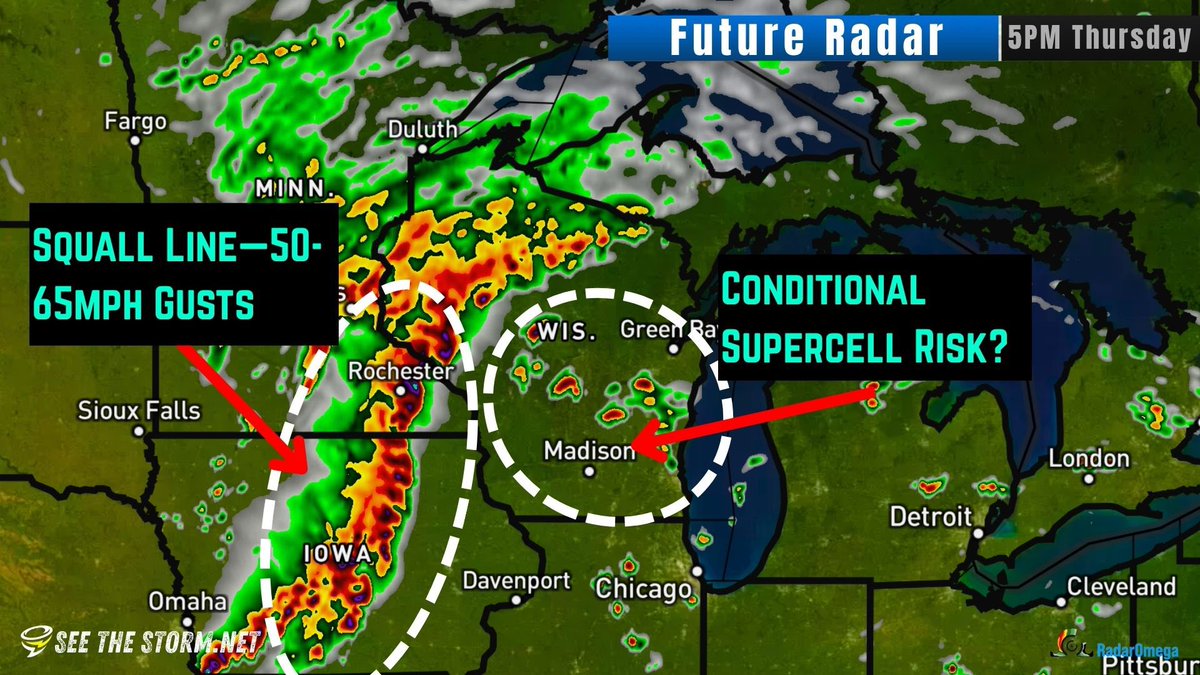
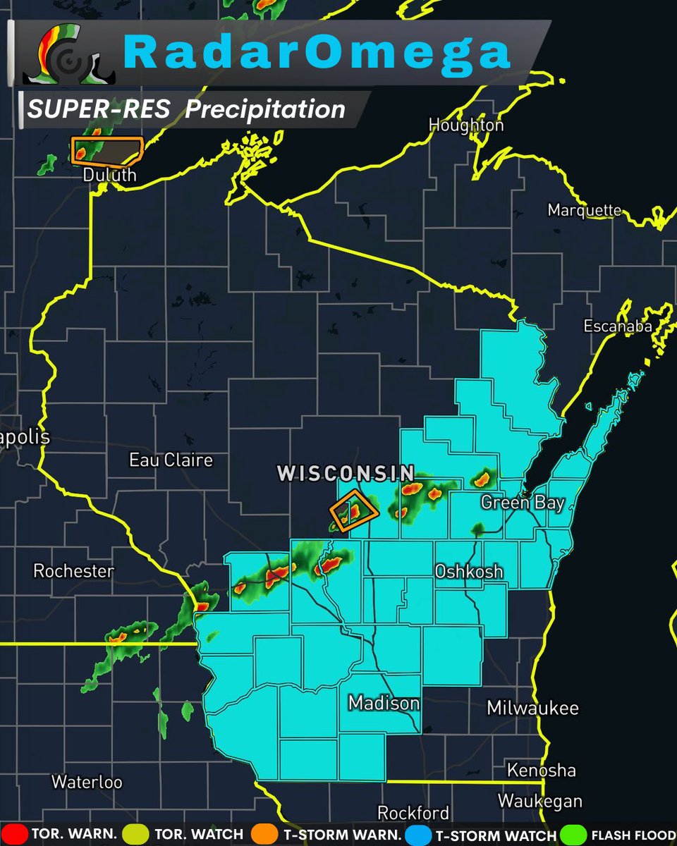
Looks like @AidanO_wx is picking up the slack for what’s left of our severe storms in Wisconsin. He’s live in @RadarOmega @stsweathereye
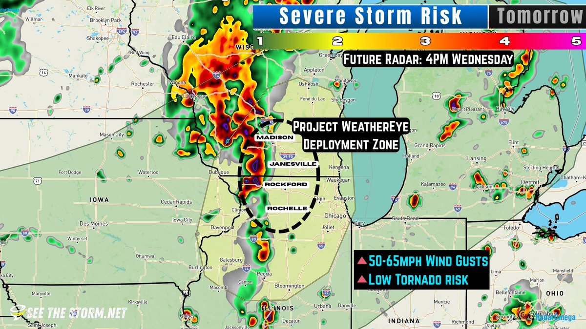
🌪️TORNADO Risk: Level 2 of 5 🧑🤝🧑3.8 MILLION PEOPLE in the Level 2 Risk Zone 📍Wisconsin & Illinois ⏱️Wednesday Afternoon & Evening
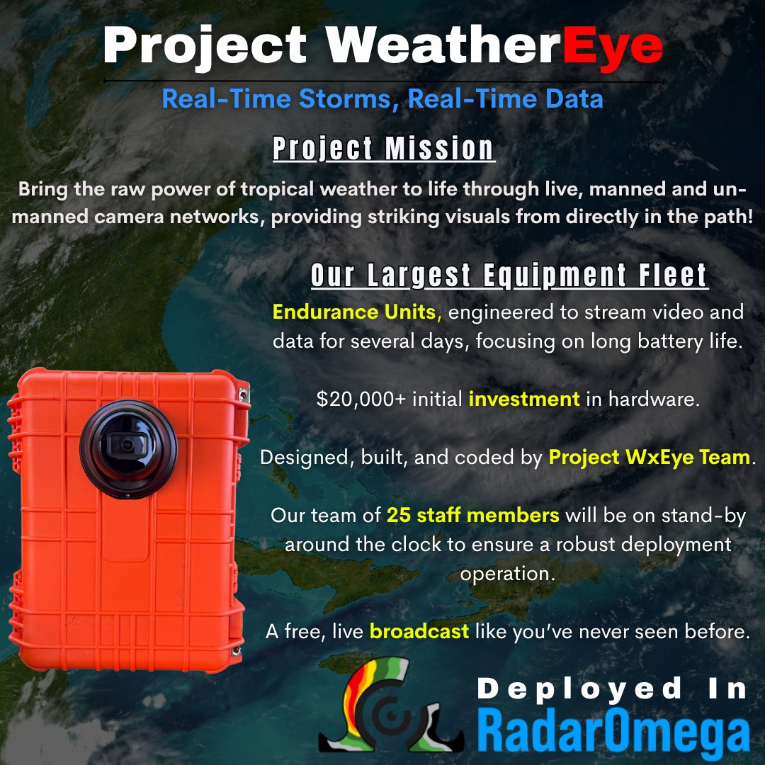
We've been working behind the scenes to design, prepare, build, and test our Endurance Units. These are multi-day battery capacity, high quality video and data streaming units that will be deployed as an ad-hoc network ahead of hurricanes and other tropical events, even with some…
🌩️Severe Storm Risk: Level 2 of 5 🧑🤝🧑13.8 MILLION PEOPLE in the Risk Zone 📍Wisconsin & Illinois ⏰Wednesday Afternoon & Evening ⚠️Wind Gust, Maybe Tornado Project WeatherEye will be considering a potential small deployment in the Madison to Rochelle area along the interstate!…
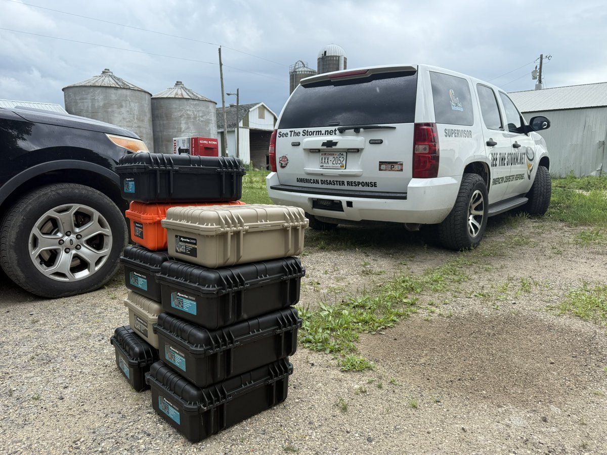
Big addition coming to the equipment fleet. Starting off with making wiring harnesses.

The remote streaming camera project is expanding fast! Join in: tinyurl.com/wxeye
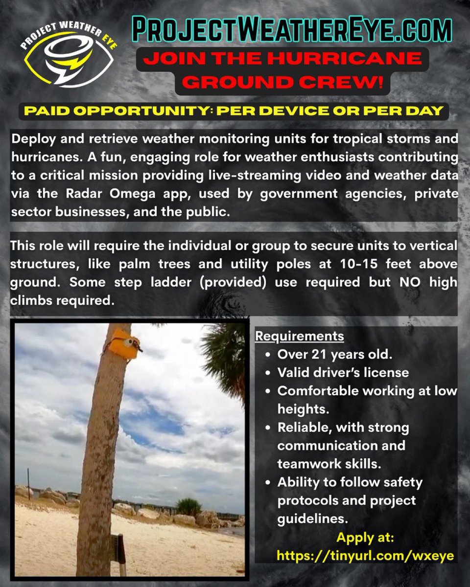
You can express interest in joining our Ground Crew by visiting: tinyurl.com/wxeye @stsweathereye
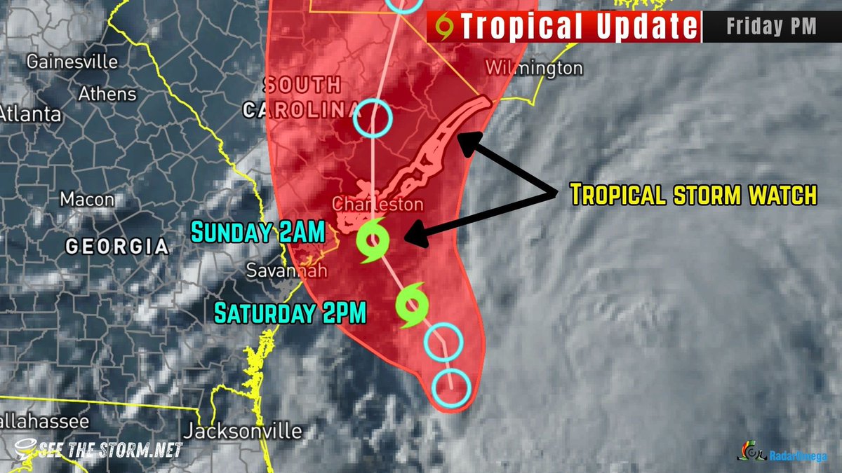
🌀 TROPICAL STORM CHANTAL UPDATE: Tracking towards South Carolina! ⚠️Tropical Storm Watches and Warnijgs for coastal South Carolina to Wilmington, North Carolina. 💨40-50mph Wind Expected 🏝️ Landfall Expected on Sunday ‼️This is not expected to strengthen any more than a…
🏝️ NEW: Tropical Storm Expected by Morning ‼️ 🌀 Tropical Depression 3 is forming and expected to become Tropical Storm Chantal. It should come ashore near Charleston, South Carolina late Saturday night or early Sunday morning. Expect 40-50mph winds and heavy rain. ⚠️TROPICAL…
‼️SEVERE WEATHER ALERT: Severe Thunderstorm Watch until 9PM tonight for hail up to 1 inch and 65 mile per hour wind gusts. @AidanO_wx and @VinceWaelti are on the way. Track with the @RadarOmega app!
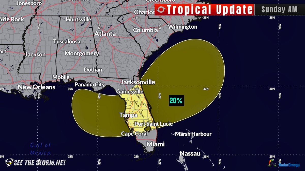
🌀TROPICAL UPDATE: There's a large area that could see tropical development over the next 7 days. The good news is that it's only a 20% chance as of now, and anything that develops will likely not be of any concerning intensity. We hope you coastal followers are ready for a…
@VinceWaelti has deployed @stsweathereye RDD-5 W of Canby on this Violent tornado, You can watch it live in the @RadarOmega App! #SDWX #MNWX #Tornado
Tornado dancing south of Gary, South Dakota earlier @RadarOmega @stsweathereye
Tornado about 15 minutes ago near Madison, Minnesota @RadarOmega @stsweathereye
A gorgeous supercell looming in the Plains of North Dakota 🌩️ #NDwx 📍 Sterling, ND 📸 @VinceWaelti
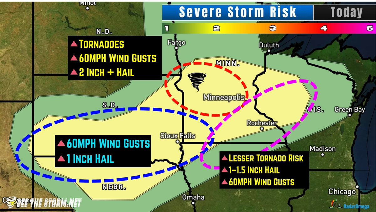
⛈️Severe Storm Risk: Level 2 of 5 📍Central Plains to Minnesota & Wisconsin ⏱️Saturday Afternoon & Evening ⚠️Areas of 2” Hail, Tornadoes, and Wind
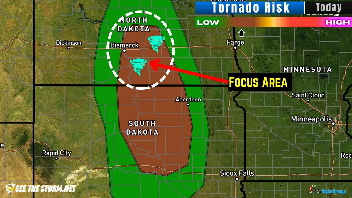
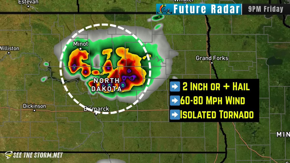
‼️ BIG HAIL & 80 MPH WIND FORECAST Storms should form in the Dakotas initially as partially isolated supercells, which will enhance hail chances. I would not be surprised to see big hail stones to baseball size. Once the storms cluster together, they will be capable of producing…


⛈️Severe Storm Risk: Level 2 of 5 📍Iowa, Minnesota, Wisconsin ⏱️Afternoon thru evening ⚠️Strong winds and Tornadoes 🌪️