Robert Johnson
@rjohnsontv
@NBCPhiladelphia Meteorologist ⚡️ | Born & Raised in Philly 🔔 | AMS Certified Broadcast Meteorologist (#937) | Penn State Proud 🎓
I’m thrilled to return to my hometown of Philadelphia & join @NBCPhiladelphia’s First Alert Weather team as a meteorologist working Monday through Friday! It is a full-circle moment to work in the city that sparked my love for weather! nbcphiladelphia.com/community/robe…

Special Marine Warning continues for the Coastal waters from Manasquan Inlet to Little Egg Inlet NJ out 20 nm until 12:15 PM EDT
Dee Atchley captures this waterspout as it comes ashore on Island Beach State Park, NJ. @NBCPhiladelphia @NWS_MountHolly
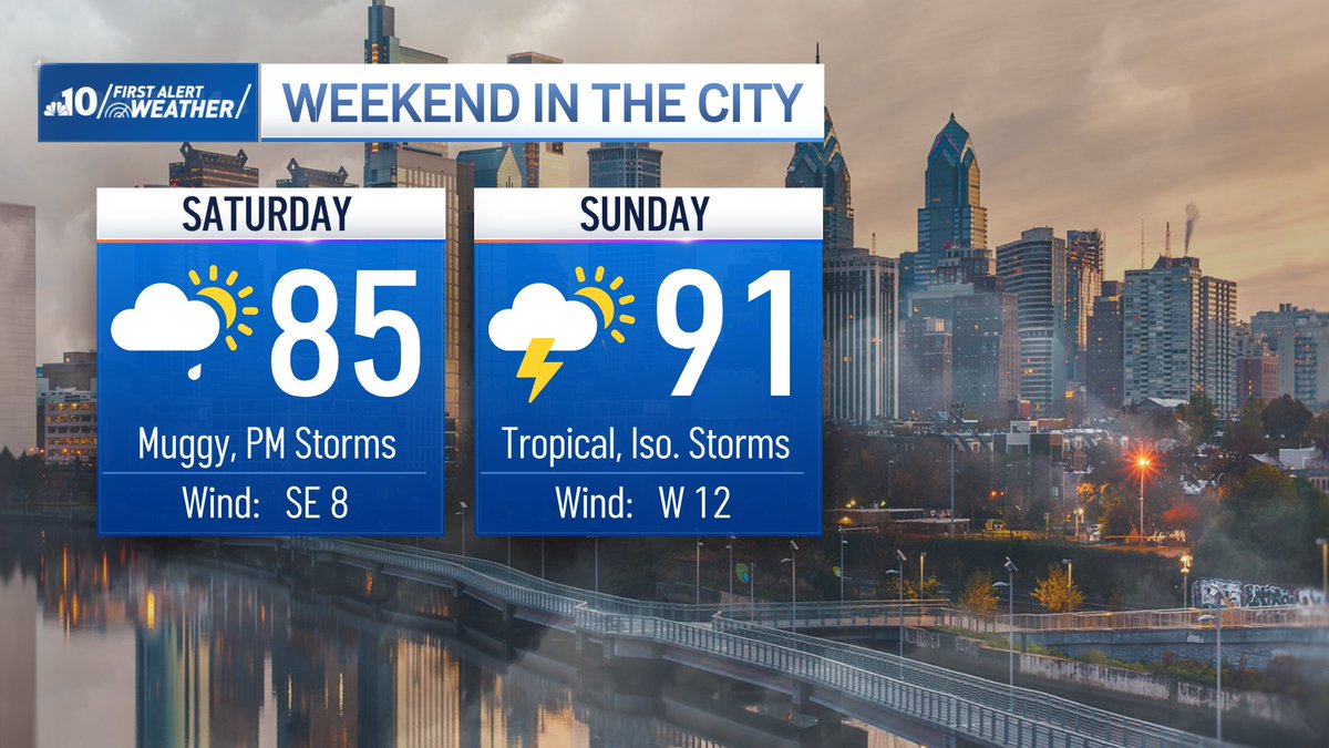
WEEKEND PLANNER Saturday: Humidity gradually rises. Cloudy start with a spotty AM shower. Mix of sun and clouds by afternoon with scattered storms Sunday: Tropical humidity. Partly cloudy with isolated afternoon/evening storms
The mugginess and humidity will make its way out of the region for Friday. Cooler air makes temperatures pleasant for the weekend. Rain chances are possible on Saturday. NBC10 First Alert Weather meteorologist @RJohnsonTV has your forecast. on.nbc10.com/Jo3vzYU
BRUTAL Head index in the upper 90s & triple digits across our region. Thankfully, cooler and more comfortable air arrives by tomorrow afternoon.

Flash Flood Warning including Wilmington DE, Newark DE and Bear DE until 2:45 AM EDT
Flash Flood Warning including Morrisville PA, Fairless Hills PA and Trevose PA until 11:45 PM EDT
Prepare for more stifling heat the next two days. Air temperatures will be in the upper 80s/low 90s but the heat index will reach into the upper 90s and triple digits. Drink plenty of water & stay cool!

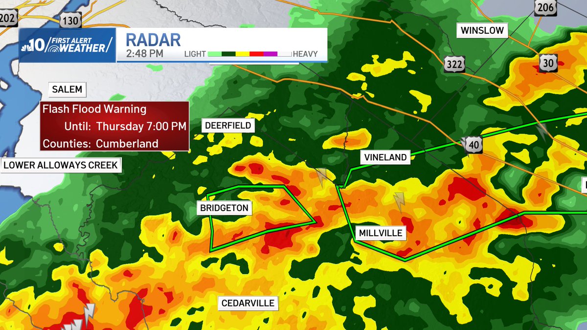
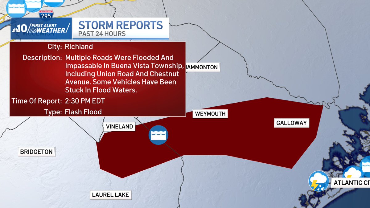
We're now tracking two flash flood warnings in South Jersey. We already have a storm report of vehicles stuck in flood waters. When you see any flooded roads, turn around - don't drown. @NBCPhiladelphia

Severe Thunderstorm Warning including Villas NJ, Cape May Court House NJ and Wildwood NJ until 10:45 PM EDT
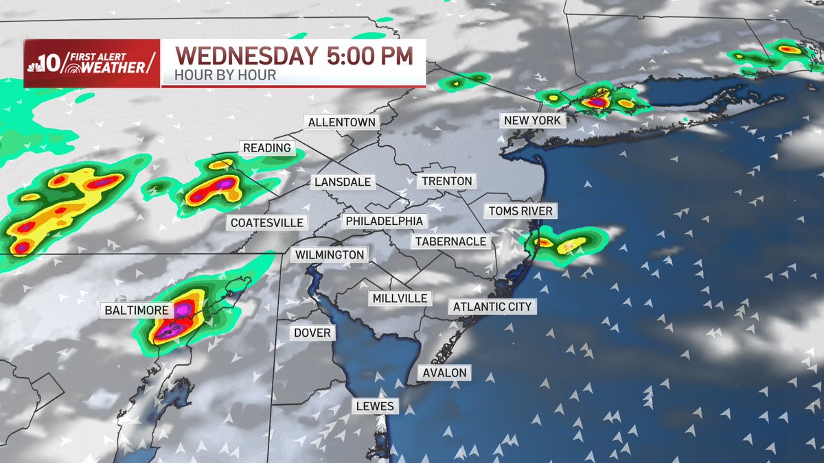
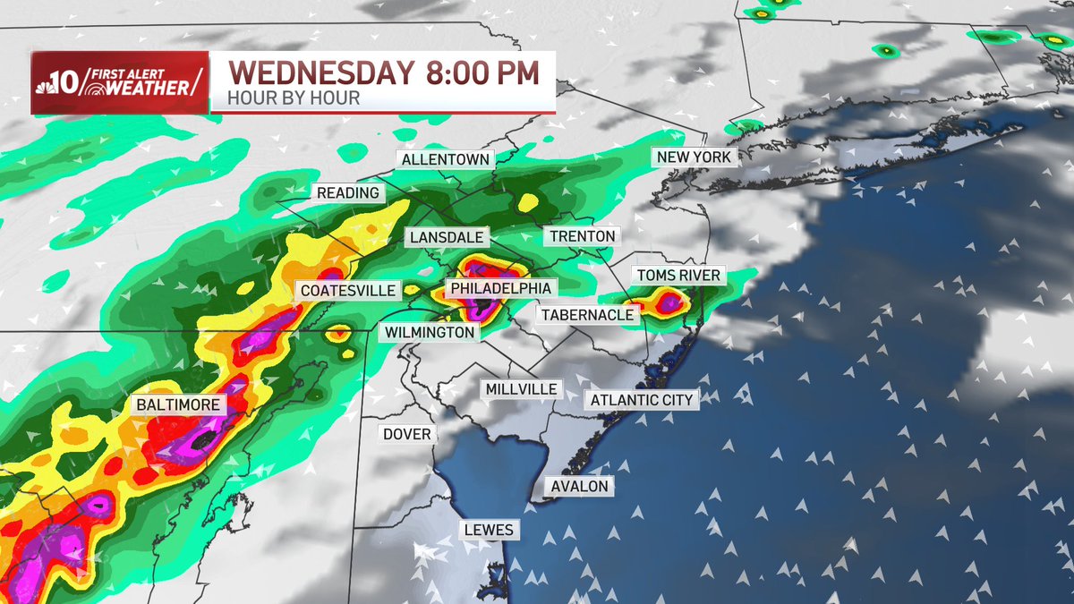
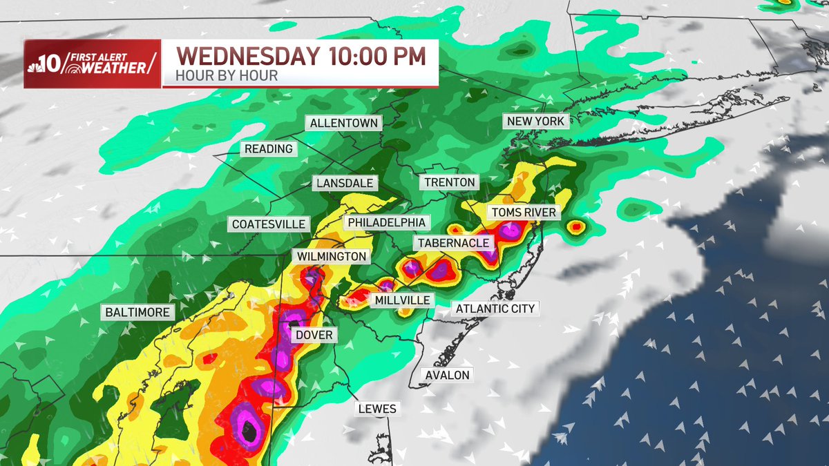
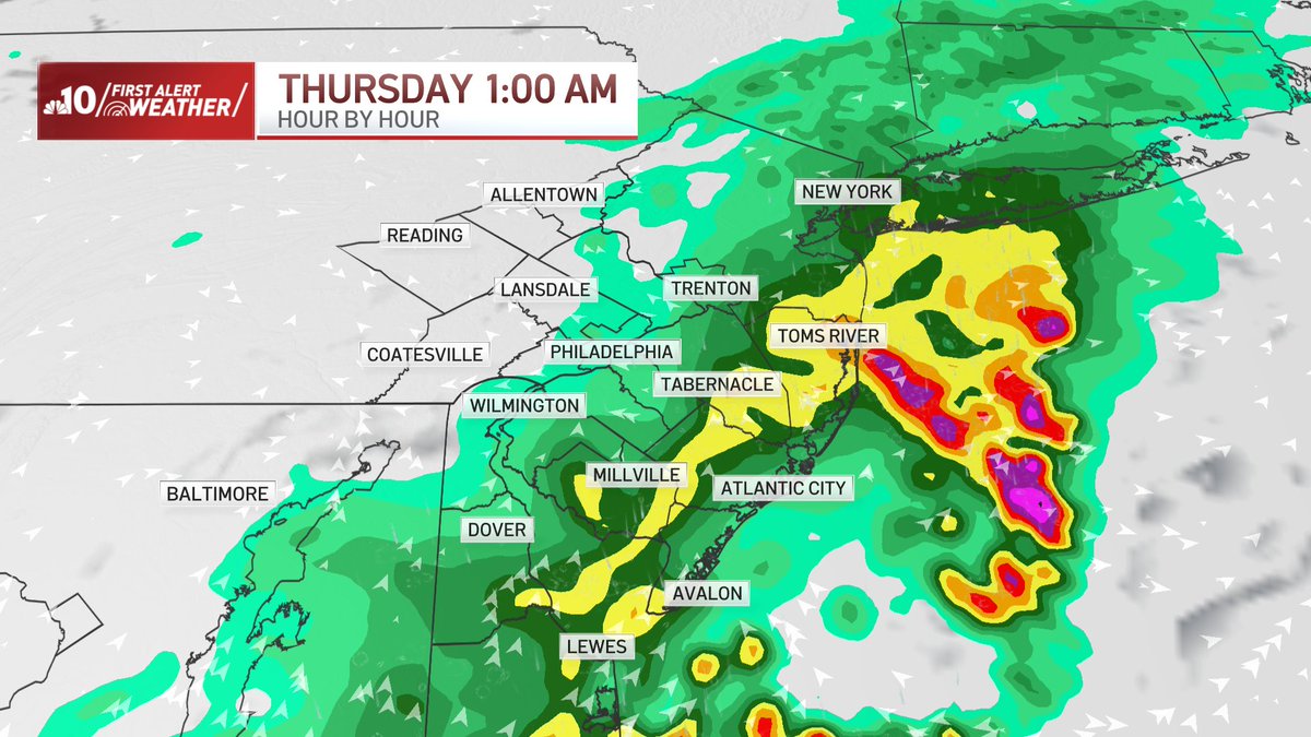
.@NBCPhiladelphia's First Alert to severe storms is in effect for our whole region from 5pm tonight (7/9) until midnight. Damaging winds & flash flooding are the primary concerns. Though the intensity is too strong, here's an idea of what the radar may look like tonight.
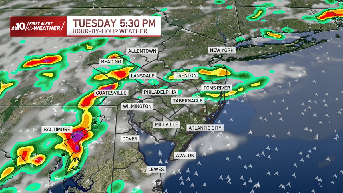
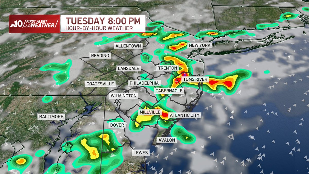
Unfortunately, today is another day with a risk of severe storms. All of us have the risk of severe weather, especially in South Jersey and Delaware. @JGodynick & and I will track these storms tonight on @NBCPhiladelphia

Thank you so much. I hope you stay safe tonight!
@rjohnsontv you are doing such an amazing job explaining everything for us tonight. Thank you!!
Thank you. I hope everyone stayed safe!
@brittneyshipp and @rjohnsontv Great coverage !! @NCCO_DE_Skywarn
A flood warning is in effect for neighborhoods in Pennsylvania until 8 p.m. as strong storms move through our region. NBC10 First Alert Weather meteorologist @rjohnsontv has the forecast. on.nbc10.com/mUACRbz
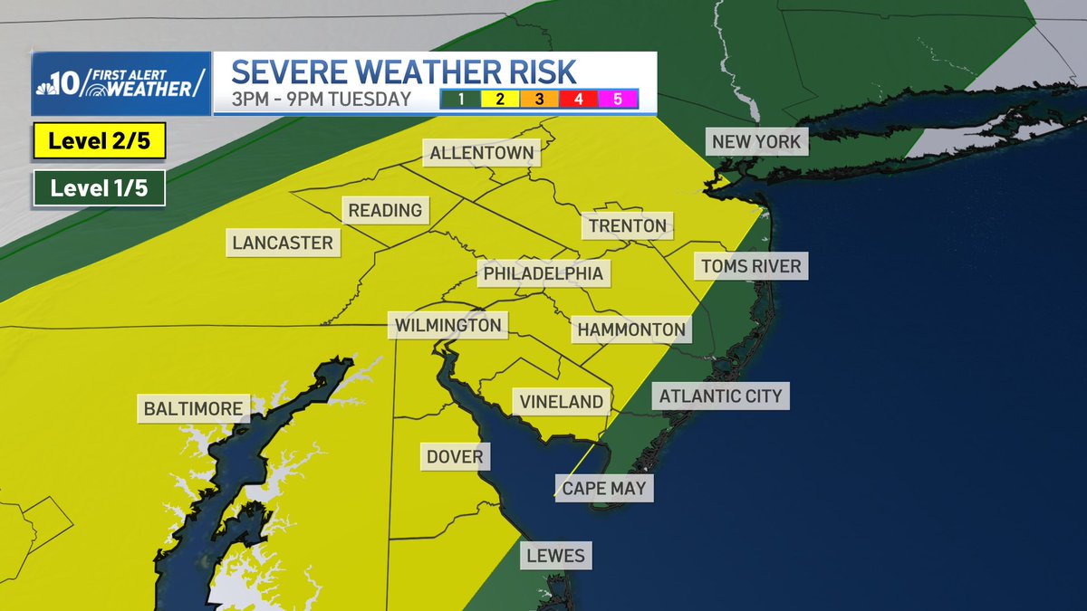
Steamy & Stormy Tuesday🚨 Feels like temps will rise into the triple digits for many neighborhoods Tue afternoon before a cold front brings strong to severe storms from 3pm-9pm. Main threat = Damaging wind gusts. Stay w/ @NBCPhiladelphia for updates on tomorrow's storm threat

The 3rd tropical storm of the year for the Atlantic basin has formed
Tropical Storm #Chantal Advisory 3A: Depression Strengthens to Tropical Storm Chantal. Tropical Storm Warning Issued For Portions of the Carolinas. hurricanes.gov


Temperatures will be comfortable and perfect to celebrate Independence Day no matter where you are in New Jersey, Pennsylvania or Delaware. NBC10 First Alert Weather meteorologist @RJohnsonTV has your holiday weekend forecast. on.nbc10.com/Q5BTMQA
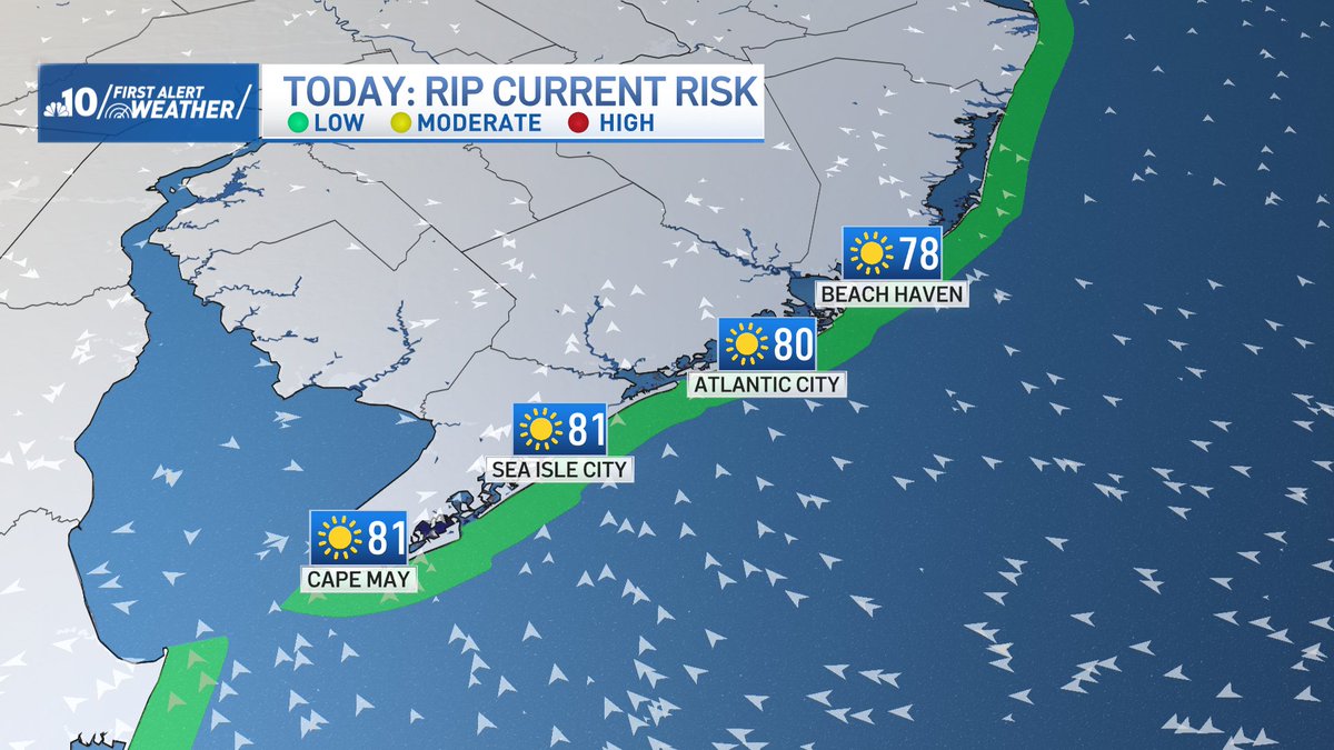
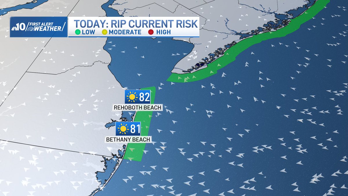
Great weather Down the Shore & for the Delaware Beaches today - plus a low risk of rip currents on this 4th of July!