
Jill Gilardi ☀️🌈❄️
@jillgilardi
First Alert Certified Meteorologist. MA native! Note: Content shared via tweets to @jillgilardi may be republished on air or online.
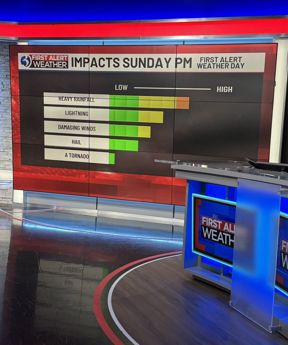
Good Sunday morning! Tracking developing showers 🌧️ & storms ⛈️ on this #FirstAlertWeatherDay, but this will not be the most impactful round today. Severe ⚠️ storm ⛈️ threat is this PM & evening! Join me and Roger Susanin from 5-8:30am on @WFSBnews
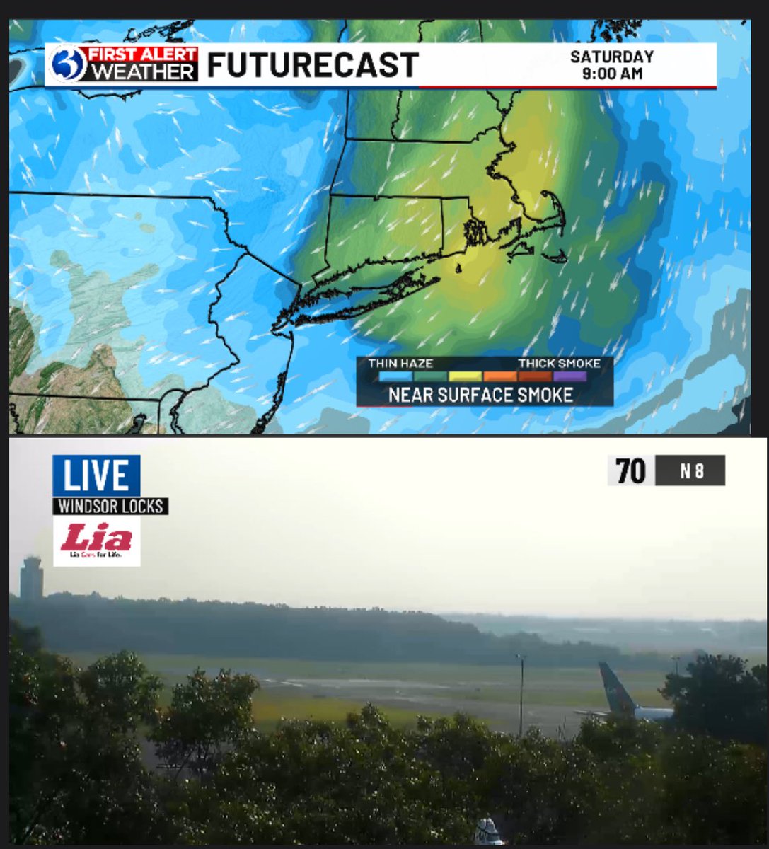
Ugh this Canadian wildfire 🔥 smoke 💨 is really messing with some of us enjoying the outdoors today! Keep up with the AQI via this 🔗 webpubcontent.gray.tv/wfsb/weather/A…

#FirstAlert Ugh the air quality is getting worse across NW CT and becoming unhealthy for anyone so limit your time outside especially if you have breathing issues!

Notice the hazy 🌫️ look to the sky?! It’s from Canadian #wildfire #smoke that has arrived! Thankfully this will only impact “unusually sensitive people” & if you fall into that group then consider reducing outdoor activity! #FirstAlert
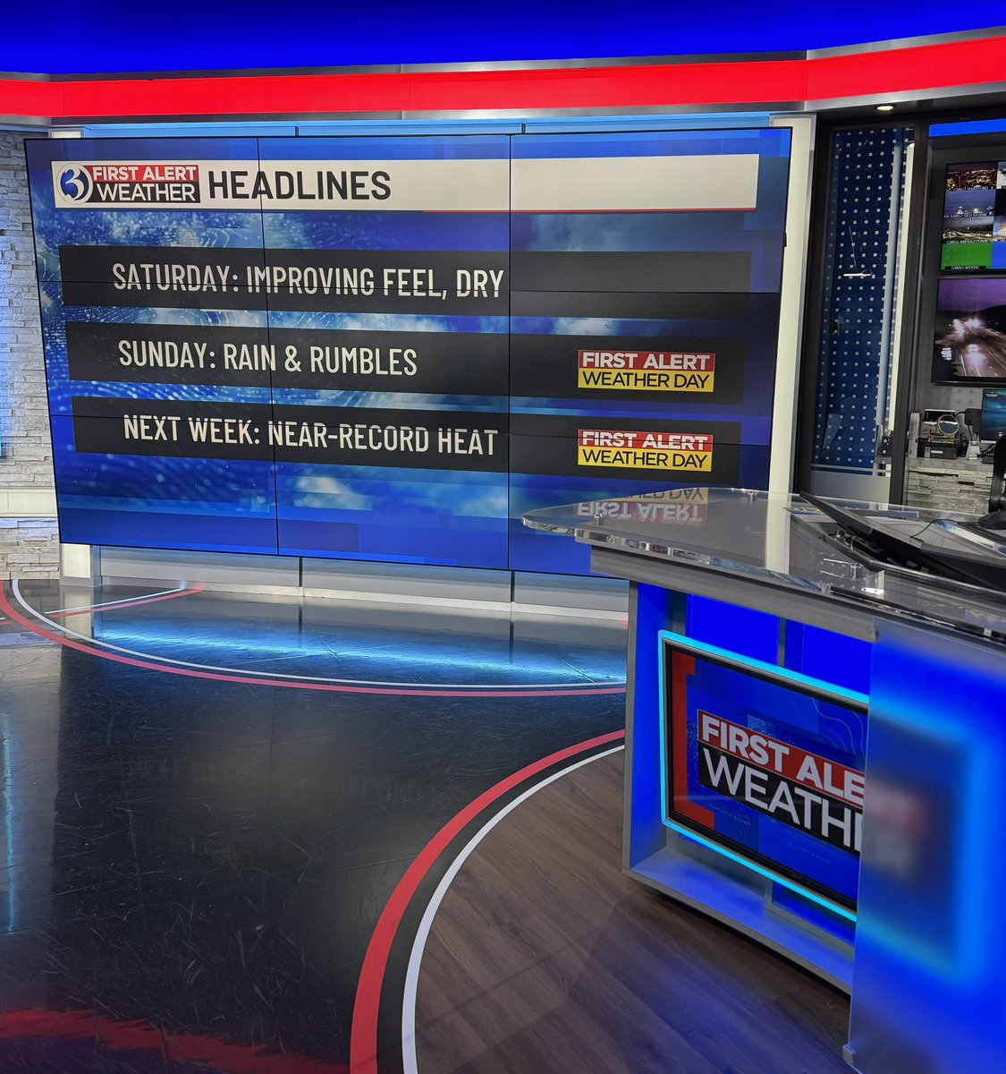
Good Saturday AM! Lots to chat about on @WFSBnews from 5-7am & 9-10am including multiple #firstalertweatherdays but nice days mixed in too! 🌧️ ⛈️ 🥵
Stay weather alert ‼️ CT is under a #SevereThunderstormWatch & there’s already a #SevereThunderstormWarning on this #FirstAlertWeatherDay Keep up with any alerts via the WFSB First Alert Weather App!!
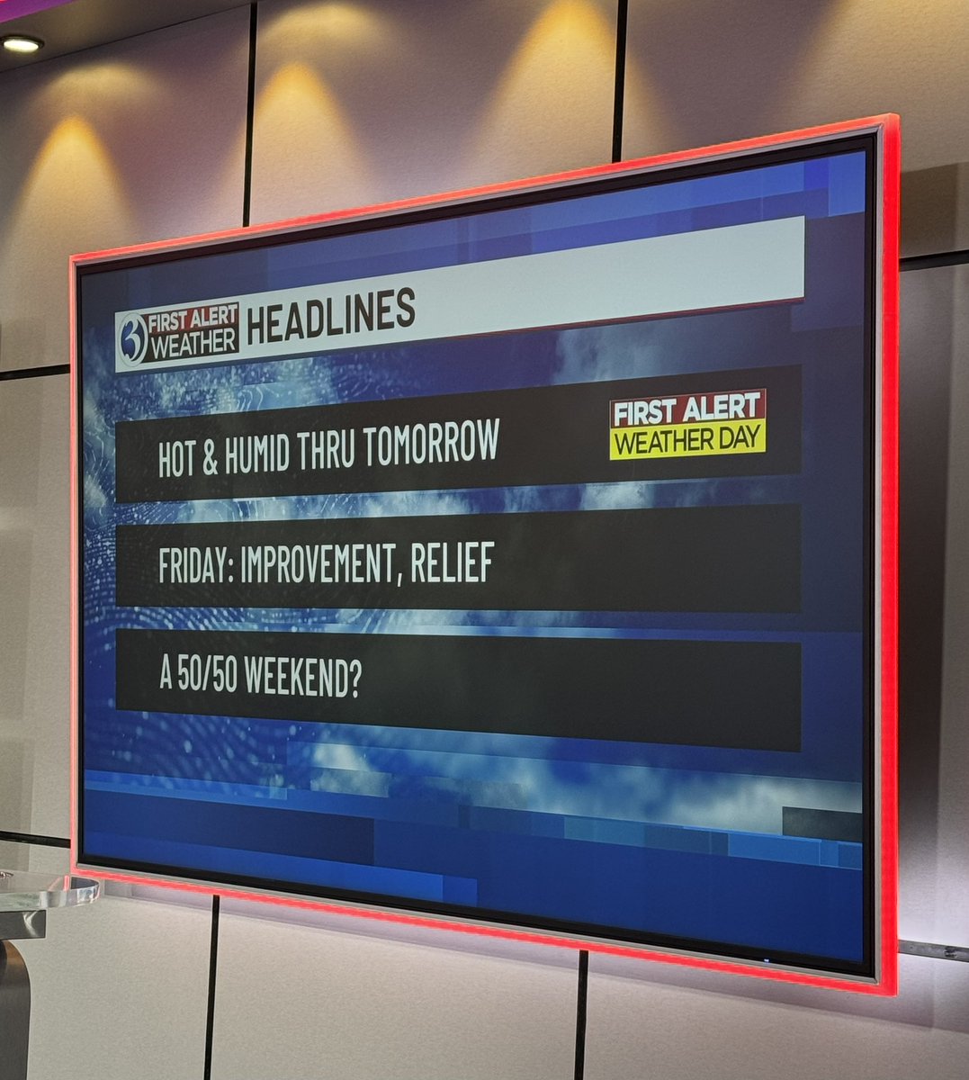
Get ready for another round of heat 🥵, the worst is Friday including the threat for strong storms! Filling you in at noon 🕛 on @WFSBnews & 🕧 on The Wax!
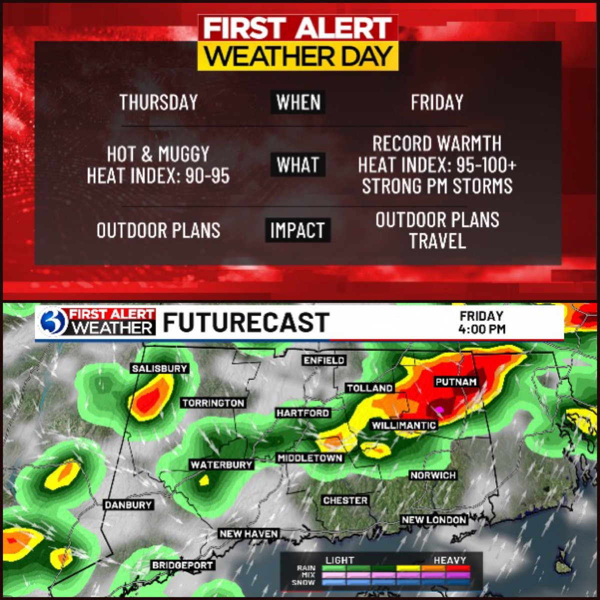


Good morning! It’s my Friday and I’m filling in for Scot again! A couple changes in the forecast in the past 24 hours that I’ll share with you on @WFSBnews this AM!
As the shelf cloud forms, passing into Haddam Neck over the CT River. @WeatherJosh @jillgilardi @MarkDixonTV @MikeSliferWX @RachelFrank_CT @Ash_Baylor @StormFurey @gilsimmons @weatherchannel @FoxNews
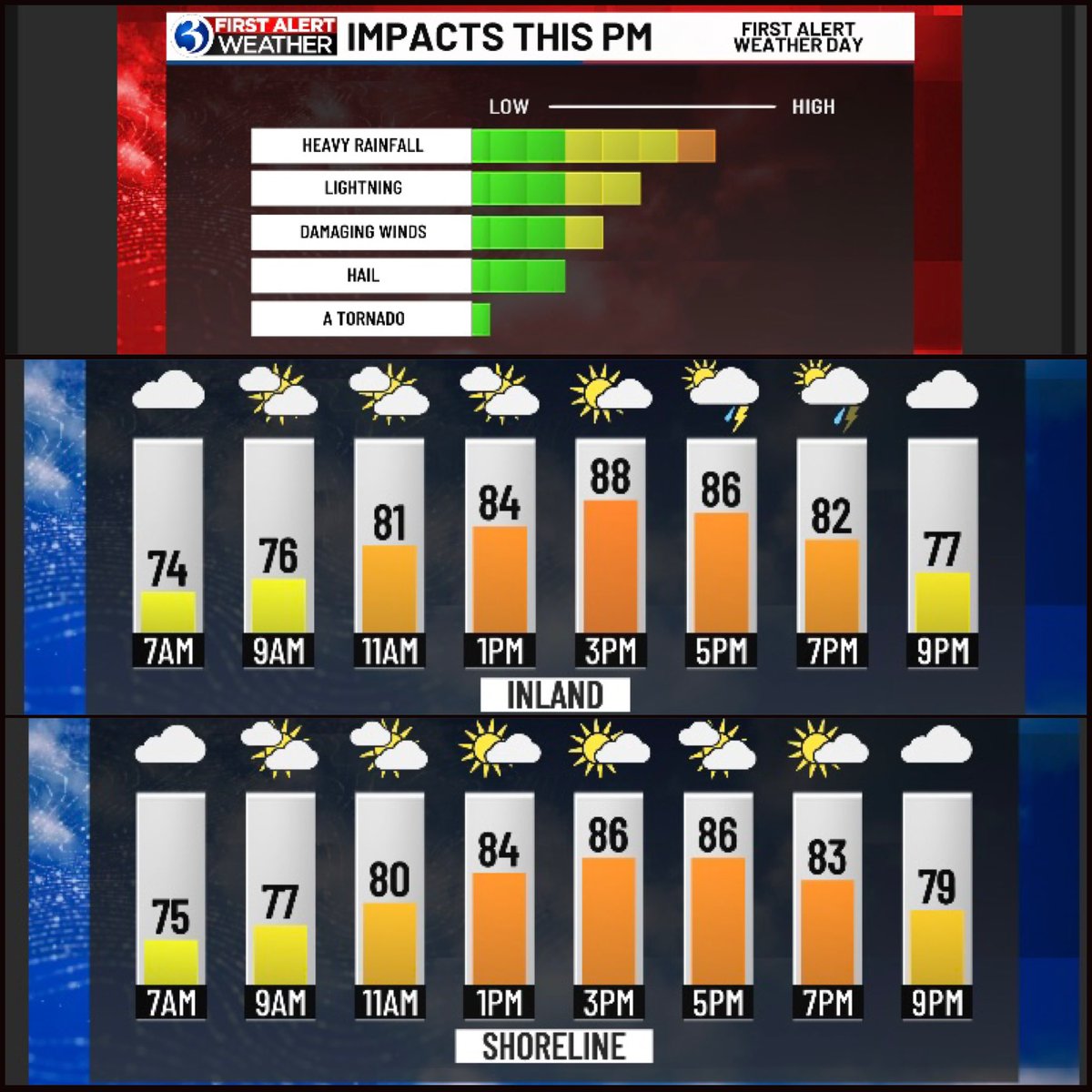
Main round of potential severe storms is between 4-10pm on this #FirstAlertWeatherDay. Coverage will be isolated to widely scattered, so not everyone will see this activity, but we want you to be alert later!
Back on @WFSBnews until 10am, talking about potential impacts tomorrow which is a #FirstAlertWeatherDay.
Good Sat AM! Comfy weather on tap today! ☀️ Sun - is a #FirstAlertWeatherDay- 2 rounds of storms, the 2nd will be strongest, but both not a washout with plenty of dry periods of well. ⛈️ Breaking the rounds down for you on @WFSBnews from 5-7am & 9-10am for the late risers.

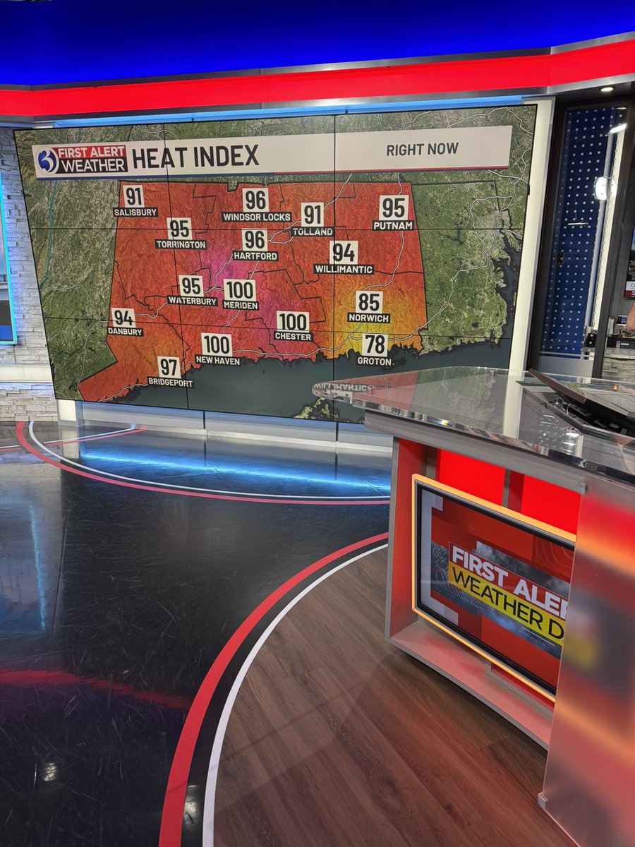
Very few places are not 🥵 on this #FirstAlertWeatherDay Timing out relief for later this week on @WFSBnews at noon
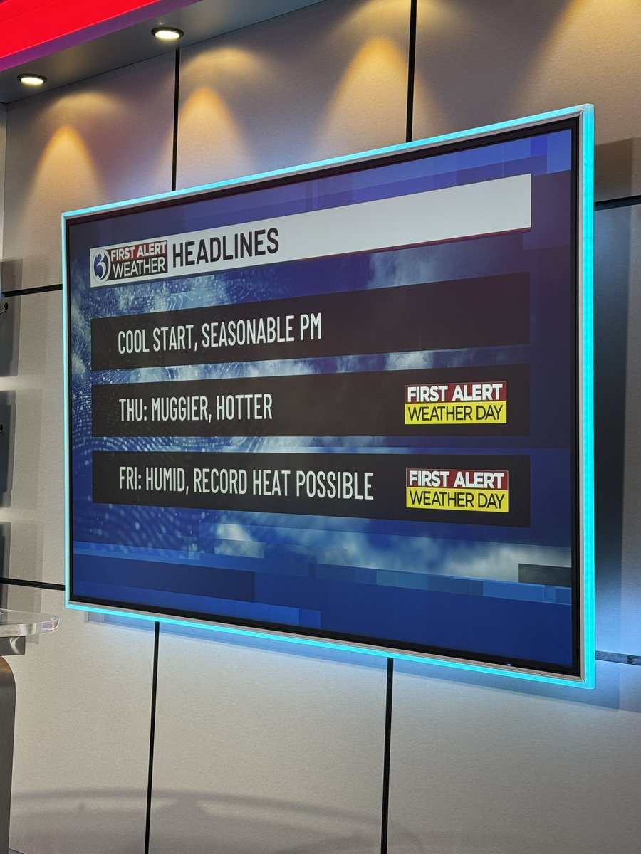
Here are the big weather topics I’ll be covering but also fog 🌫️ on The Wax from 7-8am!
*We are now tracking Invest 93L, a disturbance located off the east coast of Florida in the Atlantic. *The National Hurricane Center is giving this system a 40 percent chance of tropical development over the next seven days.
Parts of the Hudson Valley and North Jersey have seen 4 to 6" of rain in just 3 hours early this evening. At the highest end, that is a once-in-1,000 year rainfall event (from NOAA) - meaning that, IN ANY ONE SPOT, that kind of rain has a 0.1% chance in a year. #NYwx #NJwx #NYCwx
Stay weather alert ‼️ today as we are tracking slow moving downpours & storms. Heavy rainfall could cause flooding. Treat lightning ⚡️ seriously too and when the thunder roars, go indoors! Lightning ⚡️ can strike over 10 miles away from a storm & it doesn’t have to be raining.